Acton

Settlement in Cheshire

England

Acton

Cornes Bridge Bridge 96 on the Shropshire Union Canal.
Cornes Bridge Credit: Andrew Abbott

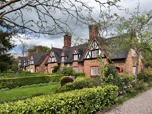
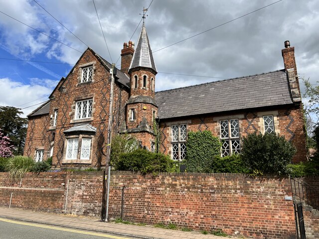
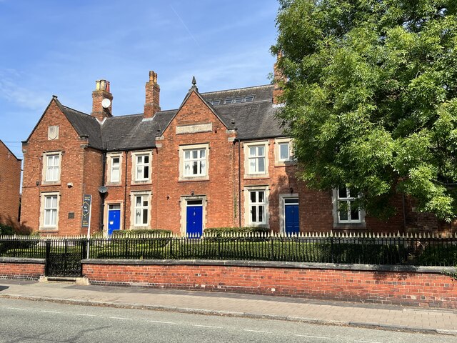
Acton is a small village located in the county of Cheshire, England. Situated approximately 3 miles southwest of the market town of Nantwich, Acton is nestled in the picturesque Cheshire countryside. The village is known for its charming rural character and traditional English architecture.

Acton is home to a population of around 1,200 residents, creating a tight-knit community atmosphere. The village is centered around the main street, which is lined with quaint cottages and small businesses. The historic St. Mary's Church, dating back to the 12th century, stands as a prominent landmark in Acton.

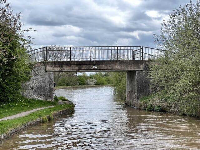
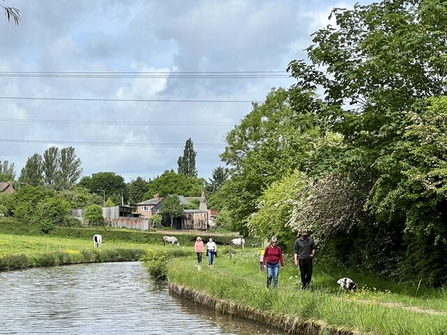
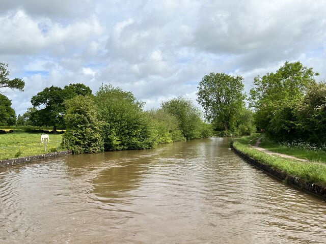
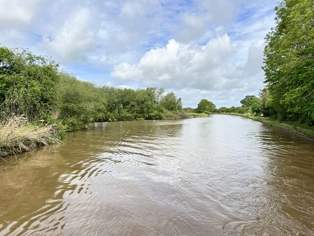
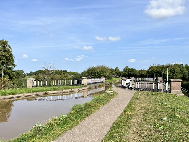
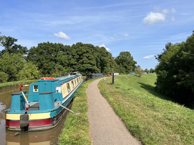
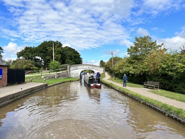
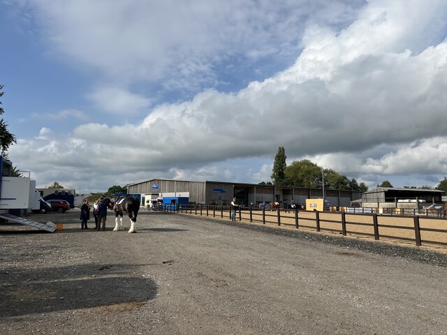
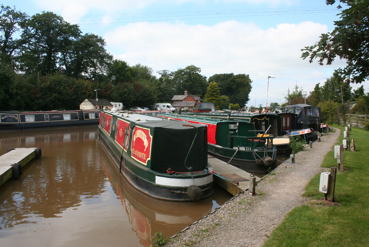
Surrounded by rolling fields and farmland, Acton offers a peaceful and idyllic setting for its residents. The area is popular among nature enthusiasts and those seeking a more rural lifestyle. The village is also a popular destination for tourists, who come to admire its charm and explore the nearby countryside.

Despite its small size, Acton offers a range of amenities for its residents. These include a village hall, primary school, post office, and a local pub. The village also benefits from its proximity to Nantwich, where residents can find a wider range of shops, restaurants, and services.

Overall, Acton is a tranquil and picturesque village in Cheshire, offering a close-knit community, beautiful scenery, and a peaceful way of life.

If you have any feedback on the listing, please let us know in the comments section below.
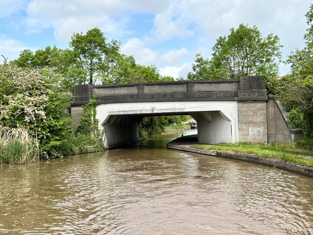
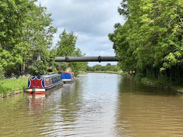
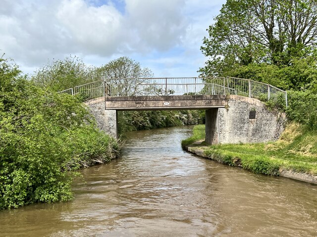
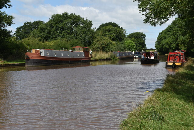
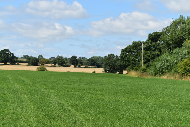
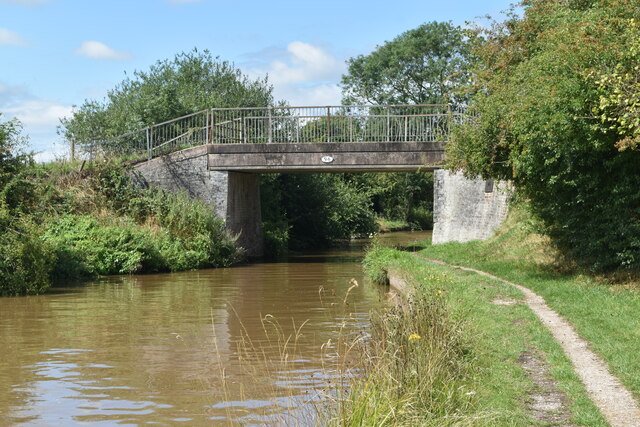
Acton Images

Images are sourced within 2km of 53.072943/-2.550212 or Grid Reference SJ6353. Thanks to Geograph Open Source API. All images are credited.

Cornes Bridge Bridge 96 on the Shropshire Union Canal.
Cornes Bridge
Bridge 96 on the Shropshire Union Canal.
Nantwich Aqueduct Grade II* listed. Listing number 1330146. Dating from 1826.
Nantwich Aqueduct
Grade II* listed. Listing number 1330146. Dating from 1826.
Wilbraham's Almshouses Grade II listed. Listing number 1249725. Dated 1870.
Wilbraham's Almshouses
Grade II listed. Listing number 1249725. Dated 1870.
108 Welsh Row, Nantwich Grade II listed. Listing number 1263595 The former Grammar School and Headmaster's House. Mid 19th century.
108 Welsh Row, Nantwich
Grade II listed. Listing number 1263595 The former Grammar School and Headmaster's House. Mid 19th century.
Shropshire Union Canal Near Acton.
Shropshire Union Canal
Near Acton.
Shropshire Union Canal North of Acton.
Shropshire Union Canal
North of Acton.
Henhull Bridge Bridge 95 on the Shropshire Union Canal.
Henhull Bridge
Bridge 95 on the Shropshire Union Canal.
Pipe bridge On the Shropshire Union Canal.
Pipe bridge
On the Shropshire Union Canal.
Poole Hill Winding Hole On the Shropshire Union Canal
Poole Hill Winding Hole
On the Shropshire Union Canal
Cornes Bridge Bridge 95 on the Shropshire Union Canal.
Cornes Bridge
Bridge 95 on the Shropshire Union Canal.
Shropshire Union Canal near Poolehill
View across fields opposite Beach Tree Farm Farm name spelling as per OS map and sign: presumably not named after a beech tree!?
View across fields opposite Beach Tree Farm
Farm name spelling as per OS map and sign: presumably not named after a beech tree!?
Cornes Bridge, Shropshire Union Canal
The Old Constabulary At 94-96 Welsh Row, Nantwich. Probably by Harry Beswick, architect.
The Old Constabulary
At 94-96 Welsh Row, Nantwich. Probably by Harry Beswick, architect.
Nantwich Aqueduct Grade II* listed. Listing number 1330146. Aqueduct carrying the main line of the Shropshire Union Canal over the Chester to Nantwich Road. Circa 1826 (consultant Thomas Telford).
Nantwich Aqueduct
Grade II* listed. Listing number 1330146. Aqueduct carrying the main line of the Shropshire Union Canal over the Chester to Nantwich Road. Circa 1826 (consultant Thomas Telford).
Shropshire Union Canal The embankment in Nantwich.
Shropshire Union Canal
The embankment in Nantwich.
Junction bridge Grade II listed. Listing number 1136456. Tow path roving bridge to Basin End, circa 1826 (consultant T.Telford). Engineering bricks in English Bond with added thin protective coating. Elliptical skew arch, on one metre high abutments. Flush stone dressed arch quoins and projecting carriageway bands. Stone edgings to canal. Cast iron rubbing posts to angles of arch. Blue brick paving with raised courses to tow path beneath bridge. Humped bridge with splayed approach walls, rounded stone parapet copings and 4-way rounded pier caps.
Junction bridge
Grade II listed. Listing number 1136456. Tow path roving bridge to Basin End, circa 1826 (consultant T.Telford). Engineering bricks in English Bond with added thin protective coating. Elliptical skew arch, on one metre high abutments. Flush stone dressed arch quoins and projecting carriageway bands. Stone edgings to canal. Cast iron rubbing posts to angles of arch. Blue brick paving with raised courses to tow path beneath bridge. Humped bridge with splayed approach walls, rounded stone parapet copings and 4-way rounded pier caps.
Outdoor school at Reaseheath Equestrian Centre
Show me another place!

Acton is located at Grid Ref: SJ6353 (Lat: 53.072943, Lng: -2.550212)

Unitary Authority: Cheshire East

Police Authority: Cheshire

What 3 Words

///afterglow.dark.swept. Near Nantwich, Cheshire

Nearby Locations

Acton

Related Wikis

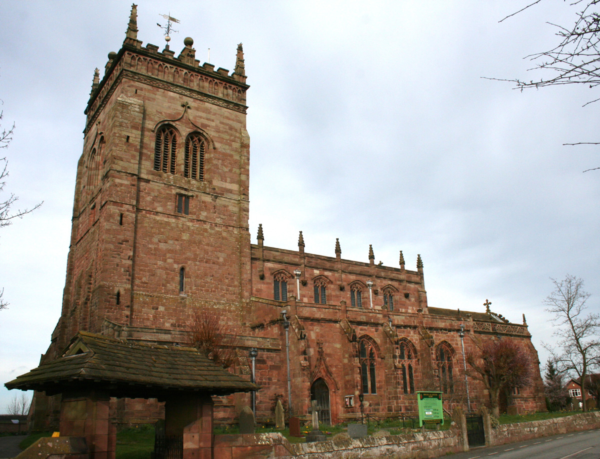
St Mary's Church, Acton

St Mary's Church is an active Anglican parish church located in Monk's Lane, Acton, a village to the west of Nantwich, Cheshire, England. Since 1967 it...

Acton, Cheshire

Acton is a small village and former civil parish, now in the parish of Burland and Acton, lying immediately west of the town of Nantwich, in the unitary...

Acton, Cheshire (ancient parish)

Acton was an ancient parish in the Nantwich Hundred of Cheshire, England.At one time it included the townships of Acton, Aston juxta Mondrum, Austerson...

Dorfold Hall

Dorfold Hall (SJ635524) is a Grade I listed Jacobean mansion in Acton, Cheshire, England, considered by Nikolaus Pevsner to be one of the two finest Jacobean...

International Cheese Awards

The International Cheese Awards is an annual cheese show and competition. Until 2019, it was held at Dorfold Park near Nantwich, England. Held since 1897...

Henhull

Henhull is a former civil parish, now in the parishes of Burland and Acton and Nantwich, in the unitary authority area of Cheshire East and the ceremonial...

Ravensmoor Windmill

Ravensmoor Windmill is a former windmill located to the south of Wrexham Road (A534) between the villages of Acton and Burland, Cheshire, England. It...

Battle of Nantwich

The Battle of Nantwich was fought on 25 January 1644 in Cheshire during the First English Civil War. In the battle, Sir Thomas Fairfax in command of a...

Nearby Amenities

Located within 500m of 53.072943,-2.550212
Star Inn
Opening Hours: closed
Was Amenity: pub
Lat/Long: 53.0727254/-2.5503947
Barrier: stile
Foot: yes
Lat/Long: 53.0753863/-2.5475766
Barrier: stile
Foot: yes
Lat/Long: 53.0707041/-2.5532893
Crossing
Crossing Island: yes
Lat/Long: 53.0727352/-2.5501748
Barrier: stile
Foot: yes
Lat/Long: 53.0712326/-2.5497959
Barrier: stile
Foot: yes
Lat/Long: 53.0712192/-2.5491603
Barrier: stile
Foot: yes
Lat/Long: 53.0761973/-2.5458763
Post Box
Collection Times: Mo-Fr 17:30; Sa 08:30
Post Box Type: lamp
Ref: CW5 213
Source: survey
Lat/Long: 53.0743797/-2.5504119
Crossing
Crossing Island: yes
Lat/Long: 53.0742349/-2.5504728
Telephone
Booth: K6
Covered: booth
Listed Status: Grade II
Operator: BT
Operator Wikidata: Q593786
Phone: +44 1270 610992
Lat/Long: 53.0736238/-2.5501473
Bus Stop
Acton, Chester Road / Primary School
Bus: yes
Naptan AtcoCode: 0600CR17441
Naptan Bearing: S
Naptan BusStopType: CUS
Naptan CommonName: Primary School
Naptan Crossing: Wilbraham Road
Naptan Indicator: o/s
Naptan Landmark: School
Naptan LocalityName: Acton
Naptan NaptanCode: chetgwm
Naptan ShortCommonName: Primary School
Naptan Street: Chester Road
Naptan Verified: no
Network: Cheshire East Council
Operator: Ansa Transport
Public Transport: platform
Source: naptan_import
Lat/Long: 53.0750978/-2.5506043
Bus Stop
Acton, Chester Road / Dorfold Hall
Bus: yes
Naptan AtcoCode: 0600CR421
Naptan Bearing: E
Naptan BusStopType: CUS
Naptan CommonName: Dorfold Hall
Naptan Indicator: opp
Naptan Landmark: Dorfold Hall
Naptan LocalityName: Acton
Naptan NaptanCode: chejtwd
Naptan ShortCommonName: Dorfold Hall
Naptan Street: Chester Road
Naptan Verified: no
Network: Cheshire East Council
Operator: Ansa Transport
Public Transport: platform
Source: naptan_import
Lat/Long: 53.0709583/-2.5457007
Bus Stop
Acton, Chester Road / Dorfold Hall
Bus: yes
Naptan AtcoCode: 0600CR422
Naptan Bearing: W
Naptan CommonName: Dorfold Hall
Naptan Indicator: o/s
Naptan Landmark: Dorfold Hall
Naptan LocalityName: Acton
Naptan NaptanCode: chejtwg
Naptan ShortCommonName: Dorfold Hall
Naptan Street: Chester Road
Naptan Verified: no
Network: Cheshire East Council
Operator: Ansa Transport
Public Transport: platform
Source: naptan_import
Lat/Long: 53.0708233/-2.5457288
Bus Stop
Acton, Chester Road / St Mary's Church
Alt Name: Acton, Chester Road / Wilbraham Road
Bus: yes
Naptan AltCommonName: Wilbraham Road
Naptan AltIndicator: cnr
Naptan AtcoCode: 0600CR423
Naptan Bearing: S
Naptan CommonName: St Mary's Church
Naptan Crossing: Wilbraham Road
Naptan Indicator: opp
Naptan Landmark: St Mary's Church
Naptan LocalityName: Acton
Naptan NaptanCode: chejtwj
Naptan ShortCommonName: St Mary's Church
Naptan Street: Chester Road
Naptan Verified: no
Network: Cheshire East Council
Operator: Ansa Transport
Public Transport: platform
Source: naptan_import
Lat/Long: 53.074119/-2.550326
Bus Stop
Acton, Chester Road / St Mary's Church
Alt Name: Acton, Chester Road / Wilbraham Road
Bus: yes
Naptan AltCommonName: Wilbraham Road
Naptan AltIndicator: opp
Naptan AtcoCode: 0600CR424
Naptan Bearing: N
Naptan CommonName: St Mary's Church
Naptan Crossing: Wilbraham Road
Naptan Indicator: o/s
Naptan Landmark: St Mary's Church
Naptan LocalityName: Acton
Naptan NaptanCode: chejtwm
Naptan ShortCommonName: St Mary's Church
Naptan Street: Chester Road
Naptan Verified: no
Network: Cheshire East Council
Operator: Ansa Transport
Public Transport: platform
Source: naptan_import
Lat/Long: 53.0741/-2.550565
Noexit: yes
Lat/Long: 53.0739545/-2.5485026
Noexit: yes
Lat/Long: 53.0733763/-2.5481404
Noexit: yes
Lat/Long: 53.0740725/-2.5485388
Noexit: yes
Lat/Long: 53.0735038/-2.5483249
Acton
Place: village
Lat/Long: 53.0741801/-2.5502172
Noexit: yes
Lat/Long: 53.0735443/-2.543115
Power: pole
Lat/Long: 53.0774196/-2.5509042
Power: pole
Lat/Long: 53.0748092/-2.5526932
Power: pole
Lat/Long: 53.07552/-2.5526695
Power: pole
Lat/Long: 53.076216/-2.5526369
Power: pole
Lat/Long: 53.0766881/-2.5529426
Power: pole
Lat/Long: 53.0769282/-2.5529158
Power: pole
Lat/Long: 53.0766107/-2.5544634
Power: pole
Lat/Long: 53.0755843/-2.5549811
Power: pole
Lat/Long: 53.0740873/-2.5560889
Power: pole
Lat/Long: 53.0734766/-2.5568292
Power: pole
Lat/Long: 53.0741663/-2.5562471
Power: pole
Lat/Long: 53.0734943/-2.5570866
Power: pole
Lat/Long: 53.0767178/-2.5470295
Power: pole
Lat/Long: 53.0768357/-2.5511287
Power: pole
Lat/Long: 53.0767385/-2.5464173
Power: pole
Lat/Long: 53.0767695/-2.5498558
Power: pole
Lat/Long: 53.0768849/-2.5521228
Power: pole
Lat/Long: 53.0767922/-2.5526157
Power: pole
Lat/Long: 53.0766674/-2.5481684
Bus Stop
Acton, Monks Lane / St Mary's Church
Bus: yes
Naptan AtcoCode: 0600CR19277
Naptan Bearing: E
Naptan BusStopType: CUS
Naptan CommonName: St Mary's Church
Naptan Crossing: Smithy Bank
Naptan Indicator: by
Naptan Landmark: St Mary's Church
Naptan LocalityName: Acton
Naptan NaptanCode: cheagdap
Naptan ShortCommonName: St Mary's Church
Naptan Street: Monks Lane
Network: Cheshire East Council
Operator: Ansa Transport
Public Transport: platform
Source: naptan_import
Lat/Long: 53.0736686/-2.5507767
Bus Stop
Acton, Monks Lane / St Mary's Church
Bus: yes
Naptan AtcoCode: 0600CR19276
Naptan Bearing: W
Naptan BusStopType: CUS
Naptan CommonName: St Mary's Church
Naptan Crossing: Smithy Bank
Naptan Indicator: nr
Naptan Landmark: St Mary's Church
Naptan LocalityName: Acton
Naptan NaptanCode: cheagdat
Naptan ShortCommonName: St Mary's Church
Naptan Street: Monks Lane
Network: Cheshire East Council
Operator: Ansa Transport
Public Transport: platform
Source: naptan_import
Lat/Long: 53.0735336/-2.5507447
Power: pole
Lat/Long: 53.0748995/-2.555252
Power: pole
Lat/Long: 53.0756994/-2.5541928
The data included in this document is from www.openstreetmap.org. The data is made available under ODbL.

Have you been to Acton?

Leave your review of Acton below (or comments, questions and feedback).