Old Gate
Settlement in Lincolnshire South Holland
England
Old Gate

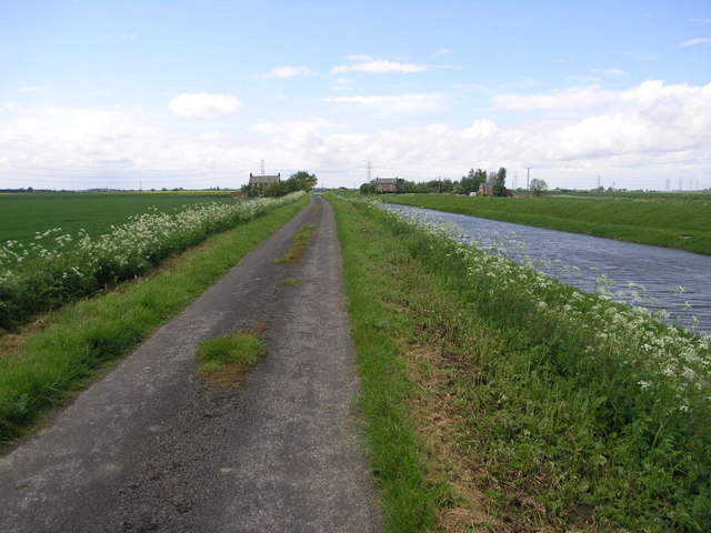
Old Gate is a small village located in the county of Lincolnshire, England. Situated in the East Midlands region, it is nestled amidst picturesque countryside and offers a serene and idyllic setting for its residents. The village is part of the district of North Kesteven and lies approximately 12 miles northeast of the city of Lincoln.
With a population of around 400 inhabitants, Old Gate retains a close-knit community feel. The village is characterized by its charming traditional architecture, consisting mainly of quaint cottages and farmhouses. The well-preserved historic buildings contribute to the village's unique ambiance and attract visitors from near and far.
The landscape surrounding Old Gate is predominantly agricultural, with vast fields and rolling hills. The area is renowned for its fertile soil, making it an ideal location for farming activities, particularly livestock rearing and crop cultivation. The local economy is largely dependent on agriculture, and farming has been a way of life for generations in this rural community.
Residents and visitors alike can enjoy the tranquility of the village and explore the beautiful natural surroundings. The area offers numerous walking trails and cycling routes, allowing outdoor enthusiasts to immerse themselves in the stunning landscapes and enjoy the local flora and fauna.
Although Old Gate may be a small village, it boasts a strong sense of community spirit and a rich history that is cherished by its inhabitants. Its peaceful ambiance and rural charm make it an appealing destination for those seeking a break from the hustle and bustle of city life.
If you have any feedback on the listing, please let us know in the comments section below.
Old Gate Images
Images are sourced within 2km of 52.7674/0.1017 or Grid Reference TF4120. Thanks to Geograph Open Source API. All images are credited.


Old Gate is located at Grid Ref: TF4120 (Lat: 52.7674, Lng: 0.1017)
Division: Parts of Holland
Administrative County: Lincolnshire
District: South Holland
Police Authority: Lincolnshire
What 3 Words
///silly.export.palettes. Near Fleet, Lincolnshire
Related Wikis

Low Fulney
Low Fulney is a hamlet in the South Holland district of Lincolnshire, England. It is in the Spalding St. Paul's ward of the South Holland District Council...

Gedney Broadgate
Gedney Broadgate is a hamlet in the civil parish of Gedney and the South Holland district of Lincolnshire, England. It is situated west from the A17 road...

Long Sutton railway station
Long Sutton railway station was a station in Long Sutton, Lincolnshire, England. It was part of the Midland and Great Northern Joint Railway which closed...

Long Sutton, Lincolnshire
Long Sutton is a market town in the South Holland district of Lincolnshire, England. It lies in The Fens, close to the Wash, 13 miles (21 km) east of Spalding...
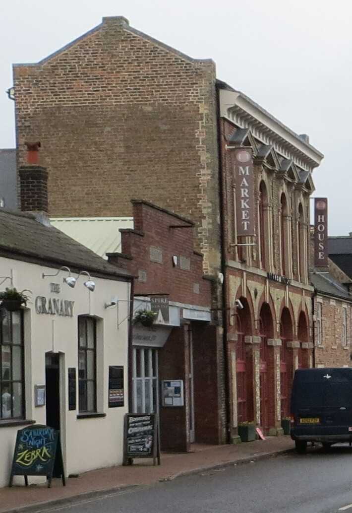
Long Sutton Market House
Long Sutton Market House, also known as Long Sutton Market House and Corn Exchange, is a commercial building in Market Street in Long Sutton, Lincolnshire...

Gedney railway station
Gedney railway station was a station in Gedney, Lincolnshire. It was a station on the Midland and Great Northern Joint Railway network. It opened on 1...

Tydd St Mary
Tydd St Mary is a village and civil parish in the South Holland district of Lincolnshire, England, about 9 miles (14 km) east of the town of Spalding and...

Sutton St James
Sutton St James is a village and civil parish in the South Holland district of Lincolnshire, England, about four miles (6.4 km) south-west of Long Sutton...
Related Videos

Dog walk at the park
13 April 2020.


Sunekos® treatment delivered by Marie at ElysiPhi Aesthetics Ltd, Long Sutton, Lincolnshire.
Contact us today to book a face to face consultation or for more information: www.elysiphi.co.uk Consent gained to share client ...
Nearby Amenities
Located within 500m of 52.7674,0.1017Have you been to Old Gate?
Leave your review of Old Gate below (or comments, questions and feedback).