Craighall, Old

Settlement in Midlothian

Scotland

Craighall, Old

Woodland, Dalkeith Park
Woodland, Dalkeith Park Credit: Richard Webb

Craighall, Old, Midlothian is a small village located in the historical county of Midlothian, Scotland. Situated approximately 6 miles southeast of the capital city of Edinburgh, it is nestled between the towns of Dalkeith and Bonnyrigg.

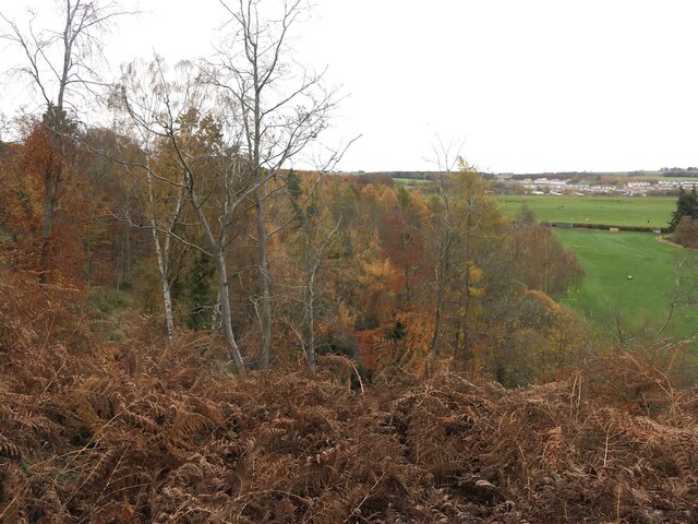
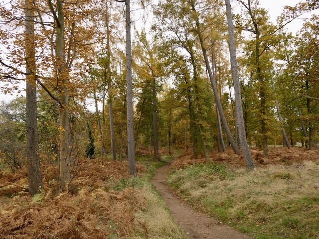
This tranquil village is characterized by its picturesque surroundings, with rolling hills and stunning landscapes. It is renowned for its rich history, dating back to the medieval period when it was a significant settlement. The name "Craighall" originates from the Gaelic words "craig" and "hall," meaning "rocky place" and "noble house" respectively, which aptly describe the village's topography and historical significance.

Despite its modest size, Craighall boasts several notable landmarks. The most prominent is Craighall Castle, an ancient ruin that stands as a testament to the village's past. The castle, believed to have been built in the 14th century, was once a grand fortress and a symbol of power and wealth. Today, only remnants of its walls and tower remain, providing a glimpse into its former glory.

The village is also home to St Peter's Church, a charming parish church that dates back to the 12th century. With its beautiful architecture and serene atmosphere, it serves as a spiritual and communal center for the local residents.

Craighall is an idyllic place for nature enthusiasts, offering numerous opportunities for outdoor activities. The surrounding countryside provides ample space for hiking, cycling, and exploring the scenic beauty of the area.

Overall, Craighall, Old, Midlothian is a quiet and historically significant village that offers a peaceful retreat from the bustling city life of nearby Edinburgh. Its combination of natural beauty and cultural heritage makes it a hidden gem in the heart of Scotland.

If you have any feedback on the listing, please let us know in the comments section below.

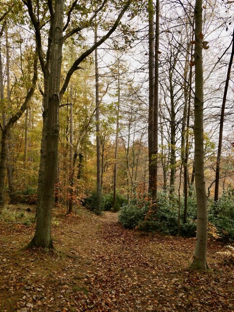
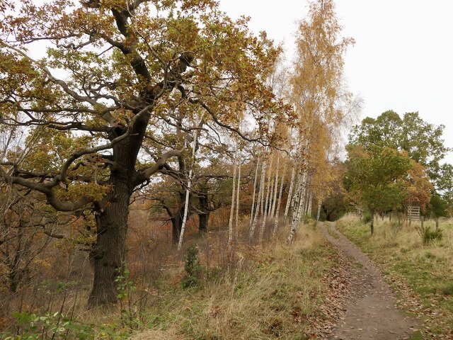
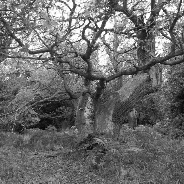
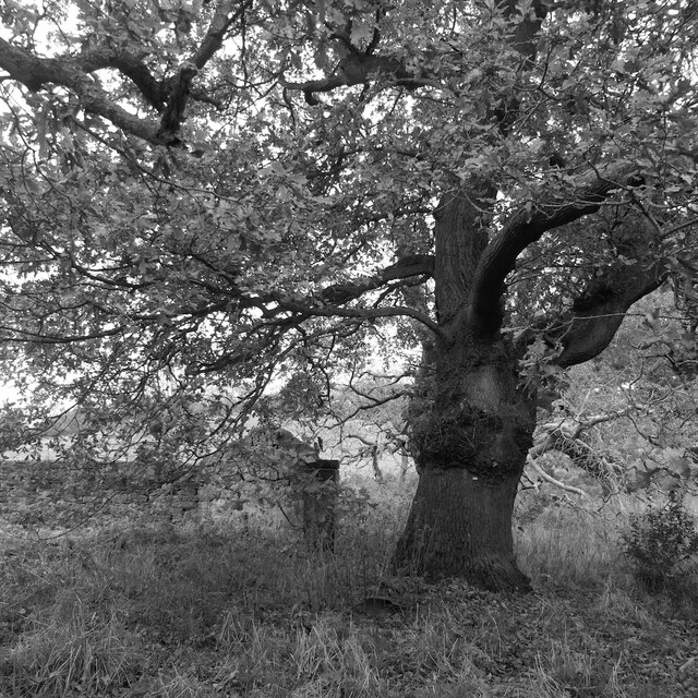
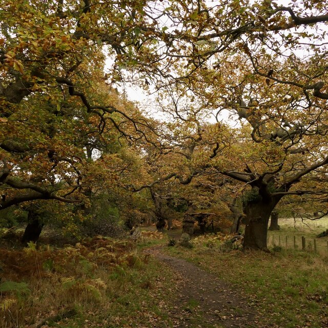
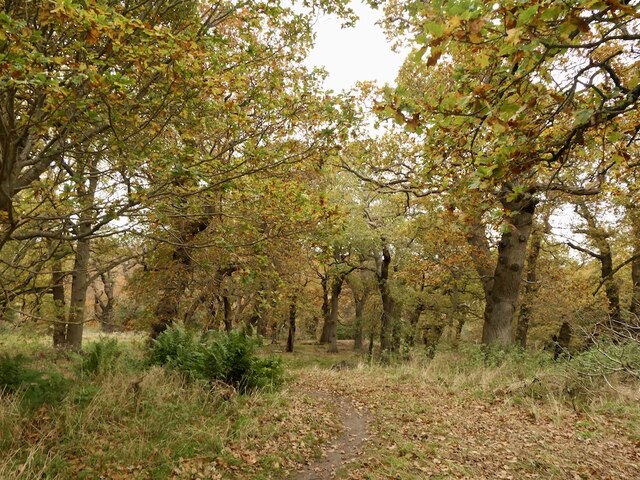
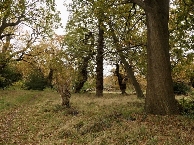
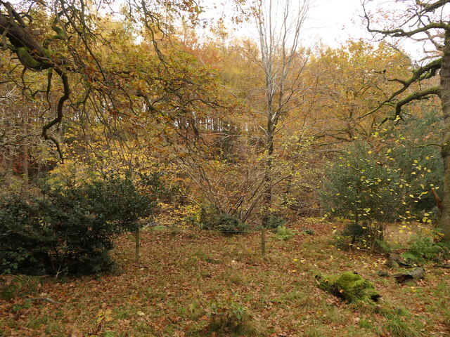
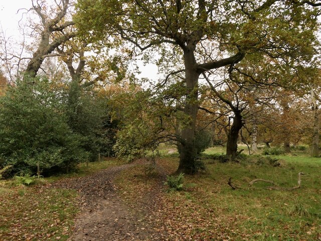
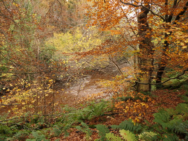
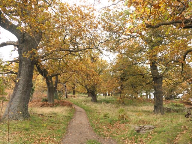
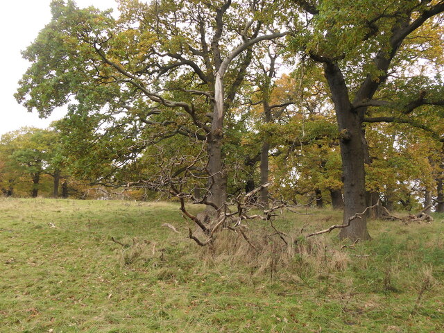
Craighall, Old Images

Images are sourced within 2km of 55.922929/-3.066377 or Grid Reference NT3370. Thanks to Geograph Open Source API. All images are credited.

Woodland, Dalkeith Park
Path, Dalkeith Park Between the North Esk and a field of Simmental cattle.
Path, Dalkeith Park
Between the North Esk and a field of Simmental cattle.
Old oak, Dalkeith Park
Oak and ruin, Dalkeith Park
Oaks, Dalkeith Park
Oaks, Dalkeith Park
Oaks, Dalkeith Park Above the Meeting of the Waters
Oaks, Dalkeith Park
Above the Meeting of the Waters
Oaks, Dalkeith Park
Oaks, Dalkeith Park
Looking across the South Esk, Dalkeith Park
Oaks, Dalkeith Park
Oaks, Dalkeith Park
River South Esk, Dalkeith Park
Oaks, Dalkeith Park
Oaks, Dalkeith Park
Oaks, Dalkeith Park
Oaks, Dalkeith Park
Steep woodland above the South Esk Above the Cat Haugh meander. There have been landslips here on the outside of the river bend.
Steep woodland above the South Esk
Above the Cat Haugh meander. There have been landslips here on the outside of the river bend.
Woodland, Dalkeith Park
New junction, Millerhill Land beyond has yet to be developed but the road junction is ready. The unused road is blocked off turning what will become a roundabout into a right angle bend.
New junction, Millerhill
Land beyond has yet to be developed but the road junction is ready. The unused road is blocked off turning what will become a roundabout into a right angle bend.
Waiting for the green man, Millerhill A road running off a new roundabout. It does not go far, the land beyond is yet to be built upon.
Waiting for the green man, Millerhill
A road running off a new roundabout. It does not go far, the land beyond is yet to be built upon.
The A68 road from the air The grade separated junction with the A6094 Slater Road, where a house can be seen encircled by roads.
The A68 road from the air
The grade separated junction with the A6094 Slater Road, where a house can be seen encircled by roads.
Whitecraig from the air On the southern outskirts of Musselburgh.
Whitecraig from the air
On the southern outskirts of Musselburgh.
Show me another place!

Craighall, Old is located at Grid Ref: NT3370 (Lat: 55.922929, Lng: -3.066377)

Unitary Authority: East Lothian

Police Authority: The Lothians and Scottish Borders

What 3 Words

///globe.butter.nation. Near Whitecraig, East Lothian

Related Wikis

Cairney railway station

Cairney railway station served the village of Millerhill, Midlothian, Scotland from 1844 to 1849 on the Edinburgh and Dalkeith Railway. == History == The...

Queen Margaret University

Queen Margaret University (Scottish Gaelic: Oilthigh BĂ nrigh Mairead) is a university founded in 1875 and located in Musselburgh, East Lothian. It is named...

Millerhill Marshalling Yard

Millerhill Marshalling Yard is a traction maintenance depot located in Millerhill, Scotland. The depot is situated on the Edinburgh and Hawick Railway...

Millerhill railway station

Millerhill railway station served the village of Millerhill, Scotland, from 1847 to 1965 on the Waverley Route. == History == The station opened on 1 September...

Nearby Amenities

Located within 500m of 55.922929,-3.066377
Traffic Signals
Traffic Signals: signal
Traffic Signals Direction: forward
Lat/Long: 55.9241379/-3.0604447
Traffic Signals
Traffic Signals: signal
Traffic Signals Direction: forward
Lat/Long: 55.9251255/-3.0604497
Motorway Junction
Old Craighall Junction
Lat/Long: 55.9266324/-3.0663309
Old Craighall
Place: village
Lat/Long: 55.9228203/-3.0666243
Bus Stop
Old Craighall
Bench: yes
Bin: yes
Lit: yes
Naptan AtcoCode: 627001030020
Naptan Bearing: NE
Naptan CommonName: Old Craighall
Naptan Indicator: at 12 Main Road
Naptan NaptanCode: 58232795
Naptan PlusbusZoneRef: EDINBUR
Naptan Street: B6415
Public Transport: platform
Shelter: yes
Source: naptan_import
Tactile Paving: no
Lat/Long: 55.9229268/-3.0664984
Bus Stop
Old Craighall
Naptan AtcoCode: 627001040020
Naptan Bearing: SW
Naptan CommonName: Old Craighall
Naptan Indicator: opposite 14 Main Road
Naptan NaptanCode: 58232794
Naptan PlusbusZoneRef: EDINBUR
Naptan Street: B6415
Naptan Verified: no
Public Transport: platform
Source: naptan_import
Lat/Long: 55.9223981/-3.0668977
Power: tower
Source: Bing
Lat/Long: 55.9217524/-3.0703496
Power: tower
Source: Bing
Lat/Long: 55.919467/-3.0659411
Traffic Signals
Traffic Signals: signal
Traffic Signals Direction: forward
Lat/Long: 55.9240971/-3.0606151
Traffic Signals
Traffic Signals: signal
Traffic Signals Direction: forward
Lat/Long: 55.9242163/-3.0590982
Power: pole
Lat/Long: 55.918877/-3.0687313
Power: pole
Lat/Long: 55.9189537/-3.0689161
Power: pole
Lat/Long: 55.9195853/-3.0677196
Power: pole
Lat/Long: 55.9196527/-3.0678788
Power: pole
Lat/Long: 55.9201379/-3.0669141
Power: pole
Lat/Long: 55.9201852/-3.0671053
Power: pole
Lat/Long: 55.9205648/-3.0663006
Power: pole
Lat/Long: 55.9206157/-3.0664726
Material: wood
Power: pole
Lat/Long: 55.9209959/-3.0597888
Power: pole
Lat/Long: 55.9212487/-3.0659216
Power: pole
Lat/Long: 55.9214582/-3.0660116
Material: wood
Power: pole
Lat/Long: 55.9215356/-3.060803
Power: pole
Lat/Long: 55.9219146/-3.0655502
Material: wood
Power: pole
Lat/Long: 55.9219586/-3.0617212
Power: pole
Lat/Long: 55.9221183/-3.0656505
Material: wood
Power: pole
Lat/Long: 55.9223762/-3.0626663
Power: pole
Lat/Long: 55.9226358/-3.065157
Power: pole
Lat/Long: 55.9227067/-3.0653201
Material: wood
Power: pole
Lat/Long: 55.9227944/-3.0635786
Power: pole
Lat/Long: 55.9232424/-3.0645847
Power: pole
Lat/Long: 55.9233296/-3.0647587
Power: pole
Lat/Long: 55.9233855/-3.0649564
Power: pole
Lat/Long: 55.9239121/-3.0642179
Power: pole
Lat/Long: 55.9239883/-3.0644104
Power: pole
Lat/Long: 55.9240414/-3.0646106
Power: pole
Lat/Long: 55.9245473/-3.0638802
Power: pole
Lat/Long: 55.9246191/-3.0640749
Power: pole
Lat/Long: 55.9246484/-3.0642725
Power: pole
Lat/Long: 55.9250869/-3.0635921
Power: pole
Lat/Long: 55.9251543/-3.0637726
Power: pole
Lat/Long: 55.9252138/-3.0639626
Addr City: Edinburgh
Addr Housenumber: 1
Addr Street: Old Craighall Road
Lat/Long: 55.9234773/-3.0659852
Addr City: Edinburgh
Addr Housenumber: 1
Addr Street: Queen Margaret University Way
Lat/Long: 55.9224439/-3.0665821
Addr City: Edinburgh
Addr Housenumber: 10
Addr Street: Old Craighall Road
Lat/Long: 55.923124/-3.0665123
Addr City: Edinburgh
Addr Housenumber: 10
Addr Street: Queen Margaret University Way
Lat/Long: 55.9225989/-3.0663491
Addr City: Edinburgh
Addr Housenumber: 11
Addr Street: Old Craighall Road
Lat/Long: 55.922988/-3.0666382
Addr City: Edinburgh
Addr Housenumber: 11
Addr Street: Queen Margaret University Way
Lat/Long: 55.922661/-3.066499
Addr City: Edinburgh
Addr Housenumber: 12
Addr Street: Old Craighall Road
Lat/Long: 55.9230067/-3.0666797
Addr City: Edinburgh
Addr Housenumber: 13
Addr Street: Old Craighall Road
Lat/Long: 55.9229436/-3.0667294
Addr City: Edinburgh
Addr Housenumber: 14
Addr Street: Old Craighall Road
Lat/Long: 55.9228868/-3.0667237
Addr City: Edinburgh
Addr Housenumber: 15
Addr Street: Old Craighall Road
Lat/Long: 55.9228186/-3.0668215
Addr City: Edinburgh
Addr Housenumber: 16
Addr Street: Old Craighall Road
Lat/Long: 55.922812/-3.0669304
Addr City: Edinburgh
Addr Housenumber: 17
Addr Street: Old Craighall Road
Lat/Long: 55.9227561/-3.0669647
Addr City: Edinburgh
Addr Housenumber: 18
Addr Street: Old Craighall Road
Lat/Long: 55.9227809/-3.0670199
Addr City: Edinburgh
Addr Housenumber: 19
Addr Street: Old Craighall Road
Lat/Long: 55.9226368/-3.0671277
Addr City: Edinburgh
Addr Housenumber: 2
Addr Street: Old Craighall Road
Lat/Long: 55.9234144/-3.0659827
Addr City: Edinburgh
Addr Housenumber: 2
Addr Street: Queen Margaret University Way
Lat/Long: 55.9223286/-3.0667507
Addr City: Edinburgh
Addr Housenumber: 20
Addr Street: Old Craighall Road
Lat/Long: 55.922663/-3.0671861
Addr City: Edinburgh
Addr Housenumber: 21
Addr Street: Old Craighall Road
Lat/Long: 55.9225696/-3.0671937
Addr City: Edinburgh
Addr Housenumber: 22
Addr Street: Old Craighall Road
Lat/Long: 55.9226018/-3.0672655
Addr City: Edinburgh
Addr Housenumber: 23
Addr Street: Old Craighall Road
Lat/Long: 55.9224559/-3.0673692
Addr City: Edinburgh
Addr Housenumber: 24
Addr Street: Old Craighall Road
Lat/Long: 55.9224861/-3.0674365
Addr City: Edinburgh
Addr Housenumber: 25
Addr Street: Old Craighall Road
Lat/Long: 55.9227708/-3.0678392
Addr City: Edinburgh
Addr Housenumber: 26
Addr Street: Old Craighall Road
Lat/Long: 55.9227884/-3.0677649
Addr City: Edinburgh
Addr Housenumber: 27
Addr Street: Old Craighall Road
Lat/Long: 55.9229077/-3.0679496
Addr City: Edinburgh
Addr Housenumber: 28
Addr Street: Old Craighall Road
Lat/Long: 55.9229275/-3.0678661
Addr City: Edinburgh
Addr Housenumber: 3
Addr Street: Old Craighall Road
Lat/Long: 55.9233466/-3.06608
Addr City: Edinburgh
Addr Housenumber: 3
Addr Street: Queen Margaret University Way
Lat/Long: 55.9222177/-3.0668984
Addr City: Edinburgh
Addr Housenumber: 33
Addr Street: Old Craighall Road
Lat/Long: 55.9244644/-3.0653783
Addr City: Edinburgh
Addr Housenumber: 34
Addr Street: Old Craighall Road
Lat/Long: 55.924781/-3.0653089
Addr City: Edinburgh
Addr Housenumber: 4
Addr Street: Old Craighall Road
Lat/Long: 55.9233407/-3.0661751
Addr City: Edinburgh
Addr Housenumber: 4
Addr Street: Queen Margaret University Way
Lat/Long: 55.9221052/-3.0666313
Addr City: Edinburgh
Addr Housenumber: 5
Addr Street: Old Craighall Road
Lat/Long: 55.9232755/-3.0662321
Addr City: Edinburgh
Addr Housenumber: 5
Addr Street: Queen Margaret University Way
Lat/Long: 55.9222015/-3.0664993
Addr City: Edinburgh
Addr Housenumber: 6
Addr Street: Old Craighall Road
Lat/Long: 55.9232942/-3.0662737
Addr City: Edinburgh
Addr Housenumber: 6
Addr Street: Queen Margaret University Way
Lat/Long: 55.9222843/-3.0663903
Addr City: Edinburgh
Addr Housenumber: 7
Addr Street: Old Craighall Road
Lat/Long: 55.9231582/-3.0663996
Addr City: Edinburgh
Addr Housenumber: 7
Addr Street: Queen Margaret University Way
Lat/Long: 55.9224246/-3.0659679
Addr City: Edinburgh
Addr Housenumber: 8
Addr Street: Old Craighall Road
Lat/Long: 55.9231769/-3.0664412
Addr City: Edinburgh
Addr Housenumber: 8
Addr Street: Queen Margaret University Way
Lat/Long: 55.9224812/-3.0660969
Addr City: Edinburgh
Addr Housenumber: 9
Addr Street: Old Craighall Road
Lat/Long: 55.9231053/-3.0664707
Addr City: Edinburgh
Addr Housenumber: 9
Addr Street: Queen Margaret University Way
Lat/Long: 55.9225422/-3.0662276
Post Box
Collection Times: Mo-Sa 12:00
Operator: Royal Mail
Post Box Type: lamp
Ref: EH21 96
Royal Cypher: scottish_crown
Lat/Long: 55.9229199/-3.0665372
Communication Mobile Phone: yes
Man Made: mast
Tower Construction: tube
Tower Type: communication
Lat/Long: 55.9270183/-3.0638354
Traffic Signals
Traffic Signals: signal
Traffic Signals Direction: forward
Lat/Long: 55.9241137/-3.0590133
Old Craighall
Place: locality
Lat/Long: 55.9261758/-3.0614195
Traffic Signals
Traffic Signals: signal
Traffic Signals Direction: forward
Lat/Long: 55.9251979/-3.060513
Railway: signal
Railway Signal Direction: backward
Railway Signal Main: GB-NR:main
Railway Signal Main Form: light
Ref: EM19
Lat/Long: 55.9220975/-3.0712119
Railway: signal
Railway Signal Direction: backward
Railway Signal Main: GB-NR:main
Railway Signal Main Form: light
Ref: EM17
Lat/Long: 55.9221057/-3.0711413
The data included in this document is from www.openstreetmap.org. The data is made available under ODbL.

Have you been to Craighall, Old?

Leave your review of Craighall, Old below (or comments, questions and feedback).