Chalford, Old

Settlement in Oxfordshire West Oxfordshire

England

Chalford, Old

Lane down to Lidstone From A44 the lane down to Lidstone
Lane down to Lidstone Credit: Shaun Ferguson

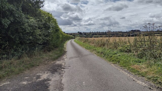
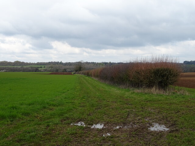
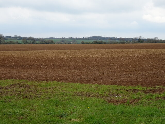
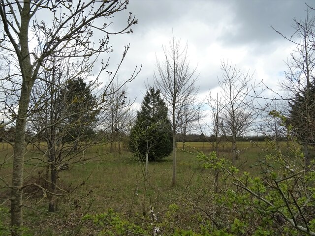
Chalford is a small village located in the southern part of Oxfordshire, England. Situated within the district of South Oxfordshire, it falls under the jurisdiction of the civil parish of Chalford. The village is nestled in the heart of the Oxfordshire countryside, offering picturesque views and a peaceful atmosphere.

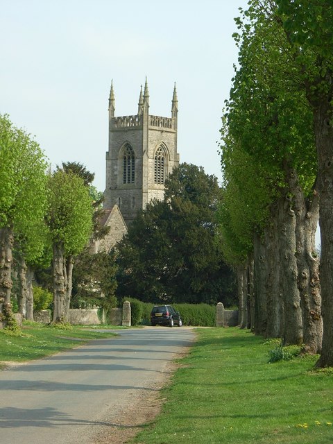
Chalford is known for its rich history, with evidence of human habitation in the area dating back to the Iron Age. The village boasts several historic landmarks, including the Grade II listed St. Mary's Church, which dates back to the 12th century. This beautiful church is a popular attraction for visitors interested in exploring the area's heritage.

The village itself is relatively small, with a close-knit community that takes pride in its surroundings. Chalford is characterized by charming cottages and well-maintained gardens, showcasing the quintessential English countryside aesthetic. The village also benefits from a local pub, providing a gathering place for residents and visitors alike.

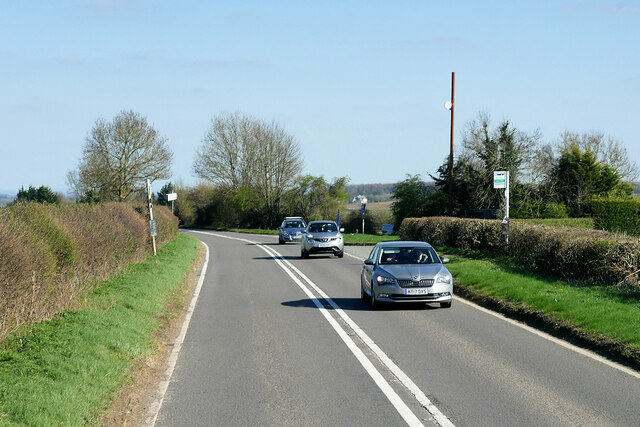
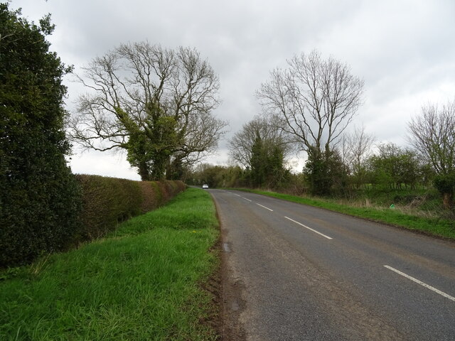
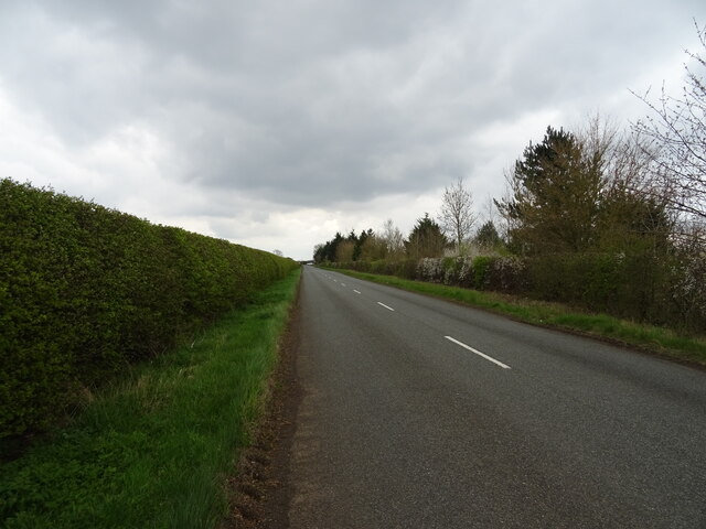
Despite its rural setting, Chalford is conveniently located close to major transport links. The nearby town of Wallingford provides access to regular bus services, and the village is within easy reach of the A4130, connecting it to larger towns and cities in the region.

Chalford is the ideal destination for those seeking a tranquil retreat in the Oxfordshire countryside, offering a glimpse into the past and a chance to embrace the beauty of rural England.

If you have any feedback on the listing, please let us know in the comments section below.

Chalford, Old Images

Images are sourced within 2km of 51.928704/-1.498222 or Grid Reference SP3425. Thanks to Geograph Open Source API. All images are credited.

Lane down to Lidstone From A44 the lane down to Lidstone
Lane down to Lidstone
From A44 the lane down to Lidstone
Heythrop Manor Garden View from the Manor House at Heythrop Park.
Heythrop Manor Garden
View from the Manor House at Heythrop Park.
Heythrop Park Manor House Heythrop Park is a Grade II* listed <span class="nowrap"><a title="https://historicengland.org.uk/listing/the-list/list-entry/1052781?section=official-list-entry" rel="nofollow ugc noopener" href="https://historicengland.org.uk/listing/the-list/list-entry/1052781?section=official-list-entry">Link</a><img style="margin-left:2px;" alt="External link" title="External link - shift click to open in new window" src="https://s1.geograph.org.uk/img/external.png" width="10" height="10"/></span> ) early 18th-century (ca1705) country house set in 400 acres of parkland approximately 1-mile southeast of the village of Heythrop in Oxfordshire. It was designed by the architect Thomas Archer in the Baroque style for Charles Talbot, 1st Duke of Shrewsbury. The original interior was gutted by a fire in 1831; it was restored and partly rebuilt in 1871 by Alfred Waterhouse. 

From 1922 until 1970 Heythrop housed a Jesuit tertiary education college, and later a training establishment. When the Jesuit college moved to London as part of the University in 1970, Heythrop Park was acquired by the National Westminster Bank which converted the house and its precincts into a staff training and conference centre. The house is now the main building of the Heythrop Park Hotel, Golf & Country Club, part of the Warner Leisure Hotels chain.
Heythrop Park Manor House
Heythrop Park is a Grade II* listed LinkExternal link ) early 18th-century (ca1705) country house set in 400 acres of parkland approximately 1-mile southeast of the village of Heythrop in Oxfordshire. It was designed by the architect Thomas Archer in the Baroque style for Charles Talbot, 1st Duke of Shrewsbury. The original interior was gutted by a fire in 1831; it was restored and partly rebuilt in 1871 by Alfred Waterhouse. From 1922 until 1970 Heythrop housed a Jesuit tertiary education college, and later a training establishment. When the Jesuit college moved to London as part of the University in 1970, Heythrop Park was acquired by the National Westminster Bank which converted the house and its precincts into a staff training and conference centre. The house is now the main building of the Heythrop Park Hotel, Golf & Country Club, part of the Warner Leisure Hotels chain.
Manor House at Heythrop Park Heythrop Park is a Grade II* listed <span class="nowrap"><a title="https://historicengland.org.uk/listing/the-list/list-entry/1052781?section=official-list-entry" rel="nofollow ugc noopener" href="https://historicengland.org.uk/listing/the-list/list-entry/1052781?section=official-list-entry">Link</a><img style="margin-left:2px;" alt="External link" title="External link - shift click to open in new window" src="https://s1.geograph.org.uk/img/external.png" width="10" height="10"/></span> ) early 18th-century (ca1705) country house set in 400 acres of parkland approximately 1-mile southeast of the village of Heythrop in Oxfordshire. It was designed by the architect Thomas Archer in the Baroque style for Charles Talbot, 1st Duke of Shrewsbury. The original interior was gutted by a fire in 1831; it was restored and partly rebuilt in 1871 by Alfred Waterhouse. 

From 1922 until 1970 Heythrop housed a Jesuit tertiary education college, and later a training establishment. When the Jesuit college moved to London as part of the University in 1970, Heythrop Park was acquired by the National Westminster Bank which converted the house and its precincts into a staff training and conference centre. The house is now the main building of the Heythrop Park Hotel, Golf & Country Club, part of the Warner Leisure Hotels chain.
Manor House at Heythrop Park
Heythrop Park is a Grade II* listed LinkExternal link ) early 18th-century (ca1705) country house set in 400 acres of parkland approximately 1-mile southeast of the village of Heythrop in Oxfordshire. It was designed by the architect Thomas Archer in the Baroque style for Charles Talbot, 1st Duke of Shrewsbury. The original interior was gutted by a fire in 1831; it was restored and partly rebuilt in 1871 by Alfred Waterhouse. From 1922 until 1970 Heythrop housed a Jesuit tertiary education college, and later a training establishment. When the Jesuit college moved to London as part of the University in 1970, Heythrop Park was acquired by the National Westminster Bank which converted the house and its precincts into a staff training and conference centre. The house is now the main building of the Heythrop Park Hotel, Golf & Country Club, part of the Warner Leisure Hotels chain.
Heythrop Park Hotel and Country Club Heythrop Park is a Grade II* listed <span class="nowrap"><a title="https://historicengland.org.uk/listing/the-list/list-entry/1052781?section=official-list-entry" rel="nofollow ugc noopener" href="https://historicengland.org.uk/listing/the-list/list-entry/1052781?section=official-list-entry">Link</a><img style="margin-left:2px;" alt="External link" title="External link - shift click to open in new window" src="https://s1.geograph.org.uk/img/external.png" width="10" height="10"/></span> ) early 18th-century (ca1705) country house set in 400 acres of parkland approximately 1-mile southeast of the village of Heythrop in Oxfordshire. It was designed by the architect Thomas Archer in the Baroque style for Charles Talbot, 1st Duke of Shrewsbury. The original interior was gutted by a fire in 1831; it was restored and partly rebuilt in 1871 by Alfred Waterhouse. 

From 1922 until 1970 Heythrop housed a Jesuit tertiary education college, and later a training establishment. When the Jesuit college moved to London as part of the University in 1970, Heythrop Park was acquired by the National Westminster Bank which converted the house and its precincts into a staff training and conference centre. The house is now the main building of the Heythrop Park Hotel, Golf & Country Club, part of the Warner Leisure Hotels chain.
Heythrop Park Hotel and Country Club
Heythrop Park is a Grade II* listed LinkExternal link ) early 18th-century (ca1705) country house set in 400 acres of parkland approximately 1-mile southeast of the village of Heythrop in Oxfordshire. It was designed by the architect Thomas Archer in the Baroque style for Charles Talbot, 1st Duke of Shrewsbury. The original interior was gutted by a fire in 1831; it was restored and partly rebuilt in 1871 by Alfred Waterhouse. From 1922 until 1970 Heythrop housed a Jesuit tertiary education college, and later a training establishment. When the Jesuit college moved to London as part of the University in 1970, Heythrop Park was acquired by the National Westminster Bank which converted the house and its precincts into a staff training and conference centre. The house is now the main building of the Heythrop Park Hotel, Golf & Country Club, part of the Warner Leisure Hotels chain.
Heythrop Park Hotel Heythrop Park Hotel is a Warner Leisure Hotel
Heythrop Park Hotel
Heythrop Park Hotel is a Warner Leisure Hotel
Layby on the A44 near Chalford Oaks The A44 is a major road in the United Kingdom that runs for 155 miles from Oxford in southern England to Aberystwyth in west Wales.
<span class="nowrap"><a title="http://www.sabre-roads.org.uk/wiki/index.php?title=A44" rel="nofollow ugc noopener" href="http://www.sabre-roads.org.uk/wiki/index.php?title=A44">Link</a><img style="margin-left:2px;" alt="External link" title="External link - shift click to open in new window" src="https://s1.geograph.org.uk/img/external.png" width="10" height="10"/></span>  SABRE
<span class="nowrap"><a title="https://en.wikipedia.org/wiki/A44_road" rel="nofollow ugc noopener" href="https://en.wikipedia.org/wiki/A44_road">Link</a><img style="margin-left:2px;" alt="External link" title="External link - shift click to open in new window" src="https://s1.geograph.org.uk/img/external.png" width="10" height="10"/></span>  Wikipedia
Layby on the A44 near Chalford Oaks
The A44 is a major road in the United Kingdom that runs for 155 miles from Oxford in southern England to Aberystwyth in west Wales. LinkExternal link SABRE LinkExternal link Wikipedia
Layby on the A44 near Old Chalford The A44 is a major road in the United Kingdom that runs for 155 miles from Oxford in southern England to Aberystwyth in west Wales.
<span class="nowrap"><a title="http://www.sabre-roads.org.uk/wiki/index.php?title=A44" rel="nofollow ugc noopener" href="http://www.sabre-roads.org.uk/wiki/index.php?title=A44">Link</a><img style="margin-left:2px;" alt="External link" title="External link - shift click to open in new window" src="https://s1.geograph.org.uk/img/external.png" width="10" height="10"/></span>  SABRE
<span class="nowrap"><a title="https://en.wikipedia.org/wiki/A44_road" rel="nofollow ugc noopener" href="https://en.wikipedia.org/wiki/A44_road">Link</a><img style="margin-left:2px;" alt="External link" title="External link - shift click to open in new window" src="https://s1.geograph.org.uk/img/external.png" width="10" height="10"/></span>  Wikipedia
Layby on the A44 near Old Chalford
The A44 is a major road in the United Kingdom that runs for 155 miles from Oxford in southern England to Aberystwyth in west Wales. LinkExternal link SABRE LinkExternal link Wikipedia
HGV on the A44 near Chalford Park Grenhaul's Scania S500 (S500 GHL) travelling north on the A44 between Enstone and Chipping Norton
HGV on the A44 near Chalford Park
Grenhaul's Scania S500 (S500 GHL) travelling north on the A44 between Enstone and Chipping Norton
A44 near Enstone The A44 is a major road in the United Kingdom that runs for 155 miles from Oxford in southern England to Aberystwyth in west Wales.
<span class="nowrap"><a title="http://www.sabre-roads.org.uk/wiki/index.php?title=A44" rel="nofollow ugc noopener" href="http://www.sabre-roads.org.uk/wiki/index.php?title=A44">Link</a><img style="margin-left:2px;" alt="External link" title="External link - shift click to open in new window" src="https://s1.geograph.org.uk/img/external.png" width="10" height="10"/></span>  SABRE
<span class="nowrap"><a title="https://en.wikipedia.org/wiki/A44_road" rel="nofollow ugc noopener" href="https://en.wikipedia.org/wiki/A44_road">Link</a><img style="margin-left:2px;" alt="External link" title="External link - shift click to open in new window" src="https://s1.geograph.org.uk/img/external.png" width="10" height="10"/></span>  Wikipedia
A44 near Enstone
The A44 is a major road in the United Kingdom that runs for 155 miles from Oxford in southern England to Aberystwyth in west Wales. LinkExternal link SABRE LinkExternal link Wikipedia
Bus Stop on the A44 near Enstone The A44 is a major road in the United Kingdom that runs for 155 miles from Oxford in southern England to Aberystwyth in west Wales.
<span class="nowrap"><a title="http://www.sabre-roads.org.uk/wiki/index.php?title=A44" rel="nofollow ugc noopener" href="http://www.sabre-roads.org.uk/wiki/index.php?title=A44">Link</a><img style="margin-left:2px;" alt="External link" title="External link - shift click to open in new window" src="https://s1.geograph.org.uk/img/external.png" width="10" height="10"/></span>  SABRE
<span class="nowrap"><a title="https://en.wikipedia.org/wiki/A44_road" rel="nofollow ugc noopener" href="https://en.wikipedia.org/wiki/A44_road">Link</a><img style="margin-left:2px;" alt="External link" title="External link - shift click to open in new window" src="https://s1.geograph.org.uk/img/external.png" width="10" height="10"/></span>  Wikipedia
Bus Stop on the A44 near Enstone
The A44 is a major road in the United Kingdom that runs for 155 miles from Oxford in southern England to Aberystwyth in west Wales. LinkExternal link SABRE LinkExternal link Wikipedia
A44 near Southcombe The A44 is a major road in the United Kingdom that runs for 155 miles from Oxford in southern England to Aberystwyth in west Wales.
<span class="nowrap"><a title="http://www.sabre-roads.org.uk/wiki/index.php?title=A44" rel="nofollow ugc noopener" href="http://www.sabre-roads.org.uk/wiki/index.php?title=A44">Link</a><img style="margin-left:2px;" alt="External link" title="External link - shift click to open in new window" src="https://s1.geograph.org.uk/img/external.png" width="10" height="10"/></span>  SABRE
<span class="nowrap"><a title="https://en.wikipedia.org/wiki/A44_road" rel="nofollow ugc noopener" href="https://en.wikipedia.org/wiki/A44_road">Link</a><img style="margin-left:2px;" alt="External link" title="External link - shift click to open in new window" src="https://s1.geograph.org.uk/img/external.png" width="10" height="10"/></span>  Wikipedia
A44 near Southcombe
The A44 is a major road in the United Kingdom that runs for 155 miles from Oxford in southern England to Aberystwyth in west Wales. LinkExternal link SABRE LinkExternal link Wikipedia
Field and hedgerow off the B4026
Prepared field off the B4026
B4026 towards Charlbury
Young woodland beside he B4026
B4026 towards Charlbury
Track to Old Chalford
Show me another place!

Chalford, Old is located at Grid Ref: SP3425 (Lat: 51.928704, Lng: -1.498222)

Administrative County: Oxfordshire

District: West Oxfordshire

Police Authority: Thames Valley

What 3 Words

///congested.happier.harvest. Near Chipping Norton, Oxfordshire

Nearby Locations

Chalford, Old Old Chalford

Related Wikis

Old Chalford

Old Chalford is a hamlet in Enstone civil parish, about 2 miles (3 km) east of Chipping Norton, Oxfordshire. Old Chalford is on the River Glyme, which...

Glyme Valley

Glyme Valley is a 28.9-hectare (71-acre) biological Site of Special Scientific Interest east of Chipping Norton in Oxfordshire. An area of 3 hectares...

Lidstone

Lidstone is a hamlet on the River Glyme in Oxfordshire, about 3 miles (5 km) east of Chipping Norton. The hamlet is in Enstone civil parish, about 1+1...
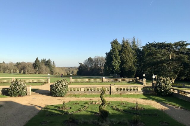
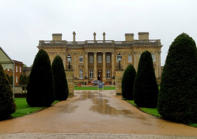
Heythrop Park

Heythrop Park is a Grade II* listed early 18th-century country house 1 mile (1.6 km) southeast of Heythrop in Oxfordshire. It was designed by the architect...

RAF Chipping Norton

Royal Air Force Chipping Norton or more simply RAF Chipping Norton is a former Royal Air Force satellite station located near Chipping Norton, Oxfordshire...

Hawk Stone

The Hawk Stone is a neolithic standing stone just north of the hamlet of Dean, Oxfordshire, England on Diddly Squat Farm belonging to Jeremy Clarkson....

Heythrop

Heythrop is a village and civil parish just over 2 miles (3 km) east of Chipping Norton, Oxfordshire. The parish includes the hamlet of Dunthrop. The 2001...

Dean, Oxfordshire

Dean is a hamlet in Spelsbury civil parish, about 2 miles (3 km) north of Charlbury and 3.5 miles (5.6 km) southeast of Chipping Norton, Oxfordshire. Its...

Nearby Amenities

Located within 500m of 51.928704,-1.498222
Ford: yes
Shelter: yes
Lat/Long: 51.9300262/-1.5034278
Parking
Description: Layby
Parking: lane
Lat/Long: 51.9319979/-1.494512
Old Chalford
Place: hamlet
Source Name: OS_OpenData_StreetView
Wikidata: Q7083633
Wikipedia: en:Old Chalford
Lat/Long: 51.928956/-1.5004044
Power: pole
Lat/Long: 51.9254069/-1.4990195
Power: pole
Lat/Long: 51.9249983/-1.4980459
Power: pole
Lat/Long: 51.9245699/-1.4969998
Power: pole
Lat/Long: 51.9258178/-1.4999951
Power: pole
Lat/Long: 51.9262073/-1.5009302
Power: pole
Lat/Long: 51.9264714/-1.501608
Power: pole
Lat/Long: 51.9269285/-1.5012257
Power: pole
Lat/Long: 51.9273022/-1.500893
Power: pole
Lat/Long: 51.9277161/-1.5005111
Power: pole
Lat/Long: 51.9280196/-1.5002563
Barrier: stile
Lat/Long: 51.9260077/-1.5009365
The data included in this document is from www.openstreetmap.org. The data is made available under ODbL.

Have you been to Chalford, Old?

Leave your review of Chalford, Old below (or comments, questions and feedback).