Old Brampton

Settlement in Derbyshire North East Derbyshire

England

Old Brampton

Barley field near the Linacre Reservoirs Chesterfield is seen in the distance.
Barley field near the Linacre Reservoirs Credit: Bill Boaden

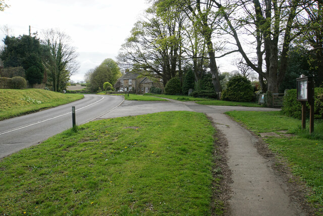
Old Brampton is a charming village located in Derbyshire, England. Situated approximately 3 miles west of the bustling market town of Chesterfield, it lies on the edge of the Peak District National Park. With a population of around 1,300, Old Brampton exudes a peaceful and picturesque ambiance.

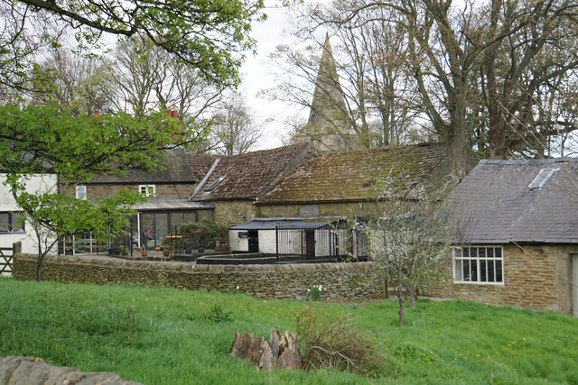
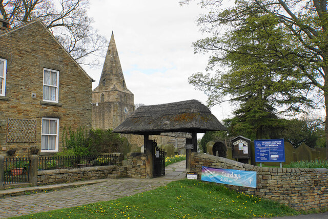
The village is renowned for its well-preserved historic buildings, showcasing a blend of architectural styles. The centerpiece is the notable St. Peter and St. Paul's Church, which dates back to the 13th century and features a striking tower. Other notable landmarks include the Old Manor House, a Grade II listed building with origins in the 17th century, and the Old Brampton Hall, an elegant Georgian building.

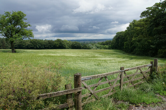
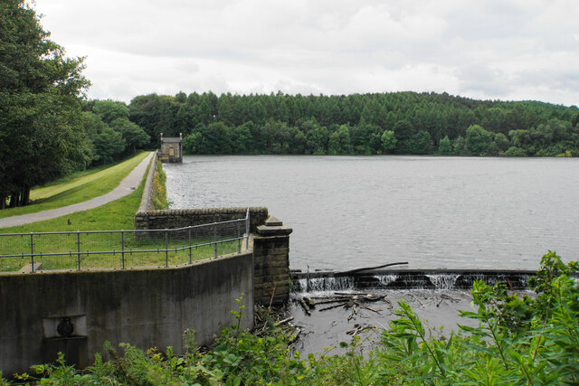
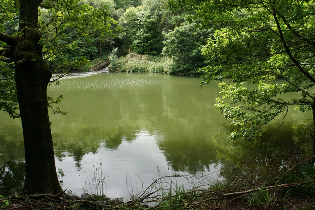
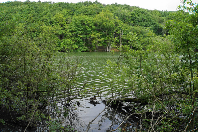
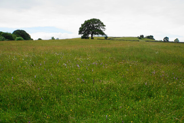
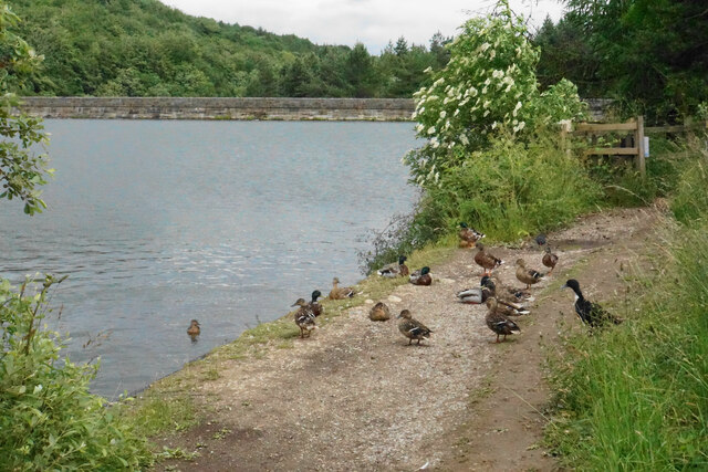
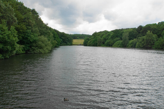
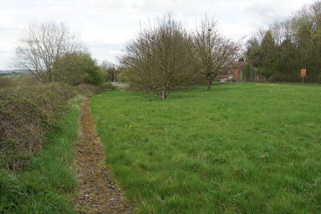
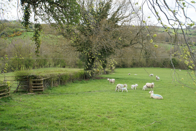
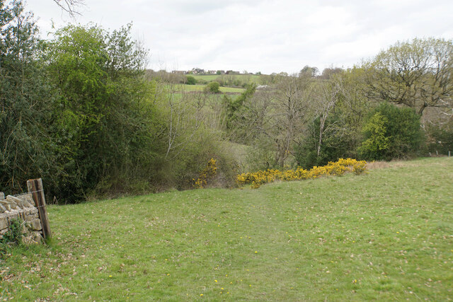
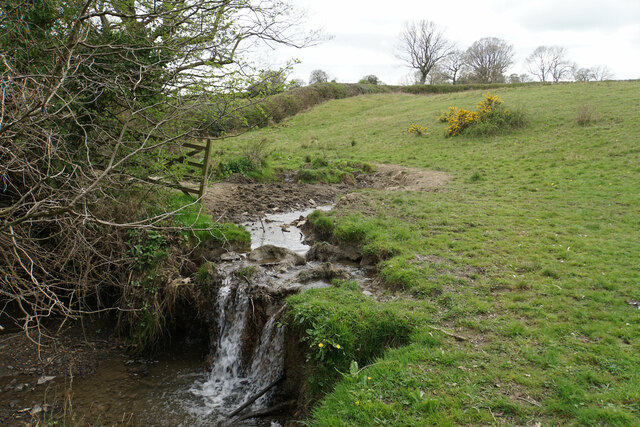
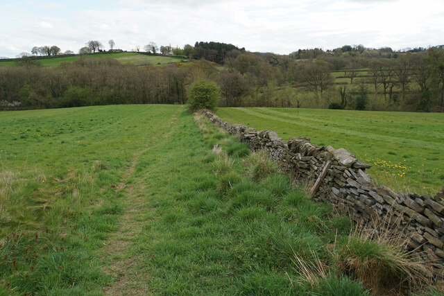
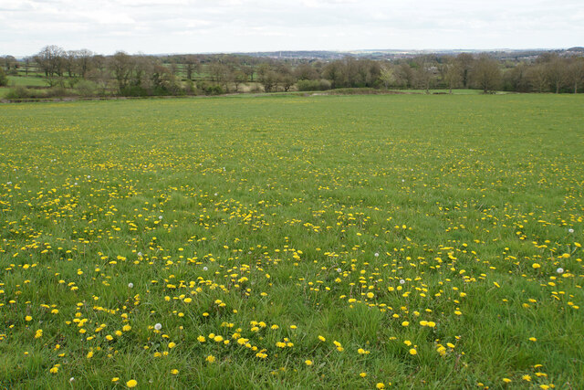
Surrounded by rolling countryside, Old Brampton offers an abundance of outdoor activities and scenic walks. The nearby Linacre Reservoirs provide a tranquil setting for fishing, birdwatching, and leisurely strolls. The village also benefits from its close proximity to the Peak District, offering opportunities for hiking, cycling, and exploring the stunning natural landscapes.

Residents and visitors alike are well catered for in terms of amenities, with a local pub, the "Three Merry Lads," serving as a popular gathering spot. The village also has a primary school, a post office, and a village hall that hosts various community events throughout the year.

Overall, Old Brampton is a captivating village that seamlessly blends its rich history with the beauty of the surrounding countryside, making it a desirable place to live or visit for those seeking a peaceful retreat.

If you have any feedback on the listing, please let us know in the comments section below.

Old Brampton Images

Images are sourced within 2km of 53.241247/-1.496491 or Grid Reference SK3371. Thanks to Geograph Open Source API. All images are credited.

Barley field near the Linacre Reservoirs Chesterfield is seen in the distance.
Barley field near the Linacre Reservoirs
Chesterfield is seen in the distance.
Outflow from Middle Linacre Reservoir
The head of Middle Linacre Reservoir Opposite is the outflow from the Upper Reservoir.
The head of Middle Linacre Reservoir
Opposite is the outflow from the Upper Reservoir.
Upper Linacre Reservoir Much of it is surrounded by ancient woodland.
Upper Linacre Reservoir
Much of it is surrounded by ancient woodland.
Meadow above Upper Linacre Reservoir The meadow has a wide diversity of plants, including marsh orchids.
Meadow above Upper Linacre Reservoir
The meadow has a wide diversity of plants, including marsh orchids.
Ducks gathering by Upper Linacre Reservoir The reservoir dam is seen behind.
Ducks gathering by Upper Linacre Reservoir
The reservoir dam is seen behind.
Lower Linacre Reservoir The smallest of the three reservoirs. The dam of the Middle Reservoir can be seen.
Lower Linacre Reservoir
The smallest of the three reservoirs. The dam of the Middle Reservoir can be seen.
Brampton, Woodnook Lane BM on roadside wall

Sk33427300
Brampton, Woodnook Lane
BM on roadside wall Sk33427300
Former course of the A619 The road from Chesterfield to Baslow used to be bendier on this side of the hill, but many of the bends have been lessened. The new road runs to the right in this image where the road signs are.
Former course of the A619
The road from Chesterfield to Baslow used to be bendier on this side of the hill, but many of the bends have been lessened. The new road runs to the right in this image where the road signs are.
Lambs with their mothers near Ladywood Farm The valley behind carries a tributary of the River Hipper.
Lambs with their mothers near Ladywood Farm
The valley behind carries a tributary of the River Hipper.
Footpath to Old Brampton Perhaps not the most scenic start for the path as it leaves the A619.
Footpath to Old Brampton
Perhaps not the most scenic start for the path as it leaves the A619.
Footpath to Old Brampton The path has just left Westwick Lane. It descends to a brook, then climbs to Old Brampton which can be seen at the top of the hill.
Footpath to Old Brampton
The path has just left Westwick Lane. It descends to a brook, then climbs to Old Brampton which can be seen at the top of the hill.
Brook below Frithhallwood Farm A footpath crosses this brook. It is fine at the moment, but could be a challenge in the winter months when the mud is wet and soft.
Brook below Frithhallwood Farm
A footpath crosses this brook. It is fine at the moment, but could be a challenge in the winter months when the mud is wet and soft.
Footpath towards Chanderhill Two brooks are crossed in the valley bottom before the path climbs the other side.
Footpath towards Chanderhill
Two brooks are crossed in the valley bottom before the path climbs the other side.
Field of dandelions near Old Brampton From this field you can see down to Chesterfield with its crooked spire.
Field of dandelions near Old Brampton
From this field you can see down to Chesterfield with its crooked spire.
Old Brampton A view of the old part of the village from a footpath approaching from the south.
Old Brampton
A view of the old part of the village from a footpath approaching from the south.
Parish church of St Peter & St Paul, Old Brampton A Grade I listed church dating from the 14th Century with Victorian renovations. The lych gate is one of a pair donated in 1937.
Parish church of St Peter & St Paul, Old Brampton
A Grade I listed church dating from the 14th Century with Victorian renovations. The lych gate is one of a pair donated in 1937.
Hemming Green The road is climbing steadily from Old Brampton. On the right is a parish council noticeboard.
Hemming Green
The road is climbing steadily from Old Brampton. On the right is a parish council noticeboard.
Show me another place!

Old Brampton is located at Grid Ref: SK3371 (Lat: 53.241247, Lng: -1.496491)

Administrative County: Derbyshire

District: North East Derbyshire

Police Authority: Derbyshire

What 3 Words

///comedy.slack.makeovers. Near Walton, Derbyshire

Related Wikis

St Peter and St Paul's Church, Old Brampton

St Peter and St Paul's Church is a Grade I listed parish church in the Church of England in Old Brampton, Brampton, North East Derbyshire. == History... ==

Old Brampton

Old Brampton is a village in the civil parish of Brampton, in the county of Derbyshire, England. It lies 3 miles to the west of Chesterfield, on a spur...

Ingmanthorpe, Derbyshire

Ingmanthorpe is a hamlet in Brampton, Derbyshire, England. Ingmanthorpe is located on the B6050 road some 3 miles (4.8 km) west of the town of Chesterfield...

Brampton, North East Derbyshire

Brampton is a civil parish in North East Derbyshire, England, with a population of 1,201 in 2011. Lying 130 miles (210 km) north west of London, 20 miles...

Brookfield Community School, Chesterfield

Brookfield Community School is an academy school located on Chatsworth Road (A619) in the west of Chesterfield, Derbyshire. The school's most recent Ofsted...

Somersall Hall

Somersall Hall is a small country house near Brampton, Chesterfield, Derbyshire. It is a Grade II listed building.The Clarke family owned the estate in...

Wadshelf

Wadshelf is a small village in Derbyshire, England. It is located between Chesterfield and Baslow, just inside the Peak District national park. It is near...

Brampton, Derbyshire

Brampton is a suburb in the west of Chesterfield, Derbyshire. Originally a village known as New Brampton and separate from the town, it became absorbed...

Nearby Amenities

Located within 500m of 53.241247,-1.496491
Post Box
Collection Times: Mo-Fr 09:00; Sa 07:00
Post Box Mounting: brick_pillar
Post Box Type: wall
Ref: S42 199D
Royal Cypher: GR
Royal Cypher Wikidata: Q33102273
Lat/Long: 53.2432181/-1.4993318
Public Bookcase
Booth: K6
Colour: red
Covered: booth
Disused Amenity: telephone
Man Made: telephone_box
Public Bookcase Type: phone_box
Lat/Long: 53.2432021/-1.4992986
Old Brampton
Is In: Derbyshire, England, UK
Place: village
Wikidata: Q7083519
Wikipedia: en:Old Brampton
Lat/Long: 53.2425417/-1.4986012
Bus Stop
George & Dragon (both ways)
Bus: yes
Public Transport: platform
Lat/Long: 53.2429056/-1.4970662
Ele: 162.3471680
Lat/Long: 53.2389292/-1.497974
Ele: 159.2229004
Lat/Long: 53.2379135/-1.4976357
Ele: 158.7421875
Lat/Long: 53.2374893/-1.4974661
Ele: 191.9074707
Information: board
Tourism: information
Lat/Long: 53.2431929/-1.4992582
Bus Stop
Bus: yes
Ele: 184
Public Transport: platform
Lat/Long: 53.2427807/-1.4971418
Ele: 159
Lat/Long: 53.2377179/-1.5001137
Ele: 159
Lat/Long: 53.2388407/-1.4996646
Ele: 158
Lat/Long: 53.2392757/-1.4994391
Barrier: stile
Ele: 175
Steps: 3
Stile: wall
Lat/Long: 53.2406878/-1.4995574
Barrier: stile
Ele: 181
Steps: 3
Stile: wall
Lat/Long: 53.2418163/-1.4988863
Barrier: stile
Ele: 187
Stile: squeezer
Lat/Long: 53.2430111/-1.49903
Ele: 185
Lat/Long: 53.2430269/-1.4990087
Barrier: stile
Ele: 166
Steps: 0
Stile: stepover
Lat/Long: 53.2434933/-1.4908015
Ele: 176.0457764
Lat/Long: 53.2428825/-1.4938632
Ele: 178.9298096
Lat/Long: 53.2437861/-1.4977761
Barrier: stile
Ele: 178.9298096
Steps: 2
Stile: stepover
Lat/Long: 53.2437897/-1.4976537
Barrier: stile
Ele: 176.5264893
Steps: 0
Stile: stepover
Lat/Long: 53.2439953/-1.4976752
Barrier: stile
Ele: 171.2392578
Steps: 0
Stile: stepover
Lat/Long: 53.2448736/-1.4975491
Barrier: stile
Steps: 0
Stile: stepover
Lat/Long: 53.2443812/-1.4912167
Restaurant
Dragon's Fold
Lat/Long: 53.2427469/-1.4970267
Barrier: stile
Steps: 0
Stile: stepover
Lat/Long: 53.2435024/-1.4908428
Parking
Lat/Long: 53.2428208/-1.4902999
Barrier: stile
Steps: 1
Stile: wall
Lat/Long: 53.237217/-1.4990252
Defibrillator
Access: yes
Check Date: 2023-03-08
Defibrillator Location: outside The School Room, Old Brampton
Emergency: defibrillator
Indoor: no
Ref GB The Circuit: C45EB2C4-A158-430E-9A2C-51ECDD98630A
Lat/Long: 53.2432032/-1.4986095
Generator Method: photovoltaic
Generator Output Electricity: yes
Generator Source: solar
Generator Type: solar_photovoltaic_panel
Location: roof
Power: generator
Lat/Long: 53.2432351/-1.4977959
Generator Method: photovoltaic
Generator Output Electricity: yes
Generator Source: solar
Generator Type: solar_photovoltaic_panel
Location: roof
Power: generator
Lat/Long: 53.242418/-1.5025877
The data included in this document is from www.openstreetmap.org. The data is made available under ODbL.

Have you been to Old Brampton?

Leave your review of Old Brampton below (or comments, questions and feedback).