Oathill

Settlement in Somerset

England

Oathill

Chard Road, Drimpton
Chard Road, Drimpton Credit: Vieve Forward

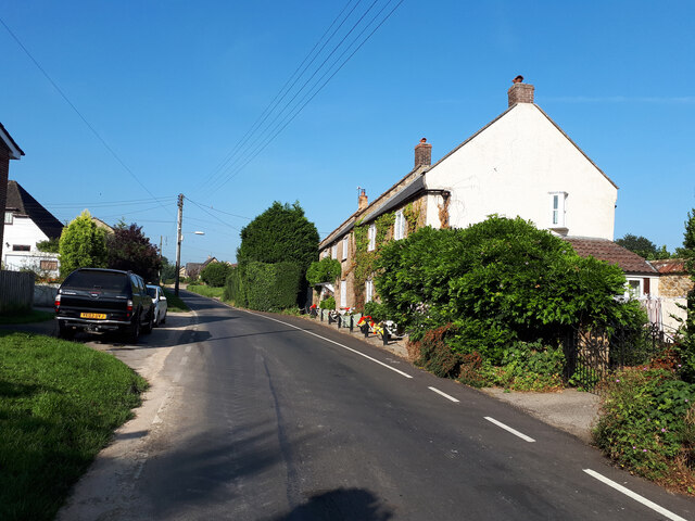
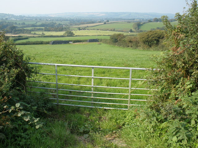
Oathill is a small village located in Somerset, England. It is situated on the outskirts of the town of Street and is surrounded by picturesque countryside. The village is known for its charming rural setting and quaint cottages, making it a popular destination for those seeking a peaceful and idyllic retreat.

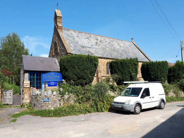
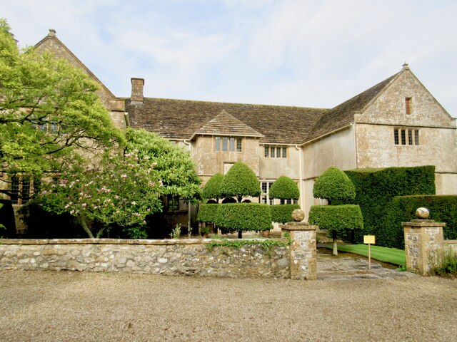
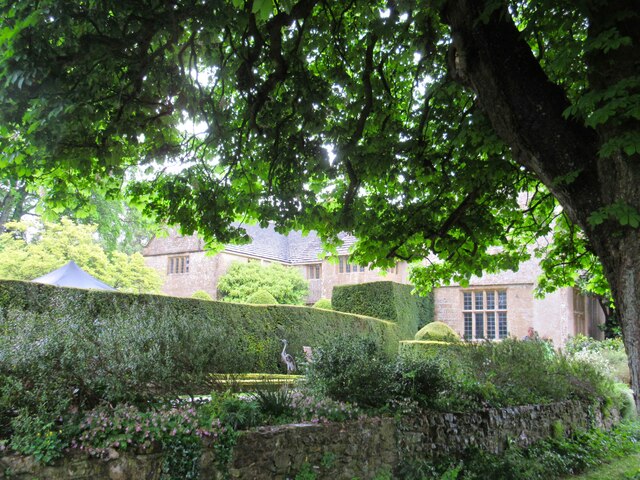
Oathill is home to a close-knit community of residents who take pride in their village and its heritage. The village has a rich history, with many of its buildings dating back to the medieval period. Visitors to Oathill can explore the historic architecture, including the parish church and traditional thatched cottages that line the streets.

In addition to its historical charm, Oathill offers a range of amenities for residents and visitors alike. The village has a local pub, community center, and small shops, providing essential services and a sense of community cohesion.

Overall, Oathill is a charming village in Somerset that offers a peaceful and picturesque setting for those looking to escape the hustle and bustle of modern life. Its historic charm, friendly community, and beautiful surroundings make it a hidden gem in the English countryside.

If you have any feedback on the listing, please let us know in the comments section below.

Oathill Images

Images are sourced within 2km of 50.8414/-2.8535193 or Grid Reference ST4005. Thanks to Geograph Open Source API. All images are credited.

Chard Road, Drimpton
St Mary's Church, Drimpton
Old Boundary Marker on Clapton Road, West Crewkerne Parish Boundary Marker set in the garden wall of Mill House on the north side of the T junction of the B3165 Clapton Road and Wayford Hill. West Crewkerne parish. Although it was probably erected to show the boundary of Wayford and Crewkerne parishes, the current boundary of Wayford and West Crewkerne (created from part of Crewkerne in 1894) has been about 20 metres to the northwest since at least 1885. Grade II Listed details <span class="nowrap"><a title="https://historicengland.org.uk/listing/the-list/list-entry/1345959" rel="nofollow ugc noopener" href="https://historicengland.org.uk/listing/the-list/list-entry/1345959">Link</a><img style="margin-left:2px;" alt="External link" title="External link - shift click to open in new window" src="https://s1.geograph.org.uk/img/external.png" width="10" height="10"/></span>. 

Milestone Society National ID: SO_WAYWCR01pb
Old Boundary Marker on Clapton Road, West Crewkerne
Parish Boundary Marker set in the garden wall of Mill House on the north side of the T junction of the B3165 Clapton Road and Wayford Hill. West Crewkerne parish. Although it was probably erected to show the boundary of Wayford and Crewkerne parishes, the current boundary of Wayford and West Crewkerne (created from part of Crewkerne in 1894) has been about 20 metres to the northwest since at least 1885. Grade II Listed details LinkExternal link. Milestone Society National ID: SO_WAYWCR01pb
St Michael's Church Wayford - interior Built in the 13th C and Grade II listed.
St Michael's Church Wayford - interior
Built in the 13th C and Grade II listed.
Wayford Manor Once home to the Daubeney and Pinney families, Wayford Manor was rebuilt circa 1602 from a much earlier dwelling for Giles Daubeney.  Since then it has been added to and restored a number of times.
Wayford Manor
Once home to the Daubeney and Pinney families, Wayford Manor was rebuilt circa 1602 from a much earlier dwelling for Giles Daubeney. Since then it has been added to and restored a number of times.
Wayford Manor - garden The garden is terraced and sloping and partly wooded with many beautiful hidden corners, plants and trees.  It is open to the public once a year.
Wayford Manor - garden
The garden is terraced and sloping and partly wooded with many beautiful hidden corners, plants and trees. It is open to the public once a year.
Cuckoo Lane, approaching Chaffeigh Farm
Lower Synderford Farm
Footpath and stile, Stony Knaps
Primrose Cottage from Blackdown Hill
Holy Trinity Church, Blackdown, Dorset
Methodist Chapel, Netherhay, Dorset
St. Mary's, Drimpton, Dorset
St. Michael and All Angels, Wayford, Somerset The style of windows would indicate that construction was some time during the 13th-century, although the rendering could have been applied during a restoration in 1902. It was during that restoration that the North aisle was built.
St. Michael and All Angels, Wayford, Somerset
The style of windows would indicate that construction was some time during the 13th-century, although the rendering could have been applied during a restoration in 1902. It was during that restoration that the North aisle was built.
St. Michael and All Angels, Wayford, Somerset The Nave
St. Michael and All Angels, Wayford, Somerset
The Nave
St. Michael and All Angels, Wayford, Somerset Royal Coat of Arms - to remind the parishioners of the Monarch they pray for
St. Michael and All Angels, Wayford, Somerset
Royal Coat of Arms - to remind the parishioners of the Monarch they pray for
Show me another place!

Oathill is located at Grid Ref: ST4005 (Lat: 50.8414, Lng: -2.8535193)

Unitary Authority: Dorset

Police Authority: Dorset

What 3 Words

///dose.lectured.corporate. Near Crewkerne, Somerset

Nearby Locations

Oathill

Related Wikis

Blackdown Hill, Dorset

Blackdown Hill is a prominent elevation, 215 metres (705 ft) high, 5 miles (8.0 km) south west of the town of Crewkerne, in the county of Dorset in the...

Netherhay Methodist Chapel

Netherhay Methodist Chapel is a Methodist Chapel in Netherhay, near Drimpton, West Dorset, England. The chapel remains active as part of the South Petherton...

West Bay Methodist Church

West Bay Methodist Church is a former Methodist chapel at West Bay, West Dorset, England. Opened in 1849, the chapel was locally known as "the chapel on...

Wayford

Wayford is a village and civil parish on the River Axe, 3 miles (5 km) south-west of Crewkerne, in the South Somerset district of Somerset, England....

Nearby Amenities

Located within 500m of 50.8414,-2.8535193
Power: pole
Lat/Long: 50.8382459/-2.8573787
Power: pole
Lat/Long: 50.8390471/-2.8563058
Power: pole
Lat/Long: 50.8399244/-2.8551793
Power: pole
Lat/Long: 50.8407933/-2.8540903
Power: pole
Lat/Long: 50.8412253/-2.8524917
Power: pole
Lat/Long: 50.8416521/-2.8509253
Power: pole
Lat/Long: 50.8420535/-2.8493804
Power: pole
Lat/Long: 50.8425023/-2.8477469
Direction: SSE
Generator Method: photovoltaic
Generator Output Electricity: yes
Generator Solar Modules: 8
Generator Source: solar
Generator Type: solar_photovoltaic_panel
Location: roof
Power: generator
Lat/Long: 50.8383069/-2.8518309
Direction: SSE
Generator Method: photovoltaic
Generator Output Electricity: yes
Generator Solar Modules: 8
Generator Source: solar
Generator Type: solar_photovoltaic_panel
Location: roof
Power: generator
Lat/Long: 50.8382882/-2.8518185
The data included in this document is from www.openstreetmap.org. The data is made available under ODbL.

Have you been to Oathill?

Leave your review of Oathill below (or comments, questions and feedback).