Nurton

Settlement in Staffordshire South Staffordshire

England

Nurton

Potato Field, The Bradshaws, Staffordshire Potatoes are grown extensively around The Bradshaws.
Potato Field, The Bradshaws, Staffordshire Credit: Roger D Kidd

Nurton is a small village located in the county of Staffordshire, England. It is situated on the outskirts of the town of Burton upon Trent, approximately 4 miles southeast of the town center. The village is surrounded by picturesque countryside, with rolling hills and fields, contributing to its idyllic and tranquil setting.

Nurton has a rich history dating back to the medieval period. It is believed that the village was originally established as a farming community, and remnants of this can still be seen today, with several traditional cottages and farmhouses dotting the landscape. The village also boasts a beautiful parish church, St. Mary’s, which dates back to the 13th century and serves as a focal point for the local community.

Despite its small size, Nurton offers a range of amenities for residents and visitors alike. There is a local pub, The Nurton Inn, where visitors can enjoy a hearty meal and sample a selection of local ales. Additionally, the village is well-connected to nearby towns and cities, with regular bus services providing easy access to Burton upon Trent and other surrounding areas.

Nurton is also appreciated for its proximity to various outdoor recreational activities. The village is located near the National Forest, providing ample opportunities for walking, cycling, and exploring the area's natural beauty. This makes Nurton an attractive destination for nature lovers and those seeking a peaceful escape from the hustle and bustle of urban life.

In summary, Nurton is a charming and historically significant village in Staffordshire, offering a tranquil setting, rich history, and easy access to both natural beauty and nearby amenities.

If you have any feedback on the listing, please let us know in the comments section below.
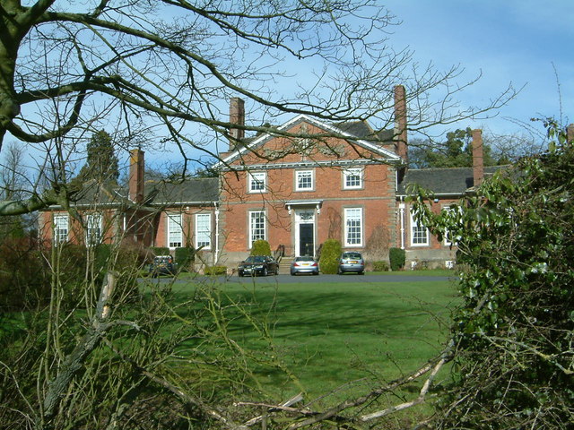
Nurton Images

Images are sourced within 2km of 52.592492/-2.23808 or Grid Reference SO8399. Thanks to Geograph Open Source API. All images are credited.

Potato Field, The Bradshaws, Staffordshire Potatoes are grown extensively around The Bradshaws.
Potato Field, The Bradshaws, Staffordshire
Potatoes are grown extensively around The Bradshaws.
Disused Buildings, near Cranmoor Lodge Farm, Perton The Staffordshire Way passes these military style buildings, all disused but with roofs intact, in the corner of a large grass covered field. Apparently they are the remains of  2nd World War RAF Perton accommodation, later used to house Dutch Army barracks.

There are threats to close the footpath to enable development. The exact original use of all the buildings here can be dug out from these planning applications: <span class="nowrap"><a title="http://www.sstaffs.gov.uk/pdf/Regulatory%20Committee%2022nd%20May%202007.pdf" rel="nofollow ugc noopener" href="http://www.sstaffs.gov.uk/pdf/Regulatory%20Committee%2022nd%20May%202007.pdf">Link</a><img style="margin-left:2px;" alt="External link" title="External link - shift click to open in new window" src="https://s1.geograph.org.uk/img/external.png" width="10" height="10"/></span>

There is fascinating detail on this Dutch website (make sure you get the translated page) <span class="nowrap"><a title="http://translate.google.co.uk/translate?hl=en&sl=nl&u=http://www.prinsesirenebrigade.nl/wrottesleypark_nabij_wolverhampt.htm&ei=rQ-5SdSoHqKHjAfAmOCwCA&sa=X&oi=translate&resnum=1&ct=result&prev=/search%3Fq%3DCranmore%2BLodge%2Bfarm%2Bperton%26hl%3Den%26client%3Dfirefox-a%26rls%3Dorg.mozilla:en-GB:official%26hs%3DI25%26sa%3DN%26start%3D10" rel="nofollow ugc noopener" href="http://translate.google.co.uk/translate?hl=en&sl=nl&u=http://www.prinsesirenebrigade.nl/wrottesleypark_nabij_wolverhampt.htm&ei=rQ-5SdSoHqKHjAfAmOCwCA&sa=X&oi=translate&resnum=1&ct=result&prev=/search%3Fq%3DCranmore%2BLodge%2Bfarm%2Bperton%26hl%3Den%26client%3Dfirefox-a%26rls%3Dorg.mozilla:en-GB:official%26hs%3DI25%26sa%3DN%26start%3D10">Link</a><img style="margin-left:2px;" alt="External link" title="External link - shift click to open in new window" src="https://s1.geograph.org.uk/img/external.png" width="10" height="10"/></span>
Disused Buildings, near Cranmoor Lodge Farm, Perton
The Staffordshire Way passes these military style buildings, all disused but with roofs intact, in the corner of a large grass covered field. Apparently they are the remains of 2nd World War RAF Perton accommodation, later used to house Dutch Army barracks. There are threats to close the footpath to enable development. The exact original use of all the buildings here can be dug out from these planning applications: LinkExternal link There is fascinating detail on this Dutch website (make sure you get the translated page) LinkExternal link
Disused Buildings near Cranmoor Lodge Farm, Perton The Staffordshire Way passes these military style buildings, all disused but with roofs intact, in the corner of a large grass covered field. Apparently they are the remains of  2nd World War RAF Perton accommodation, later used as a Dutch Army barracks.

There are threats to close the footpath to enable development. The exact original use of all the buildings here can be dug out from these planning applications: <span class="nowrap"><a title="http://www.sstaffs.gov.uk/pdf/Regulatory%20Committee%2022nd%20May%202007.pdf" rel="nofollow ugc noopener" href="http://www.sstaffs.gov.uk/pdf/Regulatory%20Committee%2022nd%20May%202007.pdf">Link</a><img style="margin-left:2px;" alt="External link" title="External link - shift click to open in new window" src="https://s1.geograph.org.uk/img/external.png" width="10" height="10"/></span>

There is fascinating detail on this Dutch website (make sure you get the translated page) <span class="nowrap"><a title="http://translate.google.co.uk/translate?hl=en&sl=nl&u=http://www.prinsesirenebrigade.nl/wrottesleypark_nabij_wolverhampt.htm&ei=rQ-5SdSoHqKHjAfAmOCwCA&sa=X&oi=translate&resnum=1&ct=result&prev=/search%3Fq%3DCranmore%2BLodge%2Bfarm%2Bperton%26hl%3Den%26client%3Dfirefox-a%26rls%3Dorg.mozilla:en-GB:official%26hs%3DI25%26sa%3DN%26start%3D10" rel="nofollow ugc noopener" href="http://translate.google.co.uk/translate?hl=en&sl=nl&u=http://www.prinsesirenebrigade.nl/wrottesleypark_nabij_wolverhampt.htm&ei=rQ-5SdSoHqKHjAfAmOCwCA&sa=X&oi=translate&resnum=1&ct=result&prev=/search%3Fq%3DCranmore%2BLodge%2Bfarm%2Bperton%26hl%3Den%26client%3Dfirefox-a%26rls%3Dorg.mozilla:en-GB:official%26hs%3DI25%26sa%3DN%26start%3D10">Link</a><img style="margin-left:2px;" alt="External link" title="External link - shift click to open in new window" src="https://s1.geograph.org.uk/img/external.png" width="10" height="10"/></span>
Disused Buildings near Cranmoor Lodge Farm, Perton
The Staffordshire Way passes these military style buildings, all disused but with roofs intact, in the corner of a large grass covered field. Apparently they are the remains of 2nd World War RAF Perton accommodation, later used as a Dutch Army barracks. There are threats to close the footpath to enable development. The exact original use of all the buildings here can be dug out from these planning applications: LinkExternal link There is fascinating detail on this Dutch website (make sure you get the translated page) LinkExternal link
Cereal crop and gas pipeline indicator near Wrottesley, Staffordshire The fields around are predominantly arable. Gas pipelines all over the country are not far beneath the surface of the fields.
Cereal crop and gas pipeline indicator near Wrottesley, Staffordshire
The fields around are predominantly arable. Gas pipelines all over the country are not far beneath the surface of the fields.
Woodland reservoir in Wrottesley Old Park, Staffordshire There are two enormous covered "water tanks" hidden in the Wrottesly Park Plantation here. They are recorded as reservoirs on the 1:25000 map.
Woodland reservoir in Wrottesley Old Park, Staffordshire
There are two enormous covered "water tanks" hidden in the Wrottesly Park Plantation here. They are recorded as reservoirs on the 1:25000 map.
Bridleway, Wrottesley Old Park, Staffordshire This bridleway is a beautiful walk. It is wide, "green lane" in appearance, and in several places shows signs of having had the surface strengthened with medium sized rounded stones.
Bridleway, Wrottesley Old Park, Staffordshire
This bridleway is a beautiful walk. It is wide, "green lane" in appearance, and in several places shows signs of having had the surface strengthened with medium sized rounded stones.
Bridleway, Wrottesley Old Park, Staffordshire A thoroughly delightful byway!
Bridleway, Wrottesley Old Park, Staffordshire
A thoroughly delightful byway!
Bridleway and farmland near Wrottesley in Staffordshire The cereal crops are growing well, and the woods ring with the call of pheasant. The weather has been dry for a while and the track is breaking up into very fine sand, creating dense clouds when farm vehicles pass. Wrottesley Lodge farm buildings are at the end of this track, which is a bridleway.
Bridleway and farmland near Wrottesley in Staffordshire
The cereal crops are growing well, and the woods ring with the call of pheasant. The weather has been dry for a while and the track is breaking up into very fine sand, creating dense clouds when farm vehicles pass. Wrottesley Lodge farm buildings are at the end of this track, which is a bridleway.
Lane/Public Footpath, near Nurton, Staffordshire This well surfaced (cul-de-sac) lane is actually signposted as a public footpath!
In fact, it acts as a private access road to several seriously desirable detached residences in extensive landscaped gardens.
Lane/Public Footpath, near Nurton, Staffordshire
This well surfaced (cul-de-sac) lane is actually signposted as a public footpath! In fact, it acts as a private access road to several seriously desirable detached residences in extensive landscaped gardens.
Private Garden and Mini Golf Course, near Nurton, Staffordshire The last house on the surfaced part of the lane has extensive gardens including this immaculately presented miniature golf course. Shame about the power lines!!
Private Garden and Mini Golf Course, near Nurton, Staffordshire
The last house on the surfaced part of the lane has extensive gardens including this immaculately presented miniature golf course. Shame about the power lines!!
Cranmoor Lodge Farm The Staffordshire and Monarch's Ways pass by the Farm.
Cranmoor Lodge Farm
The Staffordshire and Monarch's Ways pass by the Farm.
Wrottesley Old Park Path
Woodland Reservoir
Woodland Reservoir
Pattingham View The View from Nurton Hill Road.
Pattingham View
The View from Nurton Hill Road.
Westbeech Trig Post
Westbeech Trig Post
Lane to Nurton Hill
Lane to Nurton Hill
Trig point on Nurton Hill Unusually, this trig point is not at the top of the hill; that lies 500 yards away in <a href="https://www.geograph.org.uk/gridref/SJ8300">SJ8300</a>, and is occupied by two large tanks forming a water supply reservoir.
Trig point on Nurton Hill
Unusually, this trig point is not at the top of the hill; that lies 500 yards away in SJ8300, and is occupied by two large tanks forming a water supply reservoir.
Bridleway and woods near Nurton
Show me another place!

Nurton is located at Grid Ref: SO8399 (Lat: 52.592492, Lng: -2.23808)

Administrative County: Staffordshire

District: South Staffordshire

Police Authority: Staffordshire

What 3 Words

///scope.builds.pencil. Near Pattingham, Staffordshire

Nearby Locations

Nurton Nurton Hill

Related Wikis

Nurton

Nurton is a hamlet in the South Staffordshire District, in the English county of Staffordshire. Nearby settlements include the city of Wolverhampton and...

Pattingham

Pattingham is a village and former civil parish, now in the parish of Pattingham and Patshull, in the South Staffordshire district, in the county of Staffordshire...

Perton

Perton is a large village and civil parish located in the South Staffordshire District, Staffordshire, England. It lies 3 miles to the south of Codsall...

Oaken

Oaken is a small village in Staffordshire, England. The first mention of the Oaken place-name was in 1086 when it was listed in the Domesday book as Ache...

Wrottesley Hall

Wrottesley Hall is a 1923-built Grade II listed house in the civil parish of Perton, and historically part of Tettenhall in Staffordshire, England. The...

Wightwick

Wightwick ( WIT-ik) is a part of Tettenhall Wightwick ward in Wolverhampton, West Midlands, England. It is named after an ancient local family the "de...
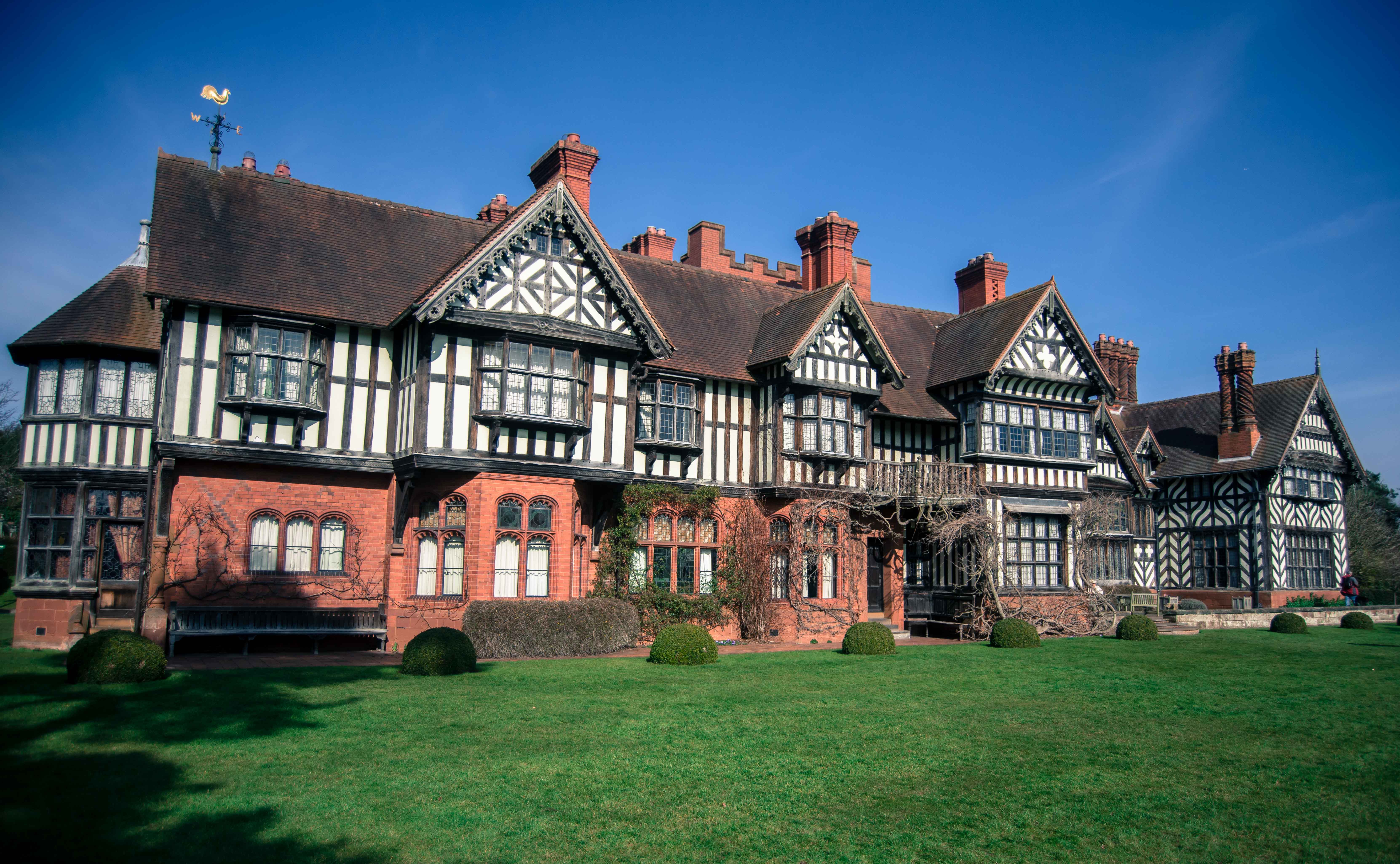
Wightwick Manor

The legacy of a family's passion for Victorian art and design, Wightwick Manor (pronounced "Wittick") is a Victorian manor house located on Wightwick Bank...

Rudge, Shropshire

Rudge is a settlement and civil parish about 6 miles east of Bridgnorth, in the Shropshire district, in the ceremonial county of Shropshire, England. In...

Nearby Amenities

Located within 500m of 52.592492,-2.23808
Nurton
Created By: Potlatch 0.10f
Place: hamlet
Wikidata: Q7070288
Lat/Long: 52.5935527/-2.2389328
Post Box
Collection Times: Mo-Fr 16:45; Sa 11:30
Lat/Long: 52.5918009/-2.2429623
Barrier: yes
Lat/Long: 52.5917051/-2.2366286
Barrier: stile
Lat/Long: 52.5898641/-2.2440677
Barrier: stile
Lat/Long: 52.5911162/-2.2446739
The data included in this document is from www.openstreetmap.org. The data is made available under ODbL.

Have you been to Nurton?

Leave your review of Nurton below (or comments, questions and feedback).