Northern Moor

Settlement in Cheshire

England

Northern Moor

Railway view towards Stockport From the bridge on Hall Lane across the Altrincham to Stockport line
Railway view towards Stockport Credit: Kevin Waterhouse

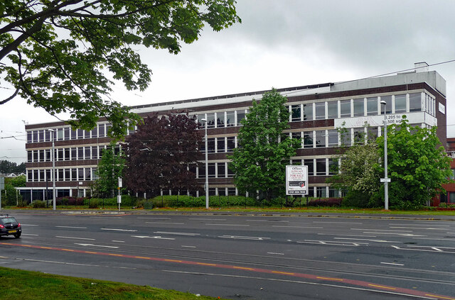
Northern Moor is a suburban area located in Cheshire, England. Situated approximately 7 miles southwest of Manchester city center, it falls under the jurisdiction of the Metropolitan Borough of Trafford. The neighborhood is primarily residential, with a population of around 10,000 people.

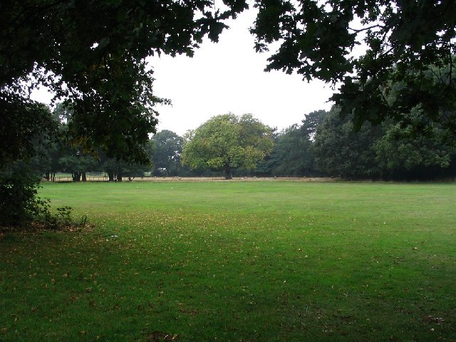
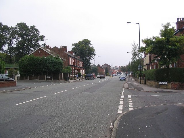
Northern Moor features a mix of housing types, including post-war council estates and newer developments. The area is known for its well-maintained green spaces and parks, such as Wythenshawe Park and Sale Water Park, which are in close proximity. These parks provide opportunities for outdoor activities and leisure pursuits.

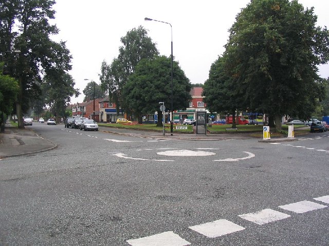
The neighborhood has a range of amenities and services to cater to its residents' needs. It has a shopping precinct with a variety of local shops, including convenience stores, a pharmacy, and a post office. There are also several primary schools within the area, ensuring easy access to education for families with young children.

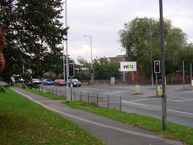
Transport links in Northern Moor are excellent. The neighborhood is well-connected to Manchester city center and neighboring areas through regular bus services. The nearby Wythenshawe Town Center tram stop and the M56 motorway provide convenient options for commuting and traveling further afield.

Overall, Northern Moor offers a pleasant residential environment with a community feel. Its proximity to Manchester and the presence of various amenities make it an attractive place to live, particularly for those seeking a balance between suburban tranquility and easy access to urban amenities.

If you have any feedback on the listing, please let us know in the comments section below.

Northern Moor Images

Images are sourced within 2km of 53.41223/-2.280485 or Grid Reference SJ8190. Thanks to Geograph Open Source API. All images are credited.

Railway view towards Stockport From the bridge on Hall Lane across the Altrincham to Stockport line
Railway view towards Stockport
From the bridge on Hall Lane across the Altrincham to Stockport line
Fun bikes on running track The large fenced track in Wythenshawe Park
Fun bikes on running track
The large fenced track in Wythenshawe Park
Southmoor House, Southmoor Road, Manchester A 1930s block fronting Southmoor Industrial Estate. There is a further block to the right, Trafford House, and extensive sheds behind.
The tram runs in front.
Southmoor House, Southmoor Road, Manchester
A 1930s block fronting Southmoor Industrial Estate. There is a further block to the right, Trafford House, and extensive sheds behind. The tram runs in front.
Offices, Southmoor Road, Manchester Post-war, possibly counting as part of the Southmoor Industrial Estate.
Since pulled down and replaced by a Lidl supermarket.
Offices, Southmoor Road, Manchester
Post-war, possibly counting as part of the Southmoor Industrial Estate. Since pulled down and replaced by a Lidl supermarket.
Moorcot Court, Bideford Drive, Manchester A nine-storey slab containing 73 flats which was probably built in the late 1960s.
Moorcot Court, Bideford Drive, Manchester
A nine-storey slab containing 73 flats which was probably built in the late 1960s.
Brookway Court, Bideford Drive, Manchester A 17-storey point block containing 94 flats which was built c1967.
Brookway Court, Bideford Drive, Manchester
A 17-storey point block containing 94 flats which was built c1967.
Southmoor, Glebelands Road, Manchester A nine-storey slab containing 73 flats which was built c1960.
Southmoor, Glebelands Road, Manchester
A nine-storey slab containing 73 flats which was built c1960.
Car through shop window Car accident. The vehicle was driven into the window of Town and Country Carpets
Car through shop window
Car accident. The vehicle was driven into the window of Town and Country Carpets
Car through shop window Another shot of the car into Town and Country Carpet windows.
Car through shop window
Another shot of the car into Town and Country Carpet windows.
Sale Moor Community Centre On Norris Road
Sale Moor Community Centre
On Norris Road
M56 joins the A560 in Wythenshawe Not sure what this building is, but I thought it looked great.
M56 joins the A560 in Wythenshawe
Not sure what this building is, but I thought it looked great.
Wythenshawe Hall This picture is of Wythenshawe hall at SJ816897. The Building unfortunately is not open to the public but is available for weddings and functions.
Wythenshawe Hall
This picture is of Wythenshawe hall at SJ816897. The Building unfortunately is not open to the public but is available for weddings and functions.
Oliver Cromwell This picture is of the statue of Oliver Cromwell opposite Wythenshawe Hall at SJ816898.
Oliver Cromwell
This picture is of the statue of Oliver Cromwell opposite Wythenshawe Hall at SJ816898.
Park land This picture was taken from SJ820895 looking east from Wythenshawe park to Lane Wood.
Park land
This picture was taken from SJ820895 looking east from Wythenshawe park to Lane Wood.
A6144 This picture was taken from SJ797913 looking Northeast along Marsland Road (A6144) towards Sale Moor.
A6144
This picture was taken from SJ797913 looking Northeast along Marsland Road (A6144) towards Sale Moor.
Mini roundabout and shops This picture taken from SJ796908 looking SSW across the junction of Norris road and Derbyshire Road South in the Brooklands area of Sale.
Mini roundabout and shops
This picture taken from SJ796908 looking SSW across the junction of Norris road and Derbyshire Road South in the Brooklands area of Sale.
Southmoor Road Looking in a southerly direction on Southmoor Road, Baguley. The base for the NTL cable TV company in the Manchester area. SJ80528930
Southmoor Road
Looking in a southerly direction on Southmoor Road, Baguley. The base for the NTL cable TV company in the Manchester area. SJ80528930
Baguley Hall Wythenshawe-the largest municipal Estate in Europe at the time-mushroomed around the old Hall at Baguley from the late 1940's. The original timber-framed building was constructed in the 1350's. It is hoped that the Hall will be re-opened to the public later this year, after being closed and unoccupied since the 1950's.
Baguley Hall
Wythenshawe-the largest municipal Estate in Europe at the time-mushroomed around the old Hall at Baguley from the late 1940's. The original timber-framed building was constructed in the 1350's. It is hoped that the Hall will be re-opened to the public later this year, after being closed and unoccupied since the 1950's.
Show me another place!

Northern Moor is located at Grid Ref: SJ8190 (Lat: 53.41223, Lng: -2.280485)

Unitary Authority: Manchester

Police Authority: Greater Manchester

What 3 Words

///gravel.luxury.fade. Near Chorlton cum Hardy, Manchester

Nearby Locations

Northern Moor

Related Wikis

Pioneer House High School

Pioneer House High School is a coeducational special school located in the Northern Moor area of Manchester, England.It is a free school that was established...

Manchester (Wythenshawe) Aerodrome

Manchester (Wythenshawe) Aerodrome was the first airfield built to serve Manchester, England. It is now occupied by Rack House Primary School. == History... ==

Church of St Michael and All Angels, Northenden

The Church of St Michael and All Angels, Orton Road, Lawton Moor, Northenden, Manchester, is an Anglican church of 1935-7 by N. F.Cachemaille-Day. Pevsner...

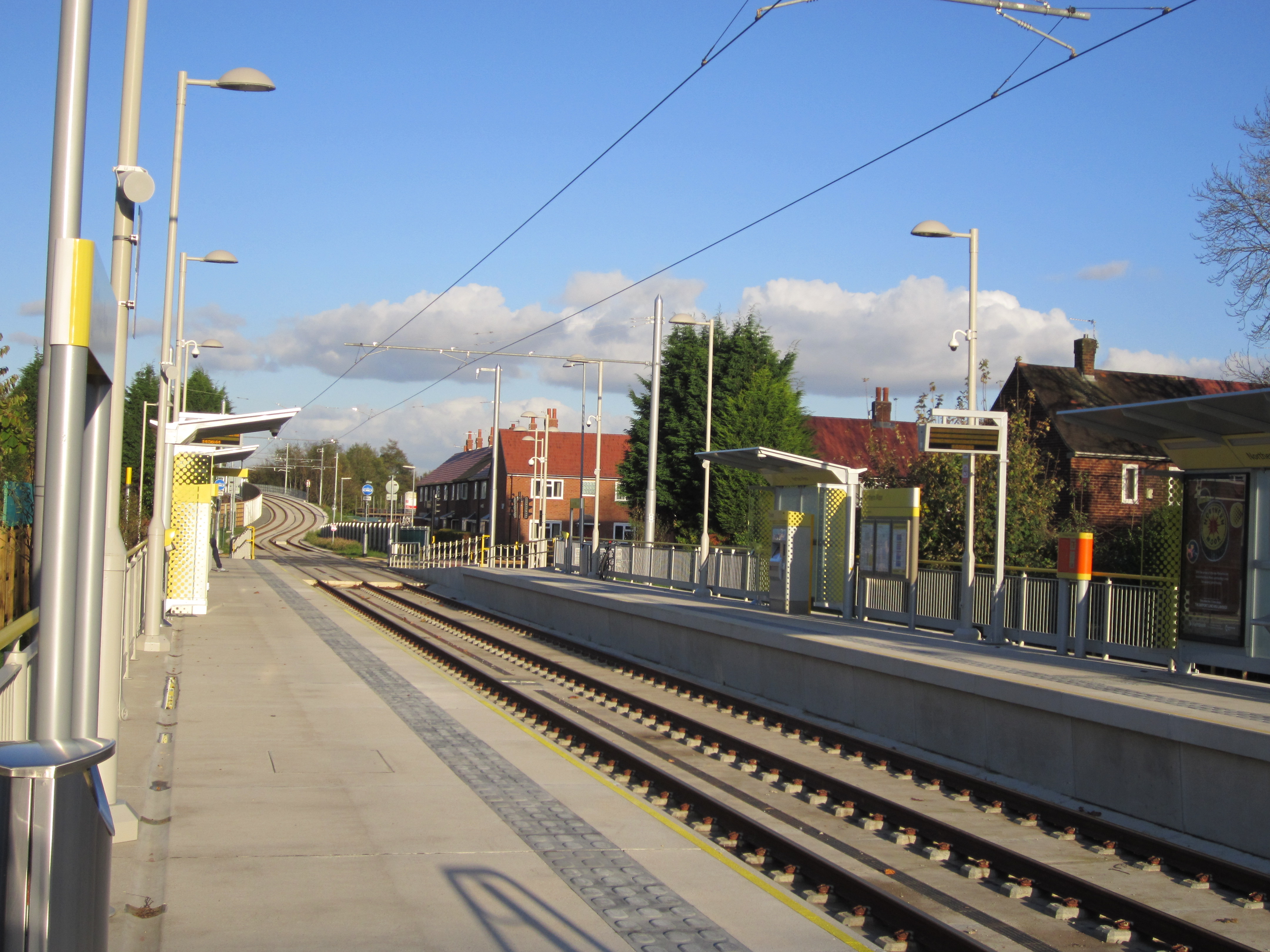
Northern Moor tram stop

Northern Moor is a tram stop for Phase 3b of the Manchester Metrolink. It opened on 3 November 2014. and is on the Airport Line on Sale Road. The tram...

Nearby Amenities

Located within 500m of 53.41223,-2.280485
Turning Circle
Lat/Long: 53.4108198/-2.2735511
Turning Circle
Lat/Long: 53.4105231/-2.2811613
Turning Circle
Lat/Long: 53.4102749/-2.2813711
Turning Circle
Lat/Long: 53.4109095/-2.2807991
Turning Circle
Lat/Long: 53.4113325/-2.2800851
Turning Circle
Lat/Long: 53.4108449/-2.2788119
Bus Stop
Northern Moor, Sale Road / at Sale Circle
Bus: yes
Naptan AtcoCode: 1800SB14731
Naptan Bearing: SE
Naptan CommonName: Sale Road/Sale Circle
Naptan Indicator: Shops
Naptan Landmark: SHOPS
Naptan NaptanCode: mangtdaw
Naptan PlusbusZoneRef: MNCRPIC
Naptan ShortCommonName: Sale Circle
Naptan Street: SALE ROAD
Naptan Verified: no
Network: TfGM
Operator: TfGM
Public Transport: platform
Source: naptan_import
Lat/Long: 53.4108754/-2.2765544
Bus Stop
Northern Moor, Sale Road / adjacent Rackhouse Road
Bench: no
Bin: no
Bus: yes
Naptan AtcoCode: 1800SB14751
Naptan Bearing: NW
Naptan CommonName: Sale Road/Rackhouse Road
Naptan Indicator: O/s House 79
Naptan Landmark: HOUSE 79
Naptan NaptanCode: mangtdgd
Naptan PlusbusZoneRef: MNCRPIC
Naptan ShortCommonName: Rackhouse Road
Naptan Street: SALE ROAD
Naptan Verified: no
Network: TfGM
Operator: TfGM
Public Transport: platform
Shelter: no
Source: naptan_import
Tactile Paving: yes
Lat/Long: 53.4100069/-2.2750745
Bus Stop
Northern Moor, Sale Road / adjacent Sale Circle
Bus: yes
Naptan AtcoCode: 1800SB14771
Naptan Bearing: NW
Naptan CommonName: Sale Road/Sale Circle
Naptan Indicator: Public Footpath
Naptan Landmark: SHOPS
Naptan NaptanCode: mangtdgm
Naptan PlusbusZoneRef: MNCRPIC
Naptan ShortCommonName: Sale Circle
Naptan Street: SALE ROAD
Naptan Verified: no
Network: TfGM
Operator: TfGM
Public Transport: platform
Source: naptan_import
Lat/Long: 53.4111782/-2.277775
Bus Stop
Northern Moor, Sale Road / near Yew Tree Lane
Bus: yes
Naptan AtcoCode: 1800SB14781
Naptan Bearing: SE
Naptan CommonName: Sale Road/The Yew Tree
Naptan Indicator: Day Nursery
Naptan Landmark: DAY NURSERY
Naptan NaptanCode: mangtdgp
Naptan PlusbusZoneRef: MNCRPIC
Naptan ShortCommonName: The Yew Tree
Naptan Street: SALE ROAD
Naptan Verified: no
Network: TfGM
Operator: TfGM
Public Transport: platform
Source: naptan_import
Lat/Long: 53.4119381/-2.2795852
Bus Stop
Northern Moor, Orton Road / adjacent Sale Road
Bus: yes
Naptan AtcoCode: 1800SB14791
Naptan Bearing: SW
Naptan CommonName: Orton Road/Sale Road
Naptan Indicator: House No 3
Naptan Landmark: HOUSE 3
Naptan NaptanCode: mangtdgt
Naptan PlusbusZoneRef: MNCRPIC
Naptan ShortCommonName: Sale Road
Naptan Street: ORTON ROAD
Naptan Verified: no
Network: TfGM
Operator: TfGM
Public Transport: platform
Source: naptan_import
Lat/Long: 53.4119448/-2.280748
Bus Stop
Northern Moor, Orton Road / near Moorcroft Road
Bus: yes
Naptan AtcoCode: 1800SB14801
Naptan Bearing: NE
Naptan CommonName: Orton Road/Moorcroft Road
Naptan Indicator: O/s House 34
Naptan Landmark: HOUSE 34
Naptan NaptanCode: mangtdgw
Naptan PlusbusZoneRef: MNCRPIC
Naptan ShortCommonName: Moorcroft Road
Naptan Street: ORTON ROAD
Naptan Verified: no
Network: TfGM
Operator: TfGM
Public Transport: platform
Source: naptan_import
Lat/Long: 53.4104753/-2.2823738
Bus Stop
Northern Moor, Moorcroft Road / near Orton Road
Bus: yes
Naptan AtcoCode: 1800SB42501
Naptan Bearing: W
Naptan CommonName: Moorcroft Road/Orton Road
Naptan Indicator: House 3
Naptan Landmark: HOUSE 3
Naptan NaptanCode: mangwmtm
Naptan PlusbusZoneRef: MNCRPIC
Naptan ShortCommonName: Orton Road
Naptan Street: MOORCROFT ROAD
Naptan Verified: no
Network: TfGM
Operator: TfGM
Public Transport: platform
Source: naptan_import
Lat/Long: 53.4100094/-2.2833409
Bus Stop
Sale Road/Cleeve Road
Bus: yes
Naptan AtcoCode: 1800SB47491
Naptan Bearing: SE
Naptan CommonName: Sale Road/Cleeve Road
Naptan Indicator: O/s House 180
Naptan Landmark: HOUSE 180
Naptan NaptanCode: manjadad
Naptan PlusbusZoneRef: MNCRPIC
Naptan ShortCommonName: Cleeve Road
Naptan Street: SALE ROAD
Naptan Verified: no
Network: TfGM
Public Transport: platform
Source: naptan_import
Lat/Long: 53.4133424/-2.2832672
Bus Stop
Northern Moor, Sale Road / near Orton Road
Bus: yes
Naptan AtcoCode: 1800SB47511
Naptan Bearing: NW
Naptan CommonName: Sale Road/The Yew Tree
Naptan Indicator: House No 163
Naptan Landmark: HOUSE 163
Naptan NaptanCode: manjadag
Naptan PlusbusZoneRef: MNCRPIC
Naptan ShortCommonName: The Yew Tree
Naptan Street: SALE ROAD
Naptan Verified: no
Network: TfGM
Operator: TfGM
Public Transport: platform
Source: naptan_import
Lat/Long: 53.4124039/-2.2810042
Bus Stop
Northern Moor, Sale Road / near Brenchley Drive
Bus: yes
Naptan AtcoCode: 1800SB47521
Naptan Bearing: NW
Naptan CommonName: Sale Road/Brenchley Drive
Naptan Indicator: O/s House 199
Naptan Landmark: HOUSE 199
Naptan NaptanCode: manjadaj
Naptan PlusbusZoneRef: MNCRPIC
Naptan ShortCommonName: Brenchley Drive
Naptan Street: SALE ROAD
Naptan Verified: no
Network: TfGM
Operator: TfGM
Public Transport: platform
Source: naptan_import
Lat/Long: 53.4135001/-2.2842444
Bus Stop
Northern Moor, Sale Road / Northern Moor Metrolink (Stop B)
Bus: yes
Local Ref: B
Naptan AtcoCode: 1800SB47531
Naptan Bearing: NW
Naptan CommonName: Sale Road/Button Lane
Naptan Indicator: O/s House 215
Naptan Landmark: HOUSE 215
Naptan NaptanCode: manjadam
Naptan PlusbusZoneRef: MNCRPIC
Naptan ShortCommonName: Button Lane
Naptan Street: SALE ROAD
Naptan Verified: no
Network: TfGM
Operator: TfGM
Public Transport: platform
Ref: B
Source: naptan_import
Lat/Long: 53.4143396/-2.2865218
Crossing
Crossing: unmarked
Crossing Island: yes
Tactile Paving: yes
Lat/Long: 53.4121506/-2.2799525
Turning Circle
Lat/Long: 53.4096659/-2.283707
Turning Circle
Lat/Long: 53.4097783/-2.2846978
Northern Moor
Place: suburb
Lat/Long: 53.4110127/-2.2861977
Turning Circle
Lat/Long: 53.4117964/-2.2821249
Crossing
Crossing: traffic_signals
Lat/Long: 53.4111045/-2.2773795
Turning Circle
Lat/Long: 53.4132785/-2.2848216
Turning Circle
Lat/Long: 53.4143979/-2.284606
Turning Circle
Lat/Long: 53.4135256/-2.2734941
Barrier: kissing_gate
Lat/Long: 53.4156242/-2.2794162
Nisa Local
Brand: Nisa Local
Brand Wikidata: Q16999069
Shop: convenience
Lat/Long: 53.4113365/-2.2775977
Cafe
Mazaj Lounge
Lat/Long: 53.4123441/-2.2793011
Restaurant
Fayrouz Restaurant
Lat/Long: 53.4123554/-2.2794808
Addr City: Manchester
Addr Country: GB
Addr Housenumber: 215
Addr Street: Sale Moor Road
Source: Naptan
Lat/Long: 53.4142645/-2.2866103
Addr City: Manchester
Addr Country: GB
Addr Housenumber: 199
Addr Street: Sale Moor Road
Source: Naptan
Lat/Long: 53.4134076/-2.2843036
Addr City: Manchester
Addr Country: GB
Addr Housenumber: 180
Addr Street: Sale Moor Road
Source: Naptan
Lat/Long: 53.4134459/-2.2831878
Entrance: yes
Lat/Long: 53.4120101/-2.2785729
Crossing
Crossing: traffic_signals
Crossing Island: no
Crossing Ref: toucan
Lat/Long: 53.4123589/-2.2807426
Bus Stop
Northern Moor, Sale Road / near Cleeve Road
Bus: yes
Network: TfGM
Operator: TfGM
Public Transport: platform
Lat/Long: 53.4133219/-2.2832091
Post Office
Sale Circle Post Office
Addr City: Manchester
Addr Housenumber: 128
Addr Postcode: M23 0BX
Addr Street: Sale Road
Brand: Post Office
Brand Wikidata: Q1783168
Check Date: 2022-05-27
Check Date Opening Hours: 2022-05-27
Opening Hours: Mo-Fr 09:00-17:00; Sa,Su 09:00-12:30
Operator: Nisa Local
Operator Wikidata: Q16999069
Ref Pol Id: 112765
Lat/Long: 53.4113701/-2.2775656
Crossing
Crossing: uncontrolled
Crossing Markings: zebra
Lat/Long: 53.4100287/-2.2790338
Crossing
Crossing: uncontrolled
Crossing Markings: zebra
Lat/Long: 53.4099657/-2.2790391
Parking
Access: private
Parking: surface
Surface: asphalt
Lat/Long: 53.4098493/-2.2792247
Give Way
Direction: backward
Lat/Long: 53.4088401/-2.2829679
Give Way
Direction: forward
Lat/Long: 53.4088498/-2.2830837
Cafe
Wythenshawe Community Café
Opening Hours: Mo 08:30-16:00; Th-Fr 08:30-16:00
Lat/Long: 53.4095095/-2.2824805
Fast Food
Shrek's Pizza
Addr City: Manchester
Addr Housenumber: 109
Addr Postcode: M23 0BU
Addr Street: Sale Road
Cuisine: pizza
Opening Hours: Su-Th 16:00-23:00; Fr-Sa 16:00-24:00
Phone: +441619985111
Lat/Long: 53.4107334/-2.2774342
The data included in this document is from www.openstreetmap.org. The data is made available under ODbL.

Have you been to Northern Moor?

Leave your review of Northern Moor below (or comments, questions and feedback).