Northenden

Settlement in Cheshire

England

Northenden

Railway view towards Stockport From the bridge on Hall Lane across the Altrincham to Stockport line
Railway view towards Stockport Credit: Kevin Waterhouse

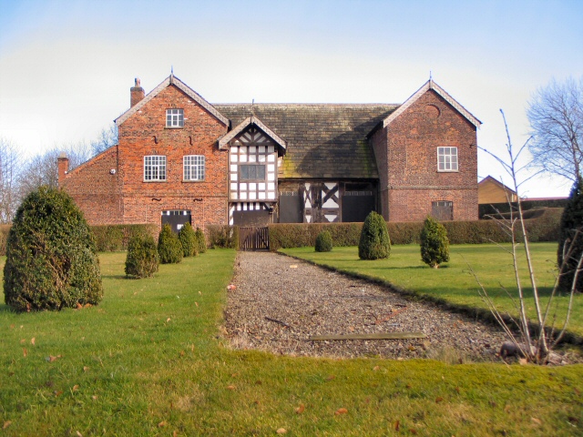
Northenden is a suburban village located in the county of Cheshire, England. Situated approximately 7 miles southwest of Manchester city center, it falls within the administrative boundaries of the City of Manchester. Historically, Northenden was a rural area, but it gradually transformed into a residential suburb during the Industrial Revolution.

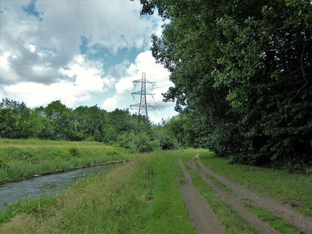
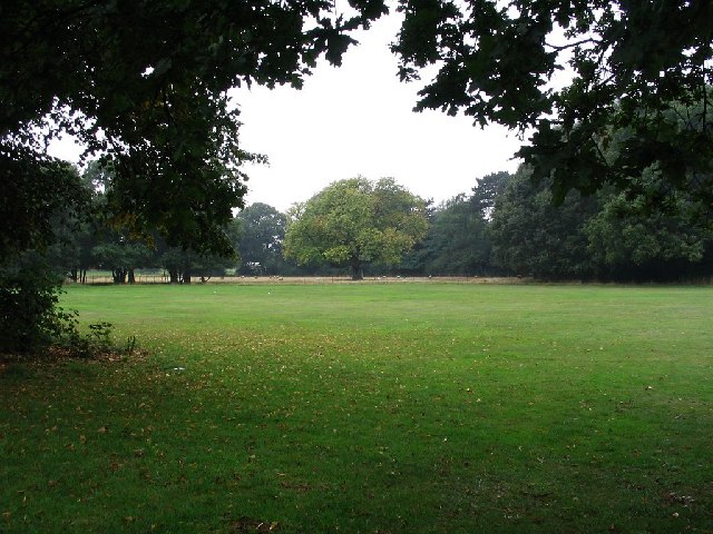
The village is bordered by the River Mersey to the south, which provides picturesque riverside walks and recreational opportunities for residents and visitors alike. Northenden also benefits from its proximity to Wythenshawe Park, a large green space offering sports facilities, gardens, and a community farm.

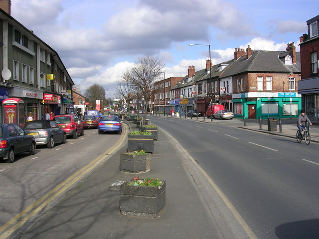
Northenden's housing stock primarily consists of Victorian and Edwardian terraced houses, as well as newer developments and apartments. The village center features a range of shops, including local businesses, supermarkets, and cafes, catering to the needs of the community.

Transport links in Northenden are well-established, with regular bus services connecting the area to Manchester city center and surrounding towns. Additionally, the nearby M56 motorway provides easy access to Manchester Airport and other major cities in the region.

Education provision in Northenden includes several primary schools, ensuring accessibility for families with young children. The village is also home to Northenden Community School, which offers education for children of all ages.

Overall, Northenden offers a peaceful and attractive residential area within easy reach of Manchester and its urban amenities, while still maintaining its own distinct character and community feel.

If you have any feedback on the listing, please let us know in the comments section below.

Northenden Images

Images are sourced within 2km of 53.409217/-2.261721 or Grid Reference SJ8290. Thanks to Geograph Open Source API. All images are credited.

Railway view towards Stockport From the bridge on Hall Lane across the Altrincham to Stockport line
Railway view towards Stockport
From the bridge on Hall Lane across the Altrincham to Stockport line
Fun bikes on running track The large fenced track in Wythenshawe Park
Fun bikes on running track
The large fenced track in Wythenshawe Park
Riverside track By the side of the River Mersey
Riverside track
By the side of the River Mersey
Former bus garage, Bradnor Road, Manchester By G. Noel Hill, City Architect, 1938-42. A very innovative building. "A huge clear span of 296 by 185ft covers spaces for 100 buses". The concrete exterior employed the Chisarc system. "On completion it was handed over to Messrs. A.V. Roe for building Lancaster bombers." Grade II* listed.
It now sits in the Sharston Industrial Area and appears to be used for something.
Former bus garage, Bradnor Road, Manchester
By G. Noel Hill, City Architect, 1938-42. A very innovative building. "A huge clear span of 296 by 185ft covers spaces for 100 buses". The concrete exterior employed the Chisarc system. "On completion it was handed over to Messrs. A.V. Roe for building Lancaster bombers." Grade II* listed. It now sits in the Sharston Industrial Area and appears to be used for something.
124 Longley Lane, Manchester The Sharston Industrial Area has several modest 1930s Deco factories.
Siltint provides "Thin Film Vacuum Coating processes  for the precision optical and opto-electronic industries."
124 Longley Lane, Manchester
The Sharston Industrial Area has several modest 1930s Deco factories. Siltint provides "Thin Film Vacuum Coating processes for the precision optical and opto-electronic industries."
M56 joins the A560 in Wythenshawe Not sure what this building is, but I thought it looked great.
M56 joins the A560 in Wythenshawe
Not sure what this building is, but I thought it looked great.
Wythenshawe Hall This picture is of Wythenshawe hall at SJ816897. The Building unfortunately is not open to the public but is available for weddings and functions.
Wythenshawe Hall
This picture is of Wythenshawe hall at SJ816897. The Building unfortunately is not open to the public but is available for weddings and functions.
Oliver Cromwell This picture is of the statue of Oliver Cromwell opposite Wythenshawe Hall at SJ816898.
Oliver Cromwell
This picture is of the statue of Oliver Cromwell opposite Wythenshawe Hall at SJ816898.
Park land This picture was taken from SJ820895 looking east from Wythenshawe park to Lane Wood.
Park land
This picture was taken from SJ820895 looking east from Wythenshawe park to Lane Wood.
Longley Lane, Northenden Looking in a southeasterly direction along Longley Lane, Northenden near its junction with Sharston Road. Sharston Industrial Area to the right, a residential area to the left. SJ83248948.
Longley Lane, Northenden
Looking in a southeasterly direction along Longley Lane, Northenden near its junction with Sharston Road. Sharston Industrial Area to the right, a residential area to the left. SJ83248948.
Old Bedians The playing fields of Old Bedians Sports Centre, East Didsbury, Manchester. Sports teams associated with St Bede's College, Manchester. Also in the picture is a plane on its final approach to Manchester International Airport. Looking SE from SJ84308960
Old Bedians
The playing fields of Old Bedians Sports Centre, East Didsbury, Manchester. Sports teams associated with St Bede's College, Manchester. Also in the picture is a plane on its final approach to Manchester International Airport. Looking SE from SJ84308960
Benchill Community Centre Newly built and almost completed - community centre and sports training facility at Benchill, Wythenshawe. Urban regeneration project part funded by the European Union.
Benchill Community Centre
Newly built and almost completed - community centre and sports training facility at Benchill, Wythenshawe. Urban regeneration project part funded by the European Union.
Baguley Hall Wythenshawe-the largest municipal Estate in Europe at the time-mushroomed around the old Hall at Baguley from the late 1940's. The original timber-framed building was constructed in the 1350's. It is hoped that the Hall will be re-opened to the public later this year, after being closed and unoccupied since the 1950's.
Baguley Hall
Wythenshawe-the largest municipal Estate in Europe at the time-mushroomed around the old Hall at Baguley from the late 1940's. The original timber-framed building was constructed in the 1350's. It is hoped that the Hall will be re-opened to the public later this year, after being closed and unoccupied since the 1950's.
New houses in Alders Avenue
Spire on Bradnor Road With Brodericks Coffee warehouse in the background.
Spire on Bradnor Road
With Brodericks Coffee warehouse in the background.
The Royal's office complex
The Open University Office complex from the Royal's car park.
The Open University
Office complex from the Royal's car park.
Side road off Hall Lane, Baguley This short access road down to the Stockport-Altrincham railway line provides access to local shops just off Hall Lane.
Side road off Hall Lane, Baguley
This short access road down to the Stockport-Altrincham railway line provides access to local shops just off Hall Lane.
Show me another place!

Northenden is located at Grid Ref: SJ8290 (Lat: 53.409217, Lng: -2.261721)

Unitary Authority: Manchester

Police Authority: Greater Manchester

What 3 Words

///moth.looked.wells. Near Didsbury, Manchester

Nearby Locations

Northenden

Related Wikis

Northenden

Northenden is a suburb of Manchester, Greater Manchester, England, with a population of 14,771 at the 2011 census. It lies on the south side of the River...

Wythenshawe and Sale East (UK Parliament constituency)

Wythenshawe and Sale East is a parliamentary constituency in the city of Manchester and the borough of Trafford. It returns one Member of Parliament...

Northern Moor

Northern Moor is an area of Manchester, England, north of Baguley, west of Northenden and east of Sale, 5 miles south of Manchester city centre. The Tatton...

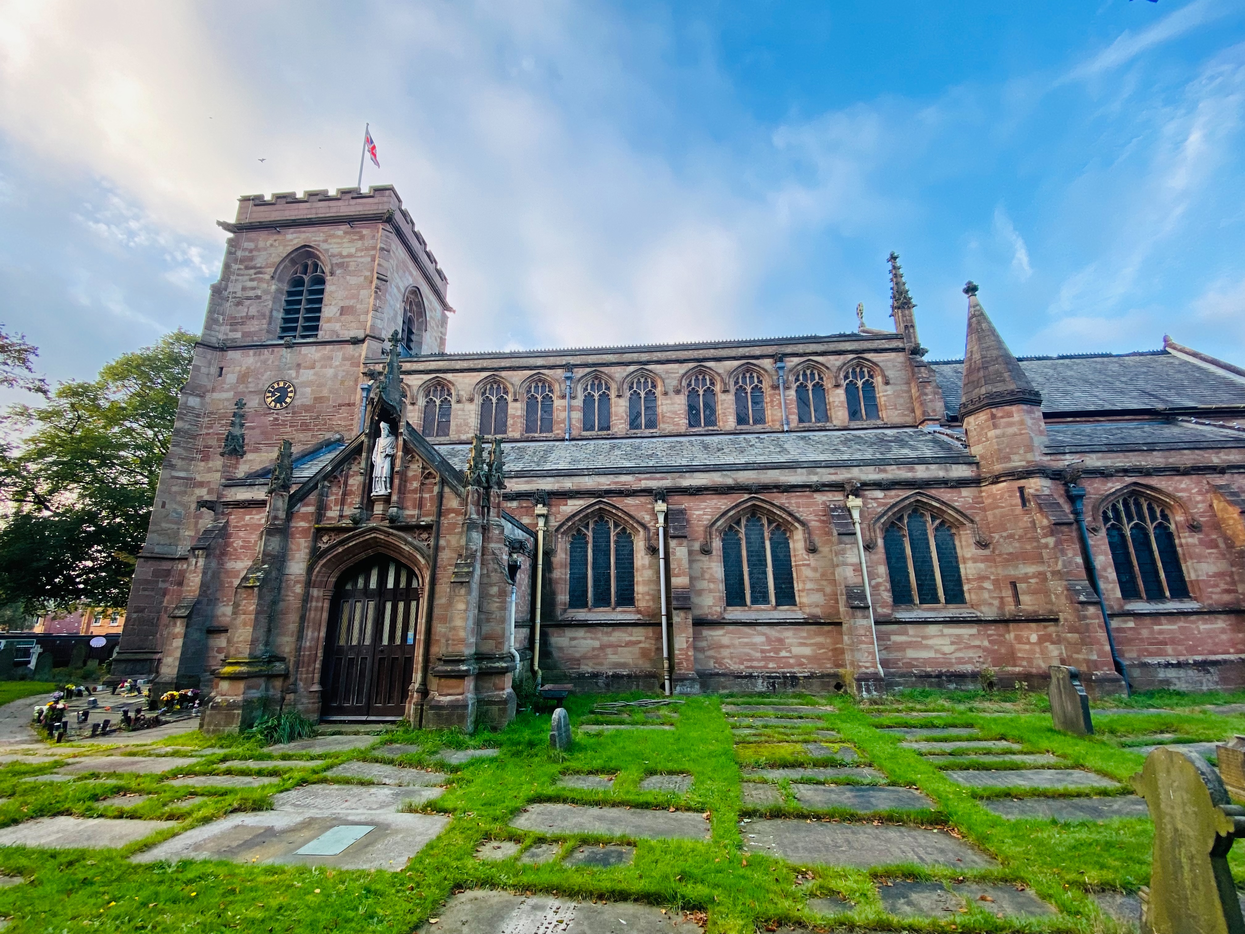
Church of St Wilfrid, Northenden

The Church of St Wilfrid is an Anglican church in the suburb of Northenden in Manchester, England. It stands on Ford Lane, close to the River Mersey, approximately...

Nearby Amenities

Located within 500m of 53.409217,-2.261721
Motorway Junction
Princess Parkway Interchange
Ref: 5
Lat/Long: 53.410992/-2.2666474
Motorway Junction
Lat/Long: 53.4091862/-2.2668541
Traffic Signals
Traffic Signals: signal
Lat/Long: 53.4068099/-2.2678247
Traffic Signals
Traffic Signals: signal
Lat/Long: 53.406892/-2.2681757
Turning Circle
Lat/Long: 53.4060556/-2.2663894
Traffic Signals
Lat/Long: 53.4072285/-2.2591584
Turning Circle
Lat/Long: 53.4086369/-2.2590638
Turning Circle
Lat/Long: 53.4105581/-2.2596694
Turning Circle
Lat/Long: 53.4089825/-2.2596808
Turning Circle
Lat/Long: 53.4118212/-2.2631214
Turning Circle
Lat/Long: 53.4112082/-2.262537
Turning Circle
Lat/Long: 53.4102655/-2.263499
Turning Circle
Lat/Long: 53.4101287/-2.2622913
Turning Circle
Lat/Long: 53.4094041/-2.2626933
Turning Circle
Lat/Long: 53.4081279/-2.2630516
Turning Circle
Lat/Long: 53.4095973/-2.26862
Turning Circle
Lat/Long: 53.4106728/-2.2679334
Turning Circle
Lat/Long: 53.4117274/-2.2586453
Fuel
Esso
Addr City: Manchester
Addr Street: Palatine Road
Brand: Esso
Brand Wikidata: Q867662
Brand Wikipedia: en:Esso
Contact Website: https://www.esso.co.uk/en-gb/find-station/esso-manchester-essorontecsthildas-100348648
Operator: Rontec
Operator Website: http://www.rontec-servicestations.co.uk/ss_results-id.cfm?id=7180
Operator Wikidata: Q107439152
Lat/Long: 53.4100211/-2.2565465
Telephone
Booth: KXPlus
Covered: booth
Lat/Long: 53.40869/-2.2572074
Telephone
Booth: KX100
Covered: booth
Lat/Long: 53.4081559/-2.2577772
Post Box
Brand: Royal Mail
Brand Wikidata: Q638098
Operator: Royal Mail
Operator Wikidata: Q638098
Post Box Type: pillar
Lat/Long: 53.4076181/-2.2584236
Telephone
Booth: KXPlus
Covered: booth
Lat/Long: 53.406759/-2.2608567
Crossing
Crossing: traffic_signals
Crossing Island: no
Lat/Long: 53.4065421/-2.2638252
Barrier: bollard
Lat/Long: 53.4133287/-2.2623079
Bus Stop
Northenden, Princess Parkway / Britannia Hotel (Stop A)
Bus: yes
Local Ref: A
Naptan AtcoCode: 1800SB42011
Naptan Bearing: N
Naptan CommonName: Britannia Hotel (Stop A)
Naptan Indicator: Stop A
Naptan Landmark: PLAYING FIELDS
Naptan NaptanCode: mangwmjt
Naptan PlusbusZoneRef: MNCRPIC
Naptan ShortCommonName: Britannia Hotel
Naptan Street: PRINCESS PARKWY
Naptan Verified: no
Network: TfGM
Operator: TfGM
Public Transport: platform
Ref: A
Source: naptan_import
Lat/Long: 53.4075062/-2.2679882
Bus Stop
Britannia Hotel (Stop B)
Bus: yes
Local Ref: B
Naptan AtcoCode: 1800SB42021
Naptan Bearing: N
Naptan CommonName: Britannia Hotel (Stop B)
Naptan Indicator: Stop B
Naptan Landmark: NR PLAYING FILD
Naptan NaptanCode: mangwmjw
Naptan PlusbusZoneRef: MNCRPIC
Naptan ShortCommonName: Britannia Hotel
Naptan Street: PRINCESS PARKWY
Naptan Verified: no
Network: TfGM
Public Transport: platform
Source: naptan_import
Lat/Long: 53.4076502/-2.2678989
Bus Stop
Northenden, Princess Parkway / near Yewtree Lane
Bench: yes
Bin: no
Bus: yes
Naptan AtcoCode: 1800SB42031
Naptan Bearing: N
Naptan CommonName: Princess Parkway/Yew Tree Lane
Naptan Indicator: M56 Slip Road
Naptan Landmark: M56 SLIP ROAD
Naptan NaptanCode: mangwmpa
Naptan PlusbusZoneRef: MNCRPIC
Naptan ShortCommonName: Yew Tree Lane
Naptan Street: PRINCESS PARKWY
Naptan Verified: no
Network: TfGM
Operator: TfGM
Public Transport: platform
Shelter: yes
Source: naptan_import
Lat/Long: 53.4117787/-2.2667212
Bus Stop
Northenden, Princess Parkway / opposite Yew Tree Lane
Bench: no
Bin: no
Bus: yes
Naptan AtcoCode: 1800SB42041
Naptan Bearing: S
Naptan CommonName: Princess Parkway/Yew Tree Lane
Naptan Indicator: Park
Naptan Landmark: PARK
Naptan NaptanCode: mangwmpd
Naptan PlusbusZoneRef: MNCRPIC
Naptan ShortCommonName: Yew Tree Lane
Naptan Street: PRINCESS PARKWY
Naptan Verified: no
Network: TfGM
Operator: TfGM
Public Transport: platform
Shelter: no
Source: naptan_import
Lat/Long: 53.4114929/-2.265892
Bus Stop
Northenden, Princess Parkway / Britannia Hotel (Stop D)
Bench: yes
Bus: yes
Local Ref: D
Naptan AtcoCode: 1800SB42061
Naptan Bearing: S
Naptan CommonName: Britannia Hotel (Stop D)
Naptan Indicator: Stop D
Naptan Landmark: HOTEL
Naptan NaptanCode: mangwmpg
Naptan PlusbusZoneRef: MNCRPIC
Naptan ShortCommonName: Britannia Hotel
Naptan Street: PRINCESS PARKWY
Naptan Verified: no
Network: TfGM
Operator: TfGM
Public Transport: platform
Ref: D
Shelter: yes
Source: naptan_import
Lat/Long: 53.4063128/-2.267018
Bus Stop
Moor End, Palatine Road / Moor End (Stop B)
Bus: yes
Local Ref: B
Naptan AtcoCode: 1800SB42111
Naptan Bearing: SW
Naptan CommonName: Palatine Road/Moor End (Stop B)
Naptan Indicator: Stop B
Naptan Landmark: HOUSE 429
Naptan NaptanCode: mangwmpj
Naptan PlusbusZoneRef: MNCRPIC
Naptan ShortCommonName: Moor End
Naptan Street: PALATINE ROAD
Naptan Verified: no
Network: TfGM
Operator: TfGM
Public Transport: platform
Ref: B
Source: naptan_import
Lat/Long: 53.4064525/-2.2612182
Bus Stop
Northenden, Palatine Road / Britannia Hotel (Stop E)
Bus: yes
Local Ref: E
Naptan AtcoCode: 1800SB14511
Naptan Bearing: E
Naptan CommonName: Britannia Hotel (Stop E)
Naptan Indicator: Stop E
Naptan Landmark: HOTEL
Naptan NaptanCode: mangtata
Naptan PlusbusZoneRef: MNCRPIC
Naptan ShortCommonName: Britannia Hotel
Naptan Street: PALATINE ROAD
Naptan Verified: no
Network: TfGM
Operator: TfGM
Public Transport: platform
Shelter: yes
Source: naptan_import
Lat/Long: 53.4067771/-2.2657138
Bus Stop
Northenden, Palatine Road / Northenden Health Centre (Stop F)
Bench: yes
Bus: yes
Local Ref: F
Naptan AtcoCode: 1800SB14521
Naptan Bearing: W
Naptan CommonName: Palatine Rd/Northenden Health Ctr (F)
Naptan Indicator: Stop F
Naptan Landmark: HEALTH CENTRE
Naptan NaptanCode: mangtatd
Naptan PlusbusZoneRef: MNCRPIC
Naptan ShortCommonName: Northenden Health
Naptan Street: PALATINE ROAD
Naptan Verified: no
Network: TfGM
Operator: TfGM
Public Transport: platform
Ref: F
Shelter: yes
Source: naptan_import
Lat/Long: 53.4065337/-2.2647179
Bus Stop
Moor End, Palatine Road / opposite Parkway House
Bus: yes
Naptan AtcoCode: 1800SB14531
Naptan Bearing: E
Naptan CommonName: Palatine Road/Parkway House
Naptan Indicator: Park
Naptan Landmark: KINGDOM HALL
Naptan NaptanCode: mangtatg
Naptan PlusbusZoneRef: MNCRPIC
Naptan ShortCommonName: Parkway House
Naptan Street: PALATINE ROAD
Naptan Verified: no
Network: TfGM
Operator: TfGM
Public Transport: platform
Route Ref: 48;108
Source: naptan_import
Lat/Long: 53.4065787/-2.2628752
Bus Stop
Moor End, Palatine Road / Moor End (Stop A)
Bus: yes
Local Ref: A
Naptan AtcoCode: 1800SB14551
Naptan Bearing: NE
Naptan CommonName: Palatine Road/Moor End (Stop A)
Naptan Indicator: Stop A
Naptan Landmark: SHOPS
Naptan NaptanCode: mangtatj
Naptan PlusbusZoneRef: MNCRPIC
Naptan ShortCommonName: Moor End
Naptan Street: PALATINE ROAD
Naptan Verified: no
Network: TfGM
Operator: TfGM
Public Transport: platform
Ref: A
Source: naptan_import
Lat/Long: 53.4068942/-2.2603827
Bus Stop
Northenden, Palatine Road / Northenden Village (Stop C)
Bus: yes
Local Ref: C
Naptan AtcoCode: 1800SB14561
Naptan Bearing: NE
Naptan CommonName: Palatine Rd/Northenden Village (Stop C)
Naptan Indicator: Stop C
Naptan Landmark: SHOPS
Naptan NaptanCode: mangtatm
Naptan PlusbusZoneRef: MNCRPIC
Naptan ShortCommonName: Northenden Villag
Naptan Street: PALATINE ROAD
Naptan Verified: no
Network: TfGM
Operator: TfGM
Public Transport: platform
Ref: C
Source: naptan_import
Lat/Long: 53.4079908/-2.2578545
Bus Stop
Northenden, Palatine Road / Northenden Village (Stop D)
Bus: yes
Local Ref: D
Naptan AtcoCode: 1800SB14571
Naptan Bearing: SW
Naptan CommonName: Palatine Rd/Northenden Village (Stop D)
Naptan Indicator: Stop D
Naptan Landmark: SHOPS
Naptan NaptanCode: mangtatp
Naptan PlusbusZoneRef: MNCRPIC
Naptan ShortCommonName: Northenden Villag
Naptan Street: PALATINE ROAD
Naptan Verified: no
Network: TfGM
Operator: TfGM
Public Transport: platform
Ref: D
Source: naptan_import
Lat/Long: 53.4082127/-2.2573722
Bus Stop
Northenden, Palatine Road /near Riverside Park
Bus: yes
Naptan AtcoCode: 1800SB14581
Naptan Bearing: SW
Naptan CommonName: Palatine Road/Mill Lane
Naptan Indicator: Restaurant
Naptan Landmark: RESTAURANT
Naptan NaptanCode: mangtatw
Naptan PlusbusZoneRef: MNCRPIC
Naptan ShortCommonName: Mill Lane
Naptan Street: PALATINE ROAD
Naptan Verified: yes
Network: TfGM
Operator: TfGM
Public Transport: platform
Source: naptan_import
Lat/Long: 53.4102292/-2.2559703
Bus Stop
Northenden, Palatine Road / opposite Riverside Park
Bus: yes
Naptan AtcoCode: 1800SB14591
Naptan Bearing: NE
Naptan CommonName: Palatine Road/Mill Lane
Naptan Indicator: O/s House 290
Naptan Landmark: HOUSE 290
Naptan NaptanCode: mangtawa
Naptan PlusbusZoneRef: MNCRPIC
Naptan ShortCommonName: Mill Lane
Naptan Street: PALATINE ROAD
Naptan Verified: yes
Network: TfGM
Operator: TfGM
Public Transport: platform
Source: naptan_import
Lat/Long: 53.4104358/-2.2560467
Bus Stop
Northenden, Church Road / Palatine Road (Stop E)
Bus: yes
Local Ref: E
Naptan AtcoCode: 1800SB14601
Naptan Bearing: W
Naptan CommonName: Church Road/Palatine Road (Stop E)
Naptan Indicator: Stop E
Naptan Landmark: SHOP
Naptan NaptanCode: mangtawd
Naptan PlusbusZoneRef: MNCRPIC
Naptan ShortCommonName: Palatine Road
Naptan Street: CHURCH ROAD
Naptan Verified: no
Network: TfGM
Operator: TfGM
Public Transport: platform
Ref: E
Source: naptan_import
Lat/Long: 53.4070866/-2.2585387
Bus Stop
Northenden, Longley Lane / outside Farmer's Arms
Bus: yes
Naptan AtcoCode: 1800SB14711
Naptan Bearing: NW
Naptan CommonName: Longley Lane/Farmer's Arms
Naptan Indicator: Shops
Naptan Landmark: PUBLIC HOUSE
Naptan NaptanCode: mangtdap
Naptan PlusbusZoneRef: MNCRPIC
Naptan ShortCommonName: Farmer's Arms
Naptan Street: LONGLEY LANE
Naptan Verified: no
Network: TfGM
Public Transport: platform
Route Ref: 178;270;X5
Source: naptan_import
Lat/Long: 53.4053537/-2.2617472
Northenden
Place: suburb
Lat/Long: 53.4061914/-2.2588813
Power: substation
Substation: minor_distribution
Lat/Long: 53.4110839/-2.2671049
Bank
NatWest
Atm: yes
Brand: NatWest
Brand Wikidata: Q2740021
Brand Wikipedia: en:NatWest
Lat/Long: 53.407051/-2.2589508
Co-Op Funeral Home
Shop: funeral_directors
Lat/Long: 53.4074222/-2.259109
Bicycle Parking
Lat/Long: 53.410675/-2.2557136
Rudys Autotek
Addr City: Manchester
Addr Country: GB
Addr Housename: Unit 4, Kingsley Trading Centre,
Addr Housenumber: 18
Addr Postcode: M22 4NL
Addr Street: Kingsley Road
Shop: car_repair
Lat/Long: 53.4062786/-2.2585723
Fast Food
Oriental Express
Cuisine: chinese
Drive In: no
Drive Through: no
Internet Access Fee: no
Wheelchair: yes
Lat/Long: 53.4101072/-2.2559593
Fast Food
Deli Spice
Cuisine: indian
Lat/Long: 53.4102091/-2.2558966
Barrier: bollard
Bicycle: yes
Foot: yes
Lat/Long: 53.4130241/-2.2624732
Fast Food
The Chu's
Addr City: Manchester
Addr Country: GB
Addr Housenumber: 436
Addr Street: Palatine Road
Cuisine: chinese
Drive In: no
Drive Through: no
Phone: +44 161 9981419
Wheelchair: limited
Lat/Long: 53.406918/-2.260807
Pub
Lounge About
Addr City: Manchester
Addr Country: GB
Addr Street: Palatine Road
Microbrewery: no
Takeaway: no
Lat/Long: 53.406985/-2.260623
Perfect Nails & Beauty
Shop: beauty
Wheelchair: yes
Lat/Long: 53.407058/-2.259215
Pol Mark
Shop: convenience
Wheelchair: no
Lat/Long: 53.407041/-2.2592829
Bicycle Parking
Bicycle Parking: stands
Capacity: 10
Covered: no
Fee: no
Lat/Long: 53.407257/-2.259352
Atm
Lat/Long: 53.407194/-2.259672
Bar
Bar Bibo
Lat/Long: 53.4076106/-2.2580151
Restaurant
Mi & Pho
Addr City: Manchester
Addr Street: Palatine Road
Cuisine: vietnamese
Drive In: no
Internet Access Fee: no
Microbrewery: no
Organic: no
Outdoor Seating: yes
Smoking: no
Takeaway: yes
Wheelchair: no
Lat/Long: 53.4075896/-2.2587546
Post Office
Northenden Post Office
Addr City: Manchester
Addr Country: GB
Addr Postcode: M22 4FZ
Addr Street: Palatine Road
Brand: Post Office
Brand Wikidata: Q1783168
Contact Website: https://www.postoffice.co.uk/branch-finder/315422x/northenden
Ref Pol Id: 12568
Wheelchair: yes
Lat/Long: 53.407661/-2.2585702
Restaurant
Viks
Cuisine: asian
Drive In: no
Organic: no
Outdoor Seating: no
Smoking: no
Wheelchair: yes
Lat/Long: 53.408269/-2.257135
Fast Food
The Appetizer
Cuisine: kebab
Drive In: no
Drive Through: no
Wheelchair: no
Lat/Long: 53.4077196/-2.2578297
Razarz Barber
Shop: hairdresser
Lat/Long: 53.4076502/-2.2579526
Fast Food
Robin's Hood
Cuisine: pizza
Drive In: no
Drive Through: no
Wheelchair: no
Lat/Long: 53.4076856/-2.2578883
Donovans
Shop: clothes
Lat/Long: 53.4075858/-2.2580636
Vision Service
Shop: optician
Wheelchair: no
Lat/Long: 53.4077518/-2.2577666
Restaurant
Jai Kathmandu
Cuisine: indian
Organic: no
Outdoor Seating: no
Smoking: no
Lat/Long: 53.4085072/-2.2569412
Bar
Escape
Wheelchair: yes
Lat/Long: 53.4078426/-2.257595
Veterinary
Acorn Veterinary Surgery
Wheelchair: no
Lat/Long: 53.4080372/-2.2580342
Fast Food
Chesters
Cuisine: kebab
Drive In: no
Drive Through: no
Wheelchair: yes
Lat/Long: 53.408137/-2.257316
Traffic Signals
Traffic Signals: signal
Lat/Long: 53.4067481/-2.2668928
Quidds In Discount
Shop: general
Lat/Long: 53.4092326/-2.2569923
Fast Food
Subway
Brand: Subway
Brand Wikidata: Q244457
Brand Wikipedia: en:Subway (restaurant)
Contact Website: https://restaurants.subway.com/united-kingdom/en/manchester/320-palatine-road-northenden
Cuisine: sandwich
Takeaway: yes
Lat/Long: 53.4093026/-2.2569457
Northenden Grooming Parlour
Shop: pet
Wheelchair: no
Lat/Long: 53.4104869/-2.2557438
Fast Food
Ai Loy
Cuisine: chinese
Drive In: no
Drive Through: no
Wheelchair: no
Lat/Long: 53.4104317/-2.2557712
TaxAssist Accountants
Brand: TaxAssist Accountants
Brand Wikidata: Q122459380
Office: accountant
Website: https://www.taxassist.co.uk/accountants/northenden/
Wheelchair: no
Lat/Long: 53.410334/-2.2558312
Halfords auto
Baby: no
Shop: car_repair
Wheelchair: yes
Lat/Long: 53.410565/-2.255162
Manchester Trophy Market
Shop: gift
Wheelchair: yes
Lat/Long: 53.4102529/-2.2558707
Massimo Gents Barber Shop
Shop: hairdresser
Wheelchair: limited
Lat/Long: 53.4102926/-2.2558547
Fast Food
Sagor Balti
Cuisine: indian
Drive In: no
Drive Through: no
Wheelchair: no
Lat/Long: 53.4103848/-2.2558031
Fast Food
Simply Delicious
Cuisine: kebab
Wheelchair: no
Lat/Long: 53.4095412/-2.2562827
Restaurant
Dosa
Cuisine: indian
Drive In: no
Outdoor Seating: no
Smoking: no
Wheelchair: yes
Lat/Long: 53.4096766/-2.2561994
Cafe
Costa
Addr Housenumber: 332-334
Addr Postcode: M22 4HE
Addr Street: Palatine Road
Brand: Costa
Brand Wikidata: Q608845
Brand Wikipedia: en:Costa Coffee
Cuisine: coffee_shop
Fhrs Id: 1333992
Internet Access: wlan
Internet Access Fee: no
Outdoor Seating: no
Smoking: no
Takeaway: yes
Wheelchair: yes
Lat/Long: 53.408937/-2.257146
The Barber Shop
Shop: hairdresser
Wheelchair: no
Lat/Long: 53.409594/-2.2562453
Restaurant
Broadway
Lat/Long: 53.4097714/-2.2561408
Bar
The Grapes Lounge Bar
Lat/Long: 53.409905/-2.2560879
Nisa Local
Brand: Nisa Local
Brand Wikidata: Q16999069
Brand Wikipedia: en:Nisa (retailer)
Shop: convenience
Wheelchair: yes
Lat/Long: 53.4090356/-2.2570912
Co-op
Addr City: Manchester
Operator: Co-Op
Shop: supermarket
Wheelchair: yes
Lat/Long: 53.4106315/-2.2556002
Entrance: yes
Lat/Long: 53.4099853/-2.2565188
Car Wash
Lat/Long: 53.4100808/-2.2564778
Compressed Air
Lat/Long: 53.410004/-2.2566374
Crossing
Crossing: traffic_signals
Lat/Long: 53.4092087/-2.2566374
Noexit: yes
Lat/Long: 53.4088131/-2.2577845
Ladybirds Massage Parlour
Addr City: Manchester
Addr Country: GB
Addr Housenumber: 309b
Addr Postcode: M22 4HH
Addr Street: Palatine Road
Brothel: yes
Contact Email: enquiries@ladybirdsweb.co.uk
Contact Phone: +44 161 945 1962
Shop: massage
Website: https://ladybirdsweb.co.uk/
Lat/Long: 53.4095604/-2.2562022
Shop: greengrocer
Lat/Long: 53.4087532/-2.2572741
Atm
Lat/Long: 53.4076128/-2.25856
Pharmacy
Well Pharmacy
Brand: Well Pharmacy
Brand Wikidata: Q7726524
Brand Wikipedia: en:Well Pharmacy
Healthcare: pharmacy
Website: https://finder.well.co.uk/store/northenden-352-354-palatine-road
Lat/Long: 53.4086346/-2.2573814
Entrance: yes
Lat/Long: 53.4080365/-2.2579206
Entrance: yes
Lat/Long: 53.4075665/-2.2586617
Pharmacy
Well Pharmacy
Brand: Well Pharmacy
Brand Wikidata: Q7726524
Brand Wikipedia: en:Well Pharmacy
Dispensing: yes
Healthcare: pharmacy
Opening Hours: Mo-Fr 08:15-18:15
Website: https://finder.well.co.uk/store/northenden-491-palatine-road
Lat/Long: 53.4064635/-2.2650644
Entrance: yes
Lat/Long: 53.4064547/-2.2646435
Fast Food
Cuisine: fish_and_chips
Delivery: no
Drive Through: no
Outdoor Seating: no
Smoking: no
Takeaway: yes
Lat/Long: 53.4071234/-2.2555528
Entrance: yes
Lat/Long: 53.4067217/-2.2638533
Traffic Signals
Traffic Signals: pedestrian_crossing
Lat/Long: 53.4068951/-2.2669971
Traffic Signals
Traffic Signals: signal
Lat/Long: 53.4066869/-2.26688
Traffic Signals
Traffic Signals: signal
Lat/Long: 53.4069003/-2.2669142
A1 Cycle centre
Shop: bicycle
Lat/Long: 53.4071221/-2.2602011
Police
Lat/Long: 53.4068595/-2.2646432
Library
Lat/Long: 53.4068675/-2.2644769
Fast Food
Simply Delicious
Lat/Long: 53.4070018/-2.2593888
Direction: 235
Generator Method: photovoltaic
Generator Output Electricity: yes
Generator Solar Modules: 16
Generator Source: solar
Generator Type: solar_photovoltaic_panel
Location: roof
Power: generator
Lat/Long: 53.4107874/-2.2655959
Bicycle: no
Foot: no
Horse: no
Maxspeed: 70 mph
Moped: no
Motor Vehicle: designated
Ref: M60
Traffic Sign: GB:2901
Traffic Sign Direction: forward
Lat/Long: 53.4121011/-2.266509
Barrier: cycle_barrier
Bicycle: dismount
Cycle Barrier: a_frame
Foot: yes
Horse: no
Material: steel
Motor Vehicle: no
Wheelchair: limited
Lat/Long: 53.4123995/-2.2621634
Barrier: horse_stile
Bicycle: dismount
Foot: yes
Horse: designated
Motor Vehicle: no
Wheelchair: no
Lat/Long: 53.4123106/-2.2620546
Barrier: cycle_barrier
Bicycle: dismount
Cycle Barrier: chicane
Foot: yes
Horse: no
Motor Vehicle: no
Wheelchair: limited
Lat/Long: 53.4127549/-2.2623852
Waste Basket
Lat/Long: 53.4089059/-2.2570554
Bench
Backrest: yes
Colour: black
Material: metal
Seats: 2
Lat/Long: 53.4088208/-2.2571155
Restaurant
Viet Guy
Addr City: Manchester
Addr Housenumber: 336-338
Addr Street: Palatine Road
Cuisine: vietnamese
Diet Gluten Free: yes
Diet Meat: yes
Diet Non-vegetarian: yes
Diet Vegan: yes
Diet Vegetarian: yes
Outdoor Seating: no
Payment Contactless: yes
Payment Credit Cards: yes
Payment Debit Cards: yes
Payment Mastercard: yes
Payment Visa: yes
Smoking: no
Takeaway: yes
Website: https://www.vietguyrestaurant.co.uk/
Lat/Long: 53.4088838/-2.2571789
Give Way
Lat/Long: 53.4066286/-2.2669901
Traffic Signals
Traffic Signals: signal
Lat/Long: 53.4069494/-2.2681978
Give Way
Lat/Long: 53.4070204/-2.2680601
Traffic Signals
Traffic Signals: signal
Lat/Long: 53.4068279/-2.2672253
Fast Food
Issano
Addr City: Manchester
Addr Housenumber: 367
Addr Postcode: M22 4FY
Addr Street: Palatine Road
Cuisine: pizza
Lat/Long: 53.408009/-2.2574226
The data included in this document is from www.openstreetmap.org. The data is made available under ODbL.

Have you been to Northenden?

Leave your review of Northenden below (or comments, questions and feedback).