Bewlie Mains

Settlement in Roxburghshire

Scotland

Bewlie Mains

Lilliesleaf Parish Church The first church on this site was said to be built in 1110 and replaced in 1430. The present church was built in 1771 and extended in 1883 and 1910 with the addition of a bell tower. This photo was taken at 11.50 on Christmas Day.
Lilliesleaf Parish Church Credit: Walter Baxter

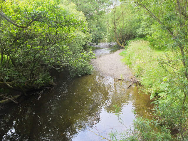
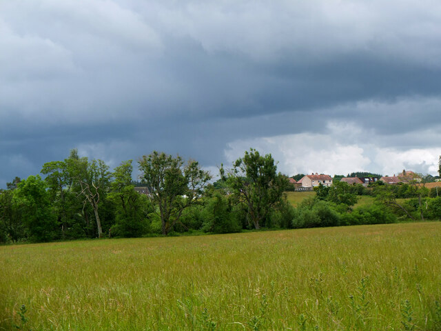
Bewlie Mains, located in Roxburghshire, Scotland, is a small rural settlement nestled in the picturesque landscape of the Scottish Borders. Situated about 5 miles northwest of the town of Jedburgh, Bewlie Mains enjoys a tranquil and idyllic setting, surrounded by rolling hills, lush green fields, and the meandering Jed Water nearby.

This charming hamlet is primarily known for its agricultural heritage, with farming being the predominant occupation of its residents. The fertile soils and favorable climate make Bewlie Mains an ideal location for cultivating crops and rearing livestock. The area is dotted with traditional farmhouses and barns, showcasing the region's rich agricultural traditions.

Despite its small size, Bewlie Mains offers a close-knit community atmosphere, where neighbors often come together to celebrate local events and festivals. The residents take pride in their community and maintain a strong sense of belonging, fostering a friendly and welcoming environment.

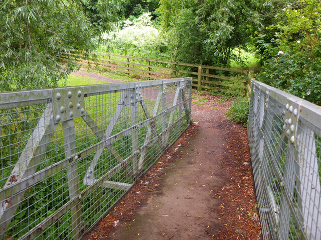
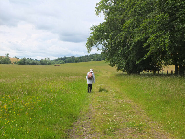
Nature enthusiasts will find plenty to explore in the surrounding countryside, with an abundance of walking trails and scenic viewpoints. The nearby Jed Water provides opportunities for fishing and other water activities, while the rolling hills offer a perfect backdrop for outdoor pursuits such as hiking, cycling, and bird-watching.

Although Bewlie Mains is a peaceful retreat away from the hustle and bustle of urban life, it benefits from its proximity to Jedburgh, where residents can find essential amenities including shops, schools, and healthcare facilities. With its stunning natural beauty and tight-knit community spirit, Bewlie Mains is a hidden gem that truly encapsulates the beauty of rural Scotland.

If you have any feedback on the listing, please let us know in the comments section below.
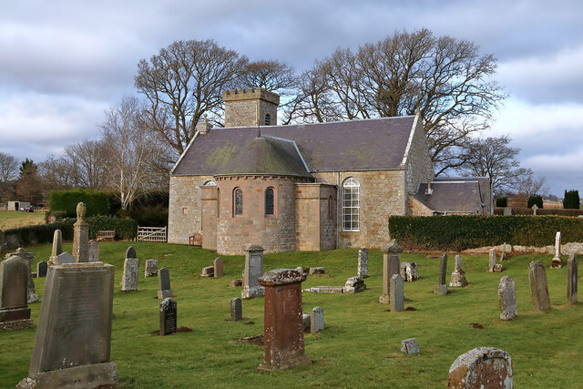
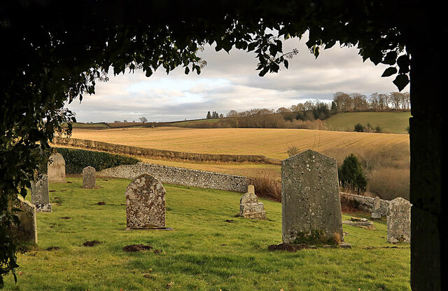
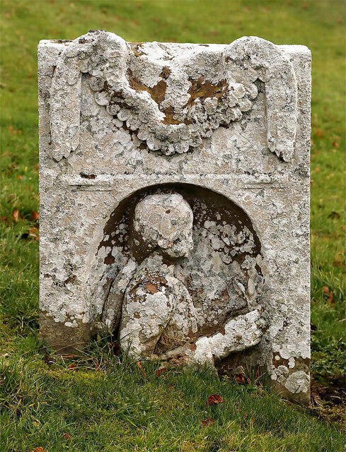
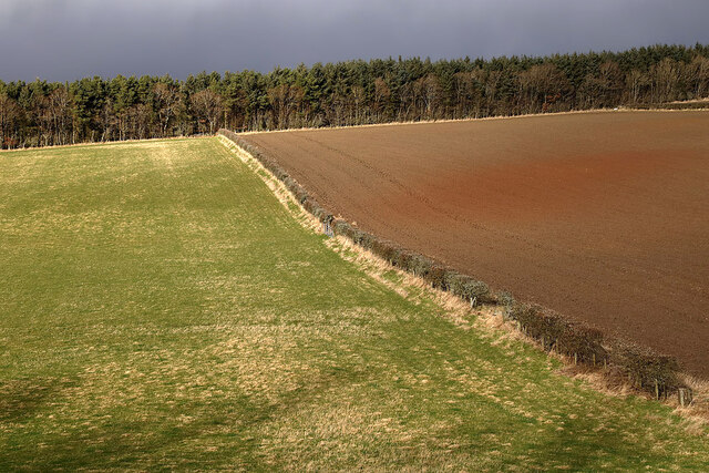
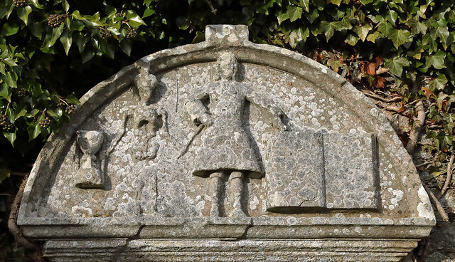
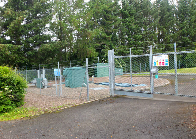
Bewlie Mains Images

Images are sourced within 2km of 55.516669/-2.7141995 or Grid Reference NT5525. Thanks to Geograph Open Source API. All images are credited.

Lilliesleaf Parish Church The first church on this site was said to be built in 1110 and replaced in 1430. The present church was built in 1771 and extended in 1883 and 1910 with the addition of a bell tower. This photo was taken at 11.50 on Christmas Day.
Lilliesleaf Parish Church
The first church on this site was said to be built in 1110 and replaced in 1430. The present church was built in 1771 and extended in 1883 and 1910 with the addition of a bell tower. This photo was taken at 11.50 on Christmas Day.
Lilliesleaf Churchyard This view of the southeast part of the churchyard was taken from the entrance to the Riddell burial aisle.
Lilliesleaf Churchyard
This view of the southeast part of the churchyard was taken from the entrance to the Riddell burial aisle.
A symbolic gravestone at Lilliesleaf Churchyard The head of the winged soul on this lichen-covered portrait headstone is missing.
A symbolic gravestone at Lilliesleaf Churchyard
The head of the winged soul on this lichen-covered portrait headstone is missing.
Mixed farmland at Lilliesleaf The fields were viewed from the B6400 opposite Lilliesleaf Parish Church.
Mixed farmland at Lilliesleaf
The fields were viewed from the B6400 opposite Lilliesleaf Parish Church.
A gravestone detail at Lilliesleaf This is the top part of an 18th century wall monument gravestone in an enclosure at Lilliesleaf Parish Churchyard. The portrait figure represents the deceased holding a book to show religious devotion, while the menacing figure on the left is a symbol of mortality, a crown-wearing skeleton, the King of Terrors, holding an hourglass and a dart. It was difficult to make anything out on the inscription below.
There is an almost identical stone at Roberton Cemetery <a href="https://www.geograph.org.uk/photo/2551444">NT4314 : A gravestone detail at Roberton</a>.
A gravestone detail at Lilliesleaf
This is the top part of an 18th century wall monument gravestone in an enclosure at Lilliesleaf Parish Churchyard. The portrait figure represents the deceased holding a book to show religious devotion, while the menacing figure on the left is a symbol of mortality, a crown-wearing skeleton, the King of Terrors, holding an hourglass and a dart. It was difficult to make anything out on the inscription below. There is an almost identical stone at Roberton Cemetery NT4314 : A gravestone detail at Roberton.
Sewage treatment plant, Lilliesleaf Near the east end of the village on the lane down to the Ale Water.
Sewage treatment plant, Lilliesleaf
Near the east end of the village on the lane down to the Ale Water.
Ale Water at Lilliesleaf Looking upstream from the Jubilee footbridge.
Ale Water at Lilliesleaf
Looking upstream from the Jubilee footbridge.
Jubilee Bridge, Lilliesleaf The bridge carries a path over the Ale Water with access westwards to a field track to Riddell or eastwards to meet the B6453 road to Midlem.
Jubilee Bridge, Lilliesleaf
The bridge carries a path over the Ale Water with access westwards to a field track to Riddell or eastwards to meet the B6453 road to Midlem.
Field track to Riddell A track through farmland to the estate at Riddell. Compare with <a href="https://www.geograph.org.uk/photo/3035817">NT5325 : Field track, Lilliesleaf</a> taken here on my previous visit in the soggy July of 2012.
Field track to Riddell
A track through farmland to the estate at Riddell. Compare with NT5325 : Field track, Lilliesleaf taken here on my previous visit in the soggy July of 2012.
Ominous sky over Lilliesleaf A heavy shower is falling somewhere to the south in unsettled weather with little wind. I encountered a flooded minor road near Bowden on the drive home a few hours later.
Ominous sky over Lilliesleaf
A heavy shower is falling somewhere to the south in unsettled weather with little wind. I encountered a flooded minor road near Bowden on the drive home a few hours later.
Cross Keys Inn, Lilliesleaf A local pub with a traditional bar and outside seating too.
Cross Keys Inn, Lilliesleaf
A local pub with a traditional bar and outside seating too.
Former coffee shop, Lilliesleaf Alas the Jammy Coo is no more, and has now reverted to a dwelling house. See Walter Baxter's photograph <a href="https://www.geograph.org.uk/photo/2037447">NT5324 : The Jammy Coo Gallery and Coffee Shop</a>.

Fortunately the Cross Keys Inn across the road is still in business and can supply coffee and sandwiches: <a href="https://www.geograph.org.uk/photo/7216353">NT5324 : Cross Keys Inn, Lilliesleaf</a>.
Former coffee shop, Lilliesleaf
Alas the Jammy Coo is no more, and has now reverted to a dwelling house. See Walter Baxter's photograph NT5324 : The Jammy Coo Gallery and Coffee Shop. Fortunately the Cross Keys Inn across the road is still in business and can supply coffee and sandwiches: NT5324 : Cross Keys Inn, Lilliesleaf.
Lilliesleaf main street The bulk of the village is along one street on the B6359, though there is a back road on the south side.
Lilliesleaf main street
The bulk of the village is along one street on the B6359, though there is a back road on the south side.
Village hall, Lilliesleaf The inscription below the clock reads 'Currie Memorial Public Hall'. For a closer view please see Walter Baxter's photograph <a href="https://www.geograph.org.uk/photo/770155">NT5325 : Clock on Lilliesleaf Village Hall</a>.
Village hall, Lilliesleaf
The inscription below the clock reads 'Currie Memorial Public Hall'. For a closer view please see Walter Baxter's photograph NT5325 : Clock on Lilliesleaf Village Hall.
Minor road near Netherraw
Minor road near Netherraw It got a bit muddy further on where the Christmas tree traffic was moving.
Minor road near Netherraw
It got a bit muddy further on where the Christmas tree traffic was moving.
Christmas trees, Netherraw
Muddy road, Netherraw Christmas tree harvest season.
Muddy road, Netherraw
Christmas tree harvest season.
Show me another place!

Bewlie Mains is located at Grid Ref: NT5525 (Lat: 55.516669, Lng: -2.7141995)

Unitary Authority: The Scottish Borders

Police Authority: The Lothians and Scottish Borders

What 3 Words

///interests.sideburns.mealtime. Near Newtown St Boswells, Scottish Borders

Nearby Locations

Bewlie Mains

Related Wikis

Lilliesleaf

Lilliesleaf is a small village and civil parish 7 miles (11 km) south east of Selkirk in the Roxburghshire area of Scottish Borders of Scotland. Other...

Old Belses

Old Belses is a village by the Ale Water, in the Parish of Ancrum, in the Scottish Borders of Scotland, in the historic county of Roxburghshire. Other...

Belses

Belses is a village on the Ale Water, in the Scottish Borders area of Scotland the former Selkirkshire. It is situated close to Old Belses, and lies south...

Belses railway station

Belses railway station served the village of Belses, Scottish Borders, Scotland from 1849 to 1969 on the Waverley Route. == History == The station opened...

Lothian and Borders

Lothian and Borders is an area in Scotland consisting of the East Lothian, City of Edinburgh, Midlothian, West Lothian council areas (collectively known...

Hassendean railway station

Hassendean railway station served the village of Hassendean, Scottish Borders, Scotland from 1850 to 1969 on the Waverley Route. == History == The station...

Hassendean, Scottish Borders

Hassendean is a hamlet in the Scottish Borders south of Edinburgh, Scotland. The stream is the Hassendean Burn which flows down to the River Teviot five...

Craigmount School

Craigmount School was a private school originally for boys, but for most of its history for girls, in Edinburgh. It opened in 1874 and closed in 1966....

Nearby Amenities

Located within 500m of 55.516669,-2.7141995
Bewlie Mains
Place: hamlet
Lat/Long: 55.5206443/-2.7120112
Hillhead
Place: isolated_dwelling
Lat/Long: 55.5185277/-2.7208872
Give Way
Direction: forward
Lat/Long: 55.519949/-2.7108426
Power: pole
Lat/Long: 55.5169027/-2.7099312
Power: pole
Lat/Long: 55.5134388/-2.7121425
Power: pole
Lat/Long: 55.5181213/-2.7216456
Power: pole
Lat/Long: 55.5210895/-2.7132952
Power: pole
Lat/Long: 55.5177315/-2.7093975
Power: pole
Lat/Long: 55.5184499/-2.7089349
Power: pole
Lat/Long: 55.5191761/-2.7084673
Power: pole
Lat/Long: 55.5156357/-2.71074
Power: pole
Lat/Long: 55.514806/-2.7112697
Power: pole
Lat/Long: 55.5139887/-2.7117915
Power: pole
Lat/Long: 55.512569/-2.7126892
The data included in this document is from www.openstreetmap.org. The data is made available under ODbL.

Have you been to Bewlie Mains?

Leave your review of Bewlie Mains below (or comments, questions and feedback).