Tamerton, North

Settlement in Cornwall

England

Tamerton, North

Lane near Layhay The lane from North Tamerton to Affaland Cross briefly crosses the square; by the time it reaches the junction ahead on the right, the turn into the farm at Fernhill, it has crossed into <a href="https://www.geograph.org.uk/gridref/SX3398">SX3398</a>.
Lane near Layhay Credit: Derek Harper

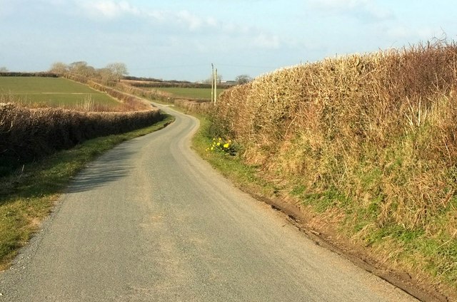
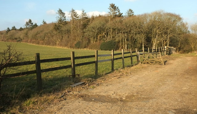
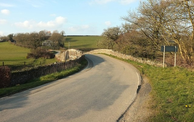
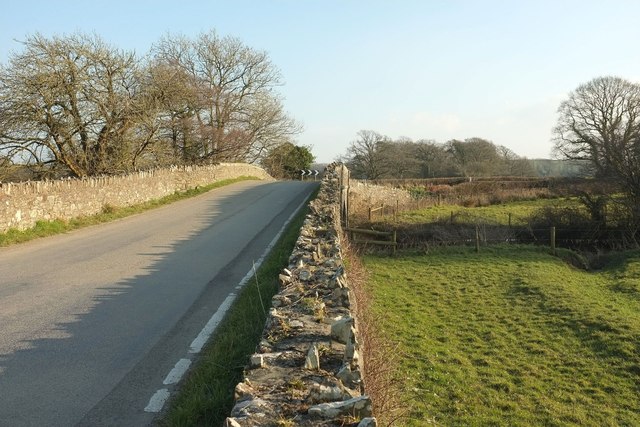
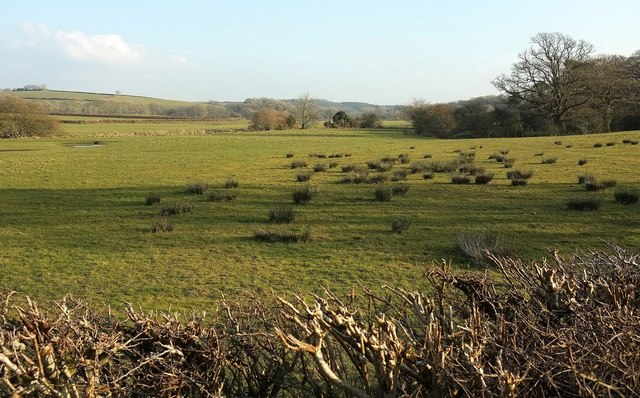
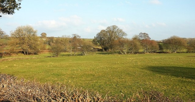
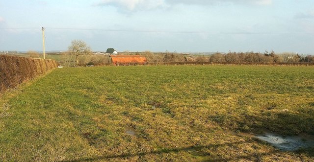
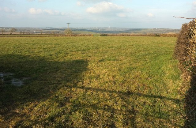
Tamerton is a small village located in the northern region of Cornwall, England. Situated between the towns of Bude and Launceston, Tamerton is nestled amidst picturesque countryside and is known for its tranquil atmosphere and natural beauty. The village is surrounded by rolling hills, lush green meadows, and scenic farmlands, offering residents and visitors alike a peaceful retreat from the bustling city life.

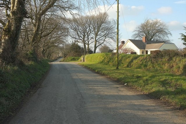
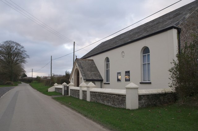
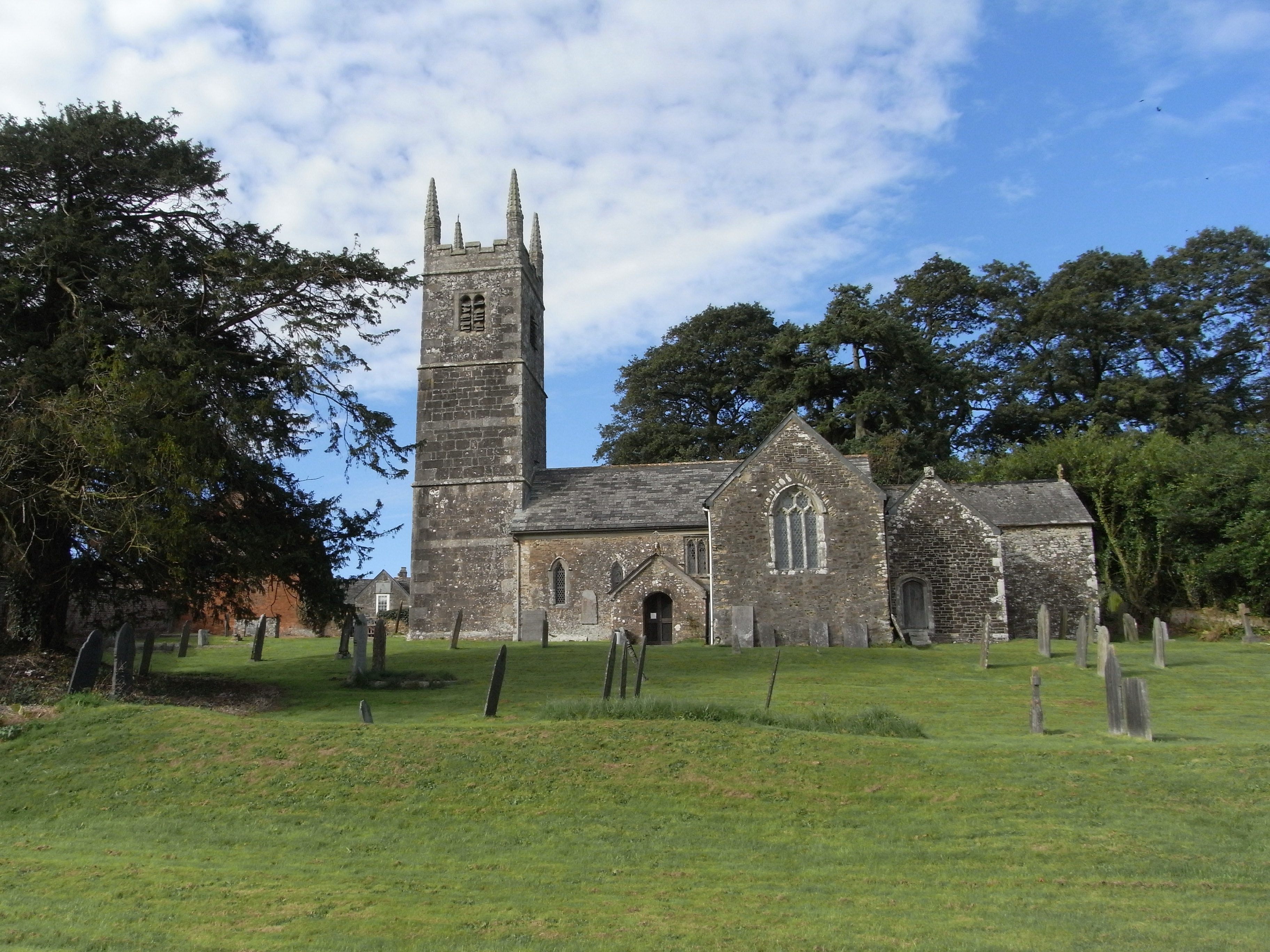
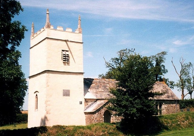
Tamerton boasts a close-knit community that takes pride in its rich history and heritage. The village is home to a number of historic buildings, including a 13th-century church, which serves as a focal point for local gatherings and events. The traditional architecture of the village, with its charming thatched cottages and winding streets, adds to the overall charm and character of the area.

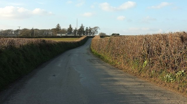
Despite its small size, Tamerton offers a range of amenities to cater to the needs of its residents. These include a local pub, a village shop, and a primary school, ensuring that essential services are easily accessible. Additionally, the village is well-connected to nearby towns and cities, with regular bus services and good road links.

For outdoor enthusiasts, Tamerton provides ample opportunities for exploration and recreation. The surrounding countryside offers numerous walking trails and cycling routes, allowing visitors to immerse themselves in nature and enjoy breathtaking views. The village is also within close proximity to the stunning North Cornwall coastline, where visitors can indulge in a variety of water sports or simply relax on the golden sandy beaches.

In summary, Tamerton is a charming and idyllic village in the heart of North Cornwall. With its beautiful landscapes, rich history, and welcoming community, it offers a peaceful retreat for those seeking a slower pace of life in a quintessentially English countryside setting.

If you have any feedback on the listing, please let us know in the comments section below.

Tamerton, North Images

Images are sourced within 2km of 50.749841/-4.393921 or Grid Reference SX3197. Thanks to Geograph Open Source API. All images are credited.

Lane near Layhay The lane from North Tamerton to Affaland Cross briefly crosses the square; by the time it reaches the junction ahead on the right, the turn into the farm at Fernhill, it has crossed into <a href="https://www.geograph.org.uk/gridref/SX3398">SX3398</a>.
Lane near Layhay
The lane from North Tamerton to Affaland Cross briefly crosses the square; by the time it reaches the junction ahead on the right, the turn into the farm at Fernhill, it has crossed into SX3398.
Farm lane to Higher Horslett The private farm road seen from its junction with the lane up Horslett Hill, and with attractive beeches on the bank.
Farm lane to Higher Horslett
The private farm road seen from its junction with the lane up Horslett Hill, and with attractive beeches on the bank.
Elger Wood A track (not a right of way - there aren't many around here) leads from the road from North Tamerton to Holsworthy into the wood, which lies along the slopes of the Deer valley.
Elger Wood
A track (not a right of way - there aren't many around here) leads from the road from North Tamerton to Holsworthy into the wood, which lies along the slopes of the Deer valley.
Lane at Horslett From the same spot as <a href="https://www.geograph.org.uk/photo/4865794">SX3297 : Farm lane to Higher Horslett</a>, looking to the right up the lane past the group of cottages shown from the other direction in <a href="https://www.geograph.org.uk/photo/599203">SX3297 : Wits End Cottage</a>.
Lane at Horslett
From the same spot as SX3297 : Farm lane to Higher Horslett, looking to the right up the lane past the group of cottages shown from the other direction in SX3297 : Wits End Cottage.
Lambs at Horslett And ... they're off. Number 50 has some ground to make up but there's certainly a spring in its step. This is across the lane from <a href="https://www.geograph.org.uk/photo/4865794">SX3297 : Farm lane to Higher Horslett</a>.
Lambs at Horslett
And ... they're off. Number 50 has some ground to make up but there's certainly a spring in its step. This is across the lane from SX3297 : Farm lane to Higher Horslett.
Tamerton Bridge Across the River Tamar; also shown in <a href="https://www.geograph.org.uk/photo/1195673">SX3197 : Bridge over River Tamar.</a>, and probably date from soon after 1847, when a flood destroyed the medieval bridge here<span class="nowrap"><a title="https://www.historicengland.org.uk/listing/the-list/list-entry/1142438" rel="nofollow ugc noopener" href="https://www.historicengland.org.uk/listing/the-list/list-entry/1142438">Link</a><img style="margin-left:2px;" alt="External link" title="External link - shift click to open in new window" src="https://s1.geograph.org.uk/img/external.png" width="10" height="10"/></span> .
Tamerton Bridge
Across the River Tamar; also shown in SX3197 : Bridge over River Tamar., and probably date from soon after 1847, when a flood destroyed the medieval bridge hereLinkExternal link .
Tamerton Bridge Another view of the listed C19 bridge over the Tamar shown in <a href="https://www.geograph.org.uk/photo/4873724">SX3197 : Tamerton Bridge</a> and <a href="https://www.geograph.org.uk/photo/1195673">SX3197 : Bridge over River Tamar.</a>, and very similar to the latter.
Tamerton Bridge
Another view of the listed C19 bridge over the Tamar shown in SX3197 : Tamerton Bridge and SX3197 : Bridge over River Tamar., and very similar to the latter.
Farmland at Circuit House A cross-grid from the lane shown in <a href="https://www.geograph.org.uk/photo/4865790">SX3298 : Lane near Layhay</a>, looking across a side valley of the Deer.
Farmland at Circuit House
A cross-grid from the lane shown in SX3298 : Lane near Layhay, looking across a side valley of the Deer.
Hawkes Place Houses on Horslett Hill; the lane is climbing steadily from the Deer valley.
Hawkes Place
Houses on Horslett Hill; the lane is climbing steadily from the Deer valley.
Road near Tamerton Bridge In the foreground is the junction with the lane to Corfcott Green. The cottage on the left is just beyond the entrance lane to Bridge Farm.
Road near Tamerton Bridge
In the foreground is the junction with the lane to Corfcott Green. The cottage on the left is just beyond the entrance lane to Bridge Farm.
Tamerton Bridge The parapets leading up to the bridge <span class="nowrap"><a title="https://www.historicengland.org.uk/listing/the-list/list-entry/1142438" rel="nofollow ugc noopener" href="https://www.historicengland.org.uk/listing/the-list/list-entry/1142438">Link</a><img style="margin-left:2px;" alt="External link" title="External link - shift click to open in new window" src="https://s1.geograph.org.uk/img/external.png" width="10" height="10"/></span> on the north side of the Tamar. See also <a title="https://www.geograph.org.uk/search.php?i=63908981" href="https://www.geograph.org.uk/search.php?i=63908981">Link</a> .
Tamerton Bridge
The parapets leading up to the bridge LinkExternal link on the north side of the Tamar. See also Link .
Tamar at Tamerton Bridge Looking downstream: the river is approaching the confluence with the Deer. Near the bend ahead the calm river breaks into rapids; could this be a nick point?
Tamar at Tamerton Bridge
Looking downstream: the river is approaching the confluence with the Deer. Near the bend ahead the calm river breaks into rapids; could this be a nick point?
Rushy meadow by the Tamar From the road south of Tamerton Bridge.
Rushy meadow by the Tamar
From the road south of Tamerton Bridge.
Meadow by the Tamar Looking left from the same spot as <a href="https://www.geograph.org.uk/photo/5001612">SX3197 : Rushy meadow by the Tamar</a>, with the river flowing past the nearer bushes, and behind it the lane crossing Deer Bridge; the rivers (Deer and Tamar) meet somewhere right of centre among the trees.
Meadow by the Tamar
Looking left from the same spot as SX3197 : Rushy meadow by the Tamar, with the river flowing past the nearer bushes, and behind it the lane crossing Deer Bridge; the rivers (Deer and Tamar) meet somewhere right of centre among the trees.
Road past Davies Farm From the point where <a href="https://www.geograph.org.uk/photo/4865808">SX3198 : Elger Wood</a> was taken, looking up the road to Venton. The building is a telephone exchange, with Brick Kiln Copse in the distance.
Road past Davies Farm
From the point where SX3198 : Elger Wood was taken, looking up the road to Venton. The building is a telephone exchange, with Brick Kiln Copse in the distance.
Barn near Affaland Wood From the road between North Tamerton and Venton. Beyond the lopsided-looking barn is Affaland Farm, in <a href="https://www.geograph.org.uk/gridref/SX3298">SX3298</a>. In between them is the Deer valley.
Barn near Affaland Wood
From the road between North Tamerton and Venton. Beyond the lopsided-looking barn is Affaland Farm, in SX3298. In between them is the Deer valley.
Field near West Venton The field behind the left-hand hedge in <a href="https://www.geograph.org.uk/photo/5001762">SX3198 : Barn near Affaland Wood</a>, with distant wind turbines.
Field near West Venton
The field behind the left-hand hedge in SX3198 : Barn near Affaland Wood, with distant wind turbines.
Road at Venton Passing a bungalow between the farms at West and East Venton, which I would say are north and south of each other rather than east and west.
Road at Venton
Passing a bungalow between the farms at West and East Venton, which I would say are north and south of each other rather than east and west.
Show me another place!

Tamerton, North is located at Grid Ref: SX3197 (Lat: 50.749841, Lng: -4.393921)

Unitary Authority: Cornwall

Police Authority: Devon and Cornwall

What 3 Words

///envisage.rafters.raced. Near Boyton, Cornwall

Related Wikis

North Tamerton

North Tamerton (Cornish: Tre war Damer) is a village and civil parish in east Cornwall, England, UK. The village is situated approximately eight miles...

River Deer

The River Deer is river in Devon, a tributary of the River Tamar, joining it at North Tamerton. == Toponymy == The root of the name is uncertain, since...

Tetcott

Tetcott is a civil parish, small settlement and former manor (once the home of the Arscotts of Tetcott) in Devon, England. The parish lies about five miles...

St James's Church, Luffincott

St James's Church in Luffincott, Devon, England was built in the 15th century. It is recorded in the National Heritage List for England as a designated...

Nearby Amenities

Located within 500m of 50.749841,-4.393921
North Tamerton
Is In: Cornwall, England, UK
Name Kw: Tredamar
Place: village
Lat/Long: 50.750214/-4.3966771
Bus Stop
Village Hall
Naptan AtcoCode: 0800COC31705
Naptan Bearing: E
Naptan CommonName: Village Hall
Naptan NaptanCode: cordtpjw
Naptan Street: Unclassified
Naptan Verified: no
Source: naptan_import
Lat/Long: 50.7499468/-4.3940313
Bus Stop
Village Hall
Naptan AtcoCode: 0800COX38461
Naptan Bearing: E
Naptan CommonName: Village Hall
Naptan Indicator: Opp
Naptan NaptanCode: cordtpjt
Naptan Street: Unclassified
Naptan Verified: no
Source: naptan_import
Lat/Long: 50.7498833/-4.3940564
Telephone
Booth: K6
Covered: booth
Lat/Long: 50.7500366/-4.3938059
Post Box
Post Box Type: lamp
Lat/Long: 50.7500196/-4.3937992
Shelter
Shelter Type: public_transport
Lat/Long: 50.7500973/-4.3940493
The data included in this document is from www.openstreetmap.org. The data is made available under ODbL.

Have you been to Tamerton, North?

Leave your review of Tamerton, North below (or comments, questions and feedback).