Beverston

Settlement in Gloucestershire Cotswold

England

Beverston

Old Milestone, Beverstone Metal plate attached to stone post by the A4135, in parish of BEVERSTONE (COTSWOLD District), West of Tetbury, by the road, on North side of road. TDW iron plate, erected by the Coldharbour District turnpike trust in the 19th century. Old image see <a title="https://www.geograph.org.uk/photo/6044001" href="https://www.geograph.org.uk/photo/6044001">Link</a>

Inscription reads: TETBURY / 1 / DURSLEY / & / WOTTON / 9

Grade II listed see <span class="nowrap"><a title="https://historicengland.org.uk/listing/the-list/list-entry/1341159" rel="nofollow ugc noopener" href="https://historicengland.org.uk/listing/the-list/list-entry/1341159">Link</a><img style="margin-left:2px;" alt="External link" title="External link - shift click to open in new window" src="https://s1.geograph.org.uk/img/external.png" width="10" height="10"/></span>

Milestone Society National ID: GL_TBDY01
Old Milestone, Beverstone Credit: Mr Red

Beverston is a small rural village located in the county of Gloucestershire, England. Situated in the Cotswolds, it is surrounded by picturesque countryside, offering breathtaking views and a peaceful atmosphere. The village is approximately 4 miles northeast of the market town of Tetbury and 20 miles southeast of the city of Gloucester.

Beverston is known for its historic Beverston Castle, a 12th-century fortress built by Maurice de Gaunt. Although the castle is now in ruins, its remnants still stand, attracting visitors interested in exploring its history. The village itself is characterized by traditional Cotswold stone houses and buildings, adding to its charm and character.

The community in Beverston is tight-knit, with a population of around 200 residents. The village has a friendly and welcoming atmosphere, with residents often participating in local events and activities. Amenities in Beverston include a village hall, a church, and a popular pub, providing a focal point for social gatherings and community events.

Nature lovers will appreciate the surrounding countryside, which offers numerous opportunities for outdoor activities such as hiking, cycling, and horse riding. The nearby Westonbirt Arboretum, renowned for its collection of trees and stunning autumn foliage, is a popular attraction for both locals and tourists.

Overall, Beverston is a charming and idyllic village, perfect for those seeking a tranquil retreat in the heart of the Cotswolds. Its rich history, beautiful surroundings, and close-knit community make it a desirable place to live or visit.

If you have any feedback on the listing, please let us know in the comments section below.
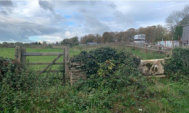
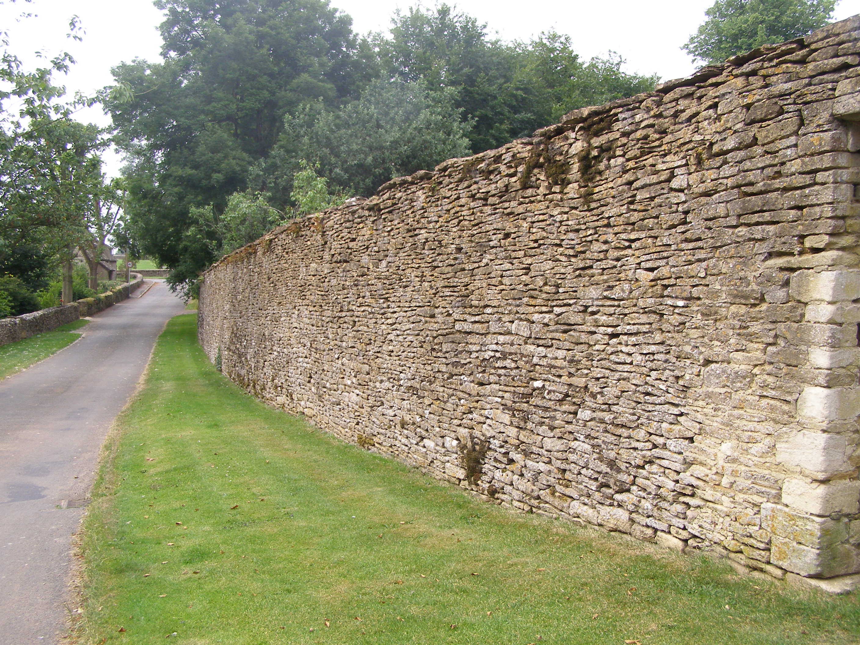
Beverston Images

Images are sourced within 2km of 51.642081/-2.200814 or Grid Reference ST8693. Thanks to Geograph Open Source API. All images are credited.

Old Milestone, Beverstone Metal plate attached to stone post by the A4135, in parish of BEVERSTONE (COTSWOLD District), West of Tetbury, by the road, on North side of road. TDW iron plate, erected by the Coldharbour District turnpike trust in the 19th century. Old image see <a title="https://www.geograph.org.uk/photo/6044001" href="https://www.geograph.org.uk/photo/6044001">Link</a>

Inscription reads: TETBURY / 1 / DURSLEY / & / WOTTON / 9

Grade II listed see <span class="nowrap"><a title="https://historicengland.org.uk/listing/the-list/list-entry/1341159" rel="nofollow ugc noopener" href="https://historicengland.org.uk/listing/the-list/list-entry/1341159">Link</a><img style="margin-left:2px;" alt="External link" title="External link - shift click to open in new window" src="https://s1.geograph.org.uk/img/external.png" width="10" height="10"/></span>

Milestone Society National ID: GL_TBDY01
Old Milestone, Beverstone
Metal plate attached to stone post by the A4135, in parish of BEVERSTONE (COTSWOLD District), West of Tetbury, by the road, on North side of road. TDW iron plate, erected by the Coldharbour District turnpike trust in the 19th century. Old image see Link Inscription reads: TETBURY / 1 / DURSLEY / & / WOTTON / 9 Grade II listed see LinkExternal link Milestone Society National ID: GL_TBDY01
Stone Stile, Beverstone Opposite the entrance to Chavenage House looking NNE. On the Gloucestershire footpath NBE9, the alternative view looking SSW is <a href="https://www.geograph.org.uk/photo/7051091">ST8795 : Stone Stile, Beverstone</a>.
Stone Stile, Beverstone
Opposite the entrance to Chavenage House looking NNE. On the Gloucestershire footpath NBE9, the alternative view looking SSW is ST8795 : Stone Stile, Beverstone.
Stone Stile, Beverstone Opposite the entrance to Chavenage House looking SSW. On the Gloucestershire footpath NBE9, the alternative view looking NNE is <a href="https://www.geograph.org.uk/photo/7051089">ST8795 : Stone Stile, Beverstone</a>.
Stone Stile, Beverstone
Opposite the entrance to Chavenage House looking SSW. On the Gloucestershire footpath NBE9, the alternative view looking NNE is ST8795 : Stone Stile, Beverstone.
Stone Stile, Chavenage Half buried remains of a stone stile. This at the kissing gate from the road, on the Gloucestershire footpath NBE10 across Lodge Farm.
Stone Stile, Chavenage
Half buried remains of a stone stile. This at the kissing gate from the road, on the Gloucestershire footpath NBE10 across Lodge Farm.
Stone Stile, Hookhouse Lane In the areas known as Charlton Down, this is a modern interpretation of a stone stile on the Gloucestershire footpath NTU24. Looking East from the road, the view looking West is <a href="https://www.geograph.org.uk/photo/7051228">ST8691 : Stone Stile, Hookhouse Lane</a>.
Stone Stile, Hookhouse Lane
In the areas known as Charlton Down, this is a modern interpretation of a stone stile on the Gloucestershire footpath NTU24. Looking East from the road, the view looking West is ST8691 : Stone Stile, Hookhouse Lane.
Stone Stile, Hookhouse Lane In the areas known as Charlton Down, this is a modern interpretation of a stone stile on the Gloucestershire footpath NTU24. Looking West to the road, the view looking East is <a href="https://www.geograph.org.uk/photo/7051225">ST8691 : Stone Stile, Hookhouse Lane</a>.
Stone Stile, Hookhouse Lane
In the areas known as Charlton Down, this is a modern interpretation of a stone stile on the Gloucestershire footpath NTU24. Looking West to the road, the view looking East is ST8691 : Stone Stile, Hookhouse Lane.
Chavenage Lane
Chavenage Lane
Entrance to Wild Carrot, Chavenage Wild Carrot is part of the Chavenage estate, and includes a cafe under tepees, more tepees and shepherd's huts for glamping, and facilities for cyclists including bike tours. I stopped there to warm up beside the log burner in the bar in one of the barns. <span class="nowrap"><a title="https://www.wildcarrot.co.uk/" rel="nofollow ugc noopener" href="https://www.wildcarrot.co.uk/">Link</a><img style="margin-left:2px;" alt="External link" title="External link - shift click to open in new window" src="https://s1.geograph.org.uk/img/external.png" width="10" height="10"/></span>
Entrance to Wild Carrot, Chavenage
Wild Carrot is part of the Chavenage estate, and includes a cafe under tepees, more tepees and shepherd's huts for glamping, and facilities for cyclists including bike tours. I stopped there to warm up beside the log burner in the bar in one of the barns. LinkExternal link
Stone barn at Chavenage and Wild Carrot bar Wild Carrot is an events/cafe business situated within the former Chavenage Farm yard. To the right is a converted byre, now housing a bar for evening and other events, and extra seating for the cafe. In the foreground is a pole for hooking up bicycles while their owners rest and warm up in the cafe. <span class="nowrap"><a title="https://www.wildcarrot.co.uk/" rel="nofollow ugc noopener" href="https://www.wildcarrot.co.uk/">Link</a><img style="margin-left:2px;" alt="External link" title="External link - shift click to open in new window" src="https://s1.geograph.org.uk/img/external.png" width="10" height="10"/></span>
Stone barn at Chavenage and Wild Carrot bar
Wild Carrot is an events/cafe business situated within the former Chavenage Farm yard. To the right is a converted byre, now housing a bar for evening and other events, and extra seating for the cafe. In the foreground is a pole for hooking up bicycles while their owners rest and warm up in the cafe. LinkExternal link
Inside Wild Carrot cafe The cafe, housed in a double-tepee, is located next to the Macmillan Way, and is popular with cyclists and walkers.
Inside Wild Carrot cafe
The cafe, housed in a double-tepee, is located next to the Macmillan Way, and is popular with cyclists and walkers.
Road junction near Chavenage Green
Stone Stile, Chavenage Near Wildlife World and Chavenage House looking NW from Chavenage Lane ( bridleway NBE8), the stile has no public right of way over it.
Stone Stile, Chavenage
Near Wildlife World and Chavenage House looking NW from Chavenage Lane ( bridleway NBE8), the stile has no public right of way over it.
The route of Chavenage Lane
Field corner
Field corner
Barn at Chavanage Manor
Primroses in the churchyard, Beverston
Pilgrim's Barn, Beverston Probably dates from the fourteenth century <span class="nowrap"><a title="https://historicengland.org.uk/listing/the-list/list-entry/1341160?section=official-list-entry" rel="nofollow ugc noopener" href="https://historicengland.org.uk/listing/the-list/list-entry/1341160?section=official-list-entry">Link</a><img style="margin-left:2px;" alt="External link" title="External link - shift click to open in new window" src="https://s1.geograph.org.uk/img/external.png" width="10" height="10"/></span>
Pilgrim's Barn, Beverston
Probably dates from the fourteenth century LinkExternal link
St Mary's church, Beverston Small parish church largely of the thirteenth and fourteenth centuries though on older foundations <span class="nowrap"><a title="https://historicengland.org.uk/listing/the-list/list-entry/1153025?section=official-list-entry" rel="nofollow ugc noopener" href="https://historicengland.org.uk/listing/the-list/list-entry/1153025?section=official-list-entry">Link</a><img style="margin-left:2px;" alt="External link" title="External link - shift click to open in new window" src="https://s1.geograph.org.uk/img/external.png" width="10" height="10"/></span>
St Mary's church, Beverston
Small parish church largely of the thirteenth and fourteenth centuries though on older foundations LinkExternal link
Show me another place!

Beverston is located at Grid Ref: ST8693 (Lat: 51.642081, Lng: -2.200814)

Administrative County: Gloucestershire

District: Cotswold

Police Authority: Gloucestershire

What 3 Words

///dolls.openly.storybook. Near Tetbury, Gloucestershire

Nearby Locations

Beverston

Related Wikis

Beverston

Beverston is a village and civil parish in the Cotswold district of Gloucestershire, England. According to the 2001 census it had a population of 132,...

Beverston Castle

Beverston Castle, also known as Beverstone Castle or Tetbury Castle, was constructed as a medieval stone fortress in the village of Beverston, Gloucestershire...

St Mary's Church, Beverston

The Church of Saint Mary the Virgin is the parish church of Beverston, Gloucestershire, England, and a Grade II* listed building. The church is of Norman...
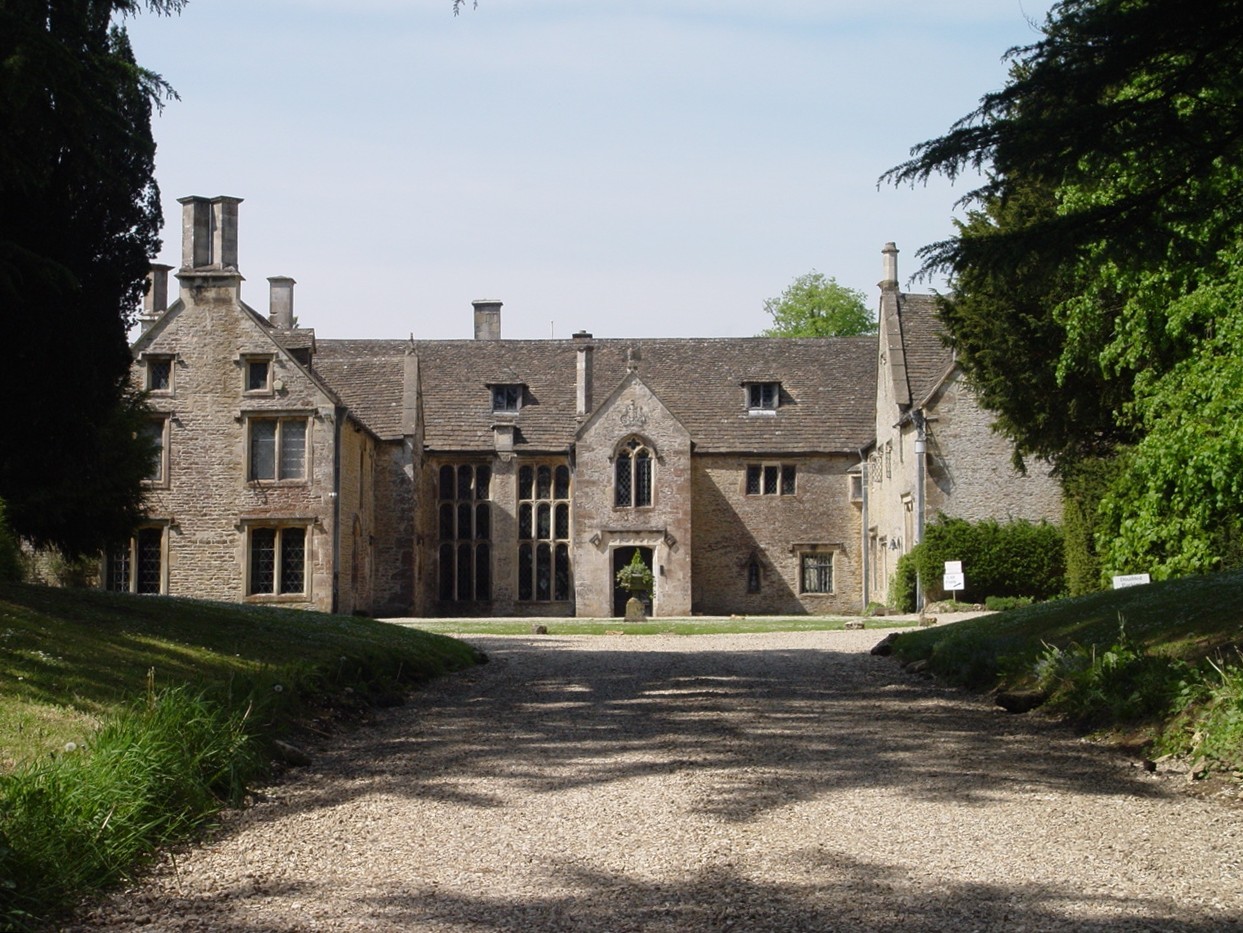
Chavenage House

Chavenage House, Beverston, Gloucestershire is a country house dating from the late 16th century. The house was built in 1576 and is constructed of Cotswold...

Veizey's Quarry

Veizey's Quarry (grid reference ST881944) is a 1.4 hectare geological Site of Special Scientific Interest near Tetbury in Gloucestershire, notified in...

RAF Babdown Farm

Royal Air Force Babdown Farm or more simply RAF Babdown Farm is a former Royal Air Force relief landing ground located 2.9 miles (4.7 km) west of Tetbury...

Tetbury Upton

Tetbury Upton is a small village and civil parish in the Cotswolds area of Gloucestershire, England. The parish extends in an arc around the north, west...

Calcot Manor

Calcot Manor is a historic building in Calcot, three and a half miles west of Tetbury on A 4135 in Gloucestershire, England, near the junction of roads...

Nearby Amenities

Located within 500m of 51.642081,-2.200814
Beverston
Alt Name: Beverstone
Is In: Gloucestershire, England, UK
Place: village
Lat/Long: 51.6432869/-2.2005697
Bus Stop
Castle
Bus: yes
Naptan AtcoCode: 1600GL389
Naptan Bearing: SE
Naptan CommonName: Castle
Naptan NaptanCode: glodjdga
Naptan Street: A4135
Naptan Verified: no
Public Transport: platform
Source: naptan_import
Lat/Long: 51.6432093/-2.2019798
Bus Stop
Memorial Gardens
Bus: yes
Naptan AtcoCode: 1600GL390
Naptan Bearing: NW
Naptan CommonName: Memorial Gardens
Naptan NaptanCode: glodjawp
Naptan Street: A4135
Naptan Verified: no
Public Transport: platform
Source: naptan_import
Lat/Long: 51.6423481/-2.1994946
Telephone
Booth: K6
Covered: booth
Operator: BT
Operator Wikidata: Q593786
Payment Electronic Purses: yes
Payment Telephone Cards: yes
Lat/Long: 51.6431838/-2.2017184
Post Box
Collection Times: Mo-Fr 17:00; Sa 08:00
Collection Times Checked: 2015-08-27
Operator: Royal Mail
Operator Wikidata: Q638098
Post Box Type: lamp
Ref: GL8 174
Royal Cypher: EIIR
Royal Cypher Wikidata: Q33102113
Lat/Long: 51.6424853/-2.1989442
Description: Norman Church
Tourism: attraction
Lat/Long: 51.6447515/-2.2013693
Waste Basket
Lat/Long: 51.6425373/-2.1990205
Advertising: board
Lat/Long: 51.6425532/-2.1990567
Milestone
Wikidata: Q26382132
Lat/Long: 51.6437337/-2.2042832
The data included in this document is from www.openstreetmap.org. The data is made available under ODbL.

Have you been to Beverston?

Leave your review of Beverston below (or comments, questions and feedback).