Llys Bedydd

Settlement in Flintshire

Wales

Llys Bedydd

Ducks on the canal at Cornhill Bridge near Bettisfield Extremely noisy ducks, almost demanding some food stuff, but entertaining nonetheless. We happily quacked at each other for some time until I had to apologise for having no peas/beans or even bread to offer them. Lovely to see.
Ducks on the canal at Cornhill Bridge near Bettisfield Credit: Jeremy Bolwell

Llys Bedydd is a small village located in the county of Flintshire, in northeastern Wales. Situated near the border with England, the village is nestled amidst picturesque countryside and rolling hills, offering stunning views of the surrounding landscape.

The village is primarily residential, with a population of around 500 residents. It is known for its peaceful and tight-knit community, where neighbors often gather for various social events and activities. The village has a charming and quaint atmosphere, with well-maintained cottages and gardens adding to its aesthetic appeal.

Despite its small size, Llys Bedydd boasts a few essential amenities. The village has a local primary school, providing education for the younger population. Additionally, there is a village hall that serves as a hub for community gatherings and events.

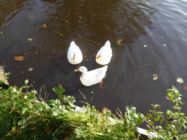
The surrounding area offers plenty of opportunities for outdoor enthusiasts. Llys Bedydd is located near several nature reserves and walking trails, making it an ideal location for those who enjoy exploring the great outdoors. The nearby River Dee also provides opportunities for fishing and boating.

For those seeking a taste of history, Llys Bedydd is in close proximity to several historical sites. The ruins of Flint Castle, a 13th-century fortress, are just a short drive away. The village is also within reach of the medieval market town of Mold, home to the impressive Mold Castle.

Overall, Llys Bedydd is a charming village that offers residents a peaceful and scenic lifestyle, with a close-knit community and plenty of opportunities for outdoor activities and historical exploration.

If you have any feedback on the listing, please let us know in the comments section below.

Llys Bedydd Images

Images are sourced within 2km of 52.913302/-2.800922 or Grid Reference SJ4635. Thanks to Geograph Open Source API. All images are credited.

Ducks on the canal at Cornhill Bridge near Bettisfield Extremely noisy ducks, almost demanding some food stuff, but entertaining nonetheless. We happily quacked at each other for some time until I had to apologise for having no peas/beans or even bread to offer them. Lovely to see.
Ducks on the canal at Cornhill Bridge near Bettisfield
Extremely noisy ducks, almost demanding some food stuff, but entertaining nonetheless. We happily quacked at each other for some time until I had to apologise for having no peas/beans or even bread to offer them. Lovely to see.
At Cornhill Bridge near Bettisfield A family group enjoy a walk here and the company of some very noisy ducks.
At Cornhill Bridge near Bettisfield
A family group enjoy a walk here and the company of some very noisy ducks.
Footpath below the canal The canal is reinforced here and lies above the footpath or towpath beside it. It is slightly unnerving being a metre or so below such a volume of water.
Footpath below the canal
The canal is reinforced here and lies above the footpath or towpath beside it. It is slightly unnerving being a metre or so below such a volume of water.
Platform at the moss edge Information board below a viewing platform.
Platform at the moss edge
Information board below a viewing platform.
Viewing platform on the edge of the moss Installed for elevation for birdwatchers and other visitors. 

The lone birdwatcher here today admitted that he hadn't seen much; no snipe or woodcock (they were at the margins of the moss and in adjoining areas but leave the moss at this time of year, apparently). Also no Redwing or other migrants yet, although they also were present in fields and woods nearby.
Viewing platform on the edge of the moss
Installed for elevation for birdwatchers and other visitors. The lone birdwatcher here today admitted that he hadn't seen much; no snipe or woodcock (they were at the margins of the moss and in adjoining areas but leave the moss at this time of year, apparently). Also no Redwing or other migrants yet, although they also were present in fields and woods nearby.
Part of the moss This is what all the fuss is about.
Part of the moss
This is what all the fuss is about.
Old abandoned peat processing plant on the moss This shed housed the plant for getting the peat onto lorries for delivery as a domestic fuel to customers.
Old abandoned peat processing plant on the moss
This shed housed the plant for getting the peat onto lorries for delivery as a domestic fuel to customers.
Fly Agaric fungus on the moss Much munched.
Fly Agaric fungus on the moss
Much munched.
Part of a tree farm A large enterprise I believe.
Part of a tree farm
A large enterprise I believe.
Winter fields Good to see some Lapwing here today.
Winter fields
Good to see some Lapwing here today.
Birds in winter fields near Bettisfield Great to see and hear Lapwing here today.
Birds in winter fields near Bettisfield
Great to see and hear Lapwing here today.
Winter fields near Bettisfield Is that an abandoned tractor I espy down there?
Winter fields near Bettisfield
Is that an abandoned tractor I espy down there?
Abandoned tractor in the field Maybe its clutch or gearbox has gone? An old model. Looks like it has been there some time. Nice cab.
Abandoned tractor in the field
Maybe its clutch or gearbox has gone? An old model. Looks like it has been there some time. Nice cab.
Scene from Bettisfield Bridge Lovely. And after a beautiful walk around the canal path and through the moss it is almost time to repair back to our friend's home for a sumptuous lamb dinner. Life doesn't get much better than this.
Scene from Bettisfield Bridge
Lovely. And after a beautiful walk around the canal path and through the moss it is almost time to repair back to our friend's home for a sumptuous lamb dinner. Life doesn't get much better than this.
Partly renovated cottage in Bettisfield village One I geographed two years ago ( <a title="https://www.geograph.org.uk/photo/6356211" href="https://www.geograph.org.uk/photo/6356211">Link</a> here), before renovation / refurbishment started. It has stopped by the looks of it. Maybe there has been a change of plan? The cottage with planning permission must be worth more than it previously was..It would be good to see this impasse resolved.
Partly renovated cottage in Bettisfield village
One I geographed two years ago ( Link here), before renovation / refurbishment started. It has stopped by the looks of it. Maybe there has been a change of plan? The cottage with planning permission must be worth more than it previously was..It would be good to see this impasse resolved.
Church sign
Church sign
Primitive Methodist Ebenezer Chapel in Bettisfield Beautifully maintained building, still operative as a Methodist chapel, built in 1873 according to the plaque.
Primitive Methodist Ebenezer Chapel in Bettisfield
Beautifully maintained building, still operative as a Methodist chapel, built in 1873 according to the plaque.
Looking east down the Llangollen Canal from Bettisfield Bridge A lovely stretch of the canal, which was busy with both moored and moving canal boats today.
Looking east down the Llangollen Canal from Bettisfield Bridge
A lovely stretch of the canal, which was busy with both moored and moving canal boats today.
Show me another place!

Llys Bedydd is located at Grid Ref: SJ4635 (Lat: 52.913302, Lng: -2.800922)

Unitary Authority: Wrexham

Police Authority: North Wales

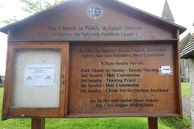
Also known as: Bettisfield

What 3 Words

///leaves.owls.paces. Near Ellesmere, Shropshire

Nearby Locations

Bettisfield Llys Bedydd

Related Wikis

Bettisfield

Bettisfield (Welsh: Llys Bedydd; standardised: Bettisfield) is a village of about 150 dwellings in Wrexham County Borough, Wales and stands on the Wales...

Bettisfield railway station

Bettisfield railway station was a station in Bettisfield, Wrexham, Wales. The station was opened on 4 May 1863 and closed on 18 January 1965. == Details... ==

Balmer Heath

Balmer Heath is a village in Shropshire, England. == External links == Media related to Balmer Heath at Wikimedia Commons

Breaden Heath

Breaden Heath is a small village in Shropshire, England. It lies right on the border with Wales.

Welshampton rail crash

The Welshampton rail crash was a fatal railway accident in the Welsh borders village of Welshampton on 11 June 1897. It resulted in the deaths of 12 people...

Welshampton railway station

Welshampton railway station was a station in Welshampton, Shropshire, England. The station was opened on 4 May 1863 and closed on 18 January 1965.The station...

Welshampton and Lyneal

Welshampton and Lyneal is a civil parish in Shropshire, England. The population of the civil parish at the 2011 census was 852.The current parish is the...

Welshampton

Welshampton is a small village and former civil parish, now in the parish of Welshampton and Lyneal, in the Shropshire district, in the ceremonial county...

Nearby Amenities

Located within 500m of 52.913302,-2.800922
Bettisfield
Name Cy: Llys Bedydd
Name En: Bettisfield
Place: village
Wikidata: Q16245967
Wikipedia: en:Bettisfield
Lat/Long: 52.9141585/-2.8051876
Grit Bin
Lat/Long: 52.9144035/-2.8051853
Barrier: stile
Lat/Long: 52.9150676/-2.7954173
Shelter
Shelter Type: public_transport
Lat/Long: 52.9141806/-2.8054976
Addr Housename: Bank House
Lat/Long: 52.9119011/-2.8004357
Power: pole
Lat/Long: 52.9097367/-2.7966991
Power: pole
Lat/Long: 52.9105827/-2.7959159
Power: pole
Lat/Long: 52.9116503/-2.7964577
Power: pole
Lat/Long: 52.9126806/-2.7968869
Power: pole
Lat/Long: 52.9138257/-2.7973375
Power: pole
Lat/Long: 52.9144711/-2.7975574
Power: pole
Lat/Long: 52.9152733/-2.7978578
Power: pole
Lat/Long: 52.9169731/-2.7985847
Water Point
Bettisfield Water Point
Access: permissive
Drinking Water: yes
Man Made: water_tap
Operator: Canal and River Trust
Waterway: water_point
Lat/Long: 52.9144085/-2.8049399
Water Point
Bettisfield Water Point
Access: permissive
Drinking Water: yes
Man Made: water_tap
Operator: Canal and River Trust
Waterway: water_point
Lat/Long: 52.9143716/-2.8046826
Direction: SSW
Generator Method: photovoltaic
Generator Output Electricity: yes
Generator Solar Modules: 18
Generator Source: solar
Generator Type: solar_photovoltaic_panel
Location: roof
Power: generator
Lat/Long: 52.9106583/-2.7993746
Direction: 145
Generator Method: photovoltaic
Generator Output Electricity: yes
Generator Solar Modules: 14
Generator Source: solar
Generator Type: solar_photovoltaic_panel
Location: roof
Power: generator
Lat/Long: 52.9118524/-2.8013393
The data included in this document is from www.openstreetmap.org. The data is made available under ODbL.

Have you been to Llys Bedydd?

Leave your review of Llys Bedydd below (or comments, questions and feedback).