Beer, North

Settlement in Cornwall

England

Beer, North

Trees screening the farm buildings at Langdon Farm
Trees screening the farm buildings at Langdon Farm Credit: David Smith

Beer is a charming coastal village located in the North of Cornwall, a county in southwestern England. Nestled within the picturesque region of East Cornwall, Beer boasts stunning natural beauty and a rich history that attracts visitors from all over the world.

The village is situated on the edge of Bodmin Moor, a rugged and unspoiled landscape known for its granite tors and wild ponies. This proximity to such a unique natural environment makes Beer an ideal destination for outdoor enthusiasts and nature lovers. The nearby Camel Trail offers excellent opportunities for walking, cycling, and horse riding, allowing visitors to immerse themselves in the stunning countryside.

In addition to its natural attractions, Beer is also steeped in history. The village is home to several ancient landmarks, including the iconic King Arthur's Hall, a Neolithic monument thought to be a ceremonial site. The historic village center is dotted with traditional thatched cottages and quaint local shops, providing a glimpse into Cornwall's past.

Despite its small size, Beer offers a range of amenities to cater to visitors' needs. The village boasts a selection of cozy pubs, charming tea rooms, and delightful restaurants serving traditional Cornish cuisine. There are also a number of accommodation options available, ranging from cozy bed and breakfasts to self-catering cottages, ensuring a comfortable stay for visitors.

Overall, Beer, North Cornwall is a captivating destination that combines natural beauty, historical significance, and a warm Cornish welcome, making it a must-visit location for those seeking an authentic and memorable experience.

If you have any feedback on the listing, please let us know in the comments section below.
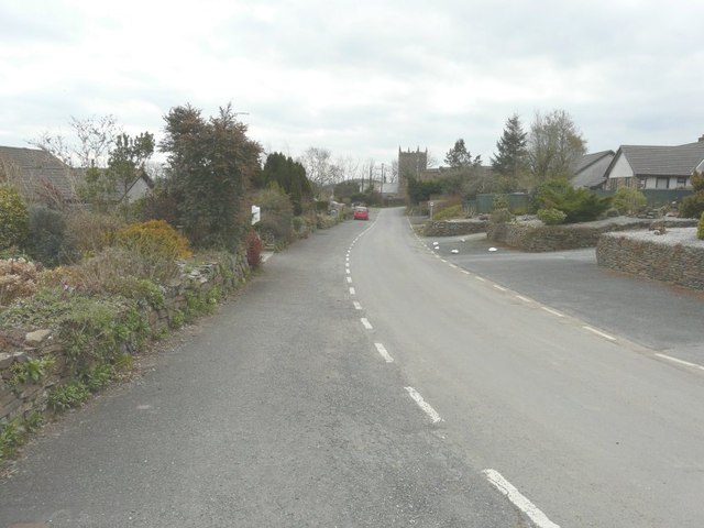
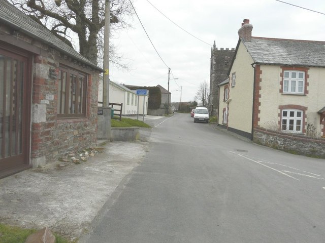
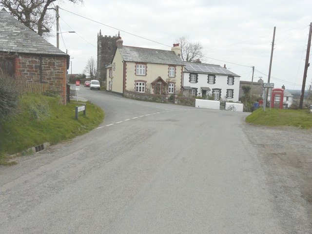
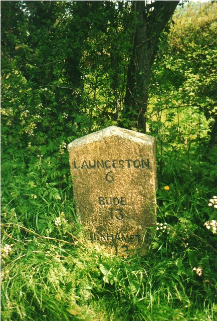
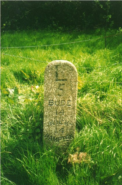
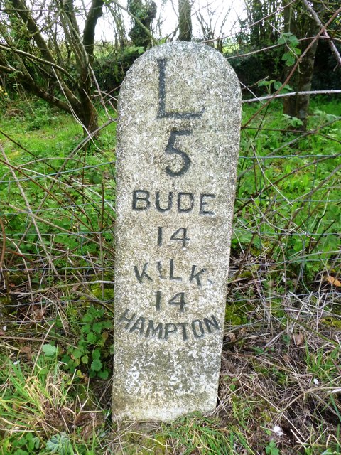
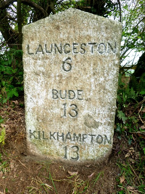
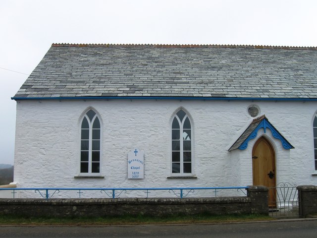
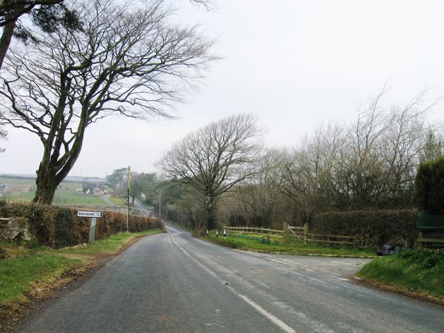
Beer, North Images

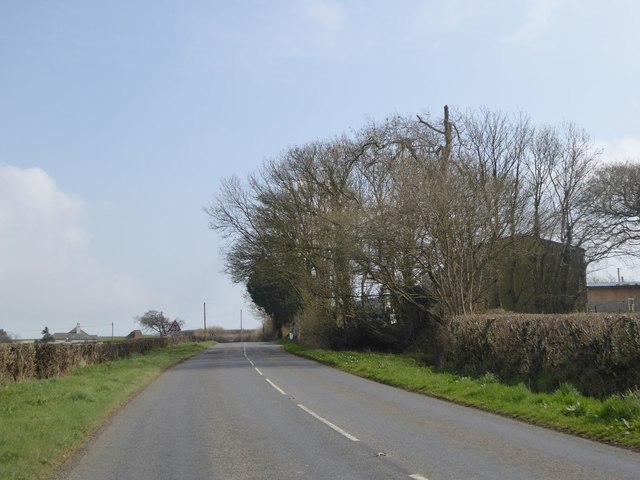
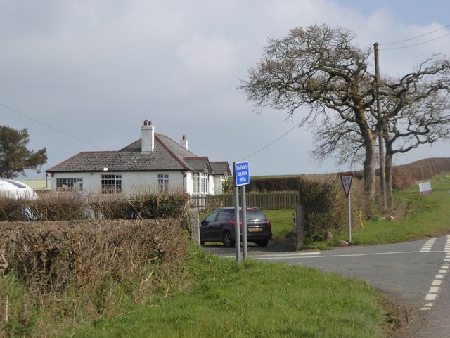
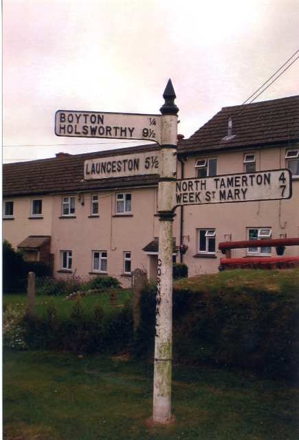
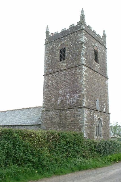
Images are sourced within 2km of 50.702674/-4.399647 or Grid Reference SX3091. Thanks to Geograph Open Source API. All images are credited.

Trees screening the farm buildings at Langdon Farm
The road junction south of Langdon Farm A solitary bungalow marks this junction
The road junction south of Langdon Farm
A solitary bungalow marks this junction
Valley south of Hillside on B3254
Old Direction Sign - Signpost in Boyton Pyramid spear finial - 3 arms; Cornwall CC iron spear by the UC road, in parish of Boyton (North Cornwall District), in front of terraced houses, on verge, West side of road.

Cornwall & Scilly HER.
HER Number: MCO57744 <span class="nowrap"><a title="https://www.heritagegateway.org.uk/Gateway/Results_Single.aspx?uid=MCO57744&resourceID=1020" rel="nofollow ugc noopener" href="https://www.heritagegateway.org.uk/Gateway/Results_Single.aspx?uid=MCO57744&resourceID=1020">Link</a><img style="margin-left:2px;" alt="External link" title="External link - shift click to open in new window" src="https://s1.geograph.org.uk/img/external.png" width="10" height="10"/></span>

Surveyed

Milestone Society National ID: CW_SX3191
Old Direction Sign - Signpost in Boyton
Pyramid spear finial - 3 arms; Cornwall CC iron spear by the UC road, in parish of Boyton (North Cornwall District), in front of terraced houses, on verge, West side of road. Cornwall & Scilly HER. HER Number: MCO57744 LinkExternal link Surveyed Milestone Society National ID: CW_SX3191
Holy Name church, Boyton, Cornwall
Looking along Underlane Towards the church tower of Holy Name.
Looking along Underlane
Towards the church tower of Holy Name.
Looking along Underlane With the church tower of Holy Name on the right.
Looking along Underlane
With the church tower of Holy Name on the right.
The road through Boyton With the name-plate for Underhill (the road to the left) on the grass verge and the church tower of Holy Name beyond.
The road through Boyton
With the name-plate for Underhill (the road to the left) on the grass verge and the church tower of Holy Name beyond.
Ordnance Survey Flush Bracket S5212 This can be found on the wall of a building at Bennacott.
For more detail see : <span class="nowrap"><a title="http://www.bench-marks.org.uk/bm20815" rel="nofollow ugc noopener" href="http://www.bench-marks.org.uk/bm20815">Link</a><img style="margin-left:2px;" alt="External link" title="External link - shift click to open in new window" src="https://s1.geograph.org.uk/img/external.png" width="10" height="10"/></span>
Ordnance Survey Flush Bracket S5212
This can be found on the wall of a building at Bennacott. For more detail see : LinkExternal link
Old Milestone by the B3254, north of Bennacott Carved stone post by the B3254, in parish of BOYTON (NORTH CORNWALL District), The Grange, 100m North West of Daracott cottage, in hedge on narrow section of road, on East side of road. Kilkhampton County stone, erected by the Local Highways Board in the 19th century. 

Inscription reads:-
LAUNCESTON
6
BUDE
13
KILKHAMPTON
13   

Grade II Listed. List Entry Number: 1142940
<span class="nowrap"><a title="https://historicengland.org.uk/listing/the-list/list-entry/1142940" rel="nofollow ugc noopener" href="https://historicengland.org.uk/listing/the-list/list-entry/1142940">Link</a><img style="margin-left:2px;" alt="External link" title="External link - shift click to open in new window" src="https://s1.geograph.org.uk/img/external.png" width="10" height="10"/></span>

Milestone Society National ID: CW_KHLA13.
Old Milestone by the B3254, north of Bennacott
Carved stone post by the B3254, in parish of BOYTON (NORTH CORNWALL District), The Grange, 100m North West of Daracott cottage, in hedge on narrow section of road, on East side of road. Kilkhampton County stone, erected by the Local Highways Board in the 19th century. Inscription reads:- LAUNCESTON 6 BUDE 13 KILKHAMPTON 13 Grade II Listed. List Entry Number: 1142940 LinkExternal link Milestone Society National ID: CW_KHLA13.
Old Milestone by the B3254, south of Bennacott Carved stone post by the B3254, in parish of BOYTON (NORTH CORNWALL District), Bennacott; opposite Bennacott Kennels and Cattery, by the road, on East side of road. Kilkhampton County stone, erected by the Launceston turnpike trust in the 18th century. 

Inscription reads:-
L
5
BUDE
14
KILK
14
HAMPTON   

Grade II Listed. List Entry Number: 1328013
<span class="nowrap"><a title="https://historicengland.org.uk/listing/the-list/list-entry/1328013" rel="nofollow ugc noopener" href="https://historicengland.org.uk/listing/the-list/list-entry/1328013">Link</a><img style="margin-left:2px;" alt="External link" title="External link - shift click to open in new window" src="https://s1.geograph.org.uk/img/external.png" width="10" height="10"/></span>

Milestone Society National ID: CW_KHLA14.
Old Milestone by the B3254, south of Bennacott
Carved stone post by the B3254, in parish of BOYTON (NORTH CORNWALL District), Bennacott; opposite Bennacott Kennels and Cattery, by the road, on East side of road. Kilkhampton County stone, erected by the Launceston turnpike trust in the 18th century. Inscription reads:- L 5 BUDE 14 KILK 14 HAMPTON Grade II Listed. List Entry Number: 1328013 LinkExternal link Milestone Society National ID: CW_KHLA14.
Old Milestone by the B3254 south of Bennacott Carved stone post by the B3254, in parish of BOYTON (NORTH CORNWALL District), Bennacott; opposite Bennacott Kennels and Cattery, by the road, on East side of road. Kilkhampton County stone, erected by the Launceston turnpike trust in the 18th century. 

Inscription reads:-
L
5
BUDE
14
KILK
14
HAMPTON 

Grade II listed.
List Entry Number: 1328013 <span class="nowrap"><a title="https://historicengland.org.uk/listing/the-list/list-entry/1328013" rel="nofollow ugc noopener" href="https://historicengland.org.uk/listing/the-list/list-entry/1328013">Link</a><img style="margin-left:2px;" alt="External link" title="External link - shift click to open in new window" src="https://s1.geograph.org.uk/img/external.png" width="10" height="10"/></span>
  
Milestone Society National ID: CW_KHLA14.
Old Milestone by the B3254 south of Bennacott
Carved stone post by the B3254, in parish of BOYTON (NORTH CORNWALL District), Bennacott; opposite Bennacott Kennels and Cattery, by the road, on East side of road. Kilkhampton County stone, erected by the Launceston turnpike trust in the 18th century. Inscription reads:- L 5 BUDE 14 KILK 14 HAMPTON Grade II listed. List Entry Number: 1328013 LinkExternal link Milestone Society National ID: CW_KHLA14.
Old Milestone by the B3254, north of Bennacott Carved stone post by the B3254, in parish of BOYTON (NORTH CORNWALL District), The Grange, 100m Northwest of Daracott Cottage, in hedge on narrow section of road, on East side of road. Kilkhampton County stone, erected by the Local Highways Board in the 19th century. 

Inscription reads:-
LAUNCESTON
6
BUDE
13
KILKHAMPTON
13 

Grade II listed.
List Entry Number: 1142940 <span class="nowrap"><a title="https://historicengland.org.uk/listing/the-list/list-entry/1142940" rel="nofollow ugc noopener" href="https://historicengland.org.uk/listing/the-list/list-entry/1142940">Link</a><img style="margin-left:2px;" alt="External link" title="External link - shift click to open in new window" src="https://s1.geograph.org.uk/img/external.png" width="10" height="10"/></span>

Milestone Society National ID: CW_KHLA13.
Old Milestone by the B3254, north of Bennacott
Carved stone post by the B3254, in parish of BOYTON (NORTH CORNWALL District), The Grange, 100m Northwest of Daracott Cottage, in hedge on narrow section of road, on East side of road. Kilkhampton County stone, erected by the Local Highways Board in the 19th century. Inscription reads:- LAUNCESTON 6 BUDE 13 KILKHAMPTON 13 Grade II listed. List Entry Number: 1142940 LinkExternal link Milestone Society National ID: CW_KHLA13.
Bennacott Chapel
Bennacott Chapel
B3254 northbound
B3254 northbound
Lane near Godcott Farm A line of oaks beside the lane as it approaches the farm.
Lane near Godcott Farm
A line of oaks beside the lane as it approaches the farm.
B3254 near Langdon Cross The B road dips to cross a tributary of the Tala Water as it approaches Langdon Cross.
B3254 near Langdon Cross
The B road dips to cross a tributary of the Tala Water as it approaches Langdon Cross.
Canal basin The depression shown in the picture was a basin on the Launceston branch of the Bude Canal, which was constructed in the 1820s and ceased to operate in about 1891.  More excellent info on this is available at <span class="nowrap"><a title="http://www.bude-canal.co.uk/" rel="nofollow ugc noopener" href="http://www.bude-canal.co.uk/">Link</a><img style="margin-left:2px;" alt="External link" title="External link - shift click to open in new window" src="https://s1.geograph.org.uk/img/external.png" width="10" height="10"/></span>
Canal basin
The depression shown in the picture was a basin on the Launceston branch of the Bude Canal, which was constructed in the 1820s and ceased to operate in about 1891. More excellent info on this is available at LinkExternal link
Show me another place!

Beer, North is located at Grid Ref: SX3091 (Lat: 50.702674, Lng: -4.399647)

Unitary Authority: Cornwall

Police Authority: Devon and Cornwall

What 3 Words

///chips.indeed.gravitate. Near Boyton, Cornwall

Nearby Locations

Bara Copse Beer, North

Related Wikis

North Beer

North Beer is a hamlet in the parish of Boyton in north Cornwall, England. North Beer is west of Boyton. == References ==

Boyton, Cornwall

Boyton (Cornish: Trevoya) is a civil parish and village in Cornwall, England, United Kingdom. It is situated close to the River Tamar and the border with...

Bennacott

Bennacott is a village in east Cornwall, England, in the United Kingdom. It is five miles (8 km) north of Launceston and in the parish of Boyton. ��2...

Curry Lane

Curry Lane is a hamlet in the parish of Boyton Cornwall, England. == References ==

Nearby Amenities

Located within 500m of 50.702674,-4.399647
North Beer
Is In: Cornwall, England, UK
Place: hamlet
Source: NPE
Wikidata: Q7054124
Lat/Long: 50.7031265/-4.3994719
Power: pole
Lat/Long: 50.701996/-4.4047853
Power: pole
Lat/Long: 50.7019535/-4.4059682
The data included in this document is from www.openstreetmap.org. The data is made available under ODbL.

Have you been to Beer, North?

Leave your review of Beer, North below (or comments, questions and feedback).