Ackworth Moor Top

Settlement in Yorkshire

England

Ackworth Moor Top

Off Green Lane,  Brackenhill Possible old quarrying equipment
Off Green Lane, Brackenhill Credit: thejackrustles

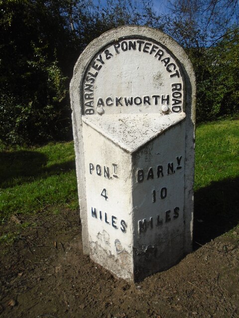
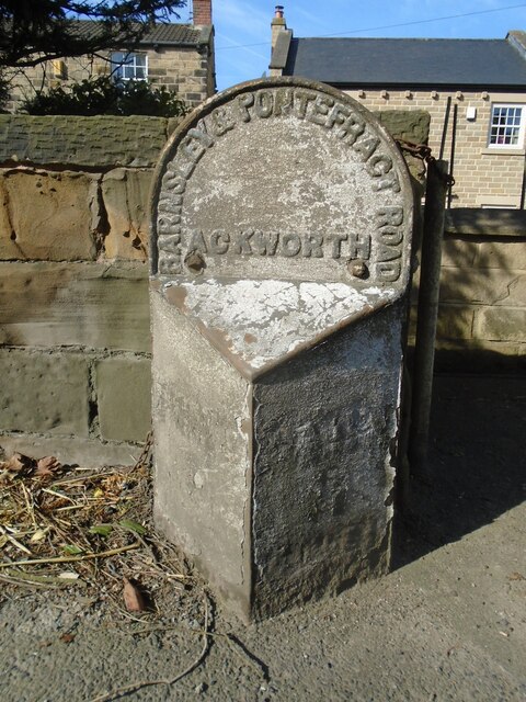
Ackworth Moor Top is a small village located in West Yorkshire, England. Situated approximately 10 miles southeast of the city of Wakefield, it falls within the historic county boundaries of the West Riding of Yorkshire. The village is part of the larger civil parish of Ackworth, which includes several other nearby settlements.

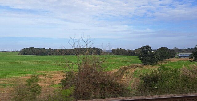
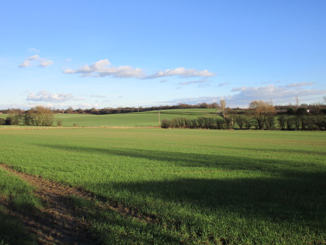
Ackworth Moor Top is characterized by its rural and picturesque surroundings, with rolling hills, moorland, and scenic countryside. The village itself is fairly small, with a population of around 2,500 residents. It has a tight-knit community feel, with a range of amenities to cater to the needs of its residents.

The village is home to a primary school, a church, and a few local shops and businesses. It also has a village hall that serves as a community hub for various activities and events. The surrounding area offers several outdoor recreational opportunities, including walking, cycling, and horse riding, thanks to its proximity to the beautiful Yorkshire countryside.

In terms of transportation, Ackworth Moor Top is well-connected to nearby towns and cities. The village is conveniently located near the A1(M) motorway, which provides easy access to major urban centers such as Leeds, Sheffield, and Doncaster. Additionally, there are regular bus services that connect the village to neighboring areas.

Overall, Ackworth Moor Top offers a peaceful and idyllic living environment, combining the charm of a rural village with the convenience of nearby amenities and transport links.

If you have any feedback on the listing, please let us know in the comments section below.

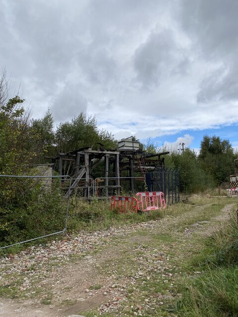
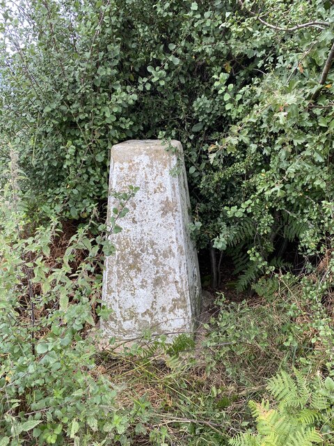
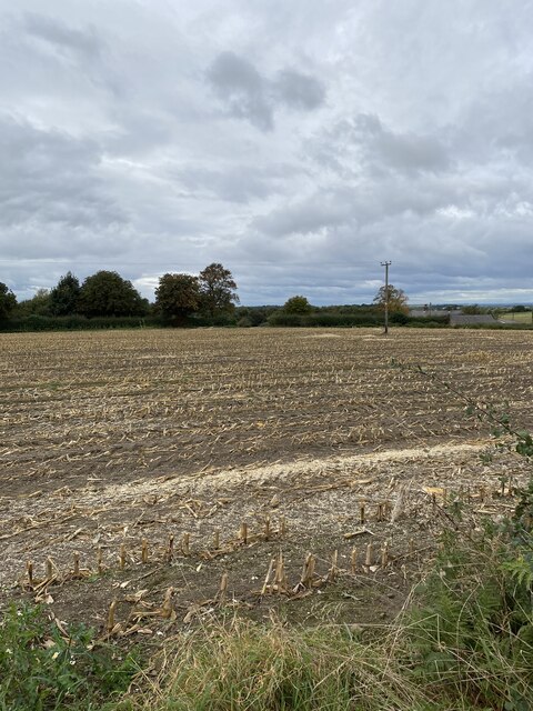
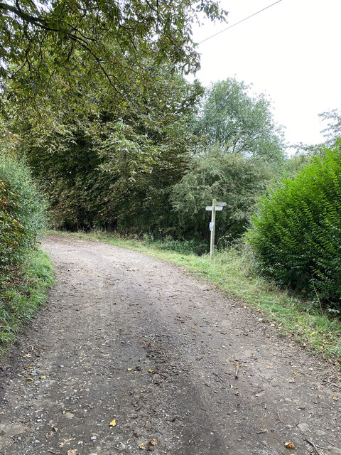
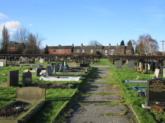
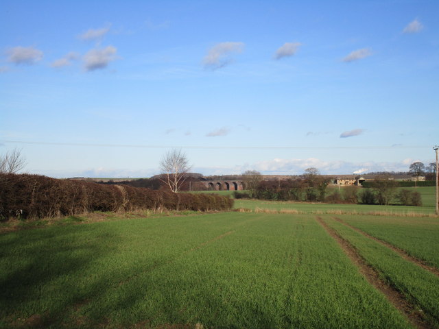
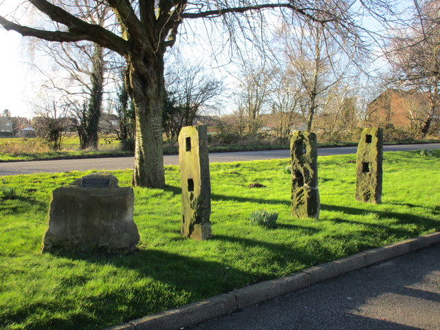
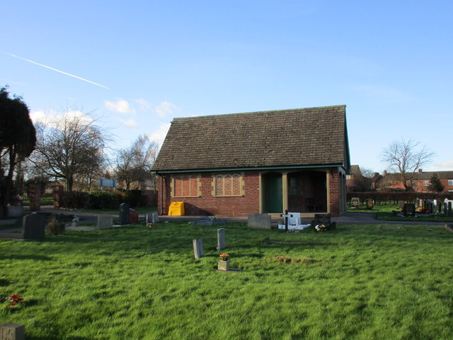
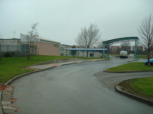
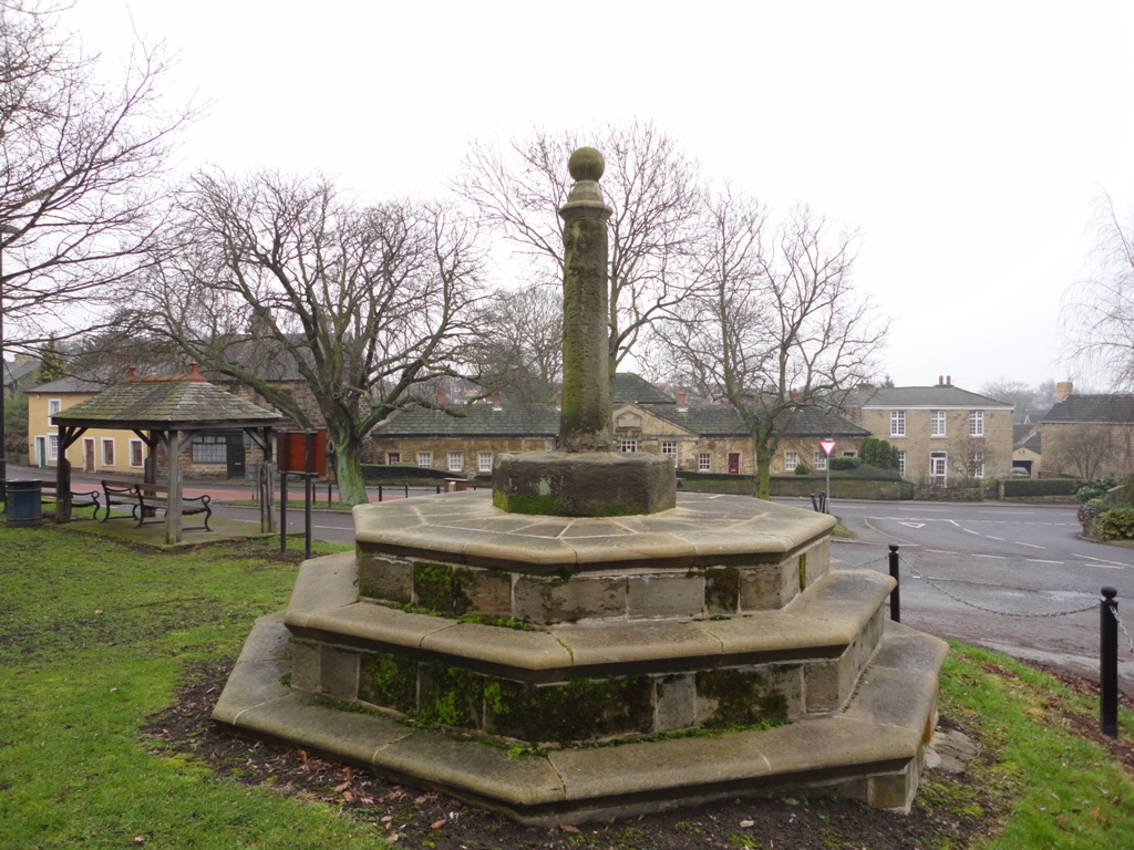
Ackworth Moor Top Images

Images are sourced within 2km of 53.638166/-1.342797 or Grid Reference SE4315. Thanks to Geograph Open Source API. All images are credited.

Off Green Lane,  Brackenhill Possible old quarrying equipment
Off Green Lane, Brackenhill
Possible old quarrying equipment
Brackenhill Trig Point Flush Bracket S1914
View towards Constitution Hill Farm
Footpath near Constitution Hill Farm
Old milepost This milepost from the Barnsley to Pontefract tollroad is near the bus stop on the A628 in Ackworth just north of the roundabout with the A638. It is known that it was painted in 2005.  Most of the mileposts on this route do not have a backing stone so this one, larger than the casting, is probably a 20C addition.  This post is the only one of those remaining that is not 'Listed'.
Old milepost
This milepost from the Barnsley to Pontefract tollroad is near the bus stop on the A628 in Ackworth just north of the roundabout with the A638. It is known that it was painted in 2005. Most of the mileposts on this route do not have a backing stone so this one, larger than the casting, is probably a 20C addition. This post is the only one of those remaining that is not 'Listed'.
Old milepost This very dilapidated metal milepost is on a very narrow verge on Pontefract Road, High Ackworth.  It was at the entrance to a Garden Centre but this is now a gated set of houses.  The faint outlines of raised legends can just be made out on the post.  It is Grade II Listed 1135473.
Old milepost
This very dilapidated metal milepost is on a very narrow verge on Pontefract Road, High Ackworth. It was at the entrance to a Garden Centre but this is now a gated set of houses. The faint outlines of raised legends can just be made out on the post. It is Grade II Listed 1135473.
Kinsley Common, from the railway On the extreme right, about to flash out of the picture, are some of the buildings of Hemsworth Turkey Farms on Hoyle Mill Road.
Kinsley Common, from the railway
On the extreme right, about to flash out of the picture, are some of the buildings of Hemsworth Turkey Farms on Hoyle Mill Road.
View from Doncaster Road, Ackworth Moor Top Cherry Tree Farm on the extreme right.
View from Doncaster Road, Ackworth Moor Top
Cherry Tree Farm on the extreme right.
Cemetery and cottages., Ackworth Moor Top
View towards Moor Farm and the railway viaduct over the River Went
Ackworth tenter poles Used in the drying and stretching of flax or skins. Probably date from the eighteenth century.
Ackworth tenter poles
Used in the drying and stretching of flax or skins. Probably date from the eighteenth century.
Ackworth Cemetery The cemetery opened in 1941 and this was probably built as a cemetery chapal.
Ackworth Cemetery
The cemetery opened in 1941 and this was probably built as a cemetery chapal.
Forecourt of The Beverley Arms at Ackworth roundabout
Low Ackworth Railway Viaduct
Footpath at Low Ackworth Railway Viaduct
Low Ackworth Railway Viaduct
Path leading to Tan House Lane
Broken footbridge at Tan House Lane
Show me another place!

Ackworth Moor Top is located at Grid Ref: SE4315 (Lat: 53.638166, Lng: -1.342797)

Division: West Riding

Unitary Authority: Wakefield

Police Authority: West Yorkshire

What 3 Words

///codes.dancer.firm. Near Low Ackworth, West Yorkshire

Nearby Locations

Ackworth Moor Top

Related Wikis

Oakfield Park School

Oakfield Park School (formerly OakTree School) is a coeducational special school in Ackworth, West Yorkshire, England.In early 2000s Oakfield Tree School...

Ackworth, West Yorkshire

Ackworth is a village and civil parish in the metropolitan borough of Wakefield, West Yorkshire, England. It stands between Pontefract, Barnsley and Doncaster...

Brackenhill

Brackenhill is a village in West Yorkshire, England, which forms part of Ackworth parish. It is situated on the A638 road on the eastern bank of Hessle...

Ackworth School

Ackworth School is an independent day and boarding school located in the village of High Ackworth, near Pontefract, West Yorkshire, England. It is one...

Hessle and Hill Top

Hessle and Hill Top is a civil parish in the City of Wakefield district of West Yorkshire, England. Scattered settlement in the rural parish includes the...

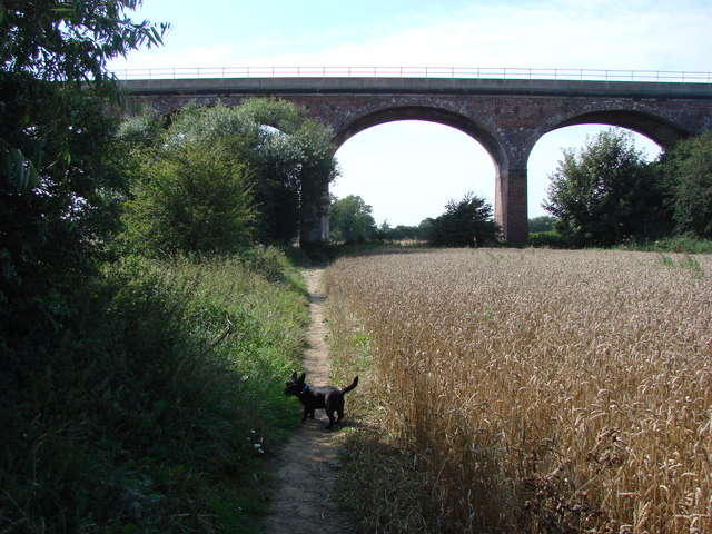
Six Arches, Ackworth

The Six Arches is a railway viaduct in Ackworth, West Yorkshire, England, named after its design. It carries the Pontefract to Rotherham line over the...

Hemsworth railway station

Hemsworth railway station served the town of Hemsworth, West Yorkshire, England from 1866 to 1967 on the West Riding and Grimsby Railway. == History... ==

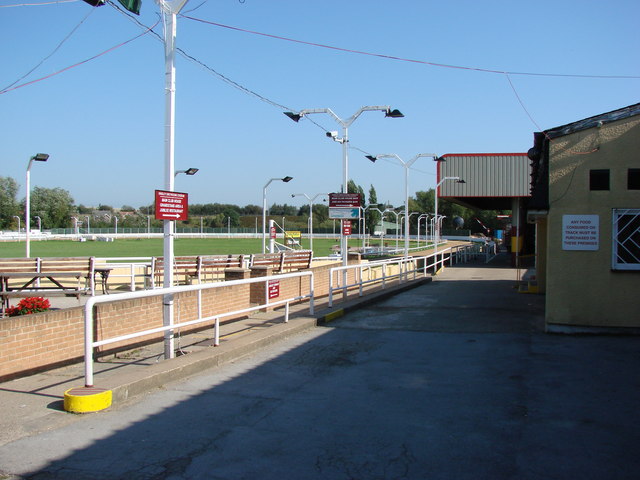
Kinsley Greyhound Stadium

Kinsley greyhound stadium is a Greyhound Board of Great Britain regulated greyhound racing stadium situated in Kinsley, West Yorkshire, England. It was...

Nearby Amenities

Located within 500m of 53.638166,-1.342797
Crossing
Crossing Island: yes
Lat/Long: 53.6410093/-1.3482711
Ackworth Moor Top
Is In: West Yorkshire, England, UK
Place: village
Source: npe
Wikidata: Q2610999
Wikipedia: en:Ackworth, West Yorkshire
Lat/Long: 53.641855/-1.3402145
Bus Stop
Wakefield Road Rosslyn Grove
Bench: yes
Local Ref: 45019500
Naptan AtcoCode: 450019500
Naptan Bearing: E
Naptan CommonName: Wakefield Road Rosslyn Grove
Naptan Crossing: Rosslyn Grove
Naptan Indicator: Stop 45019500
Naptan PlusbusZoneRef: LEEDS
Naptan ShortCommonName: Rosslyn Grove
Naptan Street: Wakefield Road
Naptan Verified: no
Shelter: yes
Source: naptan_import
Timetable: yes
Lat/Long: 53.640736/-1.3402588
Bus Stop
Wakefield Road Rhyddings Drive
Local Ref: 45019601
Naptan AtcoCode: 450019601
Naptan Bearing: W
Naptan CommonName: Wakefield Road Rhyddings Drive
Naptan Crossing: Rhyddings Drive
Naptan Indicator: Stop 45019601
Naptan Landmark: Church
Naptan PlusbusZoneRef: LEEDS
Naptan ShortCommonName: Rhyddings Drive
Naptan Street: Wakefield Road
Naptan Verified: no
Shelter: yes
Source: naptan_import
Timetable: yes
Lat/Long: 53.6406049/-1.3409416
Bus Stop
Wakefield Road Bell Lane
Local Ref: 45019602
Naptan AtcoCode: 450019602
Naptan Bearing: E
Naptan CommonName: Wakefield Road Bell Lane
Naptan Crossing: Bell Lane
Naptan Indicator: Stop 45019602
Naptan PlusbusZoneRef: LEEDS
Naptan ShortCommonName: Bell Lane
Naptan Street: Wakefield Road
Naptan Verified: no
Shelter: no
Source: naptan_import
Timetable: yes
Lat/Long: 53.6406162/-1.3429834
Bus Stop
Wakefield Road Elmwood
Layby: yes
Local Ref: 45019603
Naptan AtcoCode: 450019603
Naptan Bearing: W
Naptan CommonName: Wakefield Road Elmwood
Naptan Crossing: Nr-Opp Bell Lane
Naptan Indicator: Stop 45019603
Naptan Landmark: Boot & Shoe PH
Naptan Notes: Lorry Tyre found in shelter on 20/9/09. Reported to WMDC Job Reference 261540.
Naptan PlusbusZoneRef: LEEDS
Naptan ShortCommonName: Bell Lane
Naptan Street: Wakefield Road
Naptan Verified: no
Shelter: yes
Source: naptan_import
Timetable: yes
Lat/Long: 53.6404479/-1.3450885
Bus Stop
Barnsley Road Orchard Drive
Bus: yes
Local Ref: 45024108
Naptan AtcoCode: 450024108
Naptan Bearing: S
Naptan CommonName: Barnsley Road Orchard Drive
Naptan Crossing: Orchard Drive
Naptan Indicator: Stop 45024108
Naptan Landmark: Lady of Lourdes Church
Naptan PlusbusZoneRef: LEEDS
Naptan ShortCommonName: Orchard Drive
Naptan Street: Barnsley Road
Naptan Verified: no
Public Transport: platform
Source: naptan_import
Lat/Long: 53.6399749/-1.3359145
Bus Stop
Barnsley Road Orchard Drive
Naptan AtcoCode: 450028776
Naptan Bearing: N
Naptan CommonName: Barnsley Road Orchard Drive
Naptan Crossing: Orchard Drive
Naptan Landmark: Unknown
Naptan ShortCommonName: Barnsley Road
Naptan Street: Barnsley Road
Naptan Verified: no
Source: naptan_import
Lat/Long: 53.6401833/-1.3362138
Noexit: yes
Lat/Long: 53.6424432/-1.3446893
Turning Circle
Lat/Long: 53.6402654/-1.3376926
Fast Food
Crusty Pizzeria
Addr City: Pontefract
Addr Housenumber: 38
Addr Postcode: WF7 7AB
Addr Street: Wakefield Road
Addr Suburb: Ackworth
Addr Town: Pontefract
Cuisine: pizza
Fhrs Id: 1009893
Takeaway: yes
Lat/Long: 53.6409923/-1.3468913
Outgang
Place: locality
Source: OS Historic
Lat/Long: 53.6349707/-1.3480459
Post Box
Operator: Royal Mail
Post Box Type: lamp
Ref: WF7 56
Royal Cypher: EIIR
Royal Cypher Wikidata: Q33102113
Lat/Long: 53.6402055/-1.3361927
Post Box
Operator: Royal Mail
Post Box Design: type_k
Post Box Type: pillar
Ref: WF7 53
Royal Cypher: EIIR
Royal Cypher Wikidata: Q33102113
Lat/Long: 53.6411489/-1.3484687
Pub
Ackworth Village Social Club
Addr City: Pontefract
Addr Housenumber: 52
Addr Postcode: WF7 7AB
Addr Street: Wakefield Road
Addr Suburb: Ackworth
Addr Town: Pontefract
Fhrs Id: 313634
Lat/Long: 53.6411731/-1.3475686
Fast Food
New Tung Shing
Addr City: Pontefract
Addr Housenumber: 36
Addr Postcode: WF7 7AB
Addr Street: Wakefield Road
Addr Suburb: Ackworth
Addr Town: Pontefract
Cuisine: chinese
Fhrs Id: 284395
Takeaway: yes
Lat/Long: 53.6409831/-1.3468149
Cafe
Butterfly's Coffee Lounge
Addr City: Pontefract
Addr Housenumber: 42
Addr Postcode: WF7 7AB
Addr Street: Wakefield Road
Addr Suburb: Ackworth
Addr Town: Pontefract
Fhrs Id: 1077827
Lat/Long: 53.6410125/-1.347063
Kindergarten
Little Explorers
Addr City: Pontefract
Addr Housename: Ackworth Cricket Club
Addr Postcode: WF7 7JJ
Addr Street: Wakefield Road
Addr Suburb: Ackworth
Addr Town: Pontefract
Fhrs Id: 1030815
Lat/Long: 53.6394418/-1.3452177
Addr City: Pontefract
Addr Housename: The Boot and Shoe
Addr Postcode: WF7 7DF
Addr Street: Wakefield Road
Addr Suburb: Ackworth
Addr Town: Pontefract
Craft: caterer
Fhrs Id: 1135798
Lat/Long: 53.6401467/-1.3442186
Bargain Booze
Addr City: Pontefract
Addr Housenumber: 44-46
Addr Postcode: WF7 7AB
Addr Street: Wakefield Road
Addr Suburb: Ackworth
Addr Town: Pontefract
Brand: Bargain Booze
Brand Wikidata: Q16971315
Brand Wikipedia: en:Bargain Booze
Fhrs Id: 1138738
Shop: alcohol
Lat/Long: 53.64103/-1.3471945
Atm
Fee: no
Operator: Cashzone
Lat/Long: 53.6407658/-1.3474148
Speed Camera
Direction: 260
Maxspeed: 30 mph
Lat/Long: 53.6405642/-1.3446186
Speed Camera
Direction: 80
Lat/Long: 53.6405801/-1.3412042
Roll of Honour
Historic: memorial
Memorial: war_memorial
Website: www.roll-of-honour.com/yorkshire/ackworth.html
Lat/Long: 53.6404482/-1.3365167
Crossing
Lat/Long: 53.6426093/-1.3424011
Crossing
Lat/Long: 53.6418039/-1.3434822
Crossing
Lat/Long: 53.6421562/-1.3415925
Crossing
Lat/Long: 53.6418898/-1.3437177
Crossing
Lat/Long: 53.6415256/-1.3426528
Crossing
Lat/Long: 53.6406675/-1.3419508
Crossing
Lat/Long: 53.6406098/-1.3431418
Crossing
Lat/Long: 53.6414862/-1.3417199
Crossing
Lat/Long: 53.6418307/-1.3448043
Generator Method: photovoltaic
Generator Output Electricity: yes
Generator Source: solar
Generator Type: solar_photovoltaic_panel
Location: roof
Power: generator
Lat/Long: 53.63954/-1.3403294
Generator Method: photovoltaic
Generator Output Electricity: yes
Generator Source: solar
Generator Type: solar_photovoltaic_panel
Location: roof
Power: generator
Lat/Long: 53.6397324/-1.340847
Generator Method: photovoltaic
Generator Output Electricity: yes
Generator Source: solar
Generator Type: solar_photovoltaic_panel
Location: roof
Power: generator
Lat/Long: 53.6396656/-1.3410723
Generator Method: photovoltaic
Generator Output Electricity: yes
Generator Source: solar
Generator Type: solar_photovoltaic_panel
Location: roof
Power: generator
Lat/Long: 53.6394366/-1.3417161
Generator Method: photovoltaic
Generator Output Electricity: yes
Generator Source: solar
Generator Type: solar_photovoltaic_panel
Location: roof
Power: generator
Lat/Long: 53.6393714/-1.3419414
Generator Method: photovoltaic
Generator Output Electricity: yes
Generator Source: solar
Generator Type: solar_photovoltaic_panel
Location: roof
Power: generator
Lat/Long: 53.6385366/-1.3422659
Generator Method: photovoltaic
Generator Output Electricity: yes
Generator Source: solar
Generator Type: solar_photovoltaic_panel
Location: roof
Power: generator
Lat/Long: 53.6387067/-1.3366333
Generator Method: photovoltaic
Generator Output Electricity: yes
Generator Source: solar
Generator Type: solar_photovoltaic_panel
Location: roof
Power: generator
Lat/Long: 53.6386924/-1.3367406
Generator Method: photovoltaic
Generator Output Electricity: yes
Generator Source: solar
Generator Type: solar_photovoltaic_panel
Location: roof
Power: generator
Lat/Long: 53.6387704/-1.3368318
Generator Method: photovoltaic
Generator Output Electricity: yes
Generator Source: solar
Generator Type: solar_photovoltaic_panel
Location: roof
Power: generator
Lat/Long: 53.6387847/-1.3367084
Generator Method: photovoltaic
Generator Output Electricity: yes
Generator Source: solar
Generator Type: solar_photovoltaic_panel
Location: roof
Power: generator
Lat/Long: 53.6391631/-1.3386744
Generator Method: photovoltaic
Generator Output Electricity: yes
Generator Source: solar
Generator Type: solar_photovoltaic_panel
Location: roof
Power: generator
Lat/Long: 53.6394064/-1.338248
Generator Method: photovoltaic
Generator Output Electricity: yes
Generator Source: solar
Generator Type: solar_photovoltaic_panel
Location: roof
Power: generator
Lat/Long: 53.6403271/-1.3388756
Generator Method: photovoltaic
Generator Output Electricity: yes
Generator Source: solar
Generator Type: solar_photovoltaic_panel
Location: roof
Power: generator
Lat/Long: 53.6408678/-1.3395944
Generator Method: photovoltaic
Generator Output Electricity: yes
Generator Source: solar
Generator Type: solar_photovoltaic_panel
Location: roof
Power: generator
Lat/Long: 53.6417376/-1.339066
Generator Method: photovoltaic
Generator Output Electricity: yes
Generator Source: solar
Generator Type: solar_photovoltaic_panel
Location: roof
Power: generator
Lat/Long: 53.6414498/-1.3467506
Generator Method: photovoltaic
Generator Output Electricity: yes
Generator Source: solar
Generator Type: solar_photovoltaic_panel
Location: roof
Power: generator
Lat/Long: 53.6420921/-1.3425422
Generator Method: photovoltaic
Generator Output Electricity: yes
Generator Source: solar
Generator Type: solar_photovoltaic_panel
Location: roof
Power: generator
Lat/Long: 53.6425994/-1.3429472
Generator Method: photovoltaic
Generator Output Electricity: yes
Generator Source: solar
Generator Type: solar_photovoltaic_panel
Location: roof
Power: generator
Lat/Long: 53.6426105/-1.3430277
Crossing
Crossing: marked
Crossing Island: no
Tactile Paving: yes
Lat/Long: 53.6416147/-1.3379248
Waste Basket
Colour: #00000
Material: plastic
Operator: Wakefield Council
Lat/Long: 53.6408434/-1.3379945
Crossing
Lat/Long: 53.6398586/-1.3367902
Crossing
Lat/Long: 53.6406459/-1.3391799
Crossing
Lat/Long: 53.640613/-1.3399415
Crossing
Lat/Long: 53.6405972/-1.3402705
Crossing
Lat/Long: 53.6386942/-1.3363911
Crossing
Lat/Long: 53.6385618/-1.3364996
Crossing
Lat/Long: 53.6405287/-1.3417254
Crossing
Lat/Long: 53.6404801/-1.3427734
Crossing
Lat/Long: 53.6407175/-1.3411426
Crossing
Lat/Long: 53.6414518/-1.3412447
The data included in this document is from www.openstreetmap.org. The data is made available under ODbL.

Have you been to Ackworth Moor Top?

Leave your review of Ackworth Moor Top below (or comments, questions and feedback).