Norleywood

Settlement in Hampshire New Forest

England

Norleywood

Pylewell, farm buildings At Pylewell Home Farm.
Pylewell, farm buildings Credit: Mike Faherty

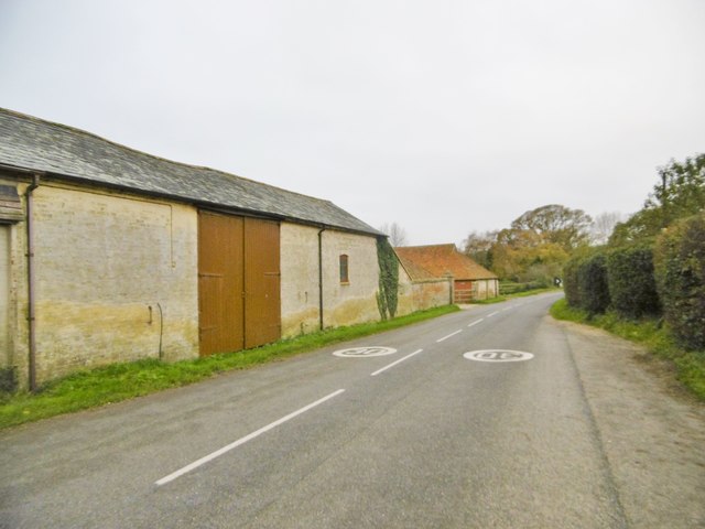
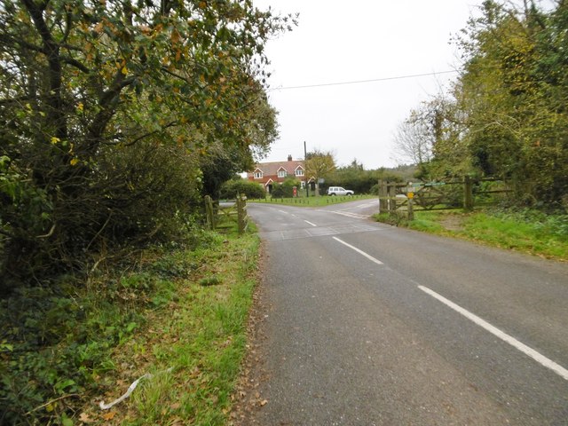
Norleywood is a small village located in the New Forest district of Hampshire, England. Situated approximately 3 miles southeast of Lymington, this picturesque rural community is known for its idyllic countryside setting and charming character.

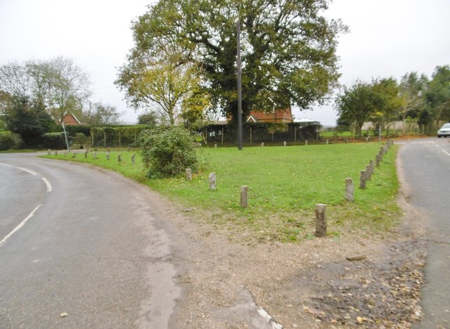
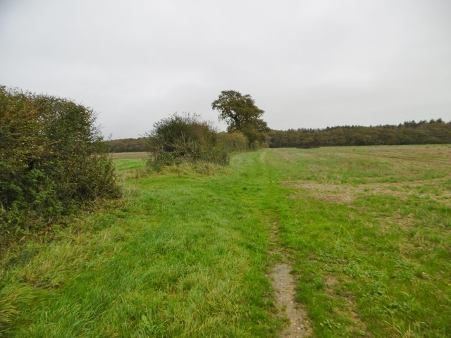
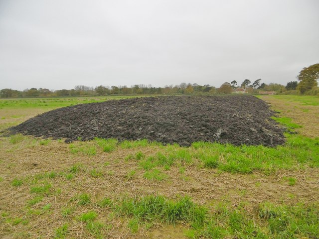
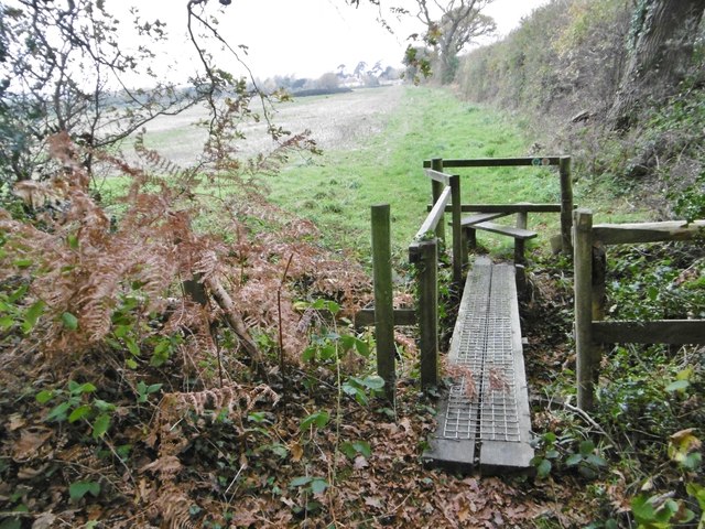
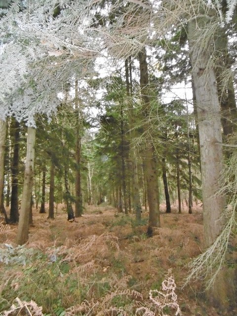
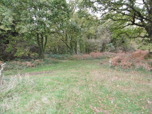
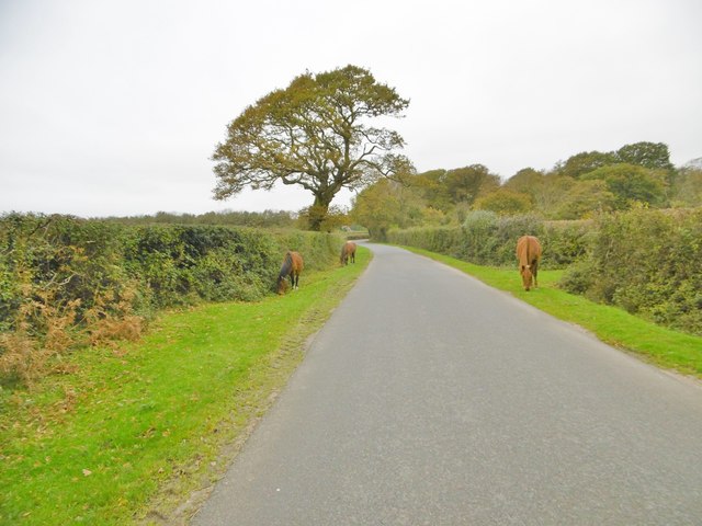
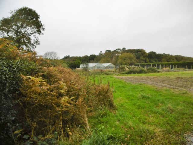
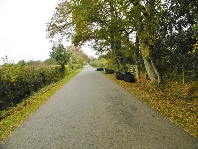
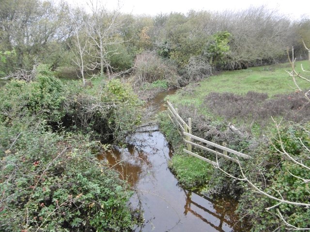
The village is surrounded by lush green fields and dense woodlands, making it an ideal destination for nature lovers and outdoor enthusiasts. It is part of the New Forest National Park, a protected area renowned for its diverse wildlife and stunning landscapes. The village itself is relatively small, with a population of around 300 residents.

Norleywood is home to a handful of historic buildings, including a 12th-century church, St. John the Baptist Church, which stands as a testament to the area's rich heritage. The church features beautiful stained glass windows and a peaceful atmosphere, providing a place for locals and visitors to find solace.

In terms of amenities, Norleywood offers limited facilities within the village itself. However, the nearby town of Lymington provides a wider range of services, including shops, restaurants, and schools. The village is well-connected, with good transport links to surrounding areas.

Norleywood is a popular destination for those seeking a rural retreat, away from the hustle and bustle of city life. Its natural beauty and tranquil surroundings make it an appealing place to live or visit, offering a peaceful escape for those looking to connect with nature and enjoy the simple pleasures of country life.

If you have any feedback on the listing, please let us know in the comments section below.
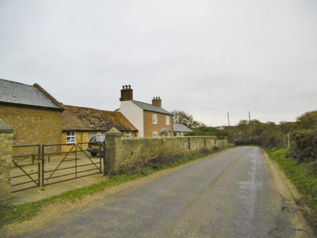
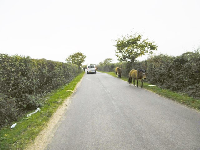
Norleywood Images

Images are sourced within 2km of 50.777268/-1.494334 or Grid Reference SZ3597. Thanks to Geograph Open Source API. All images are credited.

Pylewell, farm buildings At Pylewell Home Farm.
Pylewell, farm buildings
At Pylewell Home Farm.
Pylewell, cattle grid At the settlement's entrance. East of here, New Forest Commoners' livestock are allowed to graze.
Pylewell, cattle grid
At the settlement's entrance. East of here, New Forest Commoners' livestock are allowed to graze.
Pylewell, green At the junction of roads to Sowley, East End and Walhampton. This forms part of the Solent Way. <span class="nowrap"><a title="http://www3.hants.gov.uk/longdistance/walking-solentway.htm" rel="nofollow ugc noopener" href="http://www3.hants.gov.uk/longdistance/walking-solentway.htm">Link</a><img style="margin-left:2px;" alt="External link" title="External link - shift click to open in new window" src="https://s1.geograph.org.uk/img/external.png" width="10" height="10"/></span>
Pylewell, green
At the junction of roads to Sowley, East End and Walhampton. This forms part of the Solent Way. LinkExternal link
Pylewell, footpath Along a field margin, from Pylewell to Sowley Lane, via Sowley Brooms. This path forms part of the Solent Way: <span class="nowrap"><a title="http://www3.hants.gov.uk/longdistance/walking-solentway.htm" rel="nofollow ugc noopener" href="http://www3.hants.gov.uk/longdistance/walking-solentway.htm">Link</a><img style="margin-left:2px;" alt="External link" title="External link - shift click to open in new window" src="https://s1.geograph.org.uk/img/external.png" width="10" height="10"/></span>
Pylewell, footpath
Along a field margin, from Pylewell to Sowley Lane, via Sowley Brooms. This path forms part of the Solent Way: LinkExternal link
Sowley, clamp In a field next to Sowley Brooms.
Sowley, clamp
In a field next to Sowley Brooms.
Sowley, footbridge & stile Leaving Sowley Brooms to cross farmland to Pylewell, on the Solent Way: <span class="nowrap"><a title="http://www3.hants.gov.uk/longdistance/walking-solentway.htm" rel="nofollow ugc noopener" href="http://www3.hants.gov.uk/longdistance/walking-solentway.htm">Link</a><img style="margin-left:2px;" alt="External link" title="External link - shift click to open in new window" src="https://s1.geograph.org.uk/img/external.png" width="10" height="10"/></span>
Sowley, footbridge & stile
Leaving Sowley Brooms to cross farmland to Pylewell, on the Solent Way: LinkExternal link
Sowley Brooms A mixed woodland plantation; in this section, conifers.
Sowley Brooms
A mixed woodland plantation; in this section, conifers.
Sowley Brooms, footpath junction Take the second path for Pylewell, on the Solent Way. <span class="nowrap"><a title="http://www3.hants.gov.uk/longdistance/walking-solentway.htm" rel="nofollow ugc noopener" href="http://www3.hants.gov.uk/longdistance/walking-solentway.htm">Link</a><img style="margin-left:2px;" alt="External link" title="External link - shift click to open in new window" src="https://s1.geograph.org.uk/img/external.png" width="10" height="10"/></span>
Sowley Brooms, footpath junction
Take the second path for Pylewell, on the Solent Way. LinkExternal link
Sowley, farm track Between Sowley Brooms (left) and open farmland; on the Solent Way. <span class="nowrap"><a title="http://www3.hants.gov.uk/longdistance/walking-solentway.htm" rel="nofollow ugc noopener" href="http://www3.hants.gov.uk/longdistance/walking-solentway.htm">Link</a><img style="margin-left:2px;" alt="External link" title="External link - shift click to open in new window" src="https://s1.geograph.org.uk/img/external.png" width="10" height="10"/></span>
Sowley, farm track
Between Sowley Brooms (left) and open farmland; on the Solent Way. LinkExternal link
Sowley, Solent Way Part of the long-distance path from Milford to Emsworth; this section skirts farmland to Sowley Lane. <span class="nowrap"><a title="http://www3.hants.gov.uk/longdistance/walking-solentway.htm" rel="nofollow ugc noopener" href="http://www3.hants.gov.uk/longdistance/walking-solentway.htm">Link</a><img style="margin-left:2px;" alt="External link" title="External link - shift click to open in new window" src="https://s1.geograph.org.uk/img/external.png" width="10" height="10"/></span>
Sowley, Solent Way
Part of the long-distance path from Milford to Emsworth; this section skirts farmland to Sowley Lane. LinkExternal link
Sowley, cropland A field of young cereals.
Sowley, cropland
A field of young cereals.
East End, ponies New Forest ponies grazing on the verges of St Leonards Road, exercising their owners' Common of Pasture. <span class="nowrap"><a title="http://www.newforest.hampshire.org.uk/today1.html" rel="nofollow ugc noopener" href="http://www.newforest.hampshire.org.uk/today1.html">Link</a><img style="margin-left:2px;" alt="External link" title="External link - shift click to open in new window" src="https://s1.geograph.org.uk/img/external.png" width="10" height="10"/></span>
East End, ponies
New Forest ponies grazing on the verges of St Leonards Road, exercising their owners' Common of Pasture. LinkExternal link
East End, glasshouses At Beckheath Nurseries, on St Leonards Road.
East End, glasshouses
At Beckheath Nurseries, on St Leonards Road.
East End, cattle On St Leonards Road; perhaps, not so much jay-walking as jay-resting. Whatever, exercising their owner's Common of Pasture. <span class="nowrap"><a title="http://www.newforest.hampshire.org.uk/today1.html" rel="nofollow ugc noopener" href="http://www.newforest.hampshire.org.uk/today1.html">Link</a><img style="margin-left:2px;" alt="External link" title="External link - shift click to open in new window" src="https://s1.geograph.org.uk/img/external.png" width="10" height="10"/></span>
East End, cattle
On St Leonards Road; perhaps, not so much jay-walking as jay-resting. Whatever, exercising their owner's Common of Pasture. LinkExternal link
East End, Crockford Stream Looking upstream from East End Bridge.
East End, Crockford Stream
Looking upstream from East End Bridge.
East End, Bridge Farmhouse
East End, jaywalking ponies Exercising their owners' rights to Common of Pasture. <span class="nowrap"><a title="http://www.newforest.hampshire.org.uk/today1.html" rel="nofollow ugc noopener" href="http://www.newforest.hampshire.org.uk/today1.html">Link</a><img style="margin-left:2px;" alt="External link" title="External link - shift click to open in new window" src="https://s1.geograph.org.uk/img/external.png" width="10" height="10"/></span>
East End, jaywalking ponies
Exercising their owners' rights to Common of Pasture. LinkExternal link
Pylewell House The house is generally surrounded by trees, but two avenues through the coastal trees have been made so the house has unobstructed views of the Solent and across to the Isle of Wight. This is looking back up one of them.
Pylewell House
The house is generally surrounded by trees, but two avenues through the coastal trees have been made so the house has unobstructed views of the Solent and across to the Isle of Wight. This is looking back up one of them.
Show me another place!

Norleywood is located at Grid Ref: SZ3597 (Lat: 50.777268, Lng: -1.494334)

Administrative County: Hampshire

District: New Forest

Police Authority: Hampshire

What 3 Words

///torch.rentals.resurgent. Near Lymington, Hampshire

Related Wikis

Norley Wood

Norley Wood (or Norleywood) is a hamlet in the New Forest National Park of Hampshire, England. It is in the civil parish of Boldre. Its nearest town...

Norley Copse and Meadow

Norley Copse and Meadow is a 7.5-hectare (19-acre) biological Site of Special Scientific Interest east of Lymington in Hampshire. It is part of New Forest...

East End, Hampshire

East End is a hamlet in the civil parish of East Boldre in the New Forest National Park of Hampshire, England. Its nearest town is Lymington, which lies...

South Baddesley

South Baddesley is a small village in the civil parish of Boldre in the New Forest National Park of Hampshire, England. It lies 2.3 miles (3.7 km) north...
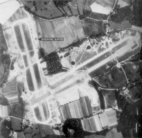
RAF Lymington

Royal Air Force Lymington or more simply RAF Lymington is a former Royal Air Force Advanced Landing Ground in Hampshire, England. The airfield is located...

Pylewell Park

Pylewell Park is a country house and park near Lymington in Hampshire. It is listed as grade II*. == History == A settlement on the site of Baddesley Manor...

Sowley Pond

Sowley Pond is a 49.3-hectare (122-acre) biological Site of Special Scientific Interest east of Lymington in Hampshire. It is part of Solent and Southampton...

Portmore, Hampshire

Portmore is a hamlet in the New Forest National Park of Hampshire, England. It is in the civil parish of Boldre. Its nearest town is Lymington, which...

Nearby Amenities

Located within 500m of 50.777268,-1.494334
Norleywood
Is In: Hampshire, England, UK
Place: village
Source: npe
Wikidata: Q7051401
Lat/Long: 50.7754271/-1.4951537
Ford: yes
Lat/Long: 50.7750908/-1.4975921
Bus Stop
Norleywood
Bus: yes
Naptan AtcoCode: 1900HA080600
Naptan Bearing: NW
Naptan CommonName: Norleywood
Naptan Crossing: Joys Lane
Naptan NaptanCode: hamapadg
Naptan Street: Norleywood Road
Naptan Verified: no
Public Transport: platform
Source: naptan_import
Lat/Long: 50.7779714/-1.4969354
Bus Stop
Norleywood
Bus: yes
Naptan AtcoCode: 1900HA080601
Naptan Bearing: SE
Naptan CommonName: Norleywood
Naptan Crossing: Thatchers lane
Naptan NaptanCode: hamapadm
Naptan Street: Norleywood Road
Naptan Verified: no
Public Transport: platform
Source: naptan_import
Lat/Long: 50.7780071/-1.4968783
Bus Stop
Norleywood Cottages
Bus: yes
Naptan AtcoCode: 1900HA080602
Naptan Bearing: E
Naptan CommonName: Norleywood Cottages
Naptan NaptanCode: hamapatg
Naptan Street: Norleywood Road
Naptan Verified: no
Public Transport: platform
Source: naptan_import
Lat/Long: 50.7762184/-1.4929262
Bus Stop
Norleywood Cottages
Bus: yes
Naptan AtcoCode: 1900HA080603
Naptan Bearing: W
Naptan CommonName: Norleywood Cottages
Naptan Crossing: Thatchers Lane
Naptan NaptanCode: hamapatm
Naptan Street: Norleywood Road
Naptan Verified: no
Public Transport: platform
Source: naptan_import
Lat/Long: 50.7761733/-1.4928983
Telephone
Booth: K6
Covered: booth
Man Made: telephone_box
Tourism: information
Lat/Long: 50.7778447/-1.496603
Post Box
Operator: Royal Mail
Operator Wikidata: Q638098
Post Box Type: lamp
Ref: SO41 101
Royal Cypher: EIIR
Royal Cypher Wikidata: Q33102113
Lat/Long: 50.7757735/-1.4960129
The data included in this document is from www.openstreetmap.org. The data is made available under ODbL.

Have you been to Norleywood?

Leave your review of Norleywood below (or comments, questions and feedback).