Noctorum

Settlement in Cheshire

England

Noctorum

On Bidston Hill – Boxing Day 1968 – 1 View from King George's Way looking through the pines towards Flaybrick Cemetery.
On Bidston Hill – Boxing Day 1968 – 1 Credit: Alan Murray-Rust

The requested URL returned error: 429 Too Many Requests

If you have any feedback on the listing, please let us know in the comments section below.
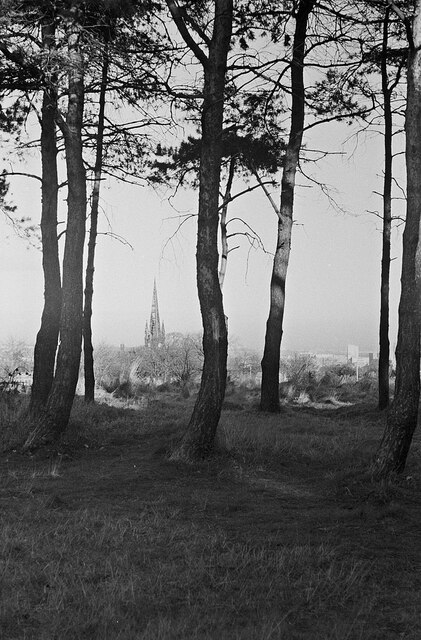
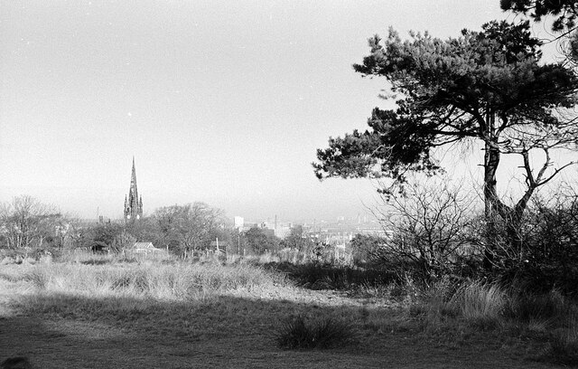
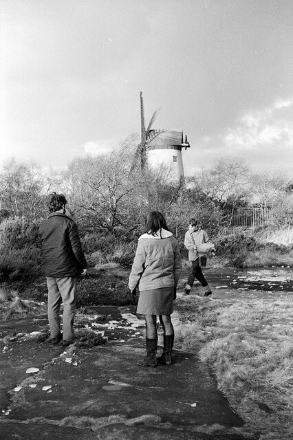
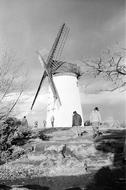
Noctorum Images

Images are sourced within 2km of 53.382629/-3.076415 or Grid Reference SJ2887. Thanks to Geograph Open Source API. All images are credited.

On Bidston Hill – Boxing Day 1968 – 1 View from King George's Way looking through the pines towards Flaybrick Cemetery.
On Bidston Hill – Boxing Day 1968 – 1
View from King George's Way looking through the pines towards Flaybrick Cemetery.
On Bidston Hill – Boxing Day 1968 – 2 View from King George's Way looking towards Flaybrick Cemetery. At this date the chapels were still in use and the fine spire intact. Today the spire has been truncated and the chapels are ruinous, although Listed Grade II.
On Bidston Hill – Boxing Day 1968 – 2
View from King George's Way looking towards Flaybrick Cemetery. At this date the chapels were still in use and the fine spire intact. Today the spire has been truncated and the chapels are ruinous, although Listed Grade II.
On Bidston Hill – Boxing Day 1968 – 3 Path towards the windmill. This is largely the naked sandstone, with puddles between which on this day were heavily frozen.
On Bidston Hill – Boxing Day 1968 – 3
Path towards the windmill. This is largely the naked sandstone, with puddles between which on this day were heavily frozen.
On Bidston Hill – Boxing Day 1968 – 4 Bidston Windmill from the south west. The windmill dates from the late 18th century, was restored in 1894 and again in 1971. It is Listed Grade II*.
On Bidston Hill – Boxing Day 1968 – 4
Bidston Windmill from the south west. The windmill dates from the late 18th century, was restored in 1894 and again in 1971. It is Listed Grade II*.
Flaybrick Memorial Gardens & ruinous chapels
Bidston Windmill
Bidston Windmill
Bidston Observatory, Bidston Hill
The Spinney The Spinney path from the highest part near West Drive
The Spinney
The Spinney path from the highest part near West Drive
A damaged benchmark At this coordinate, there is supposed to be an OS benchmark, but it has been logged as destroyed. The logger makes the note "Wall shows signs of repair, and there is no trace of this mark." <span class="nowrap"><a title="https://www.bench-marks.org.uk/bm106864" rel="nofollow ugc noopener" href="https://www.bench-marks.org.uk/bm106864">Link</a><img style="margin-left:2px;" alt="External link" title="External link - shift click to open in new window" src="https://s1.geograph.org.uk/img/external.png" width="10" height="10"/></span>. However, on closer inspection, one can make out the line and arrow on the pale stone diagonally up from the seedling in the lower right corner of the photo. The benchmark was originally 0.5 m above ground level. I suspect that the wall was partly demolished when it was repaired, and this stone found itself in a different position in the wall.
A damaged benchmark
At this coordinate, there is supposed to be an OS benchmark, but it has been logged as destroyed. The logger makes the note "Wall shows signs of repair, and there is no trace of this mark." LinkExternal link. However, on closer inspection, one can make out the line and arrow on the pale stone diagonally up from the seedling in the lower right corner of the photo. The benchmark was originally 0.5 m above ground level. I suspect that the wall was partly demolished when it was repaired, and this stone found itself in a different position in the wall.
M53 looking south near Bidston
M53 southbound near Woodchurch
M53 looking south at Junction 3
New Health Centre, Birkenhead
Mona Street, Birkenhead
Heather Brow, Heather Brow, Birkenhead
The Stirrup, Arrowe Hill
Glebe Hey Road, Arrowe Hill
Arrowe Park Road
Arrowe Park Road
Show me another place!

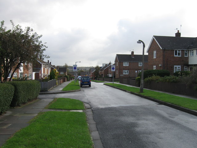
Noctorum is located at Grid Ref: SJ2887 (Lat: 53.382629, Lng: -3.076415)

Unitary Authority: Wirral

Police Authority: Merseyside

What 3 Words

///legend.theme.liner. Near Prenton, Merseyside

Nearby Locations

Noctorum

Related Wikis

Noctorum

Noctorum is a suburb of Birkenhead, Merseyside, England. Administratively it is within the Metropolitan Borough of Wirral as part of Claughton Ward. Noctorum...

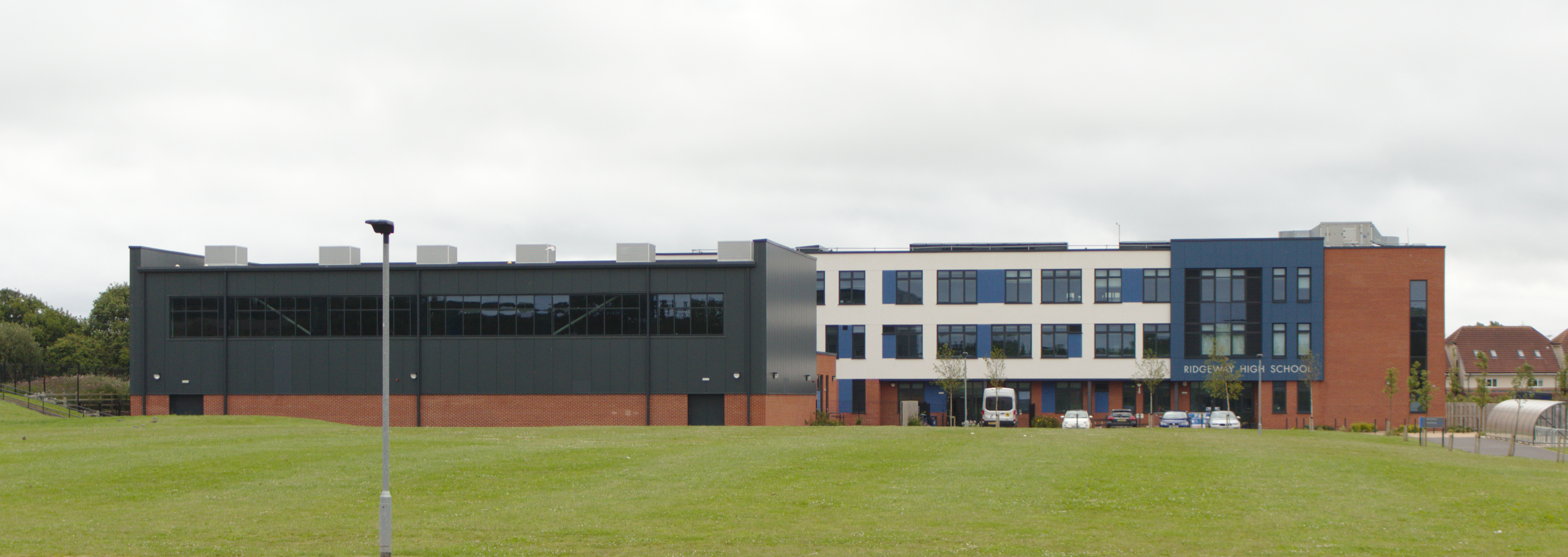
Ridgeway High School, Birkenhead

Ridgeway High School is a co-educational, comprehensive school in Noctorum, Birkenhead, on the Wirral Peninsula in England. The school caters for pupils...

Woodchurch High School

Woodchurch High School is a non-selective co-educational secondary school with academy status for 11- to 16-year-olds. It is located at Woodchurch, on...

Upton railway station

Upton railway station serves the village of Upton and the Noctorum area of Birkenhead, on the Wirral Peninsula, England. The station is situated on the...

Nearby Amenities

Located within 500m of 53.382629,-3.076415
Bus Stop
NOCTORUM AVE/UPTON ROAD
Bus: yes
Naptan AtcoCode: 2800S25078A
Naptan Bearing: NW
Naptan CommonName: NOCTORUM AVE/UPTON ROAD
Naptan Indicator: NOCTORUM AVENUE/UPTON ROAD
Naptan Landmark: O/S 8
Naptan NaptanCode: merapwdm
Naptan Notes: No Notes
Naptan ShortCommonName: Beryl Rd
Naptan Street: NOCTORUM AVENUE
Naptan Verified: no
Public Transport: platform
Source: naptan_import
Lat/Long: 53.3847603/-3.0824644
Bus Stop
NOCTORUM AVE/UPTON ROAD
Bus: yes
Naptan AtcoCode: 2800S25078B
Naptan Bearing: SE
Naptan CommonName: NOCTORUM AVE/UPTON ROAD
Naptan Indicator: NOCTORUM AVENUE/UPTON ROAD
Naptan Landmark: NR 31
Naptan NaptanCode: merapwdp
Naptan Notes: No Notes
Naptan ShortCommonName: Beryl Rd
Naptan Street: NOCTORUM AVENUE
Naptan Verified: no
Public Transport: platform
Source: naptan_import
Lat/Long: 53.3846726/-3.0822216
Bus Stop
NOCTORUM AVENUE
Bus: yes
Naptan AtcoCode: 2800S25079A
Naptan Bearing: S
Naptan CommonName: NOCTORUM AVENUE
Naptan Indicator: NOCTORUM AVENUE/UPTON ROAD
Naptan Landmark: O/S 54 OPP ST PETERS WAY
Naptan NaptanCode: merapwdt
Naptan Notes: No Notes
Naptan ShortCommonName: Noctorum Av
Naptan Street: NOCTORUM AVENUE
Naptan Verified: no
Public Transport: platform
Source: naptan_import
Lat/Long: 53.3824389/-3.0807217
Bus Stop
NOCTORUM AVE
Bus: yes
Naptan AtcoCode: 2800S25079B
Naptan Bearing: SE
Naptan CommonName: NOCTORUM AVE
Naptan Indicator: NOCTORUM AVENUE
Naptan Landmark: NR ORMOND WAY END NEWSTEAD WAY
Naptan NaptanCode: merapwdw
Naptan Notes: No Notes
Naptan ShortCommonName: Noctorum Av
Naptan Street: NOCTORUM AVENUE
Naptan Verified: no
Public Transport: platform
Source: naptan_import
Lat/Long: 53.3815057/-3.0795404
Bus Stop
NOCTORUM AVENUE/ORMOND WAY
Bus: yes
Naptan AtcoCode: 2800S25080A
Naptan Bearing: NW
Naptan CommonName: NOCTORUM AVENUE/ORMOND WAY
Naptan Indicator: NOCTORUM AVENUE
Naptan Landmark: OPP ORMOND WAY
Naptan NaptanCode: merapwga
Naptan Notes: No Notes
Naptan ShortCommonName: Ormond Way
Naptan Street: NOCTORUM AVENUE
Naptan Verified: no
Public Transport: platform
Source: naptan_import
Lat/Long: 53.380457/-3.0782059
Bus Stop
NOCTORUM AVE
Bus: yes
Naptan AtcoCode: 2800S25080B
Naptan Bearing: SE
Naptan CommonName: NOCTORUM AVE
Naptan Indicator: NOCTORUM AVENUE
Naptan Landmark: NR PAGEWOOD CLOSE OPP OLD RAILWAY FOOTBRIDGE
Naptan NaptanCode: merapwgd
Naptan Notes: No Notes
Naptan ShortCommonName: Noctorum Av
Naptan Street: NOCTORUM AVENUE
Naptan Verified: no
Public Transport: platform
Source: naptan_import
Lat/Long: 53.3802389/-3.0774787
Bus Stop
NOCTORUM AVE/WESTWAY
Bus: yes
Naptan AtcoCode: 2800S25081A
Naptan Bearing: SW
Naptan CommonName: NOCTORUM AVE/WESTWAY
Naptan Indicator: NOCTORUM AVENUE/WESTWAY
Naptan Landmark: OPP RIDGEWAY COMMUNITY CENTRE TENNIS COURTS TO
Naptan NaptanCode: merapwgj
Naptan Notes: No Notes
Naptan ShortCommonName: Noctorum Av/Westway
Naptan Street: NOCTORUM AVENUE
Naptan Verified: no
Public Transport: platform
Source: naptan_import
Lat/Long: 53.3810406/-3.0733044
Bus Stop
NOCTORUM AVENUE/WESTWAY
Bus: yes
Naptan AtcoCode: 2800S25081B
Naptan Bearing: NE
Naptan CommonName: NOCTORUM AVENUE/WESTWAY
Naptan Indicator: NOCTORUM AVENUE/WESTWAY
Naptan Landmark: CORNER RAYMOND WAY O/S 7 RENWICK CLOSE
Naptan NaptanCode: merapwgm
Naptan Notes: No Notes
Naptan ShortCommonName: Noctorum Av/Westway
Naptan Street: NOCTORUM AVENUE
Naptan Verified: no
Public Transport: platform
Source: naptan_import
Lat/Long: 53.3815917/-3.0726604
Bus Stop
NOCTORUM AVE/WESTWAY
Bus: yes
Naptan AtcoCode: 2800S25081C
Naptan Bearing: NE
Naptan CommonName: NOCTORUM AVE/WESTWAY
Naptan Indicator: NOCTORUM AVENUE/WESTWAY
Naptan Landmark: OPP RIDGEWAY HIGH SCHOOL END PAGETT CLOSE
Naptan NaptanCode: merapwgp
Naptan Notes: No Notes
Naptan ShortCommonName: Noctorum Av/Westway
Naptan Street: NOCTORUM AVENUE
Naptan Verified: no
Public Transport: platform
Source: naptan_import
Lat/Long: 53.3805994/-3.0743758
Post Box
Beryl Road
Collection Times: Mo-Fr 17:45; Sa 12:00; Su off
Description: EIIR lamp box pier CH43 123 on Beryl Road, Noctorum. Installed November 2017
Operator: Royal Mail
Operator Wikidata: Q638098
Post Box Type: lamp
Ref: CH43 123
Royal Cypher: EIIR
Royal Cypher Wikidata: Q33102113
Wikimedia Commons: File:Post box on Beryl Road, Noctorum.jpg
Lat/Long: 53.3868641/-3.0752751
Barrier: cycle_barrier
Bicycle: designated
Foot: designated
Lat/Long: 53.3781384/-3.0767622
Power: tower
Lat/Long: 53.3838808/-3.0834824
Power: tower
Lat/Long: 53.3794473/-3.077761
Power: tower
Lat/Long: 53.3814966/-3.0808257
Turning Circle
Lat/Long: 53.3839415/-3.0733177
Leisure: pitch
Natural: grassland
Lat/Long: 53.3793024/-3.0735387
Place Of Worship
St Peter's Catholic Church
Denomination: catholic
Religion: christian
Lat/Long: 53.3826108/-3.0802443
Barrier: bollard
Bicycle: yes
Foot: yes
Lat/Long: 53.3819712/-3.0791222
Barrier: bollard
Bicycle: yes
Foot: yes
Lat/Long: 53.3824467/-3.0774401
Addr Postcode: CH43 9AD
Lat/Long: 53.3841195/-3.0728222
Generator Method: photovoltaic
Generator Output Electricity: yes
Generator Source: solar
Generator Type: solar_photovoltaic_panel
Location: roof
Power: generator
Lat/Long: 53.3817834/-3.0732492
Generator Method: photovoltaic
Generator Output Electricity: yes
Generator Source: solar
Generator Type: solar_photovoltaic_panel
Location: roof
Power: generator
Lat/Long: 53.3816506/-3.0734745
Generator Method: photovoltaic
Generator Output Electricity: yes
Generator Source: solar
Generator Type: solar_photovoltaic_panel
Location: roof
Power: generator
Lat/Long: 53.3822698/-3.0741799
Generator Method: photovoltaic
Generator Output Electricity: yes
Generator Source: solar
Generator Type: solar_photovoltaic_panel
Location: roof
Power: generator
Lat/Long: 53.3807643/-3.0773985
Generator Method: photovoltaic
Generator Output Electricity: yes
Generator Source: solar
Generator Type: solar_photovoltaic_panel
Location: roof
Power: generator
Lat/Long: 53.3807051/-3.0779484
Generator Method: photovoltaic
Generator Output Electricity: yes
Generator Source: solar
Generator Type: solar_photovoltaic_panel
Location: roof
Power: generator
Lat/Long: 53.3807931/-3.0781013
Generator Method: photovoltaic
Generator Output Electricity: yes
Generator Source: solar
Generator Type: solar_photovoltaic_panel
Location: roof
Power: generator
Lat/Long: 53.3810187/-3.0772591
Generator Method: photovoltaic
Generator Output Electricity: yes
Generator Source: solar
Generator Type: solar_photovoltaic_panel
Location: roof
Power: generator
Lat/Long: 53.381569/-3.0788389
Generator Method: photovoltaic
Generator Output Electricity: yes
Generator Source: solar
Generator Type: solar_photovoltaic_panel
Location: roof
Power: generator
Lat/Long: 53.3818506/-3.0780852
Generator Method: photovoltaic
Generator Output Electricity: yes
Generator Source: solar
Generator Type: solar_photovoltaic_panel
Location: roof
Power: generator
Lat/Long: 53.3817386/-3.0784258
Generator Method: photovoltaic
Generator Output Electricity: yes
Generator Source: solar
Generator Type: solar_photovoltaic_panel
Location: roof
Power: generator
Lat/Long: 53.3817514/-3.0779242
Generator Method: photovoltaic
Generator Output Electricity: yes
Generator Source: solar
Generator Type: solar_photovoltaic_panel
Location: roof
Power: generator
Lat/Long: 53.3817082/-3.0778545
Generator Method: photovoltaic
Generator Output Electricity: yes
Generator Source: solar
Generator Type: solar_photovoltaic_panel
Location: roof
Power: generator
Lat/Long: 53.3814986/-3.0751428
Generator Method: photovoltaic
Generator Output Electricity: yes
Generator Source: solar
Generator Type: solar_photovoltaic_panel
Location: roof
Power: generator
Lat/Long: 53.3819994/-3.075293
Generator Method: photovoltaic
Generator Output Electricity: yes
Generator Source: solar
Generator Type: solar_photovoltaic_panel
Location: roof
Power: generator
Lat/Long: 53.3823274/-3.0758133
Generator Method: photovoltaic
Generator Output Electricity: yes
Generator Source: solar
Generator Type: solar_photovoltaic_panel
Location: roof
Power: generator
Lat/Long: 53.3828009/-3.0759743
Generator Method: photovoltaic
Generator Output Electricity: yes
Generator Source: solar
Generator Type: solar_photovoltaic_panel
Location: roof
Power: generator
Lat/Long: 53.3829721/-3.074829
Generator Method: photovoltaic
Generator Output Electricity: yes
Generator Source: solar
Generator Type: solar_photovoltaic_panel
Location: roof
Power: generator
Lat/Long: 53.3830537/-3.0738875
Generator Method: photovoltaic
Generator Output Electricity: yes
Generator Source: solar
Generator Type: solar_photovoltaic_panel
Location: roof
Power: generator
Lat/Long: 53.3836616/-3.0739358
Generator Method: photovoltaic
Generator Output Electricity: yes
Generator Source: solar
Generator Type: solar_photovoltaic_panel
Location: roof
Power: generator
Lat/Long: 53.3836869/-3.0738387
Generator Method: photovoltaic
Generator Output Electricity: yes
Generator Source: solar
Generator Type: solar_photovoltaic_panel
Location: roof
Power: generator
Lat/Long: 53.383914/-3.0743732
Generator Method: photovoltaic
Generator Output Electricity: yes
Generator Source: solar
Generator Type: solar_photovoltaic_panel
Location: roof
Power: generator
Lat/Long: 53.383946/-3.0747058
Generator Method: photovoltaic
Generator Output Electricity: yes
Generator Source: solar
Generator Type: solar_photovoltaic_panel
Location: roof
Power: generator
Lat/Long: 53.3839604/-3.0746521
Generator Method: photovoltaic
Generator Output Electricity: yes
Generator Source: solar
Generator Type: solar_photovoltaic_panel
Location: roof
Power: generator
Lat/Long: 53.3840036/-3.0725117
Generator Method: photovoltaic
Generator Output Electricity: yes
Generator Source: solar
Generator Type: solar_photovoltaic_panel
Location: roof
Power: generator
Lat/Long: 53.3833429/-3.0724071
Generator Method: photovoltaic
Generator Output Electricity: yes
Generator Source: solar
Generator Type: solar_photovoltaic_panel
Location: roof
Power: generator
Lat/Long: 53.3830965/-3.0727987
Generator Method: photovoltaic
Generator Output Electricity: yes
Generator Source: solar
Generator Type: solar_photovoltaic_panel
Location: roof
Power: generator
Lat/Long: 53.3830453/-3.0730106
Generator Method: photovoltaic
Generator Output Electricity: yes
Generator Source: solar
Generator Type: solar_photovoltaic_panel
Location: roof
Power: generator
Lat/Long: 53.3841092/-3.0772109
Generator Method: photovoltaic
Generator Output Electricity: yes
Generator Source: solar
Generator Type: solar_photovoltaic_panel
Location: roof
Power: generator
Lat/Long: 53.3840836/-3.0773102
Generator Method: photovoltaic
Generator Output Electricity: yes
Generator Source: solar
Generator Type: solar_photovoltaic_panel
Location: roof
Power: generator
Lat/Long: 53.3840372/-3.0775677
Generator Method: photovoltaic
Generator Output Electricity: yes
Generator Source: solar
Generator Type: solar_photovoltaic_panel
Power: generator
Lat/Long: 53.3854611/-3.0720899
Generator Method: photovoltaic
Generator Output Electricity: yes
Generator Source: solar
Generator Type: solar_photovoltaic_panel
Power: generator
Lat/Long: 53.3812014/-3.069805
Generator Method: photovoltaic
Generator Output Electricity: yes
Generator Source: solar
Generator Type: solar_photovoltaic_panel
Power: generator
Lat/Long: 53.3819009/-3.0703113
Generator Method: photovoltaic
Generator Output Electricity: yes
Generator Source: solar
Generator Type: solar_photovoltaic_panel
Power: generator
Lat/Long: 53.3862828/-3.0733766
Generator Method: photovoltaic
Generator Output Electricity: yes
Generator Source: solar
Generator Type: solar_photovoltaic_panel
Power: generator
Lat/Long: 53.386041/-3.0731847
Generator Method: photovoltaic
Generator Output Electricity: yes
Generator Source: solar
Generator Type: solar_photovoltaic_panel
Power: generator
Lat/Long: 53.3862222/-3.0733227
Generator Method: photovoltaic
Generator Output Electricity: yes
Generator Source: solar
Generator Type: solar_photovoltaic_panel
Power: generator
Lat/Long: 53.3847631/-3.0719682
Post Box
Collection Times: Mo-Fr 18:15; Sa 12:00; Su off
Description: EIIR type B post box CH43 134 by Carron Company on Noctorum Way near St Peter's Way. Listed by Royal Mail as Newstead Way.
Manufacturer: Carron Company
Operator: Royal Mail
Operator Wikidata: Q638098
Post Box Design: type_b
Post Box Type: pillar
Ref: CH43 134
Royal Cypher: EIIR
Royal Cypher Wikidata: Q33102113
Wikimedia Commons: File:Post box at St Peters Way, Noctorum.jpg
Lat/Long: 53.382562/-3.0805183
The data included in this document is from www.openstreetmap.org. The data is made available under ODbL.

Have you been to Noctorum?

Leave your review of Noctorum below (or comments, questions and feedback).