Bethania

Settlement in Cardiganshire

Wales

Bethania

Mixed grazing north-west of Bethania, Ceredigion Seen from the B4577 near Tre-faes-uchaf farm.
Mixed grazing north-west of Bethania, Ceredigion Credit: Roger D Kidd

Bethania is a small village located in the county of Cardiganshire, Wales. With a population of around 500 residents, it is nestled within the picturesque countryside, offering breathtaking views and a tranquil environment. The village is situated about 10 miles northeast of the county town of Cardigan.

Known for its rich history, Bethania was established in the late 18th century as a center for the Welsh Calvinistic Methodists. The village takes its name from a chapel built in 1790, which still stands today and serves as a focal point for the community. The chapel's architecture reflects the traditional Welsh style, with its white-washed walls and simple yet elegant design.

Despite its small size, Bethania offers a range of amenities to its residents. These include a primary school, a community center, and a small convenience store. The village is also home to a popular pub, where locals and visitors can enjoy a friendly atmosphere and traditional Welsh hospitality.

Surrounded by idyllic countryside, Bethania is a haven for nature lovers and outdoor enthusiasts. The area boasts several walking trails, allowing visitors to explore the stunning landscapes and immerse themselves in the beauty of the Welsh countryside.

Overall, Bethania offers a peaceful and close-knit community, steeped in history and natural beauty. Its serene surroundings and warm-hearted residents make it a charming destination for those seeking a slower pace of life and a true taste of Welsh culture.

If you have any feedback on the listing, please let us know in the comments section below.
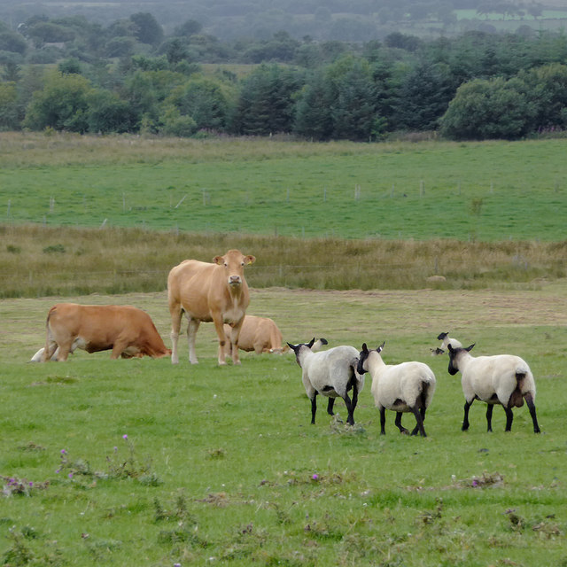
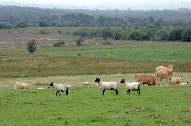
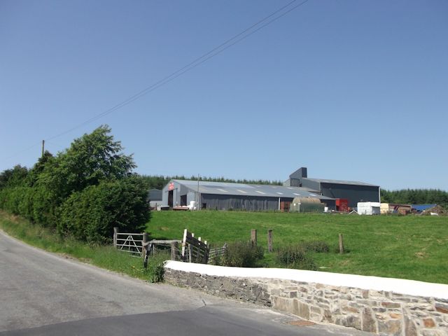
Bethania Images

Images are sourced within 2km of 52.249061/-4.089596 or Grid Reference SN5763. Thanks to Geograph Open Source API. All images are credited.

Mixed grazing north-west of Bethania, Ceredigion Seen from the B4577 near Tre-faes-uchaf farm.
Mixed grazing north-west of Bethania, Ceredigion
Seen from the B4577 near Tre-faes-uchaf farm.
Mixed grazing north-west of Bethania, Ceredigion Seen from the B4577 near Tre-faes-uchaf farm.
Mixed grazing north-west of Bethania, Ceredigion
Seen from the B4577 near Tre-faes-uchaf farm.
B4577 approaching Bethania in Ceredigion Looking south-east from near Drefaes Farm. The B4577 from Aberarth passes through Cross Inn, Bethania and Penuwch, then joins the A485 (between Tregaron and Aberystwyth) at Tyncelyn.
B4577 approaching Bethania in Ceredigion
Looking south-east from near Drefaes Farm. The B4577 from Aberarth passes through Cross Inn, Bethania and Penuwch, then joins the A485 (between Tregaron and Aberystwyth) at Tyncelyn.
B4577 to Aberarth in Ceredigion Looking north-west from near Drefaes Farm. The B4577 to Aberarth goes through Penuwch, Bethania and Cross Inn.
B4577 to Aberarth in Ceredigion
Looking north-west from near Drefaes Farm. The B4577 to Aberarth goes through Penuwch, Bethania and Cross Inn.
Pasture near Bethania, Ceredigion The B4576 to Llangwyryfon is behind the hedge on the right.
Pasture near Bethania, Ceredigion
The B4576 to Llangwyryfon is behind the hedge on the right.
Shady lane north of Bethania, Ceredigion Shady lane or not this is, in fact, the B4576 to Llangwyryfon.
Shady lane north of Bethania, Ceredigion
Shady lane or not this is, in fact, the B4576 to Llangwyryfon.
Pasture north of Bethania in Ceredigion Beyond the foreground grass is more marshy terrain, including part of Gors y Cwn
Pasture north of Bethania in Ceredigion
Beyond the foreground grass is more marshy terrain, including part of Gors y Cwn
The B4577 to Aberarth, Ceredigion Seen here leaving Bethania, the A4577 links the A485 at Tyncelyn, via Penuwch, Bethania and Cross Inn, to Aberarth on the coast near Aberaeron.
The B4577 to Aberarth, Ceredigion
Seen here leaving Bethania, the A4577 links the A485 at Tyncelyn, via Penuwch, Bethania and Cross Inn, to Aberarth on the coast near Aberaeron.
Houses and lane in Bethania, Ceredigion The narrow lane off the B4577 leads south-west towards (eventually) Temple Bar.
Houses and lane in Bethania, Ceredigion
The narrow lane off the B4577 leads south-west towards (eventually) Temple Bar.
Pasture south-east of Bethania, Ceredigion Looking across the wide marshy valley of the Afon Arth.
Pasture south-east of Bethania, Ceredigion
Looking across the wide marshy valley of the Afon Arth.
Grazing south-east of Bethania, Ceredigion A telephoto image looking across the wide marshy valley of the Afon Arth.
Grazing south-east of Bethania, Ceredigion
A telephoto image looking across the wide marshy valley of the Afon Arth.
The B4577 east of Bethania, Ceredigion The B4577 from Aberarth passes through Cross Inn, Bethania and Penuwch, then joins the A485 (between Tregaron and Aberystwyth) at Tyncelyn.
The B4577 east of Bethania, Ceredigion
The B4577 from Aberarth passes through Cross Inn, Bethania and Penuwch, then joins the A485 (between Tregaron and Aberystwyth) at Tyncelyn.
The B4577 south-east of Bethania, Ceredigion The B4577 from Aberarth passes through Cross Inn, Bethania and Penuwch, then joins the A485 (between Tregaron and Aberystwyth) at Tyncelyn.

On the right land dips gently towards the Afon Arth.
The B4577 south-east of Bethania, Ceredigion
The B4577 from Aberarth passes through Cross Inn, Bethania and Penuwch, then joins the A485 (between Tregaron and Aberystwyth) at Tyncelyn. On the right land dips gently towards the Afon Arth.
Pasture south-east of Bethania, Ceredigion Alongside the B4577 near Llys Amaeth farm the land dips gently towards the Afon Arth.
Pasture south-east of Bethania, Ceredigion
Alongside the B4577 near Llys Amaeth farm the land dips gently towards the Afon Arth.
Samstercage A mural painted by Sam young on the primary school "caban" 2010
Samstercage
A mural painted by Sam young on the primary school "caban" 2010
Llys Amaeth farm from B4577
Crossroads at Bethania
Crossroads on the B4576
Show me another place!

Bethania is located at Grid Ref: SN5763 (Lat: 52.249061, Lng: -4.089596)

Unitary Authority: Ceredigion

Police Authority: Dyfed Powys

What 3 Words

///vehicle.tailwind.decrease. Near Llanon, Ceredigion

Nearby Locations

Bethania

Related Wikis

Bethania, Ceredigion

Bethania is a hamlet in Ceredigion, mid Wales. == Geography == The centre of this dispersed community in the rural heart of the county is at the junction...

Moelfryn

Moelfryn is a small village in the community of Dyffryn Arth, Ceredigion, Wales, which is 65.4 miles (105.2 km) from Cardiff and 176.2 miles (283.5 km...

Crynfryn

Crynfryn is a hamlet bach in the community of Nantcwnlle, Ceredigion, Wales, which is 64.6 miles (104 km) from Cardiff and 175.7 miles (282.8 km) from...

Penuwch

Penuwch is a rural village in Ceredigion, Wales. Penuwch is about 1,000 feet above sea level and 8 miles west of Tregaron while the coast is a similar...

Nearby Amenities

Located within 500m of 52.249061,-4.089596
Post Box
Ref: SY23 151
Lat/Long: 52.2509079/-4.0901393
Bethania
Is In: Ceredigion, Wales, UK
Place: hamlet
Wikidata: Q4897692
Wikipedia: en:Bethania, Ceredigion
Lat/Long: 52.2509586/-4.0888576
Moelfryn
Place: village
Wikidata: Q15989245
Wikipedia: en:Moelfryn
Lat/Long: 52.245316/-4.0862704
Direction: 235
Generator Method: photovoltaic
Generator Output Electricity: yes
Generator Solar Modules: 10
Generator Source: solar
Generator Type: solar_photovoltaic_panel
Location: roof
Power: generator
Lat/Long: 52.2518883/-4.094087
Direction: 145
Generator Method: photovoltaic
Generator Output Electricity: yes
Generator Solar Modules: 6
Generator Source: solar
Generator Type: solar_photovoltaic_panel
Location: roof
Power: generator
Lat/Long: 52.2519125/-4.0941882
Give Way
Direction: forward
Lat/Long: 52.2509313/-4.0895741
The data included in this document is from www.openstreetmap.org. The data is made available under ODbL.

Have you been to Bethania?

Leave your review of Bethania below (or comments, questions and feedback).