Beswick

Settlement in Lancashire

England

Beswick

The B of the Bang! At the corner of Ashton New Road and Alan Turing Way, close to the City of Manchester Stadium.
The B of the Bang! Credit: Keith Williamson

Beswick is a small village located in the county of Lancashire, England. Situated approximately 5 miles east of the town of Manchester, Beswick falls within the administrative boundaries of the City of Manchester. The village is part of the larger area known as East Manchester, which has undergone significant redevelopment over the years.

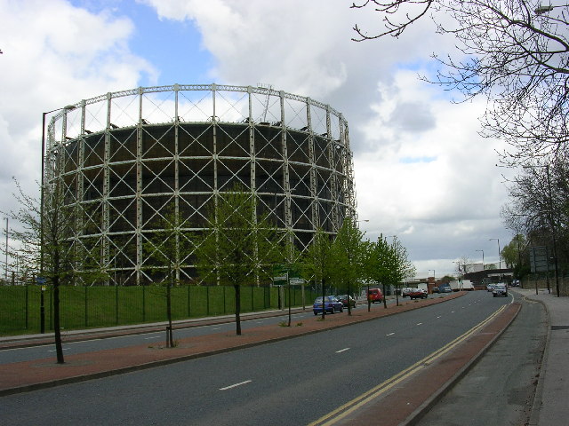
Historically, Beswick was an industrial area with a strong manufacturing presence. It was home to several large mills and factories, contributing to the growth of the local economy during the 19th and early 20th centuries. However, with the decline of the manufacturing industry in the latter part of the 20th century, Beswick experienced a period of economic stagnation.

In recent years, there has been a renewed focus on regeneration and redevelopment in Beswick. The area has seen the construction of new housing developments, including the popular Sportcity complex, which includes the Etihad Stadium, home to Manchester City Football Club, and the Manchester Velodrome, a world-class cycling venue.

Beswick enjoys good transport links, with easy access to Manchester city center and surrounding areas via the A635 road. The village is also well-served by public transport, with regular bus services connecting it to nearby towns and cities.

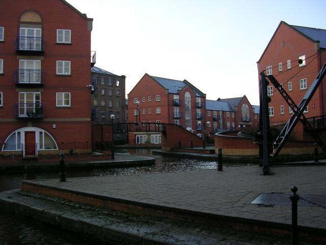
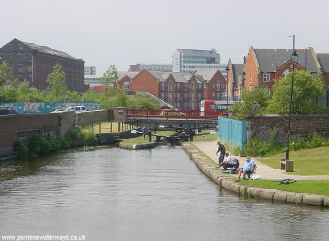
Despite its industrial past, Beswick offers a variety of green spaces and recreational facilities. The area is home to several parks, such as Philips Park and the Ashton Canal, providing residents with opportunities for outdoor activities and leisurely walks. Additionally, there are shops, schools, and community amenities within close proximity, making Beswick a desirable place to live.

If you have any feedback on the listing, please let us know in the comments section below.

Beswick Images

Images are sourced within 2km of 53.476753/-2.198854 or Grid Reference SJ8697. Thanks to Geograph Open Source API. All images are credited.

The B of the Bang! At the corner of Ashton New Road and Alan Turing Way, close to the City of Manchester Stadium.
The B of the Bang!
At the corner of Ashton New Road and Alan Turing Way, close to the City of Manchester Stadium.
Piccadilly Village, Manchester Here, on the banks of the Ashton Canal, is an interesting development incorporating both the old and the new. Many examples of industrial, canalside apparatus have been retained, along with the branches and basins that served the original warehouses and factories.
Piccadilly Village, Manchester
Here, on the banks of the Ashton Canal, is an interesting development incorporating both the old and the new. Many examples of industrial, canalside apparatus have been retained, along with the branches and basins that served the original warehouses and factories.
Fujitsu Building in West Gorton Typical Manchester rainy weather.
Fujitsu Building in West Gorton
Typical Manchester rainy weather.
B of the Bang
B of the Bang
City of Manchester Stadium New Manchester City ground.
City of Manchester Stadium
New Manchester City ground.
National Cycling Centre / Velodrome
Philips Park
Philips Park
St Cross Parish Church on Ashton Old Road
Ashton Canal
Ashton Canal
City of Manchester Stadium from Ashton Canal The City of Manchester Stadium, built for the Commonwealth Games, seen from Lock 7 of the Ashton Canal.
City of Manchester Stadium from Ashton Canal
The City of Manchester Stadium, built for the Commonwealth Games, seen from Lock 7 of the Ashton Canal.
Ancoats Locks, Ashton Canal Lock 1 of the Ashton Canal at Ancoats in Manchester.
Ancoats Locks, Ashton Canal
Lock 1 of the Ashton Canal at Ancoats in Manchester.
The Old Gorton Monastery on Gorton Lane For more information see here: <span class="nowrap"><a title="http://www.themonastery.co.uk/" rel="nofollow ugc noopener" href="http://www.themonastery.co.uk/">Link</a><img style="margin-left:2px;" alt="External link" title="External link - shift click to open in new window" src="https://s1.geograph.org.uk/img/external.png" width="10" height="10"/></span>
The Old Gorton Monastery on Gorton Lane
For more information see here: LinkExternal link
Fujitsu Building on a Glorious Spring Day See!! We do have sunshine in Manchester!!
Fujitsu Building on a Glorious Spring Day
See!! We do have sunshine in Manchester!!
Gasholder, Bradford, Manchester This gasholder is located close to the City of Manchester Stadium which was, in part, built on the site of an old gasworks. taken from SJ 868 991.
Gasholder, Bradford, Manchester
This gasholder is located close to the City of Manchester Stadium which was, in part, built on the site of an old gasworks. taken from SJ 868 991.
Gorton Baths This is the old Gorton Baths, one of the last old landmarks of Gorton. An interesting building close to Gorton Park, it was also used as a gymnastic centre, but now sadly unused and in bad condition. Will probably be demolished soon. A sad end to a proud building.
Gorton Baths
This is the old Gorton Baths, one of the last old landmarks of Gorton. An interesting building close to Gorton Park, it was also used as a gymnastic centre, but now sadly unused and in bad condition. Will probably be demolished soon. A sad end to a proud building.
City of Manchester Stadium - Commonwealth Games Photo of the City of Manchester Stadium taken at the Commonwealth Games of 2002. The stadium was later converted into a football stadium.
City of Manchester Stadium - Commonwealth Games
Photo of the City of Manchester Stadium taken at the Commonwealth Games of 2002. The stadium was later converted into a football stadium.
Last Orders! The Fox Tavern, Clayton Lane, Openshaw. Closed 2003.  Situated in a rather neglected area of east Manchester that is now undergoing regeneration on a big scale.
Last Orders!
The Fox Tavern, Clayton Lane, Openshaw. Closed 2003. Situated in a rather neglected area of east Manchester that is now undergoing regeneration on a big scale.
Feeling Blue? Rundown building at the junction of Bartlett St with Ashton Old Road, Openshaw.
Formerly a public house known as the Drover's Arms. Now (early 2008) being renovated.
Feeling Blue?
Rundown building at the junction of Bartlett St with Ashton Old Road, Openshaw. Formerly a public house known as the Drover's Arms. Now (early 2008) being renovated.
Show me another place!

Beswick is located at Grid Ref: SJ8697 (Lat: 53.476753, Lng: -2.198854)

Unitary Authority: Manchester

Police Authority: Greater Manchester

What 3 Words

///songs.covers.activism. Near Longsight, Manchester

Nearby Locations

Beswick

Related Wikis

The East Manchester Academy

The East Manchester Academy is a coeducational secondary school located in the Beswick area of Manchester, England.It was established as an academy in...

Beswick, Manchester

Beswick is an area of east Manchester, England. Historically in Lancashire, it neighbours the district of Openshaw to the east. The River Medlock and the...

Connell Sixth Form College

Connell Co-op College is a Sixth Form College in the Beswick Hub development, Manchester. Run by the Co-op Academies Trust and formerly the Bright Futures...

Bradford, Manchester

Bradford is a district of east Manchester, England, two miles north east of the city centre. The population at the 2011 census was 15,784. Historically...

Nearby Amenities

Located within 500m of 53.476753,-2.198854
Bus Stop
Ashton Old Road/Pottery Lane (Stop B)
Bench: yes
Bin: yes
Bus: yes
Lit: yes
Local Ref: B
Naptan AtcoCode: 1800EB33861
Naptan Bearing: W
Naptan CommonName: Ashton Old Road/Pottery Lane (Stop B)
Naptan Indicator: Stop B
Naptan Landmark: OPP HEALTH CTR
Naptan NaptanCode: manajatw
Naptan Notes: LOCATION AMENDED
Naptan PlusbusZoneRef: MNCRPIC
Naptan ShortCommonName: Pottery Lane
Naptan Street: ASHTON OLD ROAD
Naptan Verified: no
Network: TfGM
Public Transport: platform
Shelter: yes
Source: naptan_import
Tactile Paving: no
Lat/Long: 53.4740528/-2.195551
Pharmacy
Five Oaks Pharmacy
Healthcare: pharmacy
Lat/Long: 53.4756955/-2.194418
Traffic Signals
Traffic Signals: signal
Lat/Long: 53.474539/-2.2045397
Traffic Signals
Traffic Signals: signal
Lat/Long: 53.4745649/-2.2027289
Noexit: yes
Lat/Long: 53.4745563/-2.2053646
Beswick
Alt Name Ur: بیز وِک
Name Ur: بیزوِک
Place: suburb
Lat/Long: 53.4772765/-2.2052143
Noexit: yes
Lat/Long: 53.4753834/-2.2010011
Crossing
Lat/Long: 53.4798153/-2.1941628
Traffic Signals
Traffic Signals: crossing_only
Lat/Long: 53.4774405/-2.1933282
The Guvnor's Sports Bar
Historic Amenity: pub
Lat/Long: 53.4769017/-2.1922713
Traffic Signals
Lat/Long: 53.4761048/-2.193489
Bus Stop
Alan Turing Way/Prentice Walk
Bus: yes
Naptan AtcoCode: 1800EB05951
Naptan Bearing: N
Naptan CommonName: Alan Turing Way/Prentice Walk
Naptan Indicator: Church
Naptan Landmark: FLATS
Naptan NaptanCode: manadpwp
Naptan PlusbusZoneRef: MNCRPIC
Naptan ShortCommonName: Prentice Walk
Naptan Street: ALAN TURING WAY
Naptan Verified: no
Network: TfGM
Public Transport: platform
Source: naptan_import
Lat/Long: 53.4797747/-2.1942465
Bus Stop
Albert Street/Doric Close
Bus: yes
Naptan AtcoCode: 1800EB14581
Naptan Bearing: E
Naptan CommonName: Albert Street/Doric Close
Naptan Indicator: Nr Elec Sub Stn
Naptan Landmark: House 1
Naptan NaptanCode: managjam
Naptan PlusbusZoneRef: MNCRPIC
Naptan ShortCommonName: Doric Close
Naptan Street: ALBERT STREET
Naptan Verified: no
Network: TfGM
Public Transport: platform
Source: naptan_import
Lat/Long: 53.4796596/-2.2040103
Bus Stop
Albert Street/Sarah Street
Bus: yes
Naptan AtcoCode: 1800EB14591
Naptan Bearing: E
Naptan CommonName: Albert Street/Sarah Street
Naptan Indicator: Opp House 52
Naptan Landmark: HOUSE 6
Naptan NaptanCode: managjap
Naptan PlusbusZoneRef: MNCRPIC
Naptan ShortCommonName: Sarah Street
Naptan Street: ALBERT STREET
Naptan Verified: no
Network: TfGM
Public Transport: platform
Source: naptan_import
Lat/Long: 53.4789301/-2.1995014
Bus Stop
Albert Street/Sarah Street
Bus: yes
Naptan AtcoCode: 1800EB14601
Naptan Bearing: W
Naptan CommonName: Albert Street/Sarah Street
Naptan Indicator: House 62
Naptan Landmark: HOUSE 62
Naptan NaptanCode: managjat
Naptan PlusbusZoneRef: MNCRPIC
Naptan ShortCommonName: Sarah Street
Naptan Street: ALBERT STREET
Naptan Verified: no
Network: TfGM
Public Transport: platform
Source: naptan_import
Lat/Long: 53.4788049/-2.1991241
Bus Stop
Ashton Old Road/Kay Street
Bench: no
Bin: no
Bus: yes
Local Ref: A
Naptan AtcoCode: 1800EB18541
Naptan Bearing: E
Naptan CommonName: Ashton Old Road/Kay Street (Stop A)
Naptan Indicator: Stop A
Naptan Landmark: FLATS
Naptan NaptanCode: managjwt
Naptan Notes: NAME AMENDED
Naptan PlusbusZoneRef: MNCRPIC
Naptan ShortCommonName: Kay Street
Naptan Street: ASHTON OLD ROAD
Naptan Verified: no
Network: TfGM
Public Transport: platform
Shelter: yes
Source: naptan_import
Tactile Paving: no
Lat/Long: 53.4743153/-2.1978769
Bus Stop
Ashton Old Road/Stainforth Street
Bus: yes
Naptan AtcoCode: 1800EB33831
Naptan Bearing: W
Naptan CommonName: Ashton Old Road/Stainforth Street
Naptan Indicator: Os Wing Fat
Naptan Landmark: PET SUPPLIES
Naptan NaptanCode: manajatj
Naptan PlusbusZoneRef: MNCRPIC
Naptan ShortCommonName: Stainforth Street
Naptan Street: ASHTON OLD ROAD
Naptan Verified: no
Network: TfGM
Public Transport: platform
Source: naptan_import
Lat/Long: 53.4744668/-2.2019909
Bus Stop
Ashton Old Road/Stainforth Street
Bus: yes
Naptan AtcoCode: 1800EB33841
Naptan Bearing: E
Naptan CommonName: Ashton Old Road/Stainforth Street
Naptan Indicator: Opp R+b Wharehouse
Naptan Landmark: CAR Park
Naptan NaptanCode: manajatm
Naptan Notes: INDICATOR AMENDED
Naptan PlusbusZoneRef: MNCRPIC
Naptan ShortCommonName: Stainforth Street
Naptan Street: ASHTON OLD ROAD
Naptan Verified: no
Network: TfGM
Public Transport: platform
Shelter: yes
Source: naptan_import
Tactile Paving: no
Lat/Long: 53.4745594/-2.2013884
Bus Stop
Ashton Old Road/Kay Street
Bench: no
Bus: yes
Naptan AtcoCode: 1800EB33851
Naptan Bearing: W
Naptan CommonName: Ashton Old Road/Kay Street
Naptan Indicator: Nr Harling & Watson
Naptan Landmark: POST BOX
Naptan NaptanCode: manajatp
Naptan Notes: INDICATOR AMENDED
Naptan PlusbusZoneRef: MNCRPIC
Naptan ShortCommonName: Kay Street
Naptan Street: ASHTON OLD ROAD
Naptan Verified: no
Network: TfGM
Public Transport: platform
Shelter: yes
Source: naptan_import
Tactile Paving: no
Lat/Long: 53.4743022/-2.1997546
Bus Stop
Alan Turing Way/Ashton Old Road (C)
Bus: yes
Local Ref: C
Naptan AtcoCode: 1800EB33871
Naptan Bearing: N
Naptan CommonName: Alan Turing Way/Ashton Old Road (C)
Naptan Indicator: Stop C
Naptan Landmark: CAR PARK AREA
Naptan NaptanCode: manajawa
Naptan PlusbusZoneRef: MNCRPIC
Naptan ShortCommonName: Ashton Old Road
Naptan Street: ALAN TURING WAY
Naptan Verified: no
Network: TfGM
Public Transport: platform
Shelter: yes
Source: naptan_import
Lat/Long: 53.4746948/-2.1946615
Bus Stop
Grey Mare Lane/St Brigid's School
Bus: yes
Naptan AtcoCode: 1800EB33881
Naptan Bearing: NW
Naptan CommonName: Grey Mare Lane/St Brigid's School
Naptan Indicator: Opp School
Naptan Landmark: LIBRARY
Naptan NaptanCode: manajawd
Naptan PlusbusZoneRef: MNCRPIC
Naptan ShortCommonName: St Brigid's Sch
Naptan Street: GREY MARE LANE
Naptan Verified: no
Network: TfGM
Public Transport: platform
Source: naptan_import
Lat/Long: 53.4782076/-2.1961228
Bus Stop
Grey Mare Lane/Queen Victoria
Bus: yes
Naptan AtcoCode: 1800EB33891
Naptan Bearing: N
Naptan CommonName: Grey Mare Lane/Queen Victoria
Naptan Indicator: Queen Victoria
Naptan Landmark: Tesco Express
Naptan NaptanCode: manajawg
Naptan PlusbusZoneRef: MNCRPIC
Naptan ShortCommonName: Queen Victoria
Naptan Street: GREY MARE LANE
Naptan Verified: no
Network: TfGM
Public Transport: platform
Source: naptan_import
Lat/Long: 53.4795813/-2.1970634
Bus Stop
Grey Mare Lane/Ashton New Road (Stop B)
Bus: yes
Local Ref: B
Naptan AtcoCode: 1800EB33901
Naptan Bearing: S
Naptan CommonName: Grey Mare Lane/Ashton New Road (Stop B)
Naptan Indicator: Stop B
Naptan Landmark: PUBLIC HOUSE
Naptan NaptanCode: manajawj
Naptan PlusbusZoneRef: MNCRPIC
Naptan ShortCommonName: Ashton New Road
Naptan Street: GREY MARE LANE
Naptan Verified: no
Network: TfGM
Public Transport: platform
Source: naptan_import
Lat/Long: 53.4809381/-2.1974163
Bus Stop
Ashton Old Road/Alan Turing Way
Bench: yes
Bus: yes
Local Ref: D
Naptan AtcoCode: 1800EB33921
Naptan Bearing: E
Naptan CommonName: Ashton Old Road/Alan Turing Way
Naptan Indicator: Opp College
Naptan Landmark: OPP COLLEGE
Naptan NaptanCode: manajawp
Naptan PlusbusZoneRef: MNCRPIC
Naptan ShortCommonName: Alan Turing Way
Naptan Street: ASHTON OLD ROAD
Naptan Verified: no
Network: TfGM
Public Transport: platform
Shelter: yes
Source: naptan_import
Tactile Paving: no
Lat/Long: 53.4742285/-2.193474
Bus Stop
Pottery Lane/Ashton Old Road (Stop E)
Bench: no
Bin: no
Bus: yes
Lit: yes
Local Ref: E
Naptan AtcoCode: 1800EB34441
Naptan Bearing: S
Naptan CommonName: Pottery Lane/Ashton Old Road (Stop E)
Naptan Indicator: Stop E
Naptan Landmark: NR COLLEGE
Naptan NaptanCode: manajdtw
Naptan PlusbusZoneRef: MNCRPIC
Naptan ShortCommonName: Ashton Old Road
Naptan Street: POTTERY LANE
Naptan Verified: no
Network: TfGM
Public Transport: platform
Shelter: no
Source: naptan_import
Tactile Paving: no
Lat/Long: 53.4736445/-2.1942035
Pub
Mary D's
Lat/Long: 53.4809039/-2.1972836
Traffic Signals
Source: bing
Lat/Long: 53.4761215/-2.1938756
Traffic Signals
Source: bing
Lat/Long: 53.4762049/-2.1934685
Traffic Signals
Source: bing
Lat/Long: 53.4763695/-2.1939648
Traffic Signals
Source: bing
Lat/Long: 53.4764492/-2.1935422
Traffic Signals
Source: bing
Lat/Long: 53.4765072/-2.1938587
Noexit: yes
Lat/Long: 53.4752269/-2.1944897
Noexit: yes
Lat/Long: 53.475072/-2.194546
Noexit: yes
Lat/Long: 53.4749475/-2.1946855
Entrance: yes
Lat/Long: 53.4745148/-2.1939849
Cycleway: asl
Lat/Long: 53.4739971/-2.1941028
Traffic Signals
Traffic Signals: signal
Lat/Long: 53.4743693/-2.1941616
Traffic Signals
Traffic Signals: signal
Lat/Long: 53.4743274/-2.1948334
Crossing
Crossing: uncontrolled
Crossing Island: yes
Crossing Markings: dots
Tactile Paving: no
Lat/Long: 53.4762085/-2.1934969
Crossing
Crossing: traffic_signals
Crossing Island: yes
Crossing Markings: dots
Crossing Ref: pelican
Tactile Paving: yes
Lat/Long: 53.4763091/-2.194073
Crossing
Crossing: uncontrolled
Crossing Island: yes
Crossing Markings: dots
Tactile Paving: no
Lat/Long: 53.4761339/-2.193687
Crossing
Crossing: traffic_signals
Crossing Island: yes
Crossing Markings: dots
Crossing Ref: pelican
Tactile Paving: yes
Lat/Long: 53.476414/-2.1937262
Crossing
Crossing: uncontrolled
Crossing Island: yes
Crossing Markings: dots
Tactile Paving: no
Lat/Long: 53.4761577/-2.1938606
Crossing
Crossing: uncontrolled
Crossing Island: yes
Crossing Markings: dots
Tactile Paving: no
Lat/Long: 53.4762779/-2.1934054
Crossing
Crossing: uncontrolled
Crossing Island: yes
Crossing Markings: dots
Tactile Paving: no
Lat/Long: 53.4760953/-2.1935112
Crossing
Crossing: traffic_signals
Crossing Island: yes
Crossing Markings: dots
Crossing Ref: pelican
Tactile Paving: yes
Lat/Long: 53.4764132/-2.1935597
Crossing
Lat/Long: 53.4780761/-2.1936773
Crossing
Crossing: traffic_signals
Crossing Island: yes
Crossing Markings: dots
Crossing Ref: pelican
Tactile Paving: yes
Lat/Long: 53.4763586/-2.1939067
Crossing
Crossing: traffic_signals
Crossing Island: yes
Crossing Markings: dots
Crossing Ref: pelican
Tactile Paving: yes
Lat/Long: 53.4764791/-2.1939673
Crossing
Crossing: traffic_signals
Crossing Island: yes
Crossing Ref: toucan
Tactile Paving: yes
Lat/Long: 53.4773522/-2.1935063
Crossing
Crossing: traffic_signals
Crossing Island: yes
Crossing Ref: toucan
Tactile Paving: yes
Lat/Long: 53.4774022/-2.1933233
Crossing
Crossing: zebra
Crossing Island: yes
Priority: backward
Tactile Paving: yes
Traffic Calming: choked_table
Lat/Long: 53.4789796/-2.2009254
Entrance: main
Lat/Long: 53.4795801/-2.2007813
Barrier: bollard
Motor Vehicle: no
Lat/Long: 53.4747992/-2.2038898
Crossing
Crossing: unmarked
Lat/Long: 53.4789613/-2.2010164
Crossing
Crossing: unmarked
Lat/Long: 53.4789494/-2.2008217
Waste Basket
Lat/Long: 53.4742952/-2.1997086
Post Box
Lat/Long: 53.474283/-2.1996142
Crossing
Crossing: uncontrolled
Crossing Markings: zebra
Lat/Long: 53.4784917/-2.1966283
Crossing
Crossing: uncontrolled
Crossing Markings: zebra
Lat/Long: 53.4766747/-2.1947885
Traffic Signals
Traffic Signals: signal
Lat/Long: 53.4743329/-2.1943441
Traffic Signals
Traffic Signals: signal
Lat/Long: 53.473999/-2.1945996
Crossing
Crossing: traffic_signals
Crossing Island: yes
Crossing Ref: pelican
Tactile Paving: yes
Lat/Long: 53.4740001/-2.1947757
Crossing
Crossing: traffic_signals
Crossing Island: yes
Crossing Ref: pelican
Tactile Paving: yes
Lat/Long: 53.4742152/-2.1941467
Crossing
Crossing: traffic_signals
Crossing Island: yes
Crossing Ref: pelican
Tactile Paving: yes
Lat/Long: 53.4741108/-2.1942107
Crossing
Crossing: traffic_signals
Crossing Island: yes
Crossing Ref: pelican
Tactile Paving: yes
Lat/Long: 53.4743058/-2.1943473
Crossing
Crossing: traffic_signals
Crossing Island: yes
Crossing Ref: pelican
Tactile Paving: yes
Lat/Long: 53.4739941/-2.1943719
Crossing
Crossing: traffic_signals
Crossing Island: yes
Crossing Ref: pelican
Tactile Paving: yes
Lat/Long: 53.4743422/-2.1945767
Crossing
Crossing: traffic_signals
Crossing Island: yes
Crossing Ref: pelican
Tactile Paving: yes
Lat/Long: 53.4740256/-2.1946012
Crossing
Crossing: traffic_signals
Crossing Island: yes
Crossing Ref: pelican
Tactile Paving: yes
Lat/Long: 53.4742275/-2.1947518
Crossing
Crossing: traffic_signals
Crossing Island: yes
Crossing Ref: pelican
Tactile Paving: yes
Lat/Long: 53.474123/-2.1948096
Crossing
Crossing: traffic_signals
Crossing Island: yes
Crossing Ref: pelican
Tactile Paving: yes
Lat/Long: 53.4743684/-2.1947498
Crossing
Crossing: traffic_signals
Crossing Island: yes
Crossing Ref: pelican
Tactile Paving: yes
Lat/Long: 53.4743207/-2.1940974
Crossing
Crossing: traffic_signals
Crossing Island: yes
Crossing Ref: pelican
Tactile Paving: yes
Lat/Long: 53.4739814/-2.1941457
Barrier: bollard
Lat/Long: 53.4743534/-2.198258
Barrier: bollard
Lat/Long: 53.4744633/-2.1982431
Bus Stop
ALAN TURING WAY/Grey Mare Lane
Bench: yes
Bin: yes
Bus: yes
Lit: yes
Naptan AtcoCode: 1800EB17881
Naptan Bearing: N
Naptan Landmark: Leisure centre
Naptan NaptanCode: MANTWJMW
Naptan Street: Alan Turing Way
Network: TfGM
Public Transport: platform
Shelter: yes
Lat/Long: 53.4770636/-2.193701
Bus Stop
ALAN TURING WAY/Wilson Street
Bench: yes
Bin: yes
Bus: yes
Lit: yes
Naptan AtcoCode: 1800EB17831
Naptan Bearing: S
Naptan NaptanCode: MANTWJMT
Naptan Street: Alan Turing Way
Network: TfGM
Public Transport: platform
Shelter: yes
Tactile Paving: no
Lat/Long: 53.4777636/-2.1932396
Camera Mount: pole
Camera Type: dome
Man Made: surveillance
Surveillance: public
Surveillance Type: camera
Surveillance Zone: town
Lat/Long: 53.4740688/-2.1946809
Give Way
Lat/Long: 53.474074/-2.1948985
Cycleway: asl
Lat/Long: 53.473975/-2.1947437
Traffic Signals
Traffic Signals: signal
Lat/Long: 53.4739477/-2.1947104
Traffic Signals
Traffic Signals: signal
Lat/Long: 53.4739574/-2.1944941
Cycleway: asl
Lat/Long: 53.473997/-2.1944933
Traffic Signals
Traffic Signals: signal
Lat/Long: 53.4743725/-2.1944533
Cycleway: asl
Lat/Long: 53.474337/-2.1944579
Crossing
Crossing: traffic_signals
Crossing Island: yes
Crossing Ref: pelican
Tactile Paving: yes
Lat/Long: 53.4743097/-2.1944615
Cycleway: asl
Lat/Long: 53.4743481/-2.1947884
Cycleway: asl
Lat/Long: 53.4742279/-2.1947964
Traffic Signals
Traffic Signals: signal
Lat/Long: 53.4742283/-2.1948558
Give Way
Lat/Long: 53.4744325/-2.1946635
Give Way
Lat/Long: 53.4742605/-2.1939673
Cycleway: asl
Lat/Long: 53.4743413/-2.1941268
Traffic Signals
Traffic Signals: signal
Lat/Long: 53.4740131/-2.1940508
Cycleway: asl
Lat/Long: 53.4741084/-2.1941488
Traffic Signals
Traffic Signals: signal
Lat/Long: 53.4741061/-2.1940905
Crossing
Crossing: traffic_signals
Crossing Island: yes
Crossing Ref: pelican
Tactile Paving: yes
Lat/Long: 53.4740247/-2.1944922
Traffic Signals
Traffic Signals: crossing_only
Lat/Long: 53.4773144/-2.1935104
Tesco Express
Brand: Tesco Express
Brand Wikidata: Q98456772
Contact Website: https://www.tesco.com/store-locator/manchester/80-grey-mare-lane
Fhrs Id: 1370869
Shop: convenience
Lat/Long: 53.4792585/-2.1969974
Cycleway: asl
Lat/Long: 53.4745695/-2.2027884
Cycleway: asl
Lat/Long: 53.4746954/-2.2032357
Traffic Signals
Traffic Signals: signal
Lat/Long: 53.4746996/-2.2032982
Cycleway: asl
Lat/Long: 53.4747766/-2.2048669
Traffic Signals
Traffic Signals: signal
Lat/Long: 53.4747779/-2.2049284
Traffic Signals
Traffic Signals: signal
Lat/Long: 53.4746617/-2.2042395
Cycleway: asl
Lat/Long: 53.4746635/-2.2043001
Crossing
Crossing: traffic_signals
Crossing Island: yes
Crossing Ref: pelican
Tactile Paving: yes
Lat/Long: 53.4745733/-2.2028385
Crossing
Crossing: traffic_signals
Crossing Island: yes
Crossing Ref: pelican
Tactile Paving: yes
Lat/Long: 53.4746744/-2.202922
Crossing
Crossing: traffic_signals
Crossing Island: yes
Crossing Ref: pelican
Tactile Paving: yes
Lat/Long: 53.474775/-2.2048115
Crossing
Crossing: traffic_signals
Crossing Island: yes
Crossing Ref: pelican
Tactile Paving: yes
Lat/Long: 53.4746815/-2.2048883
Cycleway: asl
Lat/Long: 53.4747111/-2.2055633
Traffic Signals
Traffic Signals: signal
Lat/Long: 53.4747079/-2.2055032
Crossing
Crossing: marked
Lat/Long: 53.4748042/-2.2056419
Entrance: main
Lat/Long: 53.4744343/-2.1958066
Entrance: main
Lat/Long: 53.4744403/-2.1960722
Entrance: main
Lat/Long: 53.474439/-2.1962827
Entrance: main
Lat/Long: 53.4744952/-2.1966543
Entrance: main
Lat/Long: 53.474705/-2.1955323
Entrance: main
Lat/Long: 53.4745737/-2.1949542
Entrance: main
Lat/Long: 53.4746696/-2.1996507
Entrance: main
Lat/Long: 53.4746351/-2.1999142
Entrance: main
Lat/Long: 53.4746502/-2.2001238
Entrance: main
Lat/Long: 53.4746558/-2.2003922
Entrance: main
Lat/Long: 53.4749892/-2.2053417
Entrance: main
Lat/Long: 53.4749246/-2.204131
Entrance: yes
Lat/Long: 53.4751024/-2.205398
Entrance: yes
Lat/Long: 53.4750417/-2.204168
Entrance: main
Lat/Long: 53.474737/-2.2021532
Entrance: main
Lat/Long: 53.4746502/-2.2009772
Entrance: main
Lat/Long: 53.4752285/-2.2021503
Addr Housenumber: 5
Addr Postcode: M11 3RW
Addr Postcode Source: NSUL postcode overlay
Addr Street: Blackrock Street
Entrance: home
Lat/Long: 53.4773069/-2.2033838
Addr Housenumber: 7
Addr Postcode: M11 3RW
Addr Postcode Source: NSUL postcode overlay
Addr Street: Blackrock Street
Entrance: home
Lat/Long: 53.4773/-2.2033732
Addr Housenumber: 3
Addr Postcode: M11 3RW
Addr Postcode Source: NSUL postcode overlay
Addr Street: Blackrock Street
Entrance: home
Lat/Long: 53.4773318/-2.2033792
Addr Housenumber: 1
Addr Postcode: M11 3RW
Addr Postcode Source: NSUL postcode overlay
Addr Street: Blackrock Street
Entrance: home
Lat/Long: 53.4773371/-2.2033663
Addr Housenumber: 23
Addr Postcode: M11 3RH
Addr Postcode Source: NSUL postcode overlay
Addr Street: Siam Street
Entrance: home
Lat/Long: 53.4774365/-2.2030162
Addr Housenumber: 25
Addr Postcode: M11 3RH
Addr Postcode Source: NSUL postcode overlay
Addr Street: Siam Street
Entrance: home
Lat/Long: 53.4774302/-2.2030277
Addr Housenumber: 21
Addr Postcode: M11 3RH
Addr Postcode Source: NSUL postcode overlay
Addr Street: Siam Street
Entrance: home
Lat/Long: 53.4774338/-2.2029743
Addr Housenumber: 19
Addr Postcode: M11 3RH
Addr Postcode Source: NSUL postcode overlay
Addr Street: Siam Street
Entrance: home
Lat/Long: 53.4774261/-2.2029654
Addr Housenumber: 29
Addr Postcode: M11 3RH
Addr Postcode Source: NSUL postcode overlay
Addr Street: Siam Street
Entrance: home
Lat/Long: 53.4774464/-2.2031657
Addr Housenumber: 27
Addr Postcode: M11 3RH
Addr Postcode Source: NSUL postcode overlay
Addr Street: Siam Street
Entrance: home
Lat/Long: 53.4774387/-2.2031568
Addr Housenumber: 33
Addr Postcode: M11 3RH
Addr Postcode Source: NSUL postcode overlay
Addr Street: Siam Street
Entrance: home
Lat/Long: 53.4774428/-2.2032191
Addr Housenumber: 31
Addr Postcode: M11 3RH
Addr Postcode Source: NSUL postcode overlay
Addr Street: Siam Street
Entrance: home
Lat/Long: 53.4774491/-2.2032076
Entrance: main
Lat/Long: 53.4770737/-2.2024013
Kindergarten
Ashbury Meadow Children's Centre
Lat/Long: 53.4779203/-2.2056552
Entrance: main
Lat/Long: 53.4778108/-2.2054949
Addr Housenumber: 1
Addr Postcode: M11 3HL
Addr Postcode Source: NSUL postcode overlay
Addr Street: Hinkley Street
Entrance: home
Lat/Long: 53.478845/-2.2022491
Addr Housenumber: 3
Addr Postcode: M11 3HL
Addr Postcode Source: NSUL postcode overlay
Addr Street: Hinkley Street
Entrance: home
Lat/Long: 53.4788337/-2.2022512
Addr Housenumber: 30
Addr Postcode: M11 3SU
Addr Postcode Source: NSUL postcode overlay
Addr Street: Albert Street
Entrance: home
Lat/Long: 53.4789892/-2.2021567
Addr Housenumber: 32
Addr Postcode: M11 3SU
Addr Postcode Source: NSUL postcode overlay
Addr Street: Albert Street
Entrance: home
Lat/Long: 53.4789878/-2.2021361
Addr Housenumber: 34
Addr Postcode: M11 3SU
Addr Postcode Source: NSUL postcode overlay
Addr Street: Albert Street
Entrance: home
Lat/Long: 53.4789802/-2.2020207
Addr Housenumber: 36
Addr Postcode: M11 3SU
Addr Postcode Source: NSUL postcode overlay
Addr Street: Albert Street
Entrance: home
Lat/Long: 53.478979/-2.2020019
Addr Housenumber: 28
Addr Postcode: M11 3QP
Addr Postcode Source: NSUL postcode overlay
Addr Street: Ellingham Close
Entrance: home
Lat/Long: 53.479036/-2.2028432
Addr Housenumber: 26
Addr Postcode: M11 3QP
Addr Postcode Source: NSUL postcode overlay
Addr Street: Ellingham Close
Entrance: home
Lat/Long: 53.4790373/-2.2028641
Addr Housenumber: 33
Addr Postcode: M11 3DQ
Addr Postcode Source: NSUL postcode overlay
Addr Street: Grey Mare Lane
Entrance: home
Lat/Long: 53.4802913/-2.1971002
Addr Housenumber: 53
Addr Postcode: M11 3DQ
Addr Postcode Source: NSUL postcode overlay
Addr Street: Grey Mare Lane
Entrance: home
Lat/Long: 53.4803489/-2.1970952
Addr Housenumber: 47
Addr Postcode: M11 3DQ
Addr Postcode Source: NSUL postcode overlay
Addr Street: Grey Mare Lane
Entrance: home
Lat/Long: 53.4805091/-2.1971635
Addr Housenumber: 29
Addr Postcode: M11 3DQ
Addr Postcode Source: NSUL postcode overlay
Addr Street: Grey Mare Lane
Entrance: home
Lat/Long: 53.4803981/-2.1971457
Addr Housenumber: 57
Addr Postcode: M11 3DQ
Addr Postcode Source: NSUL postcode overlay
Addr Street: Grey Mare Lane
Entrance: home
Lat/Long: 53.4802421/-2.1970496
Addr Housenumber: 55
Addr Postcode: M11 3DQ
Addr Postcode Source: NSUL postcode overlay
Addr Street: Grey Mare Lane
Entrance: home
Lat/Long: 53.4802955/-2.1970724
Addr Housenumber: 51
Addr Postcode: M11 3DQ
Addr Postcode Source: NSUL postcode overlay
Addr Street: Grey Mare Lane
Entrance: home
Lat/Long: 53.4804023/-2.197118
Addr Housenumber: 25
Addr Postcode: M11 3DQ
Addr Postcode Source: NSUL postcode overlay
Addr Street: Grey Mare Lane
Entrance: home
Lat/Long: 53.4805049/-2.1971913
Addr Housenumber: 27
Addr Postcode: M11 3DQ
Addr Postcode Source: NSUL postcode overlay
Addr Street: Grey Mare Lane
Entrance: home
Lat/Long: 53.4804515/-2.1971685
Addr Housenumber: 31
Addr Postcode: M11 3DQ
Addr Postcode Source: NSUL postcode overlay
Addr Street: Grey Mare Lane
Entrance: home
Lat/Long: 53.4803447/-2.197123
Addr Housenumber: 49
Addr Postcode: M11 3DQ
Addr Postcode Source: NSUL postcode overlay
Addr Street: Grey Mare Lane
Entrance: home
Lat/Long: 53.4804557/-2.1971407
Addr Housenumber: 37
Addr Postcode: M11 3DQ
Addr Postcode Source: NSUL postcode overlay
Addr Street: Grey Mare Lane
Entrance: home
Lat/Long: 53.4801311/-2.1970318
Addr Housenumber: 63
Addr Postcode: M11 3DQ
Addr Postcode Source: NSUL postcode overlay
Addr Street: Grey Mare Lane
Entrance: home
Lat/Long: 53.4800819/-2.1969813
Addr Housenumber: 69
Addr Postcode: M11 3DQ
Addr Postcode Source: NSUL postcode overlay
Addr Street: Grey Mare Lane
Entrance: home
Lat/Long: 53.4799217/-2.1969129
Addr Housenumber: 41
Addr Postcode: M11 3DQ
Addr Postcode Source: NSUL postcode overlay
Addr Street: Grey Mare Lane
Entrance: home
Lat/Long: 53.4800243/-2.1969863
Addr Housenumber: 59
Addr Postcode: M11 3DQ
Addr Postcode Source: NSUL postcode overlay
Addr Street: Grey Mare Lane
Entrance: home
Lat/Long: 53.4801887/-2.1970268
Addr Housenumber: 61
Addr Postcode: M11 3DQ
Addr Postcode Source: NSUL postcode overlay
Addr Street: Grey Mare Lane
Entrance: home
Lat/Long: 53.4801353/-2.1970041
Addr Housenumber: 65
Addr Postcode: M11 3DQ
Addr Postcode Source: NSUL postcode overlay
Addr Street: Grey Mare Lane
Entrance: home
Lat/Long: 53.4800285/-2.1969585
Addr Housenumber: 35
Addr Postcode: M11 3DQ
Addr Postcode Source: NSUL postcode overlay
Addr Street: Grey Mare Lane
Entrance: home
Lat/Long: 53.4801845/-2.1970546
Addr Housenumber: 45
Addr Postcode: M11 3DQ
Addr Postcode Source: NSUL postcode overlay
Addr Street: Grey Mare Lane
Entrance: home
Lat/Long: 53.4799175/-2.1969407
Addr Housenumber: 43
Addr Postcode: M11 3DQ
Addr Postcode Source: NSUL postcode overlay
Addr Street: Grey Mare Lane
Entrance: home
Lat/Long: 53.4799709/-2.1969635
Addr Housenumber: 39
Addr Postcode: M11 3DQ
Addr Postcode Source: NSUL postcode overlay
Addr Street: Grey Mare Lane
Entrance: home
Lat/Long: 53.4800777/-2.1970091
Addr Housenumber: 67
Addr Postcode: M11 3DQ
Addr Postcode Source: NSUL postcode overlay
Addr Street: Grey Mare Lane
Entrance: home
Lat/Long: 53.4799751/-2.1969357
Addr Housenumber: 9
Addr Postcode: M11 3BX
Addr Postcode Source: NSUL postcode overlay
Addr Street: Dewar Close
Entrance: home
Lat/Long: 53.4799193/-2.1966234
Addr Housenumber: 19
Addr Postcode: M11 3BX
Addr Postcode Source: NSUL postcode overlay
Addr Street: Dewar Close
Entrance: home
Lat/Long: 53.4799162/-2.1965266
Addr Housenumber: 23
Addr Postcode: M11 3BX
Addr Postcode Source: NSUL postcode overlay
Addr Street: Dewar Close
Entrance: home
Lat/Long: 53.4798893/-2.1967062
Addr Housenumber: 21
Addr Postcode: M11 3BX
Addr Postcode Source: NSUL postcode overlay
Addr Street: Dewar Close
Entrance: home
Lat/Long: 53.4799028/-2.1966164
Addr Housenumber: 11
Addr Postcode: M11 3BX
Addr Postcode Source: NSUL postcode overlay
Addr Street: Dewar Close
Entrance: home
Lat/Long: 53.4799059/-2.1967132
Addr Housenumber: 7
Addr Postcode: M11 3BX
Addr Postcode Source: NSUL postcode overlay
Addr Street: Dewar Close
Entrance: home
Lat/Long: 53.4799328/-2.1965336
Addr Housenumber: 17
Addr Postcode: M11 3BX
Addr Postcode Source: NSUL postcode overlay
Addr Street: Dewar Close
Entrance: home
Lat/Long: 53.4799297/-2.1964369
Addr Housenumber: 5
Addr Postcode: M11 3BX
Addr Postcode Source: NSUL postcode overlay
Addr Street: Dewar Close
Entrance: home
Lat/Long: 53.4799462/-2.1964439
Addr Housenumber: 15
Addr Postcode: M11 3BX
Addr Postcode Source: NSUL postcode overlay
Addr Street: Dewar Close
Entrance: home
Lat/Long: 53.4799431/-2.1963471
Addr Housenumber: 3
Addr Postcode: M11 3BX
Addr Postcode Source: NSUL postcode overlay
Addr Street: Dewar Close
Entrance: home
Lat/Long: 53.4799597/-2.1963541
Addr Housenumber: 13
Addr Postcode: M11 3BX
Addr Postcode Source: NSUL postcode overlay
Addr Street: Dewar Close
Entrance: home
Lat/Long: 53.4799566/-2.1962573
Addr Housenumber: 1
Addr Postcode: M11 3BX
Addr Postcode Source: NSUL postcode overlay
Addr Street: Dewar Close
Entrance: home
Lat/Long: 53.4799731/-2.1962643
Entrance: yes
Lat/Long: 53.4803368/-2.1961806
Entrance: yes
Lat/Long: 53.4803539/-2.1960615
Entrance: yes
Lat/Long: 53.4803709/-2.1959424
Entrance: yes
Lat/Long: 53.4802685/-2.196657
Entrance: yes
Lat/Long: 53.4803026/-2.1964188
Entrance: yes
Lat/Long: 53.4803197/-2.1962997
Entrance: yes
Lat/Long: 53.4802856/-2.1965379
Entrance: yes
Lat/Long: 53.4804864/-2.1964293
Entrance: yes
Lat/Long: 53.4804692/-2.1965492
Entrance: yes
Lat/Long: 53.4804519/-2.1966699
Addr Housenumber: 24
Addr Postcode: M11 3BR
Addr Postcode Source: NSUL postcode overlay
Addr Street: Howarth Close
Entrance: home
Lat/Long: 53.4807058/-2.1965753
Addr Housenumber: 4
Addr Postcode: M11 3BR
Addr Postcode Source: NSUL postcode overlay
Addr Street: Howarth Close
Entrance: home
Lat/Long: 53.4806685/-2.1969414
Addr Housenumber: 6
Addr Postcode: M11 3BR
Addr Postcode Source: NSUL postcode overlay
Addr Street: Howarth Close
Entrance: home
Lat/Long: 53.480682/-2.1968516
Addr Housenumber: 8
Addr Postcode: M11 3BR
Addr Postcode Source: NSUL postcode overlay
Addr Street: Howarth Close
Entrance: home
Lat/Long: 53.4806954/-2.1967619
Addr Housenumber: 18
Addr Postcode: M11 3BR
Addr Postcode Source: NSUL postcode overlay
Addr Street: Howarth Close
Entrance: home
Lat/Long: 53.4806654/-2.1968446
Addr Housenumber: 20
Addr Postcode: M11 3BR
Addr Postcode Source: NSUL postcode overlay
Addr Street: Howarth Close
Entrance: home
Lat/Long: 53.4806789/-2.1967549
Addr Housenumber: 22
Addr Postcode: M11 3BR
Addr Postcode Source: NSUL postcode overlay
Addr Street: Howarth Close
Entrance: home
Lat/Long: 53.4806923/-2.1966651
Addr Housenumber: 14
Addr Postcode: M11 3BR
Addr Postcode Source: NSUL postcode overlay
Addr Street: Howarth Close
Entrance: home
Lat/Long: 53.4806385/-2.1970242
Addr Housenumber: 10
Addr Postcode: M11 3BR
Addr Postcode Source: NSUL postcode overlay
Addr Street: Howarth Close
Entrance: home
Lat/Long: 53.4807089/-2.1966721
Addr Housenumber: 16
Addr Postcode: M11 3BR
Addr Postcode Source: NSUL postcode overlay
Addr Street: Howarth Close
Entrance: home
Lat/Long: 53.480652/-2.1969344
Addr Housenumber: 12
Addr Postcode: M11 3BR
Addr Postcode Source: NSUL postcode overlay
Addr Street: Howarth Close
Entrance: home
Lat/Long: 53.4807223/-2.1965823
Addr Housenumber: 2
Addr Postcode: M11 3BR
Addr Postcode Source: NSUL postcode overlay
Addr Street: Howarth Close
Entrance: home
Lat/Long: 53.4806551/-2.1970312
Social Facility
Revive
Social Facility: outreach
Social Facility For: refugees
Website: https://www.revive-uk.org/
Lat/Long: 53.4779879/-2.1953532
Entrance: main
Lat/Long: 53.477992/-2.1954145
Entrance: main
Lat/Long: 53.4782692/-2.1957198
Entrance: main
Lat/Long: 53.4790779/-2.1961647
Addr Housenumber: 17
Addr Postcode: M11 3DJ
Addr Postcode Source: NSUL postcode overlay
Addr Street: Clydesdale Gardens
Entrance: home
Lat/Long: 53.479417/-2.1965303
Addr Housenumber: 19
Addr Postcode: M11 3DJ
Addr Postcode Source: NSUL postcode overlay
Addr Street: Clydesdale Gardens
Entrance: home
Lat/Long: 53.4794156/-2.1965021
Addr Housenumber: 23
Addr Postcode: M11 3DJ
Addr Postcode Source: NSUL postcode overlay
Addr Street: Clydesdale Gardens
Entrance: home
Lat/Long: 53.4793844/-2.1965167
Addr Housenumber: 21
Addr Postcode: M11 3DJ
Addr Postcode Source: NSUL postcode overlay
Addr Street: Clydesdale Gardens
Entrance: home
Lat/Long: 53.4793934/-2.1964929
Addr Housenumber: 25
Addr Postcode: M11 3DJ
Addr Postcode Source: NSUL postcode overlay
Addr Street: Clydesdale Gardens
Entrance: home
Lat/Long: 53.4793034/-2.1964831
Addr Housenumber: 27
Addr Postcode: M11 3DJ
Addr Postcode Source: NSUL postcode overlay
Addr Street: Clydesdale Gardens
Entrance: home
Lat/Long: 53.479302/-2.196455
Addr Housenumber: 15
Addr Postcode: M11 3DJ
Addr Postcode Source: NSUL postcode overlay
Addr Street: Clydesdale Gardens
Entrance: home
Lat/Long: 53.479498/-2.1965639
Addr Housenumber: 13
Addr Postcode: M11 3DJ
Addr Postcode Source: NSUL postcode overlay
Addr Street: Clydesdale Gardens
Entrance: home
Lat/Long: 53.479507/-2.1965401
Addr Housenumber: 9
Addr Postcode: M11 3DJ
Addr Postcode Source: NSUL postcode overlay
Addr Street: Clydesdale Gardens
Entrance: home
Lat/Long: 53.4795306/-2.1965774
Addr Housenumber: 11
Addr Postcode: M11 3DJ
Addr Postcode Source: NSUL postcode overlay
Addr Street: Clydesdale Gardens
Entrance: home
Lat/Long: 53.4795292/-2.1965493
Addr Housenumber: 7
Addr Postcode: M11 3DJ
Addr Postcode Source: NSUL postcode overlay
Addr Street: Clydesdale Gardens
Entrance: home
Lat/Long: 53.4796116/-2.196611
Addr Housenumber: 5
Addr Postcode: M11 3DJ
Addr Postcode Source: NSUL postcode overlay
Addr Street: Clydesdale Gardens
Entrance: home
Lat/Long: 53.4796206/-2.1965872
Addr Housenumber: 1
Addr Postcode: M11 3DJ
Addr Postcode Source: NSUL postcode overlay
Addr Street: Clydesdale Gardens
Entrance: home
Lat/Long: 53.4796442/-2.1966246
Addr Housenumber: 3
Addr Postcode: M11 3DJ
Addr Postcode Source: NSUL postcode overlay
Addr Street: Clydesdale Gardens
Entrance: home
Lat/Long: 53.4796428/-2.1965964
Entrance: main
Lat/Long: 53.4794615/-2.1962184
Entrance: main
Lat/Long: 53.4795823/-2.1959384
Entrance: main
Lat/Long: 53.4797606/-2.1958362
Entrance: main
Lat/Long: 53.4793786/-2.1986348
Entrance: main
Lat/Long: 53.4793953/-2.1987561
Entrance: main
Lat/Long: 53.4792266/-2.1989481
Entrance: main
Lat/Long: 53.4792099/-2.1988268
Entrance: main
Lat/Long: 53.4791933/-2.1987054
Entrance: main
Lat/Long: 53.4792599/-2.1991908
Entrance: main
Lat/Long: 53.4792433/-2.1990695
Entrance: main
Lat/Long: 53.4792766/-2.1993122
Entrance: main
Lat/Long: 53.4792933/-2.1994335
Crossing
Crossing: uncontrolled
Crossing Markings: zebra
Lat/Long: 53.4783973/-2.1972401
Entrance: main
Lat/Long: 53.479745/-2.1981236
Entrance: main
Lat/Long: 53.4797781/-2.1983644
Entrance: main
Lat/Long: 53.4797615/-2.198244
Entrance: main
Lat/Long: 53.4797946/-2.1984848
Entrance: main
Lat/Long: 53.4798111/-2.1986052
Entrance: main
Lat/Long: 53.4789938/-2.1975335
Entrance: yes
Lat/Long: 53.4802106/-2.2008289
Entrance: main
Lat/Long: 53.4797469/-2.1979363
Entrance: staircase
Lat/Long: 53.4805598/-2.1981812
Addr Housenumber: 19
Addr Postcode: M11 3TF
Addr Postcode Source: NSUL postcode overlay
Addr Street: Newcombe Close
Entrance: yes
Shop: newsagent
Lat/Long: 53.4808111/-2.1982877
Addr Housenumber: 17
Addr Postcode: M11 3TF
Addr Postcode Source: NSUL postcode overlay
Addr Street: Newcombe Close
Entrance: home
Lat/Long: 53.4807577/-2.198265
Addr Housenumber: 15
Addr Postcode: M11 3TF
Addr Postcode Source: NSUL postcode overlay
Addr Street: Newcombe Close
Entrance: home
Lat/Long: 53.4807042/-2.1982424
Addr Housenumber: 119
Addr Postcode: M11 3TF
Addr Postcode Source: NSUL postcode overlay
Addr Street: Newcombe Close
Entrance: home
Lat/Long: 53.480807/-2.1983154
Addr Housenumber: 13
Addr Postcode: M11 3TF
Addr Postcode Source: NSUL postcode overlay
Addr Street: Newcombe Close
Entrance: home
Lat/Long: 53.4806509/-2.1982198
Addr Housenumber: 11
Addr Postcode: M11 3TF
Addr Postcode Source: NSUL postcode overlay
Addr Street: Newcombe Close
Entrance: home
Lat/Long: 53.4805974/-2.1981971
Addr Housenumber: 115
Addr Postcode: M11 3TF
Addr Postcode Source: NSUL postcode overlay
Addr Street: Newcombe Close
Entrance: home
Lat/Long: 53.4807001/-2.1982701
Addr Housenumber: 111
Addr Postcode: M11 3TF
Addr Postcode Source: NSUL postcode overlay
Addr Street: Newcombe Close
Entrance: home
Lat/Long: 53.4805933/-2.1982248
Addr Housenumber: 113
Addr Postcode: M11 3TF
Addr Postcode Source: NSUL postcode overlay
Addr Street: Newcombe Close
Entrance: home
Lat/Long: 53.4806467/-2.1982476
Addr Housenumber: 117
Addr Postcode: M11 3TF
Addr Postcode Source: NSUL postcode overlay
Addr Street: Newcombe Close
Entrance: home
Lat/Long: 53.4807535/-2.1982928
Addr Housenumber: 103
Addr Postcode: M11 3TF
Addr Postcode Source: NSUL postcode overlay
Addr Street: Newcombe Close
Entrance: home
Lat/Long: 53.4803577/-2.1981251
Addr Housenumber: 109
Addr Postcode: M11 3TF
Addr Postcode Source: NSUL postcode overlay
Addr Street: Newcombe Close
Entrance: home
Lat/Long: 53.4805179/-2.1981929
Addr Housenumber: 101
Addr Postcode: M11 3TF
Addr Postcode Source: NSUL postcode overlay
Addr Street: Newcombe Close
Entrance: home
Lat/Long: 53.4803043/-2.1981024
Addr Housenumber: 107
Addr Postcode: M11 3TF
Addr Postcode Source: NSUL postcode overlay
Addr Street: Newcombe Close
Entrance: home
Lat/Long: 53.4804645/-2.1981704
Addr Housenumber: 9
Addr Postcode: M11 3TF
Addr Postcode Source: NSUL postcode overlay
Addr Street: Newcombe Close
Entrance: home
Lat/Long: 53.4805221/-2.1981652
Addr Housenumber: 1
Addr Postcode: M11 3TF
Addr Postcode Source: NSUL postcode overlay
Addr Street: Newcombe Close
Entrance: home
Lat/Long: 53.4803084/-2.1980747
Addr Housenumber: 5
Addr Postcode: M11 3TF
Addr Postcode Source: NSUL postcode overlay
Addr Street: Newcombe Close
Entrance: home
Lat/Long: 53.4804153/-2.19812
Addr Housenumber: 105
Addr Postcode: M11 3TF
Addr Postcode Source: NSUL postcode overlay
Addr Street: Newcombe Close
Entrance: home
Lat/Long: 53.4804111/-2.1981477
Addr Housenumber: 7
Addr Postcode: M11 3TF
Addr Postcode Source: NSUL postcode overlay
Addr Street: Newcombe Close
Entrance: home
Lat/Long: 53.4804687/-2.1981426
Addr Housenumber: 3
Addr Postcode: M11 3TF
Addr Postcode Source: NSUL postcode overlay
Addr Street: Newcombe Close
Entrance: home
Lat/Long: 53.4803619/-2.1980974
Entrance: main
Lat/Long: 53.4805109/-2.1986029
Entrance: main
Lat/Long: 53.4805833/-2.1985754
Entrance: main
Lat/Long: 53.4804385/-2.1986304
Entrance: main
Lat/Long: 53.480366/-2.1986579
Entrance: main
Lat/Long: 53.4792971/-2.196928
Atm
Operator: Tesco Bank
Lat/Long: 53.4793228/-2.1971281
Addr Housenumber: 10
Addr Postcode: M11 3RN
Addr Postcode Source: NSUL postcode overlay
Addr Street: Isca Street
Entrance: home
Lat/Long: 53.4787774/-2.2030076
Addr Housenumber: 12
Addr Postcode: M11 3RN
Addr Postcode Source: NSUL postcode overlay
Addr Street: Isca Street
Entrance: home
Lat/Long: 53.478779/-2.2030322
Addr Housenumber: 27
Addr Postcode: M11 3HL
Addr Postcode Source: NSUL postcode overlay
Addr Street: Hinkley Street
Entrance: home
Lat/Long: 53.4779531/-2.2024238
Addr Housenumber: 25
Addr Postcode: M11 3HL
Addr Postcode Source: NSUL postcode overlay
Addr Street: Hinkley Street
Entrance: home
Lat/Long: 53.4779651/-2.2024215
Addr Housenumber: 34
Addr Postcode: M11 3AG
Addr Postcode Source: NSUL postcode overlay
Addr Street: Charlesworth Street
Entrance: home
Lat/Long: 53.4776923/-2.2020325
Addr Housenumber: 32
Addr Postcode: M11 3AG
Addr Postcode Source: NSUL postcode overlay
Addr Street: Charlesworth Street
Entrance: home
Lat/Long: 53.4777057/-2.2020299
Addr Housenumber: 6
Addr Postcode: M11 3RH
Addr Postcode Source: NSUL postcode overlay
Addr Street: Siam Street
Entrance: home
Lat/Long: 53.4775657/-2.2022533
Addr Housenumber: 8
Addr Postcode: M11 3RH
Addr Postcode Source: NSUL postcode overlay
Addr Street: Siam Street
Entrance: home
Lat/Long: 53.4775669/-2.2022714
Addr Housenumber: 2
Addr Postcode: M11 3RH
Addr Postcode Source: NSUL postcode overlay
Addr Street: Siam Street
Entrance: home
Lat/Long: 53.4775575/-2.2021324
Addr Housenumber: 4
Addr Postcode: M11 3RH
Addr Postcode Source: NSUL postcode overlay
Addr Street: Siam Street
Entrance: home
Lat/Long: 53.4775588/-2.2021518
Entrance: main
Lat/Long: 53.4796428/-2.2045886
Delivery Point Access: public
Entrance: home
Lat/Long: 53.4793766/-2.2019937
Entrance: home
Lat/Long: 53.4802234/-2.194896
Entrance: home
Lat/Long: 53.4802061/-2.1950171
Entrance: home
Lat/Long: 53.4803918/-2.1949698
Entrance: home
Lat/Long: 53.4803745/-2.1950909
Entrance: home
Lat/Long: 53.4805626/-2.1950382
Entrance: home
Lat/Long: 53.4805453/-2.1951593
Entrance: main
Lat/Long: 53.4786479/-2.2001476
Entrance: main
Lat/Long: 53.4745033/-2.1993664
Entrance: main
Lat/Long: 53.4795259/-2.2042276
Entrance: main
Lat/Long: 53.4792705/-2.2042139
Entrance: main
Lat/Long: 53.4804351/-2.1984308
Entrance: main
Lat/Long: 53.4804498/-2.1985407
Entrance: main
Lat/Long: 53.4799129/-2.1995569
Entrance: main
Lat/Long: 53.4796515/-2.1954444
Entrance: main
Lat/Long: 53.4795497/-2.1955985
Entrance: main
Lat/Long: 53.4796136/-2.195625
Entrance: main
Lat/Long: 53.479513/-2.2025047
Entrance: main
Lat/Long: 53.480474/-2.2014462
Entrance: main
Lat/Long: 53.4804728/-2.2015611
Entrance: main
Lat/Long: 53.4804719/-2.2016505
Entrance: main
Lat/Long: 53.4804708/-2.2017545
Entrance: main
Lat/Long: 53.4804696/-2.2018658
Entrance: main
Lat/Long: 53.4804684/-2.201977
Entrance: main
Lat/Long: 53.4804669/-2.202114
Entrance: main
Lat/Long: 53.4757451/-2.199126
Entrance: main
Lat/Long: 53.4757502/-2.1991963
Entrance: main
Lat/Long: 53.4756052/-2.1996754
Entrance: main
Lat/Long: 53.475646/-2.1996502
Entrance: main
Lat/Long: 53.4757949/-2.1998196
Entrance: main
Lat/Long: 53.4758/-2.1998899
Entrance: main
Lat/Long: 53.4754902/-2.201174
Entrance: main
Lat/Long: 53.4755249/-2.2011666
Entrance: main
Lat/Long: 53.4756114/-2.2011633
Entrance: main
Lat/Long: 53.4756577/-2.2011533
Entrance: main
Lat/Long: 53.4755394/-2.2017679
Entrance: main
Lat/Long: 53.4755857/-2.201758
Entrance: main
Lat/Long: 53.4756875/-2.2017545
Entrance: main
Lat/Long: 53.4757338/-2.2017446
Entrance: main
Lat/Long: 53.4759295/-2.2017389
Entrance: main
Lat/Long: 53.4758735/-2.2019506
Entrance: main
Lat/Long: 53.4759101/-2.2019436
Entrance: main
Lat/Long: 53.4759958/-2.201954
Entrance: main
Lat/Long: 53.4760314/-2.2019472
Entrance: main
Lat/Long: 53.4760671/-2.203108
Entrance: main
Lat/Long: 53.4760208/-2.2032088
Entrance: main
Lat/Long: 53.4753038/-2.2030842
Entrance: main
Lat/Long: 53.4752755/-2.2032023
Entrance: main
Lat/Long: 53.4790119/-2.2025014
Entrance: main
Lat/Long: 53.476875/-2.2011875
Entrance: main
Lat/Long: 53.4768024/-2.2011008
Telephone
Booth: KXPlus
Operator: BR
Payment Cards: yes
Payment Coins: yes
Phone: +44 161 223 2011
Lat/Long: 53.4737451/-2.194152
Barrier: height_restrictor
Lat/Long: 53.4765661/-2.195664
Library
Beswick Library
Addr City: Manchester
Addr Housenumber: 60
Addr Postcode: M11 3DS
Addr Street: Grey Mare Lane
Addr Suburb: Beswick
Website: https://www.manchester.gov.uk/directory_record/445644/beswick_library
Lat/Long: 53.4780498/-2.1965851
Addr City: Manchester
Addr Housename: Connell Co-op College
Addr Housenumber: 301
Addr Postcode: M11 3BS
Addr Street: Alan Turing Way
Lat/Long: 53.4778142/-2.1925419
Access: private
Leisure: pitch
Sport: cricket
Surface: grass
Lat/Long: 53.4771608/-2.1984356
Entrance: main
Lat/Long: 53.4753534/-2.2045626
Entrance: main
Lat/Long: 53.4753423/-2.2040923
Entrance: main
Lat/Long: 53.4753635/-2.2041875
Access: yes
Leisure: pitch
Sport: soccer
Surface: grass
Lat/Long: 53.4786464/-2.2006611
Bench
Lat/Long: 53.4784503/-2.2010701
Bench
Lat/Long: 53.4784395/-2.2009441
Bench
Lat/Long: 53.4783696/-2.2009588
Bench
Lat/Long: 53.4783753/-2.2010829
Barrier: entrance
Lat/Long: 53.4787926/-2.2011637
Barrier: entrance
Lat/Long: 53.4785437/-2.2012112
Access: yes
Leisure: pitch
Sport: skateboard
Surface: asphalt
Lat/Long: 53.4786229/-2.2010983
Leisure: picnic_table
Lat/Long: 53.4778841/-2.2007791
Leisure: picnic_table
Lat/Long: 53.4779938/-2.2013417
Leisure: picnic_table
Lat/Long: 53.4782597/-2.2012755
Leisure: picnic_table
Lat/Long: 53.4783409/-2.2006976
Bench
Lat/Long: 53.4776429/-2.2007543
Barrier: entrance
Lat/Long: 53.4808432/-2.196739
Parking
Access: customers
Parking: surface
Lat/Long: 53.480943/-2.1965915
Access: private
Leisure: playground
Lat/Long: 53.478512/-2.2052149
Access: private
Leisure: playground
Lat/Long: 53.4778544/-2.2050336
Leisure: outdoor_seating
Lat/Long: 53.4791815/-2.2020049
Entrance: main
Lat/Long: 53.4760436/-2.2036066
Entrance: main
Lat/Long: 53.4760783/-2.2036512
Entrance: main
Lat/Long: 53.4763478/-2.2034047
The data included in this document is from www.openstreetmap.org. The data is made available under ODbL.

Have you been to Beswick?

Leave your review of Beswick below (or comments, questions and feedback).