Newton

Settlement in Dumfriesshire

Scotland

Newton

Start of the path, Wamphray Glen An information board near the road junction at Wamphray Bridge. There is room to park a few cars nearby.
Start of the path, Wamphray Glen Credit: Jim Barton

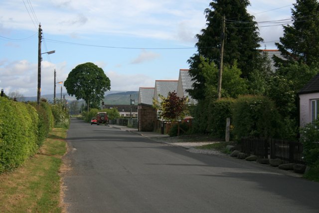
Newton is a small village located in Dumfriesshire, a historic county in the southwest of Scotland. Situated near the banks of the River Nith, it lies approximately 15 miles northwest of Dumfries, the county town. The village is nestled amidst picturesque rolling hills and lush green countryside, making it an idyllic retreat for nature enthusiasts.

Despite its small size, Newton boasts a rich history. The village was established in the 17th century and was originally an important trading hub, thanks to its strategic location along the river. Evidence of its past can still be seen today in the form of charming old buildings and narrow cobbled streets.

The heart of Newton is centered around its village square, where a handful of local businesses and amenities can be found. These include a cozy pub, a village shop, and a community hall that hosts various events throughout the year. The village exudes a friendly and close-knit atmosphere, with residents known for their warm hospitality and strong community spirit.

For those seeking outdoor activities, the surrounding area offers ample opportunities for exploration. The nearby Lowther Hills provide breathtaking views and are popular among hikers and cyclists. The River Nith also offers excellent fishing spots for anglers.

Overall, Newton is a tranquil and picturesque village that offers a peaceful escape from the bustle of city life. Its rich history, natural beauty, and tight-knit community make it a hidden gem in the Dumfriesshire countryside.

If you have any feedback on the listing, please let us know in the comments section below.

Newton Images

Images are sourced within 2km of 55.239582/-3.3990262 or Grid Reference NY1194. Thanks to Geograph Open Source API. All images are credited.

Start of the path, Wamphray Glen An information board near the road junction at Wamphray Bridge. There is room to park a few cars nearby.
Start of the path, Wamphray Glen
An information board near the road junction at Wamphray Bridge. There is room to park a few cars nearby.
The Wamphray Water Spring growth appearing in the woodland on the banks with Wamphray Bridge in the background.
The Wamphray Water
Spring growth appearing in the woodland on the banks with Wamphray Bridge in the background.
Footbridge over the Wamphray Water The path up the glen crosses here to follow the north bank of the Wamphray Water.
Footbridge over the Wamphray Water
The path up the glen crosses here to follow the north bank of the Wamphray Water.
The Wamphray Water from the footbridge Looking upstream from the bridge on the Wamphray Glen path.
The Wamphray Water from the footbridge
Looking upstream from the bridge on the Wamphray Glen path.
Field path by the Wamphray Water The Wamphray Glen path climbs to the top of the northern bank to follow the woodland edge towards Wamphray Mill.
Field path by the Wamphray Water
The Wamphray Glen path climbs to the top of the northern bank to follow the woodland edge towards Wamphray Mill.
Track to Hillhouse A track on the Wamphray Glen circular walk which can be started either at Wamphray Bridge or by Wamphray Parish Church.
Track to Hillhouse
A track on the Wamphray Glen circular walk which can be started either at Wamphray Bridge or by Wamphray Parish Church.
Hillhouse farm Farmland south of the Wamphray Water. The Wamphray Glen circular walk goes left past the farm to meet the minor road near the bridge.
Hillhouse farm
Farmland south of the Wamphray Water. The Wamphray Glen circular walk goes left past the farm to meet the minor road near the bridge.
A74(M), southbound The A74(M) & M74  run over 80 miles from the M6 at the Scottish border near Gretna to the M8 at Glasgow. This is one of the two most important routeways into Scotland from the south. The last stretch of the M74 opened in 2011 (see <a title="https://www.geograph.org.uk/snippet/590" href="https://www.geograph.org.uk/snippet/590">Link</a> ).
Wikipedia: <span class="nowrap"><a title="http://en.wikipedia.org/wiki/A74(M)_and_M74_motorways" rel="nofollow ugc noopener" href="http://en.wikipedia.org/wiki/A74(M)_and_M74_motorways">Link</a><img style="margin-left:2px;" alt="External link" title="External link - shift click to open in new window" src="https://s1.geograph.org.uk/img/external.png" width="10" height="10"/></span>
A74(M), southbound
The A74(M) & M74 run over 80 miles from the M6 at the Scottish border near Gretna to the M8 at Glasgow. This is one of the two most important routeways into Scotland from the south. The last stretch of the M74 opened in 2011 (see Link ). Wikipedia: LinkExternal link
Overbridge, A74(M)
Overbridge, A74(M)
Approaching J16, A74(M) The A74(M) & M74  run over 80 miles from the M6 at the Scottish border near Gretna to the M8 at Glasgow. This is one of the two most important routeways into Scotland from the south. The last stretch of the M74 opened in 2011 (see <a title="https://www.geograph.org.uk/snippet/590" href="https://www.geograph.org.uk/snippet/590">Link</a> ).
Wikipedia: <span class="nowrap"><a title="http://en.wikipedia.org/wiki/A74(M)_and_M74_motorways" rel="nofollow ugc noopener" href="http://en.wikipedia.org/wiki/A74(M)_and_M74_motorways">Link</a><img style="margin-left:2px;" alt="External link" title="External link - shift click to open in new window" src="https://s1.geograph.org.uk/img/external.png" width="10" height="10"/></span>
Approaching J16, A74(M)
The A74(M) & M74 run over 80 miles from the M6 at the Scottish border near Gretna to the M8 at Glasgow. This is one of the two most important routeways into Scotland from the south. The last stretch of the M74 opened in 2011 (see Link ). Wikipedia: LinkExternal link
Direction Sign – Signpost at Wamphray Bridge Located on the west side of the junction at Wamphray Bridge. 2 arms and pawn finial.

Milestone Society National ID: DF_NY1296
Direction Sign – Signpost at Wamphray Bridge
Located on the west side of the junction at Wamphray Bridge. 2 arms and pawn finial. Milestone Society National ID: DF_NY1296
Road junction near Newton Wamphray
Minor road in Annandale
Skip Knowe Standing Stone The standing stone at Skip Knowe.
Skip Knowe Standing Stone
The standing stone at Skip Knowe.
The M74 Viewed from a bridge at Green Rig.
The M74
Viewed from a bridge at Green Rig.
Bridge carrying minor road over M74 near Jocksthorn Bridge
M74 Southbound Southbound M74, north of Johnstonebridge.
M74 Southbound
Southbound M74, north of Johnstonebridge.
M74, Junction 16 The southbound M74 approaching the Johnstonebridge exit at junction 16.
M74, Junction 16
The southbound M74 approaching the Johnstonebridge exit at junction 16.
Show me another place!

Newton is located at Grid Ref: NY1194 (Lat: 55.239582, Lng: -3.3990262)

Unitary Authority: Dumfries and Galloway

Police Authority: Dumfries and Galloway

What 3 Words

///camped.heartache.triangle. Near Johnstonebridge, Dumfries & Galloway

Related Wikis

Newton Wamphray

Newton Wamphray is a village in Dumfries and Galloway. Wamphray is the name of the surrounding parish and of the Wamphray Water, which flows south-west...

Wamphray railway station

Wamphray railway station served Newton Wamphray, near Beattock, in the Scottish county of Dumfries and Galloway. It was served by local trains on what...

Annandale Water services

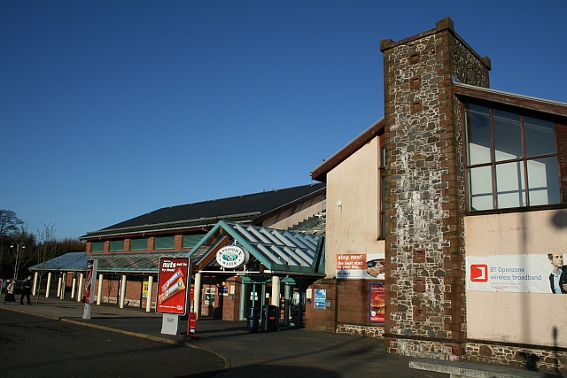
Annandale Water services is a motorway service station in the village of Johnstonebridge, Scotland. The service station is located next to the A74(M) motorway...

Annandale Water

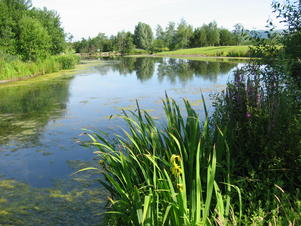
Annandale Water is a loch in Annandale, Dumfries and Galloway, in the south west of Scotland. It is part of Annandale Water service station at Junction...

Nearby Amenities

Located within 500m of 55.239582,-3.3990262
Bus Stop
Village
Bench: yes
Naptan AtcoCode: 680000234222
Naptan Bearing: S
Naptan CommonName: Village
Naptan Indicator: Station
Naptan Landmark: Station Road
Naptan NaptanCode: 34232968
Naptan Notes: none
Naptan Street: Main Road
Naptan Verified: no
Shelter: yes
Source: naptan_import
Lat/Long: 55.2401961/-3.3990064
Newton
Is In: Dumfries & Galloway, Scotland, UK
Place: hamlet
Lat/Long: 55.2399476/-3.3998847
Post Box
Ref: DG10 76
Source: survey
Lat/Long: 55.2409981/-3.3988781
Power: pole
Lat/Long: 55.235755/-3.3993924
Power: pole
Lat/Long: 55.2361883/-3.3990652
Power: pole
Lat/Long: 55.2369536/-3.3984444
Power: pole
Lat/Long: 55.2379024/-3.3983079
Power: pole
Lat/Long: 55.2387469/-3.3981791
Power: pole
Lat/Long: 55.2395782/-3.3980632
Power: pole
Lat/Long: 55.2400584/-3.3983414
Power: pole
Lat/Long: 55.2409352/-3.3985165
Power: pole
Lat/Long: 55.241157/-3.3989004
Power: pole
Lat/Long: 55.2386999/-3.3993331
Power: pole
Lat/Long: 55.2388482/-3.4004176
Power: pole
Lat/Long: 55.2389863/-3.4015484
Power: pole
Lat/Long: 55.2391434/-3.4026793
Power: pole
Lat/Long: 55.2399768/-3.4032012
Power: pole
Lat/Long: 55.2407311/-3.4036736
Power: pole
Lat/Long: 55.2415645/-3.4041733
Power: pole
Lat/Long: 55.2423781/-3.4047014
Power: pole
Lat/Long: 55.2398087/-3.4044515
Power: pole
Lat/Long: 55.2396017/-3.4059971
Wamphray
Historic Railway: station
Railway: site
Wikidata: Q7966951
Wikipedia: en:Wamphray railway station
Lat/Long: 55.2413708/-3.3958982
The data included in this document is from www.openstreetmap.org. The data is made available under ODbL.

Have you been to Newton?

Leave your review of Newton below (or comments, questions and feedback).