Newlands

Settlement in Renfrewshire

Scotland

Newlands

Approaching Clarkston Road on Muirend Road
Approaching Clarkston Road on Muirend Road Credit: Elliott Simpson

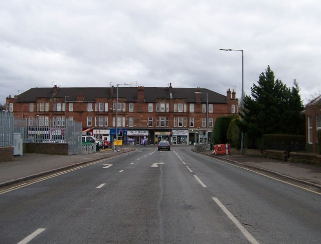
Newlands is a small residential area located in the county of Renfrewshire, Scotland. Situated on the outskirts of Glasgow, it is a popular suburb known for its peaceful and family-friendly environment.

Newlands is characterized by its leafy streets, well-maintained houses, and attractive green spaces. The area offers a mix of detached and semi-detached properties, making it an attractive option for families and professionals looking for a quieter place to live while still being within easy reach of the city center.

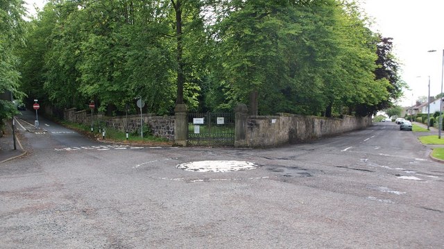
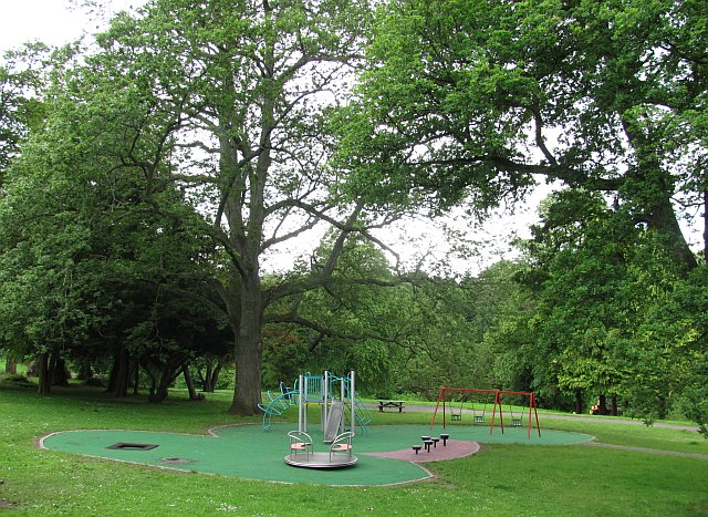
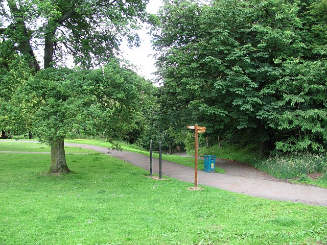
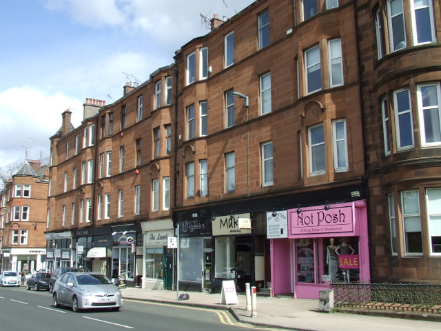
Residents of Newlands can enjoy the benefits of living in a well-established community. The area boasts a range of local amenities, including shops, restaurants, and cafes, providing convenience and a sense of community. There are also several parks and green spaces nearby, such as Newlands Park, which offers opportunities for leisure activities and outdoor recreation.

Transport links in Newlands are excellent, with regular bus services connecting the area to Glasgow city center and surrounding areas. The nearby M77 motorway provides easy access to other parts of Scotland, making it convenient for commuters.

Education is well catered for in Newlands, with several primary and secondary schools within the area. Additionally, there are various options for further education in nearby Glasgow.

Overall, Newlands offers a peaceful and family-friendly environment with excellent amenities, making it a desirable place to live for those seeking a suburban lifestyle within easy reach of the city.

If you have any feedback on the listing, please let us know in the comments section below.
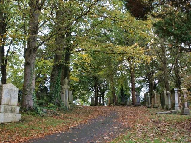
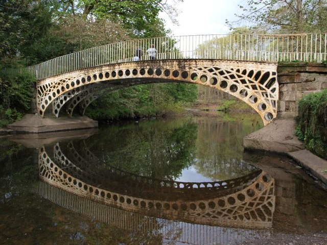
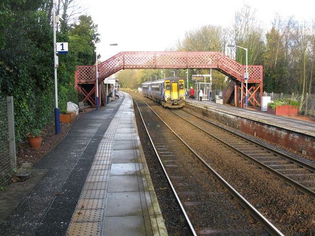
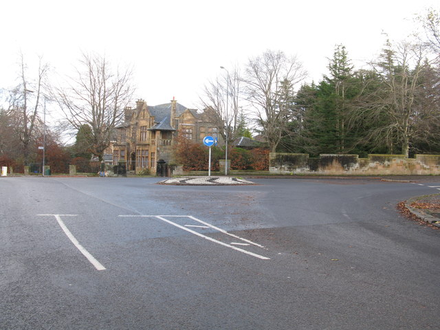
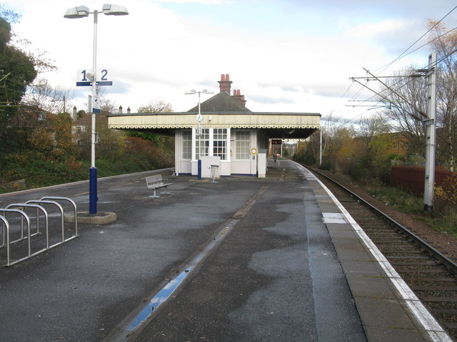
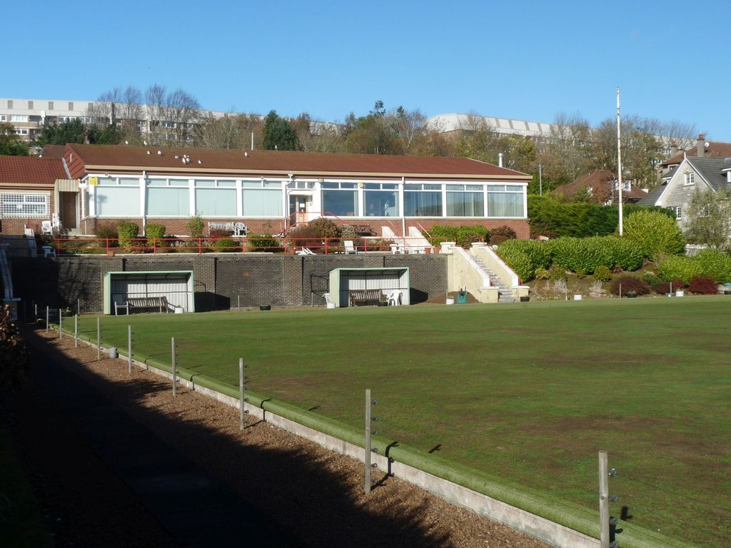
Newlands Images

Images are sourced within 2km of 55.81557/-4.2864167 or Grid Reference NS5660. Thanks to Geograph Open Source API. All images are credited.

Approaching Clarkston Road on Muirend Road
Mini-roundabout on Netherlee Road Netherlee Road meets Brenfield Road at this mini-roundabout. Netherlee Road splits Cathcart Cemetery in two and a gate into the northern section lies behind.
Mini-roundabout on Netherlee Road
Netherlee Road meets Brenfield Road at this mini-roundabout. Netherlee Road splits Cathcart Cemetery in two and a gate into the northern section lies behind.
Netherlee Road Netherlee Road used to provide a short-cut from Clarkston Road for some traffic heading north into the city. For many years it has been impossible to turn into it from Clarkston road (<a href="https://www.geograph.org.uk/photo/1342614">NS5759 : Traffic Island on Clarkston Road</a>). As shown here, it is also closed to south-heading traffic where it meets Brenfield Road.
Netherlee Road
Netherlee Road used to provide a short-cut from Clarkston Road for some traffic heading north into the city. For many years it has been impossible to turn into it from Clarkston road (NS5759 : Traffic Island on Clarkston Road). As shown here, it is also closed to south-heading traffic where it meets Brenfield Road.
Carleton Drive, Glasgow
Williamwood railway station, looking South-West View from platform 2 at Williamwood railway station, looking roughly South-West towards Neilston.
Williamwood railway station, looking South-West
View from platform 2 at Williamwood railway station, looking roughly South-West towards Neilston.
Williamwood railway station, looking North-East View from platform 2 at Williamwood railway station, looking roughly North-East towards Glasgow Central.
Williamwood railway station, looking North-East
View from platform 2 at Williamwood railway station, looking roughly North-East towards Glasgow Central.
Dorian Drive, Williamwood Looking roughly ENE along a section of Dorian Drive, Williamwood.
Dorian Drive, Williamwood
Looking roughly ENE along a section of Dorian Drive, Williamwood.
Dorian Drive, Williamwood Looking roughly WSW along a section of Dorian Drive, Williamwood.
Dorian Drive, Williamwood
Looking roughly WSW along a section of Dorian Drive, Williamwood.
Play apparatus, Linn Park Linn Park (73Ha) is the second largest park in Glasgow, according to the Council. (There may be other bigger ones looked after by the other local authorities). It is well wooded.
Play apparatus, Linn Park
Linn Park (73Ha) is the second largest park in Glasgow, according to the Council. (There may be other bigger ones looked after by the other local authorities). It is well wooded.
Linn Park Paths in the second largest park in Glasgow City Council's area (according to their website).
Linn Park
Paths in the second largest park in Glasgow City Council's area (according to their website).
Trees in Cathcart Cemetery On the lee of the hill the trees show the influence of the prevailing westerly winds.
Trees in Cathcart Cemetery
On the lee of the hill the trees show the influence of the prevailing westerly winds.
Tree in flood This slight hollow stands at the bottom of a slope in Linn Park popular for sledging in winter and egg-rolling on Easter Sunday. After the last few days' heavy rain quite a lot of water has collected there - not a particularly unusual sight in the winter.
Tree in flood
This slight hollow stands at the bottom of a slope in Linn Park popular for sledging in winter and egg-rolling on Easter Sunday. After the last few days' heavy rain quite a lot of water has collected there - not a particularly unusual sight in the winter.
Scene in Cathcart Cemetery
Bridge over the White Cart The bridge is viewed here from a little beach just to its south, on the other side from the view shown in <a href="https://www.geograph.org.uk/photo/1604980">NS5859 : Bridge over White Cart Water</a>. Since it is just upstream from the waterfall (<a href="https://www.geograph.org.uk/photo/984561">NS5859 : Waterfall in Linn Park</a>) and not far from the Clarkston Road entrance (<a href="https://www.geograph.org.uk/photo/1604974">NS5759 : Western entrance to Linn Park</a>) it sees lots of traffic from the Park's visitors. The river is not usually quite as tranquil as it was this afternoon.
Bridge over the White Cart
The bridge is viewed here from a little beach just to its south, on the other side from the view shown in NS5859 : Bridge over White Cart Water. Since it is just upstream from the waterfall (NS5859 : Waterfall in Linn Park) and not far from the Clarkston Road entrance (NS5759 : Western entrance to Linn Park) it sees lots of traffic from the Park's visitors. The river is not usually quite as tranquil as it was this afternoon.
Giffnock Railway Station The station between Clarkston and Thornliebank on the Glasgow South Western Line.
Giffnock Railway Station
The station between Clarkston and Thornliebank on the Glasgow South Western Line.
Roundabout in Muirend At the junction of Langside Drive and Muirend Road.
Roundabout in Muirend
At the junction of Langside Drive and Muirend Road.
Muirend Railway Station The station between Cathcart and Williamwood on the Neilston branch of the Cathcart Circle Line.
Muirend Railway Station
The station between Cathcart and Williamwood on the Neilston branch of the Cathcart Circle Line.
The White Bridge, Linn Park Footbridge spanning the White Cart Water just up river from the waterfall.
The White Bridge, Linn Park
Footbridge spanning the White Cart Water just up river from the waterfall.
Show me another place!

Newlands is located at Grid Ref: NS5660 (Lat: 55.81557, Lng: -4.2864167)

Unitary Authority: City of Glasgow

Police Authority: Greater Glasgow

What 3 Words

///wash.table.grain. Near Giffnock, East Renfrewshire

Nearby Locations

Newlands Auldhouse

Related Wikis

Newlands, Glasgow

Newlands is an affluent suburb in the south side of Glasgow, Scotland. The area is mainly residential in character. Shawlands and Langside lie to the north...

Auldhouse, Glasgow

Auldhouse is an area of the Scottish city of Glasgow. It is situated south of the River Clyde along the banks of the Auldhouse Burn, a tributary of the...

Muirend

Muirend is an area on the South side of Glasgow, Scotland. It is situated about 4 miles (6.5 km) south of Glasgow city centre. Muirend became extensively...

Hillpark

Hillpark (Scottish Gaelic: Pàirc a' Chnuic, Scots: Hullpairk) is an area in the city of Glasgow, Scotland. It is situated south of the River Clyde. Hillpark...

Nearby Amenities

Located within 500m of 55.81557,-4.2864167
Traffic Signals
Lat/Long: 55.8163282/-4.2886039
Traffic Signals
Traffic Signals: signal
Lat/Long: 55.8178398/-4.2927452
Turning Circle
Lat/Long: 55.8138347/-4.2827176
Newlands
Is In: Glasgow
Place: suburb
Wikidata: Q15262156
Wikipedia: en:Newlands, Glasgow
Lat/Long: 55.8171461/-4.2804376
Bus Stop
Bus: yes
Naptan AtcoCode: 6120137
Naptan NaptanCode: 37323293
Public Transport: platform
Source: survey
Lat/Long: 55.8124416/-4.292079
Bus Stop
Kilmarnock Road / Mulberry Road
Bus: yes
Naptan AtcoCode: 60902666
Naptan Bearing: SW
Naptan CommonName: Mulberry Road
Naptan Indicator: before
Naptan Landmark: Mulberry Road
Naptan NaptanCode: 45242587
Naptan Street: Kilmarnock Road
Public Transport: platform
Ref: 60902666
Source: survey
Lat/Long: 55.815246/-4.2895164
Bus Stop
Kilmarnock Road / Calderwood Road
Bus: yes
Naptan AtcoCode: 60902664
Naptan Bearing: SW
Naptan CommonName: Calderwood Road
Naptan Indicator: after
Naptan Landmark: Calderwood Road
Naptan NaptanCode: 45243628
Naptan Street: Kilmarnock Road
Public Transport: platform
Ref: 60902664
Source: survey
Lat/Long: 55.8166002/-4.2882542
Bus Stop
Kilmarnock Road / Carlaverock Road
Bus: yes
Naptan AtcoCode: 60902662
Naptan Bearing: S
Naptan CommonName: Carlaverock Road
Naptan Indicator: after
Naptan Landmark: Carlaverock Road
Naptan NaptanCode: 45235267
Naptan Street: Kilmarnock Road
Public Transport: platform
Ref: 60902662
Source: survey
Lat/Long: 55.8191297/-4.2873166
Bus Stop
Kilmarnock Road / Ledi Road
Bus: yes
Naptan AtcoCode: 60902667
Naptan Bearing: NE
Naptan CommonName: Ledi Road
Naptan Indicator: after
Naptan Landmark: Ledi Road
Naptan NaptanCode: 45234985
Naptan Street: Kilmarnock Road
Public Transport: platform
Ref: 60902667
Shelter: yes
Source: survey
Lat/Long: 55.8140165/-4.2909938
Bus Stop
Kilmarnock Road / Tinto Road
Bus: yes
Naptan AtcoCode: 60902665
Naptan Bearing: NE
Naptan CommonName: Tinto Road
Naptan Indicator: After
Naptan Landmark: Tinto Road
Naptan NaptanCode: 45243864
Naptan Street: Kilmarnock Road
Public Transport: platform
Ref: 60902665
Source: survey
Lat/Long: 55.8159204/-4.2891554
Bus Stop
Alloway Road / Mossgiel Road
Bus: yes
Naptan AtcoCode: 60902691
Naptan Bearing: W
Naptan CommonName: Mossgiel Road
Naptan Indicator: before
Naptan Landmark: Mossgiel Road
Naptan NaptanCode: 45242329
Naptan Street: Alloway Road
Public Transport: platform
Ref: 60902691
Lat/Long: 55.81927/-4.2883
Bus Stop
Alloway Road / Mossgiel Road
Bus: yes
Naptan AtcoCode: 60903667
Naptan Bearing: E
Naptan CommonName: Mossgiel Road
Naptan Indicator: Opp
Naptan Landmark: Mossgiel Road
Naptan NaptanCode: 45239769
Naptan Street: Alloway Road
Public Transport: platform
Ref: 60903667
Lat/Long: 55.81941/-4.28874
Bus Stop
Alloway Road / Lochlea Road
Bus: yes
Naptan AtcoCode: 60903995
Naptan Bearing: W
Naptan CommonName: Lochlea Road
Naptan Indicator: opp
Naptan Landmark: Lochlea Road
Naptan NaptanCode: 45293485
Naptan Street: Alloway road
Public Transport: platform
Ref: 60903995
Lat/Long: 55.8194/-4.29018
Bus Stop
Craiganour Street / Nether Auldhouse Road
Bench: no
Bin: no
Bus: yes
Lit: yes
Naptan AtcoCode: 60903668
Naptan Bearing: SW
Naptan CommonName: Holeburn Lane
Naptan Indicator: Opp
Naptan Landmark: Nether Auldhouse Road
Naptan NaptanCode: 45238738
Naptan Street: Craiganour Street
Public Transport: platform
Ref: 60903668
Shelter: no
Tactile Paving: no
Lat/Long: 55.81745/-4.29307
Bus Stop
Craiganour Street / Nether Auldhouse Road
Bench: no
Bin: yes
Bus: yes
Lit: yes
Naptan AtcoCode: 60902702
Naptan Bearing: NE
Naptan CommonName: Holeburn Lane
Naptan Indicator: after
Naptan Landmark: Nether Auldhouse Road
Naptan NaptanCode: 45235642
Naptan Street: Craiganour Street
Public Transport: platform
Ref: 60902702
Shelter: no
Tactile Paving: no
Lat/Long: 55.81762/-4.29308
Bus Stop
Glemspean Street / Beaufort Avenue
Bus: yes
Naptan AtcoCode: 60903996
Naptan Bearing: SW
Naptan CommonName: Beaufort Avenue
Naptan Indicator: opp
Naptan Landmark: Beaufort Avenue
Naptan NaptanCode: 45293486
Naptan Street: Glemspean Street
Public Transport: platform
Ref: 60903996
Lat/Long: 55.81844/-4.29198
Bus Stop
Glenspean Street / Beaufort Avenue
Bus: yes
Naptan AtcoCode: 60903997
Naptan Bearing: NE
Naptan CommonName: Beaufort Avenue
Naptan Indicator: before
Naptan Landmark: Beaufort Avenue
Naptan NaptanCode: 45293487
Naptan Street: Glenspean Street
Public Transport: platform
Ref: 60903997
Lat/Long: 55.81839/-4.29232
Bus Stop
Kilmarnock Road / Carlaverock Road
Bus: yes
Naptan AtcoCode: 60902663
Naptan Bearing: N
Naptan CommonName: Carlaverock Road
Naptan Indicator: opp
Naptan Landmark: Carlaverock Road
Naptan NaptanCode: 45243786
Naptan Street: Kilmarnock Road
Public Transport: platform
Ref: 60902663
Lat/Long: 55.8191/-4.28751
Bus Stop
Tinto Road / Cheviot Road
Bus: yes
Naptan AtcoCode: 60902711
Naptan Bearing: NE
Naptan CommonName: Cheviot Road
Naptan Indicator: after
Naptan Landmark: Cheviot Road
Naptan NaptanCode: 45235938
Naptan Street: Tinto Road
Public Transport: platform
Ref: 60902711
Lat/Long: 55.81513/-4.29205
Bus Stop
Tinto Road / Ledi Road
Bus: yes
Naptan AtcoCode: 60902712
Naptan Bearing: NE
Naptan CommonName: Hillpark Bowling Club
Naptan Indicator: At
Naptan Landmark: Ledi Road
Naptan NaptanCode: 45234869
Naptan Street: Tinto Road
Public Transport: platform
Ref: 60902712
Lat/Long: 55.81402/-4.29379
Bus Stop
Tinto Road / Cheviot Road
Bus: yes
Naptan AtcoCode: 60903675
Naptan Bearing: SW
Naptan CommonName: Cheviot Road
Naptan Indicator: Opp
Naptan Landmark: Cheviot Road
Naptan NaptanCode: 45235635
Naptan Street: Tinto Road
Public Transport: platform
Ref: 60903675
Lat/Long: 55.81493/-4.29206
Bus Stop
Tinto Road / Ledi Road
Bus: yes
Naptan AtcoCode: 60903676
Naptan Bearing: SW
Naptan CommonName: Hillpark Bowling Club
Naptan Indicator: Opp
Naptan Landmark: Ledi Road
Naptan NaptanCode: 45242796
Naptan Street: Tinto Road
Public Transport: platform
Ref: 60903676
Lat/Long: 55.81398/-4.2936
Merrylee
Place: suburb
Wikidata: Q15253155
Wikipedia: en:Merrylee
Lat/Long: 55.8137244/-4.2852401
Cafe
Dandelion Café
Addr Housenumber: 26
Addr Postcode: G43 2RY
Addr Street: Lubnaig Road
Contact Facebook: https://www.facebook.com/dandelioncafeG43/
Internet Access: wlan
Name En: Dandelion Café
Opening Hours: Mo-Su 09:00-17:00
Website: https://cafedandelion.wordpress.com/
Lat/Long: 55.8176923/-4.2823028
Cafe
Dandelion Cafe
Addr Housenumber: 26
Addr Street: Lubnaig Road
Lat/Long: 55.8177227/-4.2822799
Doctors
Merryvale Health Centre
Addr Housenumber: 4 - 6
Addr Street: Merryvale Place
Healthcare: doctor
Lat/Long: 55.8126999/-4.2916522
Crossing
Crossing: traffic_signals
Crossing Island: no
Tactile Paving: yes
Lat/Long: 55.81353/-4.2913048
Cycleway: asl
Lat/Long: 55.8177125/-4.2928762
Crossing
Crossing: traffic_signals
Lat/Long: 55.8177881/-4.2926037
Crossing
Crossing: traffic_signals
Lat/Long: 55.8179106/-4.2926742
Crossing
Crossing: traffic_signals
Lat/Long: 55.8178892/-4.2928819
Crossing
Crossing: traffic_signals
Lat/Long: 55.8177687/-4.2928184
Crossing
Crossing: traffic_signals
Lat/Long: 55.8162925/-4.2884997
Crossing
Crossing: traffic_signals
Lat/Long: 55.8164066/-4.2885285
Crossing
Crossing: traffic_signals
Lat/Long: 55.8163978/-4.2887932
Crossing
Crossing: traffic_signals
Lat/Long: 55.8162586/-4.2886742
Traffic Calming: cushion
Lat/Long: 55.8146683/-4.292578
The data included in this document is from www.openstreetmap.org. The data is made available under ODbL.

Have you been to Newlands?

Leave your review of Newlands below (or comments, questions and feedback).