Newham
Settlement in Lincolnshire East Lindsey
England
Newham

Newham is a small village located in the county of Lincolnshire, in the East Midlands region of England. It is situated near the town of Grantham and is surrounded by picturesque countryside and farmland.
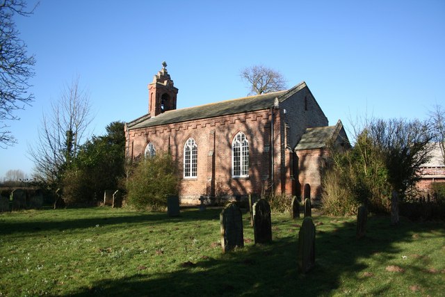
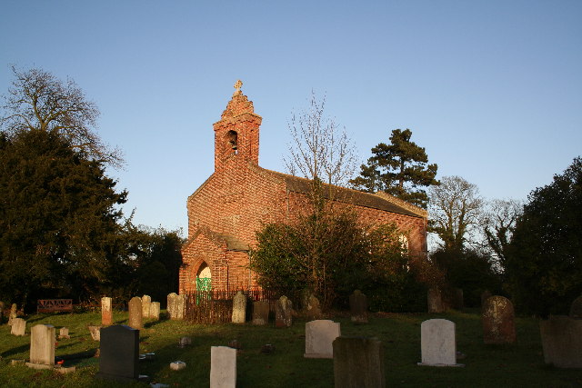
The village of Newham is known for its quaint and charming atmosphere, with traditional stone cottages and a historic parish church at its center. The village is home to a small community of residents, who enjoy a peaceful and rural way of life.
Newham has a strong sense of community, with local events and gatherings often taking place in the village hall or church. The village also has a primary school, providing education for the children in the area.
Surrounded by beautiful countryside, Newham offers residents and visitors the opportunity to enjoy scenic walks and outdoor activities. The village is also conveniently located near major road networks, providing easy access to nearby towns and cities.
Overall, Newham is a quiet and picturesque village in Lincolnshire, offering a peaceful and idyllic setting for those looking to escape the hustle and bustle of urban life.
If you have any feedback on the listing, please let us know in the comments section below.
Newham Images
Images are sourced within 2km of 53.0371/-0.0818 or Grid Reference TF2850. Thanks to Geograph Open Source API. All images are credited.


Newham is located at Grid Ref: TF2850 (Lat: 53.0371, Lng: -0.0818)
Division: Parts of Lindsey
Administrative County: Lincolnshire
District: East Lindsey
Police Authority: Lincolnshire
What 3 Words
///bunny.gripes.thudding. Near Sibsey, Lincolnshire
Nearby Locations
Related Wikis

Thornton le Fen
Thornton Le Fen is a small civil parish in the East Lindsey district of Lincolnshire, England. It is situated approximately 4 miles (6 km) north from the...

Sibsey Rural District
Sibsey was a rural district in Lincolnshire, Parts of Lindsey from 1894 to 1936. It was formed in 1894 from that part of the Boston rural sanitary district...
Langrick
Langrick is a small village in the East Lindsey district of Lincolnshire, England. It is in the civil parish of Langriville, and on the B1192 road, 5...
Langriville
Langriville is a civil parish in Lincolnshire, England, about 5 miles (8.0 km) north west of the town of Boston on the B1192, and on the banks of the...
Nearby Amenities
Located within 500m of 53.0371,-0.0818Have you been to Newham?
Leave your review of Newham below (or comments, questions and feedback).