Newham

Settlement in Northumberland

England

Newham

Entering  Chathill  on  the  road  from  Preston
Entering Chathill on the road from Preston Credit: Martin Dawes

Newham is a small village located in the county of Northumberland, in the northeastern part of England. Situated near the River Wansbeck, it is nestled amidst picturesque countryside, offering residents and visitors a serene and idyllic setting.

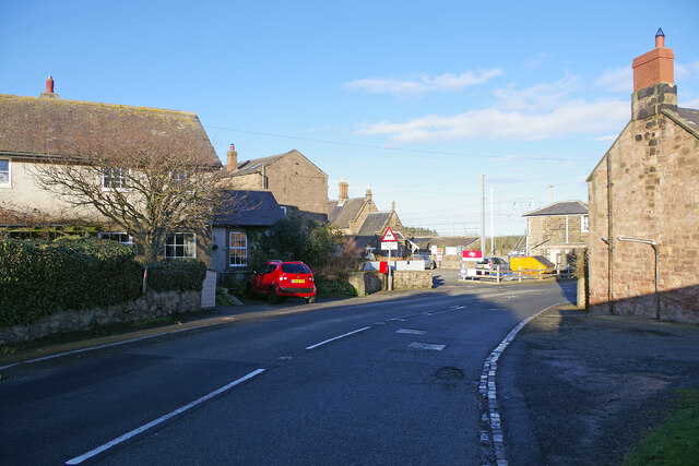
With a population of around 500 people, Newham is known for its close-knit community and friendly atmosphere. The village features a charming mix of historical and modern architecture, with traditional stone-built houses lining the streets. The local church, St. Mary's, dates back to the 13th century and is an architectural gem that attracts visitors interested in the region's history.

Nature enthusiasts are drawn to Newham due to its proximity to the stunning Northumberland National Park. The park offers ample opportunities for hiking, cycling, and exploring the great outdoors. Additionally, the nearby coast is easily accessible, providing residents with beautiful sandy beaches and coastal walks.

The village boasts a range of amenities, including a primary school, a village hall, and a pub, which serves as a social hub for the community. For shopping and other services, residents often visit the nearby town of Morpeth, which is just a short drive away.

Newham's location also makes it an ideal base for exploring the wider region. The vibrant city of Newcastle upon Tyne is within easy reach, offering a wealth of cultural attractions, shopping opportunities, and entertainment options.

Overall, Newham, Northumberland, is a picturesque village that offers a tranquil lifestyle amidst the stunning natural beauty of the Northumberland countryside.

If you have any feedback on the listing, please let us know in the comments section below.
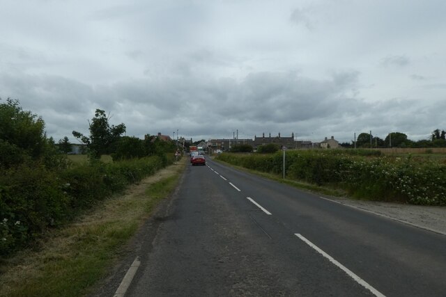
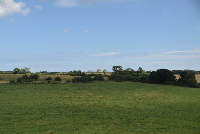
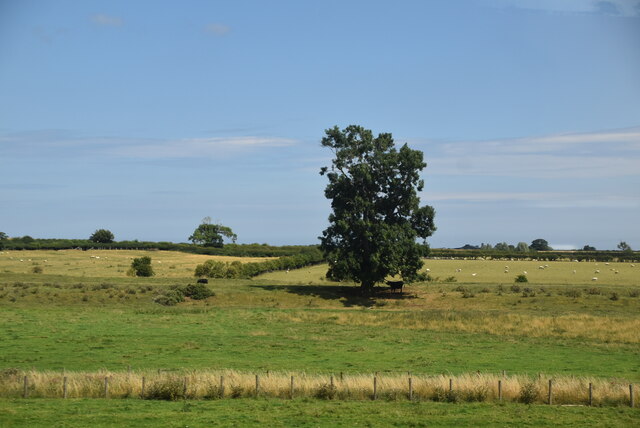
Newham Images

Images are sourced within 2km of 55.549474/-1.723384 or Grid Reference NU1728. Thanks to Geograph Open Source API. All images are credited.

Entering  Chathill  on  the  road  from  Preston
Entering Chathill on the road from Preston
Into  Chathill  railway station  ahead  round  bend Warning sign Level Crossing road sign
Into Chathill railway station ahead round bend
Warning sign Level Crossing road sign
Level  Crossing  at  Chathill  Station  on  East  Coast  main  line Station built in 1847 for the York, Newcastle and Berwick Railway Company. The station house is now privately owned and the station is unmanned
Level Crossing at Chathill Station on East Coast main line
Station built in 1847 for the York, Newcastle and Berwick Railway Company. The station house is now privately owned and the station is unmanned
Road  toward  Beadnell  leaving  Chathill The white house on the left is Pinewood
Road toward Beadnell leaving Chathill
The white house on the left is Pinewood
Approaching Chathill level crossing Looking along the road from Swinhoe as it approaches the village and the crossing of the East Coast Mainline.
Approaching Chathill level crossing
Looking along the road from Swinhoe as it approaches the village and the crossing of the East Coast Mainline.
Chathill Station car park Chathill station is situated on the East Coast Mainline and sees only a few trains per day.
Chathill Station car park
Chathill station is situated on the East Coast Mainline and sees only a few trains per day.
Approach to Chathill level crossing Looking towards Chathill as the barriers rise following the passage of 1V56.
Approach to Chathill level crossing
Looking towards Chathill as the barriers rise following the passage of 1V56.
Road north-east of Chathill The minor road stretches away from the railway level crossing at Chathill towards Swinhoe and Beadnell. The house on the left is called Pinewood.
Road north-east of Chathill
The minor road stretches away from the railway level crossing at Chathill towards Swinhoe and Beadnell. The house on the left is called Pinewood.
Chathill Level Crossing The level crossing carries a minor road across the East Coast Main Line at the south end of Chathill station. The signal box is grade II listed but is no longer in use for signalling trains. This photograph was taken on Boxing Day when all was quiet with no trains running.
Chathill Level Crossing
The level crossing carries a minor road across the East Coast Main Line at the south end of Chathill station. The signal box is grade II listed but is no longer in use for signalling trains. This photograph was taken on Boxing Day when all was quiet with no trains running.
Chathill Level Crossing Seen from the down platform at Chathill station, a minor road crosses the East Coast Main Line by means of this level crossing. The CCTV cameras that monitor the crossing can be seen at the top of the high pole. However, they would see no activity on this Boxing Day.
Chathill Level Crossing
Seen from the down platform at Chathill station, a minor road crosses the East Coast Main Line by means of this level crossing. The CCTV cameras that monitor the crossing can be seen at the top of the high pole. However, they would see no activity on this Boxing Day.
Chathill for Seahouses Perhaps surprisingly, the station at Chathill - itself no more than an isolated hamlet - has survived although the train service is meagre. It was at one time the junction for a branch to Seahouses but that closed in 1951. The station buildings are now a private residence but the occupant has placed this display of signs outside on the platform. The two 'totem' signs are of a design used by British Railways between 1948 and 1965 but the shape is so often adopted today by all sorts of businesses to signify a railway connection that they must be familiar to many people who do not remember the originals. The orange colour was used in British Railways' North Eastern Region.
Chathill for Seahouses
Perhaps surprisingly, the station at Chathill - itself no more than an isolated hamlet - has survived although the train service is meagre. It was at one time the junction for a branch to Seahouses but that closed in 1951. The station buildings are now a private residence but the occupant has placed this display of signs outside on the platform. The two 'totem' signs are of a design used by British Railways between 1948 and 1965 but the shape is so often adopted today by all sorts of businesses to signify a railway connection that they must be familiar to many people who do not remember the originals. The orange colour was used in British Railways' North Eastern Region.
Chathill Perhaps because it has an operational railway station, Chathill punches above its weight. The name is used in addresses for the surrounding area. In fact, however, Chathill is no more than a hamlet, most of which is visible in this view.
Chathill
Perhaps because it has an operational railway station, Chathill punches above its weight. The name is used in addresses for the surrounding area. In fact, however, Chathill is no more than a hamlet, most of which is visible in this view.
Northumberland pasture
Tall isolated tree
Tall isolated tree
Farmland, Newham
Farmland, Newham
Belted Galloway cattle The Belted Galloway is a heritage beef breed of cattle originating from Galloway in the west side of southern Scotland, adapted to living on the poor upland pastures and windswept moorlands of the region. The exact origin of the breed is unclear although it is often surmised that the white belt that distinguishes these cattle from the native black Galloway cattle may be as a result of cross breeding with Dutch Lakenvelder belted cattle. It is the belt that gives them their name.
Belted Galloways are primarily raised for their quality marbled beef, although they are sometimes milked and purchased to adorn pastures due to their striking appearance.
Belted Galloway cattle
The Belted Galloway is a heritage beef breed of cattle originating from Galloway in the west side of southern Scotland, adapted to living on the poor upland pastures and windswept moorlands of the region. The exact origin of the breed is unclear although it is often surmised that the white belt that distinguishes these cattle from the native black Galloway cattle may be as a result of cross breeding with Dutch Lakenvelder belted cattle. It is the belt that gives them their name. Belted Galloways are primarily raised for their quality marbled beef, although they are sometimes milked and purchased to adorn pastures due to their striking appearance.
View from a Newcastle-Edinburgh train - farmland near Chat Hill
View from a Newcastle-Edinburgh train - scrub and farmland near Newham
Show me another place!

Newham is located at Grid Ref: NU1728 (Lat: 55.549474, Lng: -1.723384)

Unitary Authority: Northumberland

Police Authority: Northumbria

What 3 Words

///impaled.agency.skips. Near Ellingham, Northumberland

Nearby Locations

Crutch Hill Newham

Related Wikis

Newham railway station

Newham railway station was a railway station that served the hamlet of Newham Hall, Northumberland, England from 1851 to 1950 on the East Coast Main Line...

Chathill railway station

Chathill is a railway station on the East Coast Main Line, which runs between London King's Cross and Edinburgh Waverley. The station, situated 46 miles...

West Fleetham

West Fleetham is a small hamlet in Northumberland, England situated about 4 miles from Seahouses and 2 miles from Chathill railway station. It originally...

Chathill

Chathill is a hamlet and former civil parish, now in the parish of Ellingham, in Northumberland, England. It is about 9 miles (14 km) north of Alnwick...

Nearby Amenities

Located within 500m of 55.549474,-1.723384
Newham
Place: hamlet
Wikidata: Q23636252
Lat/Long: 55.5491634/-1.7253069
Power: pole
Lat/Long: 55.5521027/-1.7233299
Power: pole
Lat/Long: 55.5481174/-1.7290481
Material: wood
Power: pole
Lat/Long: 55.5494004/-1.7272309
Power: pole
Lat/Long: 55.5528664/-1.7222404
Power: pole
Lat/Long: 55.5499757/-1.7264063
Power: pole
Lat/Long: 55.5513921/-1.7243554
Power: pole
Lat/Long: 55.5479582/-1.7292859
Power: pole
Lat/Long: 55.5535944/-1.72118
Power: pole
Lat/Long: 55.5506863/-1.7253894
Material: wood
Power: pole
Lat/Long: 55.5488364/-1.7280439
Newham
Crossing Barrier: double_half
Crossing Light: yes
Railway: level_crossing
Lat/Long: 55.5472256/-1.7277978
Crutch Hill
Place: locality
Lat/Long: 55.5458788/-1.7206721
Barrier: stile
Foot: no
Lat/Long: 55.5471637/-1.7279684
Newham
Historic Railway: station
Railway: site
Wikidata: Q28803289
Wikipedia: en:Newham railway station
Lat/Long: 55.5469304/-1.7273782
Crossing Barrier: double_half
Crossing Light: yes
Railway: level_crossing
Lat/Long: 55.547192/-1.7278394
Post Box
Collection Times: Mo-Fr 17:45, Sa 08:00
Ref: NE67 26
Royal Cypher: EIIR
Royal Cypher Wikidata: Q33102113
Lat/Long: 55.5489334/-1.7255905
The data included in this document is from www.openstreetmap.org. The data is made available under ODbL.

Have you been to Newham?

Leave your review of Newham below (or comments, questions and feedback).