Berkhamsted
Settlement in Hertfordshire Dacorum
England
Berkhamsted
Berkhamsted is a historic market town located in the county of Hertfordshire, England. Situated approximately 26 miles northwest of London, it lies in the Chiltern Hills, an Area of Outstanding Natural Beauty. The town has a population of around 20,000 residents.
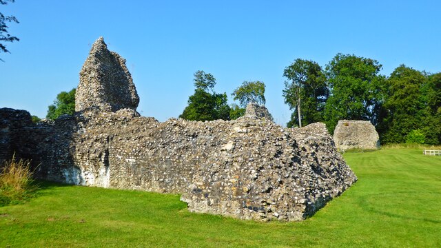
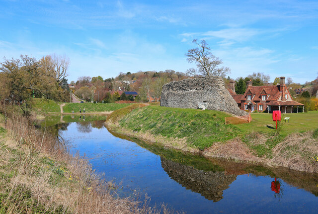
Berkhamsted is known for its rich history, dating back to the Saxon period. The town played a significant role during the Norman conquest of England and was the site of a famous castle, constructed in the 11th century. Today, the ruins of Berkhamsted Castle serve as a popular tourist attraction.
The town boasts a charming, picturesque high street lined with a mix of traditional and modern shops, cafes, and restaurants. It offers a range of amenities, including schools, a library, and healthcare facilities, making it an attractive place to live for families.
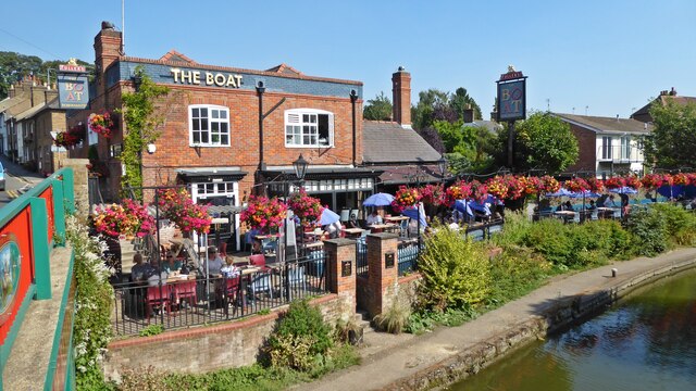
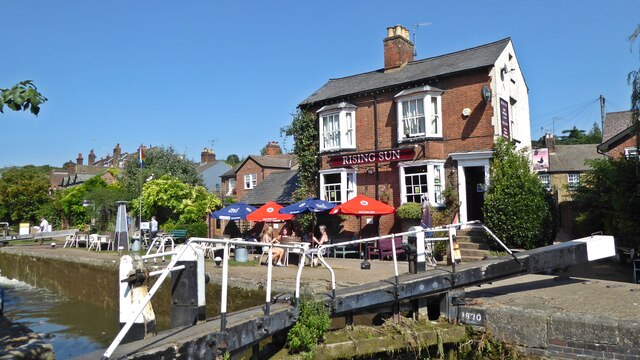
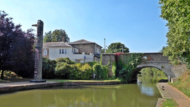
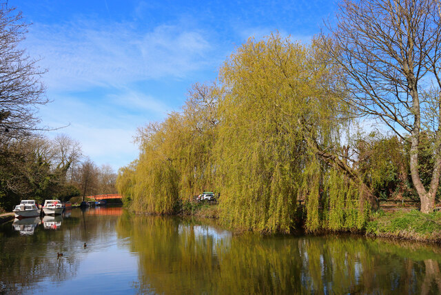
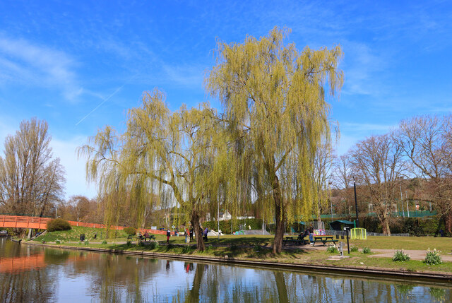
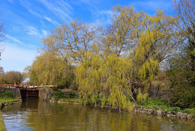
Nature enthusiasts can enjoy the beautiful countryside surrounding Berkhamsted, with numerous walking trails and parks in the area. The Grand Union Canal runs through the town, offering scenic views and opportunities for boating and fishing.
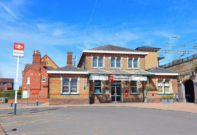
Transportation links are excellent, with Berkhamsted railway station providing regular train services to London Euston, as well as other major cities such as Birmingham. The town is also conveniently located near major road networks, including the M25 and M1 motorways.
Overall, Berkhamsted is a charming and historic town that successfully combines its rich heritage with modern amenities, making it an appealing destination for residents and visitors alike.
If you have any feedback on the listing, please let us know in the comments section below.
Berkhamsted Images
Images are sourced within 2km of 51.763679/-0.574632 or Grid Reference SP9808. Thanks to Geograph Open Source API. All images are credited.


Berkhamsted is located at Grid Ref: SP9808 (Lat: 51.763679, Lng: -0.574632)
Administrative County: Hertfordshire
District: Dacorum
Police Authority: Hertfordshire
What 3 Words
///cabbages.from.imported. Near Berkhamsted, Hertfordshire
Nearby Locations
Related Wikis

Berkhamsted Rural District
Berkhamsted Rural District was a rural district in Hertfordshire, England from 1894 to 1974, covering an area to the west of the county. Until 1937 the...
Berkhamsted F.C.
Berkhamsted Football Club is a football club from Berkhamsted, Hertfordshire, England. Founded in 2009 after Berkhamsted Town folded, they are currently...

Berkhamsted Town Hall
Berkhamsted Town Hall is a municipal building in the High Street, Berkhamsted, Hertfordshire, England. It is a Grade II listed building. == History... ==
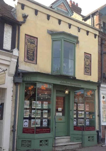
173, High Street, Berkhamsted
173, High Street, Berkhamsted, is a medieval building in Hertfordshire, England. It is considered to be the oldest extant jettied timber framed building...
Nearby Amenities
Located within 500m of 51.763679,-0.574632Have you been to Berkhamsted?
Leave your review of Berkhamsted below (or comments, questions and feedback).