New England

Settlement in Essex Braintree

England

New England

Sturmer: once a railway This path follows the trackbed of the Cambridge-Colchester Stour Valley railway line. The Shelford-Sudbury section of the railway closed in 1967.
Sturmer: once a railway Credit: John Sutton

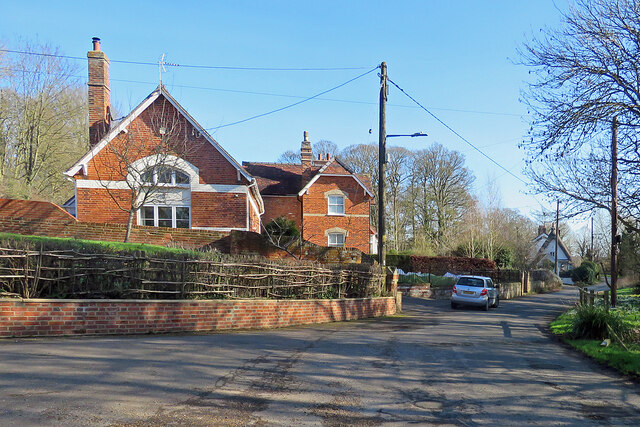
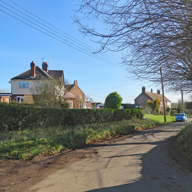
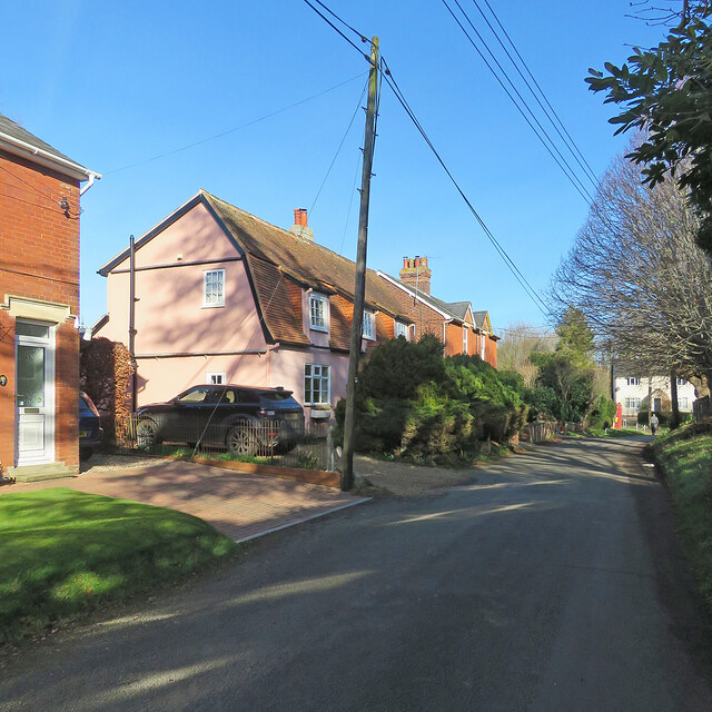
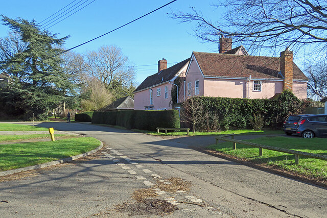
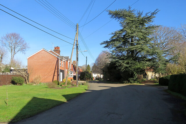
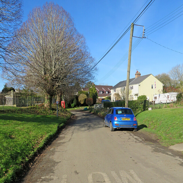
New England, Essex is a small village located in the county of Essex, in the eastern part of England. It is situated on the banks of the River Colne, approximately 55 miles northeast of London. With a population of around 5,000 residents, New England is known for its picturesque surroundings and rich history.

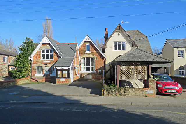
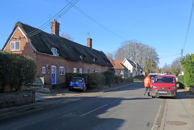
The village dates back to the medieval period and still retains much of its old-world charm. Its architecture is predominantly influenced by the Georgian and Victorian eras, with many well-preserved buildings lining its streets. The village center features a quaint marketplace, where locals and visitors can find a variety of shops, cafes, and traditional pubs.

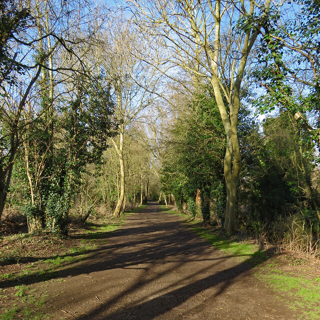
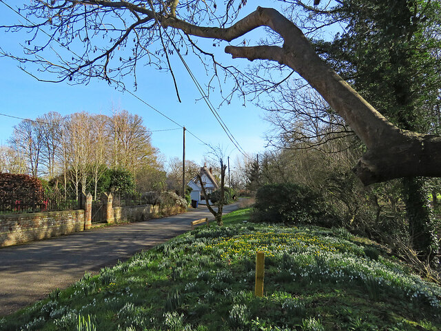
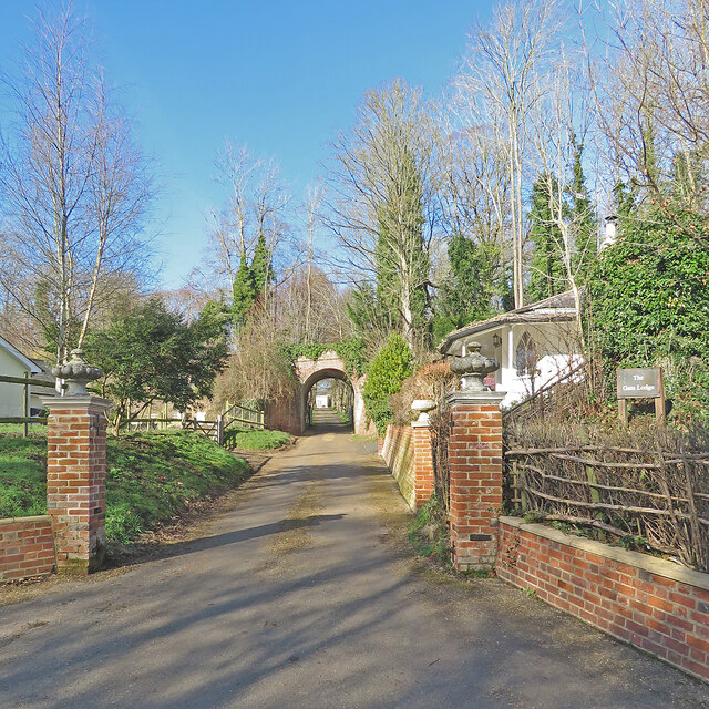
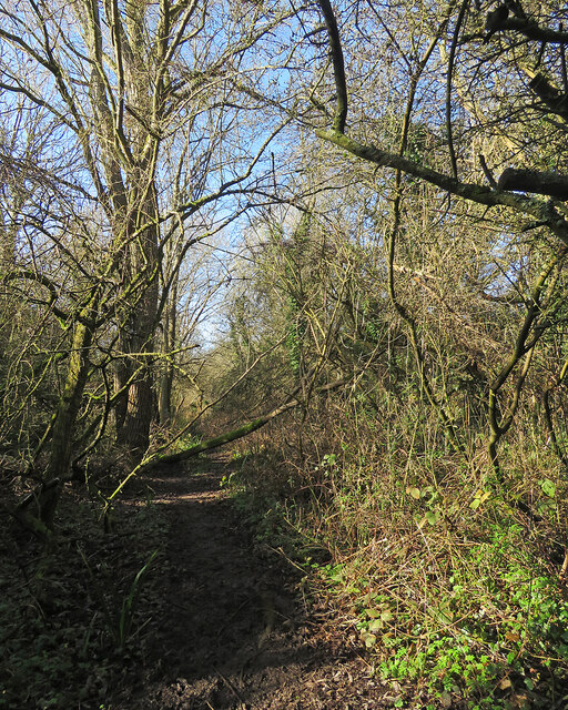
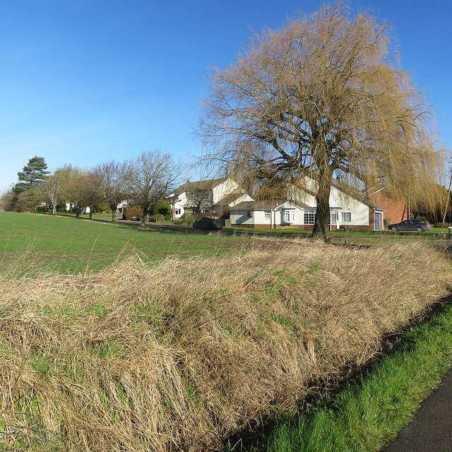
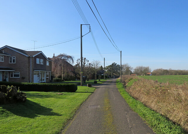
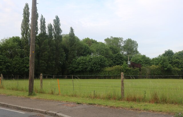
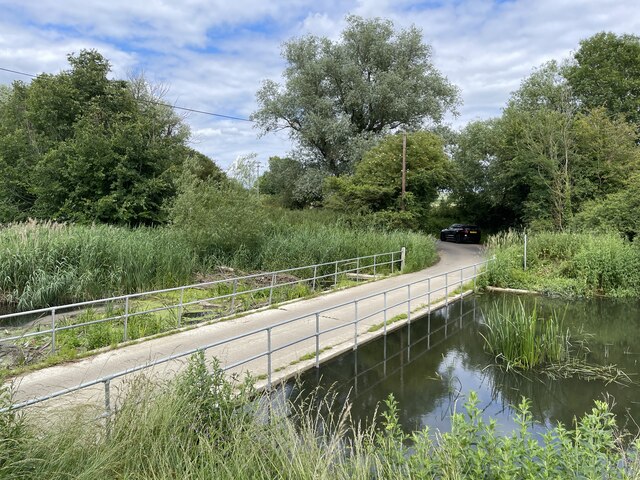
Nature enthusiasts are drawn to New England for its scenic beauty. The surrounding area boasts lush countryside, rolling hills, and the tranquil River Colne. There are several walking and cycling trails that offer stunning views of the rural landscape, making it a popular destination for outdoor activities.

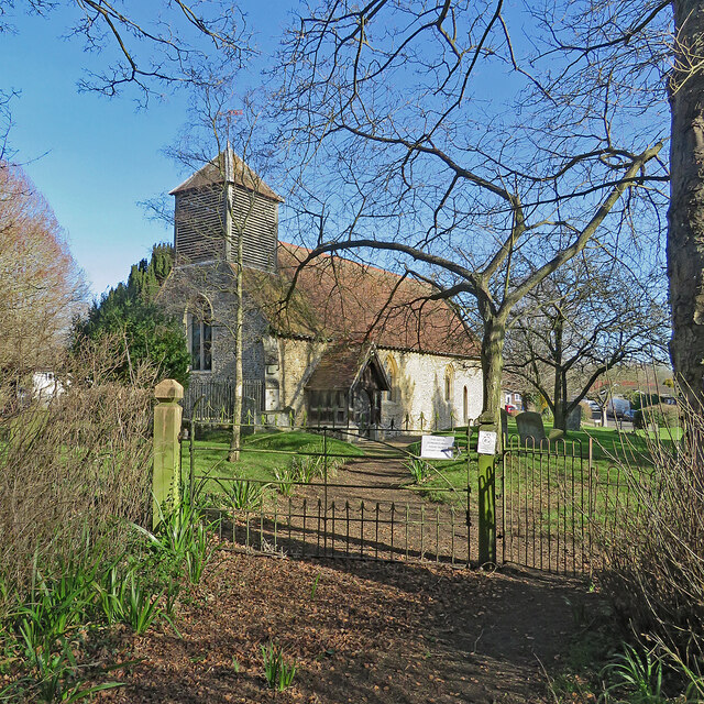
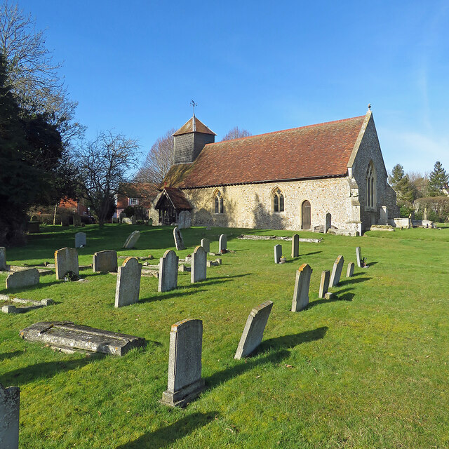
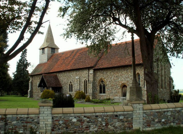
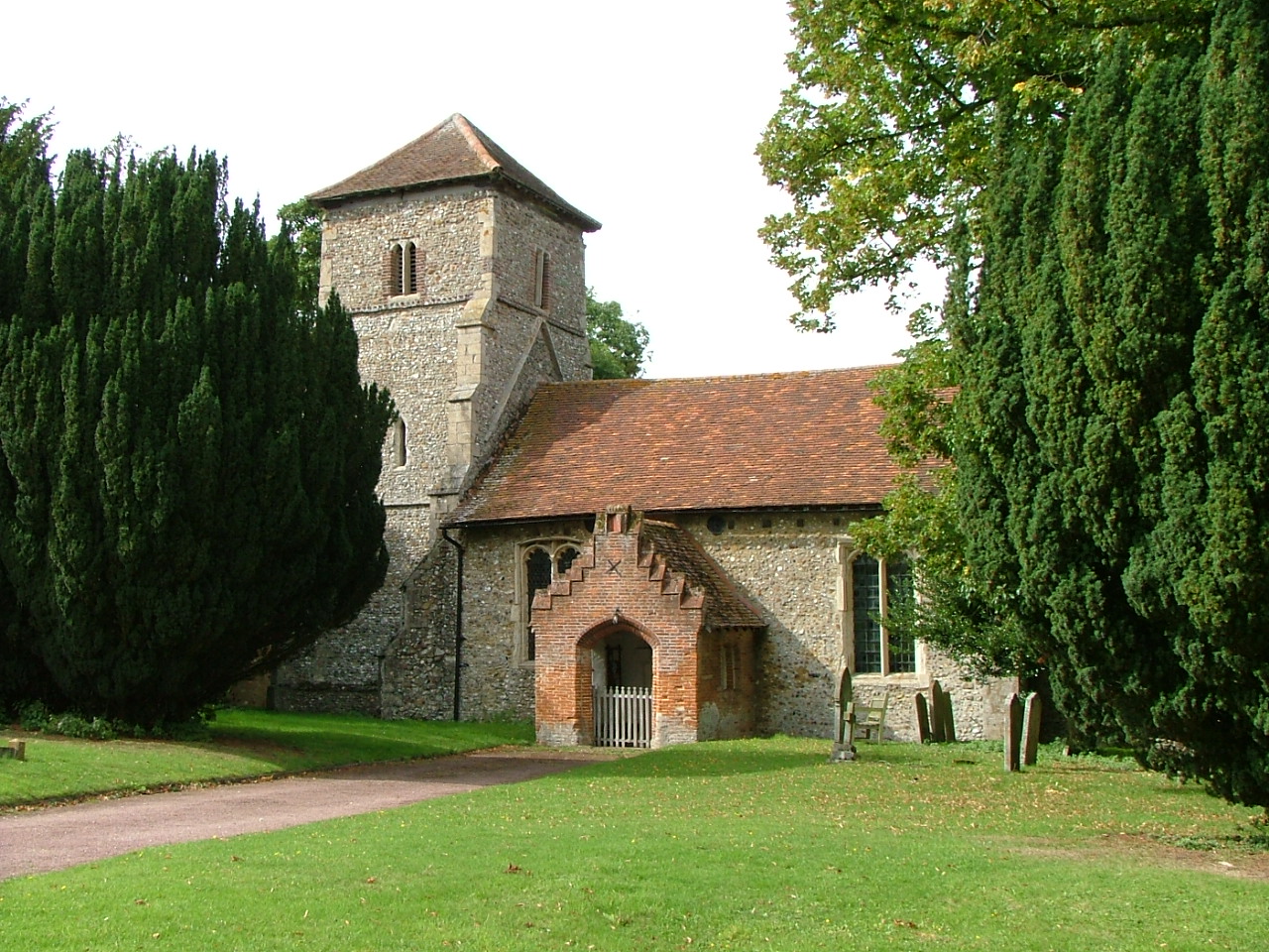
New England is also home to several historical landmarks, including the St. Mary's Church, which dates back to the 12th century. This beautiful church is known for its intricate stained glass windows and medieval architecture. Additionally, the nearby Layer Marney Tower, a Tudor gatehouse, attracts visitors with its grandeur and fascinating history.

Overall, New England, Essex offers a charming blend of natural beauty, historical significance, and a close-knit community, making it an attractive destination for both locals and tourists seeking a peaceful and idyllic retreat.

If you have any feedback on the listing, please let us know in the comments section below.

New England Images

Images are sourced within 2km of 52.056035/0.494485 or Grid Reference TL7142. Thanks to Geograph Open Source API. All images are credited.

Sturmer: once a railway This path follows the trackbed of the Cambridge-Colchester Stour Valley railway line. The Shelford-Sudbury section of the railway closed in 1967.
Sturmer: once a railway
This path follows the trackbed of the Cambridge-Colchester Stour Valley railway line. The Shelford-Sudbury section of the railway closed in 1967.
Sturmer Village Hall Victorian red brick, photographed from the other side of the A1017 on a bright February morning.
Sturmer Village Hall
Victorian red brick, photographed from the other side of the A1017 on a bright February morning.
Sturmer: pretty cottages and the postman A thatched red-brick row on the main road, the A1017, photographed on a brilliant February morning.
Sturmer: pretty cottages and the postman
A thatched red-brick row on the main road, the A1017, photographed on a brilliant February morning.
Wixoe: snowdrops and aconites on the verge The C17-C18 timber-framed thatched house in the middle distance is Grade II listed.
Wixoe: snowdrops and aconites on the verge
The C17-C18 timber-framed thatched house in the middle distance is Grade II listed.
Wixoe: The Old School The former village school, at the eastern end of the village.
Wixoe: The Old School
The former village school, at the eastern end of the village.
Wixoe: The Gate Lodge and a former railway bridge The Gate Lodge to Floriston Hall dates from the early 19th century, has pointed Gothick windows and is Grade II listed. There is a glimpse of the 19th-century Hall, also Grade II listed, through the railway arch. The bridge carried the Cambridge-Colchester Stour Valley Line until the Shelford to Sudbury section closed in 1967.
Wixoe: The Gate Lodge and a former railway bridge
The Gate Lodge to Floriston Hall dates from the early 19th century, has pointed Gothick windows and is Grade II listed. There is a glimpse of the 19th-century Hall, also Grade II listed, through the railway arch. The bridge carried the Cambridge-Colchester Stour Valley Line until the Shelford to Sudbury section closed in 1967.
Wixoe: once a railway cutting This overgrown cutting was, until the Sudbury to Shelford section closed in 1967, part of the Colchester-Cambridge (ahead) Stour Valley route.
Wixoe: once a railway cutting
This overgrown cutting was, until the Sudbury to Shelford section closed in 1967, part of the Colchester-Cambridge (ahead) Stour Valley route.
Wixoe: Church View Bright sunlight and deep shadows on a fine February morning.
Wixoe: Church View
Bright sunlight and deep shadows on a fine February morning.
Wixoe: Church Terrace Houses west of the church.
Wixoe: Church Terrace
Houses west of the church.
Wixoe: The Old Rectory "A C17 timber-framed and plastered house altered in the C18 and later. Two storeys. The windows are mainly casements. A C20 door has a lattice porch and a double-hung sash window above, with architrave and pediment" (Grade II listing text).
Wixoe: The Old Rectory
"A C17 timber-framed and plastered house altered in the C18 and later. Two storeys. The windows are mainly casements. A C20 door has a lattice porch and a double-hung sash window above, with architrave and pediment" (Grade II listing text).
Wixoe: near the corner of Stour Vale The willow at the corner of Stour Vale is winter yellow - but a closer look showed the tiniest traces of uncurling spring green in some leaves.
Wixoe: near the corner of Stour Vale
The willow at the corner of Stour Vale is winter yellow - but a closer look showed the tiniest traces of uncurling spring green in some leaves.
Wixoe: the road to Sturmer The western end of the village on a bright morning in February.
Wixoe: the road to Sturmer
The western end of the village on a bright morning in February.
Wixoe: nearing the church Church Terrace is on the left and there's a glimpse of St Leonard's Church through the trees on the right.
Wixoe: nearing the church
Church Terrace is on the left and there's a glimpse of St Leonard's Church through the trees on the right.
Wixoe: St Leonard's Church and gate There are two gates to the churchyard, one at the east end and this one south-west of the Grade II* listed church. The listing reads "A flint and stone church of C12 origin. Nave and chancel are C15. The south door is C12 with one order of shafts with scalloped capitals and zig-zag ornamentation on the arch. There is also a blocked Norman door on the north side. The windows are C19 or C20 restorations. Roof tiled, with a weatherboarded bell turret."
Wixoe: St Leonard's Church and gate
There are two gates to the churchyard, one at the east end and this one south-west of the Grade II* listed church. The listing reads "A flint and stone church of C12 origin. Nave and chancel are C15. The south door is C12 with one order of shafts with scalloped capitals and zig-zag ornamentation on the arch. There is also a blocked Norman door on the north side. The windows are C19 or C20 restorations. Roof tiled, with a weatherboarded bell turret."
Wixoe: St Leonard "A flint and stone church of C12 origin. Nave and chancel are C15. The south door is C12 with one order of shafts with scalloped capitals and zig-zag ornamentation on the arch. There is also a blocked Norman door on the north side. The windows are C19 or C20 restorations. Roof tiled, with a weatherboarded bell turret" (Grade II* listing text).
Wixoe: St Leonard
"A flint and stone church of C12 origin. Nave and chancel are C15. The south door is C12 with one order of shafts with scalloped capitals and zig-zag ornamentation on the arch. There is also a blocked Norman door on the north side. The windows are C19 or C20 restorations. Roof tiled, with a weatherboarded bell turret" (Grade II* listing text).
Wixoe: cloudless sky in February The churchyard is on the left, behind the railings.
Wixoe: cloudless sky in February
The churchyard is on the left, behind the railings.
Field by Mill Road, Baythorne End The trees on the left follow the River Stour, which marks the Essex border into Suffolk.
Field by Mill Road, Baythorne End
The trees on the left follow the River Stour, which marks the Essex border into Suffolk.
Ains Ford at Sturmer This is a much better image of this irish bridge ford at Sturmer. My previous attempt can be seen at:
<a title="https://www.geograph.org.uk/photo/3343240" href="https://www.geograph.org.uk/photo/3343240">Link</a>
Ains Ford at Sturmer
This is a much better image of this irish bridge ford at Sturmer. My previous attempt can be seen at: Link
Show me another place!

New England is located at Grid Ref: TL7142 (Lat: 52.056035, Lng: 0.494485)

Administrative County: Essex

District: Braintree

Police Authority: Essex

What 3 Words

///tomato.bedroom.lend. Near Steeple Bumpstead, Essex

Related Wikis

Wixoe

Wixoe is a village and civil parish in the West Suffolk district of Suffolk in eastern England. Located on the northern bank of the River Stour, two miles...

Birdbrook railway station

Birdbrook railway station was located 0.7 miles (1.1 km) to the northeast of the village of Birdbrook, Essex. It was 65 miles 74 chains (106.10 km; 65...

Stour Brook

Stour Brook is a river that starts north west of the town of Haverhill, Suffolk just over the Cambridgeshire border in the parish of West Wickham. After...

Baythorne End

Baythorne End is a hamlet in the English county of Essex, England. It is located directly on the border with Suffolk. The hamlet is within the civil parish...

Birdbrook

Birdbrook is a village and civil parish in Essex, England. It is located approximately 6 km (3.7 mi) southeast of Haverhill, Suffolk and is 34 km (21...

Whitley railway station

Whitley railway station was a temporary station on the former Colne Valley and Halstead Railway, three-quarters of a mile (1.2 km) to the east of the village...

Sturmer, Essex

Sturmer is a village in the county of Essex, England, 2 miles (3 km) SE of Haverhill and close to the county border with Suffolk. Its name was originally...

Boyton End, Suffolk

Boyton End is a hamlet in Suffolk, England. Boyton was recorded in the Domesday Book as Alia Boituna. == References ==

Nearby Amenities

Located within 500m of 52.056035,0.494485
New England
Place: hamlet
Lat/Long: 52.0559575/0.4918938
Pub
The Tavern
Phone: +44 1440 788277
Source: gps survey
Lat/Long: 52.0556871/0.4927346
Bus Stop
Birdbrook Tavern
Naptan AtcoCode: 1500IM2631
Naptan Bearing: SE
Naptan BusStopType: CUS
Naptan CommonName: Birdbrook Tavern
Naptan Crossing: Blois Road
Naptan Indicator: o/s
Naptan Landmark: Birdbrook Tavern
Naptan NaptanCode: esxdgwjt
Naptan Street: Rowley Hill
Naptan Verified: no
Public Transport: platform
Source: naptan_import
Lat/Long: 52.0562064/0.4923657
Birdbrook Tavern
Naptan AtcoCode: 1500IM2631AA
Naptan Bearing: NW
Naptan BusStopType: CUS
Naptan CommonName: Birdbrook Tavern
Naptan Crossing: Blois Road
Naptan Indicator: Opp
Naptan Landmark: Birdbrook Tavern
Naptan NaptanCode: esxgpjaj
Naptan Street: Rowley Hill
Naptan Verified: no
Public Transport: platform
Source: naptan_import
Lat/Long: 52.0561724/0.4922762
Power: pole
Lat/Long: 52.0601678/0.4939074
Power: pole
Lat/Long: 52.0561685/0.4929444
Power: pole
Lat/Long: 52.0599601/0.4964129
Power: pole
Lat/Long: 52.0585104/0.4942452
Power: pole
Lat/Long: 52.0598454/0.4977971
Power: pole
Lat/Long: 52.0590316/0.4945349
Power: pole
Lat/Long: 52.0602681/0.4927259
Power: pole
Lat/Long: 52.0573906/0.4936311
Power: pole
Lat/Long: 52.0595297/0.4948031
Power: pole
Lat/Long: 52.0568463/0.4933119
Power: pole
Lat/Long: 52.0580288/0.4939689
Power: pole
Lat/Long: 52.0600688/0.495102
Man Made: antenna
Lat/Long: 52.0577277/0.490247
Post Box
Operator: Royal Mail
Operator Wikidata: Q638098
Post Box Design: type_n
Post Box Mounting: pier
Post Box Type: lamp
Ref: CO9 16
Lat/Long: 52.0557169/0.492067
The data included in this document is from www.openstreetmap.org. The data is made available under ODbL.

Have you been to New England?

Leave your review of New England below (or comments, questions and feedback).