Abbey, New

Settlement in Kirkcudbrightshire

Scotland

Abbey, New

House near the A710 South of New Abbey. On the horizon the Waterloo Monument is just visible.
House near the A710 Credit: Eirian Evans

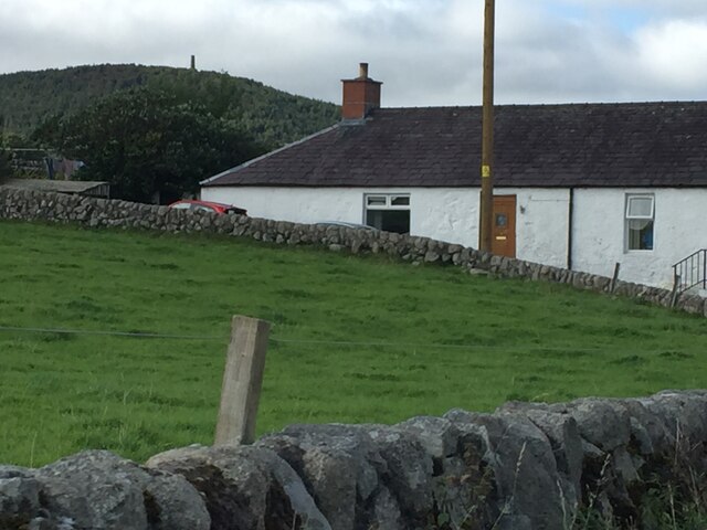
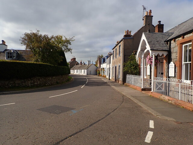
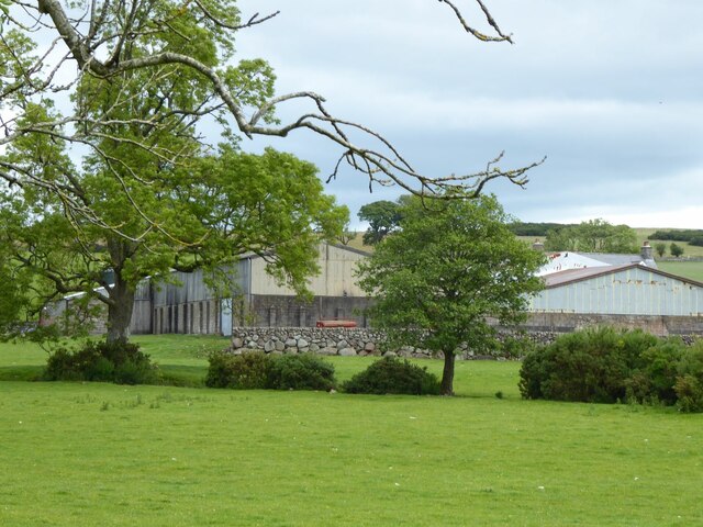
Abbey, New is a small village located in the region of Kirkcudbrightshire, in southwestern Scotland. Situated just a few miles north of the town of Dalbeattie, Abbey, New is a picturesque settlement known for its scenic beauty and historical significance.

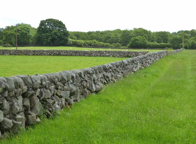
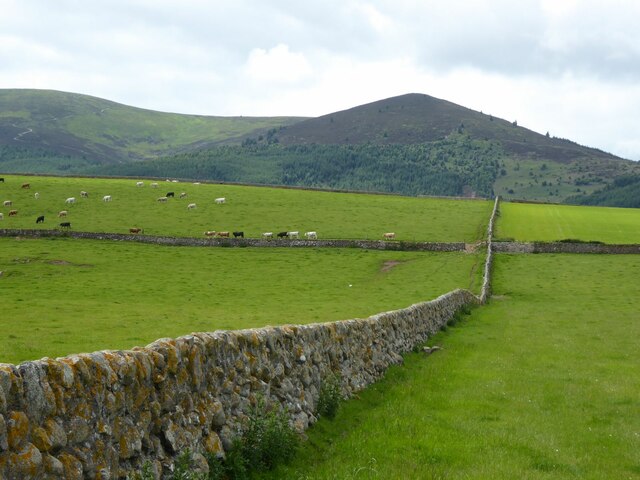
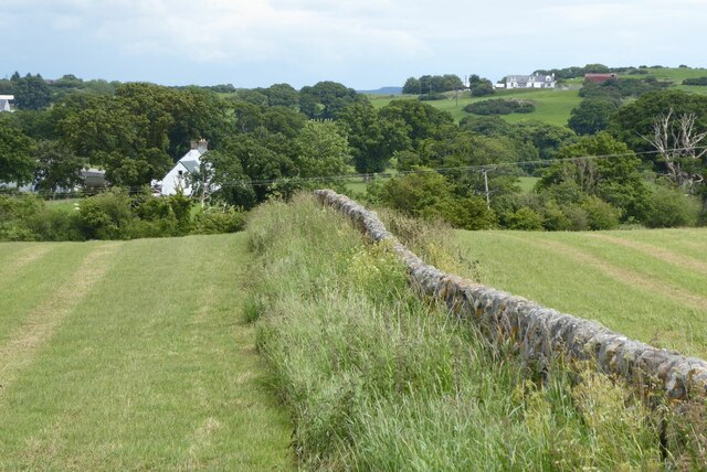
The village is surrounded by rolling hills and lush green fields, providing a peaceful and serene atmosphere for its residents and visitors. The nearby River Urr adds to the charm of the area, with its sparkling waters and abundant wildlife.

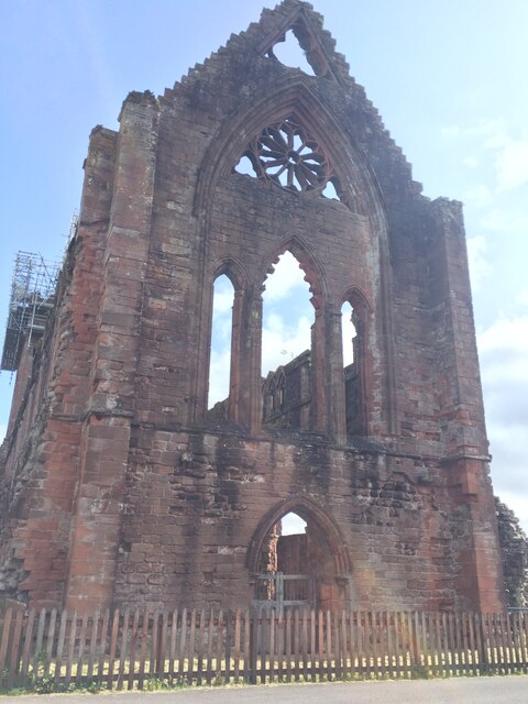
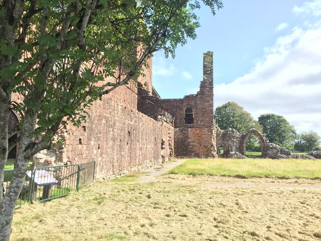
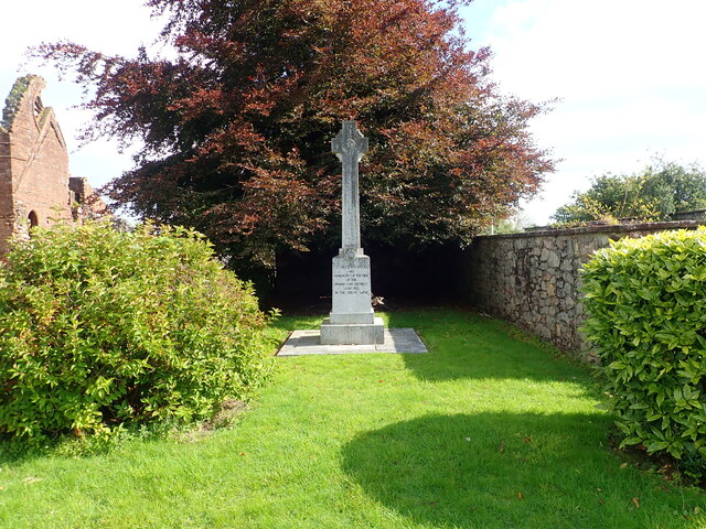
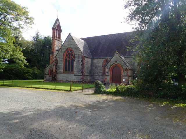
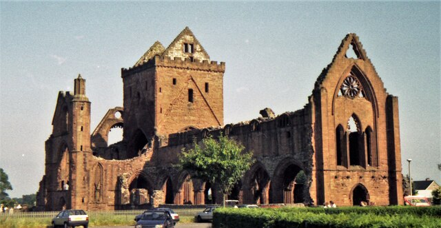
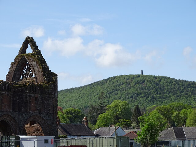
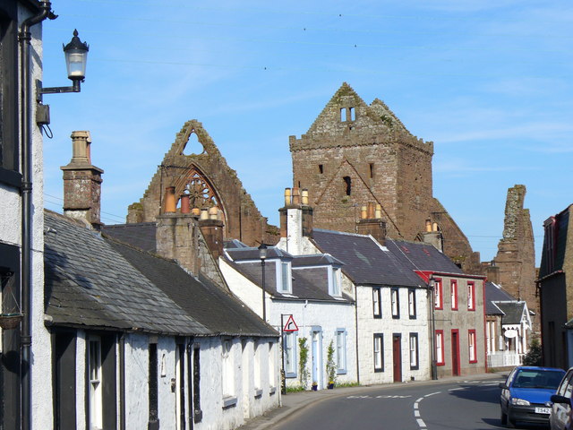
Abbey, New has a rich history dating back centuries, with evidence of human settlement in the area since prehistoric times. The village gets its name from the nearby Sweetheart Abbey, a Cistercian monastery founded in the 13th century. The abbey ruins are a popular tourist attraction, attracting history enthusiasts and nature lovers alike.

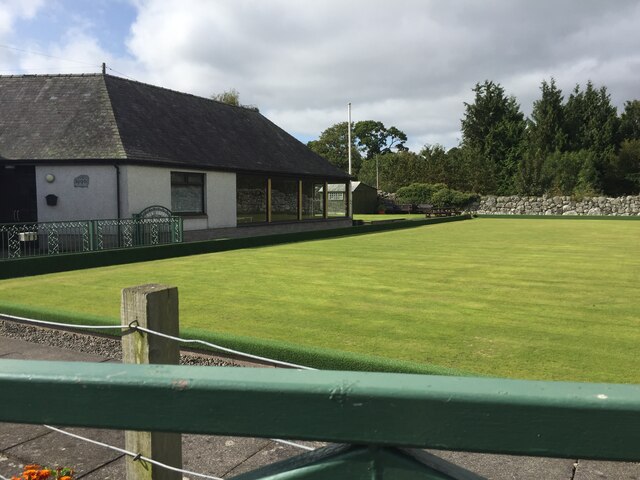
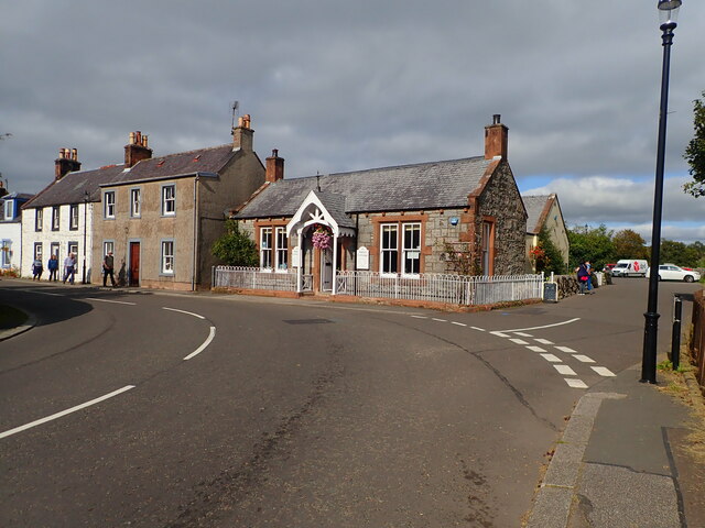
Despite its small size, Abbey, New offers amenities and services to its residents, including a local pub, a small grocery store, and a primary school. The village is well-connected to the surrounding areas by road, with easy access to Dalbeattie and other neighboring towns.

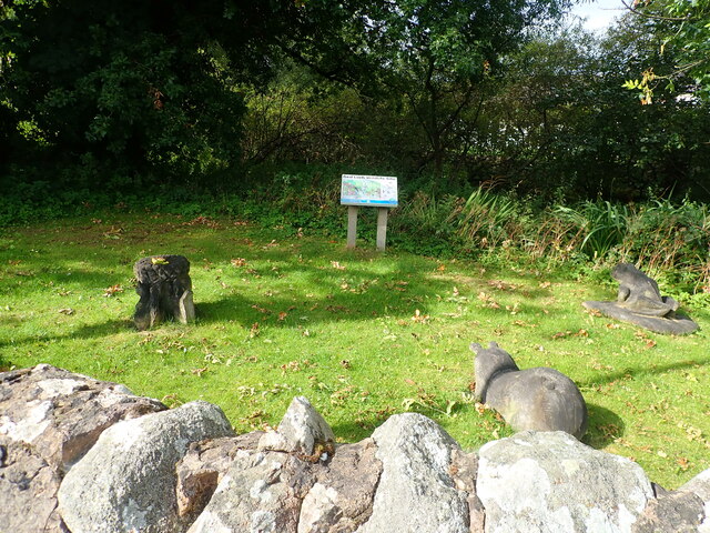
Outdoor enthusiasts will find plenty of opportunities for activities such as hiking, cycling, and fishing in the surrounding countryside. The Galloway Forest Park, with its stunning landscapes and Dark Sky Park designation, is also within easy reach from Abbey, New.

In conclusion, Abbey, New is a charming village with a rich history and natural beauty. It offers a peaceful and idyllic setting for its residents and visitors, with numerous opportunities for outdoor activities and exploration.

If you have any feedback on the listing, please let us know in the comments section below.
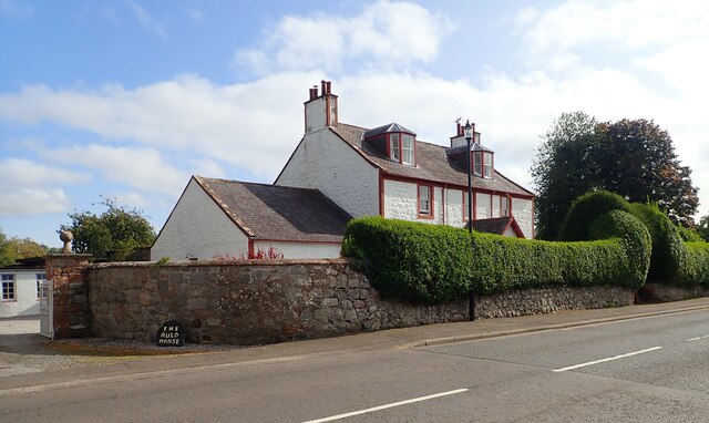
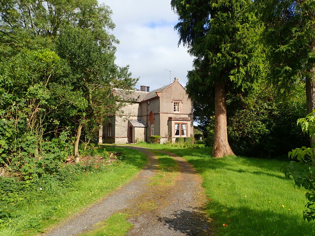
Abbey, New Images

Images are sourced within 2km of 54.981094/-3.6243903 or Grid Reference NX9666. Thanks to Geograph Open Source API. All images are credited.

House near the A710 South of New Abbey. On the horizon the Waterloo Monument is just visible.
House near the A710
South of New Abbey. On the horizon the Waterloo Monument is just visible.
New Abbey Bowling Club
Gable end of Sweetheart Abbey This splendid red-sandstone ruin of the late 13th century was founded by Lady Dervorgilla of Galloway, in memory of her husband Lord John Balliol.
Gable end of Sweetheart Abbey
This splendid red-sandstone ruin of the late 13th century was founded by Lady Dervorgilla of Galloway, in memory of her husband Lord John Balliol.
The ruins of Sweatheart Abbey
War Memorial, New Abbey A stone's throw from Sweetheart Abbey
War Memorial, New Abbey
A stone's throw from Sweetheart Abbey
Abbey Cottage tearoom Tearoom and gift shop on the corner of the main street, near the ruins of Sweetheart Abbey
Abbey Cottage tearoom
Tearoom and gift shop on the corner of the main street, near the ruins of Sweetheart Abbey
Auld Manse, New Abbey Built in 1802, this is a Category B listed building
Auld Manse, New Abbey
Built in 1802, this is a Category B listed building
St Mary's Catholic Church, New Abbey
Ged Loch Wildlife Site, New Abbey
New Abbey Parish Church
Main Street, New Abbey
Sweetheart Abbey in 1988 View from the north west
Sweetheart Abbey in 1988
View from the north west
Impressive stone wall At Martingirth farm.
Impressive stone wall
At Martingirth farm.
More fine stone walls At Martingirth farm.
More fine stone walls
At Martingirth farm.
Cattle in stone walled fields The shapely Cairn Knockendoch in the centre leading left up to Criffel.
Cattle in stone walled fields
The shapely Cairn Knockendoch in the centre leading left up to Criffel.
Carse downstream from New Abbey To the end of the wall and across the New Abbey Pow.
Carse downstream from New Abbey
To the end of the wall and across the New Abbey Pow.
Waterloo Monument The Waterloo Monument New Abbey, on a dull morning.
Waterloo Monument
The Waterloo Monument New Abbey, on a dull morning.
The Waterloo Memorial A view of the Waterloo Memorial from New Abbey graveyard.
The Waterloo Memorial
A view of the Waterloo Memorial from New Abbey graveyard.
Show me another place!

Abbey, New is located at Grid Ref: NX9666 (Lat: 54.981094, Lng: -3.6243903)

Unitary Authority: Dumfries and Galloway

Police Authority: Dumfries and Galloway

What 3 Words

///vertical.upwardly.rounds. Near Dumfries, Dumfries & Galloway

Nearby Locations

New Abbey Abbey, New

Related Wikis

National Museum of Costume

The National Museum of Costume was located at Shambellie House, in New Abbey, Dumfries and Galloway, Scotland and it formed part of the National Museums...

New Abbey

New Abbey (Scottish Gaelic: An Abaid Ùr) is a village in the historical county of Kirkcudbrightshire in Dumfries and Galloway, Scotland. It is 6 miles...

Sweetheart Abbey

The Abbey of Dulce Cor, better known as Sweetheart Abbey (Gaelic: An Abaid Ur), was a Cistercian monastery founded in 1275 in what is now the village of...

Abbey Vale F.C.

Abbey Vale Football Club are a football club based in the village of New Abbey in the historical county of Kirkcudbright shire in the Dumfries and Galloway...

River Nith

The River Nith (Scottish Gaelic: Abhainn Nid; Common Brittonic: Nowios) is a river in south-west Scotland. The Nith rises in the Carsphairn hills of East...

Glencaple

Glencaple is a small settlement in the Dumfries and Galloway area of Scotland. Situated on the banks of the River Nith, it once served as a port for nearby...

Criffel

Criffel is a hill in the historical county of Kirkcudbrightshire, Dumfries and Galloway, south-west Scotland. It is 570 m (1,870 ft) high but appears higher...

Mabie, Dumfries and Galloway

Mabie is a collection of mountain biking routes located in Dumfries and Galloway, southwest Scotland. The mountain bike routes are part of the 7Stanes...

Nearby Amenities

Located within 500m of 54.981094,-3.6243903
New Abbey
Is In: Dumfries & Galloway, Scotland, UK
Name Gd: An Abaid Ùr
Place: village
Wikidata: Q3338902
Wikipedia: en:New Abbey
Lat/Long: 54.9792329/-3.6207031
Cafe
New Abbey Tearooms
Lat/Long: 54.9801612/-3.6196285
Bus Stop
Post Office
Naptan AtcoCode: 680000026501
Naptan Bearing: E
Naptan BusStopType: CUS
Naptan CommonName: Post Office
Naptan Indicator: o/s PO
Naptan Landmark: Post Office
Naptan NaptanCode: 34235749
Naptan Notes: none
Naptan Street: Main Road
Naptan Verified: no
Source: naptan_import
Lat/Long: 54.9799723/-3.6219056
Bus Stop
Post Office
Naptan AtcoCode: 680000026502
Naptan Bearing: W
Naptan BusStopType: CUS
Naptan CommonName: Post Office
Naptan Indicator: opp PO
Naptan Landmark: Post office
Naptan NaptanCode: 34235752
Naptan Notes: none
Naptan Street: Main Road
Naptan Verified: no
Source: naptan_import
Lat/Long: 54.9797806/-3.6221323
National Museum of Costume
Tourism: museum
Wikidata: Q1967480
Wikipedia: en:National Museum of Costume
Lat/Long: 54.9832474/-3.6258796
Bench
Lat/Long: 54.9778091/-3.6240775
Criffel Inn
Tourism: hotel
Lat/Long: 54.9798866/-3.6221413
Abbey Arms
Tourism: hotel
Lat/Long: 54.9798089/-3.6221632
Post Box
Ref: DG2 109
Lat/Long: 54.9799695/-3.6220491
Power: pole
Source: bing
Lat/Long: 54.9781311/-3.6278781
Power: pole
Source: bing
Lat/Long: 54.9782463/-3.6222723
Power: pole
Source: bing
Lat/Long: 54.9788697/-3.6217627
Power: pole
Source: bing
Lat/Long: 54.978594/-3.6293925
Power: pole
Source: bing
Lat/Long: 54.9777325/-3.6265638
Power: pole
Source: bing
Lat/Long: 54.9775905/-3.6242759
Power: pole
Source: bing
Lat/Long: 54.9796565/-3.6205071
Power: pole
Source: bing
Lat/Long: 54.9792794/-3.6211243
Power: pole
Source: bing
Lat/Long: 54.9776336/-3.6227765
Power: pole
Source: bing
Lat/Long: 54.9775751/-3.6250028
Power: pole
Source: bing
Lat/Long: 54.977126/-3.6251288
Power: pole
Source: bing
Lat/Long: 54.9790433/-3.6308903
Power: pole
Source: bing
Lat/Long: 54.9788374/-3.6246435
Power: pole
Source: bing
Lat/Long: 54.9797056/-3.6253838
Power: pole
Source: bing
Lat/Long: 54.9792838/-3.6250217
Power: pole
Source: bing
Lat/Long: 54.9782233/-3.6248151
Historic: memorial
Memorial: war_memorial
Lat/Long: 54.9798643/-3.6193444
Power: pole
Source: Bing
Lat/Long: 54.9829254/-3.6220362
Power: pole
Source: Bing
Lat/Long: 54.9824929/-3.6189599
Power: pole
Source: Bing
Lat/Long: 54.9827146/-3.6205129
Power: pole
Source: Bing
Lat/Long: 54.9832948/-3.6232245
Power: pole
Source: Bing
Lat/Long: 54.9822635/-3.6173369
Bench
Lat/Long: 54.9796098/-3.6234141
Bench
Source: survey
Lat/Long: 54.9792009/-3.6196221
Bench
Lat/Long: 54.979636/-3.6237676
Bench
Source: survey
Lat/Long: 54.9790854/-3.6194725
Crossing
Lat/Long: 54.9790707/-3.6234161
Bench
Lat/Long: 54.9796142/-3.6235224
Bench
Lat/Long: 54.9796477/-3.6239954
Defibrillator
Defibrillator Location: Oddfellow Hall. External wall, right hand side of door. New Abbey.
Emergency: defibrillator
Indoor: no
Lat/Long: 54.980062/-3.6202355
The data included in this document is from www.openstreetmap.org. The data is made available under ODbL.

Have you been to Abbey, New?

Leave your review of Abbey, New below (or comments, questions and feedback).