Benwick

Settlement in Cambridgeshire Fenland

England

Benwick

Ibberson's Drove down to Betty's Nose farm Ibberson's Drove down to Betty's Nose farm
Ibberson's Drove down to Betty's Nose farm Credit: Shaun Ferguson

Benwick is a small village located in the Fenland district of Cambridgeshire, England. It is situated about 13 miles northwest of the city of Cambridge and roughly 9 miles east of Peterborough. With a population of around 1,500 residents, Benwick is a close-knit community that offers a peaceful and rural lifestyle.

The village is surrounded by picturesque countryside, characterized by flat fenland landscapes and farmlands. The area is known for its rich agricultural heritage, with farming being an important part of the local economy. Benwick benefits from its proximity to the River Nene, which flows nearby and provides opportunities for boating and fishing.

Despite its small size, Benwick offers a range of amenities to its residents. These include a primary school, a village hall, a community center, a post office, and a convenience store. The village also has a pub, providing a social hub for locals to gather and enjoy a drink or meal.

For outdoor enthusiasts, Benwick offers several recreational areas and green spaces. The village has a playing field, which is home to various sports clubs and hosts community events. There are also several footpaths and nature trails in the surrounding countryside, allowing residents to explore the natural beauty of the area.

Overall, Benwick is a charming and peaceful village that offers a close-knit community, beautiful countryside, and a range of amenities for its residents.

If you have any feedback on the listing, please let us know in the comments section below.
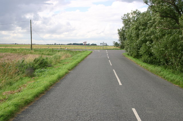
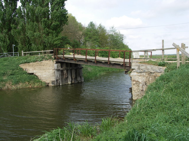
Benwick Images

Images are sourced within 2km of 52.493498/-0.024131 or Grid Reference TL3490. Thanks to Geograph Open Source API. All images are credited.

Ibberson's Drove down to Betty's Nose farm Ibberson's Drove down to Betty's Nose farm
Ibberson's Drove down to Betty's Nose farm
Ibberson's Drove junction with B1096 Ibberson's Drove junction with B1096
Ibberson's Drove junction with B1096
Ploughing south of Benwick, Cambs The scene is viewed from the B1096, Ramsey Road; the soils have a dark humose surface after wastage of the former peat cover, and are classed as Downholland series, 'humic alluvial gley soils' developed in Fen Clay. The wheat harvest continues to the left and in the distance the drain is being mown.
Ploughing south of Benwick, Cambs
The scene is viewed from the B1096, Ramsey Road; the soils have a dark humose surface after wastage of the former peat cover, and are classed as Downholland series, 'humic alluvial gley soils' developed in Fen Clay. The wheat harvest continues to the left and in the distance the drain is being mown.
Road towards Marley Farm
Fenland Drain Taken from the south east corner of TL3289
Fenland Drain
Taken from the south east corner of TL3289
Footpath to Households Farm Recently cut grass footpath to Households Farm
Footpath to Households Farm
Recently cut grass footpath to Households Farm
Great Lots Road track Great Lots Road track heading South from Benwick
Great Lots Road track
Great Lots Road track heading South from Benwick
Farmland on Benwich Mere This area of farmland was once a shallow lake, mere, and now it has been drained it sits below sea level
Farmland on Benwich Mere
This area of farmland was once a shallow lake, mere, and now it has been drained it sits below sea level
Households Farm on Benwick Mere Although still shown as a farm on O.S. mapping all the buildings appear to have been demolished when viewed on Google Earth
Households Farm on Benwick Mere
Although still shown as a farm on O.S. mapping all the buildings appear to have been demolished when viewed on Google Earth
Farmland track on Benwick Mere This area of farmland was once a shallow lake, mere, and now it has been drained it sits below sea level
Farmland track on Benwick Mere
This area of farmland was once a shallow lake, mere, and now it has been drained it sits below sea level
Doddington Road, Benwick The B1093, closed for a village fair at Doddington.
Doddington Road, Benwick
The B1093, closed for a village fair at Doddington.
Entrance to White Fen Farm A construction site on Whittlesey Road.
Entrance to White Fen Farm
A construction site on Whittlesey Road.
Roadside by White Fen Farm
Turf Fen Looking north from Ramsey Road over the flat fenland landscape.
Turf Fen
Looking north from Ramsey Road over the flat fenland landscape.
Floods Ferry Road, Ranson Moor, March Approaching the junction with the B1093 Doddington Road at Copalder Corner
Floods Ferry Road, Ranson Moor, March
Approaching the junction with the B1093 Doddington Road at Copalder Corner
B1093 Doddington Road, Ranson Moor, March At the junction with Floods Ferry Road at Copalder Corner
B1093 Doddington Road, Ranson Moor, March
At the junction with Floods Ferry Road at Copalder Corner
Roadsigns on the B1093 Doddington Road At the junction with Floods Ferry Road at Copalder Corner
Roadsigns on the B1093 Doddington Road
At the junction with Floods Ferry Road at Copalder Corner
Floods Ferry Road, Foods Ferry At the junction with the B1093 Doddington Road at Copalder Corner
Floods Ferry Road, Foods Ferry
At the junction with the B1093 Doddington Road at Copalder Corner
Show me another place!

Benwick is located at Grid Ref: TL3490 (Lat: 52.493498, Lng: -0.024131)

Division: Isle of Ely

Administrative County: Cambridgeshire

District: Fenland

Police Authority: Cambridgeshire

What 3 Words

///dares.cone.eggplants. Near Doddington, Cambridgeshire

Nearby Locations

Benwick Lilly Holt Benwick

Related Wikis

Benwick

Benwick is a village and civil parish in the Fenland district of Cambridgeshire, England. It is approximately 15 miles (24 km) from Peterborough and 30...

Flood's Ferry

Flood's Ferry and Knight's End are hamlets between Benwick and March, Cambridgeshire, England. Flood's Ferry is the site of a large marina on the old course...

Swingbrow

Swingbrow (sometimes written Swing Brow) is a hamlet near to Chatteris , Cambridgeshire lying alongside the Forty Foot Drain built by Vermuyden. A Neolithic...

Ramsey Forty Foot

Ramsey Forty Foot is a village in Ramsey civil parish, part of the Huntingdonshire district of Cambridgeshire, England. It lies on the Forty Foot Drain...

Forty Foot Drain

The Forty Foot or Forty Foot Drain is a name given to several of the principal channels in the drainage schemes of the Fens of Eastern England, the name...

Ramsey Mereside

Ramsey Mereside, known colloquially as "The Village", is a small village approximately 3.5 miles (5.6 km) north of the town of Ramsey, Cambridgeshire...

Doddington, Cambridgeshire

Doddington is a village and civil parish lying just off the A141 in the Isle of Ely, Cambridgeshire, approximately half way (4 miles (6 km)) between Chatteris...

Chatteris railway station

Chatteris railway station was a station in Chatteris, Cambridgeshire on the line between St Ives and March. For much of its history it was run by the Great...

Nearby Amenities

Located within 500m of 52.493498,-0.024131
Benwick
Place: village
Wikidata: Q2466120
Lat/Long: 52.4937114/-0.0243976
Bus Stop
Ramsey Road
Bus: yes
Naptan AtcoCode: 0500FBENW002
Naptan Bearing: NW
Naptan BusStopType: CUS
Naptan CommonName: Ramsey Road
Naptan Indicator: near
Naptan Landmark: Ramsey Road
Naptan NaptanCode: cmbdjmwt
Naptan ShortCommonName: Ramsey Road
Naptan Street: High Street
Naptan Verified: no
Public Transport: platform
Source: naptan_import
Lat/Long: 52.4926594/-0.0233271
Bus Stop
Ramsey Road
Bus: yes
Naptan AtcoCode: 0500FBENW003
Naptan Bearing: SE
Naptan BusStopType: CUS
Naptan CommonName: Ramsey Road
Naptan Indicator: opp
Naptan Landmark: Ramsey Road
Naptan NaptanCode: cmbdjpad
Naptan ShortCommonName: Ramsey Road
Naptan Street: High Street
Naptan Verified: no
Public Transport: platform
Source: naptan_import
Lat/Long: 52.4926688/-0.0231951
Bus Stop
Skeifs Row
Bus: yes
Naptan AtcoCode: 0500FBENW004
Naptan Bearing: N
Naptan BusStopType: CUS
Naptan CommonName: Skeifs Row
Naptan Indicator: near
Naptan Landmark: Skeifs Row
Naptan NaptanCode: cmbdjpag
Naptan ShortCommonName: Skeifs Row
Naptan Street: High Street
Naptan Verified: no
Public Transport: platform
Source: naptan_import
Lat/Long: 52.4940303/-0.0246691
Post Box
HIGH STREET
Post Box Type: wall
Ref: PE15 190
Royal Cypher: GR
Royal Cypher Wikidata: Q33102273
Lat/Long: 52.4942137/-0.0247604
Pub
The Five Alls
Lat/Long: 52.4940555/-0.0242806
Barrier: cycle_barrier
Lat/Long: 52.4972166/-0.023127
War Memorial
Historic: memorial
Lat/Long: 52.4936617/-0.024177
Power: pole
Lat/Long: 52.4960672/-0.0276284
Power: pole
Lat/Long: 52.4967653/-0.0291636
Power: pole
Lat/Long: 52.4964158/-0.0283455
Power: pole
Lat/Long: 52.4906331/-0.0256339
Power: pole
Lat/Long: 52.4901238/-0.0253028
Power: pole
Lat/Long: 52.4893756/-0.0248346
Building: yes
Lat/Long: 52.4903151/-0.0291081
Building: yes
Lat/Long: 52.4901698/-0.0268577
The data included in this document is from www.openstreetmap.org. The data is made available under ODbL.

Have you been to Benwick?

Leave your review of Benwick below (or comments, questions and feedback).