Benwell

Settlement in Northumberland

England

Benwell

Crossing the River Tyne at Blaydon Two more bridges further down the river - the nearer is the old Scotswood Railway Bridge while the farther one is Scotswood Road Bridge.
Crossing the River Tyne at Blaydon Credit: Eirian Evans

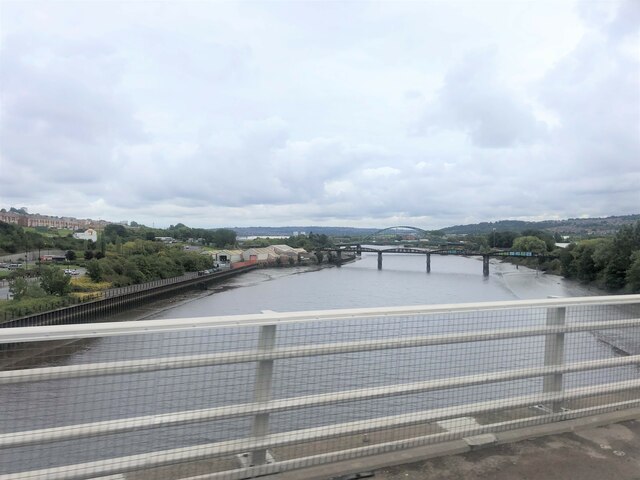
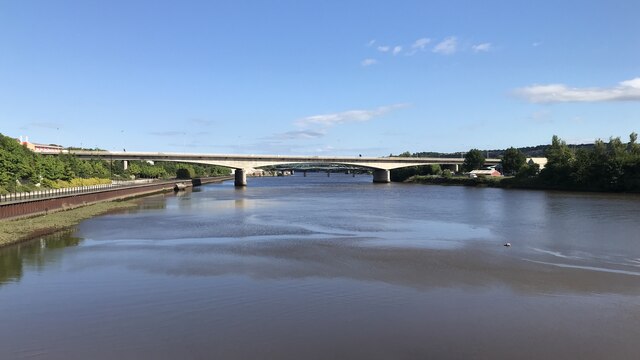
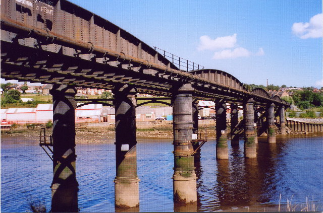
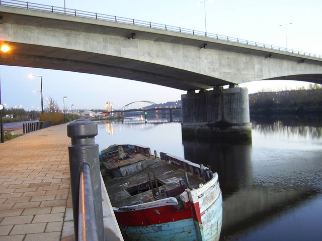
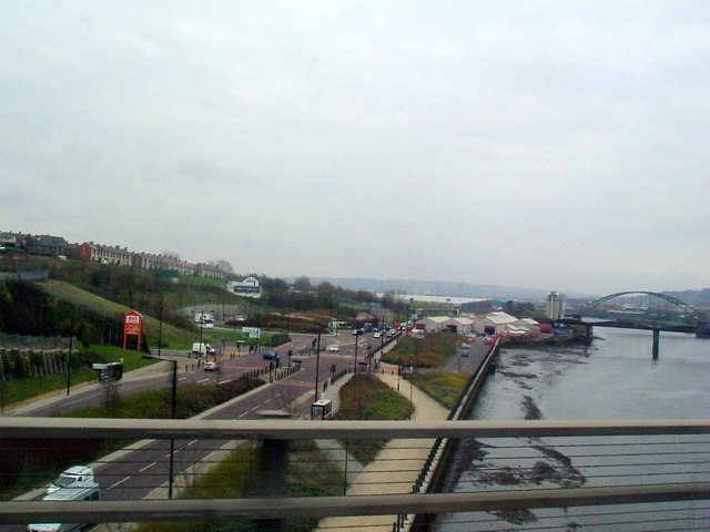
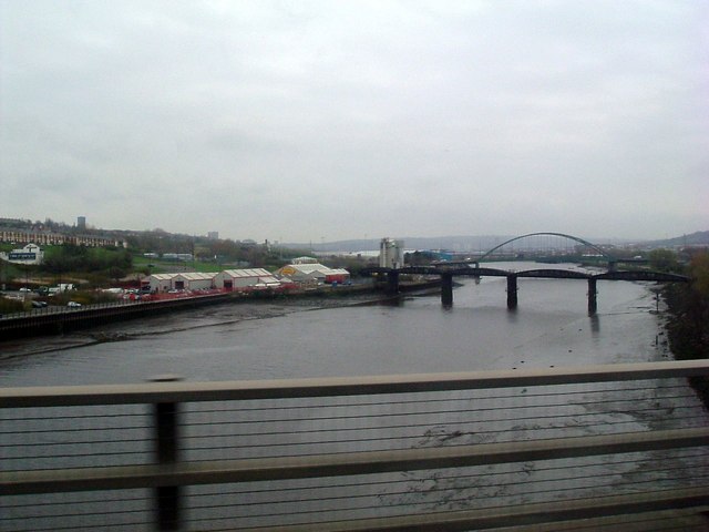
Benwell is a historic suburb located in Northumberland, England. Situated approximately 3 miles west of Newcastle upon Tyne, it lies on the southern bank of the River Tyne. With a rich history dating back to Roman times, Benwell is known for its archaeological significance and cultural heritage.

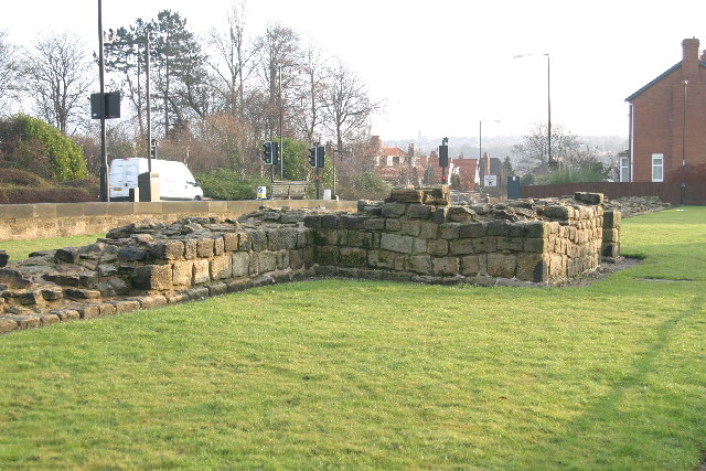
One of the most prominent historical landmarks in Benwell is the Benwell Roman Temple, also known as the Temple of Antenociticus. Built during the 2nd century AD, it is one of the best-preserved Roman temples in northern England. The temple's ruins and artifacts provide valuable insights into the Roman occupation of the area.

In addition to its Roman heritage, Benwell boasts a vibrant community with various amenities and facilities. It has a range of housing options, including traditional terraced houses and modern developments. The suburb is well-served by public transportation, with bus services connecting it to nearby towns and Newcastle city center.

Benwell offers a variety of local amenities, including schools, shops, and recreational areas. The nearby West Road Park provides green spaces for residents to relax and enjoy outdoor activities. Additionally, the area benefits from close proximity to larger retail centers, such as the Metrocentre, one of the largest shopping malls in Europe.

Overall, Benwell is a historically significant suburb of Northumberland, offering a mix of cultural heritage, modern amenities, and convenient access to nearby urban areas.

If you have any feedback on the listing, please let us know in the comments section below.

Benwell Images

Images are sourced within 2km of 54.975582/-1.668756 or Grid Reference NZ2164. Thanks to Geograph Open Source API. All images are credited.

Crossing the River Tyne at Blaydon Two more bridges further down the river - the nearer is the old Scotswood Railway Bridge while the farther one is Scotswood Road Bridge.
Crossing the River Tyne at Blaydon
Two more bridges further down the river - the nearer is the old Scotswood Railway Bridge while the farther one is Scotswood Road Bridge.
Blaydon Bridge
Blaydon Bridge
National Cycle Network milepost at Scotswood This milepost stands on Hadrian's Cycleway in the shadow of Scotswood Bridge over the River Tyne. This milepost (of the so-called "Welsh" design) was repainted as part of the 2021 repainting program. It used to be green, see <a href="https://www.geograph.org.uk/photo/1650606">NZ1964 : Cycleway Marker</a>.
National Cycle Network milepost at Scotswood
This milepost stands on Hadrian's Cycleway in the shadow of Scotswood Bridge over the River Tyne. This milepost (of the so-called "Welsh" design) was repainted as part of the 2021 repainting program. It used to be green, see NZ1964 : Cycleway Marker.
Scotswood railway bridge This rail bridge was built in 1871 and carried rail traffic from the long closed Newcastle/Scotswood line over the river.
Scotswood railway bridge
This rail bridge was built in 1871 and carried rail traffic from the long closed Newcastle/Scotswood line over the river.
Sunset behind Scotswood bridge A sunset behind Scotswood bridge, the bridge sits next to Vickers/BAE systems factory.
Sunset behind Scotswood bridge
A sunset behind Scotswood bridge, the bridge sits next to Vickers/BAE systems factory.
Denton Hall Inscription on the porch "16AED22" refers to Anthony and Dorothy Errinton. The Hall is now the official residence of the Roman Catholic Bishop of Hexham and Newcastle.
Denton Hall
Inscription on the porch "16AED22" refers to Anthony and Dorothy Errinton. The Hall is now the official residence of the Roman Catholic Bishop of Hexham and Newcastle.
Denton Hall
Denton Hall
Denton Hall Turret on the Roman Wall Looking west.
Denton Hall Turret on the Roman Wall
Looking west.
Denton Hall Turret on the Roman Wall
Blaydon Road Bridge The new Blaydon road bridge with Scotswood road and rail bridges in the background.
Blaydon Road Bridge
The new Blaydon road bridge with Scotswood road and rail bridges in the background.
The A1 Trunk Road crossing the Tyne
River Tyne north bank View from A1 bridge
River Tyne north bank
View from A1 bridge
River Tyne downstream View from south end of the A1 bridge
River Tyne downstream
View from south end of the A1 bridge
Hadrian's Wall and Denton Turret
Denton Turret
Denton Turret
Denton Turret (2)
Denton Turret (2)
Hadrian's Wall and Denton Turret (2)
Show me another place!

Benwell is located at Grid Ref: NZ2164 (Lat: 54.975582, Lng: -1.668756)

Unitary Authority: Newcastle upon Tyne

Police Authority: Northumbria

What 3 Words

///camera.just.limes. Near Benwell, Tyne & Wear

Nearby Locations

Benwell Condercvm

Related Wikis

Benwell Nature Park

Benwell Nature Park is a Local Nature Reserve in Benwell, Newcastle upon Tyne, England. Many natural habitats have been established including a pond and...

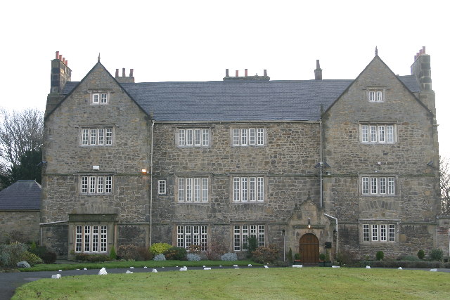
The Mitre, Newcastle upon Tyne

The Mitre is a building situated in the Benwell area in the west end of Newcastle upon Tyne, England. It is a Grade II listed building.A tower house known...

Benwell

Benwell is an area in the West End of Newcastle upon Tyne, England. == History == The place-name 'Benwell' is first attested in the Historia de Sancto...

Benwell and Scotswood

Benwell and Scotswood is an electoral ward of Newcastle upon Tyne in North East England. The ward encompasses the Benwell and Scotswood housing areas,...

Nearby Amenities

Located within 500m of 54.975582,-1.668756
Mini Roundabout
Direction: clockwise
Lat/Long: 54.9786331/-1.6692675
Created By: Merkaartor 0.12
Lat/Long: 54.97616/-1.67115
Created By: Merkaartor 0.12
Lat/Long: 54.9788486/-1.672591
Created By: Merkaartor 0.12
Lat/Long: 54.978679/-1.6727053
Noexit: yes
Lat/Long: 54.977637/-1.6713322
Created By: Merkaartor 0.12
Lat/Long: 54.9728656/-1.6668958
Created By: Merkaartor 0.12
Lat/Long: 54.97274/-1.6668
Created By: Merkaartor 0.12
Lat/Long: 54.9780139/-1.6643857
Created By: Merkaartor 0.12
Lat/Long: 54.9776198/-1.6624652
Created By: Merkaartor 0.12
Lat/Long: 54.9771764/-1.6627335
Created By: Merkaartor 0.12
Lat/Long: 54.977589/-1.6646861
Fenham TV Transmitter
Man Made: tower
Note: Ofcom transmitter #80903
Tower Type: communication
Lat/Long: 54.9780816/-1.6629159
Source: www.npemap.org.uk
Uk Postcode Centroid: NE4
Lat/Long: 54.975201/-1.673297
Bus Stop
ST. CUTHBERTS RC. UPPER SCHOOL
Local Ref: W
Naptan AtcoCode: 410000000022
Naptan Bearing: W
Naptan CommonName: ST. CUTHBERTS RC. UPPER SCHOOL
Naptan Indicator: W
Naptan Landmark: ST CUTHBERT SCHOOL GROUNDS
Naptan NaptanCode: twrgtwga
Naptan PlusbusZoneRef: NWCSTLE
Naptan Street: GRETNA ROAD
Naptan Verified: no
Source: naptan_import
Lat/Long: 54.9786404/-1.6743876
Bus Stop
St. Cuthberts RC. Lower School
Local Ref: SE
Naptan AtcoCode: 410000000023
Naptan Bearing: SE
Naptan CommonName: ST. CUTHBERTS RC. LOWER SCHOOL
Naptan Indicator: SE
Naptan Landmark: ST. CUTHBERTS RC. LOWER SCHOOL
Naptan NaptanCode: twrgtwgd
Naptan PlusbusZoneRef: NWCSTLE
Naptan Street: FOX AND HOUNDS LANE
Naptan Verified: no
Source: naptan_import
Lat/Long: 54.9762073/-1.6718763
Bus Stop
West Road-College
Bus: yes
Departures Board: timetable
Local Ref: W
Naptan AtcoCode: 410000014519
Naptan Bearing: W
Naptan Indicator: W-Bound
Naptan Landmark: Opposite Westgate Community College
Naptan NaptanCode: twrdadwp
Naptan PlusbusZoneRef: NWCSTLE
Naptan Street: West Road
Naptan Verified: no
Public Transport: platform
Shelter: yes
Source: naptan_import
Lat/Long: 54.9768629/-1.6618561
Bus Stop
WEST ROAD-ROMAN FORT
Local Ref: E
Naptan AtcoCode: 410000014520
Naptan Bearing: E
Naptan CommonName: WEST ROAD-ROMAN FORT
Naptan Indicator: E
Naptan Landmark: OUTSIDE T.V. TRANSMITTING STATION MAST
Naptan NaptanCode: twrdadwt
Naptan PlusbusZoneRef: NWCSTLE
Naptan Street: WEST ROAD
Naptan Verified: no
Source: naptan_import
Lat/Long: 54.977581/-1.6648342
Bus Stop
West Road-Tillmouth Gardens
Bus: yes
Departures Board: timetable
Lit: yes
Local Ref: W
Naptan AtcoCode: 410000014521
Naptan Bearing: W
Naptan Indicator: W-Bound
Naptan Landmark: Outside Pendower Hall Teachers Centre
Naptan NaptanCode: twrdagad
Naptan PlusbusZoneRef: NWCSTLE
Naptan Street: West Road
Naptan Verified: no
Public Transport: platform
Shelter: yes
Source: naptan_import
Lat/Long: 54.9780096/-1.6670806
Bus Stop
West Road-Fox And Hounds
Bench: no
Bin: no
Bus: yes
Departures Board: timetable
Local Ref: W
Naptan AtcoCode: 410000014522
Naptan Bearing: W
Naptan Indicator: W-Bound
Naptan Landmark: Opposite The Fox And Hounds Public House
Naptan NaptanCode: twrdagag
Naptan PlusbusZoneRef: NWCSTLE
Naptan Street: WESTACRES CRESCENT
Naptan Verified: no
Passenger Information Display: no
Public Transport: platform
Shelter: no
Source: naptan_import
Lat/Long: 54.979296/-1.672123
Bus Stop
Two Ball Lonnen-West Road
Bench: yes
Bus: yes
Departures Board: timetable
Local Ref: N
Naptan AtcoCode: 410000014523
Naptan Bearing: NE
Naptan Indicator: NE-Bound
Naptan Landmark: Opposite Ashton Court Nursing Home
Naptan NaptanCode: twrdagaj
Naptan PlusbusZoneRef: NWCSTLE
Naptan Street: Two Ball Lonnen
Naptan Verified: no
Public Transport: platform
Shelter: yes
Source: naptan_import
Lat/Long: 54.9789766/-1.6690725
Bus Stop
TWO BALL LONNEN-WEST ROAD-S/B
Local Ref: S
Naptan AtcoCode: 410000014524
Naptan Bearing: S
Naptan CommonName: TWO BALL LONNEN-WEST ROAD-S/B
Naptan Indicator: S
Naptan Landmark: OUTSIDE ASHTON COURT NURSING HOME
Naptan NaptanCode: twrdagam
Naptan PlusbusZoneRef: NWCSTLE
Naptan Street: TWO BALL LONNEN
Naptan Verified: no
Source: naptan_import
Lat/Long: 54.9790567/-1.6687906
Bus Stop
Pease Avenue - B/B
Local Ref: S
Naptan AtcoCode: 410000014530
Naptan Bearing: S
Naptan CommonName: PEASE AVENUE-S/B
Naptan Indicator: S
Naptan Landmark: OUTSIDE AUBONE AVENUE
Naptan NaptanCode: twrdagap
Naptan PlusbusZoneRef: NWCSTLE
Naptan Street: PEASE AVENUE
Naptan Verified: no
Source: naptan_import
Lat/Long: 54.9765701/-1.6697797
Bus Stop
Pease Avenue - N/B
Local Ref: N
Naptan AtcoCode: 410000014531
Naptan Bearing: N
Naptan CommonName: PEASE AVENUE-N/B
Naptan Indicator: N
Naptan Landmark: OPPOSITE AUBONE AVENUE JUNCTION
Naptan NaptanCode: twrdagat
Naptan PlusbusZoneRef: NWCSTLE
Naptan Street: PEASE AVENUE
Naptan Verified: no
Source: naptan_import
Lat/Long: 54.9771095/-1.6698534
Bus Stop
Benwell Village
Local Ref: S
Naptan AtcoCode: 410000014532
Naptan Bearing: S
Naptan CommonName: BENWELL VILLAGE
Naptan Indicator: S
Naptan Landmark: OPPOSITE ST CUTHBERTS LOWER SCHOOL
Naptan NaptanCode: twrdagaw
Naptan PlusbusZoneRef: NWCSTLE
Naptan Street: FOX AND HOUNDS LANE
Naptan Verified: no
Source: naptan_import
Lat/Long: 54.975337/-1.6723833
Bus Stop
Benwell Village
Local Ref: NE
Naptan AtcoCode: 410000014533
Naptan Bearing: NE
Naptan CommonName: BENWELL VILLAGE
Naptan Indicator: NE
Naptan Landmark: OUTSIDE ST CUTHBERTS LOWER SCHOOL
Naptan NaptanCode: twrdagda
Naptan PlusbusZoneRef: NWCSTLE
Naptan Street: FOX AND HOUNDS LANE
Naptan Verified: no
Source: naptan_import
Lat/Long: 54.9757396/-1.6717238
Bus Stop
Ferguson's Lane-Church
Bench: yes
Bus: yes
Local Ref: E
Naptan AtcoCode: 410000014534
Naptan Bearing: E
Naptan Indicator: E-Bound
Naptan Landmark: Outside Benwell Village Church
Naptan NaptanCode: twrdagdg
Naptan PlusbusZoneRef: NWCSTLE
Naptan Street: Ferguson's Lane
Naptan Verified: no
Public Transport: platform
Shelter: yes
Source: naptan_import
Tactile Paving: no
Lat/Long: 54.9747137/-1.6745287
Bus Stop
Ferguson's Lane-Church
Bench: yes
Bus: yes
Local Ref: W
Naptan AtcoCode: 410000014535
Naptan Bearing: W
Naptan Indicator: W-Bound
Naptan Landmark: Opposite Benwell Village Church
Naptan NaptanCode: twrdagdj
Naptan PlusbusZoneRef: NWCSTLE
Naptan Street: Fergusons Lane
Naptan Verified: no
Public Transport: platform
Shelter: yes
Source: naptan_import
Tactile Paving: no
Lat/Long: 54.9746422/-1.6746543
Bus Stop
Benwell Village
Local Ref: N
Naptan AtcoCode: 410000014547
Naptan Bearing: N
Naptan CommonName: BENWELL VILLAGE
Naptan Indicator: N
Naptan Landmark: OUTSIDE THE MITRE
Naptan NaptanCode: twrdagjw
Naptan PlusbusZoneRef: NWCSTLE
Naptan Street: PENDOWER WAY
Naptan Verified: no
Source: naptan_import
Lat/Long: 54.9755024/-1.6703978
Bus Stop
BENWELL VILLAGE
Local Ref: S
Naptan AtcoCode: 410000014548
Naptan Bearing: S
Naptan CommonName: BENWELL VILLAGE
Naptan Indicator: S
Naptan Landmark: OPPOSITE THE MITRE
Naptan NaptanCode: twrdagma
Naptan PlusbusZoneRef: NWCSTLE
Naptan Street: PENDOWER WAY
Naptan Verified: no
Source: naptan_import
Lat/Long: 54.9753307/-1.6700399
Bus Stop
BENWELL LANE-HODGKIN PARK ROAD-E/B
Local Ref: W
Naptan AtcoCode: 410000014568
Naptan Bearing: W
Naptan CommonName: BENWELL LANE-HODGKIN PARK ROAD-E/B
Naptan Indicator: W
Naptan Landmark: OPPOSITE BENWELL GRANGE
Naptan NaptanCode: twrdagtm
Naptan PlusbusZoneRef: NWCSTLE
Naptan Street: BENWELL LANE
Naptan Verified: no
Source: naptan_import
Lat/Long: 54.9719907/-1.664584
Bus Stop
BENWELL LANE-BENWELL CLOSE-W/B
Local Ref: NW
Naptan AtcoCode: 410000014569
Naptan Bearing: NW
Naptan CommonName: BENWELL LANE-BENWELL CLOSE-W/B
Naptan Indicator: NW
Naptan Landmark: OUTSIDE BENWELL GRANGE
Naptan NaptanCode: twrdagtp
Naptan PlusbusZoneRef: NWCSTLE
Naptan Street: BENWELL LANE
Naptan Verified: no
Source: naptan_import
Lat/Long: 54.9718921/-1.6646473
Bus Stop
BENWELL LANE-RUSHIE AVENUE-E/B
Local Ref: E
Naptan AtcoCode: 410000014570
Naptan Bearing: E
Naptan CommonName: BENWELL LANE-RUSHIE AVENUE-E/B
Naptan Indicator: E
Naptan Landmark: OPPOSITE THE HODGKIN HOUSE LODGE
Naptan NaptanCode: twrdagtw
Naptan PlusbusZoneRef: NWCSTLE
Naptan Street: BENWELL LANE
Naptan Verified: no
Source: naptan_import
Lat/Long: 54.9730544/-1.6690431
Bus Stop
BENWELL LANE-HODGKIN PARK ROAD-W/B
Local Ref: NW
Naptan AtcoCode: 410000014571
Naptan Bearing: NW
Naptan CommonName: BENWELL LANE-HODGKIN PARK ROAD-W/B
Naptan Indicator: NW
Naptan Landmark: WEST OF HODGKIN PARK ROAD
Naptan NaptanCode: twrdagwa
Naptan PlusbusZoneRef: NWCSTLE
Naptan Street: BENWELL LANE
Naptan Verified: no
Source: naptan_import
Lat/Long: 54.9725109/-1.6674853
Bus Stop
BENWELL LANE-WELLBURN HOUSE-E/B
Local Ref: E
Naptan AtcoCode: 410000014572
Naptan Bearing: E
Naptan CommonName: BENWELL LANE-WELLBURN HOUSE-E/B
Naptan Indicator: E
Naptan Landmark: OUTSIDE WELLBURN HOUSE AND PLAY AREA
Naptan NaptanCode: twrdagwd
Naptan PlusbusZoneRef: NWCSTLE
Naptan Street: BENWELL LANE
Naptan Verified: no
Source: naptan_import
Lat/Long: 54.9734761/-1.6721329
Bus Stop
BENWELL LANE-RUSHIE AVENUE-W/B
Local Ref: W
Naptan AtcoCode: 410000014573
Naptan Bearing: W
Naptan CommonName: BENWELL LANE-RUSHIE AVENUE-W/B
Naptan Indicator: W
Naptan Landmark: OPPOSITE RUSHIE AVENUE
Naptan NaptanCode: twrdagwg
Naptan PlusbusZoneRef: NWCSTLE
Naptan Street: BENWELL LANE
Naptan Verified: no
Source: naptan_import
Lat/Long: 54.9731468/-1.6699953
Bus Stop
BENWELL LANE-DENTON GARDENS
Local Ref: W
Naptan AtcoCode: 410000014575
Naptan Bearing: W
Naptan CommonName: BENWELL LANE-DENTON GARDENS
Naptan Indicator: W
Naptan Landmark: OUTSIDE DENTON GARDENS
Naptan NaptanCode: twrdagwm
Naptan PlusbusZoneRef: NWCSTLE
Naptan Street: BENWELL LANE
Naptan Verified: no
Source: naptan_import
Lat/Long: 54.9734058/-1.6727115
Bus Stop
WEST ROAD-FOX AND HOUNDS-E/B
Local Ref: SE
Naptan AtcoCode: 410000008040
Naptan Bearing: SE
Naptan CommonName: WEST ROAD-FOX AND HOUNDS-E/B
Naptan Indicator: SE
Naptan Landmark: OUTSIDE THE FOX AND HOUNDS PUBLIC HOUSE
Naptan NaptanCode: twragwmt
Naptan PlusbusZoneRef: NWCSTLE
Naptan Street: WEST ROAD
Naptan Verified: no
Source: naptan_import
Lat/Long: 54.9792251/-1.6712423
School
Source: OS OpenData StreetView
Lat/Long: 54.9760211/-1.6722412
Barrier: bollard
Lat/Long: 54.9737305/-1.6737003
Noexit: yes
Lat/Long: 54.9752375/-1.6712032
Turning Circle
Lat/Long: 54.9745816/-1.6617618
Barrier: bollard
Lat/Long: 54.9745824/-1.6643411
Post Box
Collection Times: Mo-Fr 16:15; Sa 10:45
Operator: Royal Mail
Operator Wikidata: Q638098
Post Box Type: pillar
Ref: NE15 174
Lat/Long: 54.9767444/-1.66154
Noexit: yes
Lat/Long: 54.9752811/-1.6733722
Noexit: yes
Lat/Long: 54.9749956/-1.6734043
Noexit: yes
Lat/Long: 54.9747482/-1.674046
Noexit: yes
Lat/Long: 54.9749902/-1.6740076
Noexit: yes
Lat/Long: 54.9746562/-1.6711091
Citroen - Wingrove
Addr City: Newcastle Upon Tyne
Addr Housenumber: 388
Addr Postcode: NE5 2ER
Addr Street: West Road
Phone: +44 191 274 2000
Shop: car
Website: https://www.wingrovemotors.co.uk/
Lat/Long: 54.9790331/-1.6698426
Citeron
Addr City: Newcastle Upon Tyne
Addr Housenumber: 388
Addr Postcode: NE5 2ER
Addr Street: West Road
Fixme: check details
Phone: +44 191 228 8020
Shop: car
Lat/Long: 54.9789925/-1.6694745
Rook Matthews Sayer
Addr City: Newcastle Upon Tyne
Office: estate_agent
Phone: +44 191 274 4661
Website: https://www.rookmatthewssayer.co.uk/
Lat/Long: 54.9788594/-1.6693453
Lifestyle Express
Addr City: Newcastle Upon Tyne
Addr Housenumber: 159 - 161
Addr Postcode: NE15 6PQ
Addr Street: West Road
Brand: Lifestyle Express
Brand Wikidata: Q61994869
Fhrs Id: 1106707
Shop: convenience
Lat/Long: 54.9767187/-1.6616791
Fast Food
Grill Hut
Addr City: Newcastle Upon Tyne
Addr Street: West Road
Phone: +44 191 273 6795
Lat/Long: 54.9767749/-1.6618312
KK & Co. Solicitors
Addr City: Newcastle Upon Tyne
Addr Street: West Road
Office: lawyer
Lat/Long: 54.9767329/-1.6618495
Lyles Of Newcastle
Addr City: Newcastle Upon Tyne
Addr Street: West Road
Shop: car_repair
Lat/Long: 54.9767912/-1.662067
Cafe
Fazal's Cafe
Addr City: Newcastle Upon Tyne
Addr Street: West Road
Phone: +44 191 238 6778
Lat/Long: 54.9768464/-1.6624649
Jobcentre Plus
Addr City: Newcastle Upon Tyne
Addr Street: West Road
Brand: Jobcentre Plus
Brand Wikidata: Q6206793
Office: employment_agency
Lat/Long: 54.9770289/-1.6636068
Noexit: yes
Lat/Long: 54.9746044/-1.6721636
Benwell roman temple
Historic: archaeological_site
Historic Civilization: ancient_roman
Name En: Benwell roman temple
Lat/Long: 54.976248/-1.6624235
Benwell vallum crossing
Historic: archaeological_site
Historic Civilization: ancient_roman
Name En: Benwell vallum crossing
Tourism: attraction
Wikidata: Q105722175
Lat/Long: 54.9758569/-1.6645702
Noexit: yes
Lat/Long: 54.9746712/-1.6722299
Noexit: yes
Lat/Long: 54.9748894/-1.6714846
Noexit: yes
Lat/Long: 54.9758973/-1.6734996
Condercum Hill
Alt Name: Benwell High; Benwell Hill
Ele: 126
Natural: peak
Note: Unsure about the name. PDF says "Condercum", meanwhile there are locations nearby with "Benwell High" and "Benwell Hill" in their names.
Source: Newcastle.gov.uk
Source Ref: https://newcastle.gov.uk/sites/default/files/2019-01/planning_nca_combined_citywide_and_zone_statements.pdf
Lat/Long: 54.9771434/-1.6639191
Barrier: block
Fixme: please clarify barrier or obstacle on the road, there is driver feedback that driver can't drive through this gate
Lat/Long: 54.9794007/-1.6703317
Barrier: yes
Lat/Long: 54.9714151/-1.6712921
The data included in this document is from www.openstreetmap.org. The data is made available under ODbL.

Have you been to Benwell?

Leave your review of Benwell below (or comments, questions and feedback).