Bentley

Settlement in Suffolk Babergh

England

Bentley

Station Road towards Bentley
Station Road towards Bentley Credit: Robin Webster

Bentley is a picturesque village located in the county of Suffolk, England. Situated in the Babergh district, it lies approximately 5 miles southwest of the town of Ipswich. With a population of around 1,200 residents, Bentley offers a tranquil and close-knit community atmosphere.

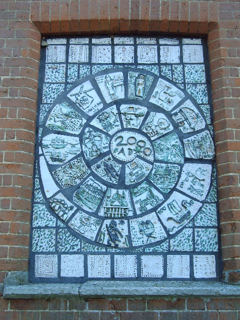
The village boasts a rich history, with evidence of human settlement dating back to the Roman times. This is evident in the remnants of a Roman villa discovered in the area. Bentley's name is derived from the Old English words "beonet" and "leah," meaning "meadow with bent grass," highlighting its agricultural past.

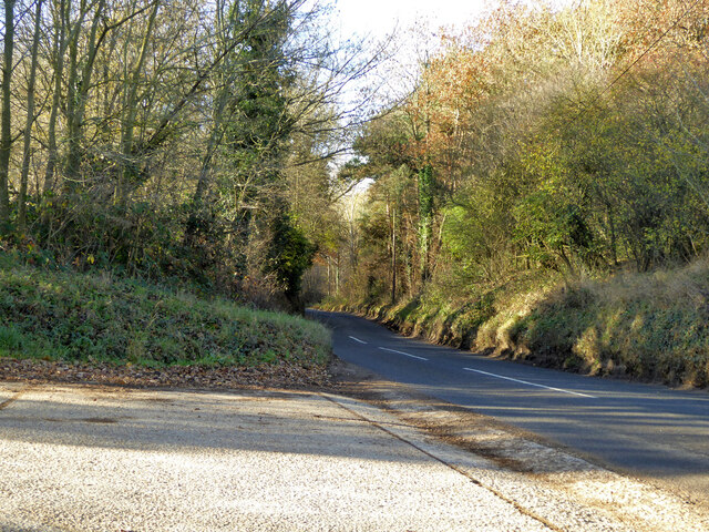
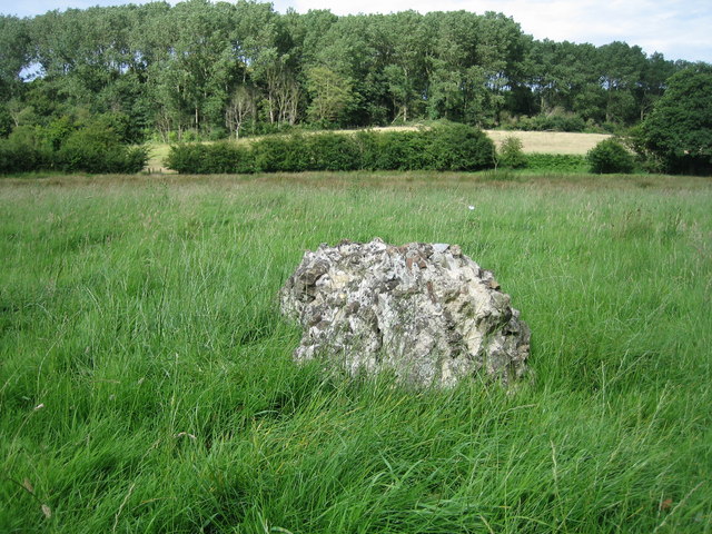
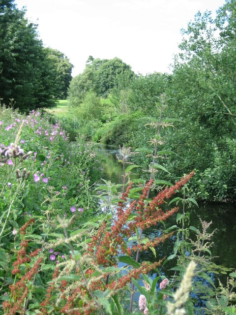
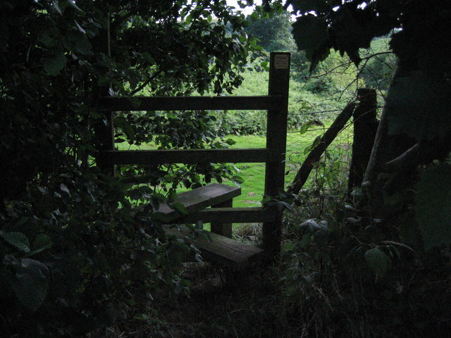
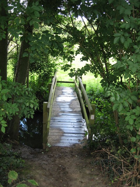
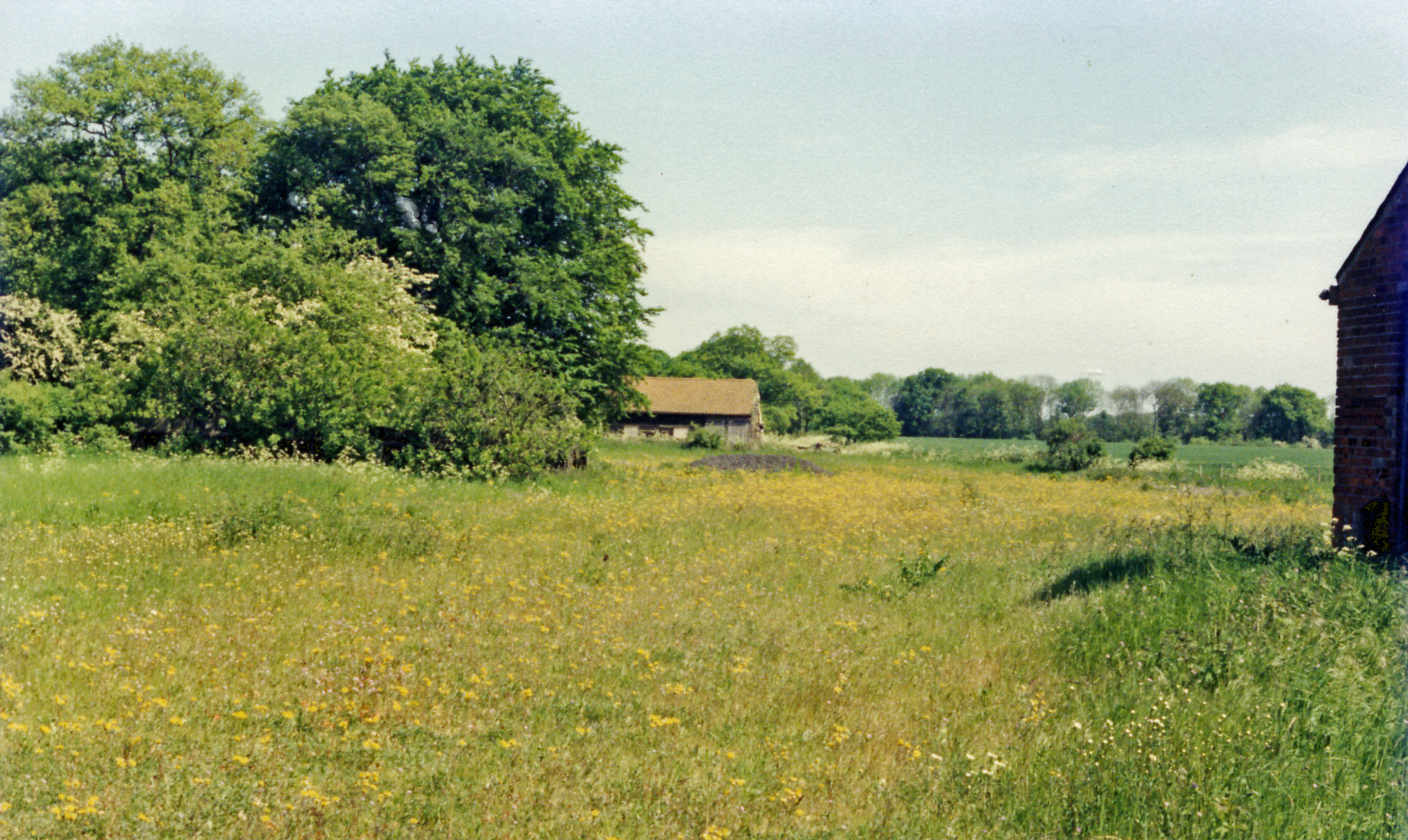
The village is known for its charming countryside landscapes, characterized by rolling hills, meadows, and woodlands. Bentley is surrounded by the Dedham Vale Area of Outstanding Natural Beauty, showcasing the region's idyllic scenery. The area offers numerous walking and cycling trails, allowing visitors and residents alike to explore the stunning countryside.

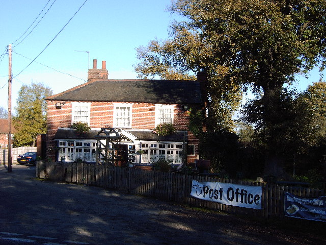
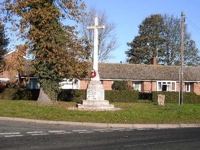
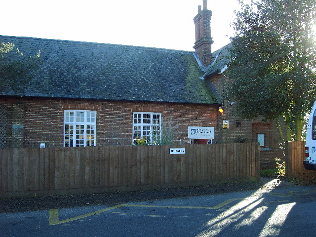
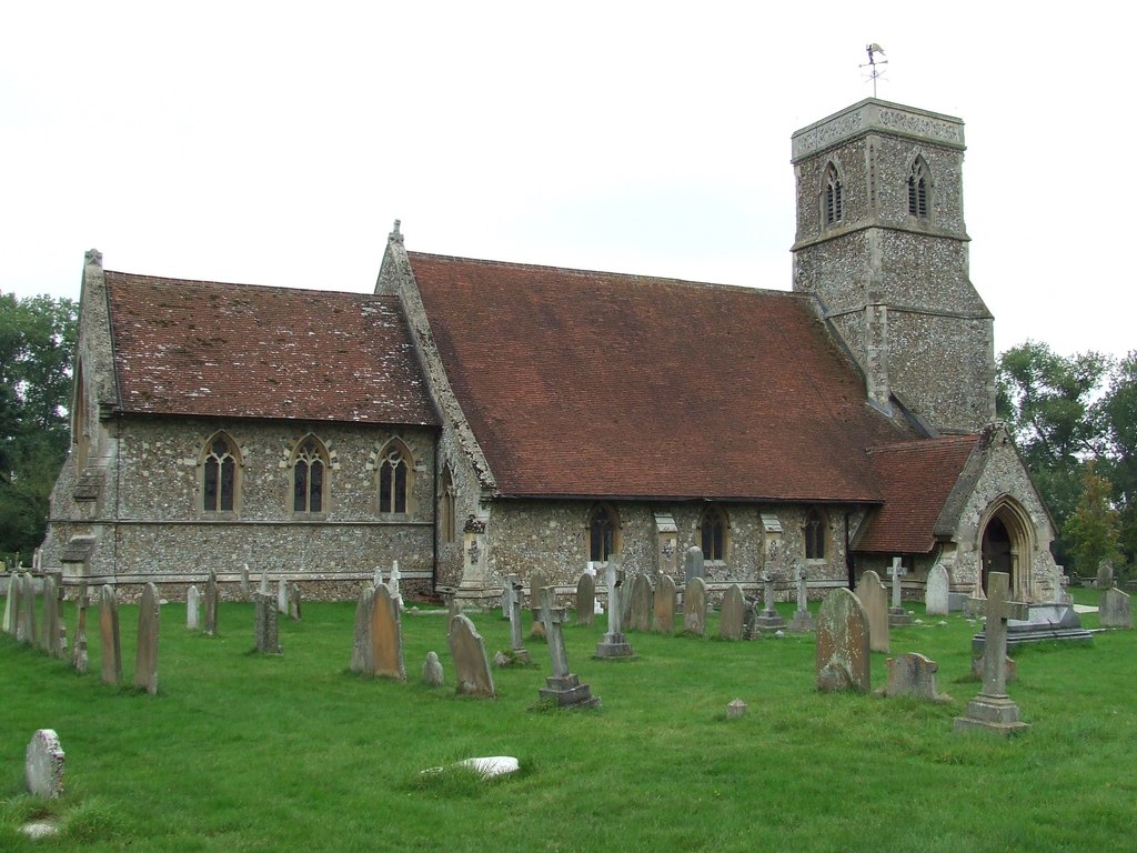
Bentley's village center is quaint and traditional, featuring a range of historic buildings and landmarks. Notable attractions include the St. Mary's Church, a picturesque medieval structure that dates back to the 14th century. The village also has a primary school, a community center, and a local pub, providing essential amenities for its residents.

Despite its small size, Bentley hosts various community events throughout the year, fostering a strong sense of community spirit. These include the Bentley Fireworks Display, the Bentley Garden Show, and the Bentley Christmas Market. These events attract visitors from neighboring areas and contribute to the village's vibrant social scene.

Overall, Bentley, Suffolk offers a peaceful and picturesque setting, making it an ideal place for those seeking a rural retreat while still being within easy reach of urban amenities.

If you have any feedback on the listing, please let us know in the comments section below.

Bentley Images

Images are sourced within 2km of 51.991344/1.0685935 or Grid Reference TM1036. Thanks to Geograph Open Source API. All images are credited.

Station Road towards Bentley
Esso Service Station on A12 north near Capel St Mary
Jet garage on A12 north at Capel St Mary
The Case is Altered, Public House, Bentley,  Suffolk When the post office in Bentley closed, a Post Office was opened here.
The Case is Altered, Public House, Bentley, Suffolk
When the post office in Bentley closed, a Post Office was opened here.
War Memorial at Bentley Suffolk Recently attended by pupils of the local Primary School Bentley.
War Memorial at Bentley Suffolk
Recently attended by pupils of the local Primary School Bentley.
Primary School Bentley Suffolk.
Windows of the Past. This work can be seen on the North Facing Wall of Bentley Primary School Suffolk.
Windows of the Past.
This work can be seen on the North Facing Wall of Bentley Primary School Suffolk.
St. Mary's church, Bentley, Suffolk This church dates back to the Normans but a lot of what we see now is restoration in 1858 and 1884. It stands a long way north of the village.
St. Mary's church, Bentley, Suffolk
This church dates back to the Normans but a lot of what we see now is restoration in 1858 and 1884. It stands a long way north of the village.
Little Chef at Capel St Mary, Suffolk This is by a major junction on the A.12
Little Chef at Capel St Mary, Suffolk
This is by a major junction on the A.12
Bentley Road, Bentley, Suffolk This is the view driving away from Bentley towards Capel St Mary.
Bentley Road, Bentley, Suffolk
This is the view driving away from Bentley towards Capel St Mary.
Rookery Farm and Farm Shop
Rookery Farm Shop Beamed barn converted to farm shop
Rookery Farm Shop
Beamed barn converted to farm shop
Last Remains of Dodnash C12th Priory by footpath Beside the footpath from East End, East Bergholt to Dodnash Wood (seen in background), you pass the last remaining lump of stones from the twelfth century Augustinian Priory that existed on this spot.  Continue up the hill and through the wood for a rewarding ramble
Last Remains of Dodnash C12th Priory by footpath
Beside the footpath from East End, East Bergholt to Dodnash Wood (seen in background), you pass the last remaining lump of stones from the twelfth century Augustinian Priory that existed on this spot. Continue up the hill and through the wood for a rewarding ramble
Pond beside footpath from Bentley to Brantham Nettles, dock and thistles are among the wild plants surrounding this pond in a boggy area of the footpath south of Dodnash Priory Farm. Press on and the walk is rewarding!
Pond beside footpath from Bentley to Brantham
Nettles, dock and thistles are among the wild plants surrounding this pond in a boggy area of the footpath south of Dodnash Priory Farm. Press on and the walk is rewarding!
Half-hidden stile near Dodnash Priory Farm Heading south from Bentley to Brantham (Gravel Pit Lane) you might miss this stile (as I did) as it is deep in a thriving alder hedge. After passing Dodnash Priory Farm on your right keep an eye on the hedge. The stile leads to a path down a steepish slope into a small valley and later a bridge over Dodnash Brook
Half-hidden stile near Dodnash Priory Farm
Heading south from Bentley to Brantham (Gravel Pit Lane) you might miss this stile (as I did) as it is deep in a thriving alder hedge. After passing Dodnash Priory Farm on your right keep an eye on the hedge. The stile leads to a path down a steepish slope into a small valley and later a bridge over Dodnash Brook
Footbridge over Dodnash Brook towards East End Coming south from Bentley and passing across the marsh where there are remains of Dodnash Priory, you cross this bridge before going up the footpath to the top of the next field
Footbridge over Dodnash Brook towards East End
Coming south from Bentley and passing across the marsh where there are remains of Dodnash Priory, you cross this bridge before going up the footpath to the top of the next field
Weight limit on weak bridge between East End & Bentley Even rural road signs are not safe from graffiti!  This sign warns drivers going north towards Bentley from East End, East Bergholt that they had better weigh no more than 8 tonnes.  The road is narrow too! Downstream from this bridge are two footbridges (at least) over Dodnash Brook - one in this square and one in TM1135, to the east.
Weight limit on weak bridge between East End & Bentley
Even rural road signs are not safe from graffiti! This sign warns drivers going north towards Bentley from East End, East Bergholt that they had better weigh no more than 8 tonnes. The road is narrow too! Downstream from this bridge are two footbridges (at least) over Dodnash Brook - one in this square and one in TM1135, to the east.
Footbridge and stile over Dodnash Brook near Brantham Going south from Bentley to Brantham, the footpath passes through a boggy and overgrown section south of Dodnash Priory Farm until it reaches this bridge and stile.  Beyond there is an open meadow before the path climbs up again past woodland
Footbridge and stile over Dodnash Brook near Brantham
Going south from Bentley to Brantham, the footpath passes through a boggy and overgrown section south of Dodnash Priory Farm until it reaches this bridge and stile. Beyond there is an open meadow before the path climbs up again past woodland
Show me another place!

Bentley is located at Grid Ref: TM1036 (Lat: 51.991344, Lng: 1.0685935)

Administrative County: Suffolk

District: Babergh

Police Authority: Suffolk

What 3 Words

///tenure.tries.credited. Near Capel St Mary, Suffolk

Related Wikis

Related Videos

Cycling around the UK /Always stay positive on a long distance cycling tour.....here's why

Rubens Dad here....my turn to post tonight. ❤ There is definitely a reason in life to stay positive, and even when things look ...

Ethel’s WONKY WHEEL and OFF GRID Chit Chat at Tattingstone | Vlog 352

We take Ethel our little white Skoda Citigo to Simpsons of Great Yarmouth for annual service and repairs. We also spend the ...

Garden House Caravan and Motorhome Club CL site near Tattingstone in Suffolk

Garden House Caravan and Motorhome Club CL site near Tattingstone in Suffolk A short video of Garden House Farm Caravan ...

Trains of South Suffolk

Watching the variety of traction running along the Great Eastern main line. Newer units have replaced the older. Class 321 are still ...

Nearby Amenities

Located within 500m of 51.991344,1.0685935
Barrier: cycle_barrier
Cycle Barrier: double
Lat/Long: 51.9920805/1.0696037
Created By: YahooApplet 1.0
Lat/Long: 51.9952546/1.0706015
Bentley
Name Lt: Bentlis
Place: village
Source: NPE
Wikidata: Q2601017
Wikipedia: en:Bentley, Suffolk
Lat/Long: 51.989667/1.075096
Bus Stop
South View Green
Local Ref: adj
Naptan AtcoCode: 390010092
Naptan Bearing: E
Naptan CommonName: South View Green
Naptan Landmark: South View Green
Naptan NaptanCode: sufadgwa
Naptan Street: South View Green
Naptan Verified: no
Public Transport: platform
Shelter: yes
Source: naptan_import
Lat/Long: 51.9901337/1.0743202
South View Green
Local Ref: opp
Naptan AtcoCode: 390010093
Naptan Bearing: W
Naptan BusStopType: CUS
Naptan CommonName: South View Green
Naptan Landmark: South View Green
Naptan NaptanCode: sufadgwd
Naptan Street: South View Green
Naptan Verified: no
Public Transport: platform
Source: naptan_import
Lat/Long: 51.9899655/1.0741775
Power: pole
Lat/Long: 51.9942569/1.0683722
Power: pole
Lat/Long: 51.9919241/1.0696328
Power: pole
Lat/Long: 51.9933981/1.0695899
Power: pole
Lat/Long: 51.9956806/1.0677687
Power: pole
Lat/Long: 51.9934394/1.0732539
Power: pole
Lat/Long: 51.9926289/1.0697328
Power: pole
Lat/Long: 51.9926698/1.0751394
Power: pole
Lat/Long: 51.9938556/1.0695363
Power: pole
Lat/Long: 51.9944403/1.0695068
Power: pole
Lat/Long: 51.9942322/1.071312
Power: pole
Lat/Long: 51.9949886/1.0694613
Waste Basket
Lat/Long: 51.9901375/1.0743707
Bicycle Parking
Capacity: 6
Lat/Long: 51.9894447/1.0719476
Barrier: kissing_gate
Lat/Long: 51.9920334/1.0696409
Barrier: stile
Lat/Long: 51.9888941/1.0724958
Barrier: stile
Lat/Long: 51.9889723/1.0738281
Barrier: stile
Lat/Long: 51.9884958/1.0717716
Leisure: picnic_table
Lat/Long: 51.9918101/1.0700472
Leisure: picnic_table
Lat/Long: 51.9917515/1.0700673
Grit Bin
Lat/Long: 51.9900152/1.0744072
Post Box
Operator: Royal Mail
Operator Type: private
Operator Wikidata: Q638098
Post Box Mounting: pier
Post Box Type: lamp
Ref: IP9 1205
Lat/Long: 51.9901414/1.0742972
The data included in this document is from www.openstreetmap.org. The data is made available under ODbL.

Have you been to Bentley?

Leave your review of Bentley below (or comments, questions and feedback).