Nerston

Settlement in Lanarkshire

Scotland

Nerston

Nerston Industrial Estate Home Store More, Carpet Right and Benson for Beds.  B&Q is behind the photographer.
Nerston Industrial Estate Credit: Gordon Brown

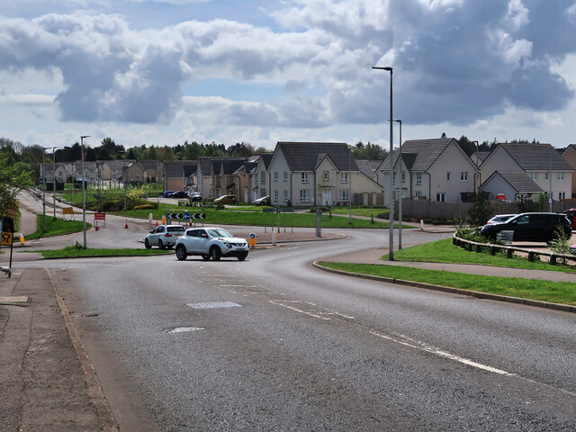
Nerston is a small village located in Lanarkshire, Scotland. It is situated near the town of East Kilbride, approximately 10 miles southeast of Glasgow. The village is primarily residential, with a mix of detached houses, semi-detached houses, and some apartment buildings.

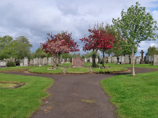
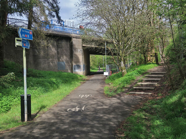
Nerston is known for its quiet and peaceful atmosphere, making it a popular choice for families and retirees. The village is surrounded by picturesque countryside, providing residents with plenty of opportunities for outdoor activities such as hiking, cycling, and horseback riding.

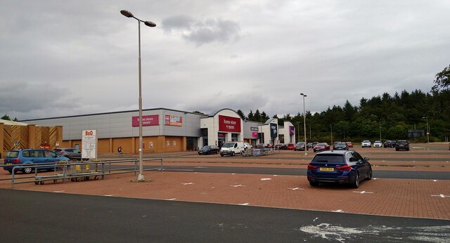
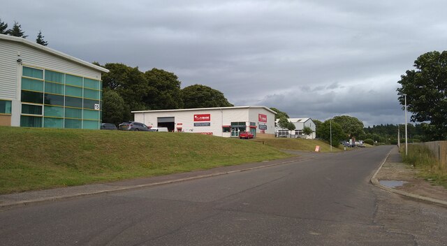
Despite its rural setting, Nerston is well-connected to nearby towns and cities via the M74 motorway and local bus services. The village also has a small number of shops, pubs, and restaurants, providing residents with essential amenities without the need to travel far.

Overall, Nerston offers a tranquil and idyllic setting for those looking to escape the hustle and bustle of city life while still being within easy reach of urban amenities.

If you have any feedback on the listing, please let us know in the comments section below.

Nerston Images

Images are sourced within 2km of 55.785753/-4.1646313 or Grid Reference NS6456. Thanks to Geograph Open Source API. All images are credited.

Nerston Industrial Estate Home Store More, Carpet Right and Benson for Beds.  B&Q is behind the photographer.
Nerston Industrial Estate
Home Store More, Carpet Right and Benson for Beds. B&Q is behind the photographer.
Law Place, Nerston, East Kilbride
Dechmont Hill Trig Point Flush Bracket S3608
Turnlaw Trig Point Flush Bracket S3650
Hill Field Trig Point Flush Bracket S3609 Not shown on OS maps
Hill Field Trig Point Flush Bracket S3609
Not shown on OS maps
Streetview car Filling up at Sainsbury's, Nerston
Streetview car
Filling up at Sainsbury's, Nerston
Streetview camera
Streetview camera
Farmland at Letterickhills With East Kilbride multi-storeys in the background
Farmland at Letterickhills
With East Kilbride multi-storeys in the background
Field with hawthorn hedge A roughly triangular shaped field bounded by minor roads
Field with hawthorn hedge
A roughly triangular shaped field bounded by minor roads
Minor road towards Cambuslang Approaching Letterickhills Farm on left
Minor road towards Cambuslang
Approaching Letterickhills Farm on left
Farmland south of Dechmont Hill Most of the farm in distance in the neighbouring square
Farmland south of Dechmont Hill
Most of the farm in distance in the neighbouring square
Cocks Burn About to pass under Flemington Road
Cocks Burn
About to pass under Flemington Road
Farmland at Dechmont Farm Slopes of Dechmont Hill behind
Farmland at Dechmont Farm
Slopes of Dechmont Hill behind
Minor roads junction Leading on to Flemington Road
Minor roads junction
Leading on to Flemington Road
Lee's Burn A tributary of the Rotten Calder
Lee's Burn
A tributary of the Rotten Calder
Mavor Avenue, East Kilbride The houses are on the site of the old Rolls-Royce Aero-Engine Works which opened in 1953 and closed in 2019. The new streets Avon Drive and Dart Avenue are named after some of the engines associated with the works.
The Mavor and Coulson Mining Equipment works was on the left side of the road and was built around 1930. This site has also been re-developed with new housing. See,  <span class="nowrap"><a title="https://maps.nls.uk/geo/explore/#zoom=15.8&lat=55.77874&lon=-4.16692&layers=170&b=1" rel="nofollow ugc noopener" href="https://maps.nls.uk/geo/explore/#zoom=15.8&lat=55.77874&lon=-4.16692&layers=170&b=1">Link</a><img style="margin-left:2px;" alt="External link" title="External link - shift click to open in new window" src="https://s1.geograph.org.uk/img/external.png" width="10" height="10"/></span>
Mavor Avenue, East Kilbride
The houses are on the site of the old Rolls-Royce Aero-Engine Works which opened in 1953 and closed in 2019. The new streets Avon Drive and Dart Avenue are named after some of the engines associated with the works. The Mavor and Coulson Mining Equipment works was on the left side of the road and was built around 1930. This site has also been re-developed with new housing. See, LinkExternal link
East Kilbride Cemetery The cemetery dates from around 1910 and is still in use.
East Kilbride Cemetery
The cemetery dates from around 1910 and is still in use.
National Cycle Route 756 in East Kilbride The route runs for 8 miles from Kelvindale in Glasgow to East Kilbride railway station. Here it follows the course of the old East Kilbride to Hamilton railway under East Mains Road. The line to Hamilton was closed in 1935 but this section remained open till 1966 to connect to the nearby Mavor and Coulson Mining Equipment works.
National Cycle Route 756 in East Kilbride
The route runs for 8 miles from Kelvindale in Glasgow to East Kilbride railway station. Here it follows the course of the old East Kilbride to Hamilton railway under East Mains Road. The line to Hamilton was closed in 1935 but this section remained open till 1966 to connect to the nearby Mavor and Coulson Mining Equipment works.
Show me another place!

Nerston is located at Grid Ref: NS6456 (Lat: 55.785753, Lng: -4.1646313)

Unitary Authority: South Lanarkshire

Police Authority: Lanarkshire

What 3 Words

///relax.corner.reason. Near East Kilbride, South Lanarkshire

Nearby Locations

Nerston Nerston

Related Wikis

Nerston

Nerston is a village situated on the northern green-belt boundary of the new town of East Kilbride in South Lanarkshire, Scotland. == Etymology == Nerston...

Playsport Arena

Playsport Arena is a two-stage sports and entertainment arena in East Kilbride, Scotland. The main arena will have a seating capacity for 6,000 spectators...

Greatest Hits Radio Glasgow & The West

Greatest Hits Radio Glasgow & The West (previously known as Clyde 2) is an Independent Local Radio station based in Glasgow, Scotland, owned and operated...

Calderwood, East Kilbride

Calderwood is a neighbourhood of the Scottish new town of East Kilbride, in South Lanarkshire. It lies on its north-east edge and is one of the largest...

Nearby Amenities

Located within 500m of 55.785753,-4.1646313
Crossing
Crossing: traffic_signals
Crossing Ref: toucan
Lat/Long: 55.782088/-4.1673267
Created By: Merkaartor 0.13
Lat/Long: 55.7854713/-4.1647712
Nerston Village
Place: village
Wikidata: Q6996695
Wikipedia: en:Nerston
Lat/Long: 55.7860787/-4.1647412
Bus Stop
Nerston
Naptan AtcoCode: 6150740
Naptan Bearing: N
Naptan CommonName: Nerston
Naptan Indicator: opp Nerston
Naptan Landmark: Nerston Residential School
Naptan NaptanCode: 75234638
Naptan Street: Glasgow Road
Naptan Verified: no
Source: naptan_import
Lat/Long: 55.7899338/-4.1662266
Bus Stop
Nerston
Naptan AtcoCode: 6150741
Naptan Bearing: S
Naptan CommonName: Nerston
Naptan Indicator: at Nerston
Naptan Landmark: Nerston Residential School
Naptan NaptanCode: 75235752
Naptan Street: Glasgow Road
Naptan Verified: no
Source: naptan_import
Lat/Long: 55.7894201/-4.1657993
Bus Stop
Kingsgate Retail Park
Naptan AtcoCode: 6150742
Naptan Bearing: S
Naptan CommonName: Kingsgate Retail Park
Naptan Indicator: near Nursing Home
Naptan Landmark: Kingsgate Nursing Home
Naptan NaptanCode: 75235492
Naptan Street: Glasgow Road
Naptan Verified: no
Source: naptan_import
Lat/Long: 55.7836559/-4.1654064
Bus Stop
Kingsgate Retail Park
Naptan AtcoCode: 6150743
Naptan Bearing: N
Naptan CommonName: Kingsgate Retail Park
Naptan Indicator: at Retail Park
Naptan Landmark: Kingsgate Retail Park
Naptan NaptanCode: 75235657
Naptan Street: Glasgow Road
Naptan Verified: no
Source: naptan_import
Lat/Long: 55.7836666/-4.1658787
Bus Stop
Kingsgate Retail Park
Naptan AtcoCode: 6150744
Naptan Bearing: NE
Naptan CommonName: Kingsgate Retail Park
Naptan Indicator: After roundabout opp number 17
Naptan Landmark: Kingsgate Retail Park
Naptan NaptanCode: 75232642
Naptan Street: Kingsgate Retail Park
Naptan Verified: no
Source: naptan_import
Lat/Long: 55.7836082/-4.1671514
Traffic Signals
Lat/Long: 55.7846364/-4.1660508
Traffic Signals
Lat/Long: 55.7846126/-4.1662083
Crossing
Crossing: traffic_signals
Crossing Ref: toucan
Lat/Long: 55.7844528/-4.1659433
Crossing
Crossing: traffic_signals
Crossing Ref: toucan
Lat/Long: 55.7843844/-4.1660989
Traffic Signals
Lat/Long: 55.7825746/-4.1655232
Crossing
Crossing: zebra
Lat/Long: 55.7838216/-4.1682567
Crossing
Crossing: zebra
Lat/Long: 55.7833887/-4.1700082
Parking
Parking: surface
Lat/Long: 55.7838737/-4.1666018
Traffic Signals
Lat/Long: 55.7822779/-4.1662238
Traffic Signals
Lat/Long: 55.7826338/-4.1653712
Traffic Signals
Lat/Long: 55.7820342/-4.1653228
Traffic Signals
Lat/Long: 55.7822329/-4.1660196
Traffic Signals
Lat/Long: 55.7819554/-4.1655106
Traffic Signals
Lat/Long: 55.7821444/-4.1653176
Bicycle Parking
FIXME: double check capacity
Bicycle Parking: stands
Capacity: 20
Covered: no
Lat/Long: 55.7830099/-4.1707068
Power: tower
Lat/Long: 55.7872635/-4.1650769
Power: tower
Lat/Long: 55.7871488/-4.1678181
Power: tower
Lat/Long: 55.7873901/-4.162459
Power: tower
Lat/Long: 55.7869558/-4.1721686
Crossing
Crossing: traffic_signals
Crossing Ref: toucan
Lat/Long: 55.7820468/-4.1673221
Power: tower
Lat/Long: 55.7894444/-4.1681836
Power: tower
Lat/Long: 55.7901872/-4.1643192
Power: tower
Lat/Long: 55.7875427/-4.1585914
Maxspeed: 70 mph
Maxspeed Type: GB:nsl_dual
Traffic Sign: maxspeed
Lat/Long: 55.7873411/-4.1667078
Maxspeed: 50 mph
Traffic Sign: maxspeed
Lat/Long: 55.787322/-4.1665522
Crossing
Crossing: zebra
Lat/Long: 55.7835021/-4.1683956
Crossing
Crossing: zebra
Lat/Long: 55.7833383/-4.1684608
Crossing
Crossing: zebra
Lat/Long: 55.7840723/-4.1692419
Crossing
Crossing: zebra
Lat/Long: 55.7834872/-4.169465
Crossing
Crossing: zebra
Lat/Long: 55.7832143/-4.1695613
Crossing
Crossing: zebra
Lat/Long: 55.7828304/-4.1700636
Crossing
Crossing: zebra
Lat/Long: 55.7826431/-4.1685671
Crossing
Crossing: zebra
Lat/Long: 55.7829764/-4.1682146
Crossing
Crossing: zebra
Lat/Long: 55.7827217/-4.1672442
Cafe
Costa
Brand: Costa
Brand Wikidata: Q608845
Brand Wikipedia: en:Costa Coffee
Cuisine: coffee_shop
Outdoor Seating: no
Smoking: no
Takeaway: yes
Lat/Long: 55.784038/-4.1706674
Home Store & More
Operator: Home Store & More
Shop: houseware
Lat/Long: 55.7814403/-4.1662728
The Gullion Well (site of)
Man Made: water_well
Lat/Long: 55.7861484/-4.1658812
Artist Name: Keith Donnelly
Artwork Type: sculpture
Tourism: artwork
Lat/Long: 55.7831602/-4.1678152
Nerston Wardlaw
Natural: peak
Lat/Long: 55.7853622/-4.1617699
Power: pole
Lat/Long: 55.7872698/-4.1676672
Power: pole
Lat/Long: 55.7861945/-4.1682275
Power: pole
Lat/Long: 55.7859579/-4.1675088
Power: pole
Lat/Long: 55.7877488/-4.1704378
Power: pole
Lat/Long: 55.7875052/-4.1690733
Power: pole
Lat/Long: 55.7870179/-4.1662485
Power: pole
Lat/Long: 55.7870437/-4.1649861
Power: pole
Lat/Long: 55.7864369/-4.1689712
Stewartfield Way Milestone
Historic: monument
Lat/Long: 55.7819769/-4.1674043
Bensons for Beds
Brand: Bensons for Beds
Brand Wikidata: Q4890299
Shop: bed
Lat/Long: 55.7816444/-4.1654921
Carpetright
Brand: Carpetright
Brand Wikidata: Q5045782
Shop: carpet
Website: https://www.carpetright.co.uk/store/east-kilbride
Lat/Long: 55.7815599/-4.1658407
The data included in this document is from www.openstreetmap.org. The data is made available under ODbL.

Have you been to Nerston?

Leave your review of Nerston below (or comments, questions and feedback).