Nenthall

Settlement in Cumberland Eden

England

Nenthall

B6294 between Blagill and Foreshield Bridge Isaac's Tea Trail is a 36 mile circular walk in the North Pennines named after Isaac Holden (c. 1805-57), an itinerant tea seller. Isaac became a familiar figure, out in all weathers, selling tea door to door to the farms, remote hamlets and mining communities scattered over the dales between Alston and Allendale Town. A pious man of humble origin, much involved in charitable work, he gained so much public respect that over 600 people contributed to his memorial. Full details at <span class="nowrap"><a title="https://isaacs-tea-trail.co.uk/" rel="nofollow ugc noopener" href="https://isaacs-tea-trail.co.uk/">Link</a><img style="margin-left:2px;" alt="External link" title="External link - shift click to open in new window" src="https://s1.geograph.org.uk/img/external.png" width="10" height="10"/></span>
B6294 between Blagill and Foreshield Bridge Credit: Chris Heaton

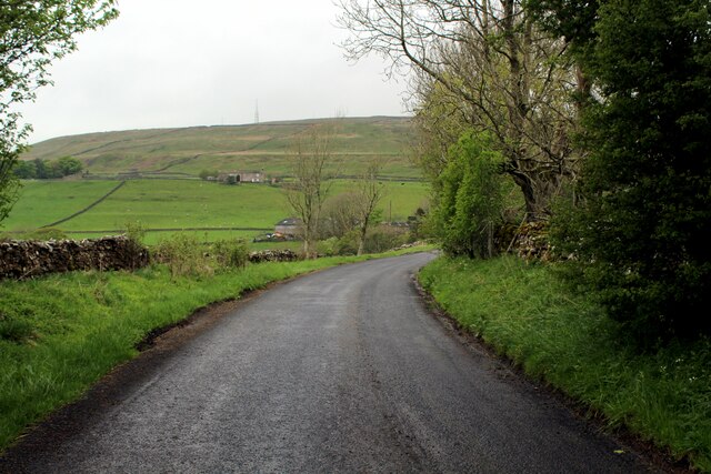
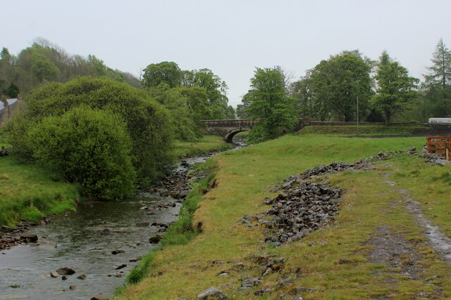
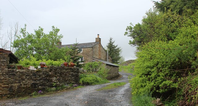
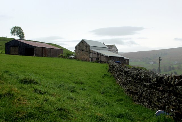
Nenthall is a small, picturesque village located in the county of Cumberland, England. Situated in the northern part of the county, Nenthall is nestled within the beautiful landscape of the North Pennines Area of Outstanding Natural Beauty. The village is surrounded by rolling hills, stunning valleys, and lush green meadows, making it a haven for nature lovers and outdoor enthusiasts.

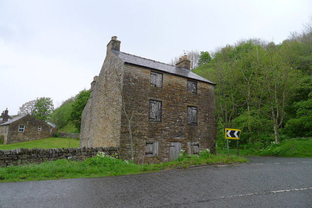
With a population of around 200 residents, Nenthall exudes a peaceful and tranquil atmosphere. It is a close-knit community where locals take great pride in their village and its heritage. The village retains much of its traditional charm, with a cluster of stone-built cottages and a quaint village square. The historic St. Cuthbert's Church, dating back to the 12th century, stands as a prominent landmark in the village.

Despite its small size, Nenthall has a strong sense of community spirit and offers a range of amenities for its residents. These include a village hall, a local pub, and a primary school, catering to the needs of both young and old. Additionally, the surrounding countryside provides ample opportunities for outdoor activities such as hiking, cycling, and birdwatching.

For those seeking a peaceful retreat away from the hustle and bustle of city life, Nenthall offers a perfect escape. Its idyllic setting, friendly community, and access to beautiful natural surroundings make it a truly charming village in the heart of Cumberland.

If you have any feedback on the listing, please let us know in the comments section below.
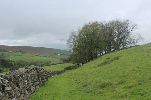
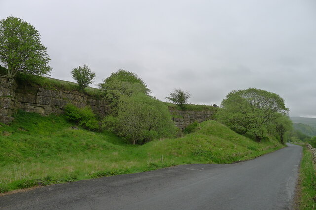
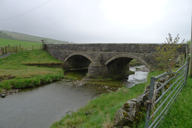
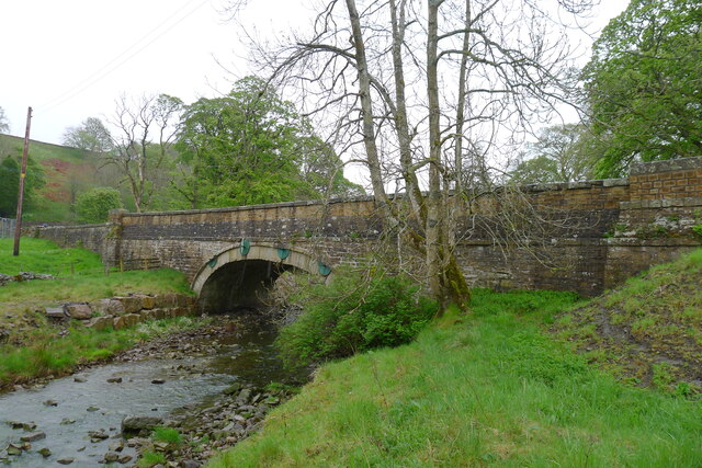
Nenthall Images

Images are sourced within 2km of 54.806039/-2.381128 or Grid Reference NY7545. Thanks to Geograph Open Source API. All images are credited.

B6294 between Blagill and Foreshield Bridge Isaac's Tea Trail is a 36 mile circular walk in the North Pennines named after Isaac Holden (c. 1805-57), an itinerant tea seller. Isaac became a familiar figure, out in all weathers, selling tea door to door to the farms, remote hamlets and mining communities scattered over the dales between Alston and Allendale Town. A pious man of humble origin, much involved in charitable work, he gained so much public respect that over 600 people contributed to his memorial. Full details at <span class="nowrap"><a title="https://isaacs-tea-trail.co.uk/" rel="nofollow ugc noopener" href="https://isaacs-tea-trail.co.uk/">Link</a><img style="margin-left:2px;" alt="External link" title="External link - shift click to open in new window" src="https://s1.geograph.org.uk/img/external.png" width="10" height="10"/></span>
B6294 between Blagill and Foreshield Bridge
Isaac's Tea Trail is a 36 mile circular walk in the North Pennines named after Isaac Holden (c. 1805-57), an itinerant tea seller. Isaac became a familiar figure, out in all weathers, selling tea door to door to the farms, remote hamlets and mining communities scattered over the dales between Alston and Allendale Town. A pious man of humble origin, much involved in charitable work, he gained so much public respect that over 600 people contributed to his memorial. Full details at LinkExternal link
West Foreshields Seen from the opposite side of the River Nent on a dark and wet afternoon
West Foreshields
Seen from the opposite side of the River Nent on a dark and wet afternoon
Isaac's Tea Trail beside the River Nent at Lovelady Shield The long distance footpath above the western bank of the River Nent, a tributary of the South Tyne.
Lovelady Shield Hotel is hidden among trees and vegetation on the opposite bank.
Isaac's Tea Trail beside the River Nent at Lovelady Shield
The long distance footpath above the western bank of the River Nent, a tributary of the South Tyne. Lovelady Shield Hotel is hidden among trees and vegetation on the opposite bank.
Approaching Nenthall Bridge on the Isaac's Tea Trail Following the River Nent upstream - a tributary of the South Tyne
Approaching Nenthall Bridge on the Isaac's Tea Trail
Following the River Nent upstream - a tributary of the South Tyne
Track beside Craig Nook House Isaac's Tea Trail is a 36 mile circular walk in the North Pennines named after Isaac Holden (c. 1805-57), an itinerant tea seller. Isaac became a familiar figure, out in all weathers, selling tea door to door to the farms, remote hamlets and mining communities scattered over the dales between Alston and Allendale Town. A pious man of humble origin, much involved in charitable work, he gained so much public respect that over 600 people contributed to his memorial. Full details at <span class="nowrap"><a title="https://isaacs-tea-trail.co.uk/" rel="nofollow ugc noopener" href="https://isaacs-tea-trail.co.uk/">Link</a><img style="margin-left:2px;" alt="External link" title="External link - shift click to open in new window" src="https://s1.geograph.org.uk/img/external.png" width="10" height="10"/></span>
Track beside Craig Nook House
Isaac's Tea Trail is a 36 mile circular walk in the North Pennines named after Isaac Holden (c. 1805-57), an itinerant tea seller. Isaac became a familiar figure, out in all weathers, selling tea door to door to the farms, remote hamlets and mining communities scattered over the dales between Alston and Allendale Town. A pious man of humble origin, much involved in charitable work, he gained so much public respect that over 600 people contributed to his memorial. Full details at LinkExternal link
High Nentsberry on a Wet Afternoon Isaac's Tea Trail is a 36 mile circular walk in the North Pennines named after Isaac Holden (c. 1805-57), an itinerant tea seller. Isaac became a familiar figure, out in all weathers, selling tea door to door to the farms, remote hamlets and mining communities scattered over the dales between Alston and Allendale Town. A pious man of humble origin, much involved in charitable work, he gained so much public respect that over 600 people contributed to his memorial. Full details at <span class="nowrap"><a title="https://isaacs-tea-trail.co.uk/" rel="nofollow ugc noopener" href="https://isaacs-tea-trail.co.uk/">Link</a><img style="margin-left:2px;" alt="External link" title="External link - shift click to open in new window" src="https://s1.geograph.org.uk/img/external.png" width="10" height="10"/></span>
High Nentsberry on a Wet Afternoon
Isaac's Tea Trail is a 36 mile circular walk in the North Pennines named after Isaac Holden (c. 1805-57), an itinerant tea seller. Isaac became a familiar figure, out in all weathers, selling tea door to door to the farms, remote hamlets and mining communities scattered over the dales between Alston and Allendale Town. A pious man of humble origin, much involved in charitable work, he gained so much public respect that over 600 people contributed to his memorial. Full details at LinkExternal link
Isaac's Tea Trail above Nentsberry Isaac's Tea Trail is a 36 mile circular walk in the North Pennines named after Isaac Holden (c. 1805-57), an itinerant tea seller. Isaac became a familiar figure, out in all weathers, selling tea door to door to the farms, remote hamlets and mining communities scattered over the dales between Alston and Allendale Town. A pious man of humble origin, much involved in charitable work, he gained so much public respect that over 600 people contributed to his memorial. Full details at <span class="nowrap"><a title="https://isaacs-tea-trail.co.uk/" rel="nofollow ugc noopener" href="https://isaacs-tea-trail.co.uk/">Link</a><img style="margin-left:2px;" alt="External link" title="External link - shift click to open in new window" src="https://s1.geograph.org.uk/img/external.png" width="10" height="10"/></span>
Isaac's Tea Trail above Nentsberry
Isaac's Tea Trail is a 36 mile circular walk in the North Pennines named after Isaac Holden (c. 1805-57), an itinerant tea seller. Isaac became a familiar figure, out in all weathers, selling tea door to door to the farms, remote hamlets and mining communities scattered over the dales between Alston and Allendale Town. A pious man of humble origin, much involved in charitable work, he gained so much public respect that over 600 people contributed to his memorial. Full details at LinkExternal link
Isaac's Tea Trail between Nentsberry and Wellgill Isaac's Tea Trail is a 36 mile circular walk in the North Pennines named after Isaac Holden (c. 1805-57), an itinerant tea seller. Isaac became a familiar figure, out in all weathers, selling tea door to door to the farms, remote hamlets and mining communities scattered over the dales between Alston and Allendale Town. A pious man of humble origin, much involved in charitable work, he gained so much public respect that over 600 people contributed to his memorial. Full details at <span class="nowrap"><a title="https://isaacs-tea-trail.co.uk/" rel="nofollow ugc noopener" href="https://isaacs-tea-trail.co.uk/">Link</a><img style="margin-left:2px;" alt="External link" title="External link - shift click to open in new window" src="https://s1.geograph.org.uk/img/external.png" width="10" height="10"/></span>
Isaac's Tea Trail between Nentsberry and Wellgill
Isaac's Tea Trail is a 36 mile circular walk in the North Pennines named after Isaac Holden (c. 1805-57), an itinerant tea seller. Isaac became a familiar figure, out in all weathers, selling tea door to door to the farms, remote hamlets and mining communities scattered over the dales between Alston and Allendale Town. A pious man of humble origin, much involved in charitable work, he gained so much public respect that over 600 people contributed to his memorial. Full details at LinkExternal link
Isaac's Tea Trail following the B6294 past an old quarry Isaac's Tea Trail is a 36 mile circular walk in the North Pennines named after Isaac Holden (c. 1805-57), an itinerant tea seller. Isaac became a familiar figure, out in all weathers, selling tea door to door to the farms, remote hamlets and mining communities scattered over the dales between Alston and Allendale Town. A pious man of humble origin, much involved in charitable work, he gained so much public respect that over 600 people contributed to his memorial. Full details at <span class="nowrap"><a title="https://isaacs-tea-trail.co.uk/" rel="nofollow ugc noopener" href="https://isaacs-tea-trail.co.uk/">Link</a><img style="margin-left:2px;" alt="External link" title="External link - shift click to open in new window" src="https://s1.geograph.org.uk/img/external.png" width="10" height="10"/></span>
Isaac's Tea Trail following the B6294 past an old quarry
Isaac's Tea Trail is a 36 mile circular walk in the North Pennines named after Isaac Holden (c. 1805-57), an itinerant tea seller. Isaac became a familiar figure, out in all weathers, selling tea door to door to the farms, remote hamlets and mining communities scattered over the dales between Alston and Allendale Town. A pious man of humble origin, much involved in charitable work, he gained so much public respect that over 600 people contributed to his memorial. Full details at LinkExternal link
Foreshield Bridge Carrying the B6294 and Isaac's Tea Trail over the River Nent
Foreshield Bridge
Carrying the B6294 and Isaac's Tea Trail over the River Nent
Bridge to Lovelady Shield The bridge across the River Nent leads (left) to a hotel and self-catering units operated by the Payman Club <span class="nowrap"><a title="https://paymanclub.com/united-kingdom/alston" rel="nofollow ugc noopener" href="https://paymanclub.com/united-kingdom/alston">Link</a><img style="margin-left:2px;" alt="External link" title="External link - shift click to open in new window" src="https://s1.geograph.org.uk/img/external.png" width="10" height="10"/></span>
Bridge to Lovelady Shield
The bridge across the River Nent leads (left) to a hotel and self-catering units operated by the Payman Club LinkExternal link
Mine ventilation shaft by the River Nent, Lovelady Shield An early 19th century ventilation shaft sunk down to the Nentforce Level - a drainage level for lead mines built for the Greenwich Hospital (The History and Workings of the Nenthead Mines, by M.F. Critchley <span class="nowrap"><a title="https://pdmhs.co.uk/MiningHistory/Bulletin%209-1%20-%20The%20History%20and%20Workings%20of%20the%20Nenthead%20Mines,%20Cumbria.pdf" rel="nofollow ugc noopener" href="https://pdmhs.co.uk/MiningHistory/Bulletin%209-1%20-%20The%20History%20and%20Workings%20of%20the%20Nenthead%20Mines,%20Cumbria.pdf">Link</a><img style="margin-left:2px;" alt="External link" title="External link - shift click to open in new window" src="https://s1.geograph.org.uk/img/external.png" width="10" height="10"/></span> )
Mine ventilation shaft by the River Nent, Lovelady Shield
An early 19th century ventilation shaft sunk down to the Nentforce Level - a drainage level for lead mines built for the Greenwich Hospital (The History and Workings of the Nenthead Mines, by M.F. Critchley LinkExternal link )
Nenthall Bridge Carrying the A689 over the River Nent
Nenthall Bridge
Carrying the A689 over the River Nent
Abandoned building, Nenthall Bridge According to <span class="nowrap"><a title="https://bowlandclimber.com/2021/06/13/isaacs-tea-trail-1-nenthead-to-alston/" rel="nofollow ugc noopener" href="https://bowlandclimber.com/2021/06/13/isaacs-tea-trail-1-nenthead-to-alston/">Link</a><img style="margin-left:2px;" alt="External link" title="External link - shift click to open in new window" src="https://s1.geograph.org.uk/img/external.png" width="10" height="10"/></span> this was a former blacksmith's shop. And <a href="https://www.geograph.org.uk/photo/2138720">NY7545 : Going round the bend</a> shows that it has been boarded up for at least 12 years.
Abandoned building, Nenthall Bridge
According to LinkExternal link this was a former blacksmith's shop. And NY7545 : Going round the bend shows that it has been boarded up for at least 12 years.
Nenthall War Memorial Listed Grade II. Built by the " ... masons Messrs Beattie & Co of Carlisle, who were responsible for many war memorials in the north of England and in Scotland ... " <span class="nowrap"><a title="https://historicengland.org.uk/listing/the-list/list-entry/1467848?section=official-list-entry" rel="nofollow ugc noopener" href="https://historicengland.org.uk/listing/the-list/list-entry/1467848?section=official-list-entry">Link</a><img style="margin-left:2px;" alt="External link" title="External link - shift click to open in new window" src="https://s1.geograph.org.uk/img/external.png" width="10" height="10"/></span>
Isaac's Tea Trail path passes through the gap in the wall to the right, before a steep climb out of the Nent valley
Nenthall War Memorial
Listed Grade II. Built by the " ... masons Messrs Beattie & Co of Carlisle, who were responsible for many war memorials in the north of England and in Scotland ... " LinkExternal link Isaac's Tea Trail path passes through the gap in the wall to the right, before a steep climb out of the Nent valley
Nether Nentsberry High Nentsberry is just up the slope to the right
Nether Nentsberry
High Nentsberry is just up the slope to the right
Isaac's Tea Trail east of Nentsberry Isaac's Tea Trail is a 36 mile circular walk in the North Pennines named after Isaac Holden (c. 1805-57), an itinerant tea seller. Isaac became a familiar figure, out in all weathers, selling tea door to door to the farms, remote hamlets and mining communities scattered over the dales between Alston and Allendale Town. A pious man of humble origin, much involved in charitable work, he gained so much public respect that over 600 people contributed to his memorial. Full details at <span class="nowrap"><a title="https://isaacs-tea-trail.co.uk/" rel="nofollow ugc noopener" href="https://isaacs-tea-trail.co.uk/">Link</a><img style="margin-left:2px;" alt="External link" title="External link - shift click to open in new window" src="https://s1.geograph.org.uk/img/external.png" width="10" height="10"/></span>
Isaac's Tea Trail east of Nentsberry
Isaac's Tea Trail is a 36 mile circular walk in the North Pennines named after Isaac Holden (c. 1805-57), an itinerant tea seller. Isaac became a familiar figure, out in all weathers, selling tea door to door to the farms, remote hamlets and mining communities scattered over the dales between Alston and Allendale Town. A pious man of humble origin, much involved in charitable work, he gained so much public respect that over 600 people contributed to his memorial. Full details at LinkExternal link
Isaac's tea Trail on the north flank of Nentdale Above Nentsberry Bridge
Isaac's tea Trail on the north flank of Nentdale
Above Nentsberry Bridge
Show me another place!

Nenthall is located at Grid Ref: NY7545 (Lat: 54.806039, Lng: -2.381128)

Administrative County: Cumbria

District: Eden

Police Authority: Cumbria

What 3 Words

///fluffed.scars.goodbyes. Near Alston, Cumbria

Related Wikis

Rampghill mine

Rampgill mine is a disused lead mine at Nenthead, Alston Moor, Cumbria, England UK Grid Reference: NY78184351It was one of the most extensive and productive...

Nenthead

Nenthead ( NENT-hed) in the county of Cumbria is one of England's highest villages, at around 1,437 feet (438 m). It was not built until the middle of...

Samuel King's School

Samuel King's School is a mixed secondary school located in Alston in the English county of Cumbria. As of 2017 it had 73 students on roll. It is a comprehensive...

Alston, Cumbria

Alston is a town in Westmorland and Furness, Cumbria, England, within the civil parish of Alston Moor on the River South Tyne. It shares the title of the...

Nearby Amenities

Located within 500m of 54.806039,-2.381128
Nenthall
Place: hamlet
Lat/Long: 54.8045044/-2.3774805
Nenthall Hotel (W bound)
Naptan AtcoCode: 090074021238
Naptan Bearing: W
Naptan BusStopType: CUS
Naptan CommonName: Nenthall Hotel (W bound)
Naptan Indicator: o/s
Naptan Landmark: Nenthall Hotel
Naptan NaptanCode: cumawtgt
Naptan Street: No name
Naptan Verified: no
Source: naptan_import
Lat/Long: 54.8060521/-2.3783956
Nenthall Hotel (E bound)
Naptan AtcoCode: 090074023466
Naptan Bearing: E
Naptan BusStopType: CUS
Naptan CommonName: Nenthall Hotel (E bound)
Naptan Indicator: opp
Naptan Landmark: Nenthall Hotel
Naptan NaptanCode: cumawtmj
Naptan Street: A689
Naptan Verified: no
Source: naptan_import
Lat/Long: 54.8061603/-2.3782877
Give Way
Direction: backward
Lat/Long: 54.8082337/-2.3850308
Post Box
Collection Times: Mo-Fr 16:15; Sa 08:30
Drive Through: no
Operator: Royal Mail
Post Box Type: wall
Ref: CA9 245
Royal Cypher: EIIR
Royal Cypher Wikidata: Q33102113
Lat/Long: 54.8061111/-2.3776445
Image: https://www.geograph.org.uk/photo/2098905
Man Made: mineshaft
Note: Ventilation shaft for Nent Force Level?
Lat/Long: 54.8100816/-2.3801582
Barrier: stile
Stile: squeezer
Lat/Long: 54.8062005/-2.3776393
Barrier: stile
Lat/Long: 54.8062974/-2.3776715
Pub
The Coach House
Contact Phone: +44 1434 381584
Food: yes
Lat/Long: 54.806003/-2.3781282
Power: pole
Lat/Long: 54.8078967/-2.3795043
Power: pole
Lat/Long: 54.8083102/-2.3809446
Power: pole
Lat/Long: 54.8087855/-2.382613
Power: pole
Lat/Long: 54.8095878/-2.3854119
Power: pole
Lat/Long: 54.8093961/-2.3847225
Power: pole
Lat/Long: 54.8091333/-2.38382
Image: https://www.geograph.org.uk/photo/6509775
Information: guidepost
Tourism: information
Lat/Long: 54.8081035/-2.3850457
Image: https://www.geograph.org.uk/photo/6056096
Information: guidepost
Tourism: information
Lat/Long: 54.8071725/-2.3825546
Nenthall War Memorial
Historic: memorial
Image: https://www.geograph.org.uk/photo/6647836
Memorial: war_memorial
Wikidata: Q87488629
Lat/Long: 54.8062821/-2.3755118
Power: pole
Lat/Long: 54.8058199/-2.3755373
Power: pole
Transformer: distribution
Lat/Long: 54.8063223/-2.3760161
Power: pole
Lat/Long: 54.8059222/-2.3822105
Power: pole
Lat/Long: 54.8051273/-2.3826505
Power: pole
Lat/Long: 54.8067335/-2.3817614
Power: pole
Transformer: distribution
Lat/Long: 54.8073588/-2.3814449
Power: pole
Lat/Long: 54.8070828/-2.3766719
Power: pole
Lat/Long: 54.8074106/-2.3778145
Power: pole
Lat/Long: 54.8046689/-2.3744864
Power: pole
Lat/Long: 54.8057181/-2.3754444
Power: pole
Lat/Long: 54.8051951/-2.3757928
Power: pole
Lat/Long: 54.8048457/-2.3764831
Power: pole
Lat/Long: 54.8045234/-2.3771586
Power: pole
Lat/Long: 54.8027565/-2.3859028
Power: pole
Lat/Long: 54.8035508/-2.3859251
Power: pole
Lat/Long: 54.8043979/-2.385935
Power: pole
Lat/Long: 54.8044222/-2.3873404
Power: pole
Lat/Long: 54.804368/-2.3845345
Power: pole
Lat/Long: 54.8043423/-2.3836413
Power: pole
Lat/Long: 54.8080272/-2.3748872
Power: pole
Lat/Long: 54.8076194/-2.375632
Power: pole
Lat/Long: 54.8093463/-2.3785987
Power: pole
Lat/Long: 54.8087317/-2.3789698
The data included in this document is from www.openstreetmap.org. The data is made available under ODbL.

Have you been to Nenthall?

Leave your review of Nenthall below (or comments, questions and feedback).