Galligill

Settlement in Cumberland Eden

England

Galligill

West Foreshields Seen from the opposite side of the River Nent on a dark and wet afternoon
West Foreshields Credit: Chris Heaton

Galligill is a small village located in the county of Cumberland, England. Situated in the picturesque Eden Valley, it is nestled amidst the rolling hills and lush green countryside. With a population of around 200 residents, Galligill exudes a sense of tranquility and charm.

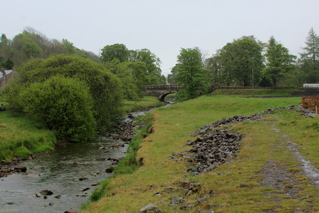
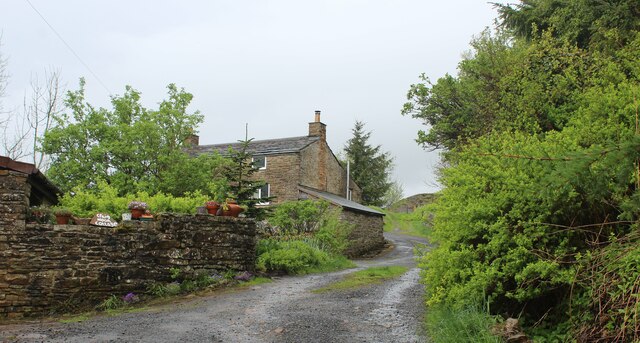
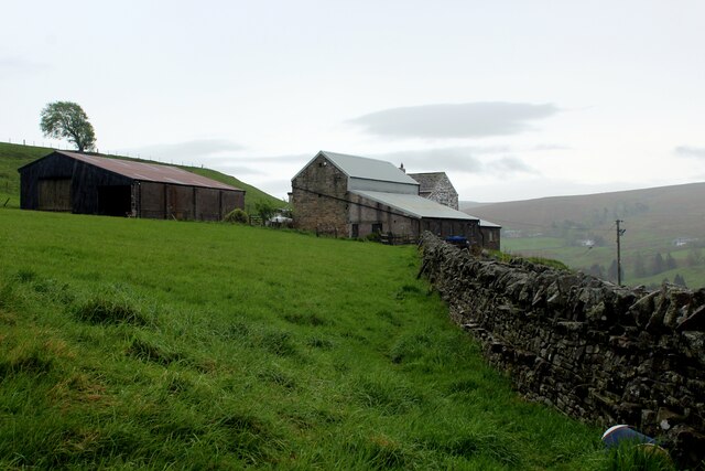
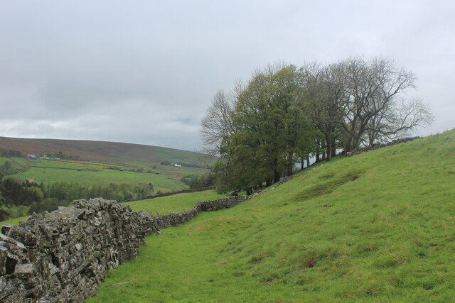
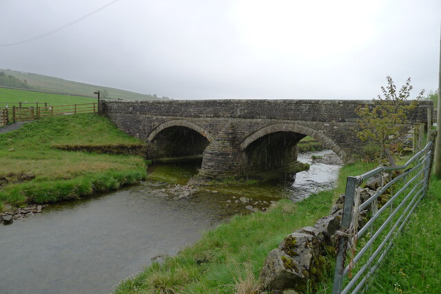
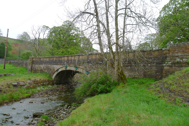
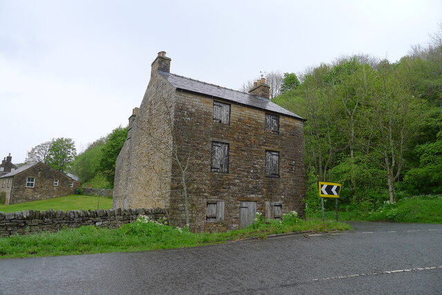
The village is characterized by its quaint stone cottages and traditional architecture, which adds to its rural appeal. The surrounding landscape is dominated by fields and farmland, with the River Eden meandering nearby. The area is renowned for its natural beauty, attracting visitors who seek a peaceful retreat away from the hustle and bustle of urban life.

Despite its small size, Galligill boasts a strong sense of community spirit. The village is home to a close-knit group of residents who actively engage in local activities and events. The village hall serves as a hub for social gatherings and various community initiatives.

In terms of amenities, Galligill offers a limited range of facilities. There is a small local pub where residents and visitors can enjoy a drink and socialize. However, for more comprehensive services such as shops and schools, residents typically rely on neighboring towns and villages.

Galligill is an ideal destination for outdoor enthusiasts. The area offers numerous walking and cycling trails, allowing visitors to explore the stunning countryside and enjoy the tranquility of nature. Additionally, fishing is a popular activity in the River Eden, attracting anglers from far and wide.

Overall, Galligill is a charming, rural village that offers a peaceful and idyllic setting for those seeking a retreat in the heart of the English countryside.

If you have any feedback on the listing, please let us know in the comments section below.

Galligill Images

Images are sourced within 2km of 54.79925/-2.3903915 or Grid Reference NY7545. Thanks to Geograph Open Source API. All images are credited.

West Foreshields Seen from the opposite side of the River Nent on a dark and wet afternoon
West Foreshields
Seen from the opposite side of the River Nent on a dark and wet afternoon
Isaac's Tea Trail beside the River Nent at Lovelady Shield The long distance footpath above the western bank of the River Nent, a tributary of the South Tyne.
Lovelady Shield Hotel is hidden among trees and vegetation on the opposite bank.
Isaac's Tea Trail beside the River Nent at Lovelady Shield
The long distance footpath above the western bank of the River Nent, a tributary of the South Tyne. Lovelady Shield Hotel is hidden among trees and vegetation on the opposite bank.
Approaching Nenthall Bridge on the Isaac's Tea Trail Following the River Nent upstream - a tributary of the South Tyne
Approaching Nenthall Bridge on the Isaac's Tea Trail
Following the River Nent upstream - a tributary of the South Tyne
Track beside Craig Nook House Isaac's Tea Trail is a 36 mile circular walk in the North Pennines named after Isaac Holden (c. 1805-57), an itinerant tea seller. Isaac became a familiar figure, out in all weathers, selling tea door to door to the farms, remote hamlets and mining communities scattered over the dales between Alston and Allendale Town. A pious man of humble origin, much involved in charitable work, he gained so much public respect that over 600 people contributed to his memorial. Full details at <span class="nowrap"><a title="https://isaacs-tea-trail.co.uk/" rel="nofollow ugc noopener" href="https://isaacs-tea-trail.co.uk/">Link</a><img style="margin-left:2px;" alt="External link" title="External link - shift click to open in new window" src="https://s1.geograph.org.uk/img/external.png" width="10" height="10"/></span>
Track beside Craig Nook House
Isaac's Tea Trail is a 36 mile circular walk in the North Pennines named after Isaac Holden (c. 1805-57), an itinerant tea seller. Isaac became a familiar figure, out in all weathers, selling tea door to door to the farms, remote hamlets and mining communities scattered over the dales between Alston and Allendale Town. A pious man of humble origin, much involved in charitable work, he gained so much public respect that over 600 people contributed to his memorial. Full details at LinkExternal link
High Nentsberry on a Wet Afternoon Isaac's Tea Trail is a 36 mile circular walk in the North Pennines named after Isaac Holden (c. 1805-57), an itinerant tea seller. Isaac became a familiar figure, out in all weathers, selling tea door to door to the farms, remote hamlets and mining communities scattered over the dales between Alston and Allendale Town. A pious man of humble origin, much involved in charitable work, he gained so much public respect that over 600 people contributed to his memorial. Full details at <span class="nowrap"><a title="https://isaacs-tea-trail.co.uk/" rel="nofollow ugc noopener" href="https://isaacs-tea-trail.co.uk/">Link</a><img style="margin-left:2px;" alt="External link" title="External link - shift click to open in new window" src="https://s1.geograph.org.uk/img/external.png" width="10" height="10"/></span>
High Nentsberry on a Wet Afternoon
Isaac's Tea Trail is a 36 mile circular walk in the North Pennines named after Isaac Holden (c. 1805-57), an itinerant tea seller. Isaac became a familiar figure, out in all weathers, selling tea door to door to the farms, remote hamlets and mining communities scattered over the dales between Alston and Allendale Town. A pious man of humble origin, much involved in charitable work, he gained so much public respect that over 600 people contributed to his memorial. Full details at LinkExternal link
Isaac's Tea Trail above Nentsberry Isaac's Tea Trail is a 36 mile circular walk in the North Pennines named after Isaac Holden (c. 1805-57), an itinerant tea seller. Isaac became a familiar figure, out in all weathers, selling tea door to door to the farms, remote hamlets and mining communities scattered over the dales between Alston and Allendale Town. A pious man of humble origin, much involved in charitable work, he gained so much public respect that over 600 people contributed to his memorial. Full details at <span class="nowrap"><a title="https://isaacs-tea-trail.co.uk/" rel="nofollow ugc noopener" href="https://isaacs-tea-trail.co.uk/">Link</a><img style="margin-left:2px;" alt="External link" title="External link - shift click to open in new window" src="https://s1.geograph.org.uk/img/external.png" width="10" height="10"/></span>
Isaac's Tea Trail above Nentsberry
Isaac's Tea Trail is a 36 mile circular walk in the North Pennines named after Isaac Holden (c. 1805-57), an itinerant tea seller. Isaac became a familiar figure, out in all weathers, selling tea door to door to the farms, remote hamlets and mining communities scattered over the dales between Alston and Allendale Town. A pious man of humble origin, much involved in charitable work, he gained so much public respect that over 600 people contributed to his memorial. Full details at LinkExternal link
Foreshield Bridge Carrying the B6294 and Isaac's Tea Trail over the River Nent
Foreshield Bridge
Carrying the B6294 and Isaac's Tea Trail over the River Nent
Bridge to Lovelady Shield The bridge across the River Nent leads (left) to a hotel and self-catering units operated by the Payman Club <span class="nowrap"><a title="https://paymanclub.com/united-kingdom/alston" rel="nofollow ugc noopener" href="https://paymanclub.com/united-kingdom/alston">Link</a><img style="margin-left:2px;" alt="External link" title="External link - shift click to open in new window" src="https://s1.geograph.org.uk/img/external.png" width="10" height="10"/></span>
Bridge to Lovelady Shield
The bridge across the River Nent leads (left) to a hotel and self-catering units operated by the Payman Club LinkExternal link
Mine ventilation shaft by the River Nent, Lovelady Shield An early 19th century ventilation shaft sunk down to the Nentforce Level - a drainage level for lead mines built for the Greenwich Hospital (The History and Workings of the Nenthead Mines, by M.F. Critchley <span class="nowrap"><a title="https://pdmhs.co.uk/MiningHistory/Bulletin%209-1%20-%20The%20History%20and%20Workings%20of%20the%20Nenthead%20Mines,%20Cumbria.pdf" rel="nofollow ugc noopener" href="https://pdmhs.co.uk/MiningHistory/Bulletin%209-1%20-%20The%20History%20and%20Workings%20of%20the%20Nenthead%20Mines,%20Cumbria.pdf">Link</a><img style="margin-left:2px;" alt="External link" title="External link - shift click to open in new window" src="https://s1.geograph.org.uk/img/external.png" width="10" height="10"/></span> )
Mine ventilation shaft by the River Nent, Lovelady Shield
An early 19th century ventilation shaft sunk down to the Nentforce Level - a drainage level for lead mines built for the Greenwich Hospital (The History and Workings of the Nenthead Mines, by M.F. Critchley LinkExternal link )
Nenthall Bridge Carrying the A689 over the River Nent
Nenthall Bridge
Carrying the A689 over the River Nent
Abandoned building, Nenthall Bridge According to <span class="nowrap"><a title="https://bowlandclimber.com/2021/06/13/isaacs-tea-trail-1-nenthead-to-alston/" rel="nofollow ugc noopener" href="https://bowlandclimber.com/2021/06/13/isaacs-tea-trail-1-nenthead-to-alston/">Link</a><img style="margin-left:2px;" alt="External link" title="External link - shift click to open in new window" src="https://s1.geograph.org.uk/img/external.png" width="10" height="10"/></span> this was a former blacksmith's shop. And <a href="https://www.geograph.org.uk/photo/2138720">NY7545 : Going round the bend</a> shows that it has been boarded up for at least 12 years.
Abandoned building, Nenthall Bridge
According to LinkExternal link this was a former blacksmith's shop. And NY7545 : Going round the bend shows that it has been boarded up for at least 12 years.
Nenthall War Memorial Listed Grade II. Built by the " ... masons Messrs Beattie & Co of Carlisle, who were responsible for many war memorials in the north of England and in Scotland ... " <span class="nowrap"><a title="https://historicengland.org.uk/listing/the-list/list-entry/1467848?section=official-list-entry" rel="nofollow ugc noopener" href="https://historicengland.org.uk/listing/the-list/list-entry/1467848?section=official-list-entry">Link</a><img style="margin-left:2px;" alt="External link" title="External link - shift click to open in new window" src="https://s1.geograph.org.uk/img/external.png" width="10" height="10"/></span>
Isaac's Tea Trail path passes through the gap in the wall to the right, before a steep climb out of the Nent valley
Nenthall War Memorial
Listed Grade II. Built by the " ... masons Messrs Beattie & Co of Carlisle, who were responsible for many war memorials in the north of England and in Scotland ... " LinkExternal link Isaac's Tea Trail path passes through the gap in the wall to the right, before a steep climb out of the Nent valley
Nether Nentsberry High Nentsberry is just up the slope to the right
Nether Nentsberry
High Nentsberry is just up the slope to the right
Isaac's Tea Trail east of Nentsberry Isaac's Tea Trail is a 36 mile circular walk in the North Pennines named after Isaac Holden (c. 1805-57), an itinerant tea seller. Isaac became a familiar figure, out in all weathers, selling tea door to door to the farms, remote hamlets and mining communities scattered over the dales between Alston and Allendale Town. A pious man of humble origin, much involved in charitable work, he gained so much public respect that over 600 people contributed to his memorial. Full details at <span class="nowrap"><a title="https://isaacs-tea-trail.co.uk/" rel="nofollow ugc noopener" href="https://isaacs-tea-trail.co.uk/">Link</a><img style="margin-left:2px;" alt="External link" title="External link - shift click to open in new window" src="https://s1.geograph.org.uk/img/external.png" width="10" height="10"/></span>
Isaac's Tea Trail east of Nentsberry
Isaac's Tea Trail is a 36 mile circular walk in the North Pennines named after Isaac Holden (c. 1805-57), an itinerant tea seller. Isaac became a familiar figure, out in all weathers, selling tea door to door to the farms, remote hamlets and mining communities scattered over the dales between Alston and Allendale Town. A pious man of humble origin, much involved in charitable work, he gained so much public respect that over 600 people contributed to his memorial. Full details at LinkExternal link
Isaac's tea Trail on the north flank of Nentdale Above Nentsberry Bridge
Isaac's tea Trail on the north flank of Nentdale
Above Nentsberry Bridge
Path route north of Nentsberry Bridge There's quite a number of public footpaths in the Nentsberry area; here, one arrives at the kissing gate from the far side, passes through it then climbs beside the wall.
Path route north of Nentsberry Bridge
There's quite a number of public footpaths in the Nentsberry area; here, one arrives at the kissing gate from the far side, passes through it then climbs beside the wall.
High Skelgill Farm With Newshield Moss in the distance.
High Skelgill Farm
With Newshield Moss in the distance.
Rough Pasture, Nent Valley Cheviot sheep grazing. Viewed from the A689 with West Foreshield Farm in the distance.
Rough Pasture, Nent Valley
Cheviot sheep grazing. Viewed from the A689 with West Foreshield Farm in the distance.
Show me another place!

Galligill is located at Grid Ref: NY7545 (Lat: 54.79925, Lng: -2.3903915)

Administrative County: Cumbria

District: Eden

Police Authority: Cumbria

What 3 Words

///noted.parsnips.jubilant. Near Alston, Cumbria

Related Wikis

Samuel King's School

Samuel King's School is a mixed secondary school located in Alston in the English county of Cumbria. As of 2017 it had 73 students on roll. It is a comprehensive...

Alston, Cumbria

Alston is a town in Westmorland and Furness, Cumbria, England, within the civil parish of Alston Moor on the River South Tyne. It shares the title of the...

Alston Moor

Alston Moor, formerly known as Alston with Garrigill, is a civil parish and electoral ward in the Westmorland and Furness district, in the ceremonial county...

Alston Town Hall

Alston Town Hall is a municipal building in Front Street, Alston, Cumbria, England. The town hall, which is currently used as a public library, is a Grade...

Nearby Amenities

Located within 500m of 54.79925,-2.3903915
Historic: mine_shaft
Source: Bing
Lat/Long: 54.7992804/-2.3967784
Historic: mine_shaft
Source: Bing
Lat/Long: 54.799726/-2.3965639
Historic: mine_shaft
Source: Bing
Lat/Long: 54.7981796/-2.3945468
Historic: mine_shaft
Source: Bing
Lat/Long: 54.799021/-2.3977655
Historic: mine_shaft
Source: Bing
Lat/Long: 54.800474/-2.3971325
Power: pole
Lat/Long: 54.8027565/-2.3859028
The data included in this document is from www.openstreetmap.org. The data is made available under ODbL.

Have you been to Galligill?

Leave your review of Galligill below (or comments, questions and feedback).