Bentley

Settlement in Staffordshire

England

Bentley

Roundabout on Reedswood Way
Roundabout on Reedswood Way Credit: JThomas

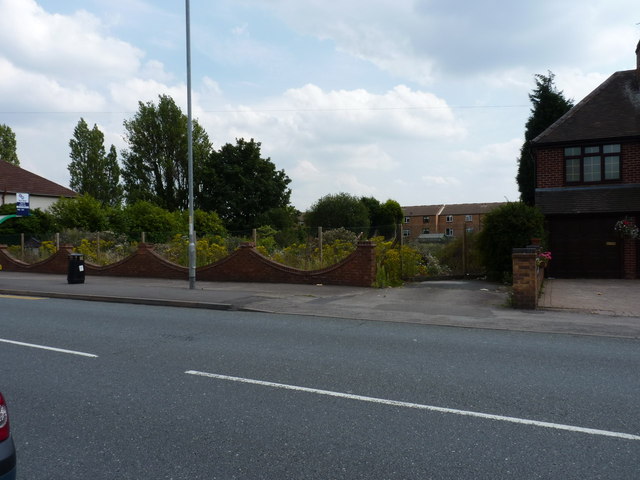
Bentley is a small village located in the district of Staffordshire, England. Situated approximately 4 miles northeast of the town of Stafford, Bentley is a rural area with a population of around 1,500 residents. The village is well-known for its picturesque countryside, charming cottages, and tranquil atmosphere.

Historically, Bentley was primarily an agricultural community, with farming being the main occupation of its inhabitants. Over the years, however, the village has seen some economic diversification, with a few small businesses and local services emerging.

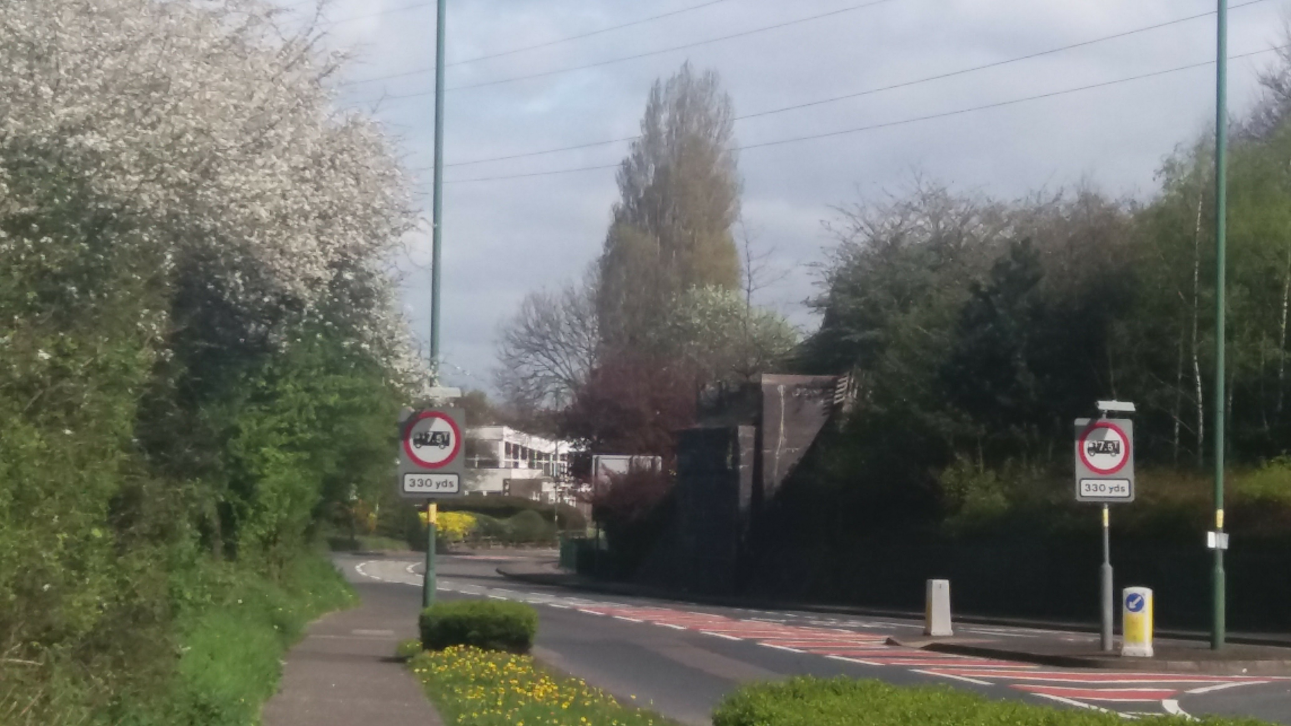
The village is surrounded by beautiful greenery, including rolling hills and farmland, making it an ideal location for nature enthusiasts and those seeking a peaceful retreat. The nearby Cannock Chase, an Area of Outstanding Natural Beauty, provides opportunities for outdoor activities such as hiking, cycling, and wildlife spotting.

Bentley is also proud of its close-knit community spirit, with various social and cultural events taking place throughout the year. The village hosts an annual summer fair, which brings together residents and visitors for a day of entertainment, local crafts, and food stalls.

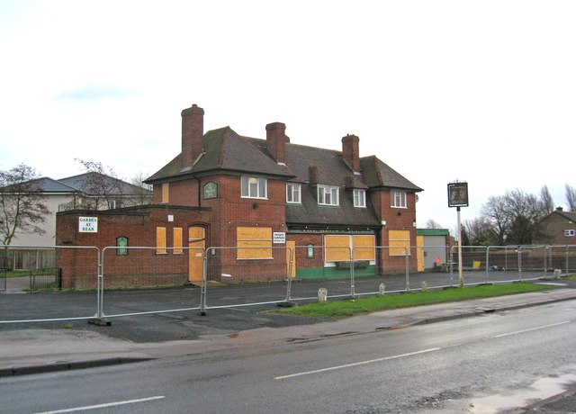
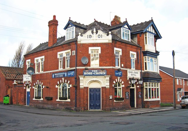
In terms of amenities, Bentley offers a primary school, a post office, a local shop, and a village pub, which serves as a popular gathering spot for locals. Public transportation is available, with regular bus services connecting Bentley to nearby towns and villages.

Overall, Bentley, Staffordshire, is a charming village that offers a peaceful countryside setting, a strong sense of community, and access to natural beauty.

If you have any feedback on the listing, please let us know in the comments section below.
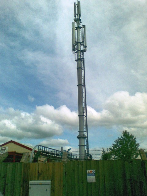
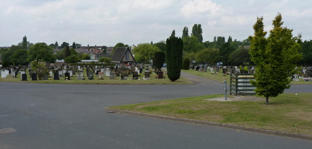
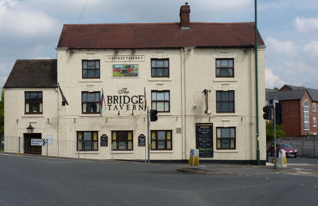
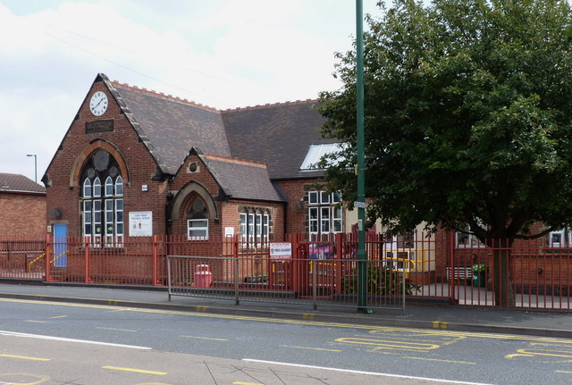
Bentley Images

Images are sourced within 2km of 52.588503/-2.024323 or Grid Reference SO9898. Thanks to Geograph Open Source API. All images are credited.

Roundabout on Reedswood Way
SK 000000 Electricity Substation at Poukhill According to my GPS, <a href="https://www.geograph.org.uk/gridref/SK+000000">SK 000000</a> lies just to the right of this building which is part of a large sub station. The photo was taken through the railings in terrible weather.
SK 000000 Electricity Substation at Poukhill
According to my GPS, SK 000000 lies just to the right of this building which is part of a large sub station. The photo was taken through the railings in terrible weather.
Flats on Bentley Lane In the Birchills area of Walsall.
Flats on Bentley Lane
In the Birchills area of Walsall.
Flats and garages A cul-de-sac off Bentley Lane, Walsall.
Flats and garages
A cul-de-sac off Bentley Lane, Walsall.
Rose & Crown - Birchills Large pub near the top of the Birchills flight of locks.
Rose & Crown - Birchills
Large pub near the top of the Birchills flight of locks.
Telecommunications mast, Ezekiel Lane
Willenhall Lawn Cemetery Cemetery, Gardens of Remembrance, Chapel of Rest etc, all on the site here beside Bentley Lane
Willenhall Lawn Cemetery
Cemetery, Gardens of Remembrance, Chapel of Rest etc, all on the site here beside Bentley Lane
The Bridge Tavern, Lane Head Very appropriately named, as it sits practically on the bridge over the Curly Wyrley cut.
The Bridge Tavern, Lane Head
Very appropriately named, as it sits practically on the bridge over the Curly Wyrley cut.
The Lane Head Nursery School
All gone! The site of the former Lane Heath Methodist Church - all that's left is a rather sad wooden sign just inside the chain-link fence, to give away the identity of the church that formerly occupied the site.
All gone!
The site of the former Lane Heath Methodist Church - all that's left is a rather sad wooden sign just inside the chain-link fence, to give away the identity of the church that formerly occupied the site.
Piling boat Wyrley & Essington canal Construction of Lane Head moorings adjacent to United Kingdom pub car park
Piling boat Wyrley & Essington canal
Construction of Lane Head moorings adjacent to United Kingdom pub car park
The former Brown Jug (1), 52 Sandbeds Road, Shortheath, Willenhall The Brown Jug pub has closed and is boarded up. I have no information on the future of the building.

<a href="https://www.geograph.org.uk/photo/2745585">SJ9700 : The former Brown Jug (2) - sign, 52 Sandbeds Road, Shortheath, Willenhall</a>.
The former Brown Jug (1), 52 Sandbeds Road, Shortheath, Willenhall
The Brown Jug pub has closed and is boarded up. I have no information on the future of the building. SJ9700 : The former Brown Jug (2) - sign, 52 Sandbeds Road, Shortheath, Willenhall.
The former Brown Jug (2) - sign, 52 Sandbeds Road, Shortheath, Willenhall The sign of this closed pub is still present, on top of a post in the front car park, adjacent to Sandbeds Road.

<a href="https://www.geograph.org.uk/photo/2745575">SJ9700 : The former Brown Jug (1), 52 Sandbeds Road, Shortheath, Willenhall</a>.
The former Brown Jug (2) - sign, 52 Sandbeds Road, Shortheath, Willenhall
The sign of this closed pub is still present, on top of a post in the front car park, adjacent to Sandbeds Road. SJ9700 : The former Brown Jug (1), 52 Sandbeds Road, Shortheath, Willenhall.
Electrical installation Near Walsall Retail Park (once the site of Birchills Power Station).
Electrical installation
Near Walsall Retail Park (once the site of Birchills Power Station).
Stephenson Avenue, Walsall
The Rose & Crown (1), 55 Old Birchills, Walsall A friendly pub which is now a Black Country Ales house, which means there are lots of different real ales on offer. The interior is a gem, preserving period decor which is increasingly difficult to find. Whether you call it late (very late) Victorian or early Edwardian, depends on your point of view. According to the date on the front of the building, it dates from 1901 and Queen Victoria died in January of that year. It was originally the Rose & Crown Hotel, although today the word Hotel has been dropped from the name, as it no longer functions as one. The building is Grade II listed.

<a href="https://www.geograph.org.uk/photo/2802468">SP0099 : The Rose & Crown (2) - engraved glass, 55 Old Birchills, Walsall</a>.
<a href="https://www.geograph.org.uk/photo/2802499">SP0099 : The Rose & Crown (3) - Highgate Brewery lamp, 55 Old Birchills, Walsall</a>.

Update (January 2020):- The good news is that the pub remains in business but it has not been operated by Black Country Ales for a while.
The Rose & Crown (1), 55 Old Birchills, Walsall
A friendly pub which is now a Black Country Ales house, which means there are lots of different real ales on offer. The interior is a gem, preserving period decor which is increasingly difficult to find. Whether you call it late (very late) Victorian or early Edwardian, depends on your point of view. According to the date on the front of the building, it dates from 1901 and Queen Victoria died in January of that year. It was originally the Rose & Crown Hotel, although today the word Hotel has been dropped from the name, as it no longer functions as one. The building is Grade II listed. SP0099 : The Rose & Crown (2) - engraved glass, 55 Old Birchills, Walsall. SP0099 : The Rose & Crown (3) - Highgate Brewery lamp, 55 Old Birchills, Walsall. Update (January 2020):- The good news is that the pub remains in business but it has not been operated by Black Country Ales for a while.
The Rose & Crown (2) - engraved glass, 55 Old Birchills, Walsall An example of some of the wonderful engraved glass to be found inside this pub.

<a href="https://www.geograph.org.uk/photo/2802448">SP0099 : The Rose & Crown (1), 55 Old Birchills, Walsall</a>.
<a href="https://www.geograph.org.uk/photo/2802499">SP0099 : The Rose & Crown (3) - Highgate Brewery lamp, 55 Old Birchills, Walsall</a>.
The Rose & Crown (2) - engraved glass, 55 Old Birchills, Walsall
The Rose & Crown (3) - Highgate Brewery lamp, 55 Old Birchills, Walsall There are two of these old lamps, one on either side of the entrance door. The monogram is that of the Highgate Brewery, who were probably the original owners of this business. It is now a Black Country Ales house. The Highgate Brewery was established in Walsall about 1898. Since then it has changed hands several times and faced closure at least twice, but it is still in business but on a much reduced scale. 

<a href="https://www.geograph.org.uk/photo/2802448">SP0099 : The Rose & Crown (1), 55 Old Birchills, Walsall</a>.
<a href="https://www.geograph.org.uk/photo/2802468">SP0099 : The Rose & Crown (2) - engraved glass, 55 Old Birchills, Walsall</a>.
The Rose & Crown (3) - Highgate Brewery lamp, 55 Old Birchills, Walsall
There are two of these old lamps, one on either side of the entrance door. The monogram is that of the Highgate Brewery, who were probably the original owners of this business. It is now a Black Country Ales house. The Highgate Brewery was established in Walsall about 1898. Since then it has changed hands several times and faced closure at least twice, but it is still in business but on a much reduced scale. SP0099 : The Rose & Crown (1), 55 Old Birchills, Walsall. SP0099 : The Rose & Crown (2) - engraved glass, 55 Old Birchills, Walsall.
Show me another place!

Bentley is located at Grid Ref: SO9898 (Lat: 52.588503, Lng: -2.024323)

Unitary Authority: Walsall

Police Authority: West Midlands

What 3 Words

///burn.into.tinsel. Near Willenhall, West Midlands

Nearby Locations

Bentley

Related Wikis

Emmanuel Church, Bentley

Emmanuel Church, Bentley is a parish church in the Church of England in Bentley, West Midlands. == History == The church was started in 1954 by the architect...

St Andrew's Church, Walsall

St Andrew's Church is a Free Church of England church in Bentley, Walsall, West Midlands. Three services are held weekly, Sunday at 10am, 11:30am and 6pm...

Bentley, West Midlands

Bentley is an area in the Metropolitan Borough of Walsall located around Junction 10 of the M6 Motorway. It is also a rural village of houses towards its...

Darlaston Town (1874) F.C.

Darlaston Town (1874) Football Club is an English association football club that represents the town of Darlaston, West Midlands. They are currently members...
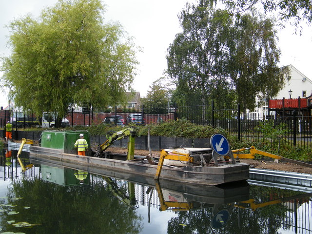
Bentley Canal

The Bentley Canal is an abandoned canal that was part of the Birmingham Canal Navigations. A very short section still exists where it joins the Wyrley...

Pouk Hill

Pouk Hill is a hill located in Walsall, West Midlands, England. The hill is situated off Bloxwich Lane in the Birchills area of the town, and overlooks...

Bentley railway station (West Midlands)

Bentley railway station was a railway station built by the Wolverhampton and Walsall Railway in 1872, and was operated by the Midland Railway from 1876...

Short Heath railway station

Short Heath railway station was a station built by the Wolverhampton and Walsall Railway in 1872, and was operated by the Midland Railway from 1876 onwards...

Nearby Amenities

Located within 500m of 52.588503,-2.024323
Traffic Signals
Source: bing
Lat/Long: 52.5848404/-2.0210393
Traffic Signals
Source: bing
Traffic Signals Direction: forward
Lat/Long: 52.5847138/-2.021382
Bus Stop
Morris Ave / Slim Rd
Bus: yes
Naptan AtcoCode: 43000627301
Naptan Bearing: NW
Naptan BusStopType: MKD
Naptan CommonName: Slim Rd
Naptan Indicator: opp
Naptan NaptanCode: nwmwamjd
Naptan Status: ACT
Naptan StopType: BCT
Naptan Street: MORRIS AVE
Naptan Towards: Willenhall
Naptan Verified: no
Public Transport: platform
Source: WMCA
Lat/Long: 52.5882374/-2.0297577
Bus Stop
Morris Ave / Slim Rd
Bus: yes
Naptan AtcoCode: 43000627302
Naptan Bearing: SE
Naptan BusStopType: MKD
Naptan CommonName: Slim Rd
Naptan Indicator: adj
Naptan NaptanCode: nwmwamjg
Naptan Status: ACT
Naptan StopType: BCT
Naptan Street: MORRIS AVE
Naptan Towards: Darlaston
Naptan Verified: no
Public Transport: platform
Source: WMCA
Lat/Long: 52.5882464/-2.0297577
Bus Stop
Wolverhampton Road W / Bentley Rd North
NaPTANAreaCode: 43000684201
Bus: yes
Naptan AtcoCode: 43000684201
Naptan Bearing: E
Naptan BusStopType: MKD
Naptan CommonName: Bentley Rd North
Naptan Indicator: opp
Naptan Landmark: The Lanes Arms
Naptan NaptanCode: nwmjdpap
Naptan PlusbusZoneRef: BHAMNWS
Naptan Status: ACT
Naptan StopType: BCT
Naptan Street: WOLVERHAMPTON ROAD W
Naptan Towards: Walsall
Public Transport: platform
Route Ref: 529
Shelter: yes
Shelter Ref: 203206
Source: WMCA
Lat/Long: 52.5850989/-2.0221644
Bus Stop
Wolverhampton Road W / Bentley Rd North
NaPTANAreaCode: 43000684202
Bus: yes
Naptan AtcoCode: 43000684202
Naptan Bearing: W
Naptan BusStopType: MKD
Naptan CommonName: Bentley Rd North
Naptan Indicator: adj
Naptan Landmark: The Lanes Arms
Naptan NaptanCode: nwmjdpat
Naptan PlusbusZoneRef: BHAMNWS
Naptan Status: ACT
Naptan StopType: BCT
Naptan Street: WOLVERHAMPTON ROAD W
Naptan Towards: Willenhall
Naptan Verified: no
Public Transport: platform
Route Ref: 303;529
Shelter: yes
Shelter Ref: 203249
Source: WMCA
Lat/Long: 52.5855595/-2.0245014
Bus Stop
Wolverhampton Road W / Bentley Cemetery
NaPTANAreaCode: 43000684301
Bus: yes
Naptan AtcoCode: 43000684301
Naptan Bearing: W
Naptan BusStopType: MKD
Naptan CommonName: Bentley Cemetery
Naptan Indicator: adj
Naptan NaptanCode: nwmjdpaw
Naptan PlusbusZoneRef: BHAMNWS
Naptan Status: ACT
Naptan StopType: BCT
Naptan Street: WOLVERHAMPTON ROAD W
Naptan Towards: Willenhall
Naptan Verified: no
Public Transport: platform
Route Ref: 303;529
Shelter: yes
Shelter Ref: 203204
Source: WMCA
Lat/Long: 52.5868023/-2.0291679
Bus Stop
Wolverhampton Road W / Bentley Cemetery
NaPTANAreaCode: 43000684302
Bench: yes
Bus: yes
Naptan AtcoCode: 43000684302
Naptan Bearing: E
Naptan BusStopType: MKD
Naptan CommonName: Bentley Cemetery
Naptan Indicator: opp
Naptan NaptanCode: nwmjdpda
Naptan PlusbusZoneRef: BHAMNWS
Naptan Status: ACT
Naptan StopType: BCT
Naptan Street: WOLVERHAMPTON ROAD W
Naptan Towards: Walsall
Naptan Verified: no
Public Transport: platform
Route Ref: 529
Shelter: yes
Shelter Ref: 203205
Source: WMCA
Lat/Long: 52.5866645/-2.0282659
Bus Stop
Churchill Rd / St Andrews Church
Bus: yes
Naptan AtcoCode: 43000686701
Naptan Bearing: N
Naptan BusStopType: MKD
Naptan CommonName: St Andrews Church
Naptan Indicator: opp
Naptan NaptanCode: nwmwadtg
Naptan PlusbusZoneRef: BHAMNWS
Naptan Status: ACT
Naptan StopType: BCT
Naptan Street: CHURCHILL RD
Naptan Verified: no
Public Transport: platform
Source: WMCA
Lat/Long: 52.5877785/-2.0313368
Bus Stop
Churchill Rd / St Andrews Church
Bus: yes
Naptan AtcoCode: 43000686702
Naptan Bearing: S
Naptan BusStopType: MKD
Naptan CommonName: St Andrews Church
Naptan Indicator: adj
Naptan NaptanCode: nwmwadtj
Naptan PlusbusZoneRef: BHAMNWS
Naptan Status: ACT
Naptan StopType: BCT
Naptan Street: CHURCHILL RD
Naptan Verified: no
Public Transport: platform
Source: WMCA
Lat/Long: 52.5875897/-2.0312186
Bus Stop
Attlee Rd / Rowlands Avenue
NaPTANAreaCode: 43000786301
Bus: yes
Naptan AtcoCode: 43000786301
Naptan Bearing: S
Naptan BusStopType: MKD
Naptan CommonName: Rowlands Avenue
Naptan Indicator: adj
Naptan NaptanCode: nwmjpmpt
Naptan PlusbusZoneRef: BHAMNWS
Naptan Status: ACT
Naptan StopType: BCT
Naptan Street: ATTLEE RD
Naptan Towards: Walsall
Naptan Verified: no
Public Transport: platform
Route Ref: 37
Shelter: yes
Shelter Ref: 202213
Source: WMCA
Lat/Long: 52.5921485/-2.027856
Bus Stop
Attlee Rd / Churchill Rd
NaPTANAreaCode: 43000786401
Bus: yes
Naptan AtcoCode: 43000786401
Naptan Bearing: S
Naptan BusStopType: MKD
Naptan CommonName: Churchill Rd
Naptan Indicator: adj
Naptan NaptanCode: nwmjpmta
Naptan PlusbusZoneRef: BHAMNWS
Naptan Status: ACT
Naptan StopType: BCT
Naptan Street: ATTLEE RD
Naptan Towards: Walsall
Naptan Verified: no
Public Transport: platform
Route Ref: 37
Shelter: yes
Shelter Ref: 203235
Source: WMCA
Lat/Long: 52.5891378/-2.0271013
Bus Stop
Attlee Rd / Churchill Rd
Bus: yes
Naptan AtcoCode: 43000786402
Naptan Bearing: N
Naptan BusStopType: MKD
Naptan CommonName: Churchill Rd
Naptan Indicator: opp
Naptan NaptanCode: nwmjpmtd
Naptan PlusbusZoneRef: BHAMNWS
Naptan Status: ACT
Naptan StopType: BCT
Naptan Street: ATTLEE RD
Naptan Towards: Willenhall
Naptan Verified: no
Public Transport: platform
Route Ref: 37
Source: WMCA
Lat/Long: 52.5895865/-2.0270868
Bus Stop
Churchill Rd / Queen Elizabeth Avenue
NaPTANAreaCode: 43000787101
Bus: yes
Naptan AtcoCode: 43000787101
Naptan Bearing: E
Naptan BusStopType: MKD
Naptan CommonName: Queen Elizabeth Avenue
Naptan Indicator: opp
Naptan NaptanCode: nwmjpmwg
Naptan PlusbusZoneRef: BHAMNWS
Naptan Status: ACT
Naptan StopType: BCT
Naptan Street: CHURCHILL RD
Naptan Towards: Walsall
Naptan Verified: no
Public Transport: platform
Shelter: yes
Shelter Ref: 203210
Source: WMCA
Lat/Long: 52.5895965/-2.0224813
Bus Stop
Churchill Rd / Queen Elizabeth Avenue
Bus: yes
Naptan AtcoCode: 43000787102
Naptan Bearing: W
Naptan BusStopType: MKD
Naptan CommonName: Queen Elizabeth Avenue
Naptan Indicator: adj
Naptan NaptanCode: nwmjpmwj
Naptan PlusbusZoneRef: BHAMNWS
Naptan Status: ACT
Naptan StopType: BCT
Naptan Street: CHURCHILL RD
Naptan Towards: Willenhall
Naptan Verified: no
Public Transport: platform
Route Ref: 37
Source: WMCA
Lat/Long: 52.5890748/-2.0238243
Bus Stop
Queen Elizabeth Ave / Cairn Drive
Bus: yes
Naptan AtcoCode: 43000787201
Naptan Bearing: N
Naptan BusStopType: MKD
Naptan CommonName: Cairn Drive
Naptan Indicator: opp
Naptan NaptanCode: nwmjpmwm
Naptan PlusbusZoneRef: BHAMNWS
Naptan Status: ACT
Naptan StopType: BCT
Naptan Street: QUEEN ELIZABETH AVE
Naptan Towards: Willenhall
Naptan Verified: no
Public Transport: platform
Route Ref: 37
Source: WMCA
Lat/Long: 52.5874299/-2.0220965
Bus Stop
Queen Elizabeth Ave / Cairn Drive
Bus: yes
Naptan AtcoCode: 43000787202
Naptan Bearing: S
Naptan BusStopType: MKD
Naptan CommonName: Cairn Drive
Naptan Indicator: adj
Naptan NaptanCode: nwmjpmwp
Naptan PlusbusZoneRef: BHAMNWS
Naptan Status: ACT
Naptan StopType: BCT
Naptan Street: QUEEN ELIZABETH AVE
Naptan Towards: Bentley
Naptan Verified: no
Public Transport: platform
Route Ref: 37;303
Source: WMCA
Lat/Long: 52.5876367/-2.0219342
Bus Stop
Queen Elizabeth Ave / Morris Avenue
NaPTANAreaCode: 43000787301
Bus: yes
Naptan AtcoCode: 43000787301
Naptan Bearing: S
Naptan BusStopType: MKD
Naptan CommonName: Morris Avenue
Naptan Indicator: opp
Naptan NaptanCode: nwmjpmwt
Naptan PlusbusZoneRef: BHAMNWS
Naptan Status: ACT
Naptan StopType: BCT
Naptan Street: QUEEN ELIZABETH AVE
Naptan Towards: Darlaston
Naptan Verified: no
Public Transport: platform
Route Ref: 37;303
Shelter: yes
Shelter Ref: 203208
Source: WMCA
Lat/Long: 52.5861263/-2.0223024
Bus Stop
Queen Elizabeth Ave / Morris Ave
Bus: yes
Naptan AtcoCode: 43000787302
Naptan Bearing: N
Naptan BusStopType: MKD
Naptan CommonName: Morris Ave
Naptan Indicator: adj
Naptan NaptanCode: nwmjptad
Naptan PlusbusZoneRef: BHAMNWS
Naptan Status: ACT
Naptan StopType: BCT
Naptan Street: QUEEN ELIZABETH AVE
Naptan Towards: Willenhall
Naptan Verified: no
Public Transport: platform
Route Ref: 37
Source: WMCA
Lat/Long: 52.5859465/-2.0226271
Bus Stop
Churchill Rd / Cairn Drive
NaPTANAreaCode: 43000787501
Bus: yes
Naptan AtcoCode: 43000787501
Naptan Bearing: NE
Naptan BusStopType: MKD
Naptan CommonName: Cairn Drive
Naptan Indicator: opp
Naptan NaptanCode: nwmjptam
Naptan PlusbusZoneRef: BHAMNWS
Naptan Status: ACT
Naptan StopType: BCT
Naptan Street: CHURCHILL RD
Naptan Towards: Walsall
Naptan Verified: no
Public Transport: platform
Shelter: yes
Shelter Ref: 203211
Source: WMCA
Lat/Long: 52.5902443/-2.0192046
Bus Stop
Churchill Rd / Cairn Drive
Bus: yes
Naptan AtcoCode: 43000787502
Naptan Bearing: SW
Naptan BusStopType: MKD
Naptan CommonName: Cairn Drive
Naptan Indicator: adj
Naptan NaptanCode: nwmjptap
Naptan PlusbusZoneRef: BHAMNWS
Naptan Status: ACT
Naptan StopType: BCT
Naptan Street: CHURCHILL RD
Naptan Towards: Willenhall
Naptan Verified: no
Public Transport: platform
Source: WMCA
Lat/Long: 52.5900825/-2.0193817
Bus Stop
Western Ave / Churchill Rd
Bus: yes
Naptan AtcoCode: 43006271001
Naptan Bearing: SE
Naptan BusStopType: CUS
Naptan CommonName: Churchill Rd
Naptan Indicator: before
Naptan NaptanCode: nwmtdwpg
Naptan PlusbusZoneRef: BHAMNWS
Naptan Status: ACT
Naptan StopType: BCT
Naptan Street: WESTERN AVE
Naptan Towards: Willenhall
Naptan Verified: no
Public Transport: platform
Route Ref: 303
Source: WMCA
Lat/Long: 52.588156/-2.0316765
Bus Stop
Queen Elizabeth Ave / Churchill Rd
NaPTANAreaCode: 43007870003
Bus: yes
Naptan AtcoCode: 43007870003
Naptan Bearing: S
Naptan BusStopType: MKD
Naptan CommonName: Churchill Rd
Naptan Indicator: after
Naptan Landmark: Library
Naptan NaptanCode: nwmpmjpa
Naptan PlusbusZoneRef: BHAMNWS
Naptan Status: ACT
Naptan StopType: BCT
Naptan Street: QUEEN ELIZABETH AVE
Naptan Towards: Darlaston
Naptan Verified: no
Public Transport: platform
Route Ref: 37;303
Shelter: yes
Shelter Ref: 203209
Source: WMCA
Lat/Long: 52.5890122/-2.022053
Mini Roundabout
Lat/Long: 52.5904027/-2.0188113
Mini Roundabout
Lat/Long: 52.5894695/-2.0225754
Crossing
Bicycle: yes
Crossing: uncontrolled
Crossing Ref: tiger
Lat/Long: 52.5891591/-2.0222912
Mini Roundabout
Lat/Long: 52.5907261/-2.0181664
Source: bing
Traffic Calming: bump
Lat/Long: 52.5858727/-2.0185059
Source: bing
Traffic Calming: bump
Lat/Long: 52.585584/-2.0201435
Traffic Signals
Source: bing
Traffic Signals: signal
Lat/Long: 52.5849552/-2.023129
Turning Circle
Source: bing
Lat/Long: 52.591211/-2.026201
Turning Circle
Source: bing
Lat/Long: 52.586233/-2.0216221
Turning Circle
Source: bing
Lat/Long: 52.5871037/-2.0231937
Turning Circle
Source: bing
Lat/Long: 52.5896579/-2.024215
Turning Circle
Source: bing
Lat/Long: 52.5864701/-2.0230154
Crossing
Crossing: uncontrolled
Source: bing
Lat/Long: 52.5872452/-2.0220538
Bentley Cairn
Historic: monument
Lat/Long: 52.5891871/-2.0211384
Traffic Signals
Source: bing
Traffic Signals: signal
Lat/Long: 52.5850067/-2.0227139
Traffic Signals
Source: bing
Lat/Long: 52.5852782/-2.0228329
Source: bing
Traffic Calming: bump
Lat/Long: 52.5855067/-2.0214272
Source: bing
Traffic Calming: bump
Lat/Long: 52.5856595/-2.0222709
Traffic Signals
Lat/Long: 52.5849367/-2.0215639
Traffic Signals
Source: bing
Lat/Long: 52.5852679/-2.0232453
Crossing
Crossing: traffic_signals
Crossing Island: no
Crossing Ref: pelican
Tactile Paving: yes
Lat/Long: 52.5847509/-2.0213807
Crossing
Crossing: unmarked
Crossing Island: yes
Tactile Paving: yes
Lat/Long: 52.5849124/-2.0211556
Crossing
Crossing: unmarked
Crossing Island: yes
Tactile Paving: yes
Lat/Long: 52.5849785/-2.0211403
Crossing
Crossing: uncontrolled
Source: bing
Lat/Long: 52.5842208/-2.0235054
Crossing
Crossing: zebra
Crossing Island: no
Tactile Paving: yes
Lat/Long: 52.589747/-2.0217915
Bus Stop
Attlee Rd / Rowlands Avenue
Bus: yes
Naptan AtcoCode: 43000786302
Naptan Bearing: N
Naptan BusStopType: MKD
Naptan CommonName: Rowlands Avenue
Naptan Indicator: opp
Naptan NaptanCode: nwmjpmpw
Naptan Status: ACT
Naptan StopType: BCT
Naptan Street: ATTLEE RD
Naptan Towards: Willenhall
Public Transport: platform
Route Ref: 37
Source: WMCA
Lat/Long: 52.59228/-2.0281369
Bus Stop
Bentley Rd North / County Bridge
Bus: yes
Naptan AtcoCode: 43000684501
Naptan Bearing: N
Naptan BusStopType: MKD
Naptan CommonName: County Bridge
Naptan Indicator: adj
Naptan NaptanCode: nwmjdpdm
Naptan Status: ACT
Naptan StopType: BCT
Naptan Street: BENTLEY RD NORTH
Naptan Towards: Bentley
Public Transport: platform
Route Ref: 37
Source: WMCA
Lat/Long: 52.584325/-2.0235564
Post Office
Queen Elizabeth Avenue Post Office
Addr City: Walsall
Addr Housenumber: 186
Addr Postcode: WS2 0BA
Addr Street: Churchill Road
Addr Village: Bentley
Brand: Post Office
Brand Wikidata: Q1783168
Fixme: verify by survey
Opening Hours: Mo-Sa 06:00-18:00; Su 07:00-13:00
Ref Pol Id: 9600
Source: pol_branch_list_2018-02
Website: https://www.postoffice.co.uk/branch-finder/2452421/queen-elizabeth-avenue
Lat/Long: 52.58911/-2.0231
Generator Method: photovoltaic
Generator Output Electricity: yes
Generator Source: solar
Generator Type: solar_photovoltaic_panel
Power: generator
Lat/Long: 52.5892706/-2.0285788
Generator Method: photovoltaic
Generator Output Electricity: yes
Generator Source: solar
Generator Type: solar_photovoltaic_panel
Power: generator
Lat/Long: 52.5917001/-2.0279807
Generator Method: photovoltaic
Generator Output Electricity: yes
Generator Source: solar
Generator Type: solar_photovoltaic_panel
Power: generator
Lat/Long: 52.5926191/-2.0262802
Generator Method: photovoltaic
Generator Output Electricity: yes
Generator Source: solar
Generator Type: solar_photovoltaic_panel
Power: generator
Lat/Long: 52.5923877/-2.0270553
Generator Method: photovoltaic
Generator Output Electricity: yes
Generator Source: solar
Generator Type: solar_photovoltaic_panel
Power: generator
Lat/Long: 52.5926093/-2.0250946
Generator Method: photovoltaic
Generator Output Electricity: yes
Generator Source: solar
Generator Type: solar_photovoltaic_panel
Power: generator
Lat/Long: 52.5926778/-2.0251375
Generator Method: photovoltaic
Generator Output Electricity: yes
Generator Source: solar
Generator Type: solar_photovoltaic_panel
Power: generator
Lat/Long: 52.5909742/-2.022399
Generator Method: photovoltaic
Generator Output Electricity: yes
Generator Source: solar
Generator Type: solar_photovoltaic_panel
Power: generator
Lat/Long: 52.5919136/-2.0235202
Generator Method: photovoltaic
Generator Output Electricity: yes
Generator Source: solar
Generator Type: solar_photovoltaic_panel
Power: generator
Lat/Long: 52.5923649/-2.0215836
Generator Method: photovoltaic
Generator Output Electricity: yes
Generator Source: solar
Generator Type: solar_photovoltaic_panel
Power: generator
Lat/Long: 52.5919054/-2.0208889
Generator Method: photovoltaic
Generator Output Electricity: yes
Generator Source: solar
Generator Type: solar_photovoltaic_panel
Power: generator
Lat/Long: 52.5910516/-2.0206502
Generator Method: photovoltaic
Generator Output Electricity: yes
Generator Source: solar
Generator Type: solar_photovoltaic_panel
Power: generator
Lat/Long: 52.591164/-2.0197731
Generator Method: photovoltaic
Generator Output Electricity: yes
Generator Source: solar
Generator Type: solar_photovoltaic_panel
Power: generator
Lat/Long: 52.5912488/-2.019529
Generator Method: photovoltaic
Generator Output Electricity: yes
Generator Source: solar
Generator Type: solar_photovoltaic_panel
Power: generator
Lat/Long: 52.5912651/-2.0193815
Generator Method: photovoltaic
Generator Output Electricity: yes
Generator Source: solar
Generator Type: solar_photovoltaic_panel
Power: generator
Lat/Long: 52.591283/-2.0190758
Generator Method: photovoltaic
Generator Output Electricity: yes
Generator Source: solar
Generator Type: solar_photovoltaic_panel
Power: generator
Lat/Long: 52.591283/-2.0189256
Generator Method: photovoltaic
Generator Output Electricity: yes
Generator Source: solar
Generator Type: solar_photovoltaic_panel
Power: generator
Lat/Long: 52.590843/-2.0200172
Generator Method: photovoltaic
Generator Output Electricity: yes
Generator Source: solar
Generator Type: solar_photovoltaic_panel
Power: generator
Lat/Long: 52.5908952/-2.0195398
Generator Method: photovoltaic
Generator Output Electricity: yes
Generator Source: solar
Generator Type: solar_photovoltaic_panel
Power: generator
Lat/Long: 52.5910141/-2.0189175
Generator Method: photovoltaic
Generator Output Electricity: yes
Generator Source: solar
Generator Type: solar_photovoltaic_panel
Power: generator
Lat/Long: 52.5901342/-2.020264
Generator Method: photovoltaic
Generator Output Electricity: yes
Generator Source: solar
Generator Type: solar_photovoltaic_panel
Power: generator
Lat/Long: 52.5900413/-2.0211196
Generator Method: photovoltaic
Generator Output Electricity: yes
Generator Source: solar
Generator Type: solar_photovoltaic_panel
Power: generator
Lat/Long: 52.5900544/-2.0212215
Generator Method: photovoltaic
Generator Output Electricity: yes
Generator Source: solar
Generator Type: solar_photovoltaic_panel
Power: generator
Lat/Long: 52.5904471/-2.0205268
Generator Method: photovoltaic
Generator Output Electricity: yes
Generator Source: solar
Generator Type: solar_photovoltaic_panel
Power: generator
Lat/Long: 52.5908887/-2.0214656
Generator Method: photovoltaic
Generator Output Electricity: yes
Generator Source: solar
Generator Type: solar_photovoltaic_panel
Power: generator
Lat/Long: 52.5906768/-2.0227692
Generator Method: photovoltaic
Generator Output Electricity: yes
Generator Source: solar
Generator Type: solar_photovoltaic_panel
Power: generator
Lat/Long: 52.5902515/-2.0254728
Generator Method: photovoltaic
Generator Output Electricity: yes
Generator Source: solar
Generator Type: solar_photovoltaic_panel
Power: generator
Lat/Long: 52.5900022/-2.0249766
Generator Method: photovoltaic
Generator Output Electricity: yes
Generator Source: solar
Generator Type: solar_photovoltaic_panel
Power: generator
Lat/Long: 52.5899647/-2.025505
Generator Method: photovoltaic
Generator Output Electricity: yes
Generator Source: solar
Generator Type: solar_photovoltaic_panel
Power: generator
Lat/Long: 52.5900381/-2.0246574
Generator Method: photovoltaic
Generator Output Electricity: yes
Generator Source: solar
Generator Type: solar_photovoltaic_panel
Power: generator
Lat/Long: 52.5898963/-2.0263231
Generator Method: photovoltaic
Generator Output Electricity: yes
Generator Source: solar
Generator Type: solar_photovoltaic_panel
Power: generator
Lat/Long: 52.5893211/-2.0251644
Generator Method: photovoltaic
Generator Output Electricity: yes
Generator Source: solar
Generator Type: solar_photovoltaic_panel
Power: generator
Lat/Long: 52.5893162/-2.025269
Generator Method: photovoltaic
Generator Output Electricity: yes
Generator Source: solar
Generator Type: solar_photovoltaic_panel
Power: generator
Lat/Long: 52.5892836/-2.0253977
Generator Method: photovoltaic
Generator Output Electricity: yes
Generator Source: solar
Generator Type: solar_photovoltaic_panel
Power: generator
Lat/Long: 52.5892559/-2.0255023
Generator Method: photovoltaic
Generator Output Electricity: yes
Generator Source: solar
Generator Type: solar_photovoltaic_panel
Power: generator
Lat/Long: 52.5882782/-2.0263365
Generator Method: photovoltaic
Generator Output Electricity: yes
Generator Source: solar
Generator Type: solar_photovoltaic_panel
Power: generator
Lat/Long: 52.5870348/-2.0278198
Generator Method: photovoltaic
Generator Output Electricity: yes
Generator Source: solar
Generator Type: solar_photovoltaic_panel
Power: generator
Lat/Long: 52.5867529/-2.0268193
Generator Method: photovoltaic
Generator Output Electricity: yes
Generator Source: solar
Generator Type: solar_photovoltaic_panel
Power: generator
Lat/Long: 52.5863292/-2.025277
Generator Method: photovoltaic
Generator Output Electricity: yes
Generator Source: solar
Generator Type: solar_photovoltaic_panel
Power: generator
Lat/Long: 52.5866274/-2.0252153
Generator Method: photovoltaic
Generator Output Electricity: yes
Generator Source: solar
Generator Type: solar_photovoltaic_panel
Power: generator
Lat/Long: 52.5871277/-2.0251724
Generator Method: photovoltaic
Generator Output Electricity: yes
Generator Source: solar
Generator Type: solar_photovoltaic_panel
Power: generator
Lat/Long: 52.5876622/-2.0256472
Generator Method: photovoltaic
Generator Output Electricity: yes
Generator Source: solar
Generator Type: solar_photovoltaic_panel
Power: generator
Lat/Long: 52.5880859/-2.0244375
Generator Method: photovoltaic
Generator Output Electricity: yes
Generator Source: solar
Generator Type: solar_photovoltaic_panel
Power: generator
Lat/Long: 52.5877519/-2.0228952
Generator Method: photovoltaic
Generator Output Electricity: yes
Generator Source: solar
Generator Type: solar_photovoltaic_panel
Power: generator
Lat/Long: 52.5876834/-2.0234665
Generator Method: photovoltaic
Generator Output Electricity: yes
Generator Source: solar
Generator Type: solar_photovoltaic_panel
Power: generator
Lat/Long: 52.5872222/-2.0228443
Generator Method: photovoltaic
Generator Output Electricity: yes
Generator Source: solar
Generator Type: solar_photovoltaic_panel
Power: generator
Lat/Long: 52.5869468/-2.0229891
Generator Method: photovoltaic
Generator Output Electricity: yes
Generator Source: solar
Generator Type: solar_photovoltaic_panel
Power: generator
Lat/Long: 52.587087/-2.0210968
Generator Method: photovoltaic
Generator Output Electricity: yes
Generator Source: solar
Generator Type: solar_photovoltaic_panel
Power: generator
Lat/Long: 52.5863895/-2.0180592
Generator Method: photovoltaic
Generator Output Electricity: yes
Generator Source: solar
Generator Type: solar_photovoltaic_panel
Power: generator
Lat/Long: 52.5854052/-2.0217499
Generator Method: photovoltaic
Generator Output Electricity: yes
Generator Source: solar
Generator Type: solar_photovoltaic_panel
Power: generator
Lat/Long: 52.5860212/-2.0220745
Generator Method: photovoltaic
Generator Output Electricity: yes
Generator Source: solar
Generator Type: solar_photovoltaic_panel
Power: generator
Lat/Long: 52.5856366/-2.0236892
Generator Method: photovoltaic
Generator Output Electricity: yes
Generator Source: solar
Generator Type: solar_photovoltaic_panel
Power: generator
Lat/Long: 52.5855698/-2.0234531
Generator Method: photovoltaic
Generator Output Electricity: yes
Generator Source: solar
Generator Type: solar_photovoltaic_panel
Power: generator
Lat/Long: 52.5855568/-2.0232117
Generator Method: photovoltaic
Generator Output Electricity: yes
Generator Source: solar
Generator Type: solar_photovoltaic_panel
Power: generator
Lat/Long: 52.5856871/-2.0230508
Generator Method: photovoltaic
Generator Output Electricity: yes
Generator Source: solar
Generator Type: solar_photovoltaic_panel
Power: generator
Lat/Long: 52.5852439/-2.0222059
Generator Method: photovoltaic
Generator Output Electricity: yes
Generator Source: solar
Generator Type: solar_photovoltaic_panel
Power: generator
Lat/Long: 52.5853384/-2.0223856
Generator Method: photovoltaic
Generator Output Electricity: yes
Generator Source: solar
Generator Type: solar_photovoltaic_panel
Power: generator
Lat/Long: 52.5854786/-2.0223561
Street Lamp
Lat/Long: 52.5911906/-2.0260815
Man Made: telegraph_pole
Lat/Long: 52.5913095/-2.026137
Street Lamp
Lat/Long: 52.5913563/-2.0255115
Door: hinged
Entrance: home
Lat/Long: 52.5912203/-2.0254928
Door: hinged
Entrance: home
Lat/Long: 52.5911993/-2.0255866
Door: hinged
Entrance: home
Lat/Long: 52.591186/-2.0257555
Addr Housenumber: 11
Addr Street: Hawthorn Place
Door: hinged
Entrance: home
Lat/Long: 52.5911674/-2.0258342
Door: hinged
Entrance: home
Lat/Long: 52.5911416/-2.0260153
Door: hinged
Entrance: home
Lat/Long: 52.5911234/-2.0260919
Door: hinged
Entrance: home
Lat/Long: 52.5910532/-2.0262414
Door: hinged
Entrance: home
Lat/Long: 52.5910319/-2.0263342
Door: hinged
Entrance: home
Lat/Long: 52.5910806/-2.0264302
Door: hinged
Entrance: home
Lat/Long: 52.5911385/-2.0264611
Door: hinged
Entrance: home
Lat/Long: 52.5912343/-2.026502
Door: hinged
Entrance: home
Lat/Long: 52.5912981/-2.0265358
Door: hinged
Entrance: home
Lat/Long: 52.5913794/-2.0263867
Door: hinged
Entrance: home
Lat/Long: 52.5913978/-2.0262975
Door: hinged
Entrance: home
Lat/Long: 52.5914306/-2.0261383
Door: hinged
Entrance: home
Lat/Long: 52.5914495/-2.0260436
Door: hinged
Entrance: home
Lat/Long: 52.5914196/-2.0258502
Door: hinged
Entrance: home
Lat/Long: 52.5914383/-2.0257597
Door: hinged
Entrance: home
Lat/Long: 52.5914025/-2.0255771
Door: hinged
Entrance: home
Lat/Long: 52.5914205/-2.0254868
Door: hinged
Entrance: home
Lat/Long: 52.5913992/-2.0253181
Door: hinged
Entrance: home
Lat/Long: 52.5914169/-2.0252221
Door: hinged
Entrance: home
Lat/Long: 52.5913652/-2.0251192
Door: hinged
Entrance: home
Lat/Long: 52.5913035/-2.0250948
Door: hinged
Entrance: home
Lat/Long: 52.591218/-2.0250404
Door: hinged
Entrance: home
Lat/Long: 52.5911508/-2.0250112
Door: hinged
Entrance: home
Lat/Long: 52.5910899/-2.0253007
Door: hinged
Entrance: home
Lat/Long: 52.5910372/-2.0252719
Street Lamp
Lat/Long: 52.5910382/-2.025172
Barrier: cycle_barrier
Lat/Long: 52.585941/-2.0287491
Barrier: cycle_barrier
Lat/Long: 52.5865248/-2.0284971
Bentley
Place: suburb
Source: OS_OpenData_StreetView
Wikidata: Q4890451
Wikipedia: en:Bentley, West Midlands
Lat/Long: 52.5875114/-2.0250786
Post Box
Post Box Type: pillar
Ref: WS2 581
Lat/Long: 52.5891443/-2.0227276
Crossing
Crossing: unmarked
Crossing Island: yes
Tactile Paving: yes
Lat/Long: 52.5848426/-2.0211078
Crossing
Crossing: uncontrolled
Lat/Long: 52.5893447/-2.0231648
The data included in this document is from www.openstreetmap.org. The data is made available under ODbL.

Have you been to Bentley?

Leave your review of Bentley below (or comments, questions and feedback).