Nantoer

Settlement in Montgomeryshire

Wales

Nantoer

Garden hedges in Stepaside The village appears to be entirely residential.
Garden hedges in Stepaside Credit: Bill Boaden

Nantoer is a small village located in the historic county of Montgomeryshire, Wales. Situated on the banks of the River Severn, it is surrounded by picturesque countryside and offers a tranquil and rural setting. The village is part of the community of Llanfair Caereinion and is approximately 3 miles southeast of the town of Llanfair Caereinion itself.

Nantoer is characterized by its charming and traditional Welsh architecture, with stone-built cottages and farmhouses dotting the landscape. The village is home to a close-knit community, with a population of around 200 residents. The local economy mainly relies on agriculture and farming activities, with fields of grazing livestock and cultivated farmlands dominating the scenery.

Nature lovers and outdoor enthusiasts will find plenty to explore in the surrounding area. Nantoer is within close proximity to the stunning Snowdonia National Park, offering opportunities for hiking, cycling, and wildlife spotting. The River Severn, which flows through the village, is also a popular spot for fishing enthusiasts.

Despite its small size, Nantoer benefits from basic amenities and services. The village has a small primary school, a village hall, and a church, providing a community focal point for social gatherings and events. For further amenities, residents can easily access the nearby town of Llanfair Caereinion, which offers a wider array of shops, restaurants, and leisure facilities.

Overall, Nantoer offers a peaceful and idyllic setting, perfect for those seeking a rural lifestyle amidst the natural beauty of Montgomeryshire.

If you have any feedback on the listing, please let us know in the comments section below.
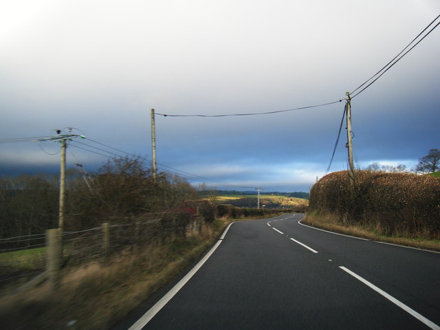
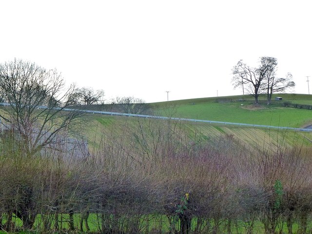
Nantoer Images

Images are sourced within 2km of 52.506449/-3.334978 or Grid Reference SO0990. Thanks to Geograph Open Source API. All images are credited.

Garden hedges in Stepaside The village appears to be entirely residential.
Garden hedges in Stepaside
The village appears to be entirely residential.
The main street in Stepaside In all honesty, there isn't much in this village to step aside for. There appear to be no community facilities.
The main street in Stepaside
In all honesty, there isn't much in this village to step aside for. There appear to be no community facilities.
High hedges on the road from Stepaside This is the road to Newtown. The road is narrow but there are small passing places.
High hedges on the road from Stepaside
This is the road to Newtown. The road is narrow but there are small passing places.
A483 heading north
A483 heading north
Dolfor Road near Pen-y-banc Wood
Newtown Bypass construction by the Mochdre Industrial Estate
Newtown Bypass construction by the Dolfor Road I think this is a base for the construction team.
Newtown Bypass construction by the Dolfor Road
I think this is a base for the construction team.
Newtown Bypass construction I think this is the entrance to a base for the construction team beside the Dolfor Road. Just across the new road is the Mochdre Industrial Estate and beyond, most of the rest of the town.
Newtown Bypass construction
I think this is the entrance to a base for the construction team beside the Dolfor Road. Just across the new road is the Mochdre Industrial Estate and beyond, most of the rest of the town.
Remains of a tree Removed during Newtown Bypass construction.
Remains of a tree
Removed during Newtown Bypass construction.
Remains of a tree Removed during Newtown Bypass construction.
Remains of a tree
Removed during Newtown Bypass construction.
Mochdre Brook
Mochdre Brook
Brook Terrace, Mochdre Presumably built to house mill workers.
See also <a title="https://www.geograph.org.uk/photo/5988403" href="https://www.geograph.org.uk/photo/5988403">Link</a>
Brook Terrace, Mochdre
Presumably built to house mill workers. See also Link
Brook Terrace, Mochdre Presumably built to house mill workers.
See also <a title="https://www.geograph.org.uk/photo/5988401" href="https://www.geograph.org.uk/photo/5988401">Link</a>
Mochdre Brook <a title="https://www.geograph.org.uk/photo/5988397" href="https://www.geograph.org.uk/photo/5988397">Link</a> flows behind the bushes on the right.
Brook Terrace, Mochdre
Presumably built to house mill workers. See also Link Mochdre Brook Link flows behind the bushes on the right.
A steep cutting below Castell-y-dail Wood The horizontal white line is the new bypass.
A steep cutting below Castell-y-dail Wood
The horizontal white line is the new bypass.
The bypass on an embankment As it passes behind Mochdre Industrial Estate.
For a closer view see <a title="https://www.geograph.org.uk/photo/6034940" href="https://www.geograph.org.uk/photo/6034940">Link</a> and <a title="https://www.geograph.org.uk/photo/6034943" href="https://www.geograph.org.uk/photo/6034943">Link</a>.
The bypass on an embankment
As it passes behind Mochdre Industrial Estate. For a closer view see Link and Link.
The bypass on an embankment  As it passes behind Mochdre Industrial Estate.
The bypass on an embankment
As it passes behind Mochdre Industrial Estate.
The bypass on an embankment  As it passes behind Mochdre Industrial Estate.
The bypass on an embankment
As it passes behind Mochdre Industrial Estate.
Newtown Bypass construction I think this is a base for the construction team beside the Dolfor Road.
Newtown Bypass construction
I think this is a base for the construction team beside the Dolfor Road.
Show me another place!

Nantoer is located at Grid Ref: SO0990 (Lat: 52.506449, Lng: -3.334978)

Unitary Authority: Powys

Police Authority: Dyfed Powys

What 3 Words

///lashed.mango.works. Near Newtown, Powys

Related Wikis

Newtown Central

Newtown Central was the name of a county electoral ward in the town of Newtown, Powys, Wales. It remains as a community ward to Newtown and Llanllwchaiarn...
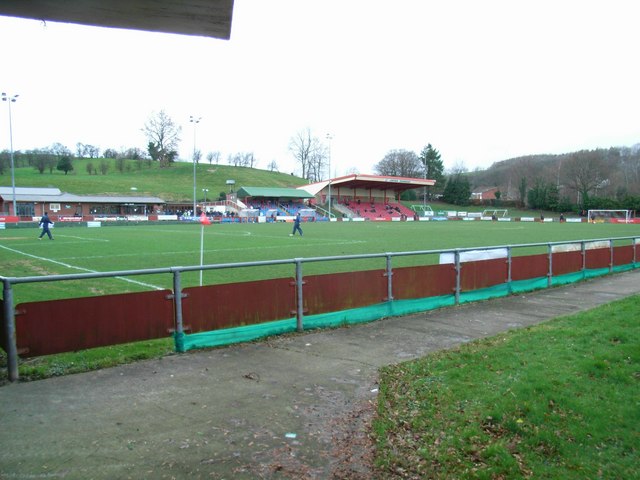
Latham Park

Latham Park is a multi-purpose stadium in Newtown, Wales. It is currently used for football matches and is the home ground of Newtown A.F.C. The stadium...

Newtown High School, Powys

Newtown High School is a secondary comprehensive school for boys and girls. The school is based on two campuses in the towns of Newtown and Presteigne...

Scafell Halt railway station

Scafell Halt was a railway station on the Cambrian Line, located to the west of Newtown, Powys, Wales; it was adjacent to Scafell Bridge on the River Severn...

Nearby Amenities

Located within 500m of 52.506449,-3.334978
Crossing
Crossing: traffic_signals
Lat/Long: 52.5073782/-3.3317357
Telephone
Booth: KX100
Covered: booth
Lat/Long: 52.5070112/-3.3324718
Crossing
Crossing: zebra
Lat/Long: 52.5064084/-3.3321281
Maesyrhandir
Place: suburb
Lat/Long: 52.5041341/-3.3295227
Maesydail
Place: suburb
Lat/Long: 52.5040753/-3.3346725
Vaynor
Place: suburb
Lat/Long: 52.5084771/-3.3374405
Power: pole
Lat/Long: 52.5028252/-3.3311285
Power: pole
Lat/Long: 52.5027428/-3.3320311
Power: pole
Lat/Long: 52.5026383/-3.332833
Power: pole
Lat/Long: 52.5031967/-3.3345872
Power: pole
Lat/Long: 52.503866/-3.3351129
Power: pole
Lat/Long: 52.5042775/-3.3360249
Power: pole
Lat/Long: 52.5045403/-3.3366069
Power: pole
Lat/Long: 52.5047363/-3.341569
Bus Stop
Bus: yes
Naptan AtcoCode: 5610AWE90147
Naptan NaptanCode: powgmad
Public Transport: platform
Lat/Long: 52.5071947/-3.3320229
Crossing
Lat/Long: 52.5049149/-3.3383315
Direction: S
Generator Method: photovoltaic
Generator Output Electricity: yes
Generator Solar Modules: 7
Generator Source: solar
Generator Type: solar_photovoltaic_panel
Location: roof
Power: generator
Lat/Long: 52.5091433/-3.3310179
Direction: 185
Generator Method: photovoltaic
Generator Output Electricity: yes
Generator Solar Modules: 17
Generator Source: solar
Generator Type: solar_photovoltaic_panel
Location: roof
Power: generator
Lat/Long: 52.5107297/-3.336204
Direction: 215
Generator Method: photovoltaic
Generator Output Electricity: yes
Generator Solar Modules: 20
Generator Source: solar
Generator Type: solar_photovoltaic_panel
Location: roof
Power: generator
Lat/Long: 52.5078468/-3.3418447
Direction: SE
Generator Method: photovoltaic
Generator Output Electricity: yes
Generator Solar Modules: 12
Generator Source: solar
Generator Type: solar_photovoltaic_panel
Location: roof
Power: generator
Lat/Long: 52.5066615/-3.3397418
Direction: 260
Generator Method: photovoltaic
Generator Output Electricity: yes
Generator Solar Modules: 9
Generator Source: solar
Generator Type: solar_photovoltaic_panel
Location: roof
Power: generator
Lat/Long: 52.5063464/-3.3294958
Direction: SSW
Generator Method: photovoltaic
Generator Output Electricity: yes
Generator Solar Modules: 16
Generator Source: solar
Generator Type: solar_photovoltaic_panel
Location: roof
Power: generator
Lat/Long: 52.5037163/-3.3322477
Direction: 170
Generator Method: photovoltaic
Generator Output Electricity: yes
Generator Solar Modules: 12
Generator Source: solar
Generator Type: solar_photovoltaic_panel
Location: roof
Power: generator
Lat/Long: 52.5050567/-3.3291793
Location Transition: yes
Power: pole
Lat/Long: 52.5034036/-3.3302844
Direction: S
Generator Method: photovoltaic
Generator Output Electricity: yes
Generator Solar Modules: 7
Generator Source: solar
Generator Type: solar_photovoltaic_panel
Location: roof
Power: generator
Lat/Long: 52.5091483/-3.33091
Direction: SSE
Generator Method: photovoltaic
Generator Output Electricity: yes
Generator Solar Modules: 8
Generator Source: solar
Generator Type: solar_photovoltaic_panel
Location: roof
Power: generator
Lat/Long: 52.5067383/-3.3328217
Direction: 235
Generator Method: photovoltaic
Generator Output Electricity: yes
Generator Solar Modules: 48
Generator Source: solar
Generator Type: solar_photovoltaic_panel
Location: roof
Power: generator
Lat/Long: 52.5022844/-3.3359599
Direction: SSW
Generator Method: photovoltaic
Generator Output Electricity: yes
Generator Solar Modules: 8
Generator Source: solar
Generator Type: solar_photovoltaic_panel
Location: roof
Power: generator
Lat/Long: 52.5041724/-3.3345472
Direction: NNE
Generator Method: photovoltaic
Generator Output Electricity: yes
Generator Solar Modules: 4
Generator Source: solar
Generator Type: solar_photovoltaic_panel
Location: roof
Power: generator
Lat/Long: 52.5042042/-3.334513
Direction: SSE
Generator Method: photovoltaic
Generator Output Electricity: yes
Generator Solar Modules: 7
Generator Source: solar
Generator Type: solar_photovoltaic_panel
Location: roof
Power: generator
Lat/Long: 52.5046325/-3.3335015
Direction: NNW
Generator Method: photovoltaic
Generator Output Electricity: yes
Generator Solar Modules: 7
Generator Source: solar
Generator Type: solar_photovoltaic_panel
Location: roof
Power: generator
Lat/Long: 52.5046635/-3.3335229
Direction: 165
Generator Method: photovoltaic
Generator Output Electricity: yes
Generator Solar Modules: 15
Generator Source: solar
Generator Type: solar_photovoltaic_panel
Location: roof
Power: generator
Lat/Long: 52.5056738/-3.3365849
Noexit: yes
Lat/Long: 52.5067102/-3.3332921
The data included in this document is from www.openstreetmap.org. The data is made available under ODbL.

Have you been to Nantoer?

Leave your review of Nantoer below (or comments, questions and feedback).