Nant y Pandy
Settlement in Caernarfonshire
Wales
Nant y Pandy

Nant y Pandy is a small village located in the county of Caernarfonshire, Wales. Situated in the northern part of the country, it lies within the picturesque countryside of Snowdonia National Park. The village is nestled in a valley surrounded by rolling hills and offers breathtaking views of the nearby mountains.
Despite its small size, Nant y Pandy has a rich history dating back centuries. The name itself translates to "stream of the fulling mill," indicating its historical association with the local wool industry. In the past, the village was a hub for textile production and milling, with several water-powered mills operating along the stream that runs through the village.
Today, Nant y Pandy retains its charming rural character while also embracing modernity. The village is home to a close-knit community, with a population of around 200 residents. The village center features a few local amenities, including a traditional pub, a small convenience store, and a community hall.
The surrounding natural beauty of Nant y Pandy makes it a popular destination for outdoor enthusiasts. The village serves as an excellent base for hikers and nature lovers looking to explore the stunning landscapes of Snowdonia National Park. Additionally, the nearby Llyn Padarn lake offers opportunities for water sports and fishing.
Overall, Nant y Pandy is a peaceful and idyllic village that offers a glimpse into Wales' industrial past, while also providing a gateway to the breathtaking natural wonders of Snowdonia National Park.
If you have any feedback on the listing, please let us know in the comments section below.
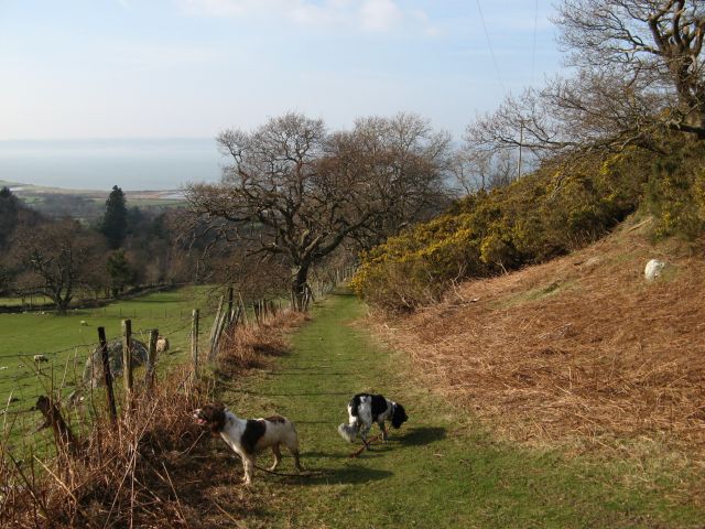
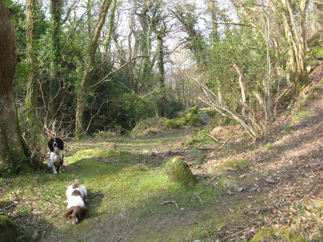
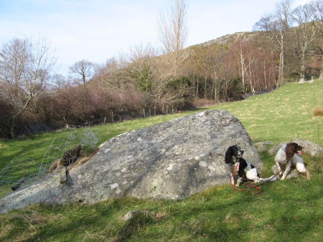
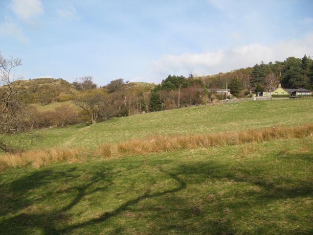
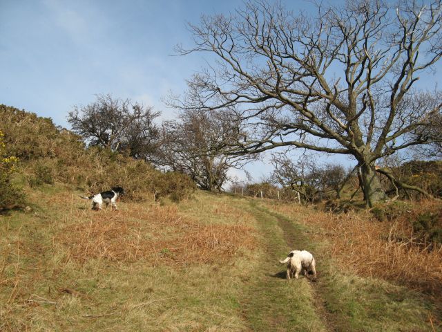
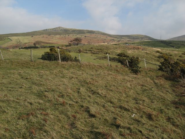
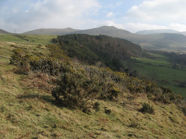
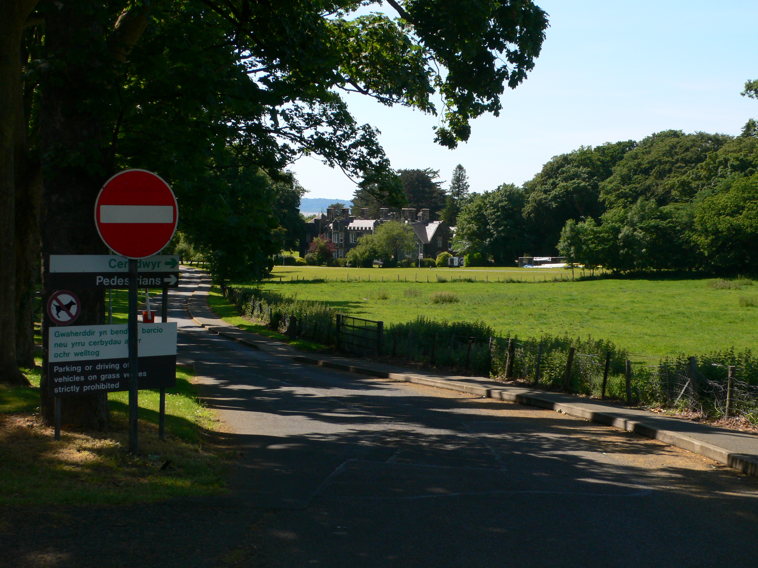
Nant y Pandy Images
Images are sourced within 2km of 53.247428/-3.964508 or Grid Reference SH6974. Thanks to Geograph Open Source API. All images are credited.


Nant y Pandy is located at Grid Ref: SH6974 (Lat: 53.247428, Lng: -3.964508)
Unitary Authority: Conwy
Police Authority: North Wales
Also known as: Nant-y-pandy
What 3 Words
///costumes.disengage.pioneered. Near Llanfairfechan, Conwy
Nearby Locations
Related Wikis

Llanfairfechan
Llanfairfechan (Welsh for 'Little St Mary's Parish') is a town and community in the Conwy County Borough, Wales. It is known as a seaside resort and had...

St Winifred's School
St Winifred's School was a school for girls in Llanfairfechan, Conwy County Borough, Wales. == History == St. Winifred's was founded on 3 May 1887 and...
Bryn y Neuadd Hospital
Bryn y Neuadd Hospital (Welsh: Ysbyty Bryn y Neuadd) is a mental health facility in Llanfairfechan, Conwy County Borough, Wales. It is managed by the Betsi...
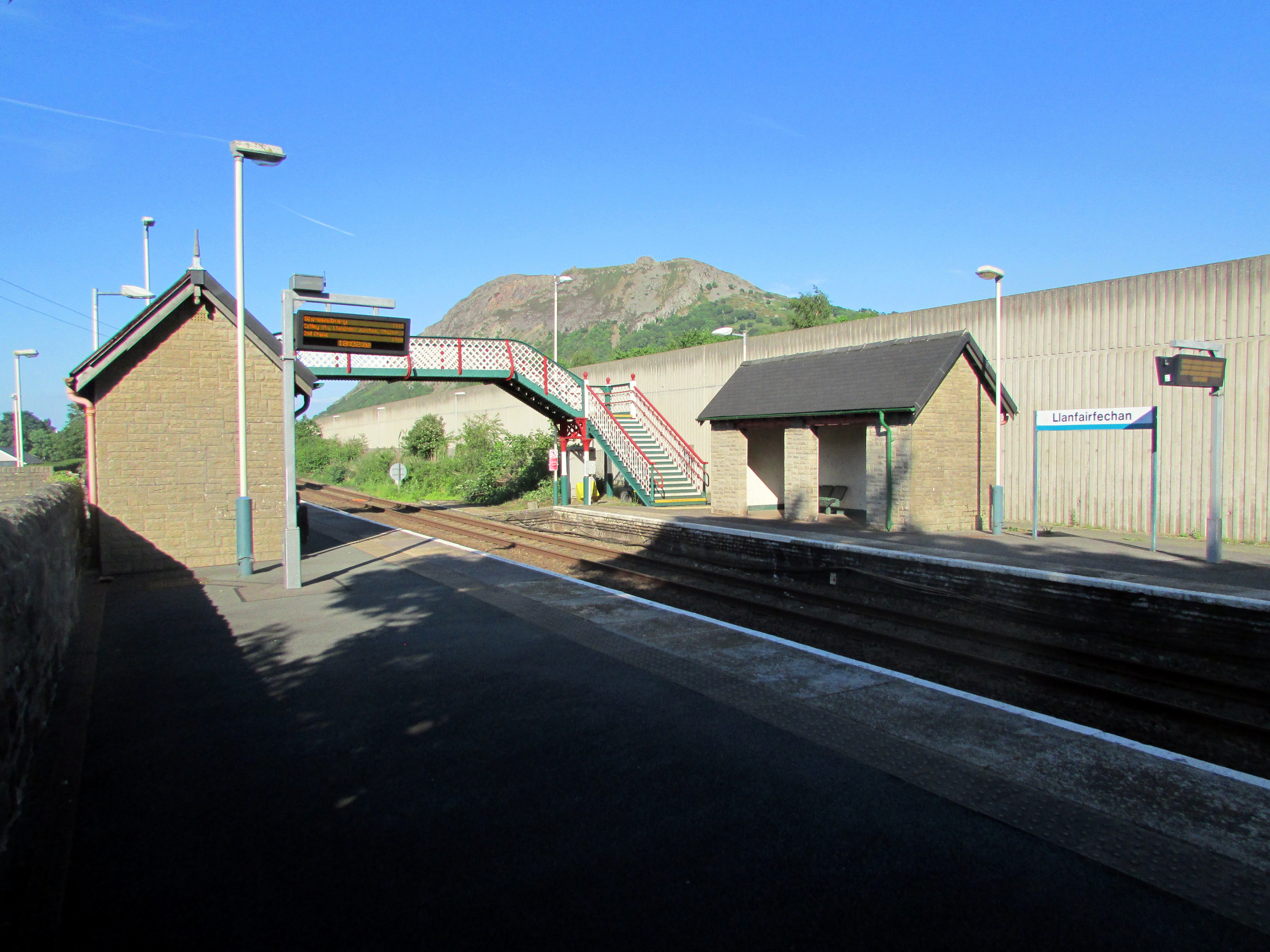
Llanfairfechan railway station
Llanfairfechan railway station serves the town of Llanfairfechan, Wales, and is located on the Crewe to Holyhead North Wales Coast Line 51+1⁄4 miles (82...

Penmaenmawr & Welsh Granite Co.
The Penmaenmawr & Welsh Granite Co. owned and operated a major granite quarry on the north Wales coast located between Conwy and Llanfairfechan. Granite...
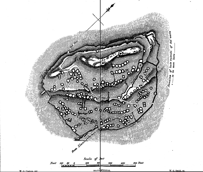
Braich-y-Dinas
Braich-y-Dinas was an extensive hillfort at the summit of Penmaenmawr, one of the northernmost peaks of the Carneddau mountain range on North coast of...

Bwlch-y-Ddeufaen
Bwlch-y-Ddeufaen (Welsh: Gap/Pass of the Two Stones) is a mountain pass in Conwy county borough, north Wales, traversable only on foot or horseback, following...

Pen y Bryn
Pen y Bryn is a two-storey manor house, in Abergwyngregyn, Gwynedd, in north-west Wales, adjacent to the A55, five miles east of Bangor and eight miles...
Nearby Amenities
Located within 500m of 53.247428,-3.964508Have you been to Nant y Pandy?
Leave your review of Nant y Pandy below (or comments, questions and feedback).