Nanquidno

Settlement in Cornwall

England

Nanquidno

Climate history revealed! Bottom: current beach - rounded rocks
Middle: raised beach (rounded pebbles but above current sea level) from warm period 120000 years ago (Mediterranean Climate in south Britain)
Top: head deposits (angular - broken by ice action) from 100000-20000 years ago when area was tundra and ice covered much of Britain.
Climate history revealed! Credit: Hugh Venables

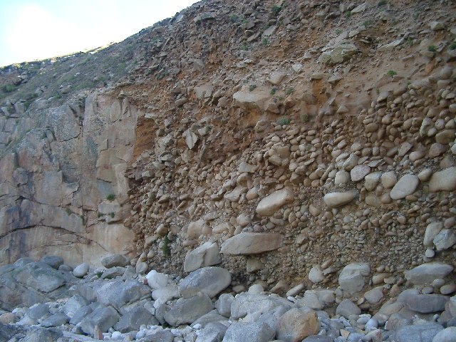
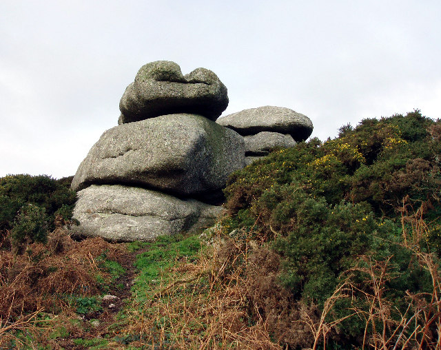
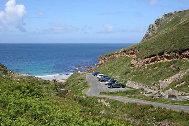
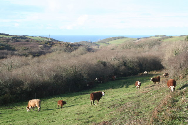
Nanquidno is a picturesque coastal village located in the southwestern region of Cornwall, England. Nestled amidst stunning natural beauty, this small hamlet is renowned for its rugged cliffs, sandy beaches, and sweeping landscapes. It lies within the Cornwall Area of Outstanding Natural Beauty, attracting visitors with its unspoiled charm.

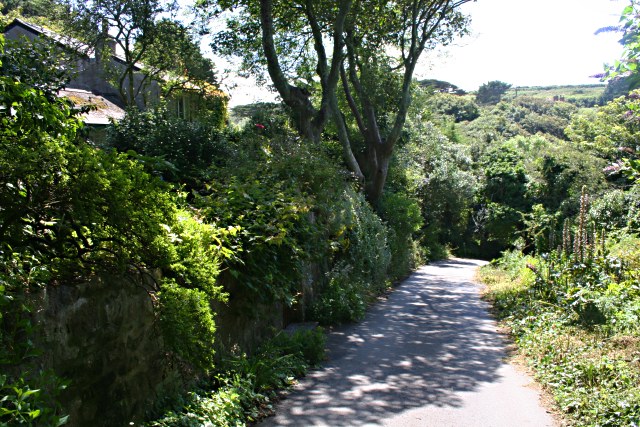
The village is situated about 5 miles northwest of the popular town of St. Just and approximately 12 miles from the bustling tourist destination of Penzance. Nanquidno is surrounded by lush green fields and rolling hills, with the Atlantic Ocean dominating the horizon.

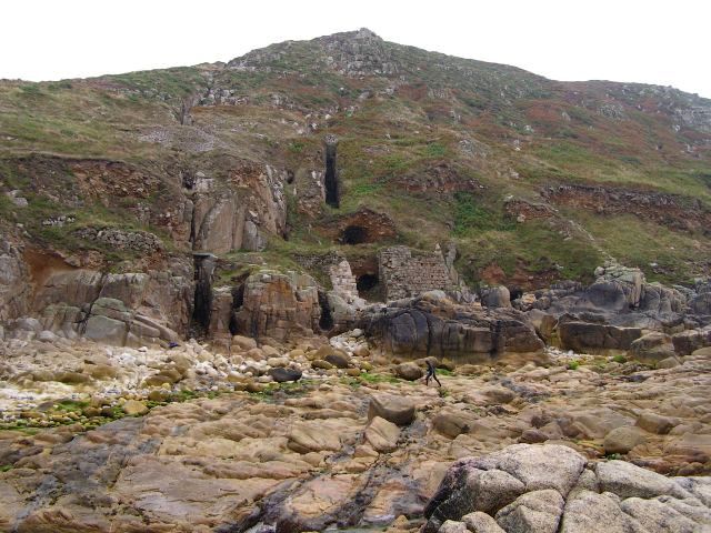
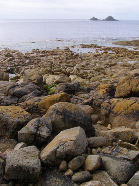
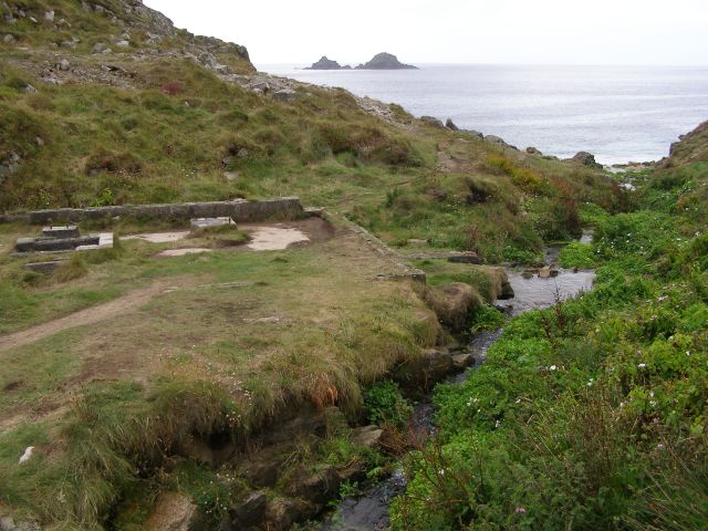
The main attraction of Nanquidno is its stunning beach, which is a haven for surfers, swimmers, and nature enthusiasts. The sandy shores are flanked by towering cliffs, offering breathtaking views of the ocean. The beach is also renowned for its rock pools, which are teeming with marine life and provide a great opportunity for exploration.

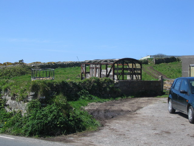
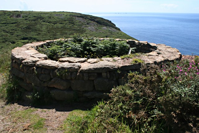
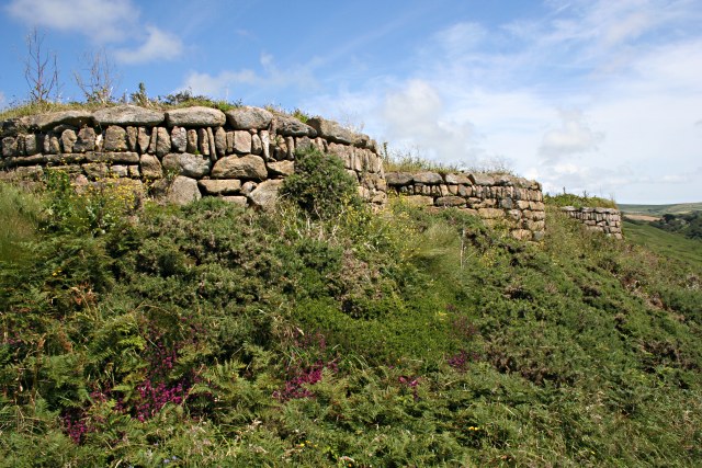
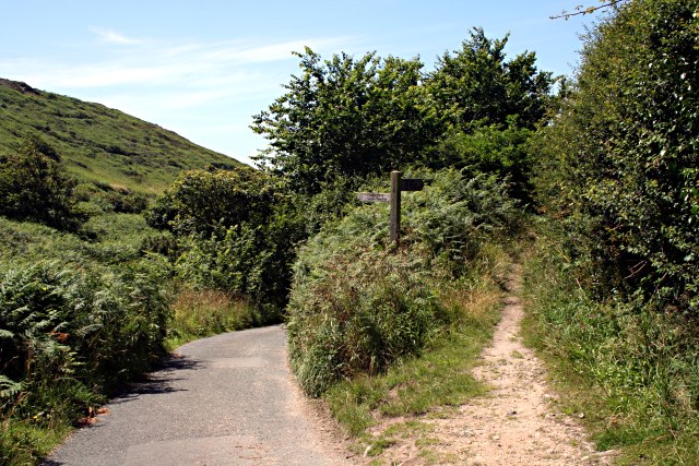
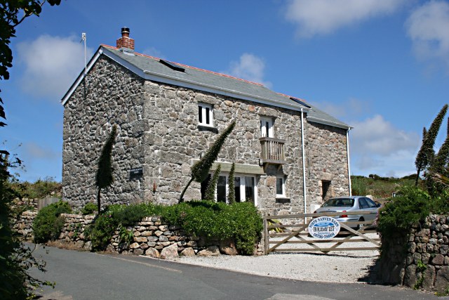
Apart from its natural beauty, Nanquidno is home to a few charming cottages and a small café that serves delicious local fare. The village is a haven for hikers and walkers, with plenty of stunning coastal paths and trails that offer panoramic views of the surrounding countryside.

Overall, Nanquidno is a hidden gem that offers visitors a peaceful and idyllic retreat away from the hustle and bustle of city life, allowing them to immerse themselves in the beauty of Cornwall's unspoiled landscapes and enjoy the tranquility of the Atlantic coast.

If you have any feedback on the listing, please let us know in the comments section below.

Nanquidno Images

Images are sourced within 2km of 50.103799/-5.685749 or Grid Reference SW3629. Thanks to Geograph Open Source API. All images are credited.

Climate history revealed! Bottom: current beach - rounded rocks
Middle: raised beach (rounded pebbles but above current sea level) from warm period 120000 years ago (Mediterranean Climate in south Britain)
Top: head deposits (angular - broken by ice action) from 100000-20000 years ago when area was tundra and ice covered much of Britain.
Climate history revealed!
Bottom: current beach - rounded rocks Middle: raised beach (rounded pebbles but above current sea level) from warm period 120000 years ago (Mediterranean Climate in south Britain) Top: head deposits (angular - broken by ice action) from 100000-20000 years ago when area was tundra and ice covered much of Britain.
Bosworlas Rock Basins Also referred to as The Giant's Chair by Dr Borlase in his 1769 book on Penwith's stones.
Bosworlas Rock Basins
Also referred to as The Giant's Chair by Dr Borlase in his 1769 book on Penwith's stones.
Tom Thumb rock St. Just-in-Penwith
Carn Bosavern A view looking west across the B3306 to a dilapidated railway van at the farm at Carn Bosavern.
Carn Bosavern
A view looking west across the B3306 to a dilapidated railway van at the farm at Carn Bosavern.
Beach and cliffs at Nanven Looking inland towards the cliff at low tide, with the rocky beach exposed. The dark vertical gashes in the cliff are the remains of mine workings which followed the seams of minerals. The cliff around the lower entrance is supported by a wall. Look closely and you can just make out a figure making their way across the rocks - they had been snorkelling and were returning to their kit.
Beach and cliffs at Nanven
Looking inland towards the cliff at low tide, with the rocky beach exposed. The dark vertical gashes in the cliff are the remains of mine workings which followed the seams of minerals. The cliff around the lower entrance is supported by a wall. Look closely and you can just make out a figure making their way across the rocks - they had been snorkelling and were returning to their kit.
Rocky beach at Nanven Looking out to sea at low tide from the rocky beach at Nanven, with boulders that have been weathered into smooth shapes by the action of the sea. On the horizon: The Brisons.
Rocky beach at Nanven
Looking out to sea at low tide from the rocky beach at Nanven, with boulders that have been weathered into smooth shapes by the action of the sea. On the horizon: The Brisons.
Ruined mine workings in the Cot Valley The stream in this photo runs along the Cot Valley and joins the sea below at Porth Nanven. On the left (and behind the photographer) are the remains of mine workings that accompanied the various shafts in the surrounding cliffs and hills. The rocky islands out to sea are The Brisons, with a profile perhaps unkindly likened to General de Gaulle lying on his back.
Ruined mine workings in the Cot Valley
The stream in this photo runs along the Cot Valley and joins the sea below at Porth Nanven. On the left (and behind the photographer) are the remains of mine workings that accompanied the various shafts in the surrounding cliffs and hills. The rocky islands out to sea are The Brisons, with a profile perhaps unkindly likened to General de Gaulle lying on his back.
Disused Mine Shaft on Carn Gloose Overlooking Porth Naven.
Disused Mine Shaft on Carn Gloose
Overlooking Porth Naven.
Row of Disused Mine Shafts On the top of the valley slope at Porth Nanven.
Row of Disused Mine Shafts
On the top of the valley slope at Porth Nanven.
The Coast Path in the Cot Valley The path descends from Carn Gloose then takes the valley road down towards Porth Nanven.
The Coast Path in the Cot Valley
The path descends from Carn Gloose then takes the valley road down towards Porth Nanven.
Converted Barn at Bosorne This is now a holiday home.
Converted Barn at Bosorne
This is now a holiday home.
The Road into Cot Valley
Car Park at Porth Nanven There are no houses or tourist facilities here, just this parking area with space for a few cars.
Car Park at Porth Nanven
There are no houses or tourist facilities here, just this parking area with space for a few cars.
Mine Shaft at Carn Leskys The cliffs to the south of Porth Nanven are riddled with old mine workings and shafts, many of which are not as well marked as this. It is not a good idea to stray from the footpath around here.
Mine Shaft at Carn Leskys
The cliffs to the south of Porth Nanven are riddled with old mine workings and shafts, many of which are not as well marked as this. It is not a good idea to stray from the footpath around here.
Clifftop Vegetation on Carn Leskys
Carn Gribba from Carn Leskys It looks like the coast path should have an easy route around the base of Carn Gribba but in fact it doubles back on itself to go over the top.  This is because on the far side of Carn Gribba is a steep cliff with no place for a footpath.
Carn Gribba from Carn Leskys
It looks like the coast path should have an easy route around the base of Carn Gribba but in fact it doubles back on itself to go over the top. This is because on the far side of Carn Gribba is a steep cliff with no place for a footpath.
Vegetation above Carn Leskys At the top of the cliff the bracken and grass makes way for some coastal heathland dominated by heather and gorse.
Vegetation above Carn Leskys
At the top of the cliff the bracken and grass makes way for some coastal heathland dominated by heather and gorse.
Gribba Point from the South The rocks in the distance are The Brisons.
Gribba Point from the South
The rocks in the distance are The Brisons.
Show me another place!

Nanquidno is located at Grid Ref: SW3629 (Lat: 50.103799, Lng: -5.685749)

Unitary Authority: Cornwall

Police Authority: Devon and Cornwall

What 3 Words

///apron.gone.peach. Near St Just, Cornwall

Nearby Locations

Nanquidno Trevegean

Related Wikis

Nanquidno

Nanquidno is a hamlet near St Just in Penwith in west Cornwall, England. It is about half a mile southwest of Kelynack. == References ==

Kelynack

Kelynack (from Cornish: Kelynek is a settlement in west Cornwall, England, UK. == Geography == Kelynack is on the Penwith peninsula approximately four...

Land's End Airport

Land's End Airport (IATA: LEQ, ICAO: EGHC), situated near St Just in Penwith, 5 NM (9.3 km; 5.8 mi) west of Penzance, in Cornwall, is the most south westerly...

Porth Nanven

Porth Nanven (grid reference SW355307; most well known as Cot Valley and occasionally known as Penanwell) is a beach in the far west of Cornwall, England...

Nearby Amenities

Located within 500m of 50.103799,-5.685749
Ford: yes
Lat/Long: 50.1031895/-5.6880093
Power: pole
Lat/Long: 50.1069522/-5.6905264
Power: pole
Lat/Long: 50.1071208/-5.689365
Power: pole
Lat/Long: 50.107236/-5.6885389
Power: pole
Lat/Long: 50.1072653/-5.6883484
Power: pole
Lat/Long: 50.1068645/-5.6877074
Power: pole
Transformer: distribution
Lat/Long: 50.1061248/-5.6853282
Power: pole
Transformer: distribution
Lat/Long: 50.1041584/-5.691787
Power: pole
Lat/Long: 50.1033671/-5.691382
Power: pole
Lat/Long: 50.1028957/-5.6903708
Power: pole
Transformer: distribution
Lat/Long: 50.1040088/-5.6878656
Power: pole
Lat/Long: 50.1043683/-5.6878281
Power: pole
Lat/Long: 50.1050788/-5.6877503
Power: pole
Lat/Long: 50.1055674/-5.6876913
Power: pole
Lat/Long: 50.107544/-5.6859827
Power: pole
Lat/Long: 50.1064344/-5.6870046
Power: pole
Lat/Long: 50.1056327/-5.6877556
Power: pole
Lat/Long: 50.1047795/-5.6885201
Power: pole
Lat/Long: 50.1037645/-5.6894749
Power: pole
Lat/Long: 50.1028355/-5.6903011
Power: pole
Lat/Long: 50.1022746/-5.6898531
Power: pole
Lat/Long: 50.1015537/-5.6892872
Power: pole
Lat/Long: 50.1010497/-5.6888822
Power: pole
Lat/Long: 50.1005146/-5.6884477
Power: pole
Lat/Long: 50.0999778/-5.6880292
Power: pole
Lat/Long: 50.0995563/-5.6876752
The data included in this document is from www.openstreetmap.org. The data is made available under ODbL.

Have you been to Nanquidno?

Leave your review of Nanquidno below (or comments, questions and feedback).