Nancwnlle

Settlement in Cardiganshire

Wales

Nancwnlle

Ordnance Survey Rivet This OS rivet can be found on the culvert SE side of the road. It marks a point 91.074m above mean sea level.
Ordnance Survey Rivet Credit: Adrian Dust

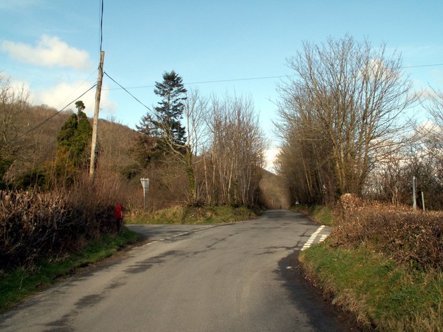
Nancwnlle is a small village located in the county of Cardiganshire, Wales. Situated in the picturesque countryside, it is surrounded by rolling hills and lush greenery. The village is positioned approximately 9 miles northeast of the town of Lampeter and 15 miles southeast of Aberystwyth.

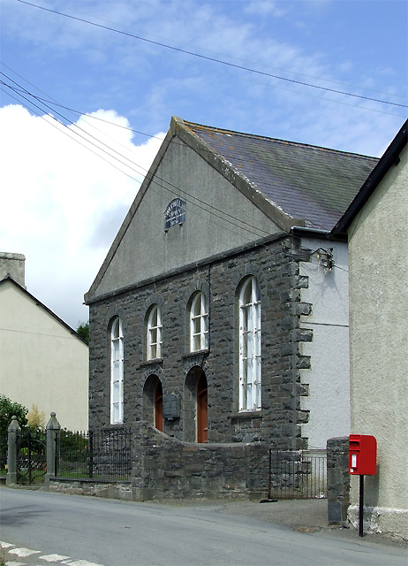
With a population of around 200 residents, Nancwnlle has a close-knit community that takes pride in its rural heritage and natural beauty. The village is characterized by traditional stone houses and quaint cottages, adding to its charm and authenticity.

One of the notable features of Nancwnlle is its proximity to Cors Caron, a large nature reserve and wetland area. This attracts nature enthusiasts and birdwatchers who come to observe the diverse range of wildlife, including rare bird species such as the red kite and merlin.

The village also offers opportunities for outdoor activities, such as hiking and cycling, with numerous scenic trails in the surrounding countryside. The nearby River Teifi provides opportunities for fishing and boating.

Although Nancwnlle is a small village, it has a strong sense of community spirit. The village hall serves as a focal point for various social events and gatherings, fostering a sense of belonging among residents.

Overall, Nancwnlle is a tranquil and picturesque village in Cardiganshire, offering a peaceful retreat for those seeking a rural lifestyle amidst stunning natural surroundings.

If you have any feedback on the listing, please let us know in the comments section below.
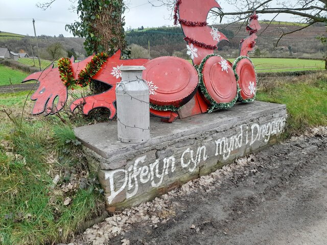
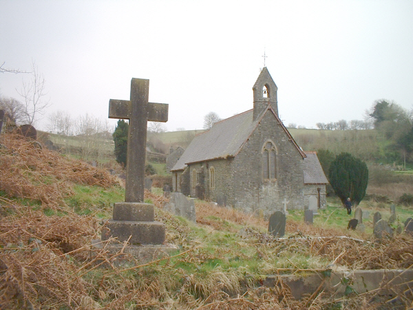
Nancwnlle Images

Images are sourced within 2km of 52.201626/-4.093899 or Grid Reference SN5758. Thanks to Geograph Open Source API. All images are credited.

Ordnance Survey Rivet This OS rivet can be found on the culvert SE side of the road. It marks a point 91.074m above mean sea level.
Ordnance Survey Rivet
This OS rivet can be found on the culvert SE side of the road. It marks a point 91.074m above mean sea level.
Ordnance Survey Rivet This OS rivet can be found on the churn stand east side of the road. It marks a point 75.978m above mean sea level. <a title="https://www.geograph.org.uk/photo/7412377" href="https://www.geograph.org.uk/photo/7412377">Link</a>
Ordnance Survey Rivet
This OS rivet can be found on the churn stand east side of the road. It marks a point 75.978m above mean sea level. Link
Churn Stand There is an Ordnance Survey rivet on the top of the stand. <a title="https://www.geograph.org.uk/photo/7412375" href="https://www.geograph.org.uk/photo/7412375">Link</a>
Churn Stand
There is an Ordnance Survey rivet on the top of the stand. Link
Forest and valley north of Trefilan in Ceredigion From the lane near Penlan House, this view is south-east across the forest lining Nant Rhiwafallen towards the Afon Aeron Valley near Abermeurig.
Forest and valley north of Trefilan in Ceredigion
From the lane near Penlan House, this view is south-east across the forest lining Nant Rhiwafallen towards the Afon Aeron Valley near Abermeurig.
Winllan Coronation Meadow Coronation Meadows are outstanding examples of our remaining meadows, rich in a wealth of flowers and able to be held up as the flagship meadow for the county they are in. They have been used to create and restore meadows through the collection of seed or 'green' hay. Winllan is in private ownership and is part of a Site of Special Scientific Interest. It is the Coronation Meadow for Ceredigion. The permission of the owner was granted for this picture to be taken and the owners open up their garden and meadows under the National Gardens Scheme.
Winllan Coronation Meadow
Coronation Meadows are outstanding examples of our remaining meadows, rich in a wealth of flowers and able to be held up as the flagship meadow for the county they are in. They have been used to create and restore meadows through the collection of seed or 'green' hay. Winllan is in private ownership and is part of a Site of Special Scientific Interest. It is the Coronation Meadow for Ceredigion. The permission of the owner was granted for this picture to be taken and the owners open up their garden and meadows under the National Gardens Scheme.
Winllan Wildlife Garden - Hay Meadow with wild flowers  A garden geared to wildlife. A nature trail passes through hay meadows, woods, past ponds, and along a river bank, where birds, butterflies, and dragonflies abound. The abundant wild-flowers create a lovely display in Spring and early Summer.
<span class="nowrap"><a title="http://www.greatbritishgardens.co.uk/winllan.htm" rel="nofollow ugc noopener" href="http://www.greatbritishgardens.co.uk/winllan.htm">Link</a><img style="margin-left:2px;" alt="External link" title="External link - shift click to open in new window" src="https://s1.geograph.org.uk/img/external.png" width="10" height="10"/></span>
Winllan Wildlife Garden - Hay Meadow with wild flowers
A garden geared to wildlife. A nature trail passes through hay meadows, woods, past ponds, and along a river bank, where birds, butterflies, and dragonflies abound. The abundant wild-flowers create a lovely display in Spring and early Summer. LinkExternal link
Winllan Wildlife Garden - Hay Meadow with wild flowers including rare marsh orchids <span class="nowrap"><a title="http://www.ngs.org.uk/ngs-bin/gardenq2.cgi?gardenID=9496&county=Ceredigion/Cardiganshire" rel="nofollow ugc noopener" href="http://www.ngs.org.uk/ngs-bin/gardenq2.cgi?gardenID=9496&county=Ceredigion/Cardiganshire">Link</a><img style="margin-left:2px;" alt="External link" title="External link - shift click to open in new window" src="https://s1.geograph.org.uk/img/external.png" width="10" height="10"/></span>
Winllan Wildlife Garden - Hay Meadow with wild flowers including rare marsh orchids
Winllan Wildlife Garden <span class="nowrap"><a title="http://www.ngs.org.uk/ngs-bin/gardenq2.cgi?gardenID=9496&county=Ceredigion/Cardiganshire" rel="nofollow ugc noopener" href="http://www.ngs.org.uk/ngs-bin/gardenq2.cgi?gardenID=9496&county=Ceredigion/Cardiganshire">Link</a><img style="margin-left:2px;" alt="External link" title="External link - shift click to open in new window" src="https://s1.geograph.org.uk/img/external.png" width="10" height="10"/></span>
Winllan Wildlife Garden
Church, Nantcwnlle
Church, Nantcwnlle
The Aeron Valley from the B4342 Near Llundain-fach.
The Aeron Valley from the B4342
Near Llundain-fach.
The road to Abermeurig From the junction with the B4342.
The road to Abermeurig
From the junction with the B4342.
The road to Abermeurig from the B4342 The white building of Pentre Farm House can be seen at the head of the road.
The road to Abermeurig from the B4342
The white building of Pentre Farm House can be seen at the head of the road.
The B4342 to Llangeitho from Tal-sarn Pic taken near to Bwlch-Llan which is first left onto the B4576 at the cross roads shown.
The B4342 to Llangeitho from Tal-sarn
Pic taken near to Bwlch-Llan which is first left onto the B4576 at the cross roads shown.
Wernfelen on the road to Abermeurig From Gartheli.
Wernfelen on the road to Abermeurig
From Gartheli.
The B4342 road from Tal-sarn The building on the right is Parc House.
The B4342 road from Tal-sarn
The building on the right is Parc House.
The B4342 road looking to Glownant Pic taken between Parc House and Glownant.
The B4342 road looking to Glownant
Pic taken between Parc House and Glownant.
The B4576 at Hafod Looking to College Wood.
The B4576 at Hafod
Looking to College Wood.
Chapel at Bwlch-Llan, Ceredigion Built originally in 1841, then rebuilt and extended in 1876. This was a Calvinistic Methodist Chapel, now run by the Presbyterian Church of Wales.
Chapel at Bwlch-Llan, Ceredigion
Built originally in 1841, then rebuilt and extended in 1876. This was a Calvinistic Methodist Chapel, now run by the Presbyterian Church of Wales.
Show me another place!

Nancwnlle is located at Grid Ref: SN5758 (Lat: 52.201626, Lng: -4.093899)

Unitary Authority: Ceredigion

Police Authority: Dyfed Powys

What 3 Words

///masks.appealing.palace. Near Llangybi, Ceredigion

Related Wikis

Nantcwnlle

Nantcwnlle is a community in Ceredigion, Wales, including the villages of Talsarn and Llwyn-y-groes. Daniel Rowland (1713–1790), was born in Nantcwnlle...

Abermeurig

Abermeurig (also spelt Aber-meurig) is a small village in the county of Ceredigion, Wales.

Cors Nantcwnlle

Cors Nantcwnlle is a Site of Special Scientific Interest near Bwlchllan in Ceredigion, west Wales. Until the early twentieth century the site was renowned...

Talsarn

Talsarn is a hamlet in the community of Nantcwnlle, Ceredigion, Wales. It lies some 16 miles (26 km) south of Aberystwyth, 64 miles (103 km) north-west...

Nearby Amenities

Located within 500m of 52.201626,-4.093899
Source: npe
Lat/Long: 52.1974662/-4.092738
Created By: POI Editor
Source: npe
Lat/Long: 52.1977862/-4.0910191
Place: farm
Lat/Long: 52.2039334/-4.0984584
Ford: yes
Lat/Long: 52.2003168/-4.0933858
Ford: yes
Lat/Long: 52.201665/-4.0941646
The data included in this document is from www.openstreetmap.org. The data is made available under ODbL.

Have you been to Nancwnlle?

Leave your review of Nancwnlle below (or comments, questions and feedback).