Musselwick

Settlement in Pembrokeshire

Wales

Musselwick

Mullock Bridge Harri Tudur marched across Wales to the Midlands, gathering troops along the way, to defeat Richard III at Bosworth Field in 1485. One of Richard's allies, Sir Rhys ap Thomas maintained his integrity here as he had promised the King that Harri would enter Wales "only over his body". By hiding under the bridge duly kept his promise!
Mullock Bridge Credit: Garth Newton

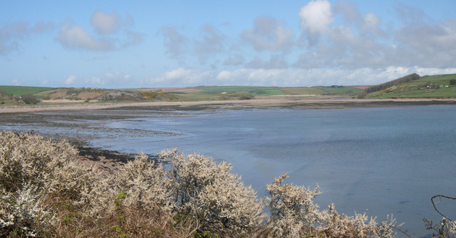
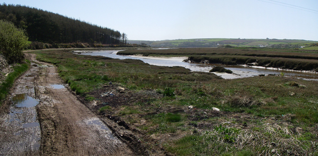
Musselwick is a small coastal village located in the county of Pembrokeshire, Wales. Situated on the westernmost coast of the country, it is known for its picturesque setting and natural beauty. The village is nestled between the towns of Marloes and Dale, offering stunning views of the rugged coastline and the Atlantic Ocean.

The main attraction of Musselwick is its beach, which stretches for miles along the coast. With its golden sand and crystal-clear waters, it is a popular destination for both locals and tourists. The beach is renowned for its excellent conditions for water sports such as surfing, windsurfing, and kayaking. It also provides a great spot for swimming and sunbathing during the summer months.

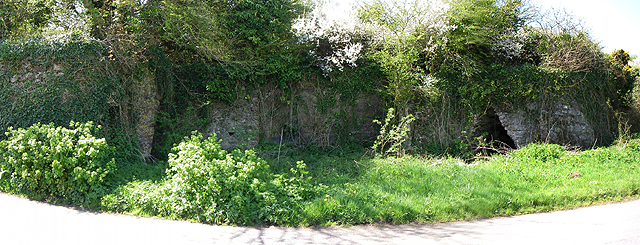
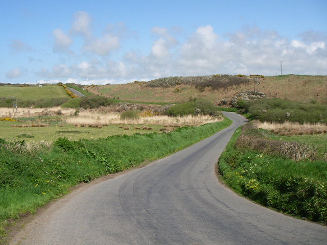
Surrounded by rolling hills and pristine countryside, Musselwick offers ample opportunities for outdoor activities. The Pembrokeshire Coast Path, a famous long-distance walking trail, passes through the village, attracting hikers and nature enthusiasts. The path provides breathtaking views of the coastline and allows visitors to explore the diverse flora and fauna of the area.

Despite its small size, Musselwick is well-equipped with amenities for visitors. The village boasts a cafe, a pub, and a small convenience store, catering to the needs of both residents and tourists. Accommodation options in the area range from cozy bed and breakfasts to self-catering cottages, ensuring a comfortable stay for visitors.

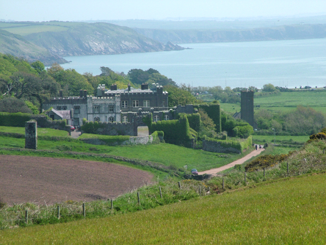
Musselwick is not only a haven for outdoor enthusiasts but also a place of historical significance. The nearby St. Bride's Castle, a medieval fortification, adds a touch of intrigue and attracts history buffs.

With its idyllic coastal setting, outdoor recreational opportunities, and rich history, Musselwick is a charming destination for those seeking a peaceful and scenic retreat in Pembrokeshire.

If you have any feedback on the listing, please let us know in the comments section below.
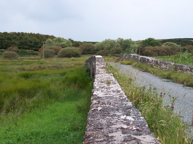
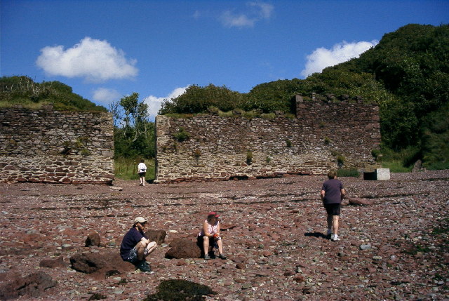
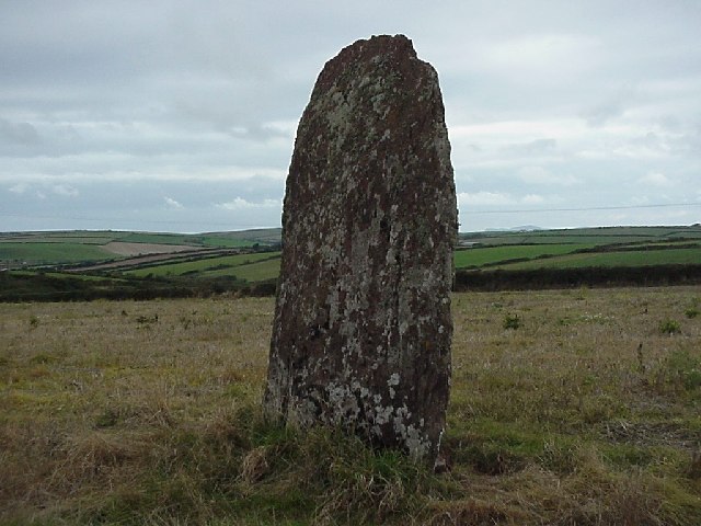
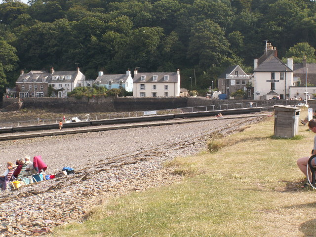
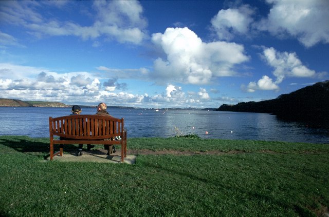
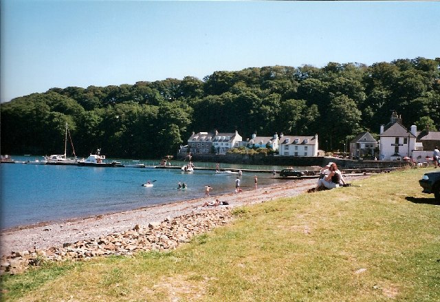
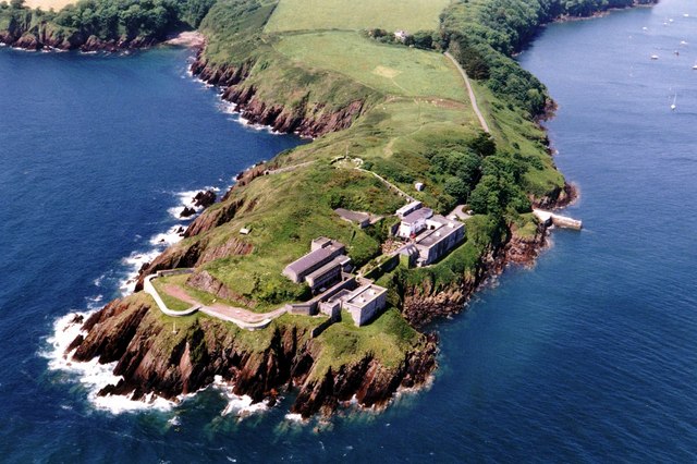
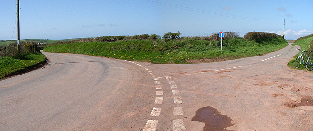
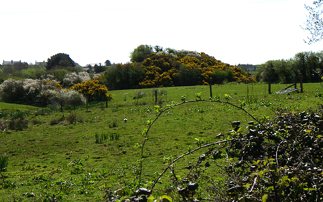
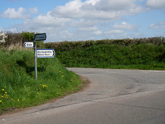
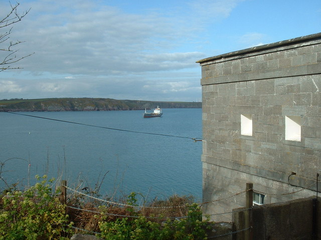
Musselwick Images

Images are sourced within 2km of 51.716089/-5.156324 or Grid Reference SM8206. Thanks to Geograph Open Source API. All images are credited.

Mullock Bridge Harri Tudur marched across Wales to the Midlands, gathering troops along the way, to defeat Richard III at Bosworth Field in 1485. One of Richard's allies, Sir Rhys ap Thomas maintained his integrity here as he had promised the King that Harri would enter Wales "only over his body". By hiding under the bridge duly kept his promise!
Mullock Bridge
Harri Tudur marched across Wales to the Midlands, gathering troops along the way, to defeat Richard III at Bosworth Field in 1485. One of Richard's allies, Sir Rhys ap Thomas maintained his integrity here as he had promised the King that Harri would enter Wales "only over his body". By hiding under the bridge duly kept his promise!
Monk Haven, Pembs Defensive wall built across the exit from Monk Haven bay. Looking North
Monk Haven, Pembs
Defensive wall built across the exit from Monk Haven bay. Looking North
Mabesgate standing stone viewed looking NW. It is covered in many interesting lichens.
Mabesgate standing stone
viewed looking NW. It is covered in many interesting lichens.
Dale, Pembrokeshire Dale beach and coastal houses.
Dale, Pembrokeshire
Dale beach and coastal houses.
Dale - Pembrokeshire.
Dale Dale is where in 1485 Henry Tudor landed on his return from exile in France, en route to his defeat of Richard III at Bosworth Field.
Dale
Dale is where in 1485 Henry Tudor landed on his return from exile in France, en route to his defeat of Richard III at Bosworth Field.
Dale Castle and Church. Taken looking almost due east.
Dale Castle and Church.
Taken looking almost due east.
Dale Fort Field Centre Built in 1856 for military use (protection of Milford Haven) it has been owned by the Field Studies Council as a field centre since 1947. The entire kilometre square is the centre and used by many 1000's of students each year. 70% of the students are A Level biologists working on the nearby shores to understand ecology.
Dale Fort Field Centre
Built in 1856 for military use (protection of Milford Haven) it has been owned by the Field Studies Council as a field centre since 1947. The entire kilometre square is the centre and used by many 1000's of students each year. 70% of the students are A Level biologists working on the nearby shores to understand ecology.
Bay I think this whole area is part of the bay called 'Dale Roads'.
Bay
I think this whole area is part of the bay called 'Dale Roads'.
Lime Kilns These 2 lime kilns are a little overgrown so are difficult to make out here. 
They are not shown on the OS map but are across the road from the car park at SM 808 066.
Lime Kilns
These 2 lime kilns are a little overgrown so are difficult to make out here. They are not shown on the OS map but are across the road from the car park at SM 808 066.
Stretch of Road The Pembrokeshire Coast Path runs along this stretch of road when the tide is in at 'Pickleridge'.
Stretch of Road
The Pembrokeshire Coast Path runs along this stretch of road when the tide is in at 'Pickleridge'.
Track Looking south.
Track
Looking south.
No Through Road The road to West Lodge farm.
No Through Road
The road to West Lodge farm.
Motte The Motte to the north of St.Ishmael's.
Motte
The Motte to the north of St.Ishmael's.
Road Junction Turn left for Haverfordwest or straight on for Milford Haven.
Road Junction
Turn left for Haverfordwest or straight on for Milford Haven.
Dale Fort and Dale Roads Looking into Milford Haven.
Dale Fort and Dale Roads
Looking into Milford Haven.
Dale Fort Overlooking Dale Roads, in Milford Haven. Now a biology field centre.
Dale Fort
Overlooking Dale Roads, in Milford Haven. Now a biology field centre.
Wetlands to the rear of the Gann estuary Near Dale. The white blob in the centre of view is a little egret - a typical wetland bird.
Wetlands to the rear of the Gann estuary
Near Dale. The white blob in the centre of view is a little egret - a typical wetland bird.
Show me another place!

Musselwick is located at Grid Ref: SM8206 (Lat: 51.716089, Lng: -5.156324)

Unitary Authority: Pembrokeshire

Police Authority: Dyfed Powys

What 3 Words

///flaking.daydream.dignitary. Near Dale, Pembrokeshire

Related Wikis

Dale, Pembrokeshire

Dale is both a small village and a community in Pembrokeshire, Wales, located on the peninsula which forms the northern side of the entrance to the Milford...
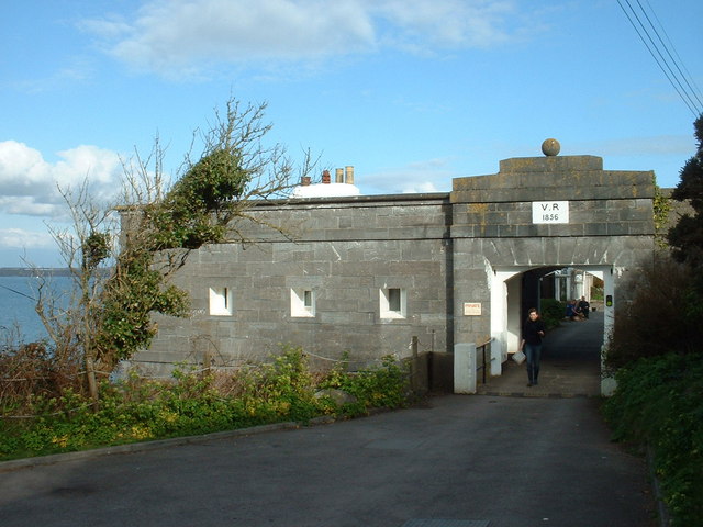
Dale Fort

Dale Fort is a mid-19th-century coastal artillery fort at Dale Head, a rocky promontory near Dale, Pembrokeshire, west of Milford Haven in Wales. It is...

St Ishmaels

St Ishmaels or St Ishmael's (Welsh: Llanismel) is a village, parish and community close to the Milford Haven Waterway in Pembrokeshire, Wales. The community...

Dale Castle

Dale Castle is a 13th-century castle located close to the village of Dale in Pembrokeshire, Wales. In 1910, part of the castle was removed and other parts...

Nearby Amenities

Located within 500m of 51.716089,-5.156324
Power: pole
Lat/Long: 51.7186291/-5.1619649
Power: pole
Lat/Long: 51.7183782/-5.1614875
Power: pole
Lat/Long: 51.717991/-5.1606882
Power: pole
Lat/Long: 51.7174252/-5.1593296
Power: pole
Lat/Long: 51.7169956/-5.1588348
Power: pole
Lat/Long: 51.7167131/-5.15847
The data included in this document is from www.openstreetmap.org. The data is made available under ODbL.

Have you been to Musselwick?

Leave your review of Musselwick below (or comments, questions and feedback).