Murroes

Settlement in Angus

Scotland

Murroes

Track through arable fields giving access to Easterton of Gagie Looking north-westward.
Track through arable fields giving access to Easterton of Gagie Credit: Peter Wood

Murroes is a small village located in the county of Angus, Scotland. Situated approximately 7 miles east of Dundee, it lies on the southern banks of the Dighty Water, a river that flows through the area. With a population of around 600 residents, Murroes offers a peaceful and scenic rural setting.

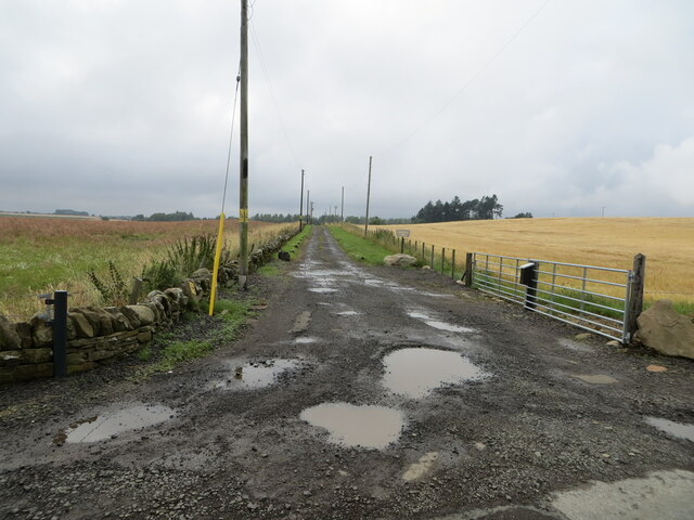
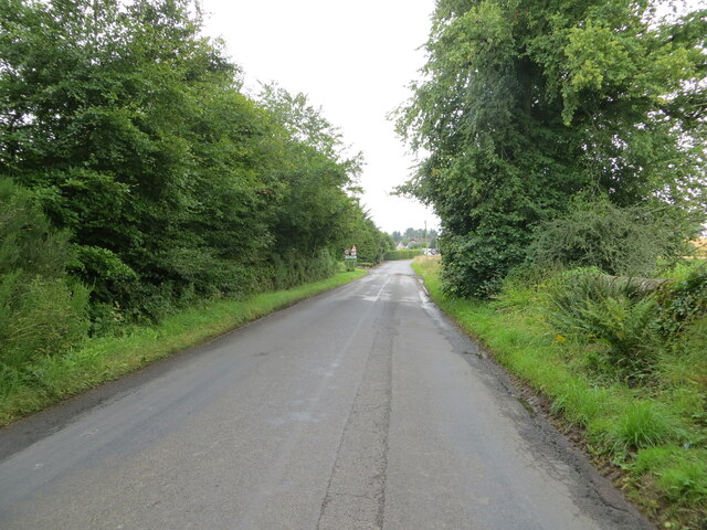
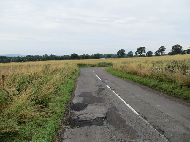
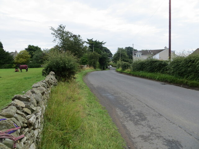
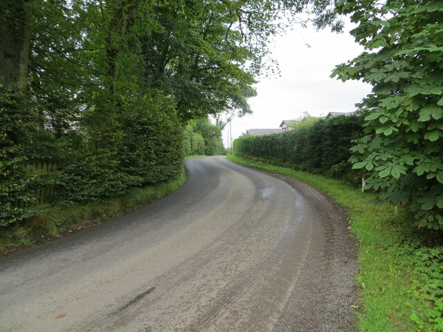
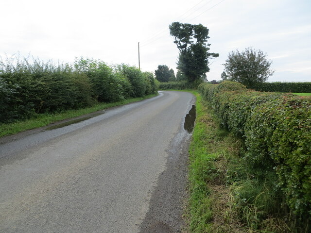
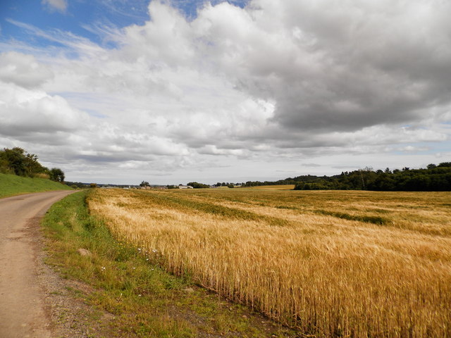
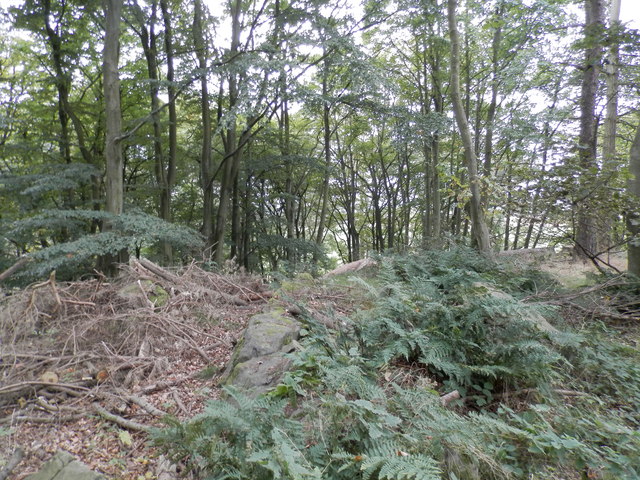
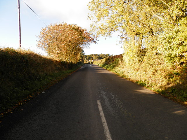
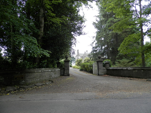
The village is characterized by its picturesque countryside, rolling hills, and farmland, making it an ideal place for those seeking a tranquil lifestyle away from the hustle and bustle of city living. Murroes also benefits from its close proximity to various amenities and services provided in nearby towns such as Monifieth and Broughty Ferry.

Historically, Murroes has been an agricultural community, with farming playing a significant role in its economy. However, in recent years, the village has witnessed some diversification, with a growing number of residents commuting to neighboring towns for work.

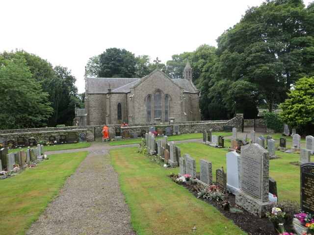
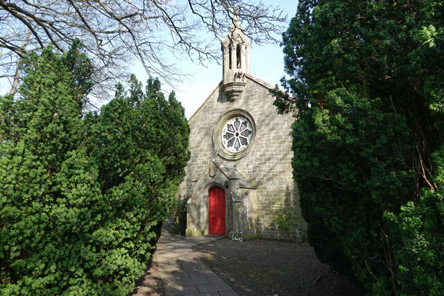
One notable landmark in Murroes is the 19th-century Murroes Parish Church, a beautiful stone building that stands as a testament to the village's rich history. The surrounding area also offers opportunities for outdoor activities such as walking, cycling, and fishing, with several nature trails and fishing spots nearby.

Overall, Murroes provides a charming and idyllic setting for those looking to embrace a peaceful rural lifestyle while still enjoying easy access to urban amenities.

If you have any feedback on the listing, please let us know in the comments section below.

Murroes Images

Images are sourced within 2km of 56.504169/-2.87425 or Grid Reference NO4635. Thanks to Geograph Open Source API. All images are credited.

Track through arable fields giving access to Easterton of Gagie Looking north-westward.
Track through arable fields giving access to Easterton of Gagie
Looking north-westward.
Chapel Road approaching Bucklerheads Looking south-eastward. Interestingly the farm is spelt Bucklershead.
Chapel Road approaching Bucklerheads
Looking south-eastward. Interestingly the farm is spelt Bucklershead.
Tree-lined road entering Kellas Looking south-eastward.
Tree-lined road entering Kellas
Looking south-eastward.
Junction of roads near to Westhall Looking south-westward.
Junction of roads near to Westhall
Looking south-westward.
Murroes Church and part of its Burial Ground Viewed from the north-east. A blacksmith can be seen undertaking gate repairs.
Murroes Church and part of its Burial Ground
Viewed from the north-east. A blacksmith can be seen undertaking gate repairs.
Road at Murroes Looking eastward.
Road at Murroes
Looking eastward.
Road at South Kingennie Looking westward.
Road at South Kingennie
Looking westward.
Road near to South Kingennie Looking south-eastward.
Road near to South Kingennie
Looking south-eastward.
St Bride's Ring An Iron Age fortification (Scale 2m) <span class="nowrap"><a title="https://monifiethhistorysociety.co.uk/2013/10/22/st-brides-ring/" rel="nofollow ugc noopener" href="https://monifiethhistorysociety.co.uk/2013/10/22/st-brides-ring/">Link</a><img style="margin-left:2px;" alt="External link" title="External link - shift click to open in new window" src="https://s1.geograph.org.uk/img/external.png" width="10" height="10"/></span>
St Bride's Ring
An Iron Age fortification (Scale 2m) LinkExternal link
Murroes Church There has been a church on this site in Murroes for hundreds of years. The current Parish Church was built in 1848 by William Scott on the site of a much older ecclesiastical building. The earliest date for a church here is 1211 when Gilchrist, Earl of Angus, granted the church to Arbroath Abbey. There are a number of carved stones from the earlier church (or churches) encorporated into the 19th century church, and an original burial vault from the earlier building survives.

A later church was built in 1642 but it is thought a 13th century church was located here originally. The current 1848 church re-uses a date stone (bearing 1642).

The private burial aisle of Colonel Fothringham and his family was built onto the church in the 18th century and documents show that the family contributed to its maintenance in 1809. (Taken from <span class="nowrap"><a title="http://www.scottishchurches.org.uk/sites/site/id/1434/image/8620/name/Murroes+Medieval+Church+Murroes+Tayside)" rel="nofollow ugc noopener" href="http://www.scottishchurches.org.uk/sites/site/id/1434/image/8620/name/Murroes+Medieval+Church+Murroes+Tayside)">Link</a><img style="margin-left:2px;" alt="External link" title="External link - shift click to open in new window" src="https://s1.geograph.org.uk/img/external.png" width="10" height="10"/></span>
Murroes Church
There has been a church on this site in Murroes for hundreds of years. The current Parish Church was built in 1848 by William Scott on the site of a much older ecclesiastical building. The earliest date for a church here is 1211 when Gilchrist, Earl of Angus, granted the church to Arbroath Abbey. There are a number of carved stones from the earlier church (or churches) encorporated into the 19th century church, and an original burial vault from the earlier building survives. A later church was built in 1642 but it is thought a 13th century church was located here originally. The current 1848 church re-uses a date stone (bearing 1642). The private burial aisle of Colonel Fothringham and his family was built onto the church in the 18th century and documents show that the family contributed to its maintenance in 1809. (Taken from LinkExternal link
Track and field at Omachie, Kingennie
St Bride's Ring, Kingennie St Bride's Ring is now largely overgrown in a wooded hill near Kingennie.  It measured roughly 60 feet in diameter. Many of the large rocks which formed the 7 foot high wall lie below.
St Bride's ring has been classified as a broch by some authorities. It is similar to some of the ring forts of central Perthshire.
See also <span class="nowrap"><a title="http://www.monifiethhistorysociety.co.uk/2013/10/22/st-brides-ring/" rel="nofollow ugc noopener" href="http://www.monifiethhistorysociety.co.uk/2013/10/22/st-brides-ring/">Link</a><img style="margin-left:2px;" alt="External link" title="External link - shift click to open in new window" src="https://s1.geograph.org.uk/img/external.png" width="10" height="10"/></span>
St Bride's Ring, Kingennie
St Bride's Ring is now largely overgrown in a wooded hill near Kingennie. It measured roughly 60 feet in diameter. Many of the large rocks which formed the 7 foot high wall lie below. St Bride's ring has been classified as a broch by some authorities. It is similar to some of the ring forts of central Perthshire. See also LinkExternal link
Minor road near South Kingennie
Entrance to Duntrune House
Strip wood, Ethiebeaton Between the quarry and the world.
Strip wood, Ethiebeaton
Between the quarry and the world.
Ballumbie Castle 7th hole, Fithie Burn The seventh hole at Ballumbie Castle golf course looking to the green.
Ballumbie Castle 7th hole, Fithie Burn
The seventh hole at Ballumbie Castle golf course looking to the green.
Ballumbie Castle 9th hole, Catherine Douglas The ninth hole at Ballumbie Castle golf course, looking to the green.
Ballumbie Castle 9th hole, Catherine Douglas
The ninth hole at Ballumbie Castle golf course, looking to the green.
Show me another place!

Murroes is located at Grid Ref: NO4635 (Lat: 56.504169, Lng: -2.87425)

Unitary Authority: Angus

Police Authority: Tayside

What 3 Words

///prongs.headlight.clips. Near Monifieth, Angus

Nearby Locations

Woodside Wood Murroes

Related Wikis

Murroes

Murroes is a parish in Angus, Scotland, situated approximately 3 miles (4.8 km) north of Dundee city centre. == Places of interest == The parish church...

Kellas, Angus

Kellas is a village in Angus, Scotland. It lies approximately two miles north of Dundee, on the B978 road. == Local Bus Services in the Area == Headquartered...

Bucklerheads

Bucklershead is a village in Angus, Scotland. It lies approximately three miles north of Monifieth, on the B978 road. == References ==

Kingennie railway station

Kingennie railway station served the village of Kingennie, Angus, Scotland, from 1870 to 1955 on the Dundee and Forfar direct line. == History == The station...

Nearby Amenities

Located within 500m of 56.504169,-2.87425
Murroes
Name Sco: The Morroes
Old Name: Muirhouses
Place: village
Wikidata: Q6939609
Wikipedia: en:Murroes
Lat/Long: 56.5047525/-2.8756788
Turning Circle
Lat/Long: 56.5084935/-2.8759591
Turning Loop
Lat/Long: 56.506067/-2.8707978
Power: pole
Lat/Long: 56.5028442/-2.8670605
Power: pole
Lat/Long: 56.5032651/-2.8681112
Power: pole
Lat/Long: 56.5036859/-2.869184
Power: pole
Lat/Long: 56.504059/-2.8701039
Power: pole
Lat/Long: 56.5040578/-2.870862
Power: pole
Lat/Long: 56.5040835/-2.8718683
Power: pole
Lat/Long: 56.5041116/-2.8729678
Power: pole
Lat/Long: 56.5041471/-2.8740273
Power: pole
Lat/Long: 56.5039073/-2.8746014
Power: pole
Lat/Long: 56.5036675/-2.8751755
Power: pole
Lat/Long: 56.5034351/-2.8757518
Power: pole
Lat/Long: 56.5031941/-2.8763348
Power: pole
Lat/Long: 56.5027256/-2.8762484
Power: pole
Lat/Long: 56.5023989/-2.8761929
Power: pole
Lat/Long: 56.5017775/-2.8761287
Power: pole
Lat/Long: 56.5011841/-2.876071
Power: pole
Lat/Long: 56.5036883/-2.8768624
Power: pole
Lat/Long: 56.5073979/-2.8795334
Power: pole
Lat/Long: 56.5075079/-2.8782367
Power: pole
Lat/Long: 56.5074443/-2.8779906
Power: pole
Lat/Long: 56.5077391/-2.8775318
Power: pole
Lat/Long: 56.5083067/-2.8766385
Power: pole
Lat/Long: 56.5076584/-2.8788884
Power: pole
Lat/Long: 56.5069856/-2.8771749
Power: pole
Lat/Long: 56.5065233/-2.8763658
Power: pole
Lat/Long: 56.5061269/-2.8757075
Power: pole
Lat/Long: 56.5058529/-2.874464
Power: pole
Lat/Long: 56.5055422/-2.8737236
The data included in this document is from www.openstreetmap.org. The data is made available under ODbL.

Have you been to Murroes?

Leave your review of Murroes below (or comments, questions and feedback).