Bengrove

Settlement in Gloucestershire Tewkesbury

England

Bengrove

Farming near Gotherington Raking and baling is taking place on a hillside field.
Farming near Gotherington Credit: Gareth James

Bengrove is a small village located in the county of Gloucestershire, England. Situated approximately 10 miles southwest of Gloucester, it is nestled in the beautiful countryside of the Cotswolds. With a population of around 800 residents, Bengrove offers a tranquil and peaceful environment for its inhabitants.

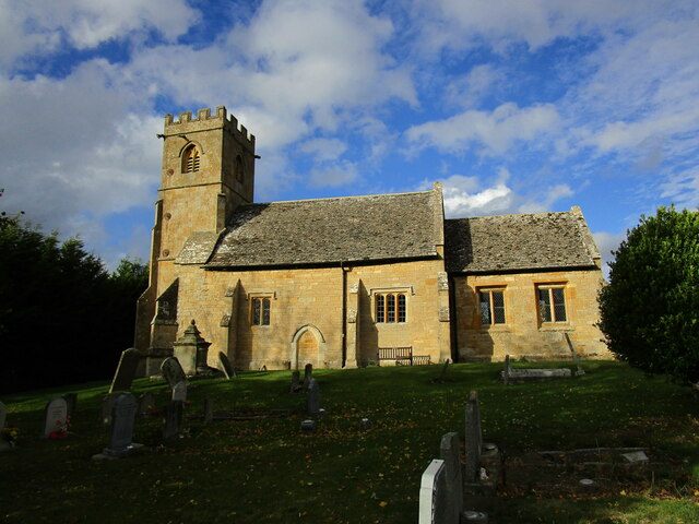
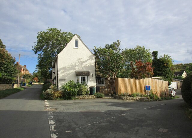
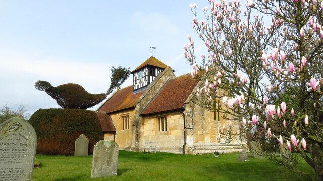
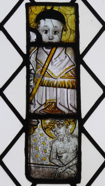
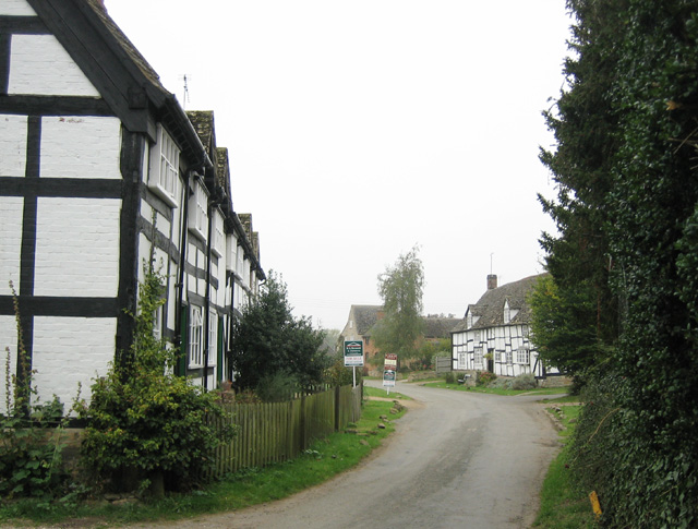
The village dates back to medieval times, and its history is evident in the charming architecture of its buildings. The centerpiece of Bengrove is the St. Mary's Church, a picturesque 12th-century church that stands proudly in the heart of the village. This historic landmark attracts visitors from near and far, who come to admire its stunning stone facade and intricate stained glass windows.

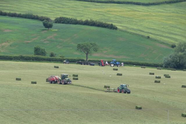
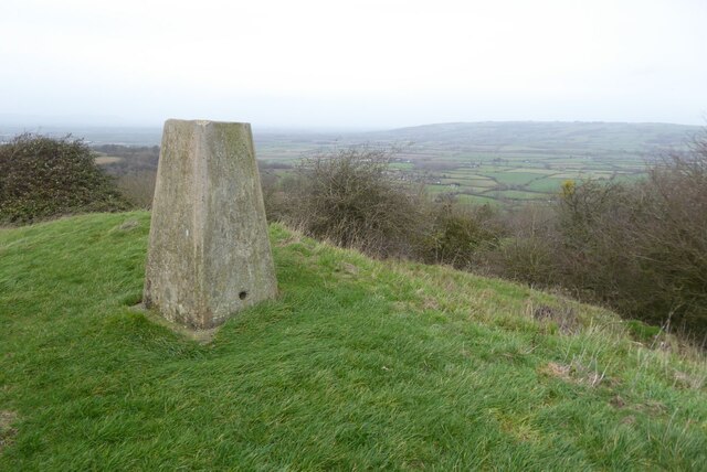
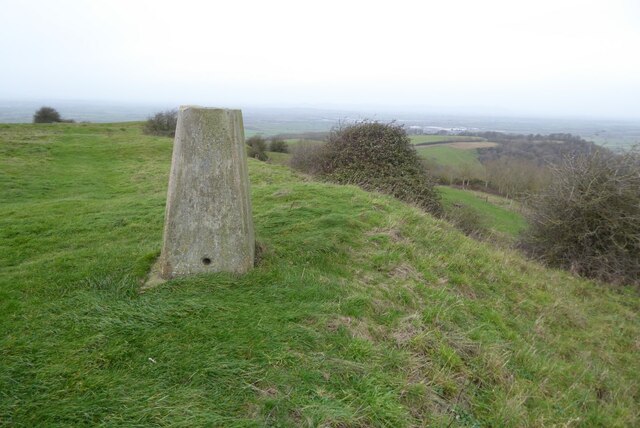
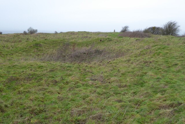
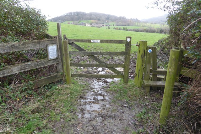
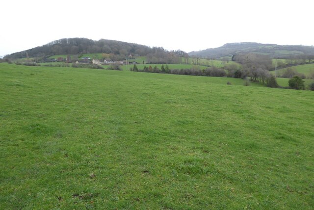
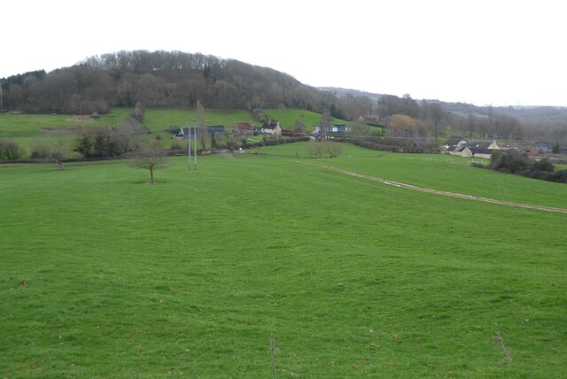
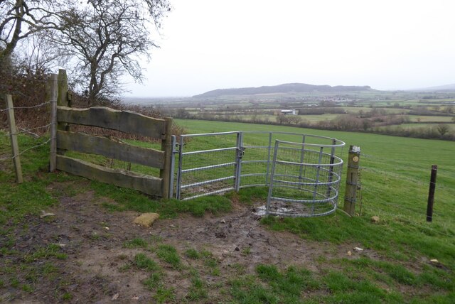
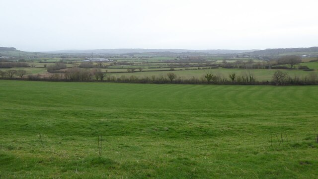
Bengrove is surrounded by lush green fields and rolling hills, making it an ideal location for nature lovers and outdoor enthusiasts. There are several walking and cycling routes available in the area, allowing residents and visitors to explore the scenic countryside and take in the breathtaking views.

Despite its small size, Bengrove boasts a strong sense of community spirit. The village has a local pub, The Rose and Crown, where residents can gather for a drink or a meal. There is also a village hall that hosts various events and activities, bringing the community together.

Overall, Bengrove offers a peaceful and picturesque setting, steeped in history and natural beauty. Its close-knit community and idyllic surroundings make it a desirable place to live or visit for those seeking a quieter, rural lifestyle.

If you have any feedback on the listing, please let us know in the comments section below.

Bengrove Images

Images are sourced within 2km of 51.991807/-2.03128 or Grid Reference SO9732. Thanks to Geograph Open Source API. All images are credited.

Farming near Gotherington Raking and baling is taking place on a hillside field.
Farming near Gotherington
Raking and baling is taking place on a hillside field.
Farming near Gotherington Raking and baling are in operation on a hillside field near Gotherington.
Farming near Gotherington
Raking and baling are in operation on a hillside field near Gotherington.
Pipeline crossing a brook Pipeline crossing a brook in the village of Alderton.  This subject was the first picture submitted on this webpage for this grid square, see: <a href="https://www.geograph.org.uk/photo/67965">SO9932 : Pipeline near Alderton</a>.
Pipeline crossing a brook
Pipeline crossing a brook in the village of Alderton. This subject was the first picture submitted on this webpage for this grid square, see: SO9932 : Pipeline near Alderton.
Alder Green development Alder Green development site in the village of Alderton.
Alder Green development
Alder Green development site in the village of Alderton.
Church of St Nicholas, Teddington The church contain substantial Norman work <span class="nowrap"><a title="https://historicengland.org.uk/listing/the-list/list-entry/1340161?section=official-list-entry" rel="nofollow ugc noopener" href="https://historicengland.org.uk/listing/the-list/list-entry/1340161?section=official-list-entry">Link</a><img style="margin-left:2px;" alt="External link" title="External link - shift click to open in new window" src="https://s1.geograph.org.uk/img/external.png" width="10" height="10"/></span>
Teddington was transferred from Worcestershire to Gloucestershire in 1931 but the ecclesiastical parish still remains in the Diocese of Worcester.
Church of St Nicholas, Teddington
The church contain substantial Norman work LinkExternal link Teddington was transferred from Worcestershire to Gloucestershire in 1931 but the ecclesiastical parish still remains in the Diocese of Worcester.
Road junction in Teddington
Trig point on Oxenton Hill View towards Bredon Hill, the largest of the Cotswolds outliers, from the trig point on Oxenton Hill.  This picture was taken soon after midday on New Year's Day.  Not such a good day weather-wise compared to when I visited this hill top almost fifteen years ago <a href="https://www.geograph.org.uk/photo/713326">SO9731 : Trig Point on Oxenton Hill</a>.
Trig point on Oxenton Hill
View towards Bredon Hill, the largest of the Cotswolds outliers, from the trig point on Oxenton Hill. This picture was taken soon after midday on New Year's Day. Not such a good day weather-wise compared to when I visited this hill top almost fifteen years ago SO9731 : Trig Point on Oxenton Hill.
Trig Point on Oxenton Hill View from the trig point on Oxenton Hill; the Malvern Hills are just visible on the hazy horizon.  Not such a good day weather-wise compared to when I visited this hill top almost fifteen years ago <a href="https://www.geograph.org.uk/photo/713326">SO9731 : Trig Point on Oxenton Hill</a>.
Trig Point on Oxenton Hill
View from the trig point on Oxenton Hill; the Malvern Hills are just visible on the hazy horizon. Not such a good day weather-wise compared to when I visited this hill top almost fifteen years ago SO9731 : Trig Point on Oxenton Hill.
The Knolls, Oxenton Hill The summit of Oxenton Hill is known as the Knolls and is the site of an Iron Age settlement rather than a hill fort. The site was excavated in 1932 and some Iron Age pottery was found.  The trig point can be seen on the horizon to the right. 
 This is an approximate recreation of the first picture uploaded in this grid square <a href="https://www.geograph.org.uk/photo/247709">SO9731 : The top of  Oxenton Hill</a>.
The Knolls, Oxenton Hill
The summit of Oxenton Hill is known as the Knolls and is the site of an Iron Age settlement rather than a hill fort. The site was excavated in 1932 and some Iron Age pottery was found. The trig point can be seen on the horizon to the right. This is an approximate recreation of the first picture uploaded in this grid square SO9731 : The top of Oxenton Hill.
Alstone - St Margaret's Church
Stile and gate on the Gloucestershire Way Stile and gate on the Gloucestershire Way approaching Dixton.  Diston Hill can be seen in the background.
Stile and gate on the Gloucestershire Way
Stile and gate on the Gloucestershire Way approaching Dixton. Diston Hill can be seen in the background.
Gloucestershire Way approaching Dixton Gloucestershire Way crossing a field as it approaches Dixton and Dixton Hill.  Langley Hill can be seen on the right in the background.
Gloucestershire Way approaching Dixton
Gloucestershire Way crossing a field as it approaches Dixton and Dixton Hill. Langley Hill can be seen on the right in the background.
Dixton Hill View of the hamlet of Dixton and Dixton Hill from the Winchcombe Way.
Dixton Hill
View of the hamlet of Dixton and Dixton Hill from the Winchcombe Way.
Komatsu excavator Komatsu excavator beside the Winchcombe Way.  The hamlet of Dixton is framed with the excavator's boom and arm.
Komatsu excavator
Komatsu excavator beside the Winchcombe Way. The hamlet of Dixton is framed with the excavator's boom and arm.
Footpath and kissing gate Footpath and kissing gate on the Winchcombe Way on the eastern slopes of Oxenton Hill.  It has changed since I last passed this way almost 15 years ago <a href="https://www.geograph.org.uk/photo/716656">SO9831 : Kissing gate and quad bike grid, near Alstone</a>.
Footpath and kissing gate
Footpath and kissing gate on the Winchcombe Way on the eastern slopes of Oxenton Hill. It has changed since I last passed this way almost 15 years ago SO9831 : Kissing gate and quad bike grid, near Alstone.
Stained glass window - Alstone church The upper stained glass figure is thought possibly to be the Archangel Gabriel holding a lily in an Annunciation scene, this is thought to be 16th century.  The lower glass is thought to be 15th century and possibly represents St Gregory, though it could also represent a Biblical Patriarch, a Prophet or even God the Father personified as the Pope.  The stained glass in the lower window may be the work of John Thornton of Coventry and date from the 15th century.
Stained glass window - Alstone church
The upper stained glass figure is thought possibly to be the Archangel Gabriel holding a lily in an Annunciation scene, this is thought to be 16th century. The lower glass is thought to be 15th century and possibly represents St Gregory, though it could also represent a Biblical Patriarch, a Prophet or even God the Father personified as the Pope. The stained glass in the lower window may be the work of John Thornton of Coventry and date from the 15th century.
Stained glass window - Alstone church The upper part of the stained glass window is thought to be the head of a divine or academic.  The middle part of the window is thought to be a Bishop or St Philip.  The lower part of the window is thought to depict a Christ of Pity standing in the tomb.  The stained glass in the lower window may be the work of John Thornton of Coventry and date from the 15th century.
Stained glass window - Alstone church
The upper part of the stained glass window is thought to be the head of a divine or academic. The middle part of the window is thought to be a Bishop or St Philip. The lower part of the window is thought to depict a Christ of Pity standing in the tomb. The stained glass in the lower window may be the work of John Thornton of Coventry and date from the 15th century.
Farmland at Dixton and Gretton View from the eastern slopes of Oxenton Hill across farmland at Dixton and Gretton.  This landscape was the subject of a painting which is displayed in Cheltenham Art Gallery; it is known as the 'Dixton Harvesters'.  The landscape was painted around 1715 and other than farm working practices is little changed in three centuries.
Farmland at Dixton and Gretton
View from the eastern slopes of Oxenton Hill across farmland at Dixton and Gretton. This landscape was the subject of a painting which is displayed in Cheltenham Art Gallery; it is known as the 'Dixton Harvesters'. The landscape was painted around 1715 and other than farm working practices is little changed in three centuries.
Show me another place!

Bengrove is located at Grid Ref: SO9732 (Lat: 51.991807, Lng: -2.03128)

Administrative County: Gloucestershire

District: Tewkesbury

Police Authority: Gloucestershire

What 3 Words

///suggested.compiled.stocked. Near Bishops Cleeve, Gloucestershire

Nearby Locations

Bangrove Coppice Bengrove

Related Wikis

Alstone, Tewkesbury

Alstone is a village and former civil parish, now in the parish of Teddington, in the Tewkesbury district, in the county of Gloucestershire, England, situated...

Bengrove

Bengrove is a village in Gloucestershire, England. It lies between Teddington and Alstone. Bengrove, Teddington and Alstone now lie in the Anglican Diocese...

Dixton Wood

Dixton Wood (grid reference SO979313) is a 13.14-hectare (32.5-acre) biological Site of Special Scientific Interest in Gloucestershire, notified in 2000...

St Mary's Church, Little Washbourne

St Mary's Church, is a historic Anglican church at Little Washbourne in the civil parish of Dumbleton, Gloucestershire, England under the care of the Churches...

Little Washbourne

Little Washbourne is a village and former civil parish, now in the parish of Dumbleton, in the Tewkesbury district, in Gloucestershire, England, 6 miles...

Teddington, Gloucestershire

Teddington is a village and parish in Gloucestershire, England. == Population == The village had a population of less than 300, of which the majority were...

Great Washbourne

Great Washbourne is a village and former civil parish, now in the parish of Dumbleton, in the Tewkesbury district, in Gloucestershire, England, 6 miles...

Dixton Manor

Dixton Manor is a Grade II*-listed 16th-century manor house in the south of Alderton parish, Gloucestershire, England. The manor was built for John Higford...

Nearby Amenities

Located within 500m of 51.991807,-2.03128
Bus Shelter
Naptan AtcoCode: 1600GL5465
Naptan Bearing: E
Naptan BusStopType: CUS
Naptan CommonName: Bus Shelter
Naptan Indicator: Opp
Naptan NaptanCode: glodwjdm
Naptan Street: Teddington Rd
Naptan Verified: no
Source: naptan_import
Lat/Long: 51.9920959/-2.0261132
Bus Stop
Bus Shelter
Bus: yes
Naptan AtcoCode: 1600GL5466
Naptan Bearing: W
Naptan CommonName: Bus Shelter
Naptan NaptanCode: glodwjdj
Naptan Street: Teddington Rd
Naptan Verified: no
Public Transport: platform
Source: naptan_import
Lat/Long: 51.9920599/-2.0261277
Barrier: stile
Lat/Long: 51.989027/-2.0271237
Defibrillator
Booth: K6
Covered: booth
Defibrillator Location: inside red phone box, Alstone
Disused Amenity: telephone
Emergency: defibrillator
Listed Status: Grade II
Man Made: telephone_box
Lat/Long: 51.9901178/-2.0264894
Alstone
Place: village
Wikidata: Q4735876
Lat/Long: 51.9906038/-2.0260419
Bench
Lat/Long: 51.9901644/-2.0264804
Post Box
Collection Times: Mo-Fr 16:15; Sa 09:15
Historic Operator: Post Office
Post Box Type: wall
Ref: GL20 27
Royal Cypher: VR
Royal Cypher Wikidata: Q33102356
Lat/Long: 51.9907936/-2.0263115
Barrier: kissing_gate
Foot: designated
Lat/Long: 51.9951499/-2.0287174
Barrier: kissing_gate
Foot: designated
Lat/Long: 51.9923316/-2.0292566
Generator Method: photovoltaic
Generator Output Electricity: yes
Generator Source: solar
Generator Type: solar_photovoltaic_panel
Location: roof
Power: generator
Lat/Long: 51.9914542/-2.0272484
Alstone
Power: pole
Transformer: distribution
Voltage Primary: 11000
Lat/Long: 51.9904793/-2.0272411
Power: pole
Lat/Long: 51.9905788/-2.0279177
Power: pole
Lat/Long: 51.9906738/-2.0286009
Power: pole
Lat/Long: 51.990891/-2.0298817
Power: pole
Lat/Long: 51.991603/-2.0338393
Power: pole
Lat/Long: 51.9911461/-2.0313562
Power: pole
Lat/Long: 51.991358/-2.0325934
Power: pole
Lat/Long: 51.9918526/-2.03511
Power: pole
Lat/Long: 51.9921305/-2.0363928
Power: pole
Lat/Long: 51.9924055/-2.0376742
The data included in this document is from www.openstreetmap.org. The data is made available under ODbL.

Have you been to Bengrove?

Leave your review of Bengrove below (or comments, questions and feedback).