Mountain Hare

Settlement in Glamorgan

Wales

Mountain Hare

End of the line at Cwmbargoed Physically, this is the limit of the railway line at Cwmbargoed. It is also likely near the end of trains running from here, as mining activity at Ffos-y-Fran opencast finished towards the end of last year, and the final trains are now moving the remaining coal stocks.
End of the line at Cwmbargoed Credit: Gareth James

Mountain Hare is a small village located in the county of Glamorgan, Wales. Situated in the picturesque countryside, this rural settlement is nestled amidst rolling hills and lush green fields, offering a serene and idyllic atmosphere.

The village is home to a close-knit community, with a population of around 500 residents. The inhabitants of Mountain Hare primarily engage in agricultural activities, cultivating crops such as wheat, barley, and potatoes. Livestock farming, particularly sheep rearing, is also a significant part of the local economy.

A key feature of Mountain Hare is its stunning natural beauty. The village is surrounded by the breathtaking Glamorgan Hills, providing ample opportunities for outdoor enthusiasts to explore the countryside. Hiking and cycling trails meander through the hills, offering breathtaking views of the landscape.

Mountain Hare boasts a few essential amenities to cater to the needs of its residents. These include a village hall, a small grocery store, and a post office. Despite its rural setting, the village is well-connected to the larger towns and cities of Glamorgan, with regular bus services and good road links.

The community of Mountain Hare takes great pride in its heritage and traditions. The village hosts an annual summer fair, where locals come together to celebrate with music, dance, and various festivities. Additionally, the village has a historic church, St. Mary's, dating back to the 12th century, which serves as a focal point for religious and community gatherings.

In conclusion, Mountain Hare is a charming and tranquil village in Glamorgan, Wales. With its stunning natural surroundings, strong community spirit, and rich agricultural heritage, it offers a delightful place to live or visit for those seeking a peaceful retreat in the heart of the Welsh countryside.

If you have any feedback on the listing, please let us know in the comments section below.

Mountain Hare Images

Images are sourced within 2km of 51.746292/-3.361411 or Grid Reference SO0606. Thanks to Geograph Open Source API. All images are credited.

End of the line at Cwmbargoed Physically, this is the limit of the railway line at Cwmbargoed. It is also likely near the end of trains running from here, as mining activity at Ffos-y-Fran opencast finished towards the end of last year, and the final trains are now moving the remaining coal stocks.
End of the line at Cwmbargoed
Physically, this is the limit of the railway line at Cwmbargoed. It is also likely near the end of trains running from here, as mining activity at Ffos-y-Fran opencast finished towards the end of last year, and the final trains are now moving the remaining coal stocks.
Old railway line at Cwmbargoed Beyond the bufferstops at the end of the line to Cwmbargoed, a few sleepers remain laid in the ballast.
Old railway line at Cwmbargoed
Beyond the bufferstops at the end of the line to Cwmbargoed, a few sleepers remain laid in the ballast.
Pond and derelict land at Cwmbargoed
Class 150 Multiple Unit at Merthyr Tydfil
End of the line at Merthyr The station is rather sidelined by a massive Tesco store.  The 14.38 service to Bridgend makes ready for departure.
End of the line at Merthyr
The station is rather sidelined by a massive Tesco store. The 14.38 service to Bridgend makes ready for departure.
Merthyr Tydfil station access road
Merthyr Tydfil station The 14.38 service to Bridgend is ready to depart.
Merthyr Tydfil station
The 14.38 service to Bridgend is ready to depart.
End of the line at Cwmbargoed This is the current extremity of the Cwmbargoed branch. The trackbed beyond once carried the railway on towards Dowlais Cae Harris.
End of the line at Cwmbargoed
This is the current extremity of the Cwmbargoed branch. The trackbed beyond once carried the railway on towards Dowlais Cae Harris.
Former railway bridge crossing Taff Trail, north of Abercanaid
A blank wall of the Merthyr Tydfil Leisure Centre, by Taff Trail
Graffiti wall of Merthyr Tydfil indoor bowls centre
A4102 bridge over Taff Trail
Graffiti damaged artwork, A4102 bridge over Taff Trail Merthyr Tydfil An earlier picture, <a href="https://www.geograph.org.uk/photo/5849893">SO0405 : O dan yr A4102 / Beneath the A4102</a>, seems to predate the graffiti
Graffiti damaged artwork, A4102 bridge over Taff Trail Merthyr Tydfil
An earlier picture, SO0405 : O dan yr A4102 / Beneath the A4102, seems to predate the graffiti
The College, Merthyr Tydfil
Entrance to footbridge (River Walk) over River Taff,  Merthyr Tydfil
Entrance to footbridge (River Walk) over River Taff, Merthyr Tydfil
River Walk footbridge over Taff, Merthyr Tydfil
River Taff and council offices, Merthyr Tydfil
Show me another place!

Mountain Hare is located at Grid Ref: SO0606 (Lat: 51.746292, Lng: -3.361411)

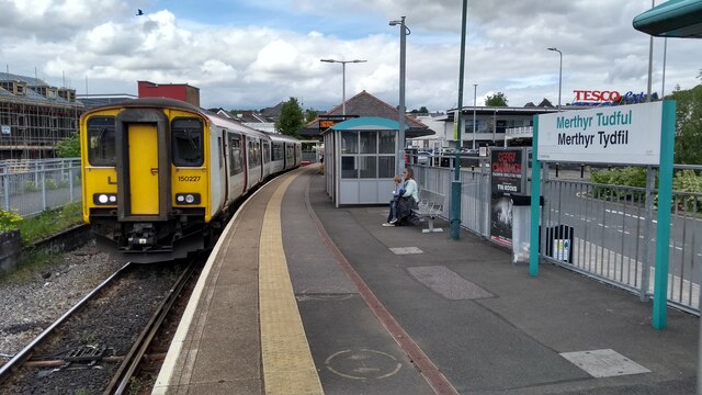
Unitary Authority: Merthyr Tydfil

Police Authority: South Wales

What 3 Words

///live.robe.meant. Near Merthyr Tydfil

Nearby Locations

Mountain Hare Incline Top

Related Wikis

A4060 road

The A4060, also known as the East of Abercynon to East of Dowlais Trunk Road, is a trunk road in Wales. == Route == The road starts at A470 The Pentrebach...

Town, Merthyr Tydfil

Town is the name of a local government community and electoral ward in the town of Merthyr Tydfil, in Merthyr Tydfil County Borough, Wales. == Description... ==

Cyfarthfa High School

Cyfarthfa High School is a comprehensive school, based in Merthyr Tydfil County Borough, Wales, that was established in 1970. Cyfarthfa means "Place of...

Merthyr Synagogue

The former Merthyr Synagogue is located on Bryntirion Road in the Thomastown section of Merthyr Tydfil, Wales. It is a Grade II listed building and is...

Nearby Amenities

Located within 500m of 51.746292,-3.361411
Mini Roundabout
Lat/Long: 51.7477953/-3.365802
Mini Roundabout
Lat/Long: 51.7440112/-3.3651301
Mini Roundabout
Lat/Long: 51.7445004/-3.3634439
Mountain Hare
Place: suburb
Wikidata: Q107033374
Lat/Long: 51.746202/-3.3606591
Crossing
Crossing: zebra
Lat/Long: 51.7470651/-3.3663779
Penyrheol
Place: suburb
Lat/Long: 51.7440245/-3.3622253
Crossing
Crossing: uncontrolled
Crossing Island: no
Crossing Ref: zebra
Lat/Long: 51.7443169/-3.3652927
Mini Roundabout
Direction: clockwise
Lat/Long: 51.7469426/-3.3668549
Crossing
Crossing: zebra
Lat/Long: 51.7476459/-3.3652292
Crossing
Crossing Island: no
Lat/Long: 51.7439373/-3.3654905
Give Way
Lat/Long: 51.7434243/-3.3649274
Give Way
Lat/Long: 51.7434012/-3.3646694
Noexit: yes
Lat/Long: 51.7501289/-3.3634285
Direction: WSW
Generator Method: photovoltaic
Generator Output Electricity: yes
Generator Solar Modules: 8
Generator Source: solar
Generator Type: solar_photovoltaic_panel
Location: roof
Power: generator
Lat/Long: 51.7501566/-3.3613135
Direction: 165
Generator Method: photovoltaic
Generator Output Electricity: yes
Generator Solar Modules: 16
Generator Source: solar
Generator Type: solar_photovoltaic_panel
Location: roof
Power: generator
Lat/Long: 51.7489189/-3.3664161
Bus Stop
Incline Bridge
Bench: no
Bin: no
Bus: yes
Lit: yes
Naptan AtcoCode: 5530AWB33875
Naptan NaptanCode: mtydjtm
Public Transport: platform
Shelter: no
Survey Date: 2017-08-08
Tactile Paving: no
Lat/Long: 51.7438482/-3.364944
Bus Stop
Incline Bridge
Bench: no
Bin: no
Bus: yes
Naptan AtcoCode: 5530AWB33874
Naptan NaptanCode: mtydjtj
Public Transport: platform
Shelter: yes
Survey Date: 2017-08-08
Tactile Paving: no
Lat/Long: 51.7437403/-3.3649407
Bus Stop
Vernon Close
Bus: yes
Naptan AtcoCode: 5530AWB33905
Naptan NaptanCode: mtydjtd
Public Transport: platform
Survey Date: 2017-08-08
Lat/Long: 51.7488697/-3.3669061
Bus Stop
Farmers Arms
Naptan AtcoCode: 5530AWB33881
Naptan NaptanCode: mtydjgd
Survey Date: 2017-08-08
Lat/Long: 51.7450424/-3.3604317
Bus Stop
Farmers Arms
Naptan AtcoCode: 5530AWB33882
Naptan NaptanCode: mtydjgj
Survey Date: 2017-08-08
Lat/Long: 51.745161/-3.3602904
Bus Stop
Mansfield Terrace
Naptan AtcoCode: 5530AWB33904
Naptan NaptanCode: mtydjgw
Survey Date: 2017-08-08
Lat/Long: 51.7464931/-3.3601711
Bus Stop
Mansfield Terrace
Naptan AtcoCode: 5530AWB33902
Naptan NaptanCode: mtydjgt
Survey Date: 2017-08-08
Lat/Long: 51.7462624/-3.3599034
Playground: seesaw
Lat/Long: 51.7438395/-3.3636135
Playground: swing
Lat/Long: 51.7438266/-3.3636644
Playground: yes
Lat/Long: 51.7437735/-3.3636007
Pub
The Farmers Arms
Addr City: Merthyr Tydfil
Addr Country: GB
Addr Housenumber: 25
Addr Postcode: CF47 0LF
Addr Street: Penheolferthyr
Addr Suburb: Twynyrodyn
Fhrs Id: 918993
Lat/Long: 51.7451935/-3.3605049
Crossing
Crossing: uncontrolled
Crossing Ref: zebra
Lat/Long: 51.744269/-3.3643409
Direction: SSW
Generator Method: photovoltaic
Generator Output Electricity: yes
Generator Solar Modules: 16
Generator Source: solar
Generator Type: solar_photovoltaic_panel
Location: roof
Power: generator
Lat/Long: 51.7439495/-3.3621946
Direction: 195
Generator Method: photovoltaic
Generator Output Electricity: yes
Generator Solar Modules: 10
Generator Source: solar
Generator Type: solar_photovoltaic_panel
Location: roof
Power: generator
Lat/Long: 51.7437104/-3.3623689
Direction: 255
Generator Method: photovoltaic
Generator Output Electricity: yes
Generator Solar Modules: 14
Generator Source: solar
Generator Type: solar_photovoltaic_panel
Location: roof
Power: generator
Lat/Long: 51.7428744/-3.3623602
Direction: 260
Generator Method: photovoltaic
Generator Output Electricity: yes
Generator Solar Modules: 18
Generator Source: solar
Generator Type: solar_photovoltaic_panel
Location: roof
Power: generator
Lat/Long: 51.7430992/-3.3628812
Give Way
Lat/Long: 51.7436475/-3.3632289
Traffic Calming: bump
Lat/Long: 51.7450572/-3.3605221
Crossing
Lat/Long: 51.7477171/-3.3658959
Direction: 235
Generator Output Electricity: yes
Generator Solar Modules: 6
Generator Source: solar
Location: roof
Power: generator
Lat/Long: 51.7484622/-3.3663701
Direction: WSW
Generator Output Electricity: yes
Generator Solar Modules: 14
Generator Source: solar
Location: roof
Power: generator
Lat/Long: 51.7485595/-3.3664016
Direction: NNW
Generator Method: photovoltaic
Generator Output Electricity: yes
Generator Solar Modules: 8
Generator Source: solar
Generator Type: solar_photovoltaic_panel
Location: roof
Power: generator
Lat/Long: 51.7487845/-3.3659537
Crossing
Crossing: uncontrolled
Crossing Island: no
Crossing Ref: zebra
Lat/Long: 51.744471/-3.3653045
Give Way
Lat/Long: 51.7436086/-3.3648134
Check Date: 2022-02-07
Foraging: permissive
Natural: shrub
Produce: plantain
Lat/Long: 51.7446034/-3.3634314
Check Date: 2022-02-07
Foraging: permissive
Natural: shrub
Produce: nettles
Lat/Long: 51.7447495/-3.3635326
Check Date: 2022-02-07
Foraging: permissive
Natural: shrub
Produce: blackberries
Lat/Long: 51.7447368/-3.3635386
Direction: SSE
Generator Method: photovoltaic
Generator Output Electricity: yes
Generator Solar Modules: 8
Generator Source: solar
Generator Type: solar_photovoltaic_panel
Location: roof
Power: generator
Lat/Long: 51.7487617/-3.3659383
Direction: WSW
Generator Method: photovoltaic
Generator Output Electricity: yes
Generator Solar Modules: 8
Generator Source: solar
Generator Type: solar_photovoltaic_panel
Location: roof
Power: generator
Lat/Long: 51.7502012/-3.361337
Direction: SSE
Generator Method: photovoltaic
Generator Output Electricity: yes
Generator Solar Modules: 3
Generator Source: solar
Generator Type: solar_photovoltaic_panel
Location: roof
Power: generator
Lat/Long: 51.7444295/-3.3615147
Direction: SSE
Generator Method: photovoltaic
Generator Output Electricity: yes
Generator Solar Modules: 3
Generator Source: solar
Generator Type: solar_photovoltaic_panel
Location: roof
Power: generator
Lat/Long: 51.7444112/-3.3616059
Direction: SSE
Generator Method: photovoltaic
Generator Output Electricity: yes
Generator Solar Modules: 22
Generator Source: solar
Generator Type: solar_photovoltaic_panel
Location: roof
Power: generator
Lat/Long: 51.7448988/-3.3605129
Direction: WSW
Generator Method: photovoltaic
Generator Output Electricity: yes
Generator Solar Modules: 6
Generator Source: solar
Generator Type: solar_photovoltaic_panel
Location: roof
Power: generator
Lat/Long: 51.7459598/-3.3607556
Direction: 165
Generator Method: photovoltaic
Generator Output Electricity: yes
Generator Solar Modules: 8
Generator Source: solar
Generator Type: solar_photovoltaic_panel
Location: roof
Power: generator
Lat/Long: 51.7455338/-3.365318
Crossing
Lat/Long: 51.7468397/-3.358882
Post Box
Operator: Royal Mail
Post Box Type: lamp
Ref: CF47 64D
Royal Cypher: EIIR
Lat/Long: 51.7454083/-3.3599804
Barrier: cattle_grid
Lat/Long: 51.7460636/-3.3574444
The data included in this document is from www.openstreetmap.org. The data is made available under ODbL.

Have you been to Mountain Hare?

Leave your review of Mountain Hare below (or comments, questions and feedback).