Mount Pleasant

Settlement in Staffordshire

England

Mount Pleasant

Junction on A50 eastbound
Junction on A50 eastbound Credit: Dave Thompson

Mount Pleasant is a small village located in the county of Staffordshire, England. Situated in the West Midlands region, it is nestled in the picturesque countryside, surrounded by rolling hills and scenic landscapes. The village is part of the district of South Staffordshire and falls within the civil parish of Himley and Swindon.

With a population of around 500 residents, Mount Pleasant offers a tight-knit community atmosphere. The village is known for its peaceful and tranquil setting, making it an ideal place for those seeking a serene countryside lifestyle. The village is primarily residential, with a scattering of traditional houses and cottages, adding to its charm and character.

Despite its small size, Mount Pleasant benefits from its close proximity to nearby towns and cities. The bustling town of Dudley is approximately 5 miles away, offering a range of amenities including shopping centers, restaurants, and entertainment venues. Wolverhampton, known for its rich industrial history, is also within easy reach, providing further opportunities for employment and leisure activities.

Nature enthusiasts will appreciate the village's location, as it is surrounded by numerous parks and green spaces. The nearby Himley Hall and Park is a popular destination for locals and visitors alike, offering stunning gardens, a lake, and a historic stately home. The area also boasts several walking and cycling trails, allowing residents to explore the beautiful Staffordshire countryside.

In summary, Mount Pleasant is a charming village in Staffordshire, providing a peaceful and idyllic setting for its residents. With its picturesque surroundings and convenient access to nearby towns and cities, it offers a perfect blend of rural tranquility and urban amenities.

If you have any feedback on the listing, please let us know in the comments section below.

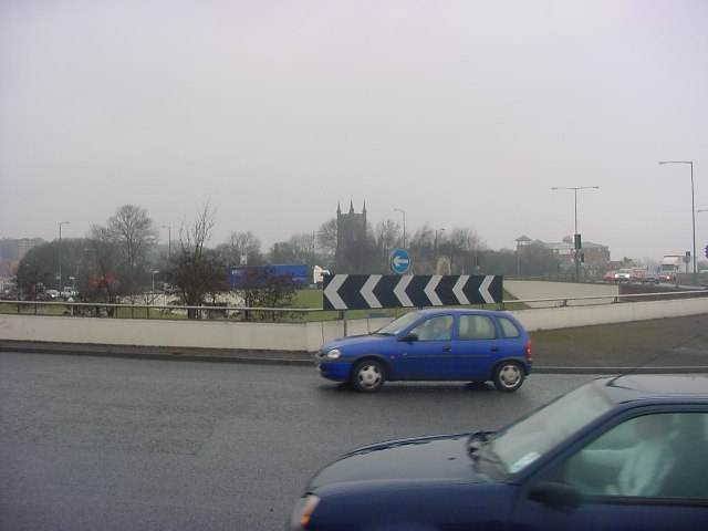
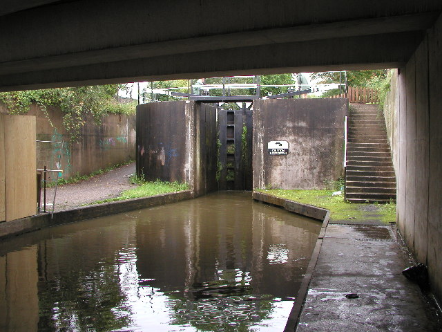
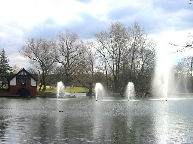
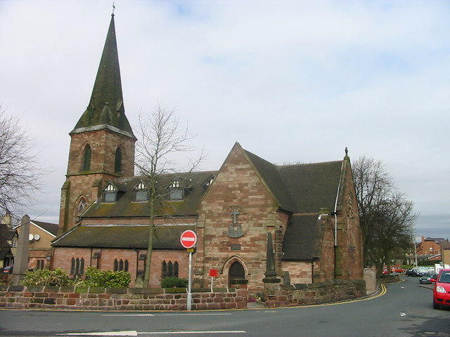
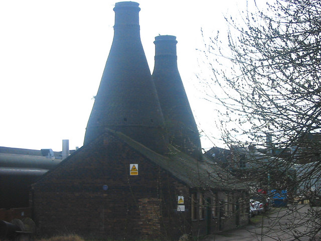
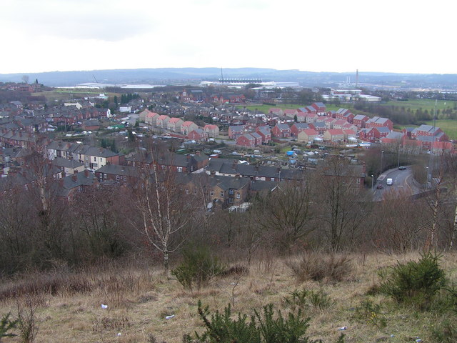
Mount Pleasant Images

Images are sourced within 2km of 52.995341/-2.17384 or Grid Reference SJ8844. Thanks to Geograph Open Source API. All images are credited.

Junction on A50 eastbound
Fenton Park Methodist Church Fenton Park was built on the site of the blacksmiths workshop. Six of the local stalwarts mortgaged their houses to pay for the original building which opened in 1900. Real faith. The second building was for the Sunday School is now the Church Hall. 
  
The Church is located high on the hill, very near to the television mast, and the neon empty cross can be seen proclaiming the good news, each night, for many a mile.
Fenton Park Methodist Church
Fenton Park was built on the site of the blacksmiths workshop. Six of the local stalwarts mortgaged their houses to pay for the original building which opened in 1900. Real faith. The second building was for the Sunday School is now the Church Hall. The Church is located high on the hill, very near to the television mast, and the neon empty cross can be seen proclaiming the good news, each night, for many a mile.
A50 climbing away from Longton The A50 leaves the concrete canyon section through Longton and climbs to a small summit.
A50 climbing away from Longton
The A50 leaves the concrete canyon section through Longton and climbs to a small summit.
Uttoxeter Road, Longton The A50 is a major trunk road running for almost 100 miles between Warrington and Leicester.

The A50 has been vastly upgraded between Stoke on Trent and J24 of the M1 at Kegworth with much of the route being built in the 1980s and 90s to form a high-speed link across the Midlands, fulfilling a role which was planned to be taken up by the planned M64 motorway which was never built.
Uttoxeter Road, Longton
The A50 is a major trunk road running for almost 100 miles between Warrington and Leicester. The A50 has been vastly upgraded between Stoke on Trent and J24 of the M1 at Kegworth with much of the route being built in the 1980s and 90s to form a high-speed link across the Midlands, fulfilling a role which was planned to be taken up by the planned M64 motorway which was never built.
The Pit Stop (Car Wash) in Longton A man in an outfit waves at passing drivers to entice them in to have their car cleaned.  I personally found the whole thing a bit creepy, especially as he is looking directly at me in this photo.
The Pit Stop (Car Wash) in Longton
A man in an outfit waves at passing drivers to entice them in to have their car cleaned. I personally found the whole thing a bit creepy, especially as he is looking directly at me in this photo.
Darbar Unique Centre, Oldfield Street, Longton Muslim place of worship.
Darbar Unique Centre, Oldfield Street, Longton
Muslim place of worship.
Fenton Cemetery
Fenton Cemetery
King Street in Longton
King Street in Fenton
City Road Roundabout! This is the junction of the A500 and the A5007 in Stoke. It has since been completely rebuilt. In the distance can be seen St. Peter's Church and further to the right, Stoke Civic Centre.
City Road Roundabout!
This is the junction of the A500 and the A5007 in Stoke. It has since been completely rebuilt. In the distance can be seen St. Peter's Church and further to the right, Stoke Civic Centre.
Stoke Bottom Lock This is the lowest lock of a flight of five on the Trent and Mersey Canal in Stoke.  I believe it was rebuilt here in the 1960s when the original line of the canal was moved to accommodate the new road system in the city.  This lock has been fabricated out of concrete as opposed to the original which would have been made out of brick/stone.
Stoke Bottom Lock
This is the lowest lock of a flight of five on the Trent and Mersey Canal in Stoke. I believe it was rebuilt here in the 1960s when the original line of the canal was moved to accommodate the new road system in the city. This lock has been fabricated out of concrete as opposed to the original which would have been made out of brick/stone.
The Britannia Stadium, Stoke The new home of Stoke City FC.
The Britannia Stadium, Stoke
The new home of Stoke City FC.
New Warehousing Built on the site of the former Hem Heath colliery. Stoke City's Britannia Stadium is visible behind.
New Warehousing
Built on the site of the former Hem Heath colliery. Stoke City's Britannia Stadium is visible behind.
Hanley Park Lake The lake in Hanley Park, Stoke on Trent. Built in the Victorian era with its boathouse the park is undergoing a facelift part of which is the fountains shown
Hanley Park Lake
The lake in Hanley Park, Stoke on Trent. Built in the Victorian era with its boathouse the park is undergoing a facelift part of which is the fountains shown
The Old Victoria Ground This shows the site of the old Victoria Ground the home of Stoke City for over 100 years now awaiting development (Mar 06). On the horizon, centre picture can be seen one of the stands at the Britannia Stadium the clubs present ground.
The Old Victoria Ground
This shows the site of the old Victoria Ground the home of Stoke City for over 100 years now awaiting development (Mar 06). On the horizon, centre picture can be seen one of the stands at the Britannia Stadium the clubs present ground.
Penkhull Church St. Thomas's church, Penkhull, Stoke on Trent built in 1842 and designed by George Gilbert Scott
Penkhull Church
St. Thomas's church, Penkhull, Stoke on Trent built in 1842 and designed by George Gilbert Scott
Portmeirion Bottle Ovens Old bottle ovens on the Portmeirion factory, Stoke on Trent. The pots were stacked inside in saggars and fired by coal causing the air to be black with smoke.
Portmeirion Bottle Ovens
Old bottle ovens on the Portmeirion factory, Stoke on Trent. The pots were stacked inside in saggars and fired by coal causing the air to be black with smoke.
Glebe Hill View
Glebe Hill View
Show me another place!

Mount Pleasant is located at Grid Ref: SJ8844 (Lat: 52.995341, Lng: -2.17384)

Unitary Authority: Stoke-on-Trent

Police Authority: Staffordshire

What 3 Words

///older.almost.really. Near Stoke-on-Trent, Staffordshire

Related Wikis

Stoke railway works

Stoke railway works was set up in 1864 by the North Staffordshire Railway in the city of Stoke-on-Trent in the county of Staffordshire, England. The railway...

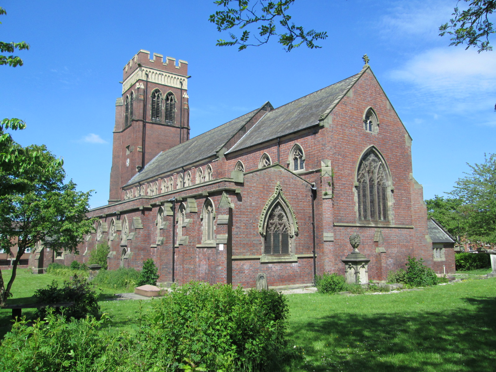
Christ Church, Fenton

Christ Church is an Anglican church in Fenton, Staffordshire, England. It is in the parish of Stoke-upon-Trent and Fenton, and in the Diocese of Lichfield...

Victoria Ground

The Victoria Ground was the home ground of Stoke City from 1878 until 1997, when the club relocated to the Britannia Stadium after 119 years. At the time...

Fenton Town Hall

Fenton Town Hall is a municipal building in Albert Square in Fenton, Staffordshire, England. It is now occupied by local businesses, a café and an art...

Fenton railway station

Fenton railway station was opened in 1864 by the North Staffordshire Railway on its line to Derby. It closed in 1961. It was located in Heron Cross and...

Bet365 Stadium

The Bet365 Stadium (stylised as bet365 Stadium) is an all-seater football stadium in Stoke-on-Trent, Staffordshire, England and the home of EFL Championship...

Stoke-on-Trent

Stoke-on-Trent (often abbreviated to Stoke) is a city and unitary authority area in Staffordshire, England, with an area of 36 square miles (93 km2). In...
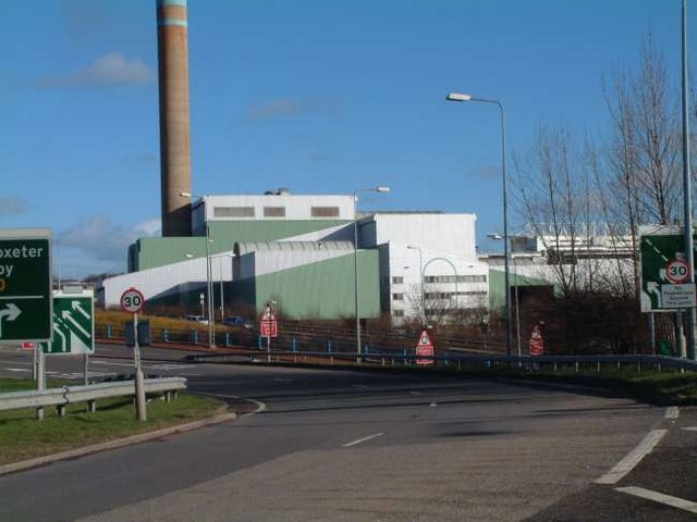
Stoke EfW

Stoke EfW is a large incineration plant in the Sideway area of Stoke-on-Trent, England. It burns municipal waste and in the process produces electricity...

Nearby Amenities

Located within 500m of 52.995341,-2.17384
Motorway Junction
Whieldon Road Junction
Lat/Long: 52.9963447/-2.1805745
Mount Pleasant
Place: locality
Lat/Long: 52.9964527/-2.1715328
Turning Circle
Lat/Long: 52.9970363/-2.1729362
Turning Circle
Lat/Long: 52.9975679/-2.173693
Railway: switch
Lat/Long: 52.9927738/-2.1790286
Railway: switch
Lat/Long: 52.9930209/-2.1781053
Railway: switch
Lat/Long: 52.9921774/-2.1790274
Railway: switch
Lat/Long: 52.9934667/-2.1779851
Power: tower
Lat/Long: 52.996559/-2.17994
Post Box
Lat/Long: 52.998738/-2.1757645
Addr Housenumber: 146
Lat/Long: 52.995588/-2.171757
Turning Circle
Lat/Long: 52.9955338/-2.175452
Shelter
Lat/Long: 52.995151/-2.1704109
Give Way
Direction: backward
Lat/Long: 52.9962423/-2.1740764
Railway: derail
Lat/Long: 52.9931406/-2.1781273
Barrier: height_restrictor
Maxheight: 6'6"
Lat/Long: 52.9989597/-2.1728373
The data included in this document is from www.openstreetmap.org. The data is made available under ODbL.

Have you been to Mount Pleasant?

Leave your review of Mount Pleasant below (or comments, questions and feedback).