Moss Pit

Settlement in Staffordshire Stafford

England

Moss Pit

Canal near Acton Trussell in Staffordshire This is the Staffordshire and Worcestershire Canal, looking north-north-east towards Acton Bridge (No 93), Stafford and Great Haywood.
Canal near Acton Trussell in Staffordshire Credit: Roger Kidd

Moss Pit is a small village located in the county of Staffordshire, England. Situated about 3 miles east of Stafford, it falls within the Stafford borough. The village is nestled in a picturesque rural setting, surrounded by beautiful countryside and farmland.

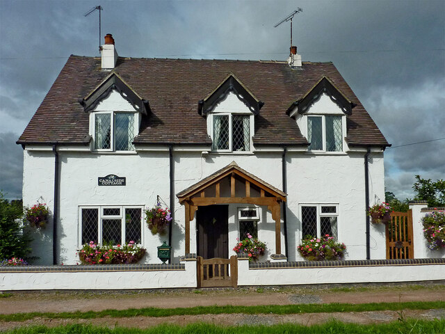
With a population of around 500 residents, Moss Pit maintains a tight-knit community feel. The village is characterized by its charming traditional houses, many of which date back several centuries. Moss Pit is known for its peaceful and serene atmosphere, making it an ideal location for those seeking a tranquil lifestyle away from the hustle and bustle of larger towns.

Despite its small size, Moss Pit offers a range of amenities to its residents. These include a local pub, a village hall, and a primary school, providing convenience and opportunities for social gatherings within the community. Additionally, the village benefits from being in close proximity to the larger town of Stafford, which offers a wider range of services, shops, and leisure facilities.

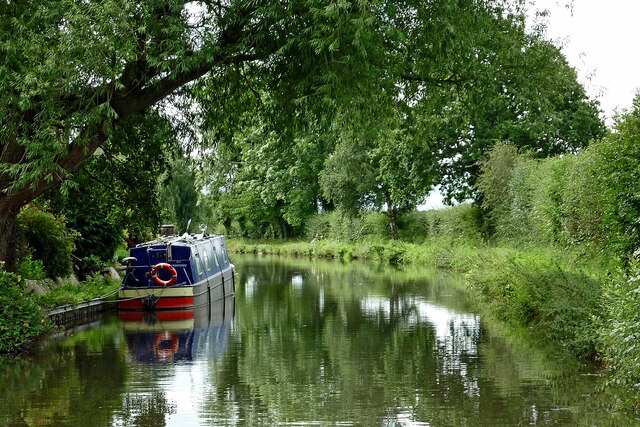
Nature enthusiasts will find themselves at home in Moss Pit, as the village is surrounded by stunning natural beauty. The nearby Cannock Chase Area of Outstanding Natural Beauty provides ample opportunities for outdoor activities such as hiking, cycling, and wildlife spotting.

Overall, Moss Pit is a charming and idyllic village in Staffordshire, offering a peaceful rural lifestyle and a strong sense of community.

If you have any feedback on the listing, please let us know in the comments section below.
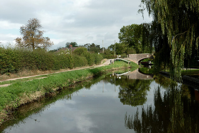
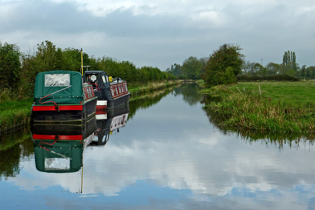
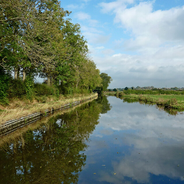
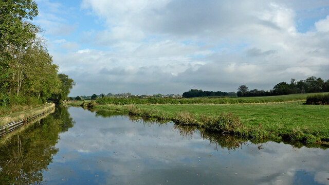
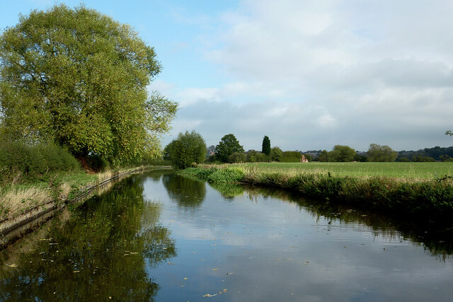
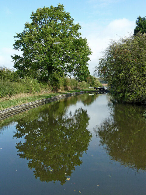
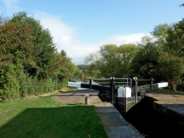
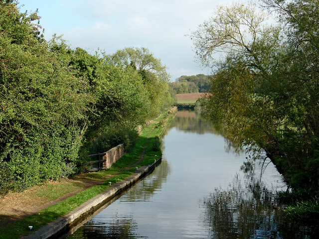
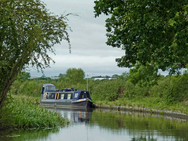
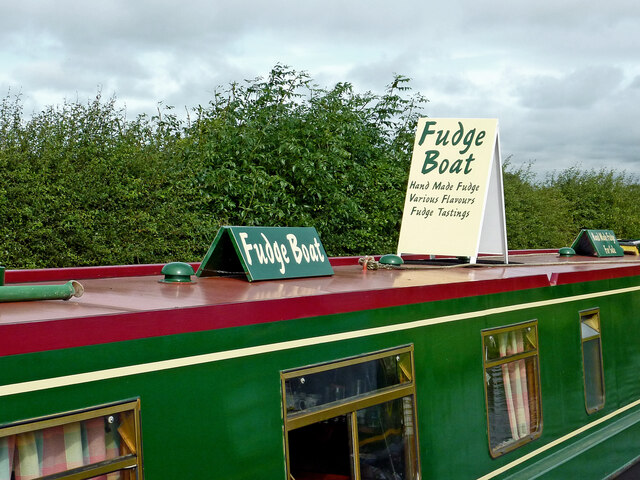
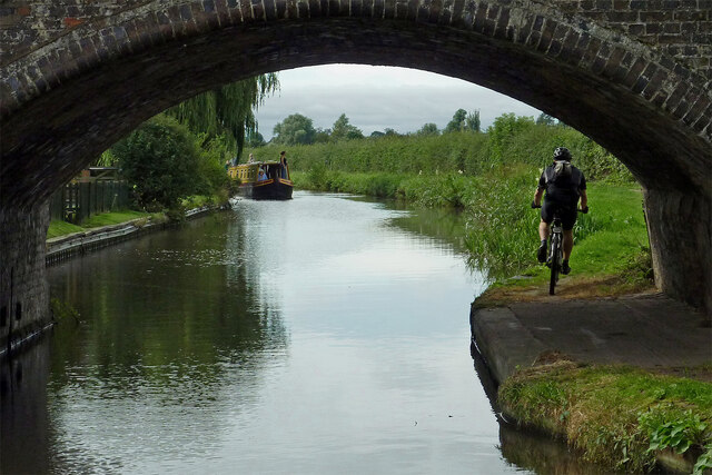
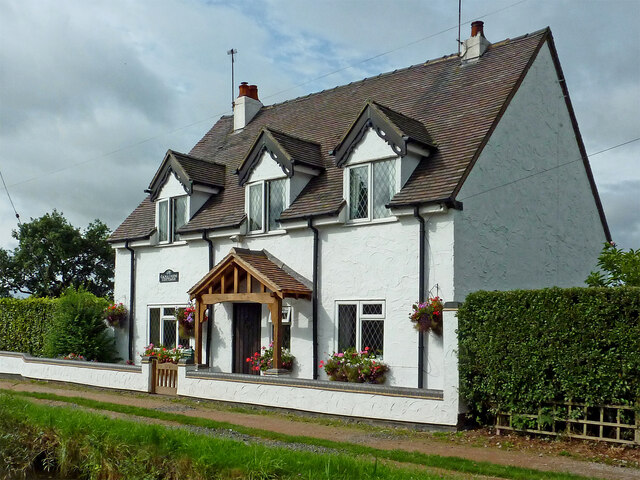
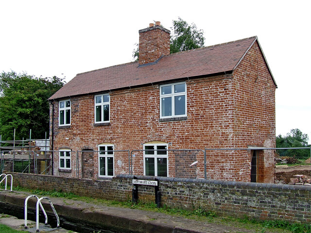
Moss Pit Images

Images are sourced within 2km of 52.774364/-2.110403 or Grid Reference SJ9219. Thanks to Geograph Open Source API. All images are credited.

Canal near Acton Trussell in Staffordshire This is the Staffordshire and Worcestershire Canal, looking north-north-east towards Acton Bridge (No 93), Stafford and Great Haywood.
Canal near Acton Trussell in Staffordshire
This is the Staffordshire and Worcestershire Canal, looking north-north-east towards Acton Bridge (No 93), Stafford and Great Haywood.
Canal north of Acton Trussell in Staffordshire This is the Staffordshire and Worcestershire Canal, looking north towards  Stafford and Great Haywood.
Canal north of Acton Trussell in Staffordshire
This is the Staffordshire and Worcestershire Canal, looking north towards Stafford and Great Haywood.
Canal north of Acton Trussell in Staffordshire This is the Staffordshire and Worcestershire Canal, looking north towards Roseford Bridge, No 94.
Canal north of Acton Trussell in Staffordshire
This is the Staffordshire and Worcestershire Canal, looking north towards Roseford Bridge, No 94.
Canal and pasture north of Acton Trussell Staffordshire This is the Staffordshire and Worcestershire Canal, looking north towards Roseford Bridge, No 94.
Canal and pasture north of Acton Trussell Staffordshire
This is the Staffordshire and Worcestershire Canal, looking north towards Roseford Bridge, No 94.
Canal and pasture north of Acton Trussell Staffordshire This is the Staffordshire and Worcestershire Canal, looking north towards Stafford. The distant brick cottage is by Deptmore (Deepmore) Lock, No 42.
Canal and pasture north of Acton Trussell Staffordshire
This is the Staffordshire and Worcestershire Canal, looking north towards Stafford. The distant brick cottage is by Deptmore (Deepmore) Lock, No 42.
Canal approaching Deptmore Lock near Stafford This is the Staffordshire and Worcestershire Canal near Deptmore (Deepmore) Lock, No 42, meandering towards Great Haywood Junction.
Canal approaching Deptmore Lock near Stafford
This is the Staffordshire and Worcestershire Canal near Deptmore (Deepmore) Lock, No 42, meandering towards Great Haywood Junction.
Deptmore Lock near Wildwood, Stafford Looking north-east as the canal meanders towards Great Haywood Junction, Deptmore Lock (Deepmore Lock) is No 42 on the Staffordshire and Worcestershire Canal. It is a deep one, allowing a fall (or rise) of 10ft 3in (about 3·1 metres).
Deptmore Lock near Wildwood, Stafford
Looking north-east as the canal meanders towards Great Haywood Junction, Deptmore Lock (Deepmore Lock) is No 42 on the Staffordshire and Worcestershire Canal. It is a deep one, allowing a fall (or rise) of 10ft 3in (about 3·1 metres).
Staffordshire and Worcestershire Canal near Wildwood, Stafford From Deptmore Lock, looking north-east as the canal meanders past Stafford towards Great Haywood Junction.
Staffordshire and Worcestershire Canal near Wildwood, Stafford
From Deptmore Lock, looking north-east as the canal meanders past Stafford towards Great Haywood Junction.
Narrowboat on the Staffordshire and Worcestershire Canal Narrowboat "Keep Smilin" is moored south-west of Deptmore Lock near Wildwood, Stafford.
Narrowboat on the Staffordshire and Worcestershire Canal
Narrowboat "Keep Smilin" is moored south-west of Deptmore Lock near Wildwood, Stafford.
Get your fudge here! The very smart boat was moored in a very rural place north of Acton Trussell in Staffordshire. A permit is required to trade from a narrowboat on the canals. I expect they do get occasional ales from passing craft. I have read that their best seller is the rhubarb and custard flavour.

Traders of all kinds of wares can be found at boat festivals and other popular canal venues.
Get your fudge here!
The very smart boat was moored in a very rural place north of Acton Trussell in Staffordshire. A permit is required to trade from a narrowboat on the canals. I expect they do get occasional ales from passing craft. I have read that their best seller is the rhubarb and custard flavour. Traders of all kinds of wares can be found at boat festivals and other popular canal venues.
Canal near Acton Trussell in Staffordshire Looking south-south-west towards Penkridge and Wolverhampton, this image shows the Staffordshire and Worcestershire Canal at Acton Bridge, No 93. The bridge carries Mill Lane.
Canal near Acton Trussell in Staffordshire
Looking south-south-west towards Penkridge and Wolverhampton, this image shows the Staffordshire and Worcestershire Canal at Acton Bridge, No 93. The bridge carries Mill Lane.
Canalside Cottage near Acton Trussell in Staffordshire By the Staffordshire and Worcestershire Canal.
There is no actual road access to the premises; just a strengthened towpath.
Canalside Cottage near Acton Trussell in Staffordshire
By the Staffordshire and Worcestershire Canal. There is no actual road access to the premises; just a strengthened towpath.
Canal near Acton Trussell in Staffordshire Looking south towards Penkridge, this is the Staffordshire and Worcestershire Canal near the southern part of Acton Trussell (off to the left). The large overhanging tree has been felled since the image was obtained.
Canal near Acton Trussell in Staffordshire
Looking south towards Penkridge, this is the Staffordshire and Worcestershire Canal near the southern part of Acton Trussell (off to the left). The large overhanging tree has been felled since the image was obtained.
Deptmore Lock and house south-east of Stafford Deptmore Lock is No 45 on the Staffordshire and Worcestershire Canal. It provides a rise of 10ft 3in (about 3·1 metres). 
The house is being renovated. There is no road connection to it. As I write (in 2022) the current owner now uses a track along the field edge, south to Roseford Bridge and Farm, then Roseford Lane.
Deptmore Lock and house south-east of Stafford
Deptmore Lock is No 45 on the Staffordshire and Worcestershire Canal. It provides a rise of 10ft 3in (about 3·1 metres). The house is being renovated. There is no road connection to it. As I write (in 2022) the current owner now uses a track along the field edge, south to Roseford Bridge and Farm, then Roseford Lane.
Deptmore Lock House south-east of Stafford Deptmore Lock is No 42 on the Staffordshire and Worcestershire Canal. It provides a rise of 10ft 3in (about 3·1 metres). 
The house is being renovated, gradually. There is no road connection to it. As I write (in 2022) the current owner now uses a track along the field edge, south to Roseford Bridge and Farm, then Roseford Lane.
Deptmore Lock House south-east of Stafford
Deptmore Lock is No 42 on the Staffordshire and Worcestershire Canal. It provides a rise of 10ft 3in (about 3·1 metres). The house is being renovated, gradually. There is no road connection to it. As I write (in 2022) the current owner now uses a track along the field edge, south to Roseford Bridge and Farm, then Roseford Lane.
Show me another place!

Moss Pit is located at Grid Ref: SJ9219 (Lat: 52.774364, Lng: -2.110403)

Administrative County: Staffordshire

District: Stafford

Police Authority: Staffordshire

What 3 Words

///prime.dices.mass. Near Stafford, Staffordshire

Nearby Locations

Acton Gate Moss Pit

Related Wikis

1996 Stafford rail crash

The 1996 Stafford rail crash occurred on 8 March 1996 when a Transrail freight train travelling from Mossend, North Lanarkshire, to Willesden, North London...

Stafford Manor High School

Stafford Manor High School is a mixed secondary school and sixth form located in Stafford in the English county of Staffordshire.Previously known as Rising...

Radford Meadows

Radford Meadows is a nature reserve of the Staffordshire Wildlife Trust, on the southern edge of Stafford, in Staffordshire, England. The reserve is a...

Hyde Lea

Hyde Lea is a village and parish in Staffordshire, England, just west of Stafford itself. Hyde Lea borders the southern boundary of Castle Church parish...

Stafford Grammar School

Stafford Grammar School is a mixed independent day school at Burton Manor, located on the outskirts of Stafford, the county town of Staffordshire. Founded...

Dunston, Staffordshire

Dunston is a small village in England lying on the west side of the A449 trunk road about 3 miles (4.8 km) south of Stafford, close to Junction 13 of the...

Acton Trussell

Acton Trussell is a village in the English county of Staffordshire. It is known as Actone in the Domesday Book. Located around 4 miles southeast of Stafford...

Brocton F.C.

Brocton Football Club is a football club representing Brocton, near Stafford, England. They are currently members of the North West Counties League Division...

Nearby Amenities

Located within 500m of 52.774364,-2.110403
Bus Stop
One Oak Rise
Bus: yes
Naptan AtcoCode: 3800C724801
Naptan Bearing: N
Naptan CommonName: One Oak Rise
Naptan Indicator: Adj
Naptan Landmark: One Oak Rise
Naptan PlusbusZoneRef: STAFFRD
Naptan Street: Ten Butts Crescent
Naptan Verified: no
Public Transport: platform
Source: naptan_import
Lat/Long: 52.7781002/-2.1117354
Bus Stop
Barn Bank Lane
Bus: yes
Naptan AtcoCode: 3800C724901
Naptan Bearing: N
Naptan CommonName: Barn Bank Lane
Naptan Indicator: Adj
Naptan Landmark: Barn Bank Lane
Naptan PlusbusZoneRef: STAFFRD
Naptan Street: Moss Pit
Naptan Verified: no
Public Transport: platform
Source: naptan_import
Lat/Long: 52.7762389/-2.1121605
Bus Stop
Barn Bank Lane
Bus: yes
Naptan AtcoCode: 3800C724902
Naptan Bearing: S
Naptan Indicator: Adj
Naptan Landmark: Gravel Lane
Naptan PlusbusZoneRef: STAFFRD
Naptan Street: Moss Pit
Naptan Verified: no
Public Transport: platform
Source: naptan_import
Lat/Long: 52.7757988/-2.1116998
Bus Stop
Barnhurst Farm
Bus: yes
Naptan AtcoCode: 3800C749101
Naptan Bearing: SE
Naptan CommonName: Barnhurst Farm
Naptan Indicator: Adj
Naptan Landmark: Barnhurst Farm
Naptan PlusbusZoneRef: STAFFRD
Naptan Street: Woverhampton Road
Naptan Verified: no
Public Transport: platform
Source: naptan_import
Lat/Long: 52.773095/-2.1094843
Bus Stop
Barnhurst Farm
Bus: yes
Naptan AtcoCode: 3800C749102
Naptan Bearing: NW
Naptan CommonName: Barnhurst Farm
Naptan Indicator: Opp
Naptan Landmark: Barnhurst Farm
Naptan PlusbusZoneRef: STAFFRD
Naptan Street: Wolverhampton Road
Naptan Verified: no
Public Transport: platform
Source: naptan_import
Lat/Long: 52.773023/-2.1095878
Bus Stop
Garage
Bus: yes
Naptan AtcoCode: 3800C749301
Naptan Bearing: NW
Naptan CommonName: Garage
Naptan Indicator: Adj
Naptan Landmark: Moss Pit Garage
Naptan PlusbusZoneRef: STAFFRD
Naptan Street: Wolverhampton Road
Naptan Verified: no
Public Transport: platform
Source: naptan_import
Lat/Long: 52.7715945/-2.1086208
Post Box
Ref: ST17 56
Lat/Long: 52.776142/-2.1108907
Post Box
Brand: Royal Mail
Brand Wikidata: Q638098
Brand Wikipedia: en:Royal Mail
Operator: Royal Mail
Operator Wikidata: Q638098
Post Box Type: lamp
Ref: ST17 380
Source: drive-by survey (not the ref)
Lat/Long: 52.770721/-2.1076947
Acton Gate
Is In: Staffordshire,UK
Place: hamlet
Lat/Long: 52.77178/-2.106827
Barrier: cattle_grid
Lat/Long: 52.7732184/-2.1093763
Noexit: yes
Lat/Long: 52.7719415/-2.1104794
Bus Stop
Garage
Bus: yes
Naptan AtcoCode: 3800C749302
Naptan NaptanCode: stagjdjm
Naptan Verified: no
Public Transport: platform
Source: naptan
Lat/Long: 52.7717927/-2.1085462
Generator Method: photovoltaic
Generator Output Electricity: yes
Generator Source: solar
Generator Type: solar_photovoltaic_panel
Location: roof
Power: generator
Lat/Long: 52.7778682/-2.1107751
Generator Method: photovoltaic
Generator Output Electricity: yes
Generator Source: solar
Generator Type: solar_photovoltaic_panel
Location: roof
Power: generator
Lat/Long: 52.7780711/-2.114372
Communication Mobile Phone: yes
Man Made: mast
Tower Construction: tubular
Tower Type: communication
Lat/Long: 52.774897/-2.1112221
Colour: green
Man Made: street_cabinet
Street Cabinet: telecom
Utility: telecom
Lat/Long: 52.7748899/-2.1112054
Colour: gray
Man Made: street_cabinet
Street Cabinet: telecom
Utility: telecom
Lat/Long: 52.7748845/-2.1111927
INTRA COMMUNITY CONSIGNMENT
Description: Склад
Office: company
Lat/Long: 52.770947/-2.1107262
Post Box
Collection Times: Mo-Fr 09:00; Sa 07:00
Operator: Royal Mail
Operator Wikidata: Q638098
Post Box Mounting: pier
Post Box Type: lamp
Ref: ST17 443
Royal Cypher: EIIR
Royal Cypher Wikidata: Q33102113
Lat/Long: 52.7746797/-2.115254
The data included in this document is from www.openstreetmap.org. The data is made available under ODbL.

Have you been to Moss Pit?

Leave your review of Moss Pit below (or comments, questions and feedback).