Belton-in-Rutland

Settlement in Rutland

England

Belton-in-Rutland

Footpath toward Belton, Rutland More of Rutland's gently rolling countryside.
Footpath toward Belton, Rutland Credit: Tim Heaton

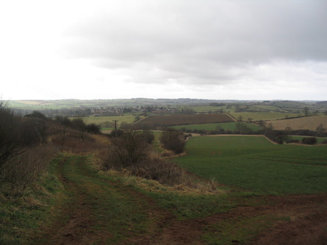
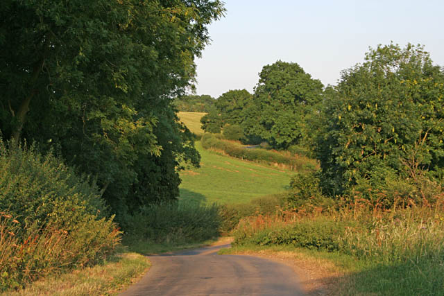
Belton-in-Rutland is a small village located in the county of Rutland, in the East Midlands region of England. Situated about 3 miles southeast of the town of Uppingham, Belton-in-Rutland is surrounded by picturesque countryside and offers a tranquil and idyllic setting.

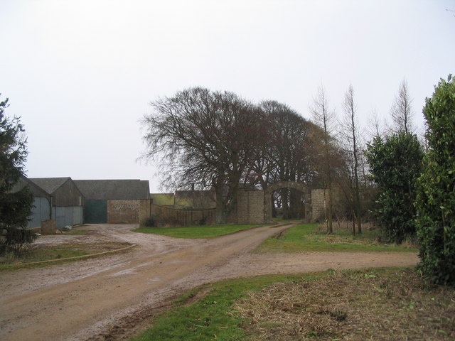
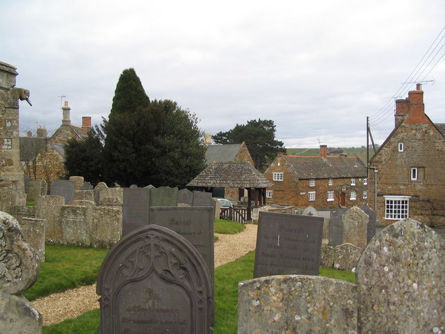
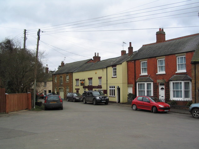
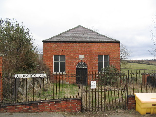
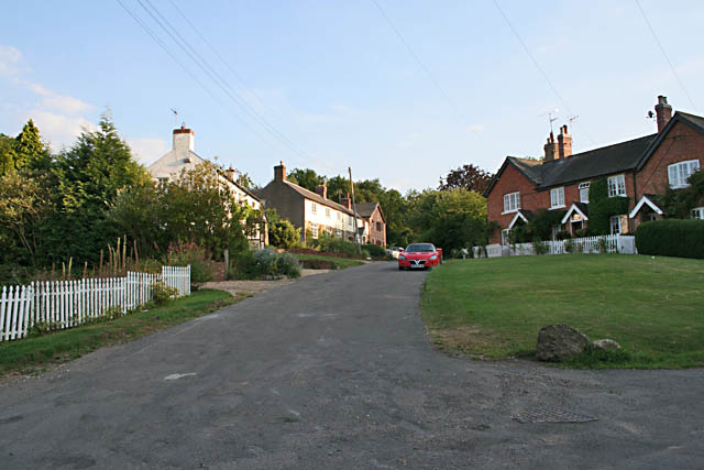
The village is known for its charming and well-preserved traditional stone cottages that line its narrow streets. The architecture reflects the village's rich history, with some buildings dating back to the 17th century. The local church, St. Peter's, is a prominent feature in the village, boasting a striking tower and beautiful stained glass windows.

Despite its small size, Belton-in-Rutland has a strong sense of community. The villagers take pride in their surroundings and often come together for various events and activities. The village hall serves as a hub for social gatherings, hosting everything from art exhibitions to community meetings.

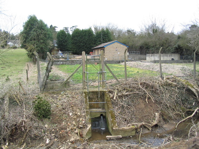
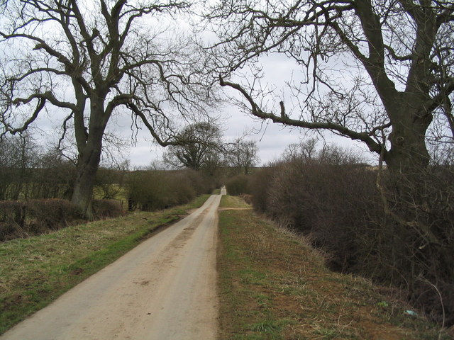
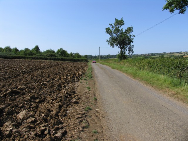
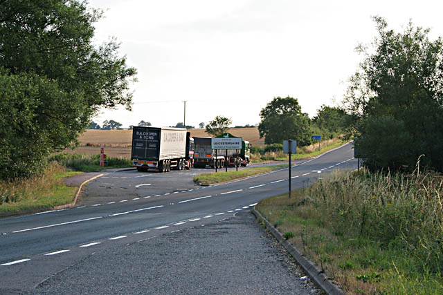
Surrounded by rolling hills and meandering streams, Belton-in-Rutland offers plenty of opportunities for outdoor activities. The village is a popular destination for walkers and cyclists, with numerous footpaths and trails to explore. The nearby Eyebrook Reservoir provides a haven for birdwatchers and anglers alike.

While Belton-in-Rutland may be a quiet and peaceful village, it benefits from its proximity to larger towns such as Uppingham and Oakham, which offer a wider range of amenities including shops, schools, and healthcare facilities.

In summary, Belton-in-Rutland is a charming village in Rutland, known for its picturesque scenery, historic buildings, and strong community spirit. It is a place where residents and visitors can escape the hustle and bustle of modern life and enjoy the beauty of the English countryside.

If you have any feedback on the listing, please let us know in the comments section below.

Belton-in-Rutland Images

Images are sourced within 2km of 52.60254/-0.796707 or Grid Reference SK8101. Thanks to Geograph Open Source API. All images are credited.

Footpath toward Belton, Rutland More of Rutland's gently rolling countryside.
Footpath toward Belton, Rutland
More of Rutland's gently rolling countryside.
Entrance to Park Farm, Ridlington
Churchyard, St Peter's, Belton-in-Rutland Now quite crowded, there's a new graveyard a little way to the north of the village
Churchyard, St Peter's, Belton-in-Rutland
Now quite crowded, there's a new graveyard a little way to the north of the village
The Sun, Belton-in-Rutland Very proud of being in England's smallest county, the village of Belton was officially renamed Belton-in-Rutland in 1982.
The Sun, Belton-in-Rutland
Very proud of being in England's smallest county, the village of Belton was officially renamed Belton-in-Rutland in 1982.
Belton Sewage Treatment Works Even a most attractive village must have one
Belton Sewage Treatment Works
Even a most attractive village must have one
Baptist Chapel, Belton-in-Rutland Erected in 1842 and, unlike the many older buildings in this village, in a rather poor state.
Baptist Chapel, Belton-in-Rutland
Erected in 1842 and, unlike the many older buildings in this village, in a rather poor state.
Lane to College Farm The route of the "Leicestershire Round" north from Belton-in-Rutland. The footpath was presumably designated when Rutland was originally forced to be part of the larger county.
Lane to College Farm
The route of the "Leicestershire Round" north from Belton-in-Rutland. The footpath was presumably designated when Rutland was originally forced to be part of the larger county.
View south to Belton-in-Rutland The ridge running west from Preston on the A6003 towards Launde Abbey offers some of Rutland's finest views. Eyebrook Reservoir in the far distance.
View south to Belton-in-Rutland
The ridge running west from Preston on the A6003 towards Launde Abbey offers some of Rutland's finest views. Eyebrook Reservoir in the far distance.
Entrance to College Farm The farm being tucked into a fold out of view
Entrance to College Farm
The farm being tucked into a fold out of view
Ridge track to Ridlington Does this ridge between the valley of the River Chater and the Eye Brook have a name?
Ridge track to Ridlington
Does this ridge between the valley of the River Chater and the Eye Brook have a name?
Farm buildings at Macmillan Way crossing The Macmillan way crosses over the ridge north of Belton-in-Rutland
Farm buildings at Macmillan Way crossing
The Macmillan way crosses over the ridge north of Belton-in-Rutland
Ridge track East to Ridlington Macmillan Way crosses to the left toward Oakham
Ridge track East to Ridlington
Macmillan Way crosses to the left toward Oakham
Stockerston Road The farmer is already ploughing his fields in early July
Stockerston Road
The farmer is already ploughing his fields in early July
Layby on the A47 Near East Norton
Layby on the A47
Near East Norton
Allexton, Leicestershire This village is just over the boundary from Rutland.
Allexton, Leicestershire
This village is just over the boundary from Rutland.
Loddington Lane, near Belton in Rutland
Phacelia with bee The field was full of bees attracted to this blue flowered plant. See <a href="https://www.geograph.org.uk/photo/208354">SK7901 : Mystery crop in the Leicestershire countryside</a>
Phacelia with bee
The field was full of bees attracted to this blue flowered plant. See SK7901 : Mystery crop in the Leicestershire countryside
Mystery crop: detail Phacelia is being championed as set aside planting which can either be ploughed in as green manure before flowering,  used as game cover or as an environment to encourage beneficial insects. It is recommended as a "wild" margin plant for large fields as it attracts bees and, in particular, hoverflies. It looks good as well!
Mystery crop: detail
Phacelia is being championed as set aside planting which can either be ploughed in as green manure before flowering, used as game cover or as an environment to encourage beneficial insects. It is recommended as a "wild" margin plant for large fields as it attracts bees and, in particular, hoverflies. It looks good as well!
Show me another place!

Belton-in-Rutland is located at Grid Ref: SK8101 (Lat: 52.60254, Lng: -0.796707)

Unitary Authority: Rutland

Police Authority: Leicestershire

What 3 Words

///however.butchers.rooks. Near Ridlington, Rutland

Related Wikis

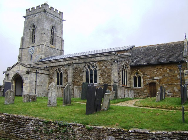
St Peter's Church, Belton-in-Rutland

St Peter's Church is a Church of England parish church in Belton-in-Rutland, Rutland. It is a Grade II* listed building. == History == The south arcade...

Belton-in-Rutland

Belton-in-Rutland is a village and civil parish in the county of Rutland in the East Midlands of England. The population at the 2001 census was 345 increasing...

St Peter's Church, Allexton

St Peter's Church is a historic Anglican church in the village of Allexton, Leicestershire, England. It is recorded in the National Heritage List for...

Allexton

Allexton is a village and civil parish in the Harborough district of Leicestershire, England. According to the 2001 census, the parish had a population...

St Botolph's Church, Wardley

St Botolph's Church, Wardley is a redundant Anglican church in the small village of Wardley, Rutland, England. It is recorded in the National Heritage...

Wardley, Rutland

Wardley is a village and civil parish in the county of Rutland in the East Midlands of England. The population at the 2001 census was 32. At the 2011 census...

Allexton Wood

Allexton Wood is a 25.9-hectare (64-acre) biological Site of Special Scientific Interest north-east of Hallaton in Leicestershire.This coppice semi-natural...

Leighfield

Leighfield is a civil parish in the county of Rutland in the East Midlands of England. There is no settlement centre in the parish, only a few isolated...

Nearby Amenities

Located within 500m of 52.60254,-0.796707
FIXME: Approximate location
Addr City: Belton-in-Rutland
Addr Country: GB
Addr Housename: Godfrey's House
Addr Housenumber: 23
Addr Postcode: LE15 9JU
Addr Street: Church Street
Building: house
Source Addr:
Wikidata: Q26576724
Lat/Long: 52.6027221/-0.7968883
Belton-in-Rutland
Is In County: Rutland
Place: village
Lat/Long: 52.6031205/-0.7956845
Historic: monument
Lat/Long: 52.6039332/-0.795404
Pub
Sun Inn
Addr City: Oakham
Addr Country: GB
Addr Housenumber: 24
Addr Postcode: LE15 9LB
Addr Street: Main Street
Addr Village: Belton In Rutland
Fhrs Authority: Rutland
Fhrs Id: 1153481
Fhrs Local Authority Id: 100043
Lat/Long: 52.6024113/-0.796441
Social Facility
Belton House Retirement Home
Addr City: Oakham
Addr Country: GB
Addr Housename: Belton House
Addr Postcode: LE15 9JZ
Addr Street: Littleworth Lane
Addr Village: Belton In Rutland
Fhrs Authority: Rutland
Fhrs Id: 1153766
Fhrs Local Authority Id: 102864
Social Facility: assisted_living
Social Facility For: senior
Lat/Long: 52.6019561/-0.7938641
Generator Method: photovoltaic
Generator Output Electricity: yes
Generator Source: solar
Generator Type: solar_photovoltaic_panel
Location: roof
Power: generator
Lat/Long: 52.6008916/-0.7955383
Generator Method: photovoltaic
Generator Output Electricity: yes
Generator Source: solar
Generator Type: solar_photovoltaic_panel
Location: roof
Power: generator
Lat/Long: 52.6008834/-0.7961995
Generator Method: photovoltaic
Generator Output Electricity: yes
Generator Source: solar
Generator Type: solar_photovoltaic_panel
Location: roof
Power: generator
Lat/Long: 52.6009005/-0.7963014
The data included in this document is from www.openstreetmap.org. The data is made available under ODbL.

Have you been to Belton-in-Rutland?

Leave your review of Belton-in-Rutland below (or comments, questions and feedback).