Mortonhall

Settlement in Midlothian

Scotland

Mortonhall

Multiple Mobile Masts And other electrical support structures - at least 5 pylons are visible, as well as poles carrying lower tension cables. Looking towards the Lothianburn junction of the A720 [Edinburgh City Bypass] and A702 [Biggar Road] at Fairmilehead.
Multiple Mobile Masts Credit: M J Richardson

Mortonhall is a suburban area located in the Midlothian region of Scotland, approximately 4 miles south of Edinburgh city center. It is primarily known for its historic cemetery, which spans over 100 acres and dates back to the late 19th century. The cemetery is a final resting place for thousands of individuals, including notable figures from Scottish history.

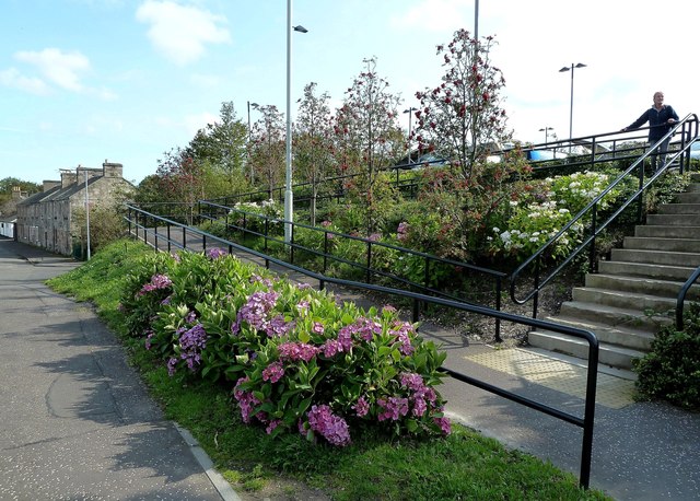
Mortonhall Cemetery is renowned for its picturesque landscape and tranquil atmosphere, attracting visitors from all over the world. Its sprawling grounds are adorned with various types of trees and flowers, providing a serene environment for reflection and remembrance. The cemetery also features several impressive monuments and memorials, showcasing the artistic and architectural styles of different eras.

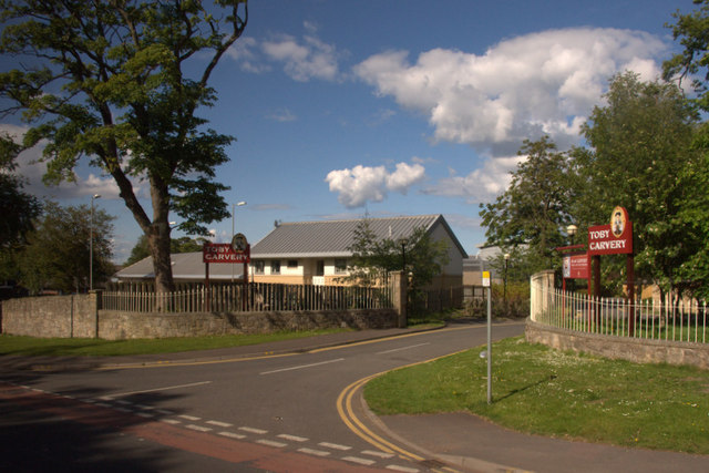
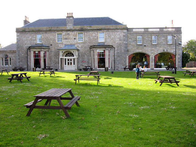
In addition to its cemetery, Mortonhall is a residential area with a mix of housing options, including detached houses, semi-detached houses, and apartments. The community is well-served by various amenities, including schools, shops, and recreational facilities. It offers a peaceful and family-friendly environment, making it an attractive place to live for those seeking a suburban lifestyle while still being close to the amenities and employment opportunities of Edinburgh.

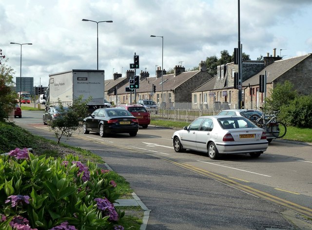
Mortonhall is easily accessible by public transportation, with regular bus services connecting it to Edinburgh and other neighboring areas. The nearby Edinburgh City Bypass also provides convenient access to the wider region and beyond. Overall, Mortonhall is a charming and historically significant area that offers a blend of natural beauty, cultural heritage, and modern living.

If you have any feedback on the listing, please let us know in the comments section below.

Mortonhall Images

Images are sourced within 2km of 55.899783/-3.175837 or Grid Reference NT2668. Thanks to Geograph Open Source API. All images are credited.

Multiple Mobile Masts And other electrical support structures - at least 5 pylons are visible, as well as poles carrying lower tension cables. Looking towards the Lothianburn junction of the A720 [Edinburgh City Bypass] and A702 [Biggar Road] at Fairmilehead.
Multiple Mobile Masts
And other electrical support structures - at least 5 pylons are visible, as well as poles carrying lower tension cables. Looking towards the Lothianburn junction of the A720 [Edinburgh City Bypass] and A702 [Biggar Road] at Fairmilehead.
Lothianburn Golf Club house Looking east from the path from Swanston to Goldburn near Hillend.
Lothianburn Golf Club house
Looking east from the path from Swanston to Goldburn near Hillend.
Petrol Station Lothianburn
Gracemount building site Work on the redevelopment of the site of the multi-storey flats to provide 215 homes (mainly high-density low-rise flats removing the open space and play areas that existed around the tower blocks). Crudens is acting as the developer for Edinburgh City Council and Hart are doing the construction work. We are promised a mix of social rent, mid market rent, shared equity and private homes.
This view looks towards the Northfield hotel and the Carnbee housing estate.  Liberton Hospital is to the left and Gracemount Mews to the right.

An image of the new housing from the same vantage point can be seen here: <a title="https://www.geograph.org.uk/photo/3958302" href="https://www.geograph.org.uk/photo/3958302">Link</a>
Gracemount building site
Work on the redevelopment of the site of the multi-storey flats to provide 215 homes (mainly high-density low-rise flats removing the open space and play areas that existed around the tower blocks). Crudens is acting as the developer for Edinburgh City Council and Hart are doing the construction work. We are promised a mix of social rent, mid market rent, shared equity and private homes. This view looks towards the Northfield hotel and the Carnbee housing estate. Liberton Hospital is to the left and Gracemount Mews to the right. An image of the new housing from the same vantage point can be seen here: Link
Gracemount: New flats go up Building work on the redevelopment of the site of the multi-storey flats to provide 215 homes (mainly high-density low-rise flats removing the open space and play areas that existed around the tower blocks). Crudens is acting as the developer for Edinburgh City Council and Hart are doing the construction work. We are promised a mix of social rent, mid market rent, shared equity and private homes.
This view looks towards the Mansion (left) and existing housing on Gracemount Drive (right).
Gracemount: New flats go up
Building work on the redevelopment of the site of the multi-storey flats to provide 215 homes (mainly high-density low-rise flats removing the open space and play areas that existed around the tower blocks). Crudens is acting as the developer for Edinburgh City Council and Hart are doing the construction work. We are promised a mix of social rent, mid market rent, shared equity and private homes. This view looks towards the Mansion (left) and existing housing on Gracemount Drive (right).
Gracemount new flats under construction Building work continues on the old site of the multi-storey flats to provide 215 homes (mainly high-density low-rise flats removing the open space that existed around the tower blocks). Crudens is acting as the developer for Edinburgh City Council and Hart are doing the construction work. We are promised a mix of social rent, mid market rent, shared equity and private homes.
Gracemount new flats under construction
Building work continues on the old site of the multi-storey flats to provide 215 homes (mainly high-density low-rise flats removing the open space that existed around the tower blocks). Crudens is acting as the developer for Edinburgh City Council and Hart are doing the construction work. We are promised a mix of social rent, mid market rent, shared equity and private homes.
House near Burdiehouse Mains
Burdiehouse Road, Edinburgh
Balmwell Terrace, Edinburgh From Howden Hall Road.
Balmwell Terrace, Edinburgh
From Howden Hall Road.
Entrance to the Toby Carvery, Liberton, Edinburgh Formerly known as the Balmwell Country Carvery, but acquired by the Toby Carvery chain in 2011.  The carvery is in a large house originally built in 1806 for a Mr John Simpson. Since being a private home it has been used as a children’s home, a care home and a hotel. The eponymous Balmwell is in the grounds.
Entrance to the Toby Carvery, Liberton, Edinburgh
Formerly known as the Balmwell Country Carvery, but acquired by the Toby Carvery chain in 2011. The carvery is in a large house originally built in 1806 for a Mr John Simpson. Since being a private home it has been used as a children’s home, a care home and a hotel. The eponymous Balmwell is in the grounds.
Arthur's Seat from Liberton Cemetery, Edinburgh
Row of shops, Liberton, Edinburgh
Balmwell House, Liberton, Edinburgh A large house that was built in 1806 for a Mr John Simpson, currently a Toby Carvery.
Balmwell House, Liberton, Edinburgh
A large house that was built in 1806 for a Mr John Simpson, currently a Toby Carvery.
St Catherine's Well, Liberton, Edinburgh Also known as the Oily Well or the Balm Well, the lintel above the well has the date 1536, but the stonework is obviously newer and the antiquity of the well is unknown. The well was associated with St Catherine, and a chapel dedicated to her was previously on the site. The well is in the grounds of Balmwell House, built in 1806, and currently a Toby Carvery.
St Catherine's Well, Liberton, Edinburgh
Also known as the Oily Well or the Balm Well, the lintel above the well has the date 1536, but the stonework is obviously newer and the antiquity of the well is unknown. The well was associated with St Catherine, and a chapel dedicated to her was previously on the site. The well is in the grounds of Balmwell House, built in 1806, and currently a Toby Carvery.
Straiton Retail Park Although the map and some signs name this facility as the Peel Pentland Centre, it's popularly known as the Straiton Retail Park, confirmed in this photo.
Straiton Retail Park
Although the map and some signs name this facility as the Peel Pentland Centre, it's popularly known as the Straiton Retail Park, confirmed in this photo.
The A701 at Straiton Viewed from the pedestrian access to the new retail park, with the original roadside buildings in the background.
The A701 at Straiton
Viewed from the pedestrian access to the new retail park, with the original roadside buildings in the background.
Pedestrian Access to Straiton Retail Park Although these out-of-town shopping centres are heavily focused on private car access, they also cater for pedestrians arriving by bus.
Pedestrian Access to Straiton Retail Park
Although these out-of-town shopping centres are heavily focused on private car access, they also cater for pedestrians arriving by bus.
Elf Loch A small loch viewed from a small hill on Mortonhall Golf Course.
Elf Loch
A small loch viewed from a small hill on Mortonhall Golf Course.
Show me another place!

Mortonhall is located at Grid Ref: NT2668 (Lat: 55.899783, Lng: -3.175837)

Unitary Authority: City of Edinburgh

Police Authority: Edinburgh

What 3 Words

///desk.luxury.trick. Near Loanhead, Midlothian

Nearby Locations

Kaimes Mortonhall

Related Wikis

Mortonhall Crematorium

The Mortonhall Crematorium is a multi-denominational crematorium in Edinburgh, Scotland. It is an example of Basil Spence's post-war expressionist style...

Mortonhall

Mortonhall is an area of Edinburgh, Scotland, on the south edge of the city. The area is along the western end of the Frogston Road between Fairmilehead...

Kaimes

Kaimes is a suburb of Edinburgh, the capital of Scotland. It is south of Alnwickhill. == Sources == (Google Maps)

Alnwickhill

Alnwickhill ( AN-ik-hill) is a suburb of Edinburgh, the capital of Scotland. It is on the southern edge of the city, approximately 4 miles (6.4 km) from...

Burdiehouse

Burdiehouse is an area in the south east of Edinburgh, Scotland, near Gilmerton and Southhouse. The name may be a corruption of the name Bordeaux, from...

Morton, Edinburgh

Morton is a locality and former barony, in Edinburgh, Scotland. King Robert I of Scotland rewarded Henry St Clair for his bravery with the gift of Pentland...

Princess Margaret Rose Orthopaedic Hospital

The Princess Margaret Rose Orthopaedic Hospital was a hospital in Fairmilehead, Edinburgh, opened in 1932 and closed in 2000. After closure, with services...

Gracemount High School

Gracemount High School (GHS) is a non-denominational six-year comprehensive secondary school serving south-east Edinburgh, Scotland. It has a current roll...

Nearby Amenities

Located within 500m of 55.899783,-3.175837
Mortonhall
Is In: Edinburgh, Scotland, UK
Place: suburb
Lat/Long: 55.9005219/-3.1691486
Check Date: 2021-06-22
Traffic Calming: hump
Lat/Long: 55.9037874/-3.174123
Check Date: 2022-08-17
Traffic Calming: bump
Lat/Long: 55.9011557/-3.177012
Traffic Calming: bump
Lat/Long: 55.9020775/-3.1785104
Check Date: 2022-07-25
Traffic Calming: bump
Lat/Long: 55.9012085/-3.1703104
Check Date: 2022-07-25
Traffic Calming: bump
Lat/Long: 55.8999263/-3.1716158
Kerb: raised
Lat/Long: 55.9001268/-3.1696718
Check Date: 2022-07-25
Traffic Calming: bump
Lat/Long: 55.9012192/-3.1688093
PENTLANDG1
Disused Man Made: petroleum_well
Ref GB Decc: LH/05-6
Source: DECC
Lat/Long: 55.9006111/-3.1684167
Power: tower
Lat/Long: 55.89763/-3.172928
Power: tower
Lat/Long: 55.9000384/-3.1754323
Power: tower
Source: Bing
Lat/Long: 55.902997/-3.1784807
Kerb: raised
Lat/Long: 55.9007234/-3.1726622
Crossing
Crossing: unmarked
Crossing Island: no
Crossing Markings: no
Kerb: lowered
Tactile Paving: no
Lat/Long: 55.9007476/-3.1696105
Kerb: raised
Lat/Long: 55.8999232/-3.1713498
Kerb: raised
Lat/Long: 55.9008494/-3.1695751
Bus Stop
Mortonhall Gate
Bench: yes
Naptan AtcoCode: 6200205475
Naptan Bearing: E
Naptan CommonName: Mortonhall Gate
Naptan Indicator: Garden Centre
Naptan Landmark: Mortonhall Gate
Naptan NaptanCode: 36235423
Naptan PlusbusZoneRef: EDINBUR
Naptan Street: Frogston Road East
Naptan Verified: no
Note: position updated
Public Transport: platform
Shelter: yes
Source: naptan_import
Tactile Paving: no
Lat/Long: 55.8998125/-3.1756126
Bus Stop
Mortonhall Park Avenue
Bench: yes
Bin: yes
Lit: yes
Naptan AtcoCode: 6200205480
Naptan Bearing: E
Naptan CommonName: Mortonhall Park Avenue
Naptan Indicator: adj
Naptan Landmark: Mortonhall Park Avenue
Naptan NaptanCode: 36235424
Naptan PlusbusZoneRef: EDINBUR
Naptan Street: Frogston Road East
Naptan Verified: no
Public Transport: platform
Shelter: yes
Source: naptan_import
Tactile Paving: no
Lat/Long: 55.8997328/-3.1720575
Bus Stop
Mortonhall Park Gardens
Bench: yes
Naptan AtcoCode: 6200205490
Naptan Bearing: E
Naptan CommonName: Mortonhall Park Gardens
Naptan Indicator: Mortonhall Park Gardens
Naptan Landmark: Mortonhall Park Avenue
Naptan NaptanCode: 36235425
Naptan PlusbusZoneRef: EDINBUR
Naptan Street: Frogston Road East
Naptan Verified: no
Public Transport: platform
Shelter: yes
Source: naptan_import
Tactile Paving: no
Lat/Long: 55.899675/-3.1705683
Bus Stop
Mortonhall Park Gardens
Bench: yes
Naptan AtcoCode: 6200244370
Naptan Bearing: W
Naptan CommonName: Mortonhall Park Gardens
Naptan Indicator: opp
Naptan Landmark: Broomhills Road
Naptan NaptanCode: 36235283
Naptan PlusbusZoneRef: EDINBUR
Naptan Street: Frogston Road East
Naptan Verified: no
Public Transport: platform
Shelter: yes
Source: naptan_import
Tactile Paving: no
Lat/Long: 55.899534/-3.1702762
Bus Stop
Mortonhall Park Avenue
Bench: yes
Bin: no
Lit: yes
Naptan AtcoCode: 6200244380
Naptan Bearing: W
Naptan CommonName: Mortonhall Park Avenue
Naptan Indicator: opp
Naptan Landmark: Mortonhall Park Avenue
Naptan NaptanCode: 36235284
Naptan PlusbusZoneRef: EDINBUR
Naptan Street: Frogston Road East
Naptan Verified: no
Public Transport: platform
Shelter: yes
Source: naptan_import
Tactile Paving: no
Lat/Long: 55.8996425/-3.1730463
Cross
Source: Bing;survey
Tourism: attraction
Lat/Long: 55.9028368/-3.1732556
Toilets
Lat/Long: 55.9018816/-3.1705965
Toilets
Lat/Long: 55.9017885/-3.1717217
Post Box
Collection Times: Mo-Fr 09:00, Sa 07:00
Ref: EH17 220
Royal Cypher: scottish_crown
Lat/Long: 55.8997878/-3.1726886
Check Date: 2021-06-22
Traffic Calming: hump
Lat/Long: 55.9034552/-3.1719957
Traffic Calming: hump
Lat/Long: 55.9035977/-3.1730484
Kerb: raised
Lat/Long: 55.9006781/-3.1726355
Check Date: 2022-07-25
Traffic Calming: bump
Lat/Long: 55.8998158/-3.169199
Check Date: 2022-07-25
Traffic Calming: bump
Lat/Long: 55.90042/-3.1692087
Check Date: 2022-07-25
Traffic Calming: bump
Lat/Long: 55.9002419/-3.1696866
Check Date: 2022-07-25
Traffic Calming: bump
Lat/Long: 55.8998364/-3.1725364
Check Date: 2022-07-25
Traffic Calming: bump
Lat/Long: 55.8998859/-3.1704708
Traffic Calming: bump
Lat/Long: 55.9015569/-3.1775528
Traffic Calming: bump
Lat/Long: 55.9026219/-3.1793791
Traffic Calming: bump
Lat/Long: 55.9030087/-3.179994
Barrier: kissing_gate
Foot: yes
Lat/Long: 55.9012941/-3.1751693
Barrier: bump_gate
Bicycle: no
Foot: yes
Lat/Long: 55.8986517/-3.1809848
Give Way
Source: Bing
Lat/Long: 55.9003043/-3.1724759
Give Way
Source: Bing
Lat/Long: 55.9003038/-3.1725745
Addr City: Edinburgh
Addr Country: GB
Addr Housenumber: 8
Addr Postcode: EH17 8BW
Addr Street: Mortonhall Park Way
Note: accuracy to improve
Lat/Long: 55.9003515/-3.17321
Addr City: Edinburgh
Addr Country: GB
Addr Housenumber: 6
Addr Postcode: EH17 8BW
Addr Street: Mortonhall Park Way
Note: accuracy to improve
Lat/Long: 55.9003737/-3.1730556
Addr City: Edinburgh
Addr Country: GB
Addr Housenumber: 4
Addr Postcode: EH17 8BW
Addr Street: Mortonhall Park Way
Note: accuracy to improve
Lat/Long: 55.9003958/-3.1728916
Addr City: Edinburgh
Addr Country: GB
Addr Housenumber: 2
Addr Postcode: EH17 8BW
Addr Street: Mortonhall Park Way
Note: accuracy to improve
Lat/Long: 55.9004468/-3.1727066
Addr City: Edinburgh
Addr Country: GB
Addr Housenumber: 10
Addr Postcode: EH17 8BW
Addr Street: Mortonhall Park Way
Note: accuracy to improve
Lat/Long: 55.9004316/-3.1733593
Addr City: Edinburgh
Addr Country: GB
Addr Housenumber: 12
Addr Postcode: EH17 8BW
Addr Street: Mortonhall Park Way
Note: accuracy to improve
Lat/Long: 55.9004284/-3.1735066
Addr City: Edinburgh
Addr Country: GB
Addr Housenumber: 14
Addr Postcode: EH17 8BW
Addr Street: Mortonhall Park Way
Note: accuracy to improve
Lat/Long: 55.9004168/-3.1736628
Cafe
The Topiary Restaurant
Lat/Long: 55.9002573/-3.1773362
Waste Basket
Lat/Long: 55.8996703/-3.1704724
Waste Basket
Lat/Long: 55.8995321/-3.1703432
Waste Basket
Lat/Long: 55.8997312/-3.1721076
Waste Basket
Lat/Long: 55.8996423/-3.1729972
Waste Basket
Lat/Long: 55.8998152/-3.1756513
Gracemount Bodybuilding Gym
Leisure: fitness_centre
Lat/Long: 55.8984291/-3.1798468
Charging Station
Capacity: 2
Lat/Long: 55.9005667/-3.1769478
The Farm Shop Edinburgh
Addr City: Edinburgh
Addr Postcode: EH16 6TJ
Addr Street: Frogston Road East
Alt Name: Farm Shop
Opening Hours: Mo-Su 09:00-18:00
Shop: deli
Website: https://farmshopedinburgh.business.site/
Lat/Long: 55.9004644/-3.1770176
Addr City: Edinburgh
Addr Housenumber: 19
Addr Street: Printonan Crescent
Lat/Long: 55.8982031/-3.1683619
Bicycle Parking
Access: yes
Bicycle Parking: stands
Capacity: 14
Covered: yes
Fee: no
Lat/Long: 55.9000178/-3.1765572
Telephone
Booth: K6
Covered: booth
Man Made: telephone_box
Lat/Long: 55.9033354/-3.1801098
The data included in this document is from www.openstreetmap.org. The data is made available under ODbL.

Have you been to Mortonhall?

Leave your review of Mortonhall below (or comments, questions and feedback).