Morton

Settlement in Lincolnshire South Kesteven

England

Morton

St.John the Baptist's church, Morton, Lincs. A grand cruciform church looking down on the village of Morton. Perpendicular tower, decorated chancel and south arcade, but the 4 bay north arcade is late 13th century Early English and has particularly good capitals.
St.John the Baptist's church, Morton, Lincs. Credit: Richard Croft

Morton is a small village located in the county of Lincolnshire, England. Situated approximately 5 miles northwest of the town of Gainsborough, Morton is nestled amidst the beautiful countryside and offers a tranquil and picturesque setting for its residents and visitors alike.

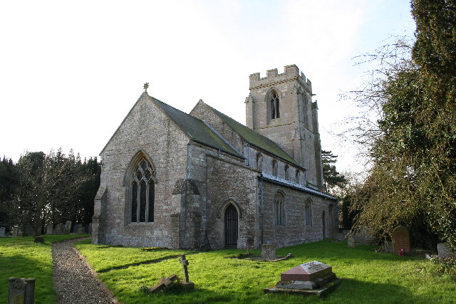
The village is home to a population of around 1,000 people, which gives it a close-knit community feel. The architecture in Morton is predominantly traditional, with charming cottages and well-maintained gardens lining the streets. The village also boasts a historic church, St. Paul's, dating back to the 12th century, which adds to its character and heritage.

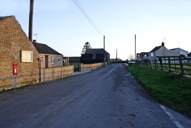
Despite its small size, Morton offers a range of amenities to cater to the needs of its residents. These include a primary school, a village hall, a local pub, and a convenience store. The village is well-connected to nearby towns and cities, with regular bus services running through the area.

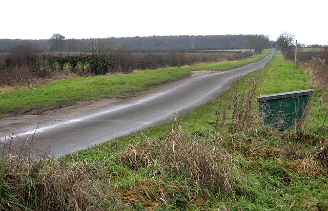
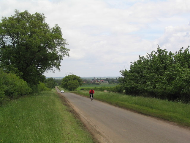
The surrounding countryside provides ample opportunities for outdoor activities, such as walking, cycling, and horse riding. The nearby River Trent is a popular spot for fishing enthusiasts, attracting anglers from far and wide.

Morton is also within easy reach of several notable attractions. The historic town of Gainsborough is just a short drive away, offering a wider range of shops, restaurants, and leisure facilities. Additionally, the bustling city of Lincoln is approximately 20 miles to the south, renowned for its stunning cathedral and medieval castle.

Overall, Morton offers a peaceful retreat in the heart of Lincolnshire, with its idyllic setting, friendly community, and convenient location making it an attractive place to live or visit.

If you have any feedback on the listing, please let us know in the comments section below.

Morton Images

Images are sourced within 2km of 52.802502/-0.37366178 or Grid Reference TF0924. Thanks to Geograph Open Source API. All images are credited.

St.John the Baptist's church, Morton, Lincs. A grand cruciform church looking down on the village of Morton. Perpendicular tower, decorated chancel and south arcade, but the 4 bay north arcade is late 13th century Early English and has particularly good capitals.
St.John the Baptist's church, Morton, Lincs.
A grand cruciform church looking down on the village of Morton. Perpendicular tower, decorated chancel and south arcade, but the 4 bay north arcade is late 13th century Early English and has particularly good capitals.
Footpaths Everywhere Taken at a junction of footpaths between Fox Wood and Hanthorpe looking east over the grid square.
Footpaths Everywhere
Taken at a junction of footpaths between Fox Wood and Hanthorpe looking east over the grid square.
The Road West A minor road near Hanthorpe.
The Road West
A minor road near Hanthorpe.
Hanthorpe The farm building in the foreground is built of the local Jurassic limestone.
Hanthorpe
The farm building in the foreground is built of the local Jurassic limestone.
Morton Village On the junction with the A15 trunk road.
Morton Village
On the junction with the A15 trunk road.
An Overgrown Bus Shelter On the A15 road at the junction with the road to the village of Dyke.
An Overgrown Bus Shelter
On the A15 road at the junction with the road to the village of Dyke.
Quarry debitage in a field near Dyke
Footpath to Stainfield This footpath leads from the A15 to Stainfield.
Footpath to Stainfield
This footpath leads from the A15 to Stainfield.
The road to Hanthorpe A ridge of high ground (for Lincolnshire) between the valley of the East Glen river and the Fens affords good views and generally quiet cycling roads
The road to Hanthorpe
A ridge of high ground (for Lincolnshire) between the valley of the East Glen river and the Fens affords good views and generally quiet cycling roads
Morton church Morton church on a sunny November afternoon
Morton church
Morton church on a sunny November afternoon
Farmland at Hanthorpe The houses in the distance are on Stanfield Road in <a href="https://www.geograph.org.uk/gridref/TF0824">TF0824</a>.
Farmland at Hanthorpe
The houses in the distance are on Stanfield Road in TF0824.
The Grove, Hanthorpe The road junction straight ahead is on the square boundary. The cottage in the centre is just in <a href="https://www.geograph.org.uk/gridref/TF0824">TF0824</a>.
The Grove, Hanthorpe
The road junction straight ahead is on the square boundary. The cottage in the centre is just in TF0824.
Hanthorpe Road, Stainfield Stainfield is a small village without a pub or a church. Its one claim to fame is the 18th century spa, see
<a href="https://www.geograph.org.uk/photo/299158">TF0825 : Stainfield Spa</a> and <a href="https://www.geograph.org.uk/photo/312144">TF0825 : Stainfield Spa from the footpath access</a>.
Hanthorpe Road, Stainfield
Stainfield is a small village without a pub or a church. Its one claim to fame is the 18th century spa, see TF0825 : Stainfield Spa and TF0825 : Stainfield Spa from the footpath access.
Roadside Verge This wide roadside verge is managed by Lincolnshire County Council so that flora and fauna are given better conditions to prosper: grass-cutting is done when spring flower seed has been set, etc.
Roadside Verge
This wide roadside verge is managed by Lincolnshire County Council so that flora and fauna are given better conditions to prosper: grass-cutting is done when spring flower seed has been set, etc.
Course of Roman Road, Hanthorpe Nothing to see of it now, but this track is on the course of the Roman road that stretched from south of Bourne (King Street) northwestwards to Ancaster.
Course of Roman Road, Hanthorpe
Nothing to see of it now, but this track is on the course of the Roman road that stretched from south of Bourne (King Street) northwestwards to Ancaster.
Junction of four footpaths All four footpaths have a finger pointing in the general direction of venture on this signpost.
Junction of four footpaths
All four footpaths have a finger pointing in the general direction of venture on this signpost.
Quizzical Sheep Sheep all turned to stare as we entered 'their' field.
Quizzical Sheep
Sheep all turned to stare as we entered 'their' field.
Milestone, near Morton This ancient stone milestone, still intact - on the east side of the A15 -  states "London 99  Bourn 2  Morton".  On the north face of the pillar, difficult to see as it is in shadow, is a benchmark.  A short distance to the south is a roadside traffic monitoring station, which belongs to Lincolnshire County Council.
Milestone, near Morton
This ancient stone milestone, still intact - on the east side of the A15 - states "London 99 Bourn 2 Morton". On the north face of the pillar, difficult to see as it is in shadow, is a benchmark. A short distance to the south is a roadside traffic monitoring station, which belongs to Lincolnshire County Council.
Show me another place!

Morton is located at Grid Ref: TF0924 (Lat: 52.802502, Lng: -0.37366178)

Division: Parts of Kesteven

Administrative County: Lincolnshire

District: South Kesteven

Police Authority: Lincolnshire

What 3 Words

///snail.refusals.speared. Near Bourne, Lincolnshire

Nearby Locations

Morton

Related Wikis

Morton and Hanthorpe

Morton and Hanthorpe is a civil parish, formerly known as Morton by Bourne in the South Kesteven district of Lincolnshire, England. It is situated 2 miles...

Morton Road railway station

Morton Road railway station was a station serving the village of Morton, Lincolnshire on the Great Northern Railway Bourne and Sleaford railway. It opened...

Haconby

Haconby is a village and civil parish in the South Kesteven district of Lincolnshire, England. The population of the civil parish at the 2001 census was...

Dyke, Lincolnshire

Dyke is a village in the South Kesteven district of Lincolnshire, England. It is situated less than 1 mile (1.6 km) east from the A15 road, and approximately...

Stainfield near Bourne

Stainfield is a hamlet in the South Kesteven district of Lincolnshire, England. It is 3 miles (5 km) north from Bourne and 1 mile (1.6 km) west from the...

Cawthorpe

Cawthorpe is a hamlet in the civil parish of Bourne , in the South Kesteven district of Lincolnshire, England. Cawthorpe holds four Grade II listed buildings...

Dunsby

Dunsby is a small village and civil parish in the South Kesteven district of in Lincolnshire, England. It is 4 miles (6.4 km) north from Bourne, just east...

Bourne Academy

Bourne Academy is an 11 to 18 mixed comprehensive school and a co-educational academy located in Bourne, Lincolnshire, England. It is one of two secondary...

Nearby Amenities

Located within 500m of 52.802502,-0.37366178
Morton
Is In: Lincolnshire, England, UK
Place: village
Lat/Long: 52.8026581/-0.3717714
Bus Stop
Village Hall
Bus: yes
Departures Board: timetable
Naptan AtcoCode: 270000008714
Naptan Bearing: W
Naptan CommonName: Village Hall
Naptan Indicator: opp
Naptan Landmark: Village Hall
Naptan NaptanCode: lingtpma
Naptan Street: High Street
Naptan Verified: no
Network: Peterborough-Bourne-Morton
Operator: The Delaine
Public Transport: platform
Shelter: yes
Source: naptan_import
Lat/Long: 52.8022698/-0.3791406
Bus Stop
Village Hall
Bus: yes
Departures Board: no
Naptan AtcoCode: 270000008715
Naptan Bearing: E
Naptan CommonName: Village Hall
Naptan Indicator: adj
Naptan Landmark: Village Hall
Naptan NaptanCode: lingtpmd
Naptan Street: High Street
Naptan Verified: no
Network: Peterborough-Bourne-Morton 101, 102
Operator: The Delaine Bus Company
Public Transport: platform
Shelter: no
Source: naptan_import
Lat/Long: 52.802378/-0.3791662
Bus Stop
John's The Baptist Church
Bus: yes
Naptan AtcoCode: 270000014571
Naptan Bearing: E
Naptan CommonName: John's The Baptist Church
Naptan Indicator: adj
Naptan Landmark: John's The Baptist Church
Naptan NaptanCode: linjpwpj
Naptan Street: High Street
Naptan Verified: no
Public Transport: platform
Source: naptan_import
Lat/Long: 52.8026487/-0.3733261
Bus Stop
John's The Baptist Church
Bus: yes
Naptan AtcoCode: 2700LMC01671
Naptan Bearing: NW
Naptan CommonName: John's The Baptist Church
Naptan Indicator: opp
Naptan Landmark: John's The Baptist Church
Naptan NaptanCode: linamgpm
Naptan Street: Station Road
Naptan Verified: no
Public Transport: platform
Source: naptan_import
Lat/Long: 52.8024353/-0.3734972
Turning Circle
Lat/Long: 52.8008572/-0.3683915
Turning Circle
Lat/Long: 52.8043722/-0.3714897
Church Farm
Place: farm
Source: Bing
Lat/Long: 52.8017101/-0.3718567
Lane Farm
Place: farm
Source: Bing
Lat/Long: 52.8048228/-0.3731529
Morton House Farm
Addr City: Bourne
Addr Country: GB
Addr Housenumber: 33
Addr Postcode: PE10 0NR
Addr Street: High Street
Addr Suburb: Morton
Fhrs Authority: South Kesteven
Fhrs Id: 1253704
Fhrs Local Authority Id: 88798
Place: farm
Source: Bing
Lat/Long: 52.8031178/-0.3755413
Crossing
Crossing: unmarked
Crossing Markings: no
Kerb: lowered
Lat/Long: 52.8022528/-0.3799565
Crossing
Bicycle: yes
Crossing: unmarked
Crossing Markings: no
Kerb: lowered
Lat/Long: 52.7999015/-0.3788225
Crossing
Bicycle: yes
Crossing: unmarked
Crossing Markings: no
Kerb: lowered
Lat/Long: 52.8002334/-0.3790104
Crossing
Bicycle: yes
Crossing: unmarked
Crossing Markings: no
Kerb: lowered
Lat/Long: 52.8015211/-0.3796691
Crossing
Bicycle: yes
Crossing: unmarked
Crossing Markings: no
Kerb: lowered
Lat/Long: 52.7999494/-0.3788479
Power: pole
Lat/Long: 52.7987223/-0.3737662
Power: pole
Lat/Long: 52.7987481/-0.3754041
Power: pole
Lat/Long: 52.7987724/-0.3769188
Power: pole
Lat/Long: 52.7995663/-0.3738603
Power: pole
Lat/Long: 52.8005309/-0.3740149
Power: pole
Lat/Long: 52.8014378/-0.3741496
Power: pole
Lat/Long: 52.804045/-0.3743489
Power: pole
Lat/Long: 52.8049024/-0.3745775
Power: pole
Lat/Long: 52.805134/-0.3744296
Power: pole
Lat/Long: 52.8057571/-0.3741024
Power: pole
Lat/Long: 52.8066945/-0.3736565
Fast Food
Morton Fish and Chips
Addr City: Bourne
Addr Country: GB
Addr Housenumber: 4a
Addr Postcode: PE10 0NS
Addr Street: Folkingham Road
Addr Suburb: Morton
Cuisine: fish_and_chips
Fhrs Authority: South Kesteven
Fhrs Id: 1095047
Fhrs Local Authority Id: 88124
Lat/Long: 52.8027679/-0.3802457
Post Box
Collection Times: Mo-Fr 09:00; Sa 07:00
Operator: Royal Mail
Post Box Type: wall
Ref: PE10 213
Royal Cypher: VR
Royal Cypher Wikidata: Q33102356
Lat/Long: 52.8023138/-0.3803689
Post Box
Brand: Royal Mail
Brand Wikidata: Q638098
Collection Times: Mo-Fr 16:45; Sa 11:45
Colour: red
Drive Through: no
Operator: Royal Mail
Operator Type: private
Operator Wikidata: Q638098
Post Box Design: type_l
Post Box Type: lamp
Ref: PE10 240
Royal Cypher: EIIR
Royal Cypher Wikidata: Q33102113
Lat/Long: 52.8025572/-0.3772527
Post Office
Morton Post Office
Addr City: Bourne
Addr Country: GB
Addr Housenumber: 25
Addr Postcode: PE10 0NR
Addr Street: High Street
Addr Suburb: Morton
Brand: Post Office
Brand Wikidata: Q1783168
Contact Website: https://www.postoffice.co.uk/branch-finder/2512300/morton
Fhrs Authority: South Kesteven
Fhrs Id: 238337
Fhrs Local Authority Id: 5535
Operator: Royal Mail
Ref Pol Id: 9886
Shop: convenience
Lat/Long: 52.8026154/-0.3772259
Halls Garage
Addr City: Bourne
Addr Country: GB
Addr Postcode: PE10 0NS
Addr Street: Folkingham Road
Addr Suburb: Morton
Brand: MG Specialists
Operator: Steve Hall
Phone: +44 1778 570286
Second Hand: yes
Service Vehicle Car Repair: yes
Service Vehicle Mg Specialists: yes
Shop: car
Website: https://www.hallsgarage.co.uk/
Lat/Long: 52.8025798/-0.3805031
Generator Method: photovoltaic
Generator Output Electricity: yes
Generator Source: solar
Generator Type: solar_photovoltaic_panel
Location: yes
Power: generator
Lat/Long: 52.801404/-0.3686125
Generator Method: photovoltaic
Generator Output Electricity: yes
Generator Source: solar
Generator Type: solar_photovoltaic_panel
Location: yes
Power: generator
Lat/Long: 52.8020688/-0.3669603
Generator Method: photovoltaic
Generator Output Electricity: yes
Generator Source: solar
Generator Type: solar_photovoltaic_panel
Location: yes
Power: generator
Lat/Long: 52.8019894/-0.3669683
Generator Method: photovoltaic
Generator Output Electricity: yes
Generator Source: solar
Generator Type: solar_photovoltaic_panel
Location: yes
Power: generator
Lat/Long: 52.801991/-0.3668852
Generator Method: photovoltaic
Generator Output Electricity: yes
Generator Source: solar
Generator Type: solar_photovoltaic_panel
Location: yes
Power: generator
Lat/Long: 52.802325/-0.3670649
Generator Method: photovoltaic
Generator Output Electricity: yes
Generator Source: solar
Generator Type: solar_photovoltaic_panel
Location: yes
Power: generator
Lat/Long: 52.8026364/-0.3666652
Generator Method: photovoltaic
Generator Output Electricity: yes
Generator Source: solar
Generator Type: solar_photovoltaic_panel
Location: yes
Power: generator
Lat/Long: 52.8026202/-0.3677033
Generator Method: photovoltaic
Generator Output Electricity: yes
Generator Source: solar
Generator Type: solar_photovoltaic_panel
Location: yes
Power: generator
Lat/Long: 52.8021533/-0.3663353
Generator Method: photovoltaic
Generator Output Electricity: yes
Generator Source: solar
Generator Type: solar_photovoltaic_panel
Location: yes
Power: generator
Lat/Long: 52.8033019/-0.3708063
Generator Method: photovoltaic
Generator Output Electricity: yes
Generator Source: solar
Generator Type: solar_photovoltaic_panel
Location: yes
Power: generator
Lat/Long: 52.8044775/-0.3703021
Generator Method: photovoltaic
Generator Output Electricity: yes
Generator Source: solar
Generator Type: solar_photovoltaic_panel
Location: yes
Power: generator
Lat/Long: 52.8044759/-0.3702323
Generator Method: photovoltaic
Generator Output Electricity: yes
Generator Source: solar
Generator Type: solar_photovoltaic_panel
Location: yes
Power: generator
Lat/Long: 52.8049412/-0.3708251
Generator Method: photovoltaic
Generator Output Electricity: yes
Generator Source: solar
Generator Type: solar_photovoltaic_panel
Location: yes
Power: generator
Lat/Long: 52.8049347/-0.3718953
Generator Method: photovoltaic
Generator Output Electricity: yes
Generator Source: solar
Generator Type: solar_photovoltaic_panel
Location: yes
Power: generator
Lat/Long: 52.8059449/-0.3721957
Generator Method: photovoltaic
Generator Output Electricity: yes
Generator Source: solar
Generator Type: solar_photovoltaic_panel
Location: yes
Power: generator
Lat/Long: 52.8057203/-0.3721099
Generator Method: photovoltaic
Generator Output Electricity: yes
Generator Source: solar
Generator Type: solar_photovoltaic_panel
Location: yes
Power: generator
Lat/Long: 52.805713/-0.3720495
Generator Method: photovoltaic
Generator Output Electricity: yes
Generator Source: solar
Generator Type: solar_photovoltaic_panel
Location: yes
Power: generator
Lat/Long: 52.8041478/-0.371847
Generator Method: photovoltaic
Generator Output Electricity: yes
Generator Source: solar
Generator Type: solar_photovoltaic_panel
Location: yes
Power: generator
Lat/Long: 52.801062/-0.3709324
Generator Method: photovoltaic
Generator Output Electricity: yes
Generator Source: solar
Generator Type: solar_photovoltaic_panel
Location: yes
Power: generator
Lat/Long: 52.8004069/-0.370176
Generator Method: photovoltaic
Generator Output Electricity: yes
Generator Source: solar
Generator Type: solar_photovoltaic_panel
Location: yes
Power: generator
Lat/Long: 52.8003339/-0.3695484
Generator Method: photovoltaic
Generator Output Electricity: yes
Generator Source: solar
Generator Type: solar_photovoltaic_panel
Location: yes
Power: generator
Lat/Long: 52.8006387/-0.3697898
Generator Method: photovoltaic
Generator Output Electricity: yes
Generator Source: solar
Generator Type: solar_photovoltaic_panel
Location: yes
Power: generator
Lat/Long: 52.8016988/-0.3777935
Generator Method: photovoltaic
Generator Output Electricity: yes
Generator Source: solar
Generator Type: solar_photovoltaic_panel
Location: yes
Power: generator
Lat/Long: 52.8029944/-0.3767743
Generator Method: photovoltaic
Generator Output Electricity: yes
Generator Source: solar
Generator Type: solar_photovoltaic_panel
Location: yes
Power: generator
Lat/Long: 52.8005304/-0.3783957
Generator Method: photovoltaic
Generator Output Electricity: yes
Generator Source: solar
Generator Type: solar_photovoltaic_panel
Location: yes
Power: generator
Lat/Long: 52.8009118/-0.3798896
Generator Method: photovoltaic
Generator Output Electricity: yes
Generator Source: solar
Generator Type: solar_photovoltaic_panel
Location: yes
Power: generator
Lat/Long: 52.8008875/-0.3800372
Generator Method: photovoltaic
Generator Output Electricity: yes
Generator Source: solar
Generator Type: solar_photovoltaic_panel
Location: yes
Power: generator
Lat/Long: 52.8010448/-0.3802598
Generator Method: photovoltaic
Generator Output Electricity: yes
Generator Source: solar
Generator Type: solar_photovoltaic_panel
Location: yes
Power: generator
Lat/Long: 52.8010562/-0.3801927
Generator Method: photovoltaic
Generator Output Electricity: yes
Generator Source: solar
Generator Type: solar_photovoltaic_panel
Location: yes
Power: generator
Lat/Long: 52.8010902/-0.3805361
Generator Method: photovoltaic
Generator Output Electricity: yes
Generator Source: solar
Generator Type: solar_photovoltaic_panel
Location: yes
Power: generator
Lat/Long: 52.8010237/-0.3805119
Generator Method: photovoltaic
Generator Output Electricity: yes
Generator Source: solar
Generator Type: solar_photovoltaic_panel
Location: yes
Power: generator
Lat/Long: 52.8009313/-0.380477
Generator Method: photovoltaic
Generator Output Electricity: yes
Generator Source: solar
Generator Type: solar_photovoltaic_panel
Location: yes
Power: generator
Lat/Long: 52.800894/-0.3804583
Generator Method: photovoltaic
Generator Output Electricity: yes
Generator Source: solar
Generator Type: solar_photovoltaic_panel
Location: yes
Power: generator
Lat/Long: 52.8008129/-0.3804207
Generator Method: photovoltaic
Generator Output Electricity: yes
Generator Source: solar
Generator Type: solar_photovoltaic_panel
Location: yes
Power: generator
Lat/Long: 52.8007724/-0.3804046
Generator Method: photovoltaic
Generator Output Electricity: yes
Generator Source: solar
Generator Type: solar_photovoltaic_panel
Location: yes
Power: generator
Lat/Long: 52.8007318/-0.3803885
Generator Method: photovoltaic
Generator Output Electricity: yes
Generator Source: solar
Generator Type: solar_photovoltaic_panel
Location: yes
Power: generator
Lat/Long: 52.8005794/-0.3803027
Generator Method: photovoltaic
Generator Output Electricity: yes
Generator Source: solar
Generator Type: solar_photovoltaic_panel
Location: yes
Power: generator
Lat/Long: 52.8005064/-0.3802759
Generator Method: photovoltaic
Generator Output Electricity: yes
Generator Source: solar
Generator Type: solar_photovoltaic_panel
Location: yes
Power: generator
Lat/Long: 52.8006605/-0.3799862
Generator Method: photovoltaic
Generator Output Electricity: yes
Generator Source: solar
Generator Type: solar_photovoltaic_panel
Location: yes
Power: generator
Lat/Long: 52.800568/-0.3799513
Generator Method: photovoltaic
Generator Output Electricity: yes
Generator Source: solar
Generator Type: solar_photovoltaic_panel
Location: yes
Power: generator
Lat/Long: 52.8011924/-0.379887
Generator Method: photovoltaic
Generator Output Electricity: yes
Generator Source: solar
Generator Type: solar_photovoltaic_panel
Location: yes
Power: generator
Lat/Long: 52.8011616/-0.3798682
Generator Method: photovoltaic
Generator Output Electricity: yes
Generator Source: solar
Generator Type: solar_photovoltaic_panel
Location: yes
Power: generator
Lat/Long: 52.8011162/-0.3798253
Generator Method: photovoltaic
Generator Output Electricity: yes
Generator Source: solar
Generator Type: solar_photovoltaic_panel
Location: yes
Power: generator
Lat/Long: 52.801348/-0.3792325
Restaurant
The Five Bells Morton
Addr City: Bourne
Addr Country: GB
Addr Housenumber: 2
Addr Postcode: PE10 0NP
Addr Street: Haconby Lane
Addr Suburb: Morton
Fhrs Authority: South Kesteven
Fhrs Id: 238656
Fhrs Local Authority Id: 5524
Phone: +44 1778 570289
Website: http://www.thefivebellsmorton.co.uk/
Lat/Long: 52.8028062/-0.3726107
Telephone
Addr City: Bourne
Addr Country: GB
Addr Suburb: Morton
Booth: K6
Covered: booth
Listed Status: Grade II
Operator: BT
Operator Wikidata: Q593786
Phone: +44 1778 570250
Lat/Long: 52.8026322/-0.3738294
Defibrillator
Defibrillator Location: outside Co-op supermarket
Emergency: defibrillator
Indoor: no
Lat/Long: 52.802179/-0.3802241
Entrance: yes
Lat/Long: 52.8021099/-0.3801836
New Day 2
Shop: second_hand
Lat/Long: 52.8026171/-0.3762402
The data included in this document is from www.openstreetmap.org. The data is made available under ODbL.

Have you been to Morton?

Leave your review of Morton below (or comments, questions and feedback).