Morton

Settlement in Norfolk Broadland

England

Morton

Top Farm Vernacular farm buildings at Top Farm
Top Farm Credit: P Gaskell

Morton is a small village located in the county of Norfolk, England. Situated approximately 7 miles south of the market town of Diss, it falls within the South Norfolk district. With a population of around 400 residents, Morton offers a tranquil and idyllic setting for those seeking to escape the hustle and bustle of city life.

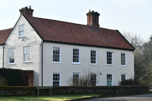
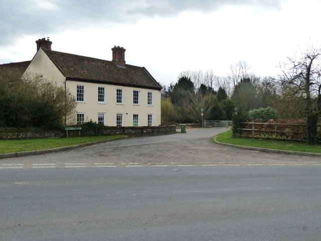
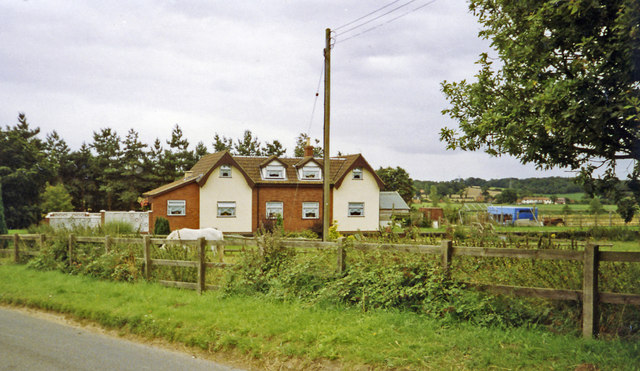
The village is surrounded by picturesque countryside, characterized by rolling hills, lush green meadows, and vast fields. It is dotted with traditional thatched cottages, giving it a charming and timeless appeal. The winding country lanes and footpaths provide ample opportunities for exploring the natural beauty of the area, making it an ideal destination for walking and cycling enthusiasts.

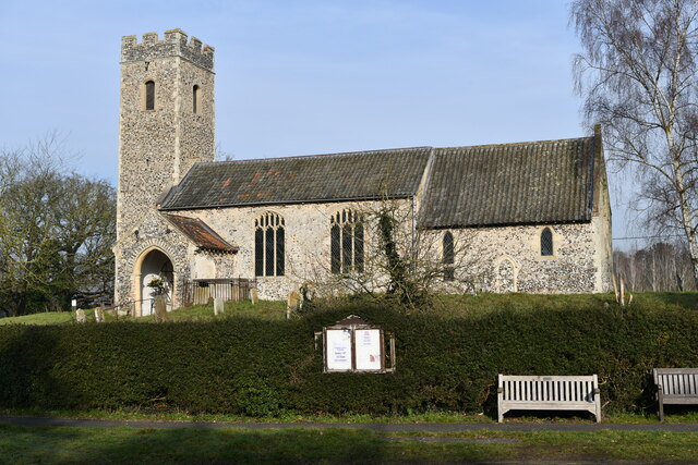
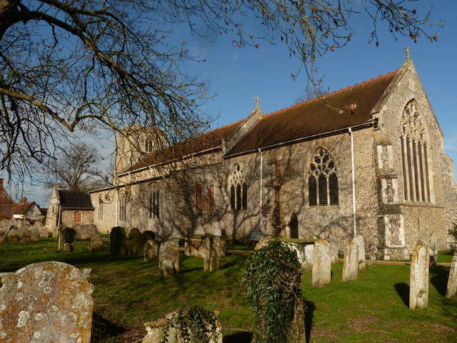
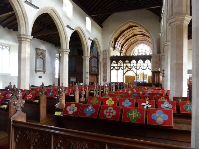
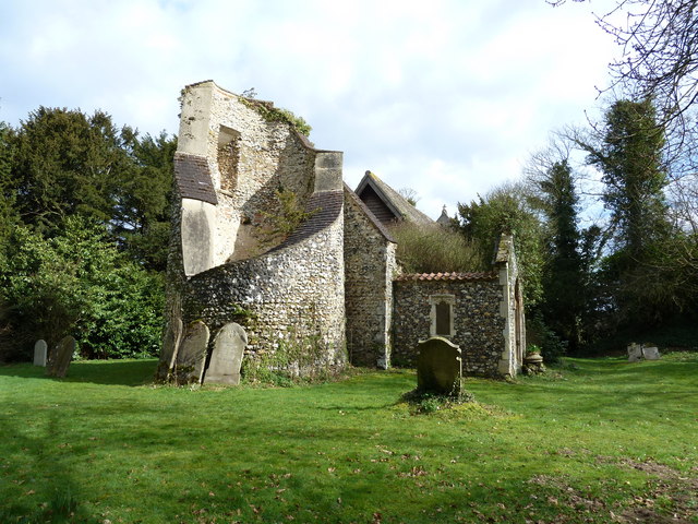
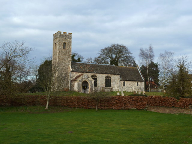
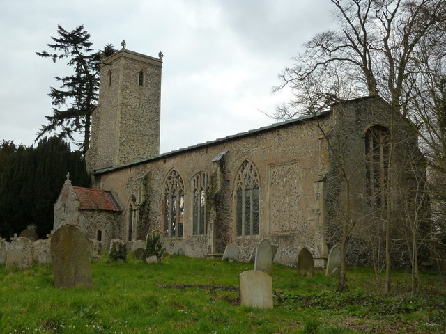
Morton is home to St. Margaret's Church, a Grade II listed building that dates back to the 13th century. The church features stunning architectural details and serves as a significant historical and cultural landmark within the village.

Despite its small size, Morton boasts a close-knit and welcoming community. The village has a village hall which serves as a focal point for social gatherings, events, and activities. Additionally, there is a primary school within the village, ensuring that families have access to excellent educational facilities.

For amenities and services, residents often rely on nearby towns such as Diss, which provides a wider range of shops, supermarkets, and leisure facilities. The village is well-connected to the rest of Norfolk and beyond, with good transport links including regular bus services and proximity to major road networks.

Overall, Morton offers a peaceful and picturesque lifestyle amidst the beauty of the Norfolk countryside, making it an attractive place for those seeking a rural retreat.

If you have any feedback on the listing, please let us know in the comments section below.
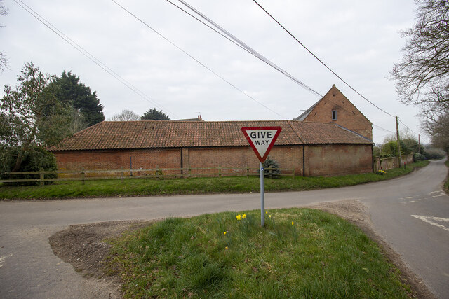
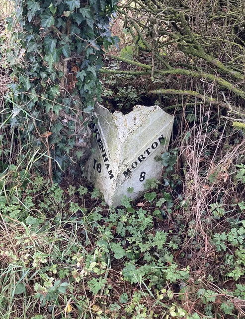
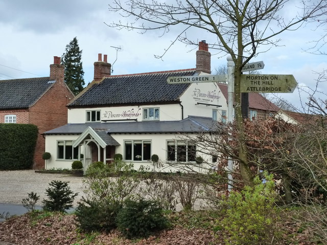
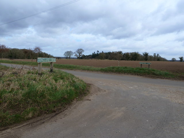
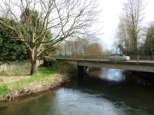
Morton Images

Images are sourced within 2km of 52.708932/1.1422479 or Grid Reference TG1216. Thanks to Geograph Open Source API. All images are credited.

Top Farm Vernacular farm buildings at Top Farm
Top Farm
Vernacular farm buildings at Top Farm
Pterodactyl at Roarr! At Roarr!
Pterodactyl at Roarr!
At Roarr!
Attlebridge, St. Andrews Church: Southern aspect
Attlebridge: The Old Barn
Attlebridge Village Sign
Old Milepost by the former A1067, Morton on the Hill parish Cast iron post by the UC road (was A1067), in parish of MORTON ON THE HILL (BROADLAND District), 100m North of No. 10 The Street, under hedge, on West side of road. Fakenham cast iron N-top, erected by the Norwich & Fakenham turnpike trust in the 19th century. Broken top.

Inscription reads:-
: FAKENHAM / 16 : : MORTON / 8 :

Milestone Society National ID: NO_NF08.
Old Milepost by the former A1067, Morton on the Hill parish
Cast iron post by the UC road (was A1067), in parish of MORTON ON THE HILL (BROADLAND District), 100m North of No. 10 The Street, under hedge, on West side of road. Fakenham cast iron N-top, erected by the Norwich & Fakenham turnpike trust in the 19th century. Broken top. Inscription reads:- : FAKENHAM / 16 : : MORTON / 8 : Milestone Society National ID: NO_NF08.
The "Parson Woodforde", Weston Longville
All Saints church, Weston Longville
All Saints church, Weston Longville - interior
Junction of Ringland Lane and Morton Lane, Weston Longville
St. Margaret's church at Morton Hall
A1067 Fakenham Road over the Wensum at Attlebridge
St. Andrew's church, Attlebridge
Old Fakenham Road - leading to the footbridge
St, John the Baptist's church, Alderford
Dovecote at Church Farm, Alderford
A family group at Dinosaur Adventure
Site -?remains - of Attlebridge station, 1993 View SW on A1067 road. The station had been on the ex-M&GN Joint line, Melton Constable (to right) - Norwich (City) line, which closed for passengers with the rest of the system from 2/3/59, but the section to Norwich City was retained for goods by means of a connection off the ex-GER Wroxham - County School line by the Themelthorpe Loop from 12/9/60 and lasted until 13/7/64. It is not obvious whether the houses had been connected with the railway.
Site -?remains - of Attlebridge station, 1993
View SW on A1067 road. The station had been on the ex-M&GN Joint line, Melton Constable (to right) - Norwich (City) line, which closed for passengers with the rest of the system from 2/3/59, but the section to Norwich City was retained for goods by means of a connection off the ex-GER Wroxham - County School line by the Themelthorpe Loop from 12/9/60 and lasted until 13/7/64. It is not obvious whether the houses had been connected with the railway.
Show me another place!

Morton is located at Grid Ref: TG1216 (Lat: 52.708932, Lng: 1.1422479)

Administrative County: Norfolk

District: Broadland

Police Authority: Norfolk

What 3 Words

///repelled.lows.crispier. Near Reepham, Norfolk

Related Wikis

Morton on the Hill

Morton on the Hill is a small but scattered village and civil parish in the English county of Norfolk, about 8 miles (13 km) north-west of Norwich. The...
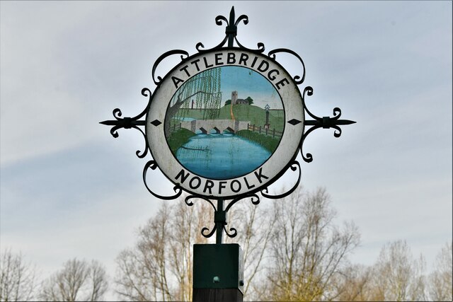
Attlebridge

Attlebridge is a village and civil parish in the English county of Norfolk. It is situated about 8 miles (13 km) north-west of Norwich, where the A1067...

Attlebridge railway station

Attlebridge railway station is a closed station in Norfolk, England. It served the small village of Attlebridge. It was constructed by the Midland and...

Alderford Common

Alderford Common is a 17.5-hectare (43-acre) biological Site of Special Scientific Interest north-west of Norwich in Norfolk.The common has a thin layer...

Weston Longville

Weston Longville is a civil parish in the English county of Norfolk, approximately 8 miles (13 km) north-west of Norwich. Its name is derived from the...

Broadland (UK Parliament constituency)

Broadland is a Norfolk constituency, which has been represented in the House of Commons of the UK Parliament since the 2019 general election by Jerome...

Alderford

Alderford is a village and civil parish in the English county of Norfolk, about ten miles (16 km) north-west of Norwich. The name 'Alderford' derives from...

River Ainse (or Eyn)

The River Ainse (or Eyn) is a small river in the county of Norfolk. It is a tributary of the River Wensum which it merges with at Lenwade. The River Ainse...

Nearby Amenities

Located within 500m of 52.708932,1.1422479
Power: tower
Ref: PS49
Lat/Long: 52.7102159/1.1358887
Power: tower
Ref: PS50
Lat/Long: 52.7124323/1.1399952
Bus Stop
The Street, adj
Naptan AtcoCode: 2900A192
Naptan Bearing: SE
Naptan CommonName: The Street
Naptan Indicator: adj
Naptan Locality: Attlebridge
Naptan NaptanCode: nfoadmam
Naptan Street: Fakenham Road
Naptan Verified: no
Shelter: yes
Source: naptan_import
Lat/Long: 52.7068242/1.1475324
Bus Stop
Fakenham Road, SE-bound
Bus: yes
Naptan AtcoCode: 2900M211
Naptan Bearing: SE
Naptan BusStopType: CUS
Naptan CommonName: Fakenham Road
Naptan Indicator: SE-bound
Naptan Locality: Morton on the Hill
Naptan NaptanCode: nfodgmtp
Naptan Street: Fakenham Road
Naptan Verified: no
Public Transport: platform
Source: naptan_import
Lat/Long: 52.7107393/1.1403068
Bus Stop
Fakenham Road, NE-bound
Bus: yes
Naptan AtcoCode: 2900M212
Naptan Bearing: NW
Naptan BusStopType: CUS
Naptan CommonName: Fakenham Road
Naptan Indicator: NE-bound
Naptan Landmark: Morton Lodge
Naptan Locality: Morton on the Hill
Naptan NaptanCode: nfodgmtw
Naptan Street: Fakenham Road
Naptan Verified: no
Public Transport: platform
Source: naptan_import
Lat/Long: 52.7107167/1.1401422
Morton
Place: village
Lat/Long: 52.7109651/1.140424
Barrier: bollard
Bicycle: yes
Foot: yes
Horse: yes
Motorcycle: no
Lat/Long: 52.7067134/1.1484901
Post Box
Collection Times: Mo-Fr 16:15; Sa 08:30
Operator: Royal Mail
Post Box Mounting: pier
Post Box Type: lamp
Ref: NR9 968
Royal Cypher: EIIR
Royal Cypher Wikidata: Q33102113
Lat/Long: 52.7107897/1.1403116
Barrier: cattle_grid
Bicycle: yes
Foot: yes
Lat/Long: 52.7062457/1.1480095
Give Way
Lat/Long: 52.7089601/1.1422373
Give Way
Lat/Long: 52.7087546/1.1426273
Power: pole
Lat/Long: 52.7084208/1.1444691
Material: wood
Power: pole
Lat/Long: 52.707774/1.1446676
Material: wood
Power: pole
Lat/Long: 52.7074571/1.144807
Power: pole
Lat/Long: 52.705858/1.1453649
Power: pole
Lat/Long: 52.7050454/1.1456573
Power: pole
Lat/Long: 52.7067437/1.1450216
Location Transition: yes
Material: wood
Power: pole
Transformer: distribution
Lat/Long: 52.7069046/1.1464405
Give Way
Lat/Long: 52.7067507/1.1477778
Power: pole
Lat/Long: 52.7129821/1.1425701
Power: portal
Lat/Long: 52.7117781/1.1399522
Power: pole
Lat/Long: 52.7119292/1.1415723
Power: pole
Lat/Long: 52.712071/1.1431669
Power: pole
Lat/Long: 52.7112028/1.1434874
Power: pole
Transformer: distribution
Lat/Long: 52.7102733/1.1438066
Power: pole
Lat/Long: 52.7093422/1.1441472
The data included in this document is from www.openstreetmap.org. The data is made available under ODbL.

Have you been to Morton?

Leave your review of Morton below (or comments, questions and feedback).