Moor Close

Settlement in Lancashire

England

Moor Close

Sewage Works Part of the old sewage works.
Sewage Works Credit: Peter McDermott

Moor Close is a small village located in the county of Lancashire, England. Situated in the southwestern part of the county, it is nestled amongst the mesmerizing green landscapes of the countryside. The village is surrounded by rolling hills, vast moorlands, and picturesque valleys, providing breathtaking views for its inhabitants.

Despite its small size, Moor Close boasts a tight-knit community that is known for its warm and friendly atmosphere. The village is home to a population of approximately 500 residents who enjoy a peaceful and tranquil way of life. This close-knit community is characterized by its strong sense of community spirit, with regular events and gatherings being organized throughout the year.

Moor Close is primarily a residential area, with most of its residents working in nearby towns and cities. The village itself offers limited amenities, including a local convenience store, a post office, and a charming village pub where locals gather to socialize and unwind.

Nature lovers are attracted to Moor Close due to its proximity to the stunning Lancashire countryside. The village is surrounded by numerous walking and hiking trails, allowing residents and visitors to explore the natural beauty of the area. Additionally, the nearby moorlands provide ample opportunities for birdwatching and wildlife spotting.

Overall, Moor Close is a peaceful and idyllic village that offers a close-knit community, stunning natural surroundings, and a tranquil way of life.

If you have any feedback on the listing, please let us know in the comments section below.
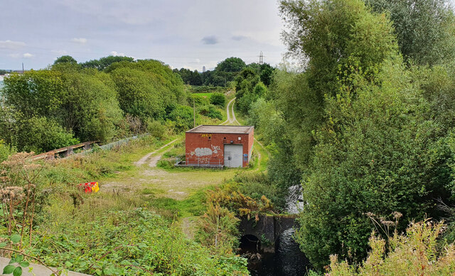
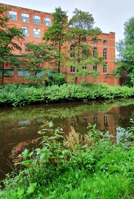
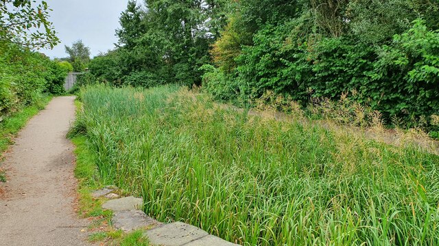
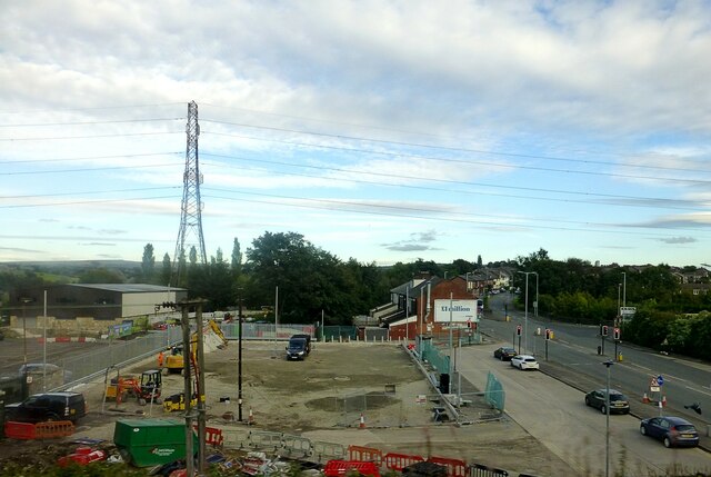
Moor Close Images

Images are sourced within 2km of 53.541504/-2.182549 or Grid Reference SD8805. Thanks to Geograph Open Source API. All images are credited.

Sewage Works Part of the old sewage works.
Sewage Works
Part of the old sewage works.
Malta Mill Old cotton mill alongside the Rochdale Canal.
Malta Mill
Old cotton mill alongside the Rochdale Canal.
Alkrington Hall
Alkrington Hall
Disused Canal Branch Branch off the Rochdale Canal leading to Ferney Field Colliery.
Disused Canal Branch
Branch off the Rochdale Canal leading to Ferney Field Colliery.
Locks on the Rochdale Canal Limefield farmhouse seen on the left of view
Locks on the Rochdale Canal
Limefield farmhouse seen on the left of view
Middleton Road View from railway bridge at Mills Hill Station
Middleton Road
View from railway bridge at Mills Hill Station
Edgar Wood The former Dusty Miller <a href="https://www.geograph.org.uk/photo/2666576">SD8605 : Dusty Miller</a> is now the Edgar Wood. A Craft Union pub.  It is named after the world acclaimed Middleton architect, Edgar Wood <span class="nowrap"><a title="http://middletonheritage.co.uk/arts-and-crafts-trail/" rel="nofollow ugc noopener" href="http://middletonheritage.co.uk/arts-and-crafts-trail/">Link</a><img style="margin-left:2px;" alt="External link" title="External link - shift click to open in new window" src="https://s1.geograph.org.uk/img/external.png" width="10" height="10"/></span>  

<a href="https://www.geograph.org.uk/photo/6992739">SD8605 : Sign of the Edgar Wood</a>.
Edgar Wood
The former Dusty Miller SD8605 : Dusty Miller is now the Edgar Wood. A Craft Union pub. It is named after the world acclaimed Middleton architect, Edgar Wood LinkExternal link SD8605 : Sign of the Edgar Wood.
Sign of the Edgar Wood Sign for the Edgar Wood <a href="https://www.geograph.org.uk/photo/6992736">SD8605 : Edgar Wood</a>.
Sign of the Edgar Wood
Sign for the Edgar Wood SD8605 : Edgar Wood.
Tesco Extra 
The filling station at the superstore which was built on the site of the former Middleton civic buildings. In the background is the now derelict Grade II listed <span class="nowrap"><a title="https://historicengland.org.uk/listing/the-list/list-entry/1356232" rel="nofollow ugc noopener" href="https://historicengland.org.uk/listing/the-list/list-entry/1356232">Link</a><img style="margin-left:2px;" alt="External link" title="External link - shift click to open in new window" src="https://s1.geograph.org.uk/img/external.png" width="10" height="10"/></span> Warwick Mill.
Tesco Extra
The filling station at the superstore which was built on the site of the former Middleton civic buildings. In the background is the now derelict Grade II listed LinkExternal link Warwick Mill.
Warwick Mill 
The  Grade II listed <span class="nowrap"><a title="https://historicengland.org.uk/listing/the-list/list-entry/1356232" rel="nofollow ugc noopener" href="https://historicengland.org.uk/listing/the-list/list-entry/1356232">Link</a><img style="margin-left:2px;" alt="External link" title="External link - shift click to open in new window" src="https://s1.geograph.org.uk/img/external.png" width="10" height="10"/></span> Warwick Mill is presently in somewhat derelict state.
Warwick Mill
The Grade II listed LinkExternal link Warwick Mill is presently in somewhat derelict state.
Warwick House 
The property dated 1990 appears to be the offices for a large number of companies with addresses divided between Conway House, Balmoral House and Windsor House.

Note: Photograph is for record purposes only. The photographer has no personal connection with any of the businesses depicted.
Warwick House
The property dated 1990 appears to be the offices for a large number of companies with addresses divided between Conway House, Balmoral House and Windsor House. Note: Photograph is for record purposes only. The photographer has no personal connection with any of the businesses depicted.
Middleton Arena 
Construction of the Middleton Arena was completed in December 2008 and the Arena officially opened for business on 4th January 2009.

It was built on Corporation Street (since renamed LCpl Joel Halliwell VC Way) on the site formerly occupied by the Hippodrome Nightclub (previously The Empire Cinema) and the old civic amenity site. To make way for construction the Hippodrome was levelled in August 2007.

Operated by yourtrust (formerly Link4Life) the arena comprises a gymnasium, swimming pools, sauna and steam rooms, sports hall & squash and a cafe. <span class="nowrap"><a title="https://www.yourtrustrochdale.co.uk/venues/middleton-arena/" rel="nofollow ugc noopener" href="https://www.yourtrustrochdale.co.uk/venues/middleton-arena/">Link</a><img style="margin-left:2px;" alt="External link" title="External link - shift click to open in new window" src="https://s1.geograph.org.uk/img/external.png" width="10" height="10"/></span>
Middleton Arena
Construction of the Middleton Arena was completed in December 2008 and the Arena officially opened for business on 4th January 2009. It was built on Corporation Street (since renamed LCpl Joel Halliwell VC Way) on the site formerly occupied by the Hippodrome Nightclub (previously The Empire Cinema) and the old civic amenity site. To make way for construction the Hippodrome was levelled in August 2007. Operated by yourtrust (formerly Link4Life) the arena comprises a gymnasium, swimming pools, sauna and steam rooms, sports hall & squash and a cafe. LinkExternal link
Middleton Arena Construction of the Middleton Arena was completed in December 2008 and the Arena officially opened for business on 4th January 2009.

It was built on Corporation Street (since renamed LCpl Joel Halliwell VC Way) on the site formerly occupied by the Hippodrome Nightclub (previously The Empire Cinema) and the old civic amenity site. To make way for construction, the Hippodrome was levelled in August 2007.

Operated by yourtrust (formerly Link4Life) the arena comprises a gymnasium, swimming pools, sauna and steam rooms, sports hall & squash and a cafe. <span class="nowrap"><a title="https://www.yourtrustrochdale.co.uk/venues/middleton-arena/" rel="nofollow ugc noopener" href="https://www.yourtrustrochdale.co.uk/venues/middleton-arena/">Link</a><img style="margin-left:2px;" alt="External link" title="External link - shift click to open in new window" src="https://s1.geograph.org.uk/img/external.png" width="10" height="10"/></span>
Middleton Arena
Construction of the Middleton Arena was completed in December 2008 and the Arena officially opened for business on 4th January 2009. It was built on Corporation Street (since renamed LCpl Joel Halliwell VC Way) on the site formerly occupied by the Hippodrome Nightclub (previously The Empire Cinema) and the old civic amenity site. To make way for construction, the Hippodrome was levelled in August 2007. Operated by yourtrust (formerly Link4Life) the arena comprises a gymnasium, swimming pools, sauna and steam rooms, sports hall & squash and a cafe. LinkExternal link
Middleton Market Place At the junction of the A664 Assheton Way and the B6189 Market Place.

#1 on the left is the Assheton Arms. Originally a J.W.Lees pub it now only operates as a B&B <a href="https://www.geograph.org.uk/photo/7026148">SD8706 : Sign of the Assheton Arms Hotel</a>.

#3 in the middle is the Grade II listed <span class="nowrap"><a title="https://historicengland.org.uk/listing/the-list/list-entry/1068505" rel="nofollow ugc noopener" href="https://historicengland.org.uk/listing/the-list/list-entry/1068505">Link</a><img style="margin-left:2px;" alt="External link" title="External link - shift click to open in new window" src="https://s1.geograph.org.uk/img/external.png" width="10" height="10"/></span> building  built in 1892 for the Manchester and Salford Bank. The local architect Edgar Wood was responsible for its design  comprising buff-coloured terracotta with a clay tile roof, 3 bays and 3 storeys. There is a panelled round-arched door between bays 2 and 3 with blocked archivolt and coat of arms above. Three 3-light mullion and transom basket-arched windows within segmental recesses on the ground floor. Secondary doors to extreme left and right. Similar 4-light windows on the first and second floor the latter within bold gabled dormers. All windows have leaded lights. The gabled dormers are only narrowly divided by the plane of the roof which continues down to a deep eaves projection. Elaborate rainwater heads with rosette motifs and downpipes with flamboyant brackets convey the rainwater to a trough at first floor sill level. The trough has bead-and-reel enrichment and channels water to an internal drain. Bold ridge chimney stacks. It became a Williams Deacon bank and subsequently the Royal Bank of Scotland. Having stood empty for many years plans to turn it into a nightclub were rejected. It has recently opened as the Lekki Lounge <span class="nowrap"><a title="https://www.lekkiloungemanchester.co.uk/" rel="nofollow ugc noopener" href="https://www.lekkiloungemanchester.co.uk/">Link</a><img style="margin-left:2px;" alt="External link" title="External link - shift click to open in new window" src="https://s1.geograph.org.uk/img/external.png" width="10" height="10"/></span> describing itself as having the best Afro Caribbean cuisine in Manchester.

#5 on the right has for many years been a branch of the Royal Bank of Scotland but that too has now closed.
Middleton Market Place
At the junction of the A664 Assheton Way and the B6189 Market Place. #1 on the left is the Assheton Arms. Originally a J.W.Lees pub it now only operates as a B&B SD8706 : Sign of the Assheton Arms Hotel. #3 in the middle is the Grade II listed LinkExternal link building built in 1892 for the Manchester and Salford Bank. The local architect Edgar Wood was responsible for its design comprising buff-coloured terracotta with a clay tile roof, 3 bays and 3 storeys. There is a panelled round-arched door between bays 2 and 3 with blocked archivolt and coat of arms above. Three 3-light mullion and transom basket-arched windows within segmental recesses on the ground floor. Secondary doors to extreme left and right. Similar 4-light windows on the first and second floor the latter within bold gabled dormers. All windows have leaded lights. The gabled dormers are only narrowly divided by the plane of the roof which continues down to a deep eaves projection. Elaborate rainwater heads with rosette motifs and downpipes with flamboyant brackets convey the rainwater to a trough at first floor sill level. The trough has bead-and-reel enrichment and channels water to an internal drain. Bold ridge chimney stacks. It became a Williams Deacon bank and subsequently the Royal Bank of Scotland. Having stood empty for many years plans to turn it into a nightclub were rejected. It has recently opened as the Lekki Lounge LinkExternal link describing itself as having the best Afro Caribbean cuisine in Manchester. #5 on the right has for many years been a branch of the Royal Bank of Scotland but that too has now closed.
Lekki Lounge #3 Market Place, Middleton is the Grade II listed <span class="nowrap"><a title="https://historicengland.org.uk/listing/the-list/list-entry/1068505" rel="nofollow ugc noopener" href="https://historicengland.org.uk/listing/the-list/list-entry/1068505">Link</a><img style="margin-left:2px;" alt="External link" title="External link - shift click to open in new window" src="https://s1.geograph.org.uk/img/external.png" width="10" height="10"/></span> building  built in 1892 for the Manchester and Salford Bank. The local architect Edgar Wood <a href="https://www.geograph.org.uk/photo/7026144">SD8706 : Edgar Wood (1860 - 1935)</a> was responsible for its design  comprising buff-coloured terracotta with a clay tile roof, 3 bays and 3 storeys. There is a panelled round-arched door between bays 2 and 3 with blocked archivolt and coat of arms above. Three 3-light mullion and transom basket-arched windows within segmental recesses on the ground floor. Secondary doors to extreme left and right. Similar 4-light windows on the first and second floor the latter within bold gabled dormers. All windows have leaded lights. The gabled dormers are only narrowly divided by the plane of the roof which continues down to a deep eaves projection. Elaborate rainwater heads with rosette motifs and downpipes with flamboyant brackets convey the rainwater to a trough at first floor sill level. The trough has bead-and-reel enrichment and channels water to an internal drain. Bold ridge chimney stacks. It became a Williams Deacon bank and subsequently the Royal Bank of Scotland. Having stood empty for many years plans to turn it into a nightclub were rejected. It has recently opened as the Lekki Lounge <span class="nowrap"><a title="https://www.lekkiloungemanchester.co.uk/" rel="nofollow ugc noopener" href="https://www.lekkiloungemanchester.co.uk/">Link</a><img style="margin-left:2px;" alt="External link" title="External link - shift click to open in new window" src="https://s1.geograph.org.uk/img/external.png" width="10" height="10"/></span> describing itself as having the best Afro Caribbean cuisine in Manchester.
Lekki Lounge
#3 Market Place, Middleton is the Grade II listed LinkExternal link building built in 1892 for the Manchester and Salford Bank. The local architect Edgar Wood SD8706 : Edgar Wood (1860 - 1935) was responsible for its design comprising buff-coloured terracotta with a clay tile roof, 3 bays and 3 storeys. There is a panelled round-arched door between bays 2 and 3 with blocked archivolt and coat of arms above. Three 3-light mullion and transom basket-arched windows within segmental recesses on the ground floor. Secondary doors to extreme left and right. Similar 4-light windows on the first and second floor the latter within bold gabled dormers. All windows have leaded lights. The gabled dormers are only narrowly divided by the plane of the roof which continues down to a deep eaves projection. Elaborate rainwater heads with rosette motifs and downpipes with flamboyant brackets convey the rainwater to a trough at first floor sill level. The trough has bead-and-reel enrichment and channels water to an internal drain. Bold ridge chimney stacks. It became a Williams Deacon bank and subsequently the Royal Bank of Scotland. Having stood empty for many years plans to turn it into a nightclub were rejected. It has recently opened as the Lekki Lounge LinkExternal link describing itself as having the best Afro Caribbean cuisine in Manchester.
Former Bricklayers Arms Former Gartside's pub now Domino's Pizza.
Former Bricklayers Arms
Former Gartside's pub now Domino's Pizza.
Edgar Wood (1860 - 1935) 
The plaque on what is now the Lekki Lounge <a href="https://www.geograph.org.uk/photo/7026044">SD8706 : Lekki Lounge</a> reads:

MIDDLETON CIVIC
ASSOCIATION

EDGAR
WOOD
ARCHITECT
(1860 - 1935)

MANCHESTER
AND SALFORD BANK
1892
GRADE II LISTED BUILDING

ROCHDALE METROPOLITAN
BOROUGH COUNCIL
Edgar Wood (1860 - 1935)
The plaque on what is now the Lekki Lounge SD8706 : Lekki Lounge reads: MIDDLETON CIVIC ASSOCIATION EDGAR WOOD ARCHITECT (1860 - 1935) MANCHESTER AND SALFORD BANK 1892 GRADE II LISTED BUILDING ROCHDALE METROPOLITAN BOROUGH COUNCIL
Sign of the Assheton Arms Hotel Sign for the Assheton Arms Hotel <a href="https://www.geograph.org.uk/photo/7026018">SD8706 : Middleton Market Place</a>.
Sign of the Assheton Arms Hotel
Sign for the Assheton Arms Hotel SD8706 : Middleton Market Place.
Show me another place!

Moor Close is located at Grid Ref: SD8805 (Lat: 53.541504, Lng: -2.182549)

Unitary Authority: Rochdale

Police Authority: Greater Manchester

What 3 Words

///ruby.trials.also. Near Middleton, Manchester

Related Wikis

Alkrington

Alkrington Garden Village is a suburban area of Middleton, in the Metropolitan Borough of Rochdale, Greater Manchester, England.Historically a part of...

Middleton Technology School

Middleton Technology School is a coeducational secondary school in the Middleton area of the Metropolitan Borough of Rochdale in Greater Manchester, England...

Middleton Junction

Middleton Junction is an industrial and residential district lying on the common border of Middleton in the Metropolitan Borough of Rochdale and Chadderton...

Middleton Junction railway station

Middleton Junction railway station was an early junction station on the Manchester and Leeds Railway, it opened when the branch to Oldham opened in 1842...

Tonge, Middleton

Tonge is a residential and industrial area of Middleton in the Metropolitan Borough of Rochdale, Greater Manchester. It lies on the east side of Middleton...

Tonge Hall

Tonge Hall is a Grade II* listed Elizabethan manor house in Tonge, Middleton, Greater Manchester, England. == History == The manor of Tonge belonged in...

St Michael's Church, Middleton

St Michael's Church is in Townley Street, Middleton, Greater Manchester, England. It is an active Anglican parish church in the deanery of Heywood and...

Laurel Mill, Middleton Junction

Laurel Mill was a cotton spinning mill in the Mills Hill/Middleton Junction area of Chadderton, Oldham, Greater Manchester, England. It was sited alongside...

Nearby Amenities

Located within 500m of 53.541504,-2.182549
Turning Circle
Turning Circle: y-head
Lat/Long: 53.53931/-2.1889793
Bus Stop
Alkrington, Kingsway / near The Glen
Bus: yes
Naptan AtcoCode: 1800NE00981
Naptan Bearing: NW
Naptan CommonName: Kingsway/The Glen
Naptan Indicator: Nr House 5
Naptan Landmark: BACK OF HOUSE
Naptan NaptanCode: mandwatg
Naptan Notes: INDICATOR AMENDED
Naptan PlusbusZoneRef: MNCRPIC
Naptan ShortCommonName: The Glen
Naptan Street: KINGSWAY
Naptan Verified: no
Network: TfGM
Operator: TfGM
Public Transport: platform
Source: naptan_import
Lat/Long: 53.5386056/-2.1827913
Bus Stop
Middleton Junction, Grimshaw Lane / near Haslam Street
Bus: yes
Naptan AtcoCode: 1800NE01021
Naptan Bearing: NW
Naptan CommonName: Grimshaw Lane/Haslam Street
Naptan Indicator: Os House 288
Naptan Landmark: HOUSE 288
Naptan NaptanCode: mandwatp
Naptan PlusbusZoneRef: MNCRPIC
Naptan ShortCommonName: Haslam Street
Naptan Street: GRIMSHAW LANE
Naptan Verified: no
Network: TfGM
Operator: TfGM
Public Transport: platform
Source: naptan_import
Lat/Long: 53.5426872/-2.1763199
Bus Stop
Moorclose, Grimshaw Lane / opposite Lonsdale Court
Bus: yes
Naptan AtcoCode: 1800NE04751
Naptan Bearing: NW
Naptan CommonName: Grimshaw Lane/Lonsdale Court
Naptan Indicator: O/s House 204
Naptan Landmark: O/S HOUSE 204
Naptan NaptanCode: mandwjwd
Naptan PlusbusZoneRef: MNCRPIC
Naptan ShortCommonName: Lonsdale Court
Naptan Street: GRIMSHAW LANE
Naptan Verified: no
Network: TfGM
Operator: TfGM
Public Transport: platform
Source: naptan_import
Lat/Long: 53.5437423/-2.1799914
Bus Stop
Alkrington, Hardfield Road / adjacent Kingsway
Bus: yes
Naptan AtcoCode: 1800NE07871
Naptan Bearing: S
Naptan CommonName: Hardfield Road/Kingsway
Naptan Indicator: O/s House 136
Naptan Landmark: HOUSE 138
Naptan NaptanCode: mandwmpa
Naptan PlusbusZoneRef: MNCRPIC
Naptan ShortCommonName: Kingsway
Naptan Street: HARDFIELD ROAD
Naptan Verified: no
Network: TfGM
Operator: TfGM
Public Transport: platform
Source: naptan_import
Lat/Long: 53.54011/-2.1864646
Bus Stop
Kingsway/Hardfield Road
Bus: yes
Naptan AtcoCode: 1800NE07881
Naptan Bearing: E
Naptan CommonName: Kingsway/Hardfield Road
Naptan Indicator: O/s House 145
Naptan Landmark: HOUSE 145
Naptan NaptanCode: mandwmpd
Naptan PlusbusZoneRef: MNCRPIC
Naptan ShortCommonName: Hardfield Road
Naptan Street: KINGSWAY
Naptan Verified: no
Network: TfGM
Public Transport: platform
Source: naptan_import
Lat/Long: 53.540728/-2.1878556
Bus Stop
Kingsway/Hardfield Road
Bus: yes
Naptan AtcoCode: 1800NE07891
Naptan Bearing: W
Naptan CommonName: Kingsway/Hardfield Road
Naptan Indicator: O/s House 112
Naptan Landmark: HOUSE 112
Naptan NaptanCode: mandwmpg
Naptan PlusbusZoneRef: MNCRPIC
Naptan ShortCommonName: Hardfield Road
Naptan Street: KINGSWAY
Naptan Verified: no
Network: TfGM
Public Transport: platform
Source: naptan_import
Lat/Long: 53.5406388/-2.1874327
Bus Stop
Alkrington, Kingsway / near Apple Way
Bus: yes
Naptan AtcoCode: 1800NE07931
Naptan Bearing: SE
Naptan CommonName: Kingsway/Hardfield Road
Naptan Indicator: Sub-station
Naptan Landmark: SUB-STATION
Naptan NaptanCode: mandwmpw
Naptan PlusbusZoneRef: MNCRPIC
Naptan ShortCommonName: Hardfield Road
Naptan Street: KINGSWAY
Naptan Verified: no
Network: TfGM
Operator: TfGM
Public Transport: platform
Source: naptan_import
Lat/Long: 53.5405882/-2.1853199
Bus Stop
Alkington, Kingsway / near Wince Close
Bus: yes
Naptan AtcoCode: 1800NE07941
Naptan Bearing: SE
Naptan CommonName: Kingsway/Wince Close
Naptan Indicator: O/s House 11
Naptan Landmark: HOUSE 11
Naptan NaptanCode: mandwmta
Naptan PlusbusZoneRef: MNCRPIC
Naptan ShortCommonName: Wince Close
Naptan Street: KINGSWAY
Naptan Verified: no
Network: TfGM
Operator: TfGM
Public Transport: platform
Source: naptan_import
Lat/Long: 53.539037/-2.1827932
Bus Stop
Alkrington, Kingsway / outside The Moss
Bus: yes
Naptan AtcoCode: 1800NE07951
Naptan Bearing: NW
Naptan CommonName: Kingsway/The Moss
Naptan Indicator: Opp House 6
Naptan Landmark: FLAT 6
Naptan NaptanCode: mandwmtd
Naptan PlusbusZoneRef: MNCRPIC
Naptan ShortCommonName: The Moss
Naptan Street: KINGSWAY
Naptan Verified: no
Network: TfGM
Operator: TfGM
Public Transport: platform
Source: naptan_import
Lat/Long: 53.5391445/-2.1830653
Bus Stop
Alkrington, Mainway East / near Lincoln Road
Bus: yes
Naptan AtcoCode: 1800NE07961
Naptan Bearing: W
Naptan CommonName: Mainway East/Lincoln Road
Naptan Indicator: O/s Comm Ctr
Naptan Landmark: Community Centre
Naptan NaptanCode: mandwmtg
Naptan PlusbusZoneRef: MNCRPIC
Naptan ShortCommonName: Lincoln Road
Naptan Street: MAINWAY EAST
Naptan Verified: no
Network: TfGM
Operator: TfGM
Public Transport: platform
Source: naptan_import
Lat/Long: 53.5374173/-2.1808788
Bus Stop
Alkrington, Mainway East / opposite Lincoln Road
Bus: yes
Naptan AtcoCode: 1800NE07971
Naptan Bearing: E
Naptan CommonName: Mainway East/Brookside Crescent
Naptan Indicator: O/s House 353
Naptan Landmark: HOUSE 353
Naptan NaptanCode: mandwmtj
Naptan PlusbusZoneRef: MNCRPIC
Naptan ShortCommonName: Brookside Cres
Naptan Street: MAINWAY EAST
Naptan Verified: no
Network: TfGM
Operator: TfGM
Public Transport: platform
Source: naptan_import
Lat/Long: 53.5377951/-2.1798943
Bus Stop
Middleton Junction, Grimshaw Lane / opposite Haslam Street
Bus: yes
Naptan AtcoCode: 1800NE08011
Naptan Bearing: SE
Naptan CommonName: Grimshaw Lane/Castle Street
Naptan Indicator: Opp Nat West
Naptan Landmark: HOUSE 310
Naptan NaptanCode: mandwmwa
Naptan PlusbusZoneRef: MNCRPIC
Naptan ShortCommonName: Castle Street
Naptan Street: GRIMSHAW LANE
Naptan Verified: no
Network: TfGM
Operator: TfGM
Public Transport: platform
Source: naptan_import
Lat/Long: 53.5424487/-2.1755052
Bus Stop
Moorclose, Grimshaw Lane / near David's Farm Close
Bus: yes
Naptan AtcoCode: 1800NE08021
Naptan Bearing: NW
Naptan CommonName: Grimshaw Lane/Sandy Lane
Naptan Indicator: Opp House 141
Naptan Landmark: HOUSE 144
Naptan NaptanCode: mandwmwd
Naptan PlusbusZoneRef: MNCRPIC
Naptan ShortCommonName: Sandy Lane
Naptan Street: GRIMSHAW LANE
Naptan Verified: no
Network: TfGM
Operator: TfGM
Public Transport: platform
Source: naptan_import
Lat/Long: 53.5445936/-2.1817305
Bus Stop
Middleton, Grimshaw Lane / outside Lonsdale Court
Bus: yes
Naptan AtcoCode: 1800NE08031
Naptan Bearing: SE
Naptan CommonName: Grimshaw Lane/Lonsdale Court
Naptan Indicator: O/s House 155
Naptan Landmark: O/S HOUSE 155
Naptan NaptanCode: mandwmwg
Naptan PlusbusZoneRef: MNCRPIC
Naptan ShortCommonName: Lonsdale Court
Naptan Street: GRIMSHAW LANE
Naptan Verified: no
Network: TfGM
Operator: TfGM
Public Transport: platform
Source: naptan_import
Lat/Long: 53.5442264/-2.1808537
Barrier: bollard
Bicycle: yes
Foot: yes
Lat/Long: 53.5441745/-2.1766812
Barrier: bollard
Bicycle: yes
Foot: yes
Lat/Long: 53.5439579/-2.1769213
Leisure: playground
Lat/Long: 53.5451643/-2.178208
Barrier: bollard
Lat/Long: 53.544241/-2.1766046
Leisure: playground
Lat/Long: 53.5425682/-2.1889056
Barrier: bollard
Bicycle: yes
Foot: yes
Horse: yes
Motor Vehicle: no
Lat/Long: 53.5433848/-2.1758548
Generator Method: photovoltaic
Generator Output Electricity: yes
Generator Source: solar
Generator Type: solar_photovoltaic_panel
Location: roof
Power: generator
Lat/Long: 53.5438449/-2.1886755
Generator Method: photovoltaic
Generator Output Electricity: yes
Generator Source: solar
Generator Type: solar_photovoltaic_panel
Location: roof
Power: generator
Lat/Long: 53.5442856/-2.1856665
Generator Method: photovoltaic
Generator Output Electricity: yes
Generator Source: solar
Generator Type: solar_photovoltaic_panel
Location: roof
Power: generator
Lat/Long: 53.5399687/-2.1858422
Generator Method: photovoltaic
Generator Output Electricity: yes
Generator Source: solar
Generator Type: solar_photovoltaic_panel
Location: roof
Power: generator
Lat/Long: 53.5385684/-2.1849584
Generator Method: photovoltaic
Generator Output Electricity: yes
Generator Source: solar
Generator Type: solar_photovoltaic_panel
Location: roof
Power: generator
Lat/Long: 53.5403305/-2.1839325
Generator Method: photovoltaic
Generator Output Electricity: yes
Generator Source: solar
Generator Type: solar_photovoltaic_panel
Location: roof
Power: generator
Lat/Long: 53.5402293/-2.1850201
Addr Housenumber: 145
Addr Street: Kingsway
Source: Naptan
Lat/Long: 53.5408302/-2.1878686
Addr Housenumber: 112
Addr Street: Kingsway
Source: Naptan
Lat/Long: 53.5404142/-2.1874555
Generator Method: photovoltaic
Generator Output Electricity: yes
Generator Source: solar
Generator Type: solar_photovoltaic_panel
Location: roof
Power: generator
Lat/Long: 53.5404653/-2.1888781
Generator Method: photovoltaic
Generator Output Electricity: yes
Generator Source: solar
Generator Type: solar_photovoltaic_panel
Location: roof
Power: generator
Lat/Long: 53.5442533/-2.1866451
Generator Method: photovoltaic
Generator Output Electricity: yes
Generator Source: solar
Generator Type: solar_photovoltaic_panel
Location: roof
Power: generator
Lat/Long: 53.5421374/-2.1859677
Barrier: block
Lat/Long: 53.5456874/-2.1818166
Power: tower
Lat/Long: 53.5450775/-2.1850563
Power: tower
Lat/Long: 53.5438318/-2.1831389
Power: tower
Lat/Long: 53.5425333/-2.1811329
Power: tower
Lat/Long: 53.5414021/-2.1795443
Power: tower
Lat/Long: 53.5401828/-2.1778229
The data included in this document is from www.openstreetmap.org. The data is made available under ODbL.

Have you been to Moor Close?

Leave your review of Moor Close below (or comments, questions and feedback).