Bell's Corner

Settlement in Suffolk Babergh

England

Bell's Corner

Sudbury Road, Stoke By Nayland
Sudbury Road, Stoke By Nayland Credit: David Howard

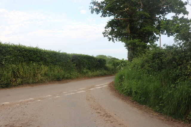
Bell's Corner is a small, charming village located in the county of Suffolk, England. Situated in the heart of the picturesque countryside, this idyllic settlement is known for its rich history, stunning natural landscapes, and close-knit community.

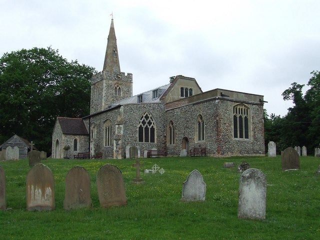
The village derives its name from the prominent bell tower that stands proudly at the intersection of two main streets, serving as a focal point for the local residents. Its origins can be traced back to the 17th century when it was primarily an agricultural hub, with farming being the main occupation of the villagers.

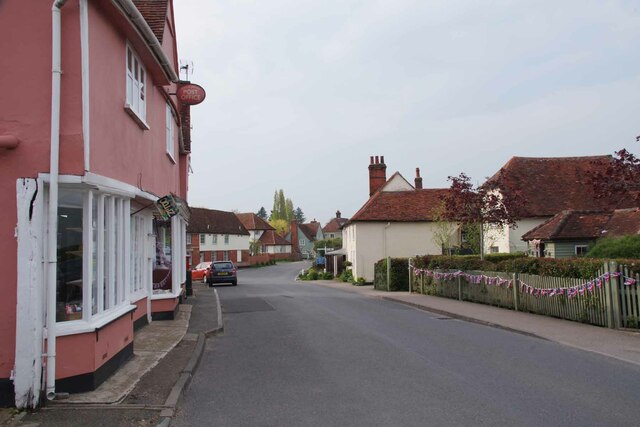
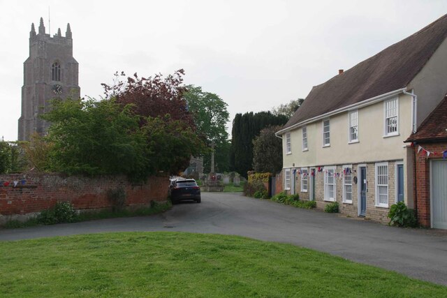
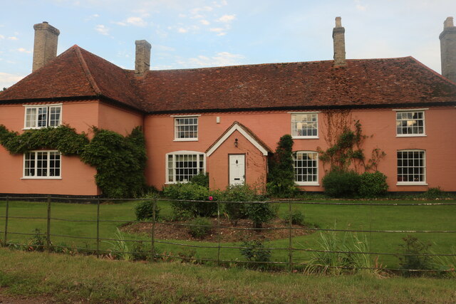
Bell's Corner boasts a variety of architectural styles, showcasing the village's evolution over the centuries. Traditional thatched-roof cottages line the streets, alongside more modern brick houses, blending old-world charm with contemporary designs. The village green, a central gathering place, is adorned with vibrant flower beds and a playground for children to enjoy.

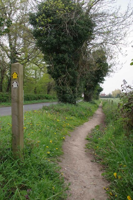
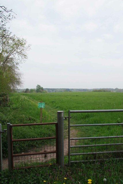
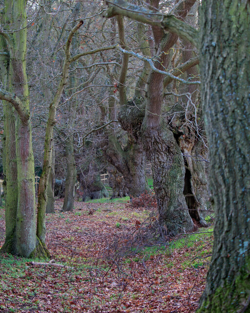
Surrounded by lush green fields and rolling hills, Bell's Corner offers breathtaking views and ample opportunities for outdoor activities. The nearby Bell's Corner Woods provide a haven for nature lovers, with its ancient trees and diverse wildlife. Residents and visitors alike can explore the numerous walking trails, picnic spots, and birdwatching areas that the woods have to offer.

Despite its tranquil atmosphere, Bell's Corner is not far from larger towns and cities, ensuring convenient access to amenities and services. The village also hosts an annual summer fair, where locals come together to celebrate their community spirit with games, food, and live music.

In summary, Bell's Corner is a quintessential English village, combining natural beauty, historical charm, and a strong sense of community. It is a hidden gem for those seeking a peaceful retreat in the heart of the Suffolk countryside.

If you have any feedback on the listing, please let us know in the comments section below.

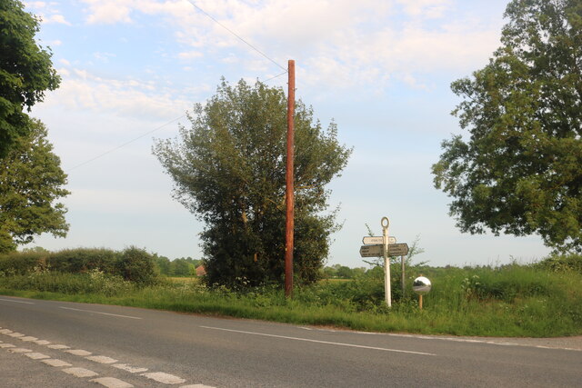
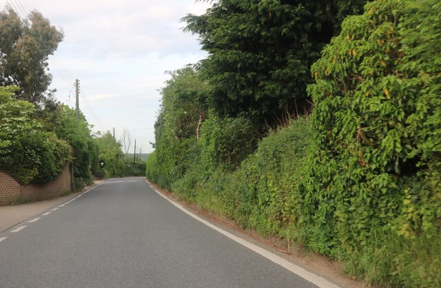
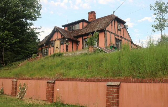
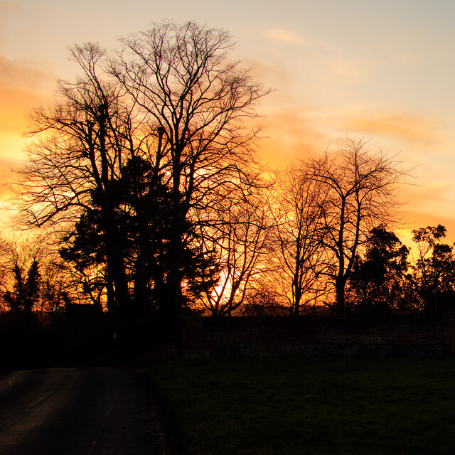
Bell's Corner Images

Images are sourced within 2km of 52.00347/0.900726 or Grid Reference TL9937. Thanks to Geograph Open Source API. All images are credited.

Sudbury Road, Stoke By Nayland
Polstead Street, Stoke by Nayland
Mill Street, Polstead
Pink house on Polstead Hill
Polstead Hill
Polstead Hill
Sudbury Road, Stoke By Nayland
Stoke Silhouettes at Sunset Looking towards a line of trees over a small green at Church Street, Stoke-by-Nayland.
Stoke Silhouettes at Sunset
Looking towards a line of trees over a small green at Church Street, Stoke-by-Nayland.
Permissive Path beside Park Road Approaching Stoke by Nayland
Permissive Path beside Park Road
Approaching Stoke by Nayland
Footpath to Scotland Street Just outside Stoke by Nayland.
Footpath to Scotland Street
Just outside Stoke by Nayland.
Approaching Stoke by Nayland On the B1068 Park Rd
Approaching Stoke by Nayland
On the B1068 Park Rd
Stoke by Nayland Near the junction of Park Street, Church Lane to the left and Polstead Street in front. Note the bunting on the fence ready for the Coronation of CR III.
Stoke by Nayland
Near the junction of Park Street, Church Lane to the left and Polstead Street in front. Note the bunting on the fence ready for the Coronation of CR III.
Village Hall on Polling Day The bunting was for the CRIII coronation and not the local elections!
Village Hall on Polling Day
The bunting was for the CRIII coronation and not the local elections!
Bunting Out in Church St All decked out for the coronation of CR III.
Bunting Out in Church St
All decked out for the coronation of CR III.
Church Lane Almshouses The Alms Houses at the end of the lane were rebuilt in 1875 in memory of Emma Jane Rowley. They are Grade II listed. <span class="nowrap"><a title="https://historicengland.org.uk/listing/the-list/list-entry/1351899" rel="nofollow ugc noopener" href="https://historicengland.org.uk/listing/the-list/list-entry/1351899">Link</a><img style="margin-left:2px;" alt="External link" title="External link - shift click to open in new window" src="https://s1.geograph.org.uk/img/external.png" width="10" height="10"/></span>
Church Lane Almshouses
The Alms Houses at the end of the lane were rebuilt in 1875 in memory of Emma Jane Rowley. They are Grade II listed. LinkExternal link
Junction on Rockalls Road, Polstead
Large cottage on Stoke Road between Polstead and Layham
Avenue of Trees, Polstead
River Box Ford  This ford on the River Box is found beside Valley Farm. We were fortunate to come across a young badger as we ascended the bridleway beyond the pig farm at Rams Farm.
River Box Ford
This ford on the River Box is found beside Valley Farm. We were fortunate to come across a young badger as we ascended the bridleway beyond the pig farm at Rams Farm.
Show me another place!

Bell's Corner is located at Grid Ref: TL9937 (Lat: 52.00347, Lng: 0.900726)

Administrative County: Suffolk

District: Babergh

Police Authority: Suffolk

What 3 Words

///with.toasters.joggers. Near Hadleigh, Suffolk

Nearby Locations

Bell's Corner

Related Wikis

South Suffolk (UK Parliament constituency)

South Suffolk is a constituency represented in the House of Commons of the UK Parliament since 2015 by James Cartlidge, a Conservative. == History == South...

Polstead

Polstead is a village and civil parish in the Babergh district of Suffolk, England. The village lies 3 miles (4.8 km) northeast of Nayland, 5 miles (8...

Gospel Oak, Polstead

The Gospel Oak was a veteran tree in Polstead, Suffolk. The tree is associated with Saint Cedd, who reputedly planted it or preached beneath it. The...

St Mary's Church, Stoke-by-Nayland

St Mary's Church is a Grade I listed parish church in the Church of England in Stoke-by-Nayland. == History == The earliest parts of the church date from...

Stoke-by-Nayland

Stoke-by-Nayland is a village and civil parish in the Babergh district, in the county of Suffolk, England, close to the border with Essex. The parish includes...

Withermarsh Green

Withermarsh Green is a village in the civil parish of Stoke-by-Nayland, in the Babergh district, in the county of Suffolk, England. It is located near...

Giffords Hall, Stoke-by-Nayland

Giffords Hall (also called Gifford's Hall) is a Tudor manor house near Stoke-by-Nayland in Suffolk, England. It was described by Nikolaus Pevsner as “one...

Thorington Street

Thorington Street is a large hamlet on the B1068 road, in the Babergh district, in the English county of Suffolk. The hamlet is part of the civil parish...

Related Videos

Tour& Tasting Experience at Suffolk Distillery✨ #distillery #distillerytour #gintasting #suffolk

Book your Tour & Tasting Experience with us today! DURATION: approximately 40-60 minutes TIMES: Monday to Thursday ...

Christmas 2021

Over Christmas, we stayed on Polstead Camping and Caravan Site. It was lovely and had everything we needed. We also took a ...

Polstead camping and caravan park

Lovely site near Ipswich.

Polstead Country Park Campsite

Motorhome Trip to Polstead Country Park near Sudbury Suffolk its a adult campsite offers both hard-standing pitches for caravan, ...

Nearby Amenities

Located within 500m of 52.00347,0.900726
Polstead
Place: village
Source: npe
Wikidata: Q541183
Lat/Long: 52.0067906/0.9002964
Post Office
Polstead Community Shop
Addr City: Colchester
Addr Housename: Polstead Community Shop
Addr Postcode: CO6 5AL
Addr Street: Polstead Green
Addr Village: Polstead
Fhrs Id: 1394804
Opening Hours Post Office: Mo,Fr 09:00-13:00,14:00-17:30; Tu-Th 09:00-13:00; Sa 09:00-12:30
Ref Pol Id: 1336
Shop: convenience
Source: gps
Source Addr: FHRS Open Data
Source Opening Hours: pol_branch_list_2018-02
Lat/Long: 52.007823/0.901911
Bus Stop
The Cock
Naptan AtcoCode: 390010379
Naptan Bearing: S
Naptan CommonName: The Cock
Naptan Indicator: o/s
Naptan Landmark: The Green
Naptan NaptanCode: sufagata
Naptan Street: Heath Road
Naptan Verified: no
Source: naptan_import
Lat/Long: 52.0072146/0.9024295
Bus Stop
The Cock
Naptan AtcoCode: 390010380
Naptan Bearing: N
Naptan BusStopType: CUS
Naptan CommonName: The Cock
Naptan Indicator: opp
Naptan Landmark: The Green
Naptan NaptanCode: sufagatd
Naptan Street: Heath Road
Naptan Verified: no
Source: naptan_import
Lat/Long: 52.0072551/0.9023129
Bus Stop
Water Lane
Naptan AtcoCode: 390010381
Naptan Bearing: N
Naptan BusStopType: CUS
Naptan CommonName: Water Lane
Naptan Indicator: N-bound
Naptan Landmark: Pond
Naptan NaptanCode: sufagatg
Naptan Street: Polstead Hill
Naptan Verified: no
Source: naptan_import
Lat/Long: 52.0056514/0.8987142
Bus Stop
Water Lane
Naptan AtcoCode: 390010382
Naptan Bearing: S
Naptan BusStopType: CUS
Naptan CommonName: Water Lane
Naptan Indicator: S-bound
Naptan Landmark: Pond
Naptan NaptanCode: sufagatj
Naptan Street: Polstead Hill
Naptan Verified: no
Source: naptan_import
Lat/Long: 52.005517/0.8986909
Historic: memorial
Lat/Long: 52.0052256/0.8971216
Bell's Corner
Place: hamlet
Wikidata: Q11687680
Lat/Long: 52.0035026/0.9015866
Bench
Backrest: yes
Seats: 3
Lat/Long: 52.005988/0.8991811
Turning Circle
Lat/Long: 51.9992379/0.9028465
Booth: K6
Covered: booth
Disused Amenity: telephone
Man Made: telephone_box
Lat/Long: 52.0065262/0.9005278
The data included in this document is from www.openstreetmap.org. The data is made available under ODbL.

Have you been to Bell's Corner?

Leave your review of Bell's Corner below (or comments, questions and feedback).