Miltonduff
Settlement in Morayshire
Scotland
Miltonduff

Miltonduff is a small village located in the county of Morayshire, Scotland. Situated on the eastern banks of the River Lossie, it is approximately 4 miles south of the town of Elgin. The village is part of the Moray region, known for its picturesque landscapes and historical significance.
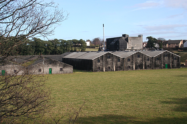
Miltonduff is primarily known for its distillery, which shares the same name. Established in 1824, Miltonduff Distillery is one of the oldest functioning distilleries in Scotland. The distillery produces a range of single malt whiskies, which are highly regarded for their quality and distinct flavors. Visitors to the village often make a point to tour the distillery and sample some of its renowned whiskies.
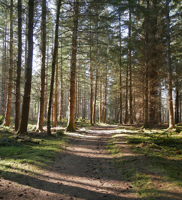
Aside from its whisky heritage, Miltonduff is also blessed with natural beauty. The surrounding countryside offers stunning views of rolling hills, fertile farmland, and the tranquil River Lossie. Outdoor enthusiasts can explore the nearby forests and walking trails, enjoying the peacefulness of the area.
Though small in size, Miltonduff has a close-knit community that takes pride in its village. The residents maintain a strong sense of community spirit, organizing local events and activities throughout the year. The village boasts a few amenities, including a small shop and a traditional pub, where locals and visitors can gather for a drink and a friendly chat.
In summary, Miltonduff is a charming village in Morayshire, Scotland, known for its historic distillery, picturesque landscapes, and welcoming community.
If you have any feedback on the listing, please let us know in the comments section below.
Miltonduff Images
Images are sourced within 2km of 57.626545/-3.374261 or Grid Reference NJ1860. Thanks to Geograph Open Source API. All images are credited.


Miltonduff is located at Grid Ref: NJ1860 (Lat: 57.626545, Lng: -3.374261)
Unitary Authority: Moray
Police Authority: North East
What 3 Words
///tells.tend.occupy. Near Elgin, Moray
Nearby Locations
Related Wikis
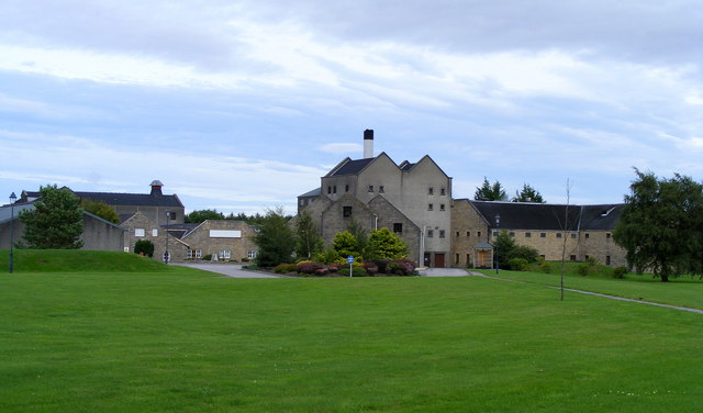
Miltonduff distillery
Miltonduff distillery is a Scotch whisky distillery located in Miltonduff six miles south-west of Elgin in the whisky region of Speyside. == History... ==

Miltonduff
Miltonduff is a hamlet 1.5 miles southwest of Elgin and is in the Scottish council area of Moray. == History == The village contains a 17th or 18th century...

RAF Elgin
Royal Air Force Elgin or RAF Elgin, also known as Bogs of Mayne, is a former airfield operated by the Royal Air Force and located approximately 1.5 kilometres...
Pittendreich Mill
Pittendreich Mill in Elgin, Scotland, was built around 1830 by Moray Estates with parts stemming from the early 19th century, and designed to handle meal...

Mosstowie railway station
Mosstowie railway station served the hamlet of Miltonduff, Moray, Scotland from 1858 to 1955 on the Inverness and Aberdeen Junction Railway. == History... ==
Glen Moray distillery
Glen Moray distillery is a Speyside distillery producing single malt scotch whisky. Situated on the banks of the River Lossie in Elgin, Moray the distillery...

Cloddach Bridge
Cloddach Bridge is a road bridge south of Elgin that crosses the River Lossie. The bridge was completed in 1905, though it was first proposed thirteen...

Knock of Alves
The Knock of Alves is a small wooded hill that lies 3 miles (4.8 km) to the west of Elgin in Moray, Scotland, rising to 335 feet (102 m) above ordnance...
Nearby Amenities
Located within 500m of 57.626545,-3.374261Have you been to Miltonduff?
Leave your review of Miltonduff below (or comments, questions and feedback).